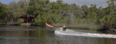
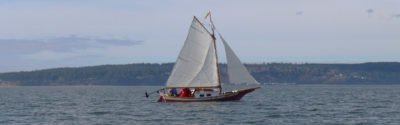
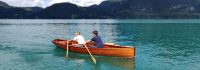
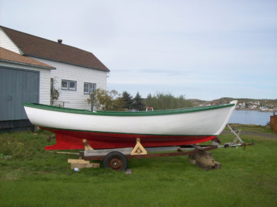
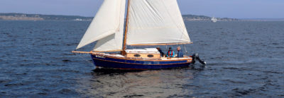
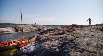
It was already past noon when I loaded three days’ worth of camping gear aboard my Flint, ARR & ARR, still on its trailer in the unpaved lot near the launch ramp at Port O’Connor, Texas. The sky over the Gulf of Mexico was thickly overcast and gray; a chilly breeze cut through my shirt, but I expected to warm up once I started rowing.
I had postponed this winter trip twice because of poor weather, so the forecast for a fair weekend was a welcome change. There would be some rain in the evening and the nights would be chilly, but the three days were supposed to be mild.
I wanted to have camp set up by twilight, before the rain arrived. I just needed to get going and keep an eye on the time. Rowing ARR & ARR, I can sustain 3 knots, and with Matagorda Island only about 6 miles from the mainland, getting to my campsite at Sunday Beach before the rain wouldn’t be a problem. I’d have ample time to explore the oyster reef and mangrove marsh along the route.
I pulled on my muck boots, tied a slack line from gunwale to gunwale just forward of the stern sheets to serve as a rowing foot brace, and launched the boat. I rowed straight across the Intracoastal Waterway’s 150-yard-wide channel between Port O’Connor and slender Blackberry Island and entered Fisherman’s Cut, a passage just 200 yards long. The water in the sheltered channels was barely rumpled and just clear enough to see the oar blades on each stroke above its dark olive-green depths.
 Photographs by the author
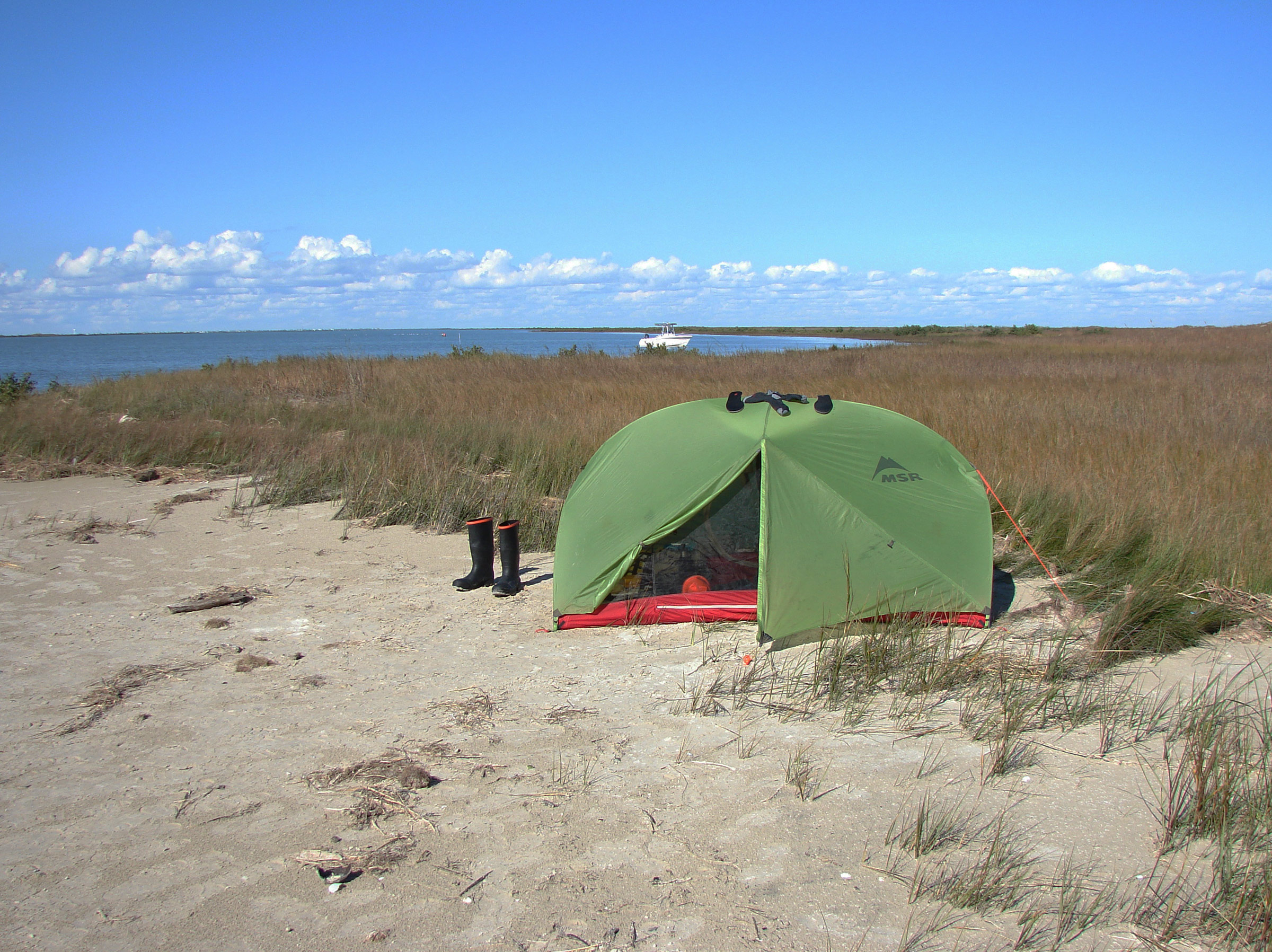
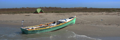
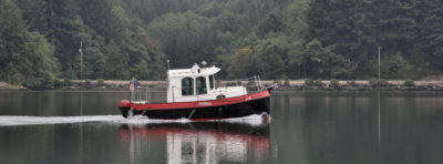
On Sunday, I set my boots, socks, and insoles out to dry at camp. The powerboat in the background belongs to a nice couple who came ashore for a while, stopped by for a chat, and then went fishing for sea trout.
I followed Fish Pond Trail, a route traced in red on the Port O’Connor Paddling Trail map that would lead me through the mangroves and into the shelter of Pelican Island. Hurricane Harvey had rearranged parts of this coast in the fall of 2017, which included cutting a pass through Sunday Beach that sheared Pelican Island off from the main 40 or so miles of Matagorda Island. There is now a 1,000′ gap where an isthmus had connected the two islands.
For a weekend, the waterways were surprisingly quiet, without a single fisherman in sight, and Port O’Connor resembled a ghost town, inhabited by only birds. Gulls hovered in the breeze; pelicans glided by in undulating single-file lines; and wading curlews dipped their long, slender beaks in the shallow water off a small beach at the edge of Barroom Bay. I crossed the bay along its eastern edge and entered Little Mary’s Cut. Four dolphins surfaced astern where I had been only a dozen strokes earlier, and a lone roseate spoonbill flew overhead, its deep pink feathers with splashes of crimson at its shoulders and tail striking against the gray sky.
Port O’Connor’s stilt-elevated houses shrank in the distance, soon leaving me surrounded by lowlands covered with thigh-high cordgrass and black mangroves thick with deep-green, thumb-sized leaves. I rowed by short beaches of pale-brown sand and low dunes fringed with sea oats.
Little Mary’s Cut was about twice as long as Fisherman’s but only about half as wide, with water deep enough for rowing right up next to the mangroves, where their upright pencil roots jutted out of the water like slender gray stalagmites.
Little Mary’s Cut emptied into Big Bayou, which was open on its east end to Matagorda Bay. Whitecaps dotted the bay and sent a light chop rolling into the bayou. I turned my stern to the chop and continued following the paddling trail, rowing a short dogleg west and turning south into calmer water at Chris’s Cut.
The cut was narrow and less than ¼-mile long, and I soon rowed over its south end where the water was so shallow that I could see the sandy bottom and seagrass laid flat by a slight current, the blades’ tips waving toward wide-open Espiritu Santo Bay. The current carried me onto a shoal with a gentle bump and dragged the hull hissing across the sand. With ARR & ARR aground, I stood and used an oar to push back into deeper water.
I rowed around the shallow spot, and the channel markers swung away from Bayucos Island out into the bay in a wide arc that didn’t turn back toward the island for another half mile. The small waves tumbling near the edge of the bay traced the edge of the massive half-moon shoal that reached out from the island. Sand and seagrass clearly visible beneath the ripples meant that it was too shallow for ARR & ARR, so I followed the markers instead of cutting across.
I followed Mitchell’s Cut through Bayucos. The cut, spanning 500′, was the widest yet, and yet so short, barely twice its width, that it seemed more like a natural gap between two islands than a manmade passage. As soon as I rowed out the other side and into Saluria Bayou, I met chop from Matagorda Bay again. This time I rowed east, into the waves.

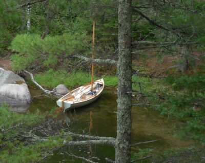
ARR & ARR was safe in the cordgrass with just enough water beneath her astern so she could slip back out into the bay. During the night, when I pointed my flashlight in the boat’s direction, all I could see was cordgrass and a tiny bright spot of reflected light. In the morning I discovered it was my rowing mirror that I’d been seeing.
Saluria Bayou is the namesake of the town Saluria, a once-thriving port and ranching center that was nearly wiped out by a hurricane in 1875 and was abandoned in the early 1900s. Only the Coast Guard station remained, and it was closed in 1942. A bare concrete platform on pillars at the east end of the bayou is all that’s left. It was hard to believe that an entire town once stood where there was only a mangrove marshland.
About 500 yards west of Matagorda Bay, I turned south into First Cut, a fairly narrow channel, just 50 yards across, once used to access now long-closed oil wells, and rowed past marker No. 25 of the paddling trail.
The water in First Cut was calm, the rowing was easy, and I made good headway. About 600 yards in, I passed a side cut that ran out perpendicular to the east from First Cut toward Matagorda Bay. Another a short distance beyond that I passed a raised 10’ by 15’ metal platform sun-bleached to a dusty pink. The bottom 2’ of the four legs were rusted and thick with barnacles. Rising above the mangroves to the east stood a row of bare utility poles that had once run lines between the Coast Guard station and a now-abandoned WW II airfield on Matagorda Island.
Another abandoned platform, this one brown and topped with a rusting vertical cylindrical tank, stood at the trail’s No. 24 marker. The route followed a dogleg west for about 1,000’, turned back south, and emptied into an expanse of water about half the size of a football field. In every direction beyond was a watery labyrinth that wends through scattered clumps of mangroves.
White pelicans flew past the little spit where ARR & ARR was beached. Barely visible on the land on the other side of the pass are some of the utility poles in a line between the abandoned airfield on Matagorda Island and the old Coast Guard station at Saluria Bayou.
Just south of marker No. 23, a flats boat sat motionless with a boy poised on top of its tower with his rod and reel; a man wading in thigh-deep water fished next to the boat. I nodded to them and rowed into the widening water.
Although the map showed the trail continuing south and east for another 1-1/2 miles toward the sheltered water behind Pelican Island, my chart and navigation app put me at the end of water deep enough to row, with only marsh and mud flats between me and Pelican Island. Boating friends who knew the area had hinted that there were ways through the flats, which was what I wanted to explore to see if I could find my way through. I couldn’t see the No. 22 marker, and there was no obvious gap in the mangroves ahead that looked like a continuation of the trail, so I rowed due south, hoping to stay close enough to the trail to keep water beneath my keel and eventually spot the marker.
I hadn’t rowed more than 30 yards before my boat squealed to a stop on oyster shells. I stepped out into water only 6″ deep and the soles of my boots crunched the shells. The oysters on the bottom were a dark, mossy brown that made it difficult to gauge the depth. It was the short path of white slivers ARR & ARR had left astern that made it clear how little water there was over the shoal.
Holding the gunwale, I walked the boat along a meandering route between the shallower spots. When I reached water deep enough to threaten pouring in over the tops of my boots, I carefully kicked them in the water to remove clumps of thick black mud, stepped back aboard, and pushed off.
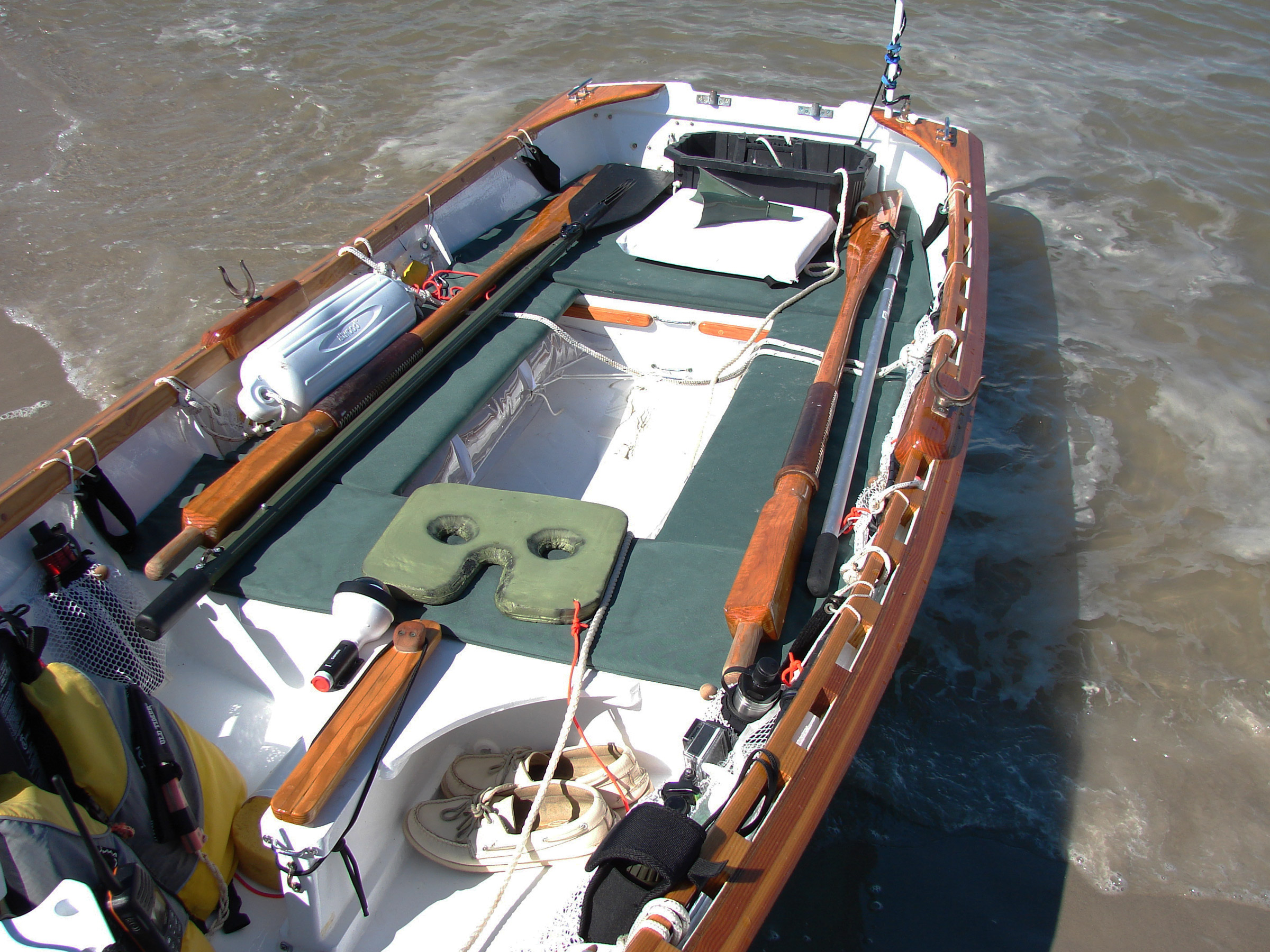
On the thwart is a rowing-seat pad made from two layers of a camping sleeping mat laminated together; strapped beneath the side benches are transparent homemade buoyancy bags. Shock cord pulled over a thumb cleat holds a plug down inside the daggerboard trunk to keep water from splashing out while I’m rowing. The line running from gunwale to gunwale and hanging slack between the side benches serves as my rowing foot brace.
Among the mangroves just in front of me was a flats boat with a boy fishing from the tower and a man fishing in the shallows next to it. Was it the same boat I just rowed past? Did they get ahead of me somehow? I checked my compass and it showed I was heading due north; I had turned myself 180 degrees without noticing it. The mangroves looked the same in every direction, and the sky, completely overcast with thick gray clouds, had blotted out the sun and offered no sense of direction.
I turned south again and ran aground after only a few strokes. I continued for a good 15 minutes, alternating between walking the boat and rowing before finally giving up the effort. I hadn’t made any appreciable headway toward where I thought the trail was, and I still had a mile or two of marsh and mud flats to negotiate if I were going to continue southward. Afternoon was turning into evening, and I didn’t have the time to walk the boat through miles of an oyster-ridden mangrove maze before the rain was supposed to start and the light would fade.
I cringed each time I heard the boat being grated by oysters and feared they would gouge through the thin layer of fiberglass and into ARR & ARR’s plywood hull. I dragged the boat back toward the trail that had brought me into the labyrinth. It baffled me that this could be part of a mapped paddling trail and have so little water. It was true that I was trying to wend my way along the trails just after low tide, but it was a low that was only 2″ shallower than the day’s high. What I didn’t know was that tides along the Texas coast have not only daily and monthly patterns, but also a seasonal one. If I had tried to navigate through the marsh and mud flats three months earlier or later, I could have had up to another 1-1/2′ of water, all the difference for a boat that draws only 8″ fully laden.
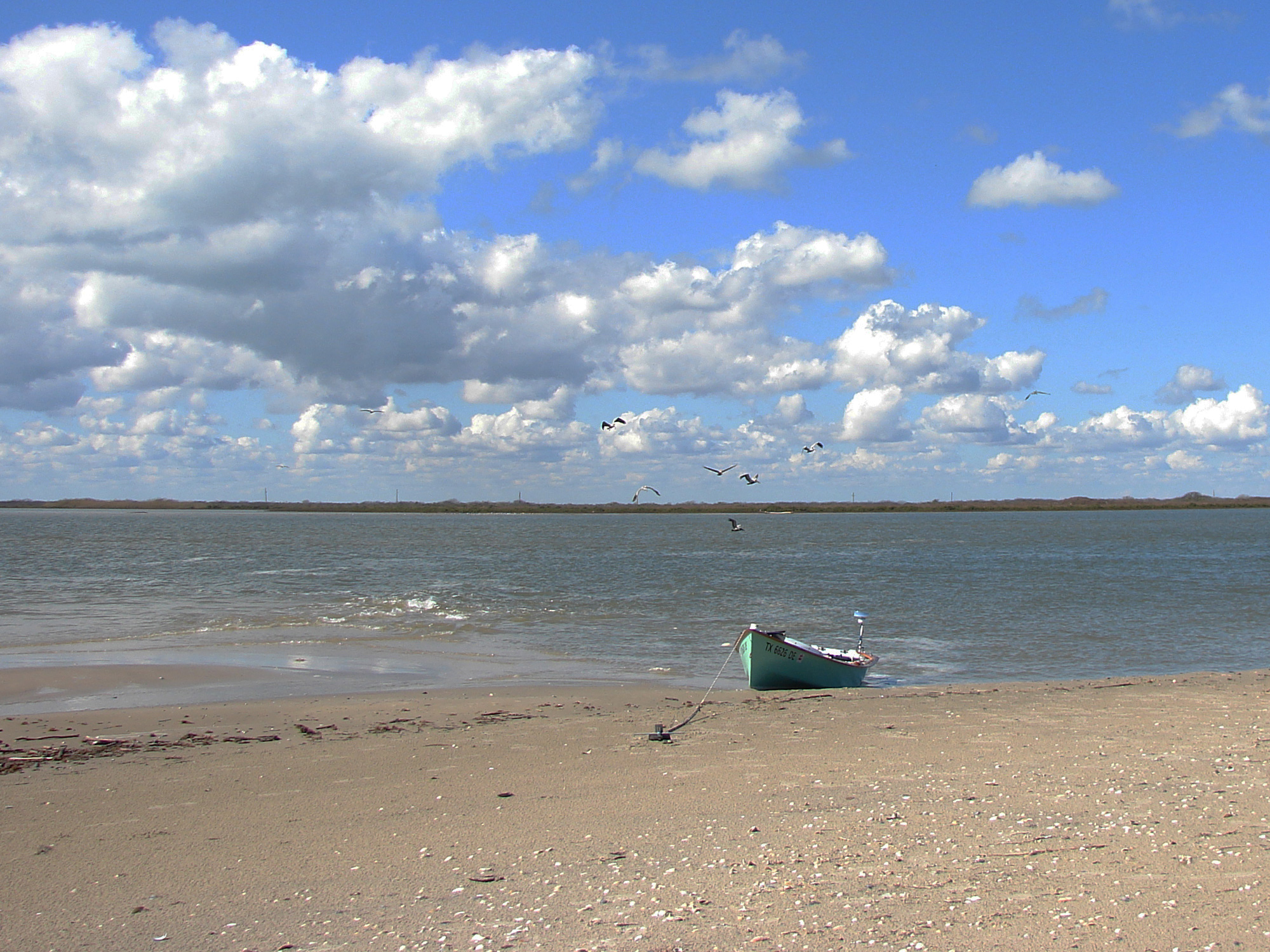
In an attempt to record the size of the beach I had camped on, I took this picture from the end of the little spit. Judging from pictures taken almost a year later, the little beach has grown at least sixfold.
Once I was past the flats boat, I rowed back down the dogleg and First Cut. A flats boat with three men in it came speeding around the bend behind me and slowed to an idle while still 100 yards away. I expected the boat to stop to fish or come ahead and squeeze between me and the mangroves, but it maintained its course at idle speed and at the same distance off my stern. They trailed me that way for a minute or so, and the distance between us didn’t seem to be shrinking. It occurred to me that the skipper might be trying to pass without making a wake, so I stopped rowing and rested the oar handles in my lap, the blades hanging in the air. ARR & ARR drifted to a stop and the flats boat drew even.
Its skipper and I nodded to each other, and he called out above the sound of his engine, “You were moving faster than I thought.”
I smiled and replied, “Thank you for slowing down.”
After he was a dozen yards past, he throttled up and sped on down the cut.
I had rowed north about half of the way along First Cut, approaching what my charts showed as a side cut, branching out to the east and stopping just shy of Matagorda Bay, but if it actually connected with the bay, or at least ended in mangroves sparse enough to allow me to drag my boat through, it would cut the distance I’d have to row in the bay in half, so it seemed worth a try.
The side cut was quite still, barely rippled, even after I’d rowed half its length. I should have encountered waves from the bay by then if the side cut connected to it. I rowed to the end and found what I’d feared: a thick mass of mangroves growing out of a ragged oyster bank. I had to turn around and row back to First Cut.
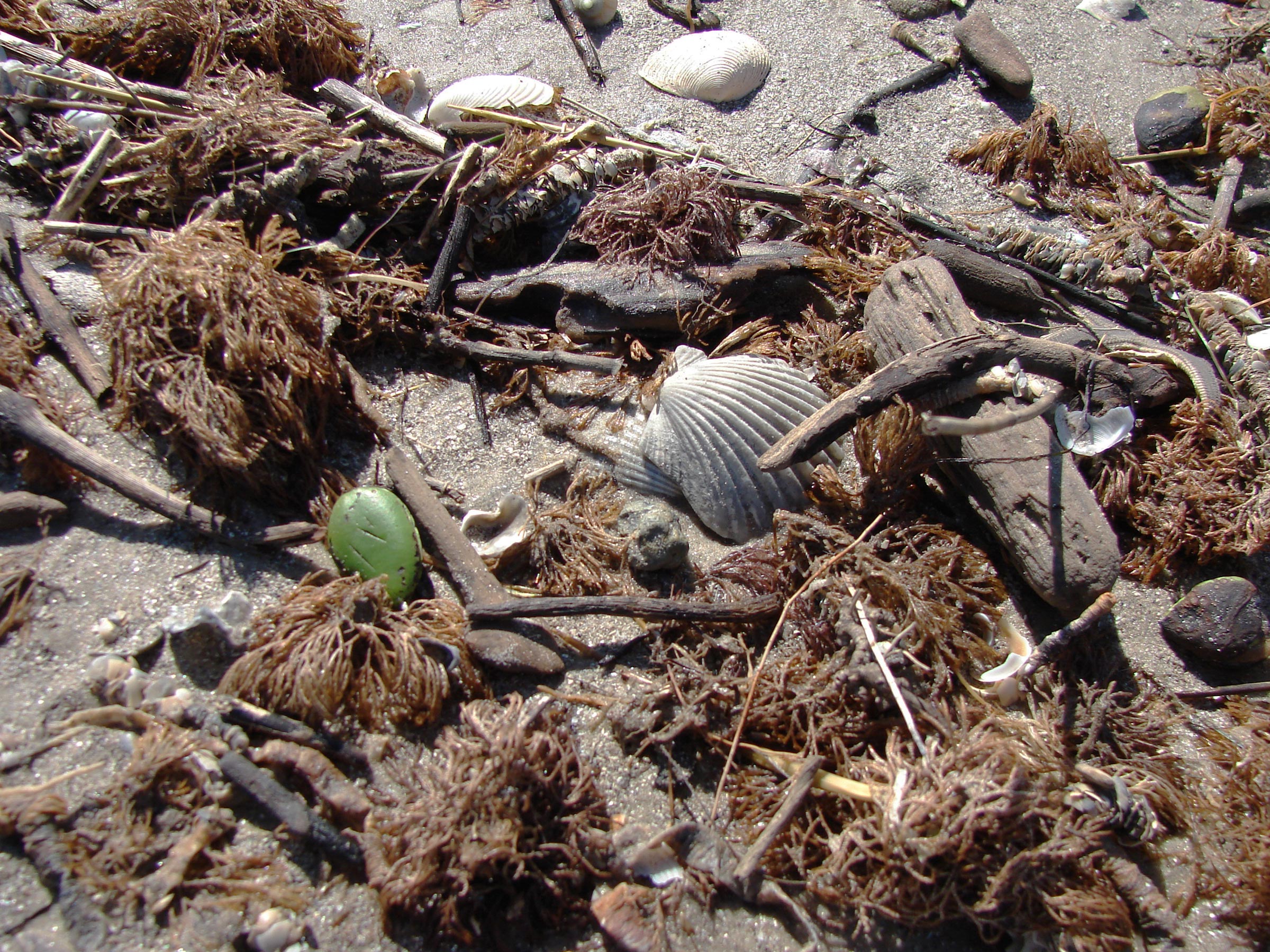
The green object, which that looks like a large lima bean sitting in the wrack line, is a black mangrove seed. The 1”-wide seeds drop from the plant’s branches and are carried by tides and currents and can travel far from the parent plant before washing ashore and putting down roots.
I was nervous about rowing in Matagorda Bay. The bay had shifting shallows all the way from Saluria Bayou to Pelican Island. To get to the still water in the lee of the J-Hook, the island’s northern peninsula, I would have to row about a mile across the shallows, taking waves on the beam. If I found the bay was too rough, I could just turn around and row with the wind and waves back into the bayou, though without a place to spend the night I’d have to return to my car. It’d be better than capsizing in winter.
Under a gray sky, I rowed into the bay and past the massive somber concrete platform of the old Coast Guard station. The waves in the bay weren’t as daunting as I had expected, especially rowing dead upwind to gain sea room before turning toward Sunday Beach. The boat pitched in the waves, occasionally shuddering violently, but nothing more than spray came aboard, and the boat’s fine forefoot cut into the waves well enough to allow me to maintain decent headway.
After I turned southwest to parallel the shoreline, ARR & ARR took the waves on the beam. They weren’t breaking but the boat rolled in the steep chop. No water came aboard, and I found myself enjoying the rolling ride. As sets of taller waves rose ahead, I didn’t fight them. I’d stop rowing and let them pass. It made for slow progress, but I enjoyed the challenge.
Though the water droplets spattered across the wide-angle mirror mounted on my stern-light post, I spotted the reflection of something low and dark blocking the path ahead. It was the skeleton of a tree trunk lying on its side with limbs jutting out in all directions, so long and thick that they held the trunk high out of the water. I headed farther out into the bay and around the trunk and the shoal it rested on.
The two plastic buckets I carried aboard the boat served as camp seats, bailers, and garbage cans. If I need extra ballast for my return trip after going through firewood, food, and drinking water, I can fill one or both buckets, snap on the lids, and lash the weight wherever it’s needed in the boat.
I passed the J-Hook and rowed into flatter water in the channel that would take me to the pass at Sunday Beach. To the southeast, beyond the island, a thick, dark band of clouds out over the gulf was hanging lower than the rest. Slate-gray sheets of rain falling beneath the dark band blurred the horizon. I picked up the pace, hoping to avoid a drenching.
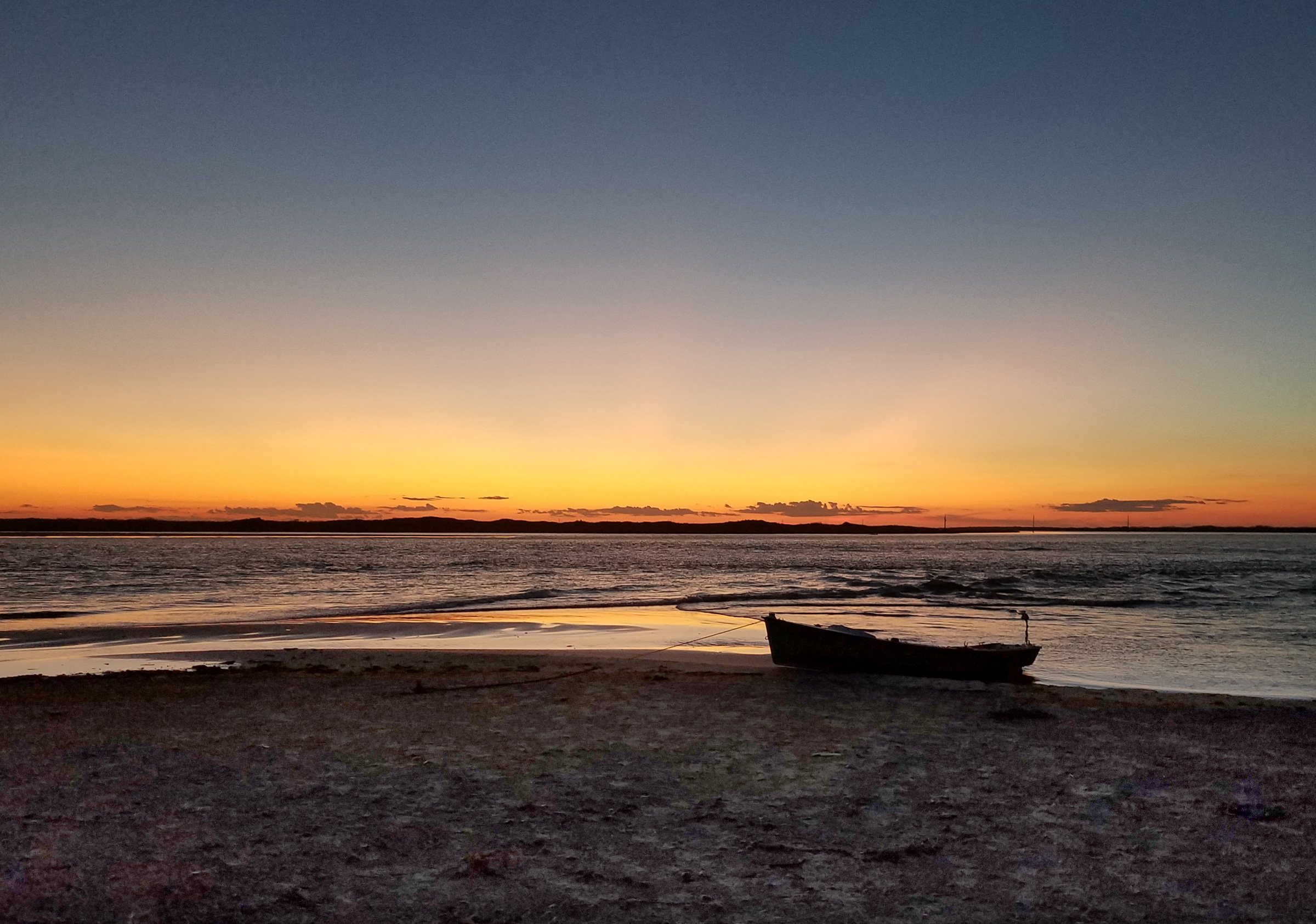
Ten minutes later, though, the clouds seemed to be no closer and the horizon appeared sharper through thinning veils of rain. Beaches the color of weathered manila rope lay on both sides of Sunday Pass. Two powerboats were beached on the south end of Pelican Island, with anchors dug in above the wrack line. Boats were beached on the Matagorda Island side of the pass as well, on a much larger expanse of sand. The deep water in the middle of the pass was full of breakers. I closed in on the little beach on Pelican, aiming for the 15-yard space of beach between the two boats already there.
After another five minutes of rowing, ARR & ARR nudged into the sand and came to a stop. I stepped over the side, lost my footing, and tumbled into the water—I was more tired than I had thought. With water squishing out of the tops of my boots on each step, I pulled the bow farther up on the beach. I was soaked and began to shiver, but I needed to tend to the boat and tent before I changed into dry clothes.
Dunes 10′ tall separated the beach from the gulf side, and while I would have liked to make camp on that high ground, a 30-yard-wide swath thick with grasses and mangroves surrounded it. The beach on my side of the barrier had only a slight slope, and I picked out what seemed the highest spot for my tent. With a tide expected to rise only inches during the night, I figured the site would do.
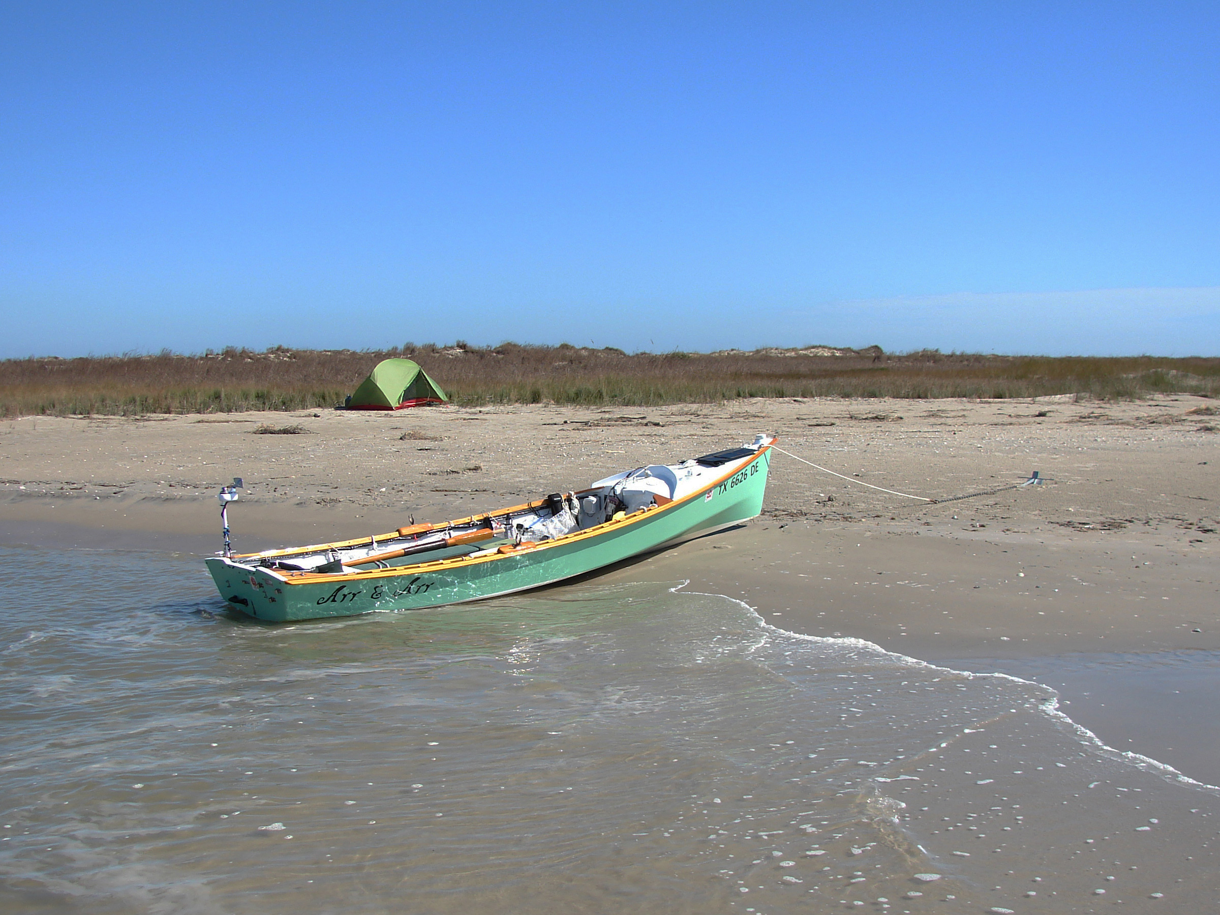
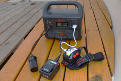
With the sun shining brightly, I pulled ARR & ARR ashore in the niche behind the little spit. A foldable solar panel draped across the foredeck charges the 15-amp-hour battery strapped down inside the forward buoyancy compartment. In the distance on the other side of Sunday Pass is Matagorda Island.
The waves edging ashore pushed my boat around until it was beam-to the little waves, getting rolled and bucked against the shore. I tried pulling the boat higher onto the beach, but the waves still hit the stern and pushed it around again. The waves had also turned one of the powerboats, but it was large and heavy enough that the little waves couldn’t bat it about—it would be fine until its crew returned. The other powerboat, closer to the pass, was nestled into a niche behind a tiny spit, clearly the sweet spot for a boat on this beach.
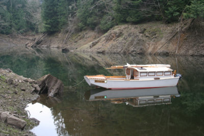
Inside the pass, the beach ended and gave way to a marshy shore thick with cordgrass and dotted with black mangroves. Curled into the grass was an inlet just large enough for my boat. I relaunched, paddled ARR &ARR around to the inlet, and dragged it in across a shallow at its mouth. In the still water there, the boat floated motionless. I set its anchor in the sand just beyond the cordgrass and tied a second line from the foredeck cleat to a short length of chain I wrapped around the exposed roots of a mangrove farther inland.
I pitched my tent, changed into dry jeans and sweatshirt, and pulled on dry socks and sneakers. I stored my boots in the tent’s vestibule, pulled out their spongy insoles, wrung them out, and draped them across the tops of the boots. I hung my damp rowing clothes on a cord tied inside the top of my tent.
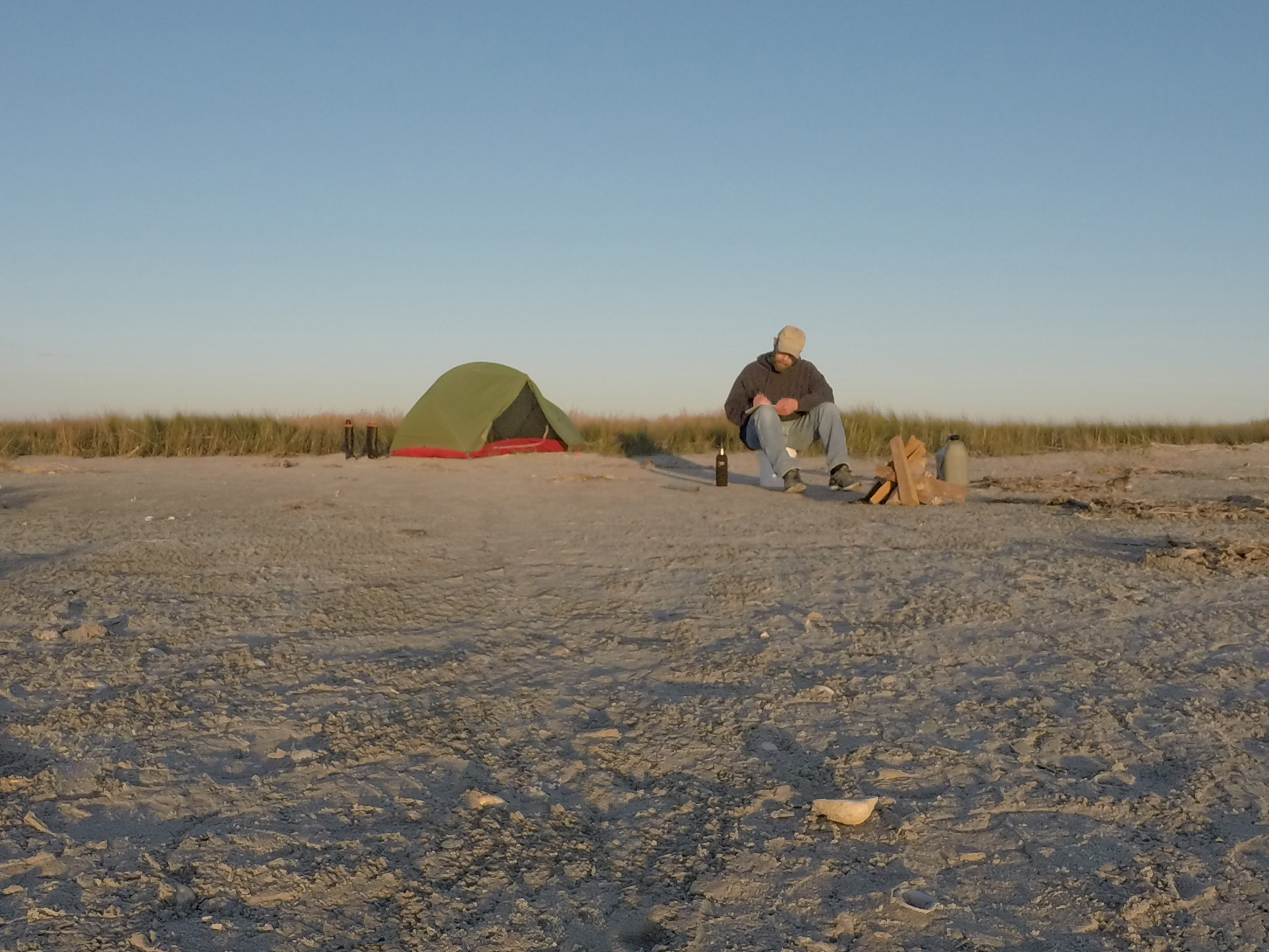
The dark band of clouds broke apart, and it didn’t rain that evening. As the light waned, the crews of the two boats returned from the gulf side of the island, shoved off, and headed back to the mainland. I spent a comfortable evening sitting on one of my 2-gallon buckets next to a campfire, enjoying my dinner snug in warm, dry clothes. I stayed up for over an hour enjoying the breeze and the shushing of the waves rolling ashore before finally putting out the fire and crawling into my bedroll in the tent.
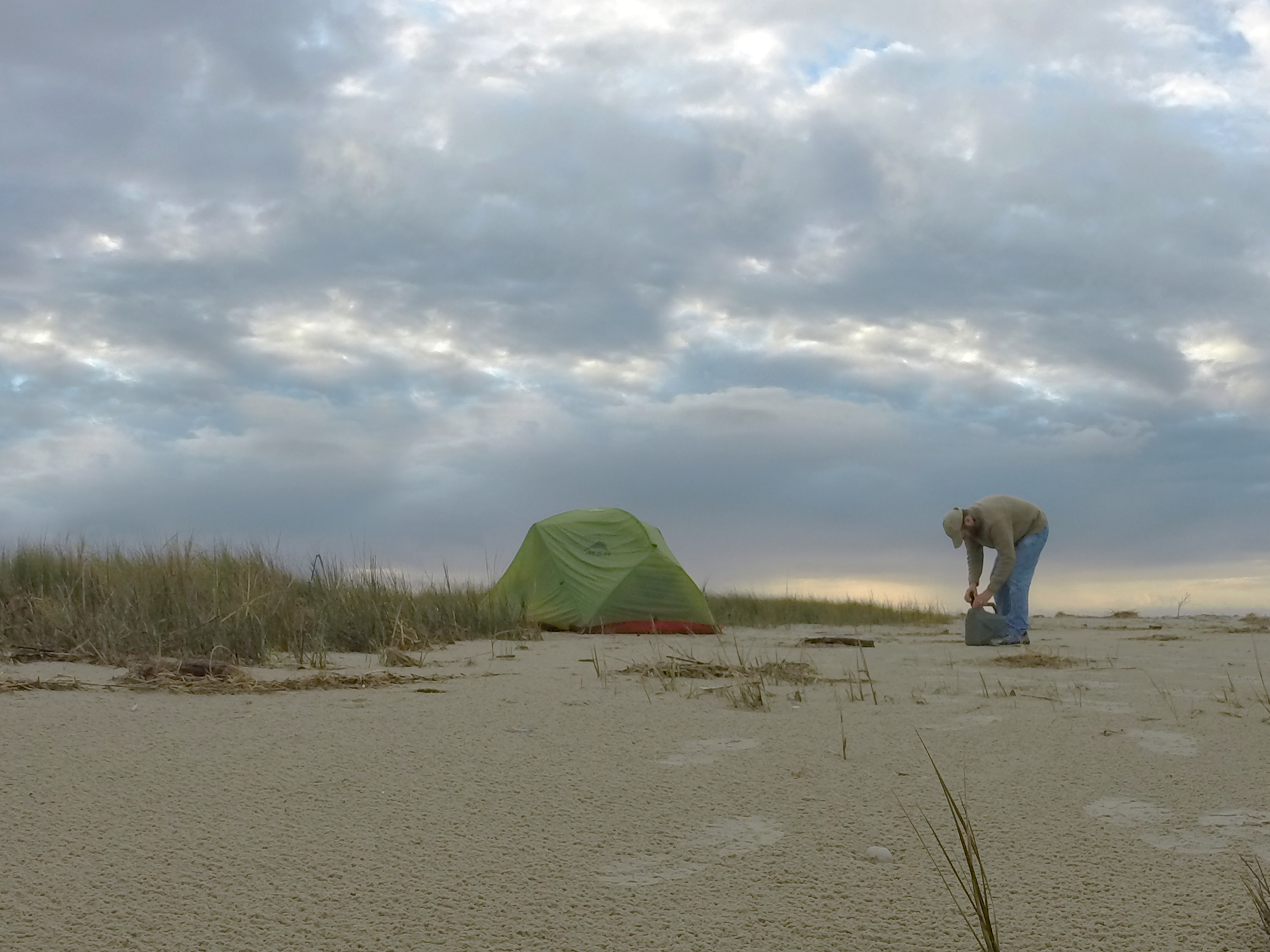
After the rain stopped on Sunday morning, the beach was left textured by tiny pits, a fresh surface for footprints. As the clouds began to break up I refilled my drinking bottles from the water can.
I woke to a dull-gray morning with rain pattering on the tent’s fly and leaving pockmarks in the sand beyond the fly’s perimeter. I crawled out of the bedroll and pulled on my sweater. For breakfast, I put a cup of coffee on the stove and ate a baggie of granola mixed with milk. Gunshots echoed in the distance—hunters out early on this drizzly Sunday morning. A boat roared somewhere out in the mangrove marsh.
After the rain stopped, I crawled out of the tent. The air was cool and still. Patches of clear sky showed between the remnants of the clouds. Pelicans, cormorants, avocets, willets, and gulls squawked and peeped while feeding in the shallow waters around the pass. I sat watching and listening on a blackened driftwood beam close to the water.
A dolphin darted and rolled in the water just 15 yards off the little spit. Farther out, jumping fish flashed silver in the morning light. White pelicans and brown pelicans circled over the pass. The brown pelicans dove and plunged into the water, resurfacing with skyward thrusts of their beaks, swallowing whatever they had caught. The white pelicans settled on the water surface, usually in teams, flapping their wings as they swam toward each other to box in fish before scooping them up.
Despite the noise of the birds, the dolphin, and fish—or maybe because of it—my morning of sitting on a driftwood beam beneath the waning cloud cover was the most peaceful I’d had in months. Port O’Connor was a faint blur of white buildings beneath a single water tower tiny on the northern horizon.
I thought about moving my camp for my second night, but I was tired and wanted to let my wet clothes dry, so I left my camp set up and struck out for a short outing. I rowed north into the little bay on Pelican Island’s west side as a cool but very light breeze came up, which was refreshing for the row beneath the mostly sunny sky.
By midmorning, powerboats were showing up at the pass. I didn’t want to stray too far from camp, so I rowed back to my beach and landed in that sweet spot behind the little spit of sand that that powerboat had occupied the day before. I set the anchor high on the beach, pulled out my solar charger, unfolded the panels across the foredeck, and hooked up the regulator to a through-deck connector wired to the boat’s battery, which is strapped down inside the forward compartment.
I noticed a snail with a gray shell about the size of a pistachio on ARR & ARR’s topsides, most likely a marsh periwinkle from the boat’s night in the cordgrass. Then I started to see dozens. I walked around the boat plucking the snails off and tossing them into the water for the crabs.
I went back to my driftwood bench and watched slender-beaked willets working the swash, plucking coquina clams from the glistening wet sand. I sat very still and the willets passed right in front of me, just 4′ away.
While I made a sandwich in my tent for lunch, the roar of an engine drew so close that it seemed right on top of me. The engine’s pitch dropped to an idle, and I heard a mix of voices. I peeked out of the tent; eight teens were packed inside a 16′ open boat nudging its bow onto the beach 10 yards from ARR & ARR. I waved and ducked back inside the tent to finish making my sandwich. The engine revved for a few seconds, and after dropping back to an idle for half a minute, its pitch rose to a constant roar again while its volume steadily dropped. By the time I reemerged from the tent with my sandwich and an apple, the little boat was already halfway across the pass, heading toward the beach on the opposite side. I must have looked a little less civilized than I’d thought.
Sunday Beach is a popular spot on weekends in the summer, and by early afternoon, even this midwinter Sunday was mild enough to lure a dozen boats to the pass. I took a short stroll around the southern end of the island to the gulf side, but I didn’t feel comfortable out of sight of camp, given the number of boats coming and going and not being able to lock up ARR & ARR’s gear. I cut my walk short and returned to camp.
A great egret, brilliant white with a school-bus-yellow stiletto beak, stood poised at the edge of an inland brackish pool, and a great blue heron waded with deliberate, punctuated steps just off the marshy shore on the island’s bay side. The washed-up wrack was a tangle of brown grass, weed, and palm fibers; broken clam, cockle, and moon snail shells; a sprinkling of drift twigs worn as smooth as creek-bottom pebbles; dark green mangrove sprouts; and bristle-worm tubes encrusted with the tiniest bits of shell. I turned over a mass of brown weed, and little gray sand fleas skittered away.
The sky had completely cleared by 5:30, and with the sun low in the sky and the air turning chilly, the dozen or so boats that had landed nearby for the day were gone. The wind swept across the beach toward the bay and the distant marsh. Sand drifted around the firewood I’d stacked for the evening. I squatted upwind of the pile to prevent the lighter from blowing out and got the fire going. After the fatwood was burning well, its amber resin liquid and bubbling, and had started the larger pieces, I sat on my bucket off to one side.
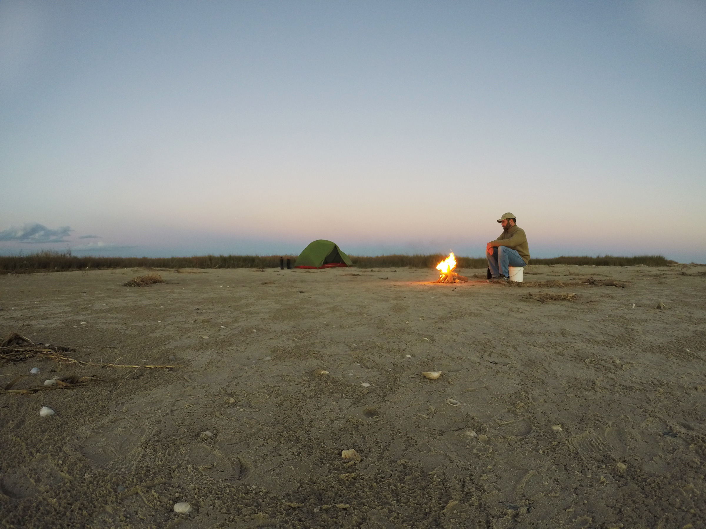
With the clear sky, the temperature plummeted after sunset, so I swapped out the hoodie for a thick sweater and got the fire going. Later I wore both the sweater and the hoodie. Matagorda Island State Park regulations allow Sunday Pass visitors to bring firewood from home, a luxury that makes starting a campfire easy.
The fire roared in the wind; flames whipped outward, sending sparks across the sand toward the bay. I moved my 3-gallon drinking water can and my other bucket to the fire’s windward side to block some of the wind and used a driftwood poker to rearrange the pieces of burning wood so that the fire was more compact. The only clouds in the sky, lying low and wide just above the horizon, pleated the fan of the sun’s copper and gold light where it spread across a purple sky. After the sun slipped beneath the horizon, the thin band of Matagorda Island’s dunes and mangroves across the pass dimmed to an empty black. The water in the pass glistened with the colors of the sky. Both sky and water dimmed around the silhouette of Matagorda Island and then disappeared entirely. Stars winked on by ones and twos and then by the dozens, and Mars glowed steady, orange, and bright. I stepped away from the fire to escape its scrim of amber light, and the Milky Way spread across a moonless sky.
Eventually I got cold and returned to the fire, and an hour or two after that, the last of my firewood burned down to only a red-orange pulsing glow deep within black-edged coals. It was 9:00 and high tide. The boat sat unmoving, its rode slack. I poured half a bucket of seawater over the coals, stirred the sludge with my driftwood poker until the last trace of the fire’s light was gone, and poured the rest of bucket of water on top.
As the sun set beyond Sunday Pass, it was hard to believe that the expanse of water between this little sand spit and Matagorda Island in the background was once Sunday Beach; the land was entirely swept away by the 130-mph winds of Hurricane Harvey in 2017.
The morning was quiet. It was Monday, and for most, the weekend was over. The birds and I had the world to ourselves.
I sat on my driftwood beam with my coffee and cereal and enjoyed the morning. With the sky so clear and the air so still, the just-risen sun could take the chill out of the air. I was looking forward to a casual row back to the mainland on such a day, but I couldn’t dillydally. A front, forecast to come through in the evening, would stir the air soon enough and pick up steam over the course of the day. Although most of my row back to Port O’Connor would be downwind, I would be exposed to waves crossing Espiritu Santo and Barroom bays, so after breakfast and a short stroll down the beach, I broke camp and loaded the boat.
It was a pleasant row back to Port O’Connor. I had suspected I might be saddened by leaving such a special place, knowing it would be a while before I could make such a trip again, but I felt surprisingly content. The place I had found was now as much within me as it was on my chart.![]()
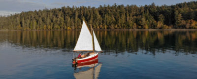
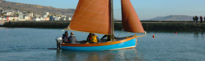
Roger Siebert is an editor in Austin, Texas. He rows and sails his Flint on local lakes, and has trailered it to a few of his favorite places on the Florida coast.
Is there a boat you’d like to know more about? Have you built one that you think other Small Boats Magazine readers would enjoy? Please email us!
Great story, I was back there again as I read. Thanks for sharing.
I’m glad you liked it. Thanks for reading.
It was a great read. Thank you for sharing and showing your interest in the natural world. You made it sound light and easy, obviously not your first solo trip.
Thank you, Sharon.
What a great story. As we say: “The smaller the boat, the greater the pleasure.” I’m sure Roger got more out of that trip than all the power boaters put together.
Thanks for reading, Matthew. Yes, there really is something special about little boats. They seem to amplify sensory perception instead of getting in its way.
I loved the story! I live just blocks from Goose Island State Park and enjoy the inland water here so much. Your story confirms my belief that a quiet weekend on the water and beach is restorative. Thanks for sharing it with the readers of Small Boats Magazine!
Thank you, Chris. “Restorative” is certainly the right word.
Hi Roger,
I loved your article. I have had the idea of adventuring to Sunday Beach in the back of my brain for quite a number of years now, but I never had the right vessel to make the voyage. I do now however. I was wondering if you could point me to some good resources to find routes and other good information about that jaunt. Thanks in advance.
Like Mack I was curious about the area while preparing my route for the Texas 200 last leg from Army Hole to Magnolia beach and wondering how I would cross Matagorda Bay. I’d be curious if anyone has sailed straight from Army Hole to Sunday Beach. Can it be done by a sailboat with a 10 inch draft? I found some interesting Kayak maps and routes at the following links:
https://tpwd.texas.gov/boating/paddling-trails/gulf-coast/port-oconnor/
https://www.sabaypartnership.org/manager/wp-content/uploads/Port-OConnor-Paddling-Trail-Guide.pdf
https://tpwd.texas.gov/documents/517/topomap_portoconnor.pdf