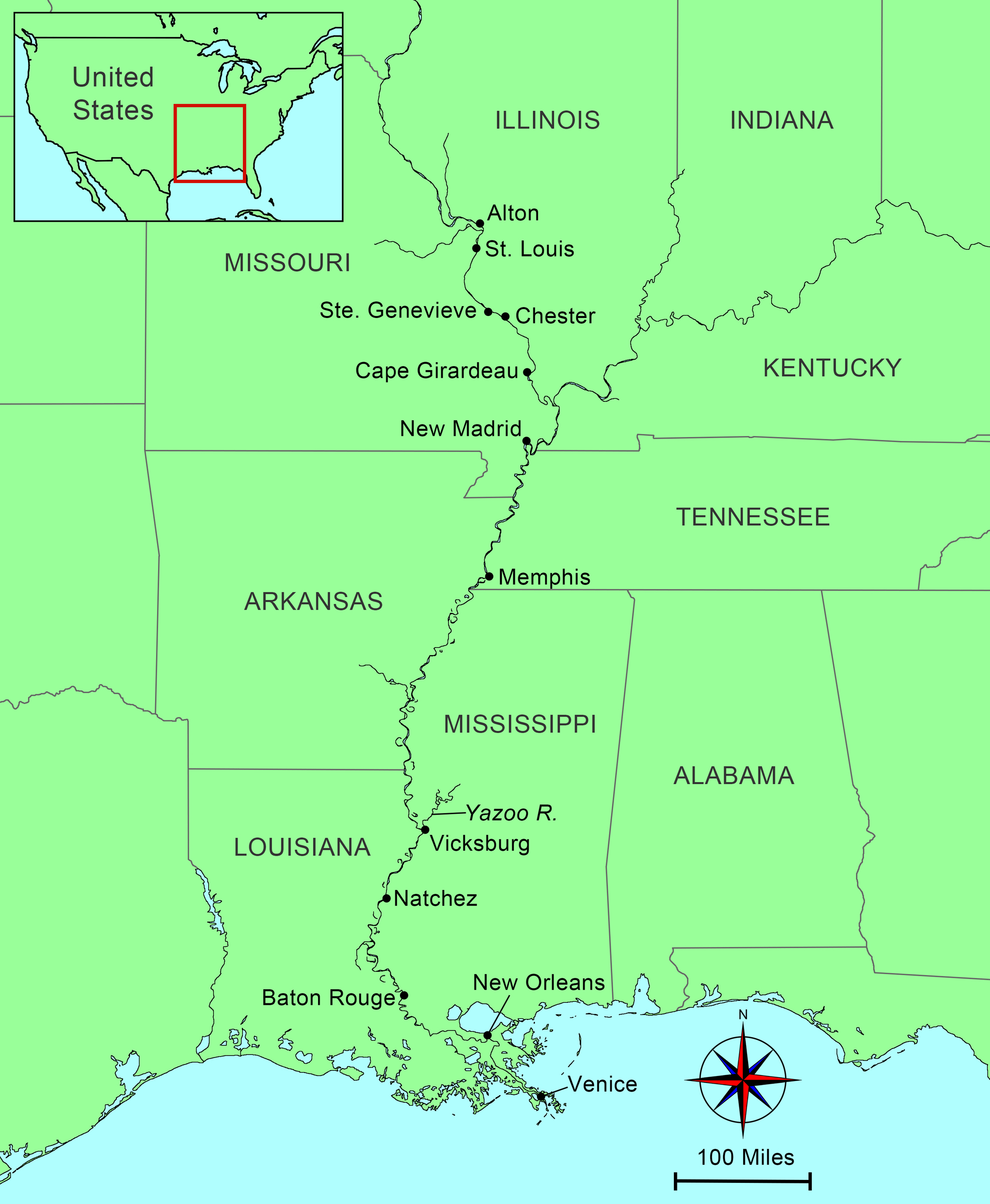
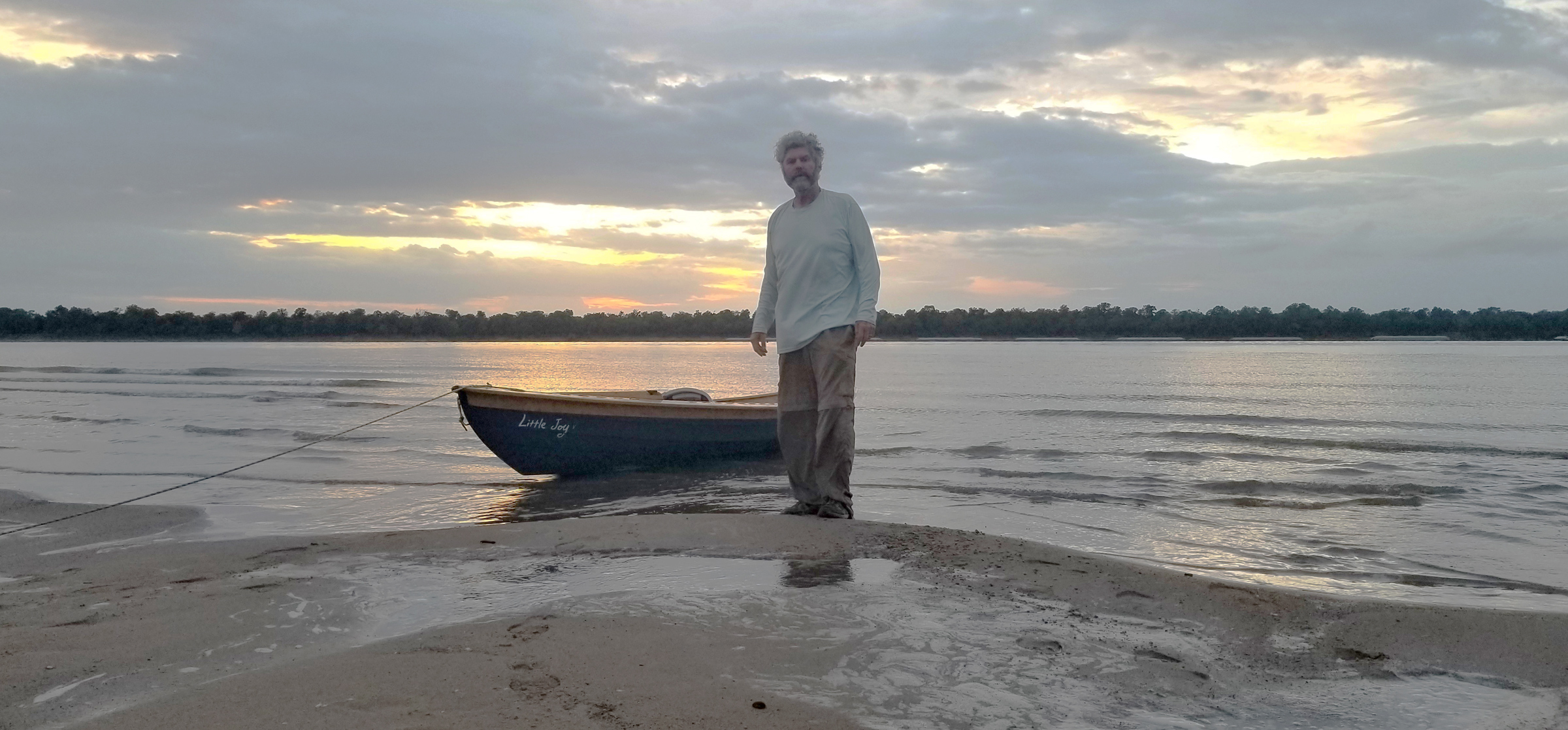
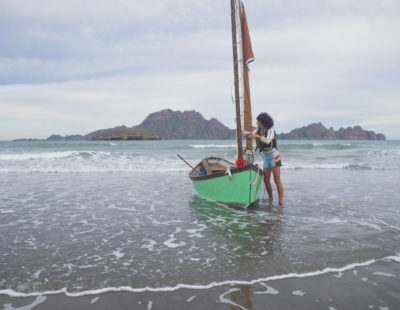
"Are you going all the way?” asked the voice from above. “I’m going to try,” I replied, looking up at the sole of a work boot at the lip of the concrete and above that a bearded face hanging over the railing. The immense tub of the lock engulfed me as I held onto a line dangling from 20’ above. The gray concrete walls stretched 1,200’ alongside my 17’ dory LITTLE JOY, and had long, heavy scrapes down their length, the scars left by the barges that pass through this lock around the clock. Sealed in on each end by battleship-gray steel gates, the water drained, dropping me another 11’. The Mel Price lock and dam, just downstream from Alton, Illinois, is the newest, busiest, and longest lock on the Mississippi River. More importantly to me, it is the last lock on the river.
The blast of an air horn made me jump as it echoed down the chamber–the all-clear signal. I rowed past the downriver gates and out into the churning river just below the dam and spillway. After a quick survey to get my bearings and check for river traffic, I pointed LITTLE JOY south. I was now free, like the river, to make my way to the Gulf of Mexico.
I had put LITTLE JOY in the river just a mile and a half above the lock and dam at the Alton marina, the very same place where I had taken out one year before when I rowed LITTLE JOY 650 miles from Minneapolis down to Alton (see “Downriver, Part 1” ).
Even though I was free of the last lock on the Mississippi, I still had a big first day ahead of me. I crossed the river from east to west and within 5 miles I reached the confluence with the Missouri River. Its muddy milk-chocolate-colored water, laden with sediment, violently shoves its way into the clearer blue-green waters of the Mississippi; whirlpools 25′ across appear quickly and then just as suddenly disappear. Water pushed up from below rose in big bubbles that splashed loud enough to make me look. I drifted through the confluence, once allowing a whirlpool to spin me completely around. After a half mile I was through the worst and prepared for the Chain of Rocks, 5 miles downriver, the last remaining natural obstacle to navigation on the Mississippi River.
The Chain of Rocks is a series of limestone ledges that stretch for 7 miles above St. Louis. The Army Corps of Engineers built an 8-mile-long canal that commercial vessels must use to bypass the ledges. In normal water levels small boats can pass through the 7 miles on the river. There is just a small set of rapids and a low dam to cross.
Three hundred yards upstream from the first ledge, I passed under the rusted steel trusses of the Old Chain of Rocks bridge and aimed for a stone tower standing alone in the river. The tower, the size of a small house but built like a castle with stone-arch windows and a round turret with a conical powder-green copper roof, was an old water intake for the city of St. Louis. The river parted and rushed around the stacked gray and white stone blocks of the tower base. It stood 40’ above me with water stains halfway up showing previous flood levels. Riding the current, I passed close enough to the base to brush it with an oar.
The boat was pulled by the current over a ledge, a foot or two high, and then carried through a couple of hundred feet of choppy whitecapping waves, and then it was over. The Chain of Rocks had been one of my big concerns of the trip and, thanks to the above-average water level and a river-worthy boat, I passed through easily and unharmed.
 Photographs by David and Xiaole Hudson
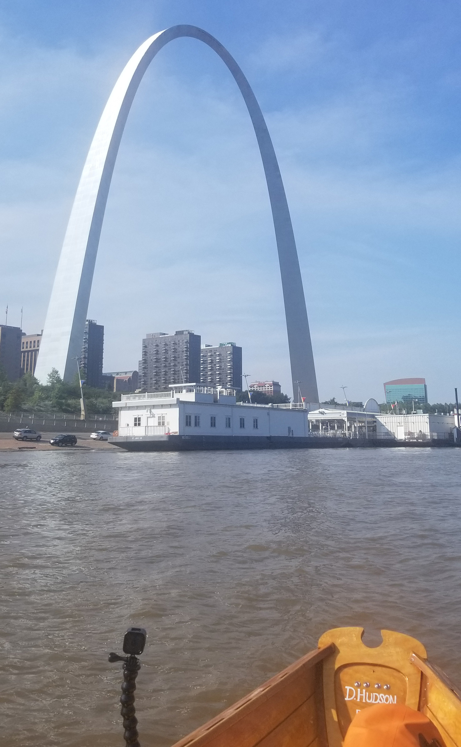
After I passed by the Gateway Arch in downtown St. Louis I had 179 miles to go to get to the confluence with the Ohio River, and 950 miles beyond that to the finish of my voyage at the Mississippi River delta.
Ahead lay the first of St. Louis’s seven bridges; beyond them, on the west bank, I saw the unmistakable silhouette of St. Louis’s Gateway Arch. I passed under the Stan Musial Bridge, a slender roadway supported by scores of white-painted cables fanning out from twin towers, then under the 146-year-old Eads Bridge, three arches of black steel latticework resting on sturdy granite piers.
I passed by the riverfront without stopping, trying to get past St. Louis by end of the day. The Gateway Arch, the iconic symbol of St. Louis, towered above the right riverbank, its stainless-steel cladding shining in the afternoon sun. I passed close by a paddle-wheel boat at a landing with tourists at its rail, waiting to debark. A woman yelled down to me, “Where are you going?” “New Orleans,” I replied. “Oh my!” she exclaimed, then I heard the husband say, “See, I told you.” I sat a little straighter and hoped I didn’t run into anything with an audience watching.

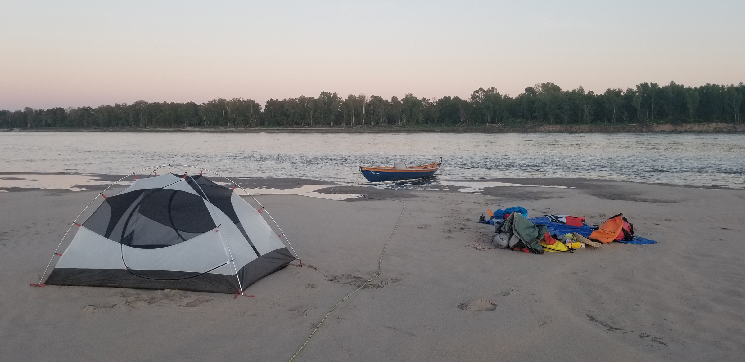
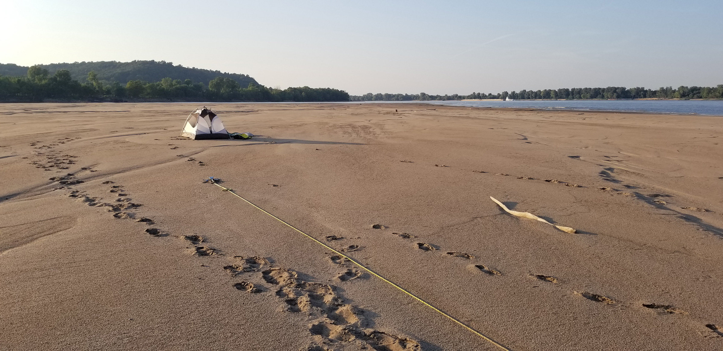
During the first days of the trip I was fortunate to find small protected beaches where I could camp for the night without hauling the boat completely out of the water. I’d set my tent close by on high ground where I could keep an eye on the boat and have a view of the river.
And there were things to run into. Downstream from the city riverfront, both sides of the river were lined with barges and industrial docks for as far as I could see. Towboats, the river tugs designed to push the barges, bolted around, moving, adjusting the barges along the banks. Rafts of barges three across and five long made their way up and down the main channel. I weaved my way down the west bank for 10 miles, stopping and scooting past the working boats.
As the industrial landscape slowly gave way to a more wooded one, I found a tiny beach protected by a small point. I set up camp, cooked up some rice and eggs, and watched the sunset over the river. I had covered 34 miles for the first day—1,230 miles to go to the Gulf.

At Ste. Genevieve, Missouri, I had a quiet night camped in a protective cove. As the sun rose over the levee, the calm remained over the water.
I was back on the river at sunrise and made it to the small town of Ste. Genevieve, Missouri, late in the day. Like many of the towns along the Mississippi, it is set back from the river, so there’s little evidence of it from my low vantage point. Adjacent to it, a limestone quarry was a dusty white scar that stretched for three-quarters of a mile along the right bank
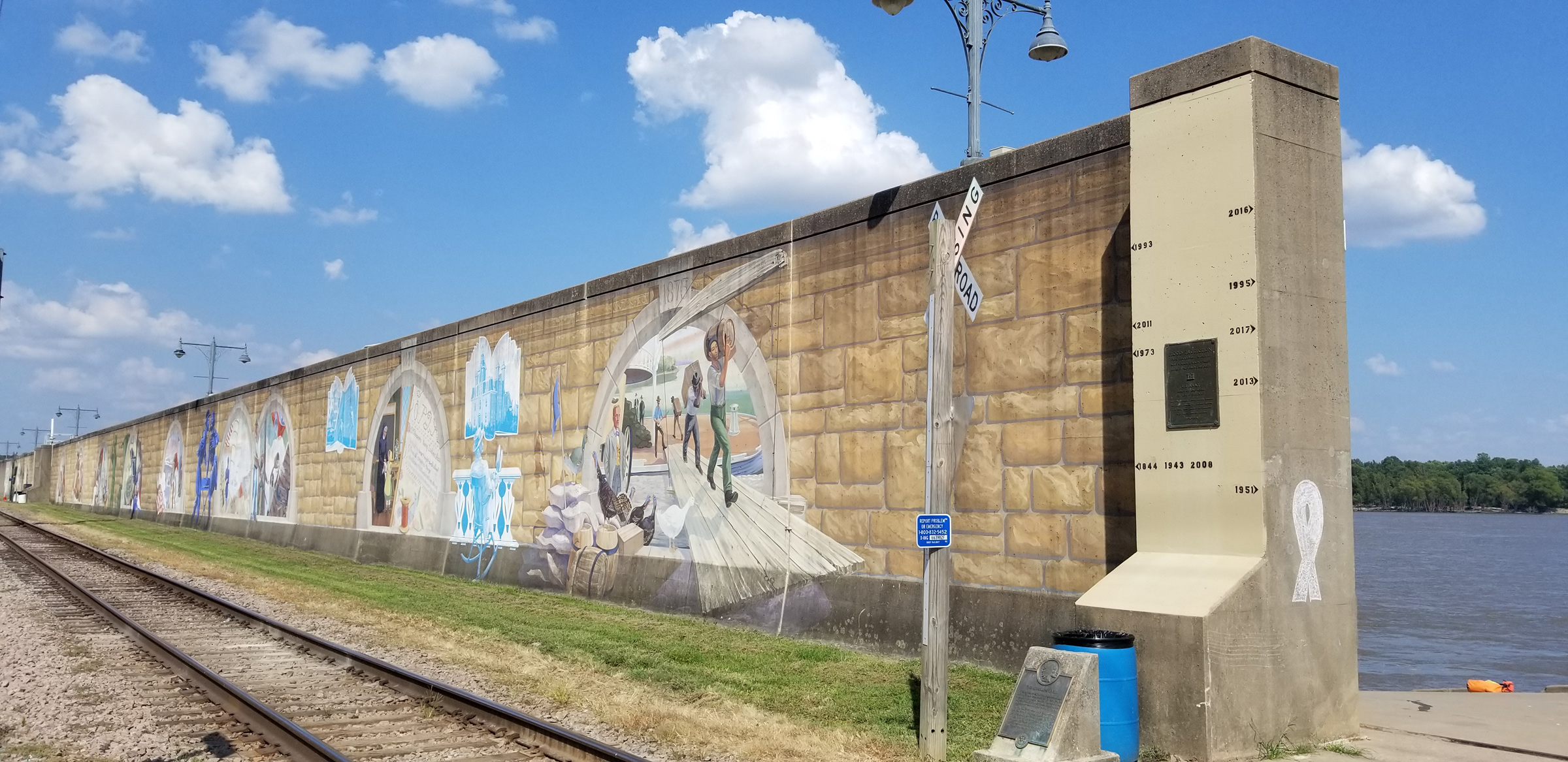
Flood walls like this one at Cape Girardeau also protect other river towns like Caruthersville, Missouri, and Vicksburg, Mississippi. Murals painted along the length of this flood wall depict the history of Cape Girardeau. The trompe-l’oeil stone work is part of the painting on the town’s side of the concrete barrier. Marks on the end post show the high-water mark of the many floods. At the top are the years 2016 and 1993.
The next day, I stopped for a hot meal in Cape Girardeau, Missouri, a city that hides behind a 20′-high, 6,000′-long concrete flood wall. I camped not far downstream, on a bend in the river surrounded by woods. The following morning, I stopped at Chester, Illinois, a town that took the high ground, a mile inland, and left the waterfront views to the inmates in the long rows of buildings of a state penitentiary.
About 110 miles downstream, I worked my way along the west bank as the Mississippi approached the confluence with the Ohio River. I pulled ashore on a sandy point at the end of the Illinois peninsula that separates the two rivers. With two empty gallon jugs in hand, I walked up the hill to Fort Defiance Park looking for water. Wearing a sun-bleached, wide soft-brimmed hat, a neck buff, and long-sleeved shirt and pants to protect myself from the sun in the 95-degree heat, I was sweat soaked. I was also wearing the dirt and smell of the past four days it took me to get there from St Louis. I took refuge under the shade of a broad-limbed oak tree. Two young women, better dressed for the day in shorts and sleeveless tops, came over to me, apparently undisturbed by my clothing choice of head-to-toe coverage. “Do you know which one is the Mississippi?” one asked. I explained to them that the Upper Mississippi was the river on our right and the larger, busy river on our left was the Ohio, which was coming down from Pittsburgh. Directly in front of us was the confluence, and beyond that the combined rivers are referred to as the Lower Mississippi. “Thanks for the geography lesson,” they said sincerely but with a laugh. They walked back to their car and I was tempted to ask them if I could sit in their air conditioning for just a couple of minutes.
For the Lower Mississippi, I switched to a new set of maps, which are produced by the Army Corps of Engineers and used by commercial traffic for navigation. They show detail of the entire river, mile by mile. Where I stood was 953 river miles to the Gulf of Mexico.
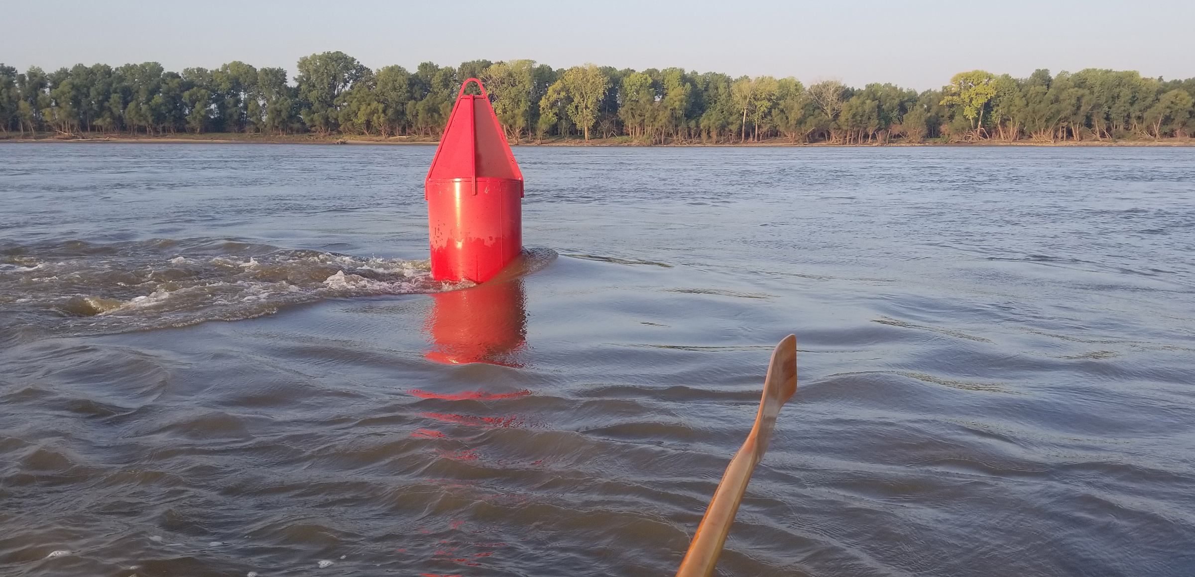
Hundreds of steel buoys mark the 9’-deep navigation channel that runs from St. Paul, Minnesota, to the Gulf of Mexico. For a little excitement, I sometimes tried to see how close I could get to one as it raced by.
I returned to LITTLE JOY and rowed on a course directly straight down the middle where the two rivers became one, and quickly realized that I’d made a mistake. The confluence is over a mile wide and for 2 miles beyond Fort Defiance, the water was choppy and swift. The shipping channels of the Upper Mississippi and the Ohio, marked by red and green steel buoys, converged right ahead of me and I was headed right down the middle of the main channel of the Lower Mississippi. Tows, consisting of a single towboat pushing a raft of 15 or 20 steel barges tied together and covering an area larger than one-and-a-half football fields, had been regularly passing in every direction, and I had to stay well clear of them. I headed west to the Missouri shore and out of the main channel, but still stayed alert for traffic.
It was a different river now, more than three-quarters of a mile wide, half again as wide as the Upper Mississippi that I’d just left. It seemed swifter too, and although I had no way of measuring its speed, I made about 4-1/2 mph the rest of the day.
I had set up camp on a large, barren sandbar about 10 miles below the confluence along the Kentucky shore. The water lapped at the sand as I stretched out and took deep breaths. Across the river, the setting sun, glowing a flaming orange, lit the cloudless sky with yellow, red, and purple streaks. On the eastern horizon, a brilliant white full moon rose big and bold.

On many evenings, I took time to get much-needed rest time before setting up camp. Here I am studying the Corps of Engineers river navigational maps to see what’s ahead in the coming days.
I set my tent on the sandbar’s high ground, which was just 2′ above the water’s level, enough, I hoped, to accommodate an overnight rise. My kitchen was a poly tarp spread on the hard sand and anchored with dry bags and food containers on it. For dinner, I cooked up a pot of rice with two foil packs of tuna stirred in. It was a simple meal, but comforting as I dined propped against a dry bag and looking out over the river. In what was left of the fading evening light I studied the river maps to get a sense of what was in store for me tomorrow. When the sun set and the air grew still, the mosquitoes came out and chased me into the tent. The clear sky promised no chance of rain, so I left the rain fly off and lay on top of my sleeping bag, watching the rising full moon through the tent’s screen roof until I drifted off to sleep.
The alarm on my phone went off at 5 a.m. In the still-dark tent, I went through a routine of lower back stretches. My trip down the Mississippi last year was cut short at St. Louis by severe lower back pain. I was determined to not have that happen on this one.
The moon, now setting on the western horizon, illuminated the dark waters of the river as I finished packing the boat and shoving off. I stayed away from the main channel and worked my way close to shore. The heavily wooded banks were cast in a long soot-black silhouette as a faint yellow light appeared in the eastern sky behind them.
My simple camp on a sandbar was usually my tent, an area to eat and rest, and the boat with the anchor line far on shore just in case.
With the sun finally rising over the tree line, I pulled in the oars and let the current carry me. With the sun came the heat, and I slathered sunblock as thick as house paint on my face, hands, and bare feet. As the morning burned on I rowed hard enough to keep moving with the current but never have to pull with all my might. I made almost 5 mph. I chugged water, hot and tasting of plastic, straight from a one-gallon jug.

The Mississippi piles up debris on the upriver points of mid-river islands. Among the tree trunks deposited by the great flood of the spring of 2019 you can see, at the left of the pile, a green channel buoy, a full 8’ in length, carried here by the current. It is just one of many buoys that get moved out of position or tossed ashore with each flood.
After making my way around a hairpin turn in the river, I found myself with the morning sun on my left shoulder, an unsettling feeling because I was heading north. I had just entered the 20-mile-long New Madrid Bend, the only place on the Mississippi where it turns completely back on itself. I continued downriver, north, for 10 miles and approached the town of New Madrid at the top of the horseshoe.
A black bassboat with an oversized outboard approached me slowly and carefully. I stopped rowing. “What y’all doin’?” one of the two burly, bearded men asked in a thick drawl. “Rowing the Mississippi. What are you guys doing?” I asked. “Catfishin’,” they told me, and then asked if I needed anything. I thanked them and told them I was going into town for supplies.
The riverfront of New Madrid, Missouri, has an uninviting mile-and-a-half-long levee of boulders, stones, and gravel 30′ high with a stone-block flood wall 10′ high on top of that. A sign on the concrete wall says “Welcome to New Madrid.” The only access to town is a long boat ramp leading to an opening in the wall at its downstream end. I approached the ramp quickly, ready to tie off to a small steel floating dock. I would have one chance. There was no going back upriver against the swift current.
Just behind the levee at the upstream end of the flood wall was a small brick building with twin glass doors, the New Madrid Historical Museum. I walked in and a cold blast of an air conditioner washed over my sweat-soaked shirt. I was soon shivering. “Are you one of my paddlers?” asked a lean man with wire-rim glasses. I told him I was in a rowboat, not in a canoe. “Oh, that’s why you’re not as dirty as the other guys.” He pointed out the restroom and mentioned a hose out front to fill water jugs, and told me I could hang out as long as I wanted. “New Madrid is known for two things,” he told me, “the battle, and of course, earthquakes.” Earthquakes?
I was the only one in the museum. I strolled through looking at iron, lead, and steel artifacts from the Battle of Island Number Ten, a 40-day-long Civil War battle fought here in 1862, and scientific instruments, charts, and maps of earthquakes that occurred here in 1811 and 1812. A poster-sized engraving depicted the three-week bombardment by Union gunboats of the fortified Confederate island, and I try to imagine what that must have been like, occurring just outside these doors on the river. The curator told me about the three massive earthquakes that shook New Madrid. They were felt across the central and eastern U.S., and the shaking caused church bells to ring as far away as Philadelphia and Boston. During one of the first tremors the earth under the Mississippi rose and made the river briefly flow backward.
I walked a half mile out to the highway for a café meal, stopped at a store for bread, tuna, and ice tea, picked up a couple of sandwiches, and had a warm walk back to the boat, a walk that I repeated when I realized I had left my phone charger at the café.
Eighteen miles downriver from New Madrid, I camped on a sandbar in mid-river. Memphis, Tennessee, was only 135 miles away and I decided if I put in some extra effort, I could be there in two-and-a-half days. In the next two days I stayed on the river for 10 hours each day and covered 100 miles.
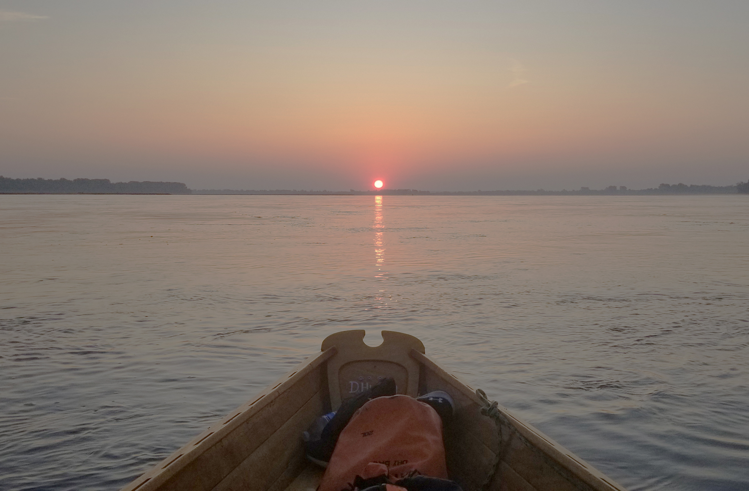
I was often on the river and rowing at dawn. I experienced a sunrise like this for four days in a row, but it never lost its effect on me.
At my camp 35 miles upstream from Memphis, I woke after daybreak with light suffusing my tent. With only 35 miles left to reach Memphis, I took some extra time in the morning to rest—the heat of the past nine days had been taking a toll. I packed up and got on the river.
As I got closer to the city, a 300′-tall glass-sided pyramid loomed over the trees lining the riverbank and dominated the other buildings in the Memphis skyline. With the city now crowding the banks next to me, I passed under the pale-green twin arches of the Hernando de Soto Bridge and rowed three-quarters of a mile to the downstream end of Mud Island and rowed into Wolf River Harbor.
The marina there was full of activity. Two cruisers, heading to the Gulf, were taking on hundreds of dollars of fuel. Other boats were heading out to the river to fish. In the marina office I was told all the slips were full because there was a catfish contest going on. A man in a wrinkled button-down fishing shirt and cargo shorts came over, pointed to a black steel dock, and said I could tie up there. When I asked what I owed him, he said, “We don’t charge you guys anything. Only I can’t let you camp here. The city will chase you off.” No problem. I had been planning on getting a hotel for two nights to rest.
In the shade of an awning, it was an oppressive 99 degrees. I walked into the city, checked into a hotel and, in my room high above the city, I turned the air conditioner as low as it went and lay down in a cool, clean bed. On my two days off, I took meandering walks around Memphis.
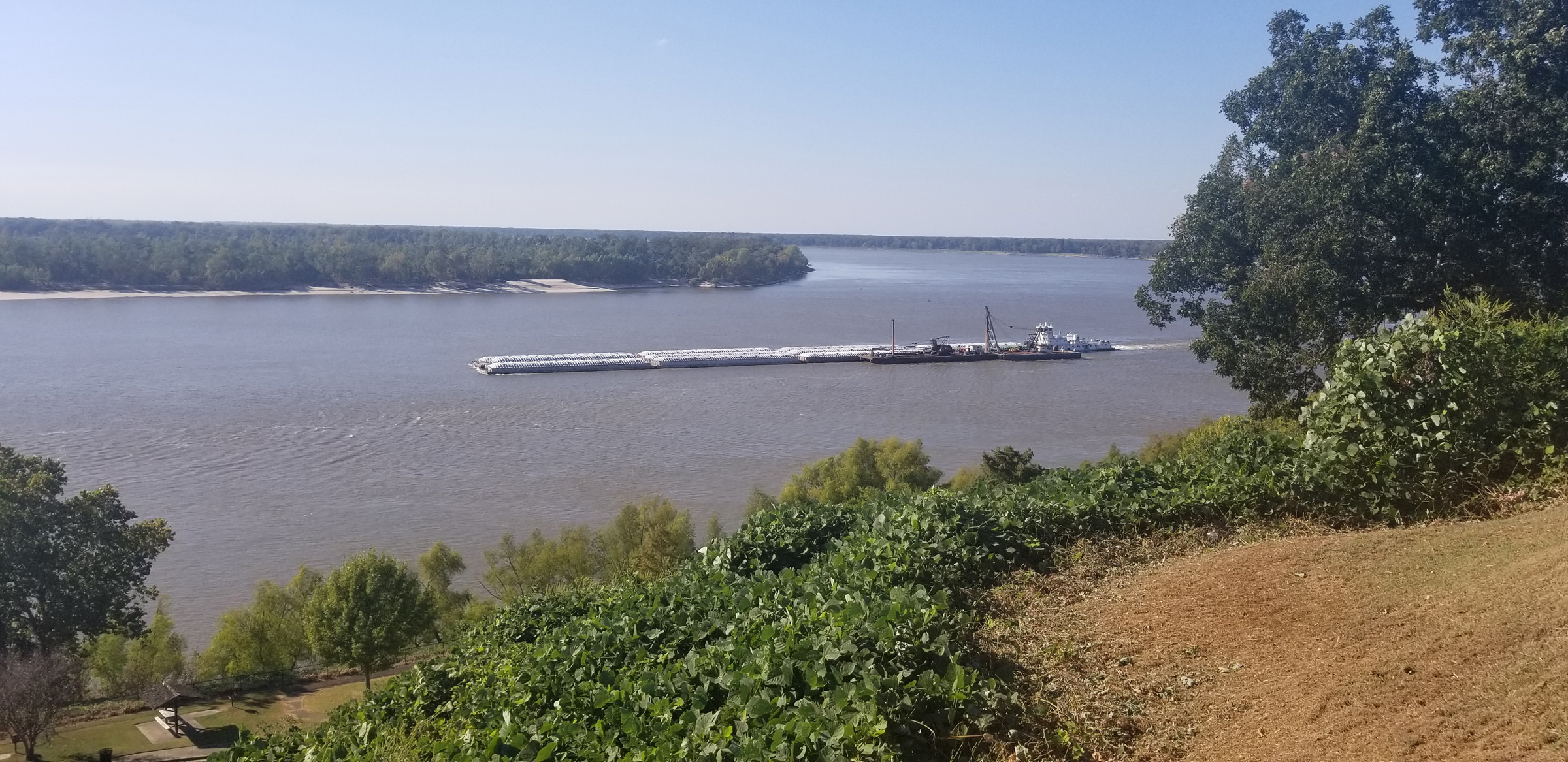
The view from high ground helps illustrate the size of the tows that ply the Lower Mississippi. This one has just 11 barges; imagine a tow with 30.
Well rested, I set out on the river again and, after rowing for three days, I beached LITTLE JOY on a bend in the river 121 miles from Memphis. The current was racing by, so I kept a hand on the bow line to keep the boat from being pulled off the shore and swept downstream. There was a tow a quarter mile away downriver. Tows on the Lower Mississippi are not restricted in size by locks, and I saw a few with more than 30 barges, covering an area greater than three-and-a-half football fields. I couldn’t tell if this tow was moving, but I didn’t want to take the risk of having my boat ashore if it passed by, leaving me to contend with its wake. I decided not to wait, and shoved off and let the current take me.

Whenever I pulled LITTLE JOY ashore near the navigation channel, I had to keep an eye out for vessel traffic. This tow was churning upriver and dragging a large wake, so I’d have to tend to my boat before the wake reached shore. Only when I pulled her on the beach or found a protected place to leave her could I turn my back on LITTLE JOY.
Another tow of six barges appeared farther downstream, churning toward me. It was too late for me to stop. The first tow I’d seen was parked with the tug’s props turning, pushing a lead barge into the bank to hold the tow fast; I waved my hat, hoping the pilot would see me and would stay put as I rowed by. The tow bound upriver was drawing near. I just kept LITTLE JOY’s bow pointed downriver and hugged close to the parked tow and flew by in the narrow channel, buffeted by the passing tow’s wake.
In the next 2 miles, on a long, straight stretch of the river, I counted 13 tows parked at an angle as if on an old-fashioned Main Street, their bows pushed into the banks of both sides. I didn’t know what to make of it and, unsure what to do, I went right down the middle of the river.
Two long blasts of a horn made me turn to look over the bow. A small tow was coming upriver and, even though I was out of the channel, I guessed he was letting me know he was coming. It was an Army Corps of Engineers barge loaded with a crane and construction equipment. A second one soon followed. It was the last moving towboat I saw for the rest of the day. I don’t know what happened to cause the commercial traffic to halt, but I took advantage of it and rowed until sunset, covering 60 miles in 12-1/2 hours on the river.
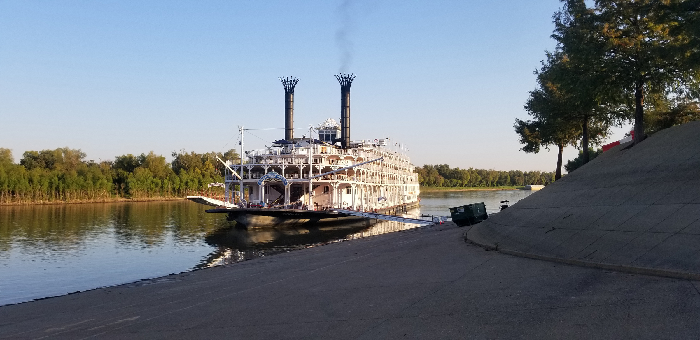
Several cruise ships passed me on the river, some more than once. This stern-wheeler, AMERICAN QUEEN, launched in 1995 with a length of 418’, may be the longest river steamboat ever built. She came in the night up the Yazoo River to stop at Vicksburg.
When I arrived at Vicksburg, Mississippi, I had to row one-and-a-half miles upstream along a tributary, the Yazoo River, to get to town. Vicksburg used to be on the Mississippi, but on April 26, 1876, the river cut across a peninsula on the Louisiana side, and left Vicksburg high and dry. It was land-bound for 27 years; in 1903 a diversion canal rerouted the Yazoo River to run by the city’s landing and reestablished Vicksburg as a Mississippi River port.
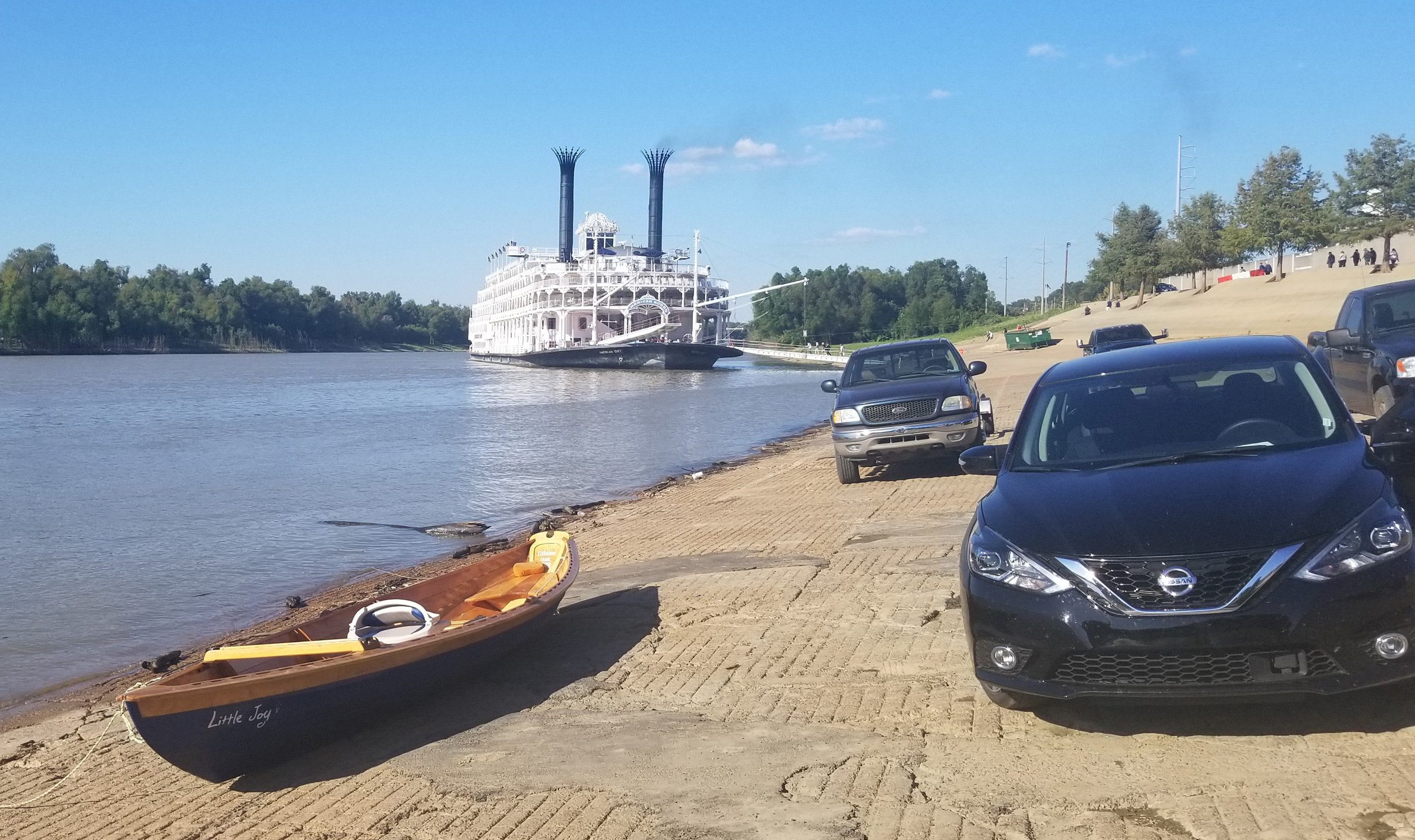
I spent two nights in Vicksburg and had no place safe to leave the boat, so I pulled LITTLE JOY out of the water and left her at this very busy boat ramp on the Yazoo River. In the morning I was surprised to find AMERICAN QUEEN, with its 222 staterooms, dropping off passengers for tours of the town.
My row from Memphis to Vicksburg covered 300 miles and took seven days, seven gallons of drinking water, two gallons of iced tea, and was without a single town visit. I stayed two nights at a hotel next to the boat ramp to take a break, do laundry, buy supplies, and pay a visit to the Civil War battlefield park.
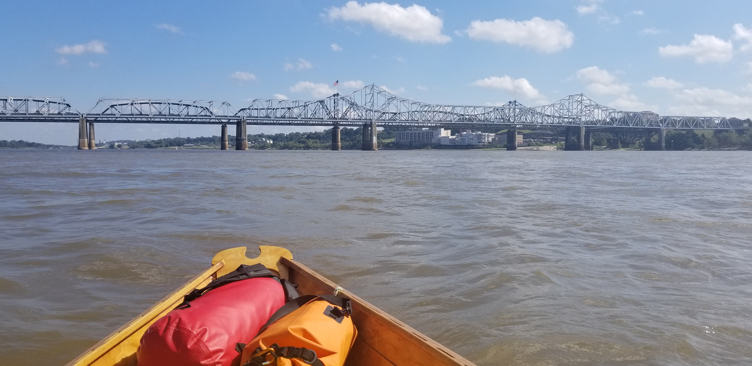
These bridges at Vicksburg are two of the 130 bridges, both auto and railroad, that span the Mississippi. The view here is upstream as I’m leaving town. Beneath the central spans, at right, is a sprawling casino/hotel complex. The town of Vicksburg is in the distance at left. Bridges were fewer and farther apart the farther south I traveled.
Back underway, I dunked my hat and neck buff in the river and put them back on. The cold water soaked my shoulders and back. Even though it was October, the weather was sweltering. I had been on the river 23 days and had not seen a drop of rain nor a day when the temperature did not reach 90 degrees.
A 2″-long dragonfly landed on the thwart in front of me. Its multifaceted iridescent eyes and electric blue and green body glowed on the muted earth tones of the wood. Its wings, all but invisible save for their black veins, blurred suddenly and the dragonfly took off. Moments later another took its place.
Herons and cormorants gathered on the beaches and in the trees. A flock of cranes flew high above me, their long necks extended ahead and their legs trailing behind with toes pointed. As I approached a wooded, mid-river island with a sandy beach, I jumped in my seat when an Asian carp, easily 2’ long, jumped over my port oar, bounced off the top of it, and came down with a splash. The Asian carp, an invasive species, always jumped at my approach in the shallows.
Standing on the bank of the island, I bathed with a jug of cold river water. While it was not muddy and appeared clean, I used it carefully. I knew from my pre-trip research that the Mississippi is the second most polluted river in the United States. The cooling effect of the bath didn’t last long. After I set up my tent I was once again dripping with sweat, and lay down to sleep, waiting for the sun to set and the barely perceptible cool of the damp river air.
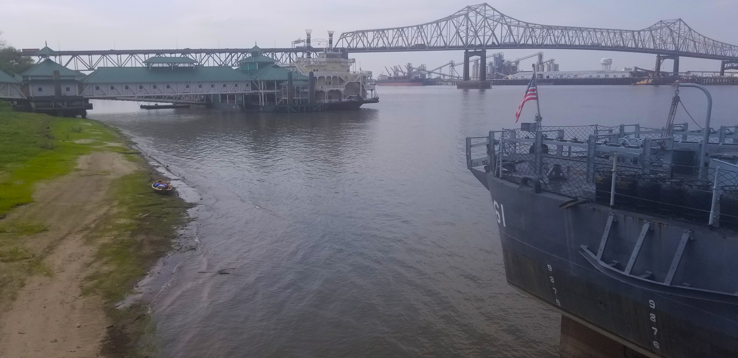
In Baton Rouge, I pulled LITTLE JOY on this beach where she was just a speck behind the USS KIDD, a 376’ destroyer. I only stayed a couple of hours before heading out for the most dangerous part of the trip—Baton Rouge to New Orleans—where I’d have to make my way through heavy commercial vessel traffic.
Baton Rouge, Louisiana, lay only a half mile away, but I could not get there. I was on the wrong side of the river and as I waited to cross, tow after tow churned up and down the main channel of the river. I stopped 75 yards upriver of a string of anchored barges and waited for my chance. The black steel bows loomed over me and I thought it would be scary if they started moving. A deckhand came walking down the length of barges. “Hey,” he said casually, “could you move out of the way?” Without replying I scooted quickly off to the side where I could see smoke and the ripples of heat rising from the towboat behind the barges. “Attention in the rowboat,” said a voice over a PA speaker. “Are you alone?” I looked up and nodded my head but I could not see anything behind the reflective glass on the bridge. “I thought I saw two of you,” the booming voice said. This time I stood up and raised one arm over my head to indicate I was indeed alone. The Captain must have understood because the engines revved to a high whine and the tow moved out into the channel. I crossed right behind and stopped in Baton Rouge for a couple of hours.
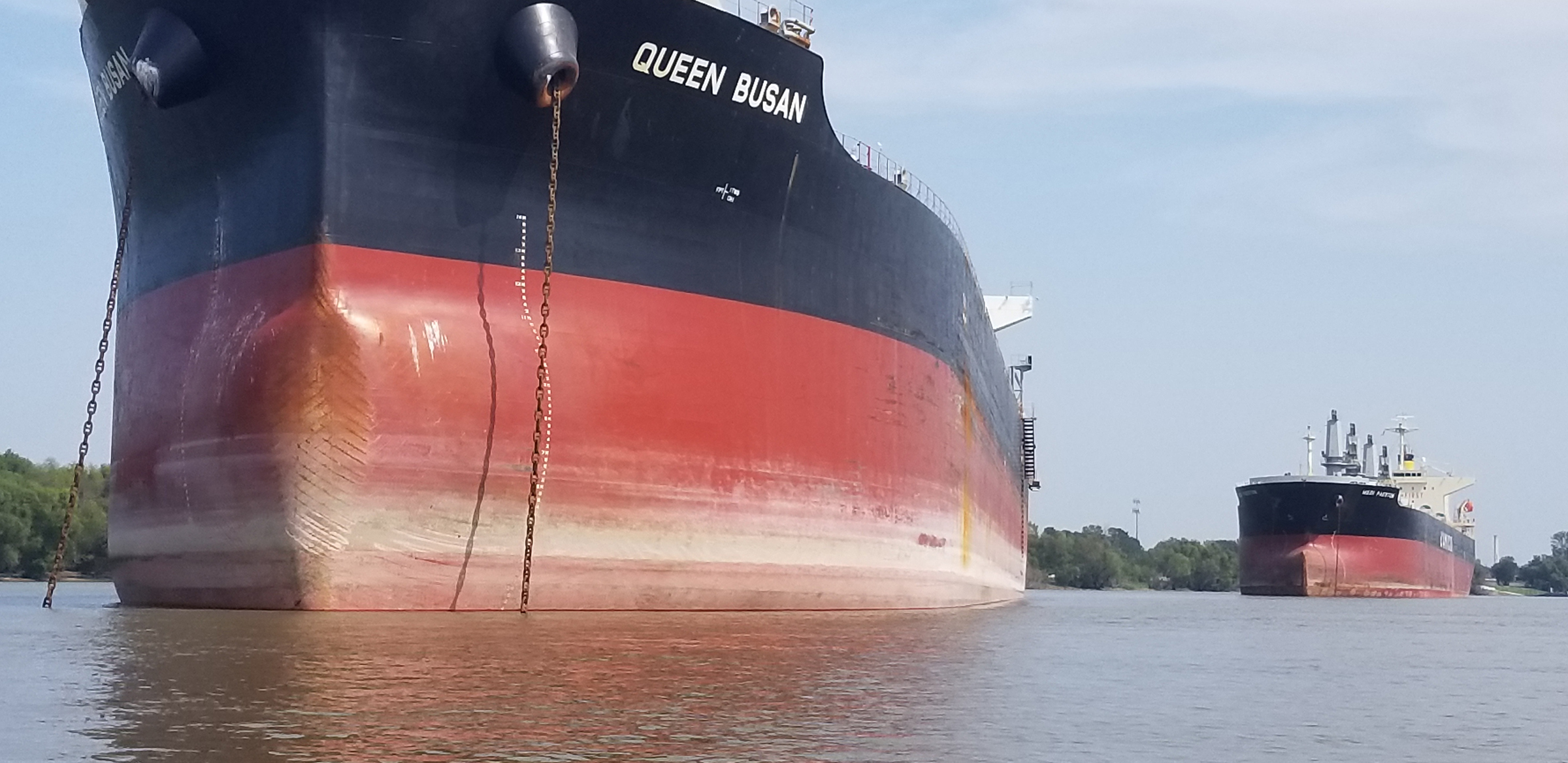
There were several ship anchorages like this one below Baton Rouge. I would look at the ships for an anchor chain or exhaust from the stack. I could pass by anchored ships in relative safety, sometimes even close enough to touch them, but I stayed well clear of ships with their engines running, whether they were underway or not.
The 105-mile stretch between Baton Rouge and New Orleans is one continuous deepwater port and one of the busiest in the world. The barge captains call this stretch Suicide Alley because of the amount of traffic.
For the 11 hours and 47 miles that followed leaving Baton Rouge, I was puckered up tight, dodging barges, shuttle boats, tugboats, piers, and docks. The ship anchorage was something new to me: large ocean-going cargo ships were anchored in line out in the river. I passed by them peacefully, but I stayed alert for the many fast shuttle boats bringing supplies or crews back and forth.
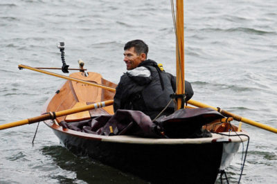
I took this self-portrait to commemorate a 60-mile day. I wasted no time setting up my camp on the sandbar so I could crawl into my tent to rest.
As I rowed downriver I spotted a large pipe stretched halfway across the river to a three-story-tall barge. It was a dredging operation. As I approached, a horn made three long blasts. My pucker got tighter. Was that for me? A fast boat from the Army Corps came out and instructed me to pass by near the bank and then took off in a blur.
I camped behind a barge anchorage with towboats shuttling barges back and forth all night to a noisy, dusty loading pier right next to me. I didn’t care. It was safe and I hadn’t seen a better place to camp all day.
I repeated the same scenario the next day but found a nicer beach for camping on the west bank at the end of a barge anchorage just above the city of New Orleans.
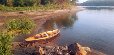
I enjoyed camping on the many sandbars on the Lower Mississippi. I made this camp far from the shore on what little high ground there was. I was unsure if the river would rise during the night and cover the sandbar.
I was up before daybreak and ready to go. Barges passed by as they had all night. I waited and ate Pop-Tarts until sunrise, when I’d have a better chance to see and be seen.
The sun was up as I passed under the Hale Boggs Bridge, a cable-stayed span over the half-mile width of the river. There would be no stopping; I wanted to get past New Orleans by the end of the day.
I reached the Huey Long Bridge, the first New Orleans landmark, at 11 a.m. I crossed the river there from right to left, holding my breath as I rowed as hard as I could, slipping in between the tows going up and down the river. At noon I reached Butterfly Riverview Park on the east side of the city. People walking the footpath along the river were enjoying their Saturday, looking out over the river and at me. I waved. Two long blasts of a horn deafened me. A barge, which I thought was anchored, was now moving along the bank. It honked at me even though I was all the way over near the shore. It passed me just as I was right in front of a group of 10 people, now gathered by the sound of the horn, to watch me get run over. I gave them a friendly wave.
Five miles downriver from the park, with the Crescent City Connection bridges right in front of me and downtown New Orleans crowds on the left bank, I had to wait under the bridges for a few minutes as the stern-wheel steamboat NATCHEZ made a U-turn right in front of me. I was next to the river cruise ship AMERICAN HARMONY and saw a uniformed officer out on a balcony. “You guys passed me four times in the past two weeks!” I said to him. “Yep,” was his only reply.
I made my way slowly past the New Orleans downtown riverfront. Most of it is set on pilings 15′ above the river, and I couldn’t see anything except the high-rise hotels and people leaning on the rail above. I rowed close to the pilings, and some people looking down at me waved, some took pics, and some just ignored me. I passed by the NATCHEZ, now tied up to the pier, as its steam-whistle calliope was playing “New York, New York.” After I rowed around Algiers Point on the right bank, the wind picked up and I put New Orleans behind me. I pushed on another 13 miles and made camp on a sandy, willow-covered bank right next to the 81-mile river marker.
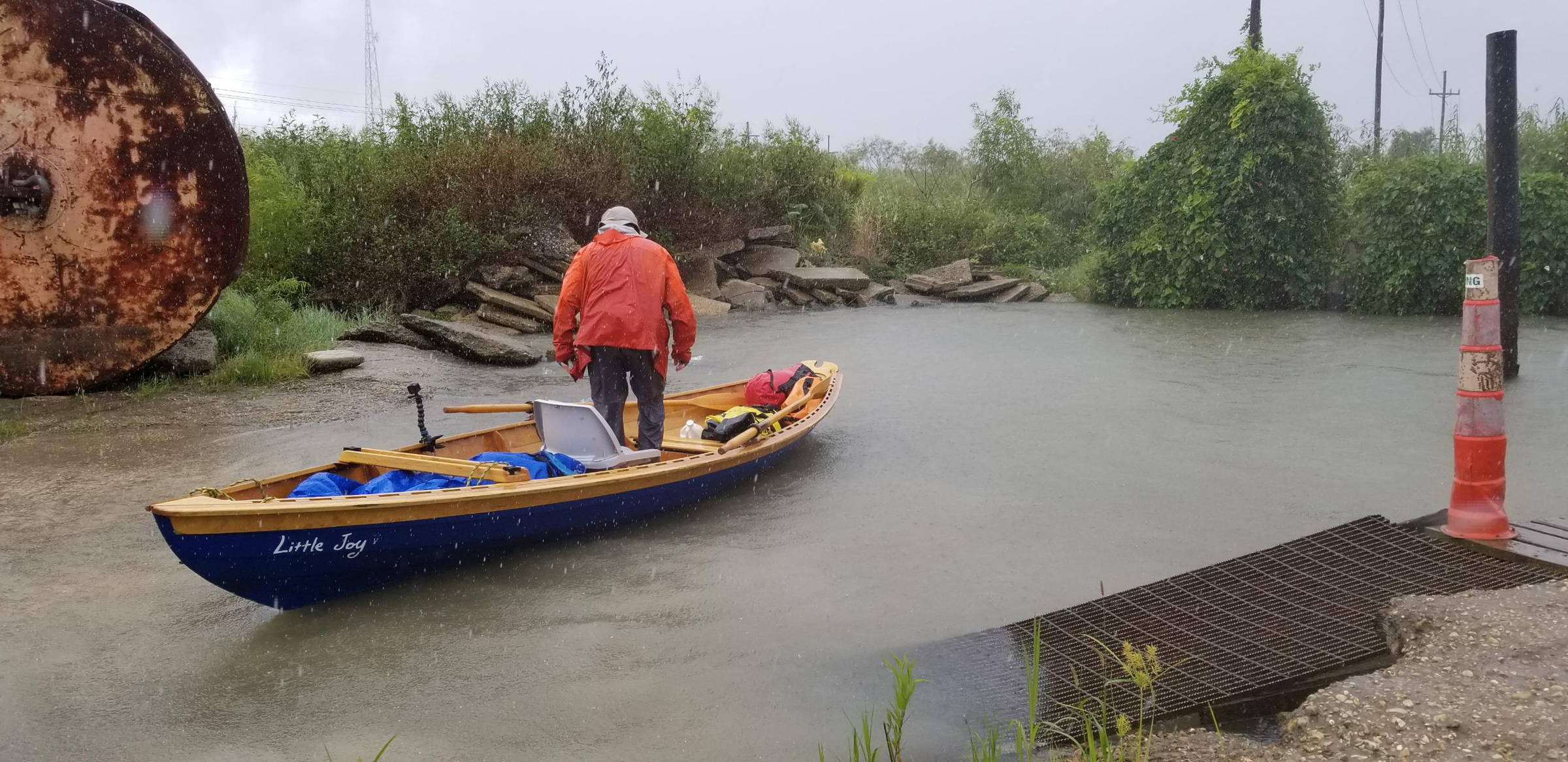
It rained on and off for the last two days of the voyage. I stopped here at a small hidden public boat ramp for a brief rest and to reunite with my wife. Over the last 60 miles of the river’s course to the Gulf of Mexico the banks were either stone levees or marsh or mud with few protected places to stop.
The first rain of the trip arrived the next morning along with strong winds and I only made 31 miles before I stopped and camped in a small grove of trees on a muddy bank.
It was pitch black as I stared out at the river in the wee hours of the morning, debating whether to go or not. My wife, Xiaole, had flown in to New Orleans the night before and would meet me in Venice, just 40 miles downriver and the last community on the river accessible by road. I had to finish today. I pushed LITTLE JOY off the mud and got aboard. As I rowed close to the bank, I looked over my shoulder much more than usual since I couldn’t see obstacles in the river any farther than 100 yards ahead. Shortly after my start, at Pointe à la Hache, a rural riverside neighborhood, I stopped just upstream of the ferry dock and waited for a ferry, loaded with a half-dozen cars, to leave for its half-mile crossing of the river. It was 5:30 a.m. when I scooted by.

With 15 miles to go to the finish I set out between storms. I was exhausted by this point and made the last few miles only on the adrenaline generated by the excitement of finishing.
The blue-gray wall of a storm was coming at me from the east, and flashes of lightning pushed back the dark. I stayed right next to the left bank and took refuge from the driving rain and the frequent lightning under some small trees.
When the rain eased, I crossed the river to shave off some distance as I approached a blind bend in the river. I only needed 15 minutes to cross, but I could not see up or down the river far enough to see oceangoing cruise ships and giant container ships. They were passing about every half hour and moving fast so I kept a close watch on the river. I crossed the river several times that day without incident.
Later that morning, a second storm rolled over me bringing thunder, lightning, and high winds. On the river, the thunder seemed much louder than on land and it was so close that I could feel it in my chest.
The rain continued on and off through the afternoon as I approached the take-out in the town of Venice. “David!” I heard Xiaole’s voice over the wind. She was standing by the edge of the river at a small, nearly hidden boat ramp. It was the first time I’d seen her in a month and in her orange raincoat she was looking as beautiful as ever. I rowed ashore and got out and kissed her briefly. I was exhausted from the wind and the rain and the waves and, with 13 miles still left to row and unsure if I could reach Venice, I’d save a long hug for the finish.
The rain stopped and I set back out, but immediately the wind picked up and the waves battered the boat as a third storm from the east rolled in, the fiercest yet. I found a protective cove behind a jetty and held on tight to a willow bush. I turned my back to the rain and waited.
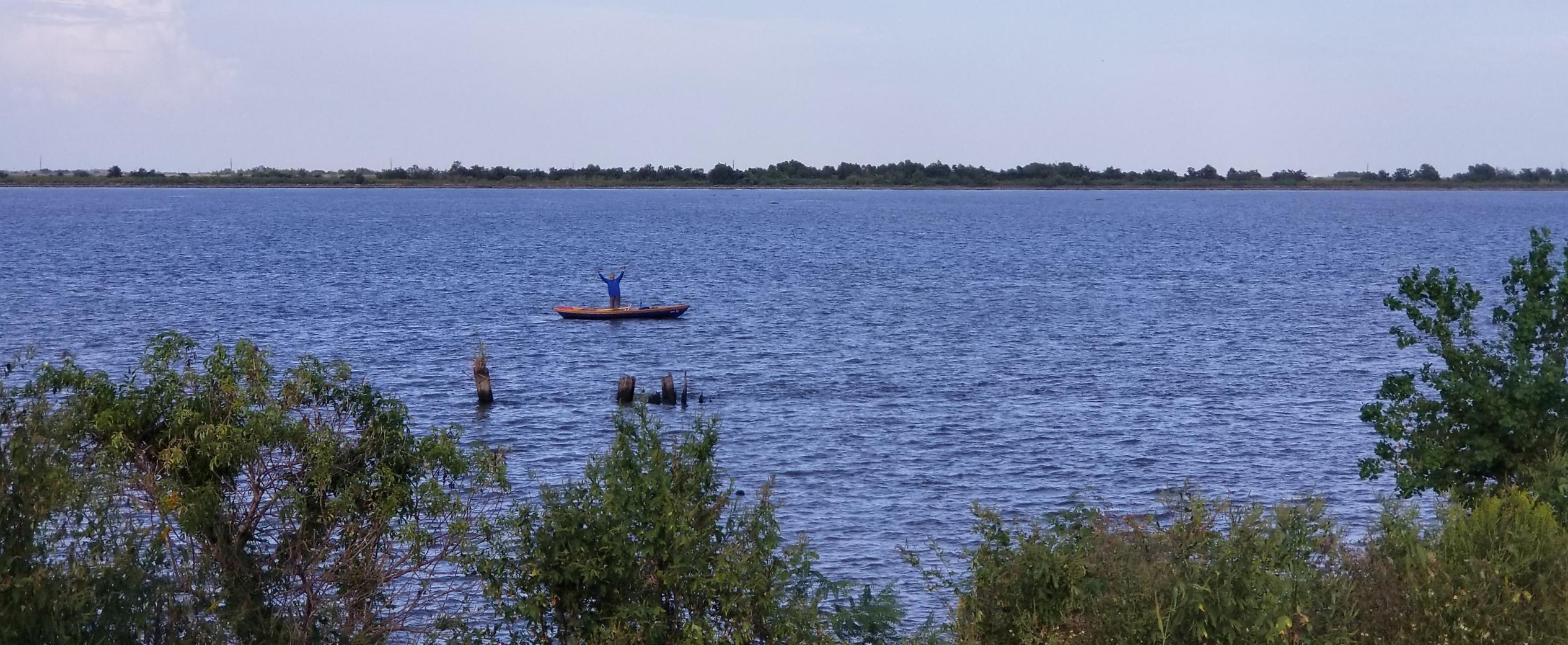
With just a few more miles left to row, I was exultant at seeing Xiaole on the riverbank.
As the storm passed, patches of blue sky shone through. It was only 3 o’clock as I set out for the last 12 miles. Channel markers counted down the remaining miles. The wind eased and came around from the northeast, helping me along. There were still 5 miles to go. My hands ached, but I rowed hard, without stopping. Now 3 miles. I saw a couple of fishing boats coming upriver from the Gulf heading into the channel that would take them up to Venice. I rowed even harder and stopped only when I reached that channel. Hunched over to catch my breath I heard yelling from the shore. Xiaole was jumping up and down on top of the levee. I stood in the boat, facing her, and raised my arms.
I still had 2 miles to row down the channel to reach the Venice Marina. I rowed at an easy pace as 40′ sport-fishing boats with four outboards passed by, some slowing, some not. I really didn’t care.
At the marina, the manager said, “We never ask you guys for anything.” He gave me a small, out-of-the way slip where I could leave the boat for a few days as I got ready to take LITTLE JOY home. Xiaole found me on the dock, and this time I hugged her tight and held on.![]()
David Hudson is a happy corporate refugee. As a teenager, he spent countless summer days rowing a 10′ aluminum pram around a small New Jersey lake. Later he cruised the Atlantic and Mediterranean atop the deck of a U.S. Naval helicopter carrier. Downsizing since the Navy, he has spent time exploring the rivers and lakes of New Jersey, New York, and Ontario in a canoe. Putting his woodworking skills to a test, he built his 17′ dory, LITTLE JOY, and can be found, along with his wife Xiaole, rowing it up and down the Schuylkill River outside of Philadelphia.
If you have an interesting story to tell about your adventures with a small boat, please email us a brief outline and a few photos.
Great trip and great story, David!
Thanks for telling us about it.
Alex
Great story. I got a good sense of the power of the river, and the challenges of rowing a small boat among the large boat traffic.
Thank you David! I really enjoyed the trip and admire your adventurous spirit. I’ve read Four Months in a Sneak-Box, so your trip was like an update.
Four Months in a Sneak-Box by Nathaniel Bishop has been digitized by Project Gutenberg and is available for free.
Ed.
Great story. Glad you made the trip–so now I don’t have to.
Thanks for sharing your journey with us David. I’m sure many like me would love to experience such a voyage but never will.