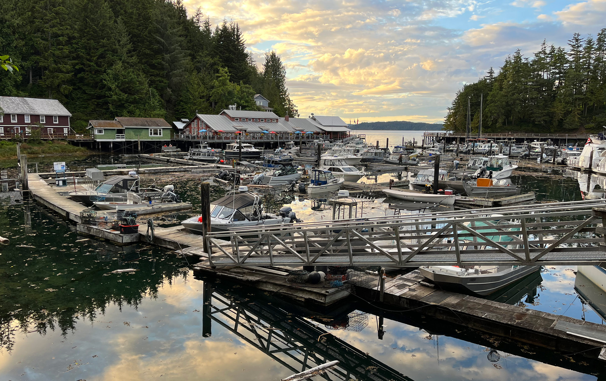
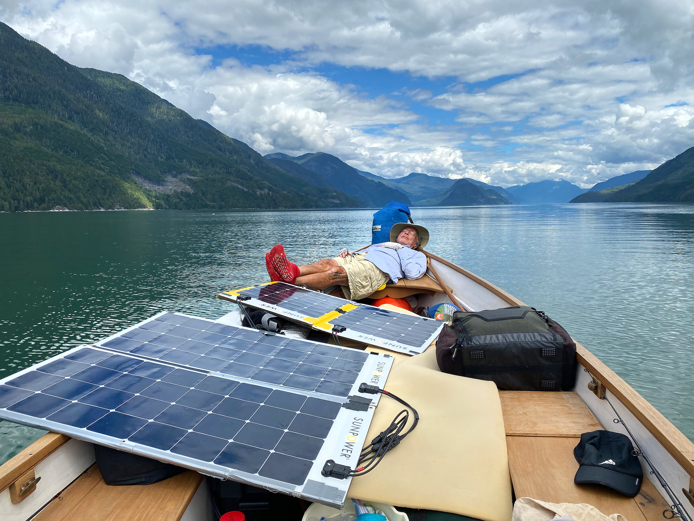
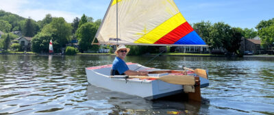
The low clouds and fog of dawn had given way to sunny midday skies by the time we motored out through the sportfishing fleet tucked into Telegraph Cove, British Columbia. My old friend Craig and I were aboard my 20′ Whitehall propelled by an oddly squarish 3-hp electric motor, powered by two pairs of folding solar panels, which occupied most of the center of the boat.
We slipped quietly between the fishing boats with their enclosed pilothouses and stout aluminum hulls with 4′ of freeboard. People bustling about the docks watched as we silently motored by and must have thought the two of us, in our slender boat with a noiseless motor, were about to do something foolish. As we left the cove and entered the expanse of Johnstone Strait, I wondered if we were doing something foolish.
I had gained a fair bit of boating experience over the years on various lakes and oceans, though never in this part of the world, and Craig had experience on Canadian lakes and around the Channel Islands of California. He had joined me on my first two small-boat expeditions 34 years earlier—the first under sail and the second under electric power and (as it turned out) paddle power across Canadian lakes in my 17′ Whitehall. When I invited him to join me on the coast of British Columbia, I ran through the pros and cons of the boat and the equipment I had assembled, and recounted the planning and preparations I’d made over the previous months. I also noted that the experience and preparation did not guarantee I wouldn’t make mistakes.
 Tim O’Meara
The white-painted wood hull of the 20’ Whitehall stands out at center right among the fiberglass and aluminum sport-fishing boats in Telegraph Cove the evening before our departure.
Out in the strait, we soon passed a whiskered sea otter lolling about on its back and gradually caught up to a spread of eight sea kayaks in bright white, yellow, green, and red heading east along the shore, the paddlers all torso, hat, and elbows as they wigwagged their dripping black paddle blades left and right over decks that rose only inches above the water. We didn’t look so small in their company.
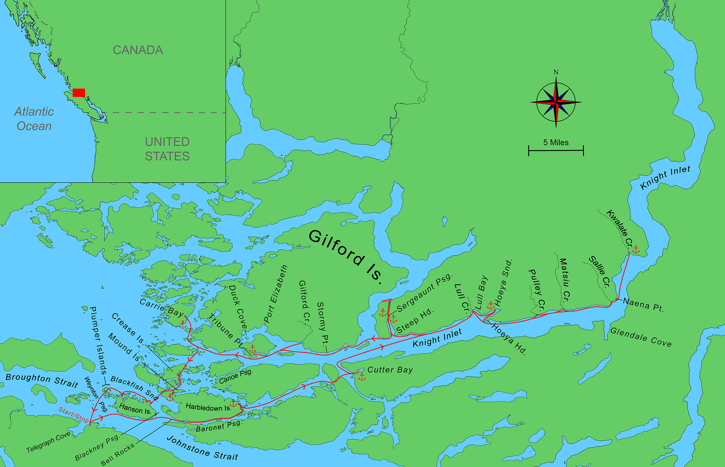
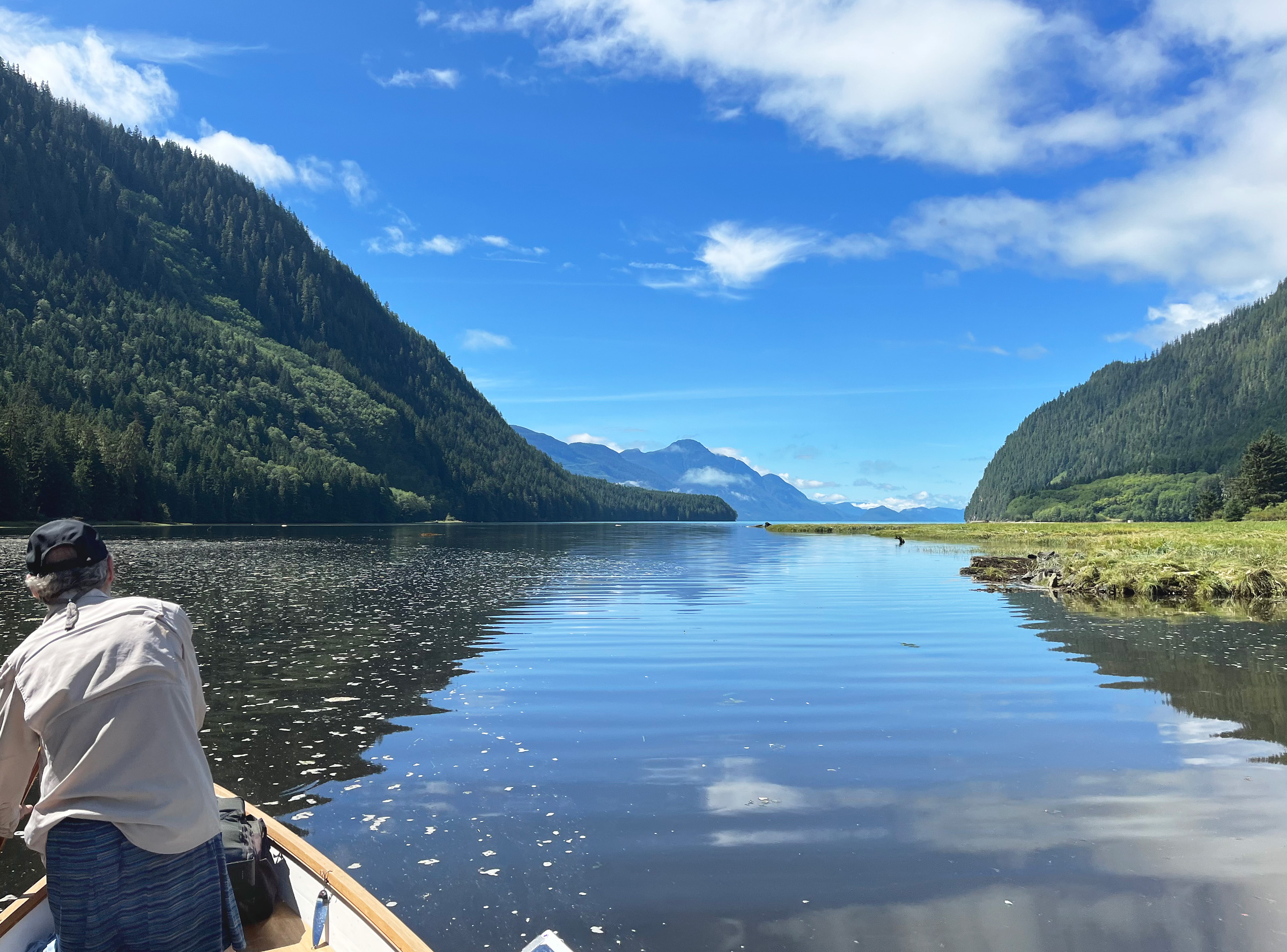
We struck out north-northeast for heavily forested Hanson Island, which stood out in craggy silhouette 2 1⁄2 miles across Johnstone Strait. To the west was the even greater expanse of Queen Charlotte Sound and to the east were the steep-sided fjords and jagged mountains of the distant interior, which is where we were headed.
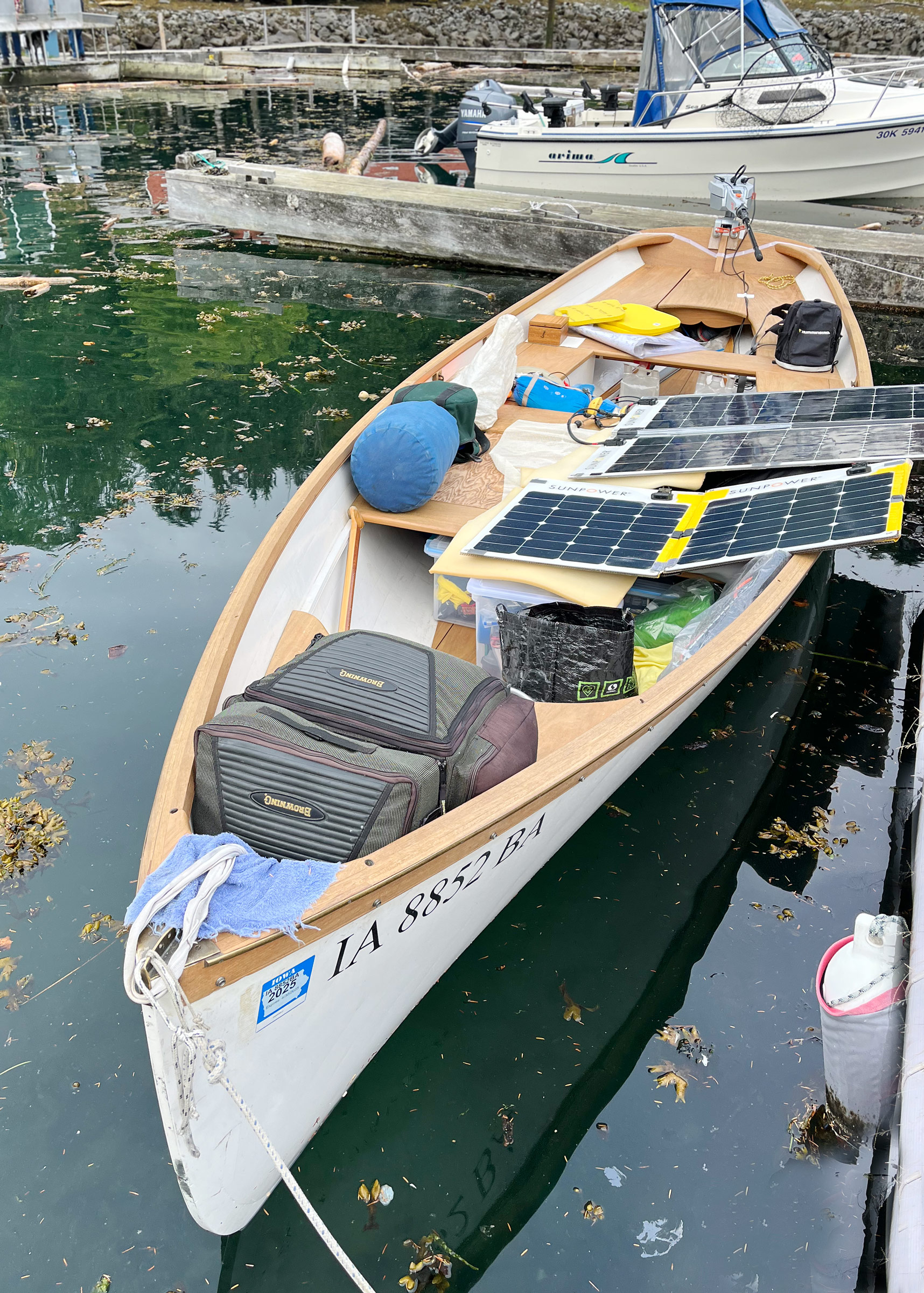
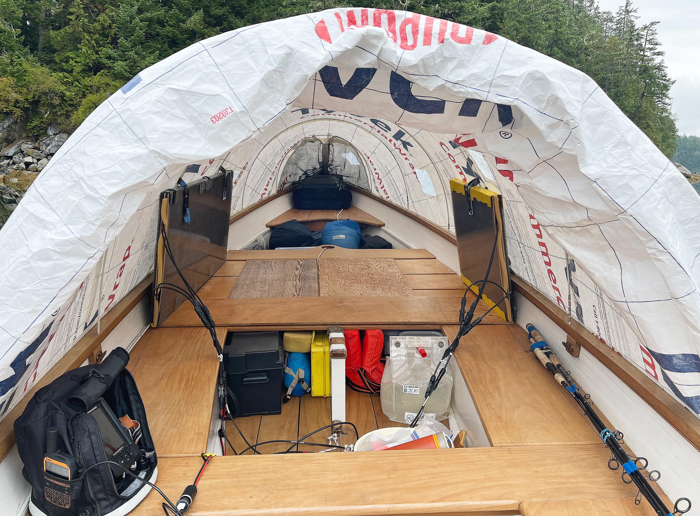
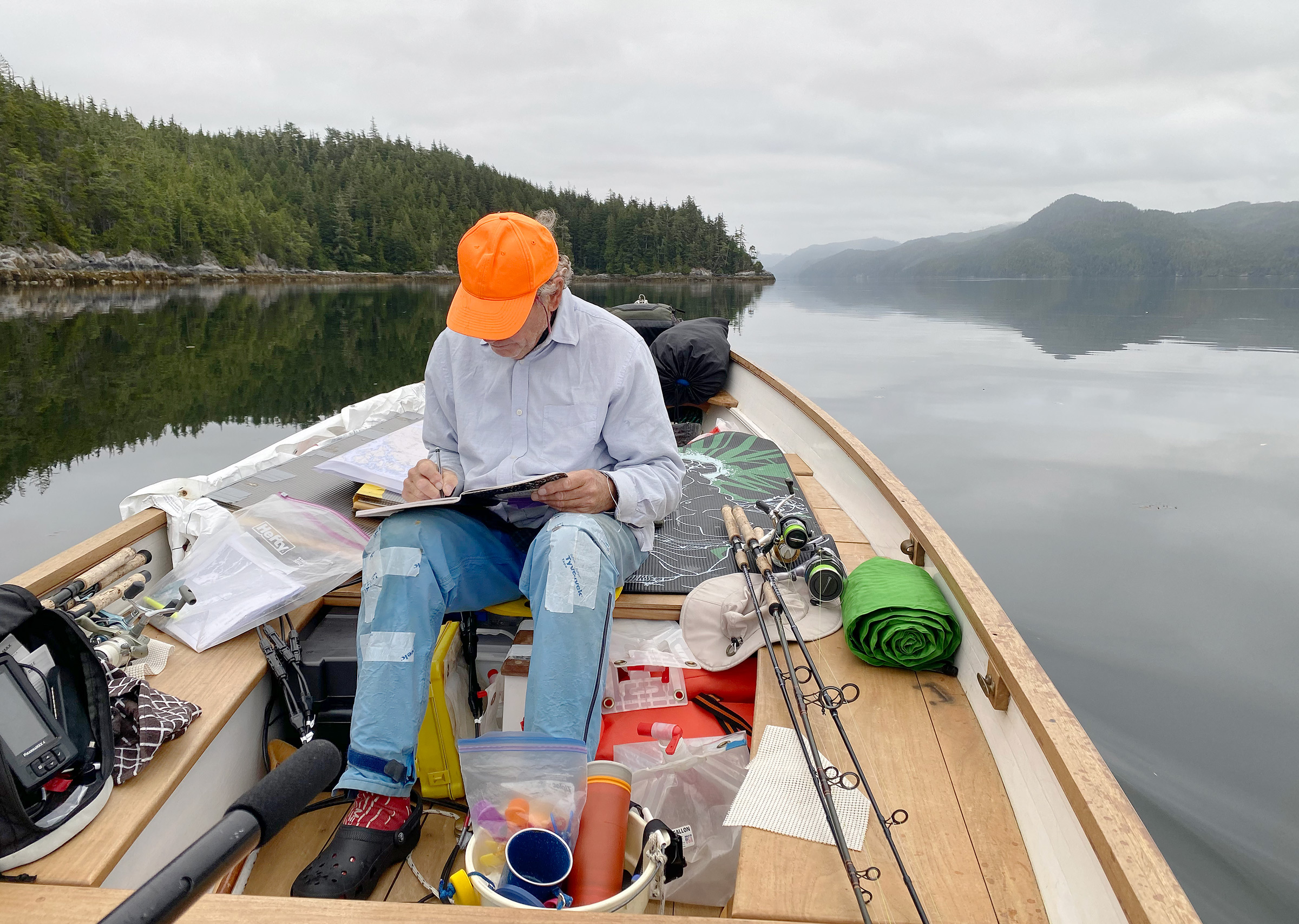
The boat was as tidy as we could make it. The boat tent, made of slippery white Tyvek (the CommercialWrap version), was rolled up against the midsection of the port rail while clothes, electronics, food, and kitchen gear were stowed in watertight plastic bins under the seats or stowed loose inside the two lockers under the amidships benches. The 20-lb lithium battery was wedged under the seat next to the port locker with pencil-thick, licorice-black wires running to and from charge regulators and buss switches mounted inside the locker and from the locker to the solar panels resting on deck. Stuff sacks with sleeping bags, foulweather gear, and the boat’s jib with halyard, block, and sheets were all wedged under the seats. The floor and bow platform were cluttered with fishing and crabbing gear, anchors and anchor lines, and three collapsible jugs that held a total of about 6 gallons of fresh water.
We had planned our outing for mid-August to catch the best weather the BC coast has to offer and to avoid the more extreme tides and currents that accompany the full moon. We also hoped to meet the early run of salmon as they moved up the straits and inlets to freshwater streams and rivers to spawn.
 Tim O’Meara
We launched and packed the boat the evening before our departure and left it overnight at a slip so we could get away at first light. Dense fog out in the channel delayed our morning departure, but we spread the solar panels out on deck in anticipation of clearing skies to come.
Our target for the first day was a little cove at the eastern tip of Harbledown Island—one of several dozen potential anchorages in the region I had identified on the navigation charts and then cross-checked against Google Earth images. We had planned to depart Telegraph Cove that morning at first light in order to ride the last of the flood tide running east up Johnstone Strait, then slide past Cracroft Point on the far side of Blackney Passage at slack tide and, still headed east, pick up the start of the ebb tide that—according to the arrows printed on the chart—incongruously also flows east through Baronet and Clio passages to Knight Inlet.
 Roger Siebert
.
It would have been a neat trick to ride the flood, slack, and ebb tides all 14 miles to the Harbledown cove—saving battery power all the way—but dense morning fog had delayed our departure by four hours. Starting late, we motored against the current at a speed over water that looked to be 3 1⁄2 knots, but the GPS display on the motor showed we were managing only 2 1⁄2 knots over ground. Seeking protection from the ebb tide, we hugged the precipitous shore of Hanson Island, weaving around dark rock ledges and leathery fronds of bull kelp that bent toward us in the current.
As we left Hanson Island behind and crossed Blackney Passage with the midday sun shining brightly overhead, we passed through current lines and whirlpools that formed, dissipated, and re-formed, slapping our bow from side to side. Our timing with the flood and ebb was completely off, but most of the waters were only ruffled by modest currents.
As we approached the Bell Rocks that clog the narrow entrance of Baronet Passage, a pair of loud blows far ahead and two puffs of white mist hanging in the air announced the presence of whales, their dark, round backs visible for brief moments against the glimmer of the sea as first one and then the other rose slowly and then dove again close against the bare gray granite rocks.
We entered the Harbledown cove cautiously at its east end through a shallow, sandy channel only 30′ wide. A second channel opened 200 yards away leading north from the cove into Beware Channel where Care Rock was followed by Caution Rock, then Beware Rock, and finally Dead Point at the terminus of the narrow channel. Beware Channel was known for its treacherous currents, but no current flowed inside the cove where the water appeared stagnant and slightly milky—our first sign of the glacial runoff flowing from the rivers and streams at the head of Knight Inlet 65 miles to the northeast.
 Craig Woodman
We reviewed route options on the charts and planned our travel or idleness each day. Options depended heavily on wind, tides, weather, the state of charge in the batteries, and the prospects for recharging the batteries during that day and the next. Even though we were powered by a motor, we generally were just as limited in what we could do as we would have been in a boat under sail or a kayak being paddled.
With a tidal range that night of nearly 10′ and the low coming at 2 a.m., we planned to put two anchors out, Bahamian style, to hold the boat between them and keep it in at least 6′ of water at low tide. Motoring slowly around the cove, reading depths and bottom conditions on the 4″ color monitor of the portable fish-finder, we found that the only area of the cove that wasn’t too deep, too shallow, or too rocky to anchor was already crowded with half a dozen bullet-shaped crab-pot buoys of red and white Styrofoam, each one coated with dark green slime along its waterline.
We left the cove to the crab pots and moved 800 yards north to a V-shaped cove that was only 150 yards wide at the mouth and completely open to the east, but it proved to have patches of sandy bottom of adequate depth.
The rain started sometime that night, but we were snug and dry under the full-length home-built Tyvek canopy stretched the full length of the Whitehall over eight fiberglass tent poles bent in hoops like a Conestoga. The heavy-duty polyethylene was as stiff as paper and rattled loudly as raindrops pelted it.
From the outside, the tent appeared perfectly white, but on the inside, the fabric was printed with bold red-and-blue logos, technical certifications, and a 1-800 number. Five rectangular portholes fashioned from freezer bags let in the soft light of a rainy morning. Trickles of rainwater slid down the outside of each window, streaking the view of the gray-green forest that surrounded the cove.
I turned on our satellite GPS-and-texting gizmo to read the weather update that my sailor-friend Jack was sending each morning and evening and to see what replies we had received from the “All good” check-in message we had sent the night before. Waiting for the messages to load, I pulled the electric kettle out of its bin, plugged it into the cigarette-lighter socket that otherwise connected the house battery to the motor battery, ground four scoops of coffee beans in the hand grinder, and made two steaming mugs of coffee.
 Tim O’Meara
In fine weather, we could fold the aft end of the boat tent over the fiberglass poles to open up the cockpit. The boat has a 5′ 6″ beam, and temporary plywood inserts between the middle seats provide a fairly spacious sleeping platform. The two sets of solar panels are folded up and stowed vertically along the rails with their wiring still connected. Each set of panels is held up by two Velcro® straps that wrap around fiberglass tent poles. The portable fish-finder is on the seat in the left foreground. The black wire running from it connects to the transducer mounted temporarily with silicone glue to the stem of the wineglass transom.
Two days later, as we motored close along the north shore of Knight Inlet toward Hoeya Sound, we had our first sighting of a bear. It was sitting motionless on its haunches 200 yards up the hillside in a ragged, clear-cut strip of grey stumps and forest slash. It was facing directly toward us and appeared to be watching us. We had reached the margin of grizzly bear territory, but we couldn’t tell at that distance what kind of bear it was. The westerly wind had built to 12 to 14 knots, and whitecaps flecked the inlet. There is only one good anchorage in the upper section of Knight Inlet, and that is at Glendale Cove, which lies 12 miles farther inland and 2 miles across the inlet from Hoeya Sound. The sound itself is a poor anchorage as it forms a drawn-out U-shape 2 miles long and 1⁄2 mile wide that lies open to the west-southwest, but it was our only option.
We found that the back of Hoeya provided no shelter at all as the bottom is sandy and rocky and goes dry, or nearly so, at low tide. Hoeya Creek meanders out of dense forest at the back of the sound and then, as a shallow tidal stream, winds through mud banks covered with yellow-green sedge and grass before reaching deeper water near the middle of the sound.
We had hoped to do some fishing for trout and salmon in the creek but there was no sign of either so we headed to a slight indentation in the north shoreline where there was a log boom and a 40′ floating tank chained to mooring buoys and arranged to provide some protection for an aluminum dock. Two inflatable pink mooring buoys bobbed in the chop midway between the log boom and the dock.
We pulled up alongside the dock to read a sign posted on shore. Below the word Nalaxdlala—the original name for Hoeya Sound—the First Nations community of Mamalilikulla asked that any visitors treat the area with respect as it lies within their traditional territory. Not wanting to intrude, we anchored away from the dock and floats.
Clouds had formed and the evening light had begun to fade as we surveyed the bottom with the fish-finder. As we did, we noticed two bears on a narrow beach at the opposite shore. One appeared as a large black blob sitting in front of tall grass just behind the beach, and the other appeared as a little black dot sitting in sand near the water’s edge. I had read that bears regularly forage along beaches at low tide, and the tide had just passed low.
 Craig Woodman
We stored fresh eggs, fruits, and vegetables in the seat lockers lying against the hull where the cold water of the bays and inlets helped keep them in good condition throughout the journey. In fine weather, we pulled back the tent and cooked on the “afterdeck.”
The tidal range that night was 9′, and we wanted at least 6′ under us at low tide to deter bears and to account for any undetected humps or rocky outcrops. After setting and resetting the 8-lb and the 10-lb anchors three times, we finally settled on a compromise position that avoided shallow rocks and ledges and a steep drop-off from the shore to a depth of 26′ but left us lying only 25 yards from shore. By then the sky had darkened, the wind had dropped, and Craig and I were both tired.
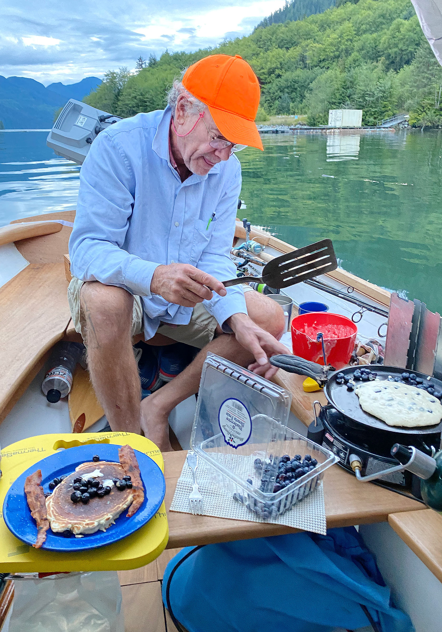
We dawdled about the next morning drinking coffee, frying bacon, and making blueberry pancakes with a cast-iron griddle on a propane camp stove. When the sky cleared around midday, we motored well back into Hoeya Creek to take a freshwater bath, then paddled out into the sound under a deep blue sky.
We fished the rest of the day in deep water along bold cliffs just outside the sound, but we caught only rockfish and released them. When the wind blowing down the inlet freshened to 15 knots in the afternoon, we retreated into the sound.
Early the following morning, we headed out in a dead calm heading due east up Knight Inlet for Kwalate Creek 18 miles away. A satellite text from Jack had reported a weather forecast of sunny skies with a west wind rising in the afternoon to 15 knots with gusts to 20.
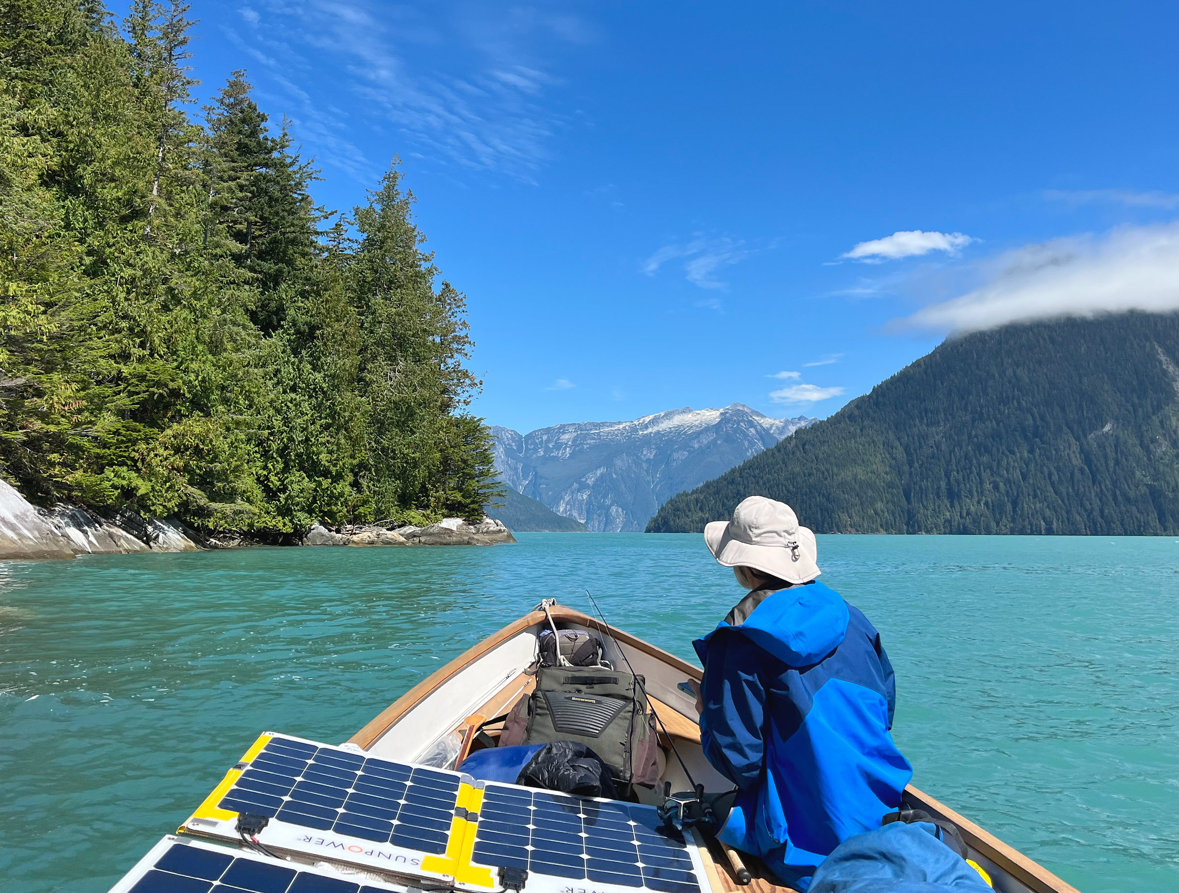
We motored quietly in calm water close to the rocky shore with the hum of the prop and the light splash of the bow wave the only sounds. The solar panels were spread open on deck and propped up on plastic bins to face the morning sun. Checking the electrical current with a clamp meter, I found that the combined output of the panels was nearly 300 watts—close to their full capacity and half again greater than the 200 watts being consumed by the motor.
 Tim O’Meara
We motored and then paddled up meandering Hoeya Creek looking for fish until rocks blocked our path. Finding no fish, we paddled lazily back out through a tidal marsh here toward the broad mouth of Hoeya Sound where it joins Knight Inlet.
The chart showed a depth of more than 500′ just off the shore and more than 1,500′ in the center of the channel, but the fish-finder screen showed only static as suspended silt from the glacial runoff apparently scattered the sonar beams. We relied instead on streaming fronds of bull kelp to indicate any hidden rocks and ledges. Across the inlet, heavily wooded mountains rose thousands of feet, and far to the north, the peaks were whitened with the summer remnants of pocket glaciers and patches of snowfields. Around the boat the water was a dull teal color, but in the far distance toward the head of the inlet, it gleamed bright turquoise.
Looking for a source of fresh water to replenish our supply, we pulled into a little V-shaped inlet where the chart showed an unnamed creek. Craig stood in the bow and cast a spinner toward the mouth of the creek hoping for a strike by a migrating salmon or a resident cutthroat trout. I went ashore in the shade of red cedars and dense undergrowth that had grown back after the area had been clearcut decades earlier. Walking along a floodwater bench of dirt and cobble above the stream, I found an iron pulley 3′ across and other pieces of rusted metal protruding from knee-deep grass. We chose to fill our jugs elsewhere.
A mile farther up Knight Inlet, we heard the gurgling of another stream, I tilted-up the motor as we approached, and Craig clambered ashore carrying our three collapsible water jugs. I paddled the boat back off the cobble beach and stayed close by, watching the forest for any sign of movement. Craig bent over a little pool to fill the jugs, but he stood up again and again to scan the woods behind him.
Cruising along Knight Inlet’s north shore, we ducked in again at Matsiu Creek, at another unnamed creek, and finally at Sallie Creek. At each one, I paddled from the stern and checked the fish-finder as Craig stood in the bow to cast a spinner at the mouth of the creek. When we reached Naena Point where Knight Inlet turns north on the final 33 serpentine miles of its 78-mile length, whitecaps broke along the tops of waves 3′ to 4′ high across the full 1 1⁄2-mile width of the inlet.
If we turned north at Naena Point toward Kwalate Creek, we would be sheltered from the west wind, but the anchorage in front of Kwalate Creek was largely unprotected from the southwest to the east. Two miles across the inlet to the south, the mast of a sailing yacht and the white hull of a big motoryacht were visible inside Glendale Cove. The cove is home to a boutique fly-in lodge that specializes in grizzly-bear tours on which visitors can watch grizzlies from the safety of tour boats as the bears forage along the shore. The lodge bills the location as having the greatest concentration of grizzly bears in North America.
 Tim O’Meara
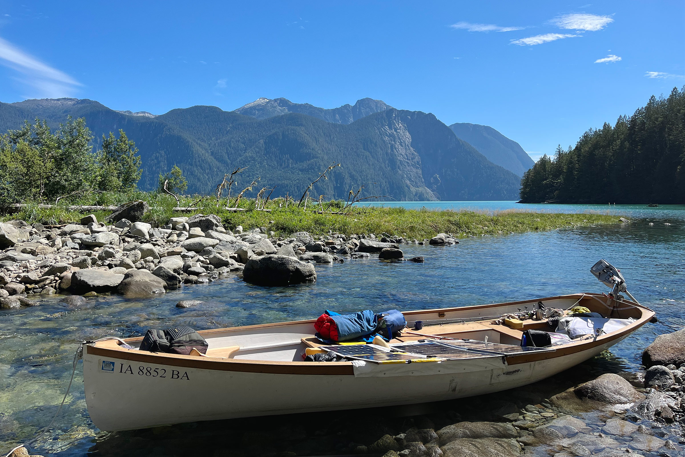
Kwalate Creek runs clean and clear into the teal-colored waters of Knight Inlet. Remnants of late-season snow dust the peak of Cap Cone Mountain in the distance. We were so delighted by the scene at Kwalate Creek that we wandered off to explore—failing to note that the falling tide would soon strand our boat on the rocks.
The tide was high by the time we arrived at Kwalate Creek, so we pulled in and put the anchor ashore right at the mouth. The stream looked more promising than the smaller streams we had passed, and Craig quickly pulled on his rubber-soled boots and headed up the stream with a fishing pole to search for trout. I pulled on my reef shoes and wandered up the stream over rounded boulders carrying only my phone.
The water in the stream was cold and perfectly clear as it tumbled over rounded boulders into a pool at my feet. Inland, the stream disappeared around a bend into a cedar-and-spruce forest just 100 yards away. At the mouth of the stream, the white hull and teak sheerstrake of the Whitehall stood out against a bright turquoise line of sunlit water that lay in the distance beneath towering mountains under a deep blue sky.
I ambled halfway back to the boat when I noticed it wasn’t sitting properly. It was a bit too high and listing slightly. I rushed to it and quickly saw that the tide had fallen enough that the boat was aground on the rocks. I jumped into thigh-deep water and tried to lift the bow off the rocks. It didn’t budge. I tried again, straining my back, but there is no good handhold at the bow of a Whitehall, and I failed again.
To get some weight out of the bow, I grabbed the anchors and anchor lines and tossed them ashore and then grabbed the big green tacklebox and tossed it ashore followed by two plastic bins that I could reach under the front seat. I stepped back into the water and tried again to lift the bow, but again it didn’t budge. I climbed back up the bank and called to Craig, who was standing in a shallow pool about 60 yards away. He didn’t hear my shout over the sound of the stream.
I cupped my hands and yelled louder, and he looked up from the pool. I motioned for him to come, but he pointed instead to something in the pool. I motioned again with exaggerated, rapid sweeps of my arm. He understood and came racing back to the boat wearing only his rubber boots, hopping over boulders as fast as he could manage. Together we tried to lift the bow, but it still didn’t budge. I tried wrapping the painter over my shoulders to use as a lifting strap, but we failed again.
I moved quickly to the stern of the boat and crouched in knee-deep water with my back under the turn of the bilge. Craig followed, grabbed the boat, and lifted with me, but it didn’t budge.
I had just one more idea. I told Craig to move to the shore side of the boat and push the boat sideways as I crouched again at the transom. No luck. I waded to the shore side of the boat, crouched under the bilge, and we heaved again. The stern scraped loudly and moved sideways a fraction of an inch. We heaved again and again, and each time the stern scraped sideways a fraction of an inch. On the fourth heave, the keel scraped long and loud across the rock that was holding it, and the back of the boat floated free. We moved quickly to the bow and with two heaves managed to set it free. Standing thigh-deep in the cold water and breathing hard, we leaned on the gunwales, exhausted.
I had made a mistake that might well have ended in disaster. The boat had gone aground late in the afternoon on the first fall of the tide. If we had not gotten it off the rocks at that moment, we would have been stranded at least overnight in the heart of grizzly country with a boat that was a veritable lunchbox of bear attractants.
 Craig Woodman
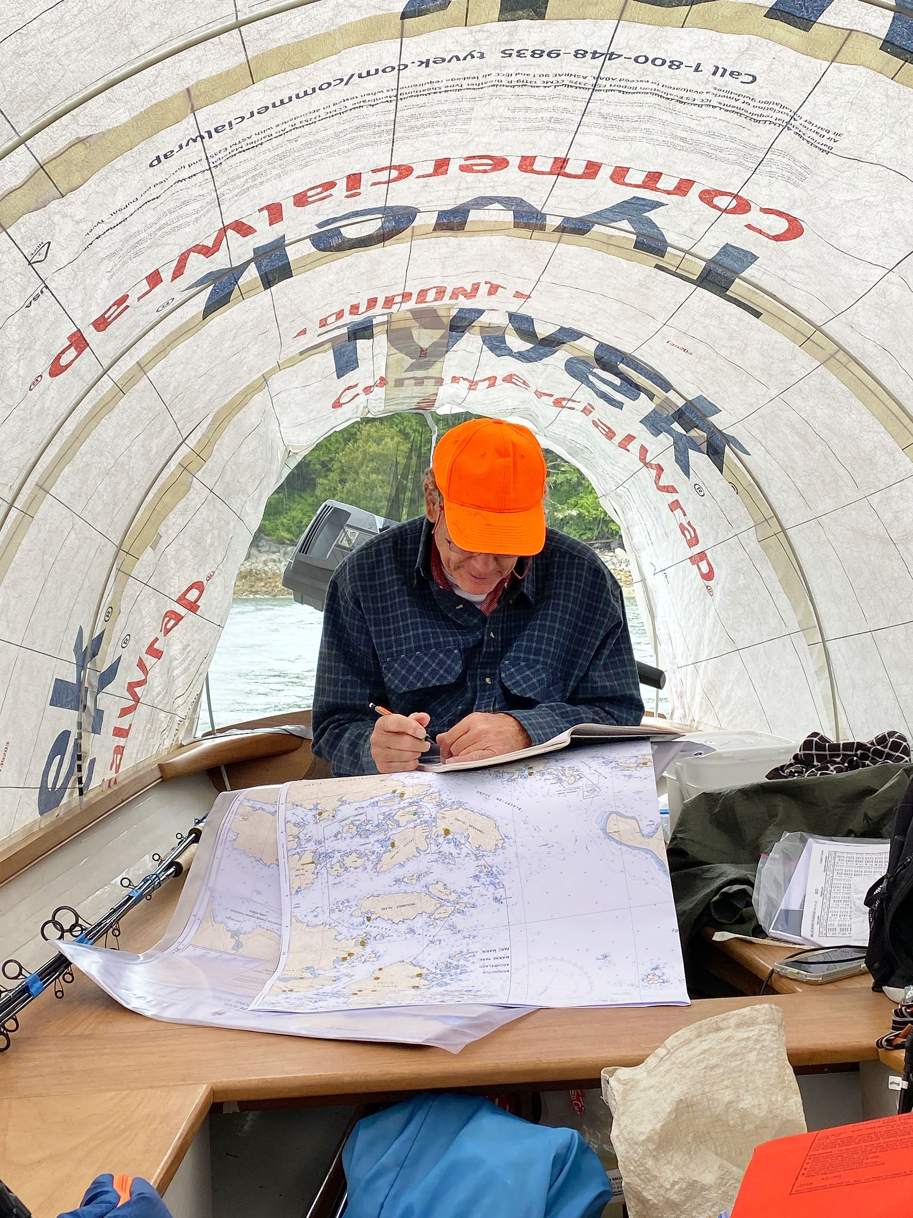
In most of the bays we entered in and around Knight Inlet the bottom was rocky and uneven and dropped precipitously from the shore to depths unsuitable for anchoring a small boat. We were often forced to anchor in poorly protected areas near shore where the margin of error was small. We surveyed the bottom carefully before anchoring and estimated closely how much the tide would rise and fall overnight from the observed depths at the time of our soundings. We used those rise-and-fall estimates to determine the minimum and maximum observed depths in which we could set the anchors and position the boat, as well as how much scope would be required on each anchor. The easiest way to work out those numbers was to construct a new graph in the logbook each evening.
The narrow bay outside Kwalate Creek proved to be another poor anchorage as waves coming down the inlet curled around the point and into the bay. After several attempts at anchoring, we gave up and tied up alongside another floating dock built by the First Nations community a quarter mile south of the creek.
The forecast for the rest of the week was for strong afternoon winds, and it was apparent that the farther we went up Knight Inlet, the more open and potentially dangerous were the potential anchorages. It had also become clear that we had arrived too early for the salmon run.
At first light the next morning, we left Kwalate Creek into a light breeze to head south-southwest and then due west back down Knight Inlet. At noon we rounded Hoeya Head into a strong westerly and 3′ swells, and juiced the motor to 450°W as we lurched over the confused seas that ricocheted from the headlands crosswise into the incoming swells and turned north toward the calm arc of Lull Bay. There, old pilings off a sandy beach and the remains of a derelict house ashore crowded by encroaching trees marked the location of an historic First Nations community. We anchored near the pilings, aligned the solar panels directly into the sun, and lounged through the afternoon waiting to see if the wind would die enough for us to continue east with the ebb tide to get farther up Knight Inlet.
 Tim O’Meara
We stopped frequently at streams along our route to refill water jugs and—on sunny days—to bathe in the chilly streams. Here at Lull Creek, Craig walks carefully on slippery rocks while carrying two jugs of water back to the boat. The wood pilings in the background are remnants of a pier that once served an historic village built along the broad sandy beach where the creek enters Lull Bay.
At 6 p.m. we motored half a mile out to the point at the southwest end of the bay to get a closer look at the inlet. In the main channel, the wind was blowing close to 20 knots and steep waves broke in frothing whitecaps. We immediately decided to retreat and turned the boat to run downwind back to Hoeya Sound with whitecaps breaking along our starboard quarter. As we neared the rock cliffs that marked the entrance to the sound, the boat began to toss and lurch in confused seas where the waves broke against the cliffs and reflected across the incoming swells which were bending around the headland directly into the sound. We motored into the quiet cove on the north side of the sound, went straight to the first pink mooring buoy there, and tied on for the night.
The next morning, we carried on westward and around noon rounded Steep Head into narrow Sargeaunt Passage and pulled up on the mainland side of the passage behind a low rock jetty that a logging company had bulldozed into the channel years ago. I went ashore while Craig held the boat off the barnacle-covered rocks exposed by low tide. As I stood on the top of the jetty surveying the rough beach on the other side, an adult black bear and two cubs emerged dripping from the water 100 yards up the beach. I hadn’t seen them approach because their dark fur blended into the dark water of the channel.
 Tim O’Meara
The tide was low at Pulley Creek on the north shore of Knight Inlet when I went ashore to check out the stream. Craig moved the boat off into deeper water to await my return.
The bears didn’t seem to notice me as I stood motionless watching them wander slowly up the beach away from me. Then a second adult bear emerged from the water, its fur plastered to its body in a sharp profile, revealing long, powerful legs and a solid frame that would otherwise be obscured by thick fur. It looked every bit a predator. That bear did notice me, and it immediately turned and charged, galloping directly toward me like a racehorse coming out of a starting chute.
I retreated quickly down the rocks, calling to Craig to bring the boat as I scrambled head down using both hands and feet, trying not to slice my hands on the barnacles and mussels or slip on the kelp and tumble into a crevice between the rocks. I pulled up on a flat rock in 2′ of water then climbed awkwardly into the bow, looking over my shoulder toward the top of the jetty as Craig backed the boat into the channel.
A shiny aluminum but otherwise utilitarian boat soon appeared cruising steadily up the middle of the passage. When it was a quarter of a mile away, it changed course toward us. We could see three or four adults and a couple of children through the big windows of the enclosed cabin, and we thought it might be a First Nations community boat shuttling members into the back-country. When the boat had closed to within 75 yards, we waved a casual greeting to say hello but also to let them know we were okay, and the boat turned back toward the channel. Perhaps they had just been curious, but it seemed that they had turned in to see if we were in distress, and we appreciated their kindness.
Two days of strong westerly winds followed, and we spent the time fishing in the lee of basalt headlands near the north and south ends of Sargeaunt Passage. At the north end, we encountered three orca hunting close along the rocky shore. One adult with completely black sides and a sharply pointed dorsal fin was cruising in close company with two much smaller orca that had a pinkish tint to their topsides and small, rounded dorsal fins.
We left Sargeaunt Passage in fog early on the third day there and headed west into a light wind. Visibility was down to less than a mile, and we hugged the north shore of Knight Inlet to gain a little shelter from the wind and to avoid any traffic that might come down the channel. We soon passed Stormy Point where a thick fog of visible droplets blew sideways down the channel, soon drenching us and the boat.
Our options were to turn north off our route to seek protection in Port Elizabeth or Duck Cove or to continue west into the wind to Tribune Point where we could either try to cross the channel to a sheltered cove at the entrance to Canoe Passage or retreat just northeast of Tribune Point to an unnamed bay that offered protection from the west wind but was entirely open to the east. Arriving at Tribune Point in thick fog and strong breeze, the prudent choice was to retreat into that nearby bay.
 Tim O’Meara
After passing Naena Point, where Knight Inlet turns north, we were protected from the strong westerly wind that raised breaking waves across the inlet. Riding close to the rocks in the lee of the shore, a strong flood tide helped carry us north toward Kwalate Point in the distance.
Inside the bay we found quiet water but, once again, difficult anchoring. After several attempts, we settled on a rather awkward position with the boat lying port-side-to and nearly parallel to a steep rock ledge topped by pine trees. We set the 8-lb anchor from the bow in a patch of thin sand near the head of the bay and set a 2-lb anchor from the stern between barnacle-covered rocks at the bottom of the ledge. At low tide, around 10:30 p.m., the boat should be in at least 6′ of water but only 25 yards off the rock ledge.
The night was completely black as we prepared for bed by the light of a headlamp. I was sitting at the stern when a great splash came from in front of the ledge close off our port quarter followed by the sound of something very large running through deep water and then swimming quickly toward the boat. Craig and I jumped in unison and shouted at each other, “That’s a bear!” At that, the swimming sounds seemed to make a sharp U-turn right at the boat and head toward shore.
I leaned back and pressed my head into the mosquito net in the gap between the motor and the end of the tent. Peering around the corner of the tent into the darkness, I heard the splashing recede and perhaps saw a trail of phosphorescence where the bear had executed the U-turn and then scrambled up the beach.
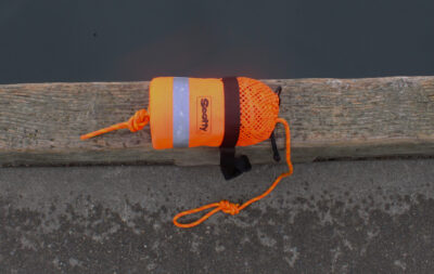
Craig handed me the headlamp, and I shined its weak light out the back of the tent onto the ledge and up onto the beach, but I couldn’t see anything moving. I then pulled open the port locker and dug out the cannister of bear spray and the foghorn and set them in the stern, but thinking again, I blasted the foghorn out the back a couple of times just to make some kind of statement. Neither of us had ever read the instructions on the cannister of bear spray, but we sure did then.
 Craig Woodman
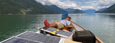
I found time for a nap after we left Cutter Cove on our way to Hoeya Sound. The red hospital socks I wore had grippy soles to help prevent slipping. I had foolishly re-sanded all the unpainted teak on the boat with 200-grit paper, which made the wood dangerously slippery even when it was dry.
We crossed Blackfish Sound four days later in bright sunshine with the sights and sounds of whales diving and spouting along the north shore of Hanson Island. We first jigged and then trolled for salmon along the many points and finally caught some small pinks. Their iridescent sides and tails were dotted with sea lice, and we unhooked them and watched them swim quickly into the depths.
Drifting quietly with the ebb tide in bright sun along the north shore of the Plumper Islands, we spotted a great whale directly abeam, perhaps 300 yards away and coming head-on toward us in a regular series of rhythmic, shallow dives. When the whale had closed to 100 yards—still coming directly at us—its huge, rounded back rose a bit higher out of the water and the whale dove under the boat, emerging minutes later 200 yards away on the other side.
We drifted on with the current and approached a noisy colony of sea lions jostling for position on an outlying rock off the northernmost of the Plumper Islands. As we watched and listened to their bellows, a sea lion rose, thrashing violently, just 10′ off our bow with a salmon clamped between its jaws. The current carried us swiftly away between two little wooded islands until we emerged into Weynton Passage at the west end of Hanson Island. Five miles across Johnstone Strait lay Telegraph Cove and the end of our travels.![]()
Tim O’Meara grew up sailing and otherwise mucking about in small wooden boats on Lake Okoboji in northern Iowa during the 1950s and ’60s. In college he was fortunate to sail 30′ sloops on San Francisco Bay as a junior member of a club team, and during two summer breaks crewed on a wooden 50′ Rhodes cutter off the California coast and then around the Hawaiian Islands and back to San Francisco. After graduating in 1970, he set off with two friends and a brother and sailed around the Caribbean for a year in an aging fiberglass sloop. A lost year soon followed during which Tim built a cold-molded version of the tender for Herreshoff’s yacht COLUMBIA; the tender now hangs in his garage above the 20′ Whitehall. Three graduate degrees in archeology and anthropology were followed by 13 years of teaching at universities in the U.S. and Australia and then 25 years working as a consultant on economic development projects focused on the Pacific Islands where he learned to sail traditional wood canoes: in 1973 on the island of Taha’a in the Leeward Society Islands and in 1988 and again in 1993 on Ifaluk Atoll in the Western Caroline Islands. Tim is now retired and spending as much time on the water as possible.
If you have an interesting story to tell about your adventures with a small boat, please email us a brief outline and a few photos.
Great story! Thanks.
You could spend a lifetime exploring all the BC coast inlets and still not see them all, I think.
Thanks, Alex. Yes, indeed, and a what worthy goal that would be!
What a great adventure, Uncle Tim! Love all the pics too.
Thanks, Maddie! You’re a sweetheart!
That bear encounter sure sounded fun! Any reports of people actually being attacked in their boat? Is there an offshore distance considered safe?
I had never heard of a bear actually trying to get into a boat, Andrew, but I knew it was a possibility, and I had tried hard to avoid it on this trip. I tried even harder after it happened! My own guess is that 50 yds of water deep enough that a bear would have to swim–roughly 6′ deep–would be an adequate deterrent. That’s what I was trying to achieve in Knight Inlet. The problem was that bottom conditions and a tidal range over 10′ often made anchoring away from shore difficult.
My sorta-Aunt and Uncle were attacked, killed and eaten, by a grizzly bear, while they were on a rafting trip. Actually my x ‘uncle in law’ and his second wife, but the split was amicable and they attended family reunions. They were in their tent during the time of the attack, but the bear charged the guide and his customers in their raft(s), who were the ones to report it. The bear kept coming until he slipped and hurt himself.
National Geographic wrote an article about it in their Adventure supplement of Oct 2005.
Something that is not often talked about and therefore may not be true but if is would be important: I’ve read that a can of bear spray used and tested, smells enticing to bears. Carry a fresh one.
Thanks for a great read. I’m wondering about the “boat’s jib, halyard, and tackle.” How do you deploy it? Have you got a mast aboard? And did you have a chance to use it? Also wondering about the predator bear that was “charging you like a racehorse.” I guess he didn’t pursue you after you made it into the boat? Whew, my heart was in my mouth! Anyway, thanks again for an exciting story and beautiful photos.
Thanks, Ken.
Regarding the jib: I’ve been carrying the jib and its tackle as a backup means of propulsion, and I’ve tried using it in two different ways–both successfully. My son and I took the jib and tackle, but no mast, with us on a fishing/camping expedition to Reindeer Lake (MB/SK) some years ago, and just for a lark, we cut a dead pine and shaped its base a bit for use as a mast. The boat sailed well downwind, but the wind was light during our trial, so we didn’t test it on other tacks. Then on a solo electric trip to Lake Nipigon two summers ago, I took a substitute mast that was just an 8′ x 1 7/8″ wood dowel, which stows easily and can be deployed quickly, to which I had tied a pulley at one end. I hoisted the jib by its clew using one of the attached sheets as halyard, so the jib was upside down on the 8′ mast with the tack still at the bow but the head acting as clew, the attached halyard acting as sheet, and the luff of the sail acting as foot. I tested the rig in about 15 knots of wind using a paddle to steer and made 3 1/2 knots (GPS) on a beam reach. I took the same rig to Knight Inlet but didn’t use it.
Regarding the black bear that charged me: Once I had tumbled into the boat, I looked up to the rock embankment expecting to see the bear coming over the top, but she had broken off the chase once I turned and fled. I never would have made it into the boat if she had really wanted to catch me. The bear was undoubtedly a female as there were two adult bears and two cubs, and they are careful to avoid adult male bears as they sometimes kill cubs.
I hope you didn’t release all the bottom fish you caught. Various rockfish (black, copper, quill back, canary, etc.) are all excellent eating. I have the most consistent luck jigging with a Buzz Bomb, and in fact never bother to take any other lure. Long ago I gave up using bait. If you happen onto a school of black rockfish, which inhabit the whole water column, you can haul them in almost as fast as you can deploy the B B. I have had them strike even as I was pulling the lure from the water. Once, at Belmont Point (Vancouver Is) three of us caught as many black rockfish as seven of us could eat, in less than 10 minutes. The head chef had three or four of us fire up our one-pot stoves, poured olive oil in our frying pans, dipped the filets in bannock batter, and fried them to a golden brown. The freshest fish you could ever eat, and the best tasting I’ve ever had. No tartar sauce needed.
This was all fishing from kayaks. Ling cod are also often on the menu; also kelp greenling, which are speckled like trout, have greenish flesh (hence the name) as do ling cod, which are also of the greenling family, and provide meat that closely resembles Dover sole–fine textured and delicate in flavor. I did one time happen onto a small coho salmon while trolling with a B B, but I otherwise have not had luck trolling that way. Lost the salmon, of course.
Thanks very much for the tips, David. Fishing from a kayak is great fun. We were jigging with MacFish and couldn’t keep the rockfish off the hook long enough to find out if there were other fish down there. We had to be careful where we fished because rockfish are protected in much of the area, and there appeared to be no way to keep them off the hook.
A great story and sounds like a great trip. Thanks for sharing.
I missed any mention of where the boat design came from. Plans available? Custom design? Reminds me of the Kurylko Alaska but a little bigger.
Hi Steve,
The boat was designed by Bruce King. He is long deceased and his design office closed. Your best bet is likely to contact Chris Franklin, who is now Chief Naval Architect at Hodgdon Yachts in East Boothbay, ME. According to my limited internet sleuthing just now, Chris worked with Bruce King for many years and perhaps managed his design portfolio for some time after wrapping up the design office. Note that the design sail plan was originally a ketch, but I had it changed to a sloop because I didn’t want the mizzen mast in the cockpit. I might reconsider that now in my old age. I think the design hull is carvel, but King designed most of his custom designs as cold molded, so there might be a cold-molded version. Please let me know what you learn. It is a beautiful design.
Cheers,
Tim