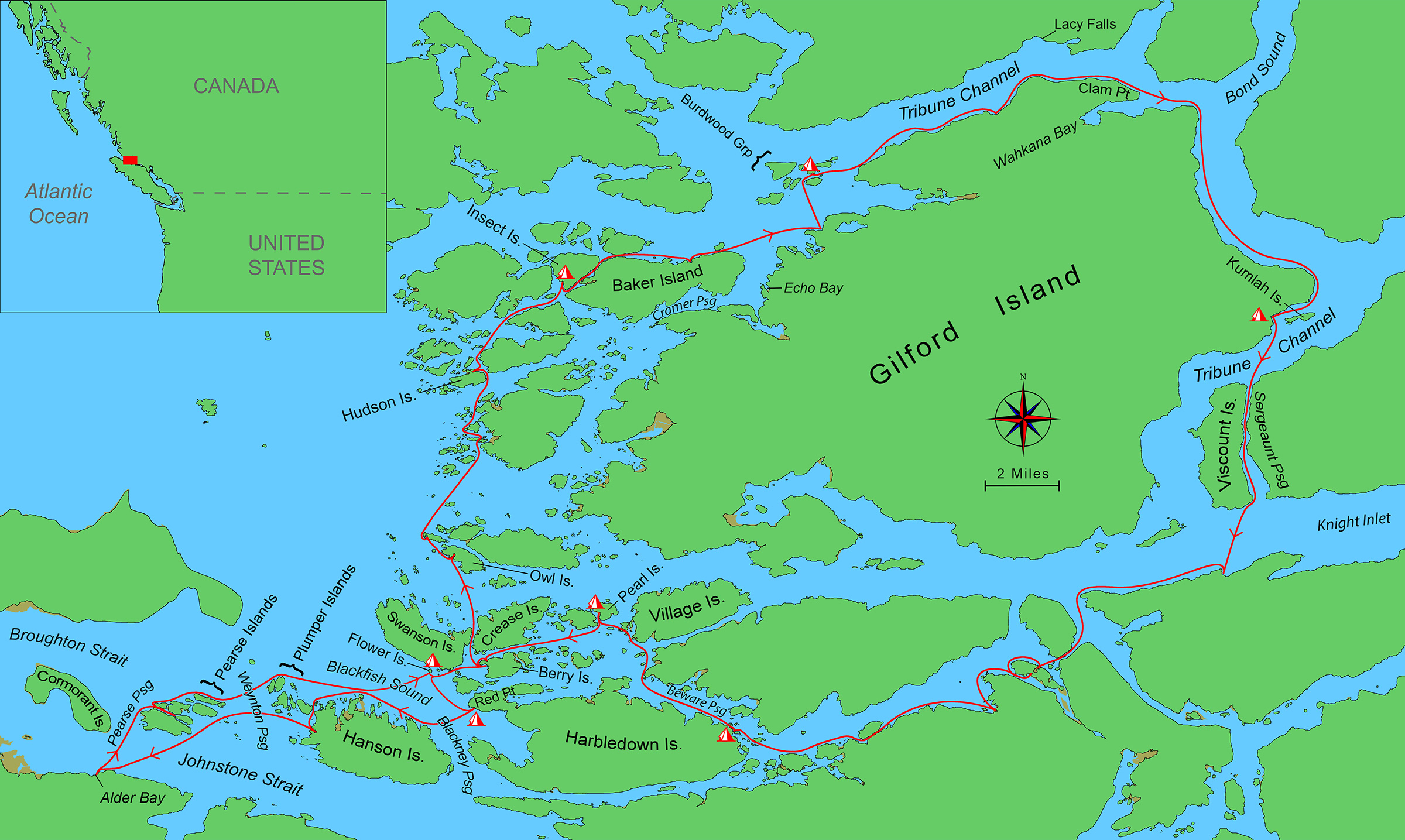
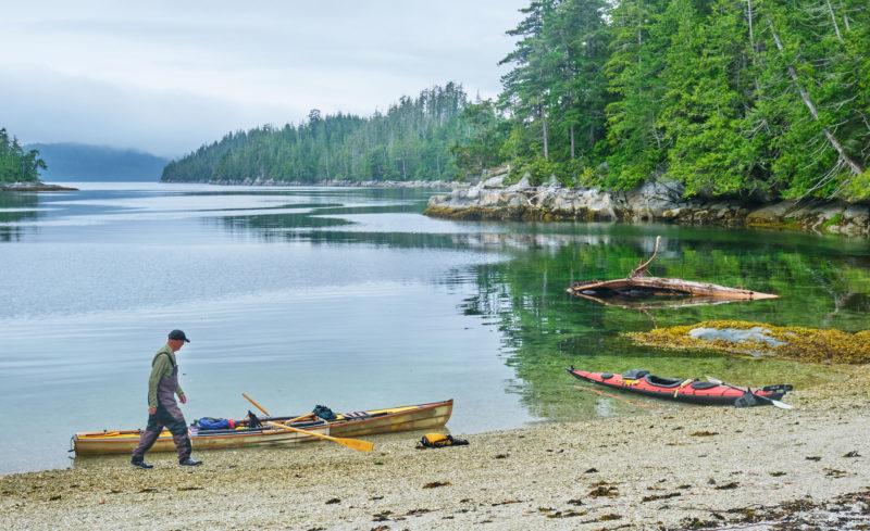
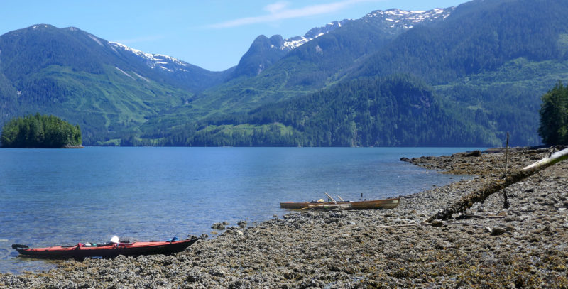
Dave and I launched his folding kayak and my decked skin-on-frame rowboat from Alder Bay on the northeast coast of British Columbia’s Vancouver Island for the 1 1⁄2-mile crossing of Johnstone Strait. Our destination for this first day was the Broughton Archipelago 10 miles east, so we headed north toward Weynton Passage, the 2 3⁄4-nautical-mile-wide gap between the Pearse and Plumper islands, but a strong ebb current pushed us to the west end of the Pearse group as we crossed. Rounding the largest island into Pearse Passage, we took the first of the channels heading northeast. We fought the current in which tips of rippling fronds of bull kelp pointed directly at us. Still, my GPS said we were making 2 knots and that seemed better than going around the long way, so we continued.
Dark green, densely forested islands rose on each side of us, indented by small coves filled with seaweed and barnacle-covered boulders. Beds of bull kelp blocked our path, sometimes making it difficult to drop an oar into the water through the thickly overlapping olive-green blades. We inched up the channel; three sailboats anchored in the deeper water in the middle of the channel swayed back and forth in the current.
Staying to the north bank, we made good progress up to the sailboats, but I could see a narrows ahead split by a fast-flowing river of foamy seawater heading our way. We stopped in an eddy to assess the situation. We had a long day ahead and really did not want to backtrack. Seeing another eddy on the opposite shore, I pushed my bow out and pulled hard for the other side. As my bow entered the current, it was yanked forcefully to starboard, nearly tipping me from the boat, and propelling me rapidly downstream toward the sailboats. That made the decision for us. After Dave managed a more careful turnaround, we went back the way we had come and, staying outside of all the narrow channels, continued to the east.
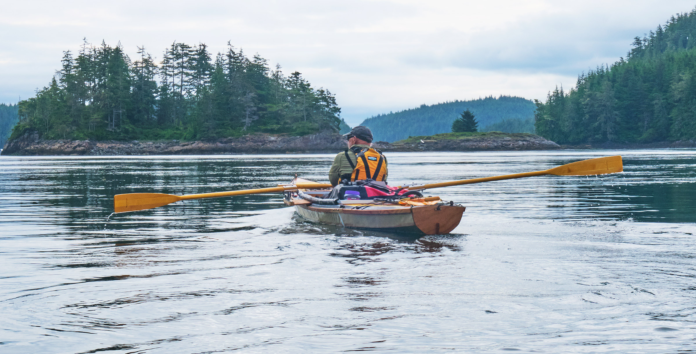
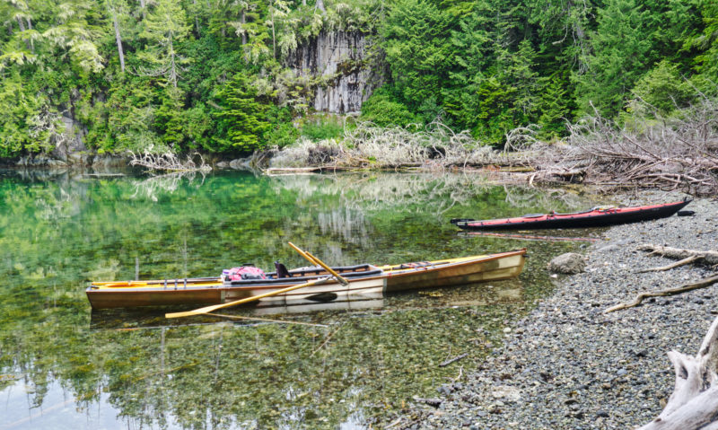
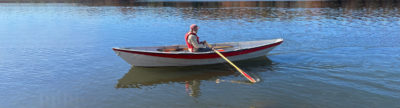
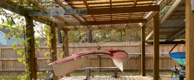
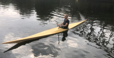
I had planned a 12-day, one-way journey from Alder Bay to the Vancouver Island city of Campbell River. Before the pandemic, I had been trying to complete a multi-year journey down the Inside Passage from Juneau, Alaska, to Seattle, Washington. Dave and I had paddled an Alaska section together in 2018, and I finished Alaska on a solo trip in 2019. Dave is from Maine and I’m from Colorado. We share a unique bond as adventure partners: his son is married to my daughter and we share two granddaughters. In the last couple of years, I had developed arthritis in a shoulder that made paddling a kayak painful, so we decided to skip the British Columbia Central Coast section of the Inside Passage and do a more protected section to Campbell River. Rowing didn’t hurt my shoulder, so I built the skin-on-frame rowboat to use on the journey and rigged it for forward-facing rowing. I brought my red Feathercraft folding kayak for Dave to paddle.
 Roger Siebert
.
We continued past the Pearse group, crossed Weynton Passage uneventfully, and stayed north of the small islands of the Plumper group just northwest of 4-mile-long Hanson Island. Coasting eastward around the Plumpers, we heard a whale blow to the north, then saw the pale mist of the blow hanging in the air over the dark water.
Blackfish Sound, our next crossing, was only 1 1⁄2 miles wide but known for heavy traffic, from small boats plying the waters around the Broughtons to cruise ships and barge tows passing to and from Alaska. The water was rippled from a light but building westerly breeze. Swanson Island, about 3 miles long, was straight ahead and we pointed our bows toward the center of the island, expecting to hold that heading and let the breeze move us eastward toward our goal of tiny, 150-yard-wide Flower Island at Swanson’s southeast corner. We heard a whale blow again, saw the mist in the air, and beyond the whale a dark-hulled cruise ship in the distance. Cruise ships can move fast, so we began the crossing, but watched carefully to allow the ship to pass ahead of us before continuing into the middle of the Sound. Moments later, we heard more whale blows off our stern starboard quarter from a pod of orcas swimming between us and Hanson Island. The whales disappeared just before the ship passed in front of us and the way was clear to continue the crossing. The ship, bearing a big Mickey Mouse on the stack, moved slowly past, and the music of the Disney tune “It’s a Small World” faded away with it into the distance.
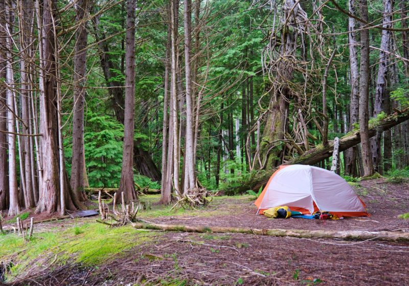
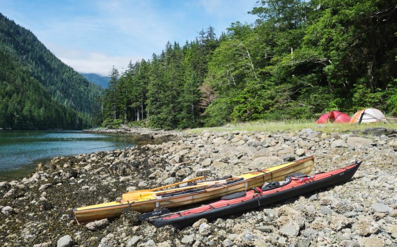
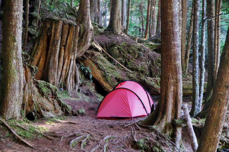
As we approached Swanson Island, the wind picked up and moved us rapidly to the east toward Flower Island. Small whitecapped waves followed us, causing my bow to pull to port and making me work extra hard with the oar on what was my weak side. On the shore of Swanson Island to port, we saw a cabin and what appeared to be a hot tub, then just past that a sandy beach with a fleet of kayaks, signaling a likely guided kayak tour group. We pulled out on a small beach on the east side of Flower Island, chatted with a group of kayakers who were just leaving, and after 14 miles we called it a day. Dave and I each set up our tents on soft carpets of fallen pine needles in separate small clearings carved out of the trees just above the beach. Stout tree limbs stretched out nearly horizontal over the beach, and after making camp, we lifted our boats to set them on the limbs to ensure they were above that night’s high tide.
 David Mention
We left our first campsite at Flower Island under a cloudy sky and headed to a meeting with my friends Tim and Kelli at Farewell Harbour Lodge. The islets in the picture are just two of hundreds of similar islets in the Broughton Archipelago.
Fresh from a restful night, we rose to calm winds, high clouds, and the prospect of a long day in the boats. After coffee and breakfast, we moved the boats down to the water and reloaded them with our gear. Some friends of mine, Tim and Kelli, ran a lodge on Berry Island and I’d made arrangements to pay them a visit. We climbed into our boats and pushed off, heading east through a cluster of a half-dozen islets, and tied up to the lodge’s dock. Tim and Kelli had purchased Farewell Harbour Lodge, a former fishing lodge, a few years before and had substantially renovated and expanded it. Kelli welcomed us into a cedar-lined high-ceilinged dining room, offered us hot coffee and freshly baked scones, and gave us a tour of the lodge.
After we refilled our water containers from their freshwater tank using a hose near the dock, Dave and I headed north and wound our way through the archipelago. There were densely wooded islands everywhere, some no more than an acre and some covering square miles, all interspersed with rocky ledge islets and separated by channels of calm water. A rhinoceros auklet with the distinctive horn on top of its short apricot-colored beak surfaced directly ahead of me and took off running over the water. A few minutes later the fin and back of a harbor porpoise quietly broke the surface a couple of times before disappearing again. We passed by pigeon guillemots, numerous murrelets, and, at each landfall, two to three soaring bald eagles, and too many Pacific crows and ravens to count.
 David Mention
Tired and hungry, we stopped at a cove on the north shore of Hunter Island where my chart showed a campsite. Unfortunately, the beach was covered with downed trees, there were almost no clearings in the forest, and mosquitoes were swarming us as we scouted.
We crossed from Crease Island north to Owl Island and landed in a rectangular cove with a small sandy beach on the island’s south shore for a welcome lunch break of ham and cheese wraps and cookies. There was a nice campsite here, but we had miles to go before the end of the day. During the stop, Dave said that his wrist was hurting and that he was concerned that we were putting in too many miles too fast. We agreed to head to a campsite shown on my chart on Hudson Island a few more miles to the north.
We arrived at a shallow cove on the north shore of Hudson Island and beached the boats. The campsite there was not promising. The beach was shallow and did not appear to have much space for the boats above the overnight high tide. Downed trees littered most of the beach making it difficult to even reach the forest for fear of tripping, even if we weren’t carrying our gear. The forest had no tent clearings, and the ground beneath the trees was littered with fallen branches. Mosquitoes swarmed us as we scouted. Our chart indicated there was a campsite on Insect Island 3 miles farther north. We had been told it was quite nice, so we returned to our boats and headed back out. As we started, I added insult to injury to our long day and headed the wrong way in the labyrinth of islands, going nearly half a mile before I realized my error and turned us around.
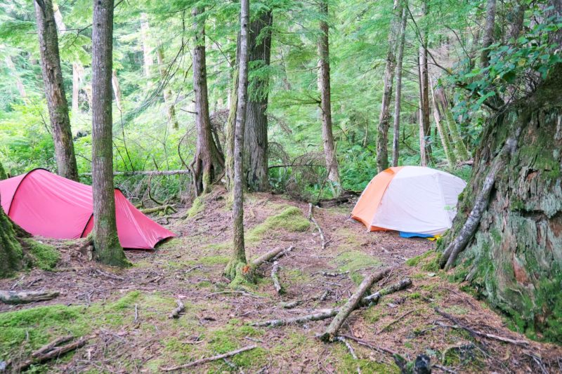
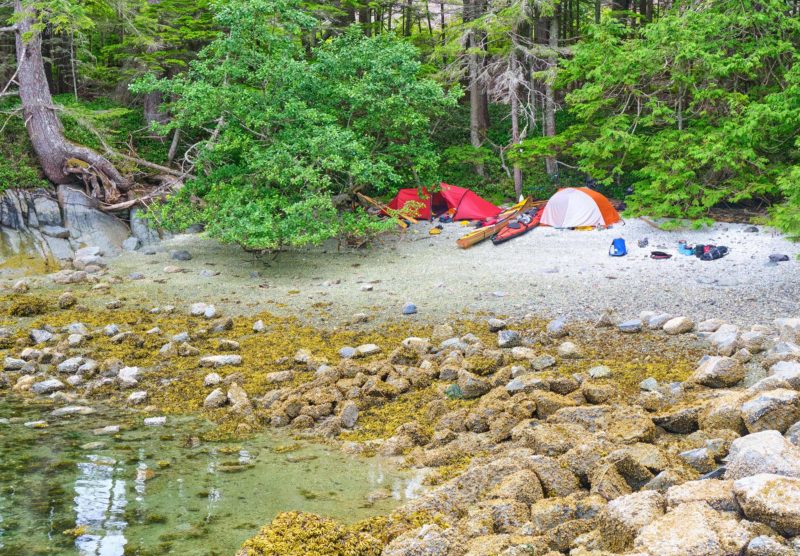
 David Mention
Our campsite in the Burdwood group was at a former First Nations site that has been a popular small-boat camp in recent years. Much of the brush had been cleared from the shore surrounding the beaches and tent sites were numerous. Here, Dave set up his tent to catch a westerly breeze to dry out from that day’s wet and foggy morning.
We continued north. I was tiring and was pretty sure that Dave was, too; we had stopped talking. After another hour, we landed on a white sand beach on Insect Island. A sign on the beach announced that the site was within the traditional territory of a First Nations group and asked visitors to respect the land. Above the sign was a 20′-high cliff of dirt embedded with shell fragments.
We had seen another paddling group at the site when we landed, so Dave climbed the cliff using a knotted rope fixed on its face and went off to check in with the other group and to scout for tent sites. While he was gone, I began unloading my boat. Dave came back with a positive report and I began the arduous process of hauling my gear up the cliff to the campsite, a large area among tall cedars cleared of brush. Everywhere, shell fragments were embedded in the dirt—an indication that the site had been occupied for centuries. After setting up camp, we pulled our boats up above the high-tide line, just under the cliff and horizontal to the beach, then tied them up for the night. We had gone 17 miles that day and were bone-tired, so after a quick dinner, we both retired to our tents.
 David Mention
We packed up to leave the Burdwoods on the shell beach that was formed from many generations of First Nations shellfish gathering. The white of similar beaches above the tide was often visible for miles and the relative lack of boulders and rocks made for easy landings and launches.
That night it rained lightly, and in the morning a dense fog filled the forest, wetting every surface. We ate breakfast, packed our gear, and made the difficult haul of gear back down to the beach. Twice, I nearly lost my balance on the steep slope, but avoided a painful fall. The beach of fine shell fragments made moving the boats and loading easy and we were soon on our way, heading east for the seven small islands and numerous rocky islets of the Burdwood Group at the entrance to Tribune Channel on the north side of Gilford Island.
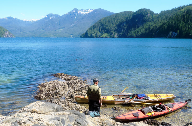
Paralleling the north shore of Baker Island, we took a lunch break before the short crossing of Cramer Passage to the deeply contoured west coast of Gilford Island. To the south was Echo Bay, a marina and lodge on the site of the former First Nations village of Ḵ̓waxwalawadi. Once across the passage, we stopped at a freshwater stream on Gilford to replenish our water supply; all the islands in the Burdwoods would be too small to have any fresh water.
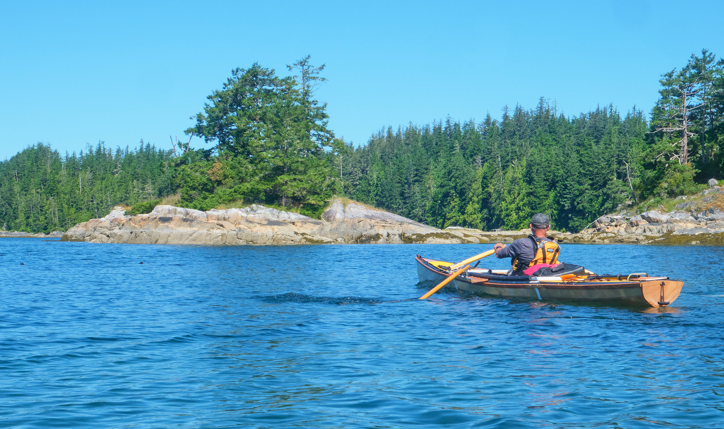
 Roger Voeller
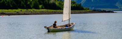
After a lunch stop on Gilford’s north shore, we headed back out into Tribune Passage. The steep rock-faced peaks of the north shore of the passage fell to Lacey Falls visible in the distance beyond Dave’s boat.
We headed north toward the islands, which are about 1 1⁄2 miles across the entrance to Tribune Channel. On its north side, the mainland foothills all but blocked the British Columbia Coast range but a few snow-covered peaks appeared in the gaps. The sky began to clear as we crossed, and a light westerly breeze followed us as we headed for a campsite known to have another shell-midden beach on a small island right in the middle of the group. Despite the wind, the ebb set us slightly to the west and we rounded the west side of a half-mile-long unnamed island toward the southeast end of the group. Once around, the cove we were looking for was directly ahead and gleaming like snow in the sunshine.
 David Mention
The steep shores of Gilford Island afforded few places to camp, so we knew we had another long day. With several miles left, we pulled out briefly for a snack break at Clam Point before crossing Wahkana Bay and turning south. To the east was the mainland inlet, Bond Sound, overlooked by snow-capped peaks of the Pacific Coast Range.
We landed by the west side of a narrow south-pointing peninsula on a beach that continued for 100 yards along the south side of the island. The island had clearly been used for camping for years. Nestled among cedars and hemlocks there were many patches of flat needle-blanketed ground for setting our tents. Not far from the beach was a one-room cabin not yet weathered silver-gray with the same sign we had seen at Insect Island asking visitors to “Respect our Land.” Dave set up his tent and laid his damp sleeping bag over the tent to dry in the sun and breeze.
After I set up my tent, I walked a trail densely lined with salal—a berry-producing shrub native to the Pacific Northwest—that led up a forested hill above the cabin. The trees were almost all cedar, with some massive stumps scattered among smaller, younger trees. On the way back down, I took a wrong turn in the salal on a trail that dead-ended at a red cedar tree with a 30′ high, narrow, tapering scar where the bark had been harvested long ago. This was one of the culturally modified trees common in the area. First Nations people removed the bark in a manner that would not kill the tree, then peeled out the inner bark to make clothing, blankets, and cordage. I found my way back down to the cabin, and discovered ripe huckleberries on a bush right behind it. Dave and I spent the afternoon relaxing in the sunshine.
 David Mention
Most of the campsites in the Broughtons themselves had tent sites that were expansive and obviously frequently used. Once we moved east around Gilford Island, campsites were few and small and good tent sites were not always very flat, forcing close quarters for the tents.
The next day we continued east along the north shore of Gilford Island. Gilford is more than 20 miles long east to west and a dozen miles wide in places. Its shore is densely lined with cedar and hemlock, draped from steep hills and scarred in places from logging both in the distant past and still ongoing in spots. Beaches were few and rocky where they existed at all. After 5 miles we stopped for lunch and to refill our water containers. Just as we landed, four sharply hooked fins, with a curve of slate-gray on the leading edges and dusty gray behind, surged out of the water barely yards to port, followed by the arched back of what were clearly dolphins. The area is known for Pacific white-sided dolphins. They raced about in the cove, evidently hunting, before speeding away back into the channel.
 Roger Voeller
Once we decided not to go all the way to Campbell River, we could do shorter days. We spent two nights in a cove on the eastern edge of Gilford Island just behind Kumlah Island and facing the Coast Range on the mainland across the channel. Logging scars on the hillsides in the picture were a common sight throughout our days around Gilford Island.
Before getting underway again, Dave and I discussed his sore wrist and decided to scrap the plan to make it to Campbell River, and to circumnavigate Gilford Island instead, returning through the Broughtons to our car at Alder Bay. For the next six days the weather remained dry and even more sunny as we rounded Gilford. To the east and the north, high peaks rose above the steep forested hills that flanked the mile-wide inlets carved deeply into the mainland. Far to the north rose the Coast Range, its highest peaks flecked white with snowfields.
 David Mention
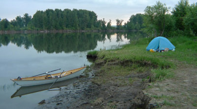
We crossed over Tribune Channel to the mainland and into Sargeaunt Passage for a protected route toward our crossing of Knight Inlet. The narrow passage has little wave action, no real beaches, and a steep shore, so we camped on rough cobble just above our estimated high tide. I stayed up late until I was sure our tents weren’t going to be flooded, then entered my tent where my sleeping pad did a great job of smoothing out the rocks under me.
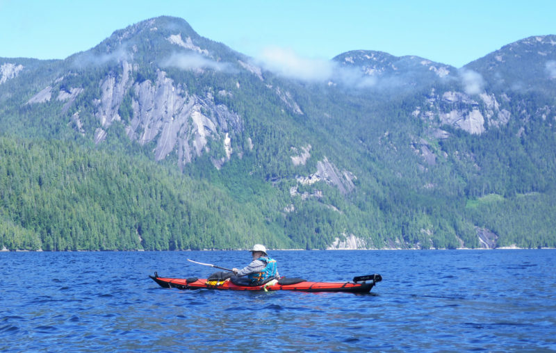
As we approached the southeast corner of Gilford, we veered east away from the island to enter Sargeaunt Passage and go due south along the narrow 2 1⁄2-mile passage between Viscount Island and the mainland. At its end we began the crossing of the 1 3⁄4-mile-wide entrance to Knight Inlet, a steep-sided fjord that reaches a crooked 50 miles inland. In the open water we hit wind of about 15 knots and 2′ seas, the first challenging conditions of our trip, though we were under clear skies and the whitecaps in the middle of the channel sparkled with sunlight. We weathered the crossing and I was pleased that my home-built decked rowboat handled the breaking waves well. Its cockpit stayed generally dry, although I endured the occasional splash when an oar caught the top of a wave.
 David Mention
After crossing Knight Inlet, we continued back west toward the Broughtons and camped one night on the northeast corner of Harbledown Island. Once again, a steep shore behind us forced us to the beach, which this time was sand, but quite small. We were just able to fit two tents and the boats into the available space above high tide.
With just a few days left, we headed west down Knight Inlet and passed Village Island where thimbleberry bushes above a 250-yard-long shell beach surrounded the site of ’Mimkwamlis, a historic native village. In a clearing between two houses clad in weathered clapboards and shingles stood two thick posts supporting a massive log as a crossbeam, the centuries-old remnants of a traditional longhouse of the ancient village.
 David Mention
We knew competition for campsites could sometimes be fierce once back in the Broughtons. Our mornings were now sunny and we pulled hard down rock-and-islet-strewn Beware Passage, past Village Island with its ancient First Nations ruins, to nab a campsite on the west side of Pearl Island back in the marine park.
We camped for the night on a small island to the west of Village Island and continued the next day past Berry Island and beyond to land on Flower Island where we hoped to camp as we had on the first night, but every site was taken. We took a break for lunch, then returned to the boats, and set off under a cloudless sky for a campsite at Red Point on Harbledown Island about 1 1⁄2 miles away. Weather reports had suggested afternoon winds up to 25 knots, but there was only a light breeze rippling the water, which made for easy rowing. We had gone less than a quarter mile when a whale spouted a few hundred yards to starboard; as its glistening black back gently fell, the water folded over it.
 David Mention
Our favorite campsite during the trip was on Harbledown Island’s Red Point. The sandy beach faced west toward Hanson Island and the setting sun, and there were numerous tent sites in the forest above. I spent the night in a perfectly flat tent site floored with soft hemlock needles, waking frequently during the night to hear whales just off the beach in Blackfish Sound.
We passed Red Point’s steep rocky shore, and 1⁄4 mile farther along the prominence’s south side, arrived at a 100-yard-wide crescent beach of gray gravel and sand—a welcome break from the barnacle-encrusted boulders or cobble we’d had to contend with at many of our previous camps. At the edge of the woods, yellow alders stretched their limbs over the sand. After landing and unloading the boats, we carried them up the beach, set them in the sand, and tied their painters to the roots of fallen trees clinging to the undercut soil above the beach. Our tide tables said the midnight high was going to be 15′, but the line of dark brown dry seaweed left by an earlier high tide indicated the tide would not reach the boats. In the clearing above the beach, we set up our tents on ground cushioned with a mat of fallen hemlock needles. Overhead, the branches of towering hemlock and cedar trees knit together and allowed only speckles of sky to show through.
After setting up camp, we sat in the soft sand. Silvery trickles of fresh water crossed the rocks at the south end of the beach. In wetter weather, these would have provided ample water, but it had not rained for 10 days. Fortunately, we had filled our water containers at a bigger stream the day before. To the west, Blackfish Sound was a thoroughfare for marine traffic. Sportfishing boats, water taxis, and kayak-shuttle boats sped back and forth between Vancouver Island and the islands of the Broughton Archipelago. A couple of Alaska cruise ships went by with bright white hulls perforated with rows of portholes and topped with layer upon layer of cabin balconies. Long after they had disappeared, their wakes reached our beach and broke the silence with 2’-high cresting waves. A tug towing a barge stacked with green shipping containers crept southeast toward Blackney Passage and Johnstone Strait.
Humpback whales crossed back and forth in the Sound; their blows were followed by the mist from their breath hanging for seconds in the still air, often followed by an arc of a black back and a small dorsal fin, barely breaking the surface. One whale raised its flukes high in the air before sliding vertically beneath the surface.
For a few minutes a pod of 10 orcas passed from south to north on the Hanson Island side of the Sound. They were mostly females—evident by their curved 2′- to 3′-tall dorsal fins—accompanied by at least two males, with fins straight and twice as tall. Their raspy exhalations carried to us across a half-mile of water. Three adult and four juvenile bald eagles joined a swarm of gulls feeding at an eddy line caused by opposing currents a couple of hundred yards off the beach. The eagles glided low across the water and struck at the water with outstretched talons, but none of them caught anything; eventually, a white-headed-and-tailed adult and mottled brown juvenile eagle flew our way and rested 50′ above us in the limbs of a hemlock tree.
By nine o’clock, the sun was down. It was still a bright twilight, but I was tired and retreated to my tent and was soon asleep. During the night I woke several times to near silence, but I could always hear the whales’ breathing, which sounded different than during the day—sometimes a deep echoing bellow, occasionally a grumble.
Early in the pre-dawn morning—my watch said 5:15—a thunderous crash came from the water, close enough that a few seconds later I heard waves tumble on the beach. Apparently, in the dark, a whale had breached. A few minutes later, there were loud slapping sounds, likely a humpback slapping the water with its tail or a pectoral fin.
When Dave and I stepped out of our tents that morning, Blackfish Sound was almost completely still—no wind, no waves, and no boats. A thin layer of fog lay over the water, but the sky was clear above and Hanson Island rose above the fog on the other side of the Sound. As we drank our coffee and ate a pancake breakfast, the whales continued to blow and swim by. After breakfast, Dave did the dishes at the water’s edge, while I packed up the camp kitchen. We took down our tents and hauled dry bags from the woods to the beach. The low tide had been at 7 a.m. and was rising again as we brought the boats down to the water’s edge and packed them. Even at low tide, there were few large rocks on the beach, making it easy to carry the boats and move the gear. As we packed, the rising tide floated the boats, making for a straightforward launch. We headed out to cross the Sound for Hanson Island and after one more pleasant night in camp, crossed back over to Vancouver Island where, in a heat wave, we packed up the car and began the journey home. The Campbell River leg of my Inside Passage journey would have to wait.![]()
Roger Voeller is a retired environmental consultant. After discovering sea kayaks while living in Massachusetts, he worked part-time as a sea-kayaking instructor for the National Outdoor Leadership School for 15 years, paddling the waters of Alaska, British Columbia, and Baja California. The boat used in the article is the fourth he has built. He currently lives in Colorado.
If you have an interesting story to tell about your adventures with a small boat, please email us a brief outline and a few photos.

I’ve been to the Broughtons several times over the years in kayaks and sail-and-oar boats and still haven’t experienced it all. Thanks for sharing the story of your voyage and taking me along to a few places I haven’t been.
Wonderful photos – helps some of us East coasters imagine your world there.
Congrats
Very well written trip journal—thank you. I owned and paddled a sea kayak while living in Maine. Paddled a few times with Dave Mention, including in frozen seas. (And, ice climbed with Dave also). It’s delightful to look at the photos of the Pacific NW ocean, which I did paddle on a couple of times. Sure would like to paddle on it again. Alaska beckons & scares me.
Thanks again for the trip report.
PS Winter Brothers by Ivan Doig is a treasure if you haven’t read it.
His “winter brother” was James G. Swan, an early explorer and ethnologist (ethnology was not yet something you could get a PHD in. Virtually all early science was done by amateurs—I should say gifted amateurs). Swan wrote The Northwest Coast, which is well worth reading. He actually started his sojourn amongst the Salish people with the Chinooks of the lower Columbia, then worked his way north to Port Townsend.
Doig also wrote The Sea Runners, about a small group of indentured workers who escaped from Russian servitude at Sitka, Alaska, by stealing a dugout canoe and paddling it south. They also stole Russian charts, but they only served them as far south as Vancouver Island. They paddled down the outside of the island, and across the Strait of Juan de Fuca. They tried landing at (I think) the entrance to Willipa Bay, where at least one of them drowned as they crashed in the surf. (Memory may be a bit iffy here). They did not recognize the Strait of Juan de Fuca (foggy?) nor did they realize they could have paddled to Port Townsend and safety. Anyhow, a good book, even if my memory is a bit wobbly as to details.
Sure would appreciate the story of the boat build , set up , and such. Enjoyed the story!
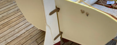
The boat is a heavily modified Ruth design by Dave Gentry. I built bulkheads into it and a deck with hatch structure for dry storage and flotation. The forward-facing rowing system is from Gig Harbor boats. Skin and coating is from Skinboats.
How have you found that forward facing rowing system to be? Did you at any time decide you preferred the traditional facing backward setup in lieu of the mechanical system required for facing forward?
I’m really a paddler and my rowing skills are weak at best. I find it really difficult to keep a boat going where I want to when facing the “wrong” direction. Once I started using the forward system it felt pretty normal, like anything does, when you use it enough.
Biggest weakness in the Gig Harbor system is that it doesn’t feather at all. In these conditions that was okay, but would not be in rougher water.
Thanks for the great writeup. I will be taking my young boys and wife through Desolation Sound and around East Redonda Island this summer on our Caledonia Yawl, which will be our first time in the inside passage (though we’ve cruised the Puget sound region extensively over the last 4 years). The practical details of your camps and descriptions of the general conditions are very helpful as I prepare.
Regarding Dave’s sore wrist: does he paddled feathered or unfeathered? Virtually all of the paddlers in my area (Bellingham, WA) go unfeathered, and sore wrists are uncommon (almost unheard of). Another suggestion is to try an Inuit style paddle (very narrow blades, and no need to feather). Also, I have a bad shoulder (bone on bone) and I find my forward stroke relies on torso rotation, with minimal arm movement. So far, it has not hindered my paddling. When we are coaching newcomers here, we strongly emphasize torso rotation.
I haven’t paddled in the Broughton’s, but have done numerous trips on the outside of Vancouver Island–Kyuquot Sound (at least 10 trips), Esperanza Inlet (half a dozen or so), and Nootka Sound (a couple of trips). One trip we did was from Winter Harbor, around the Brooks Peninsula, through the Bunsbies, thence to the take out at Fair Harbor. Brooks is intimidating in one’s imagination, but our trip was uneventful. Another time we put in at Fair Harbor, paddled coastwise, and then inland at Nootka Sound and back to Zeballos, leaving a car shuttle back to Fair Harbor of about 25 miles or so. Also took the ferry to Bella Bella (from Port Hardy), paddled south through the McMullen Group, then to Goose Island (actual camping on little Duck Is.), then through Cultus Sound, and back to Bella Bella.
And, even though you didn’t bargain for it, here’s a little piece of doggerel based on Coast Salish names:
“When the boy from Bella Bella met the girl from Walla Walla, his heart went Hamma Hamma, and his teeth went Klickitat.”