It was evening before my brother Lance and I set out from our campsite on Hawk Island at the northern end of Ontario’s Georgian Bay. We had been windbound all day, our boats anchored just off the cobblestone beach on the island’s north side. Finally, in a moment of dubious optimism based on nothing more than a brief lull and a purely theoretical expectation of a favorable wind shift, we shoved off to give it a try.
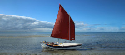
It was a poor choice. As we passed the rocky point sheltering our anchorage, the wind revealed its full brutality, with frequent gusts that must have been nearing 30 knots. Even double-reefed, FOGG, my Don Kurylko–designed Alaska, was pushed rail-down again and again. Each time it happened, a few liters of cold water poured in before I could ease the sheet enough to bring us upright. Lance had come about onto a starboard tack in his Ross Lillistone–designed Phoenix III and was somewhere behind me, headed offshore—I was too busy to keep track of him more closely than that.
I was reasonably confident that I could reach the mainland 2 miles north, even in these conditions, but I had no desire to try it. I had foolishly neglected to don my foulweather bibs and rain jacket and being cold and wet was doing nothing to increase my enthusiasm. When yet another gust came close to knocking us down, I headed up into the wind and dropped the rig in a fluttering tangle of sailcloth and spars, hoping that Lance wouldn’t think I had capsized. Then, immediate crisis averted, I carefully un-stepped the mast, laid it across the thwarts, and started rowing back toward the beach I had left just a few minutes ago. Lance, I saw, was already safely ashore, with the Phoenix III back at anchor—he must have turned back almost immediately.
 Roger Siebert
.
It had been a long time since we had managed a two-boat trip together, so with nine free days on the calendar, we had decided to head for Georgian Bay’s Thirty Thousand Islands region, a small-boat Neverland of granite, pines, and infinite possibilities. Two days of driving for seven days of sailing seemed a reasonable exchange.
I approached my planning with the usual rigor. The day before our departure, I loaded my gear in the car, tucked my passport into the glove box, and conducted a hasty search of the kitchen cupboards for food. Later that evening, I accompanied my brother to a local supermarket, where I added apple cider drink mix, noodle packets, a carton of Golden Oreos, and a suitcase-sized bag of popcorn that would, if nothing else, provide a significant volume of flotation.
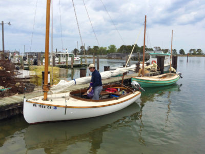
After a 12-hour drive and a rainy night in a Killarney motel, we launched the boats, loaded our gear, and parked our trailers in the back lot at the Church of St. Bonaventure just down the street, leaving an envelope of cash in the drop box at the gate to cover the cost.
St. Bonaventure: Good luck. It seemed like a promising start. But was it meant as a blessing, or a warning? One way or another, we’d soon find out.
We rowed out of the tiny marina in the early morning and let a quiet breeze push us east down the empty channel through town, toward Georgian Bay. With no other boat traffic, we drifted along undisturbed, using the time to organize our gear and ready our sails. When we reached the Killarney East Light on its low red-rock headland, we hoisted sail and set off up the coast.
After a mile and a half of paralleling the shoreline northeast of Killarney, past the cliffs and jumbled-rock shoals of Tarvat Bay, we turned offshore at the Rannie Rocks, heading east toward the Fox Islands. Lance had never been to Georgian Bay, but I could have left my charts in the car; every rock and inlet seemed familiar.
 Photographs by the author except as noted
The lighthouse at the east end of the Killarney Channel marks the gateway to Georgian Bay. An hour after launching our boats at the town ramp, we were ghosting along at the foot of the lighthouse cliff waiting for the wind to fill in.
We made our first landfall at West Fox Island, 8 miles east of town. I anchored off a rocky beach on the island’s west side and waded ashore while Lance continued around the island to land on the leeward side. We met on the summit, a flat-topped sweep of bedrock that offered a panoramic view. A jagged skyline of massive white pines surrounded the summit slab, arms lifted to the sky. Far out on the water, sunlight glinted and sparked on the wavetops. Every cleft and crack in the bedrock around us sprouted unruly tangles of raspberry bushes, but our decision to come in early June was already imposing harsh penalties—all thorns, and no berries.
Landing on the rocky slabs of West Fox Island’s east side is manageable when the wind is westerly and the waves are small, but it’s not a good place to leave a boat unattended for long. Depending on the wind, the cobblestone beach on the west side of the island and the narrow inlet on the southeast end provide better landing spots.
From the summit, we chose our next objective: Fox Island, less than half a mile to the northeast. I had noticed a gravel beach on the north side of the island on a previous trip but hadn’t taken time to land. With the wind holding southeasterly, I thought we might manage a landing and a climb to the island’s steep summit.
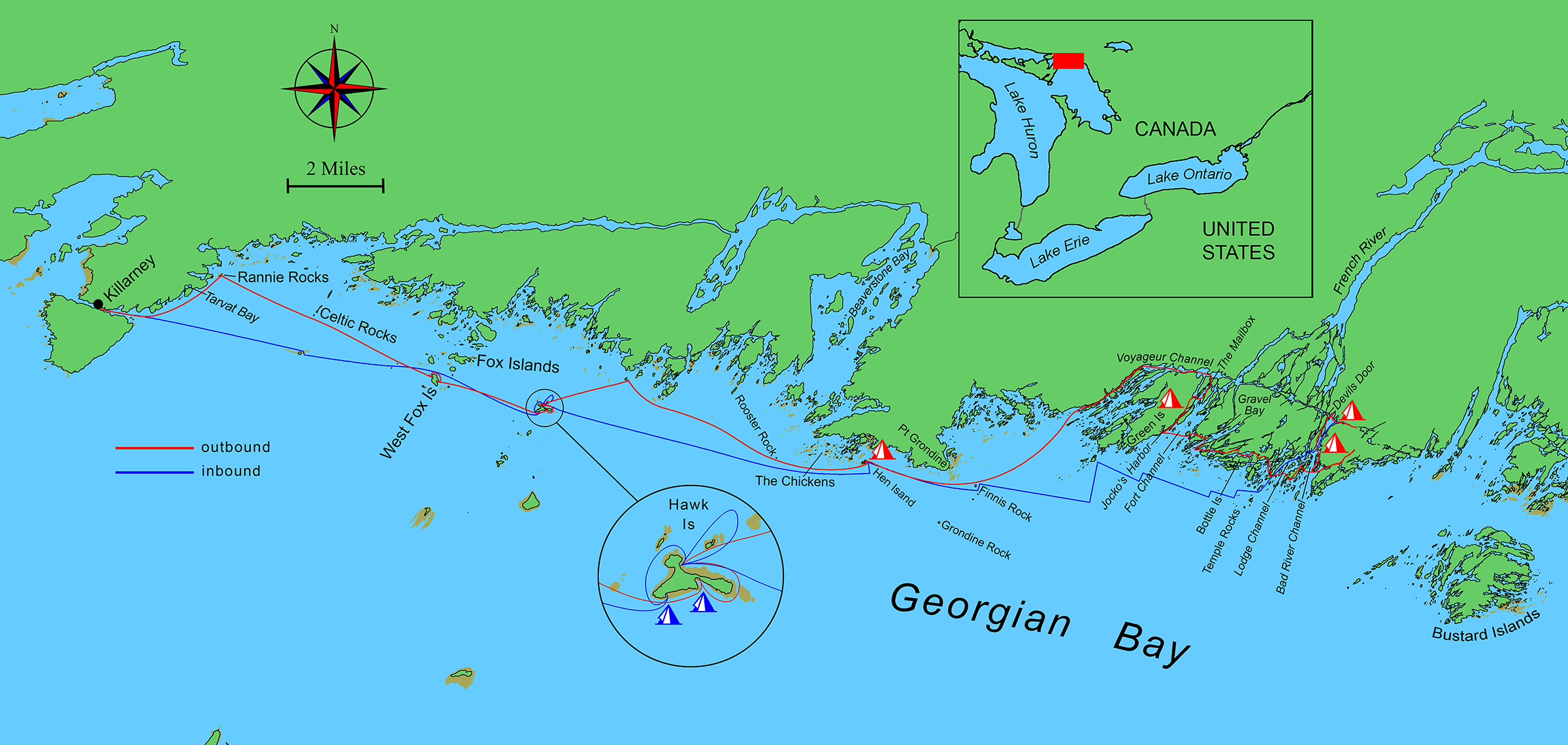
We opted to row the short crossing rather than take time to rig the sails—a reasonable choice in boats that row as well as ours—but the beach proved too exposed for an easy landing, with enough boulders scattered around to make anchoring in the shallows difficult. Neither of us had a VHF along, so we held a quick boat-to-boat discussion just off the beach, an oar’s length apart. With the wind picking up, I suggested we make the 2-mile crossing southeast to Hawk Island, one of my favorite summits in all of Georgian Bay. Lance agreed to the plan, and we hoisted our sails and set out.
It was a beautiful passage, with both boats moving easily on a broad reach under blue skies. We stayed about 2 miles offshore, with open water to the south, and the long ridge of the La Cloche Mountains on the northern horizon. From this distance, the foreshore was nothing but a low-lying stretch of dark pines with a thin band of pale stone at the water’s edge. Ahead, Hawk Island rose in seemingly gentle curves of pine and granite, its true nature concealed by distance.
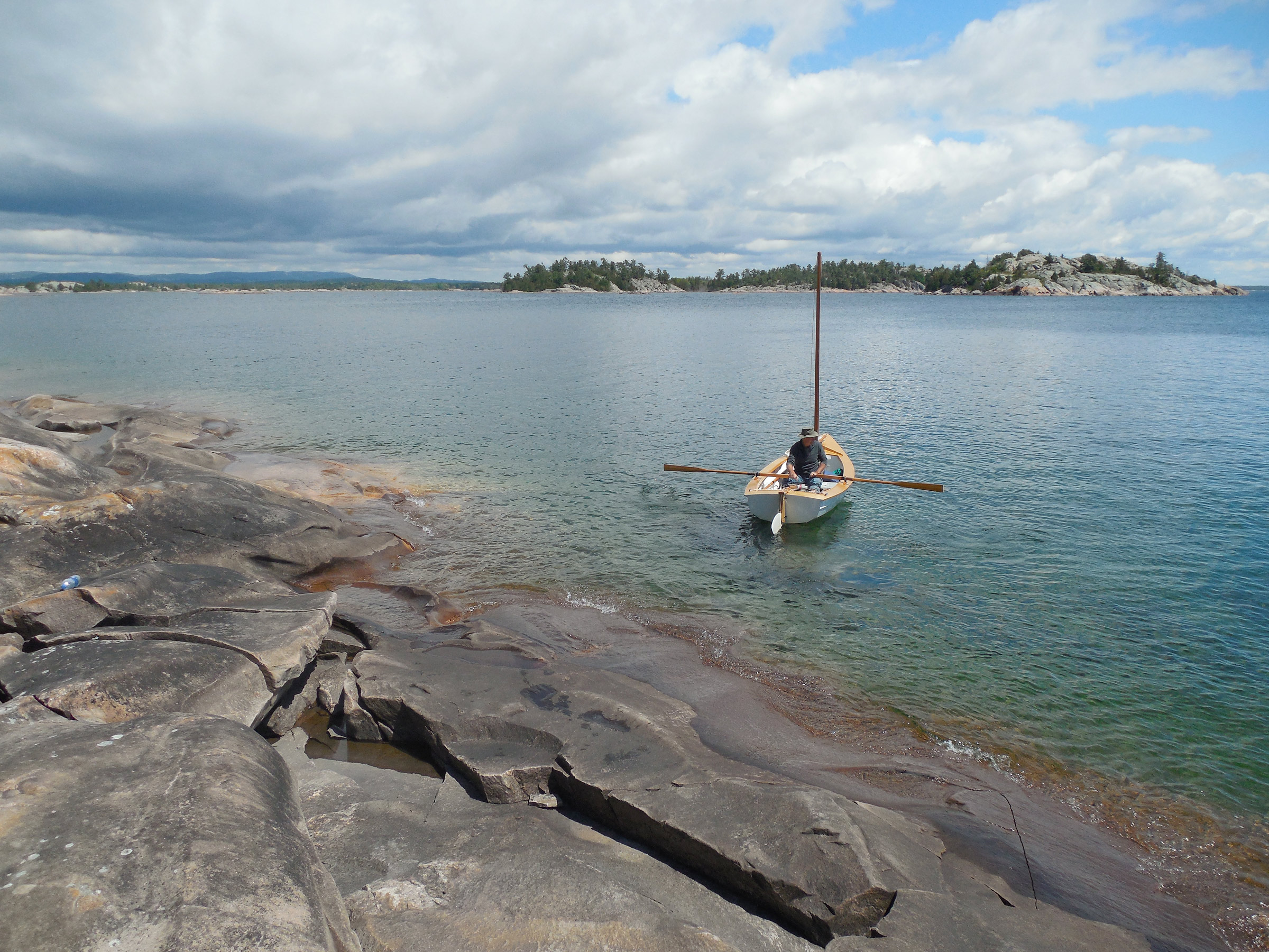
We passed south of the island a few boat-lengths off the rocky shore—it was obvious now how rugged the topography was, with vertical cliffs dropping directly into the water—heading for a small cove where I had once anchored for the night. But water levels were much higher now, and the cobbled beach at the head of the inlet had become a boulder-strewn shoal. Lance managed to land there, but we couldn’t leave the boats unattended. We continued around the island under oars, and landed on the north side, where there was a sweep of stony beach, perfectly protected from the wind and waves.
I tied FOGG to shore in knee-deep water with an anchor off the stern while Lance did the same with his Phoenix III. We spent the next few hours exploring, climbing from the stony beach to the summit slabs, then scrambling down and up and down and up again along a series of granite cliffs and ledges to reach the island’s far western tip. There was still plenty of daylight left when we got back to the boats.
After considering our options, we decided to continue east for another 6 or 7 miles, skirting the southern edge of The Chickens—a 2-mile stretch of rocky islets and shoals just east of the entrance to Beaverstone Bay—to camp at Hen Island at the eastern end of the shoals. I had stopped there on a previous trip and knew exactly what we’d find: a few acres of low granite slabs, scrub brush, and white pines laid out in the shape of a roasted chicken, with a flat sandy beach tucked up at the head of a narrow bay, right between the drumsticks.
The narrow bay between Hen Island’s “drumsticks” offers the only sand beach I’ve found in all of the Thirty Thousand Islands of Georgian Bay’s eastern shore. Since it’s difficult to cross the wide belt of rocks and shoals that guards the mainland, an offshore campsite with a sandy beach provides a welcome refuge at the end of a long day’s sail.
Hen Island was a perfect campsite, with a wide expanse of gently sloping granite for tenting along the island’s west side. The moon—full, or nearly full—rose above Georgian Bay to cast a shining path over the water. It was late in the night before Lance and I retreated to our tents.
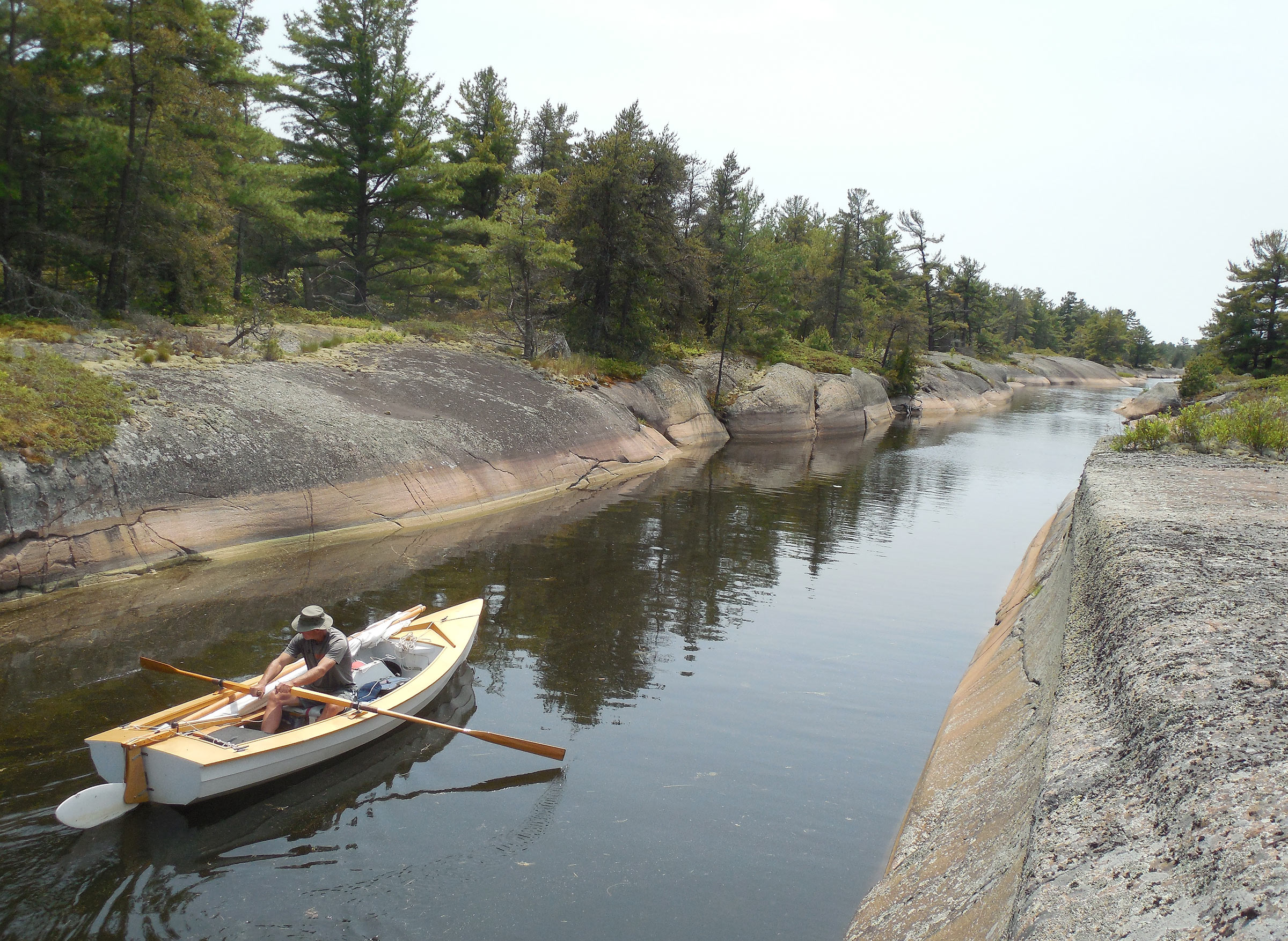
The next day brought blue skies and a boisterous southwest breeze. I suggested we sail east until we rounded Point Grondine—2 miles more or less—before turning northeast, into the westernmost branch of the French River Delta, the centerpiece of Ontario’s French River Provincial Park. Here we’d find the Voyageur Channel, a broad bay filled with dozens of parallel channels between long fingers of pine-topped granite, all running southwest-to-northeast, where the earth had been raked with monstrous claws of glacial ice and drift that scored deep furrows all throughout the Canadian Shield, mile after mile. For small-boat sailors, these parallel grooves offer easy and spectacular traveling when the wind is right: cliff-lined waterways often less than 10 or 20 yards wide.
I wanted to sail these glacial tracks all the way up the Voyageur Channel, skirt the northern side of Green Island, and return to Georgian Bay via the Fort Channel of the French River, just a few miles east. My first attempt on an earlier solo trip had failed when I hit a dead-end far up the Voyageur Channel, the result of pilot error. If we managed to find our way through now, it would be a redemption of sorts.
By the time we rounded Point Grondine and headed in toward Voyageur Channel, the wind had picked up considerably—an edgy proposition when approaching a lee shore lined with rocks and shoals. FOGG was well in the lead as we approached the entrance, but Lance passed me when I rounded up to tie in a double reef—with the channel narrowing dramatically, it was well past time for reducing sail. I caught up half a mile farther on, where he had pulled into a sheltered inlet to wait.

Although we could sail up the Voyageur Channel when the wind is right, there’s not much room for maneuvering, and no guarantees that we wouldn’t hit rocks. Although we managed to make it through without any collisions, we made sure to leave our rudder downhauls uncleated, just in case.
We set out again, but even double-reefed, FOGG was moving too fast, with little room to maneuver in a rocky channel barely 30 yards wide. And besides, this was Neverland, and we were rushing through it. I headed up into the wind, dropped the sail—there was barely room to make the turn at this speed—and rowed to one of the channel’s many narrow islands, a long finger of rock that formed a low ridge between parallel channels. Lance pulled in not far away. We wanted some shore leave: a break from the wind, some lunch, and an aimless ramble along the ridge.
When we shoved off again, we left our sails down. It was a pleasant change of pace to drift along quietly side by side, rowing a few lazy strokes now and then, or simply steering with the tiller as the wind carried us along. Gnarled pines hung from the shore like grasping hands while the dark water mirrored the ragged skyline of the islands all around us. At times the channels were so narrow we had to stand up and use an oar to paddle through, moving from sail-and-oar to SUP. Just above the treetops a heron flew by, wingbeat after slow wingbeat, a reminder that speed was no virtue here.
 Lance Pamperin
For much of our time in the French River Delta, I rowed from FOGG’s aft thwart so I could face forward and avoid obstacles in the narrow rocky channels. Lance borrowed one of the filler planks from my sleeping platform for a temporary rowing thwart across the Phoenix III cockpit, which allowed him to do the same.
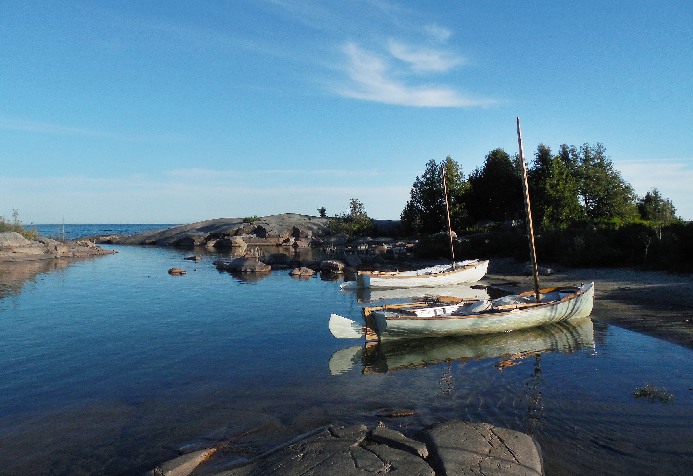
Now and then we pulled into a side channel or back bay to explore, gliding through reeds and lily pads that parted around our hulls with a shushing hiss, or landing to scramble up bald slabs of granite, balancing along weathered ridges at the water’s edge to follow hidden canyons that cut deep into the woods. At the end of the day, we tied up to a steep-sided rock the size of a railroad car, tucked into a quiet backwater on the east side of Green Island, our traverse of the Delta a success. It didn’t matter that there was barely room to set up our tents—or that Lance arrived first and took the only flat spot. But I made a mental note not to lag so far behind next time.
Along the north side of Green Island, more than 2 miles up the French River Delta, the channel widened considerably, making for easy progress with a tailwind blowing. We had plenty of time to stop along the way to explore the rocky canyons and slabs of Canadian Shield country.
The next few days brought brooding clouds and thunderstorms, gray skies, and too much wind. We didn’t care. The poor sailing conditions gave us all the excuse we needed to stay inshore, weaving through an intricate tangle of narrow passages where a sailing rig would only have been an impediment. We had discovered a strange liminal zone between dry land and open water—dark pine forests, bare bedrock, and swampy lowlands to the north, a broad belt of bare slabs and shoals to the south. Caught between boreal forest and inland sea, we followed a series of haphazardly intersecting faults in the bedrock that formed a complex network of canals—narrow boating at its finest, with the tips of our oars almost scraping the cliffsides. But all too soon it was time to head back to Killarney.
When the third day of our trip began with a series of violent thunderstorms followed by heavy wind, we abandoned our vague plan to sail out to the Bustard Islands 2-1/2 miles offshore. Instead, we rowed up this narrow seam in the bedrock to a dead end in a rock-lined pool filled with lily pads, then continued east to the Bad River Channel to find our next campsite.
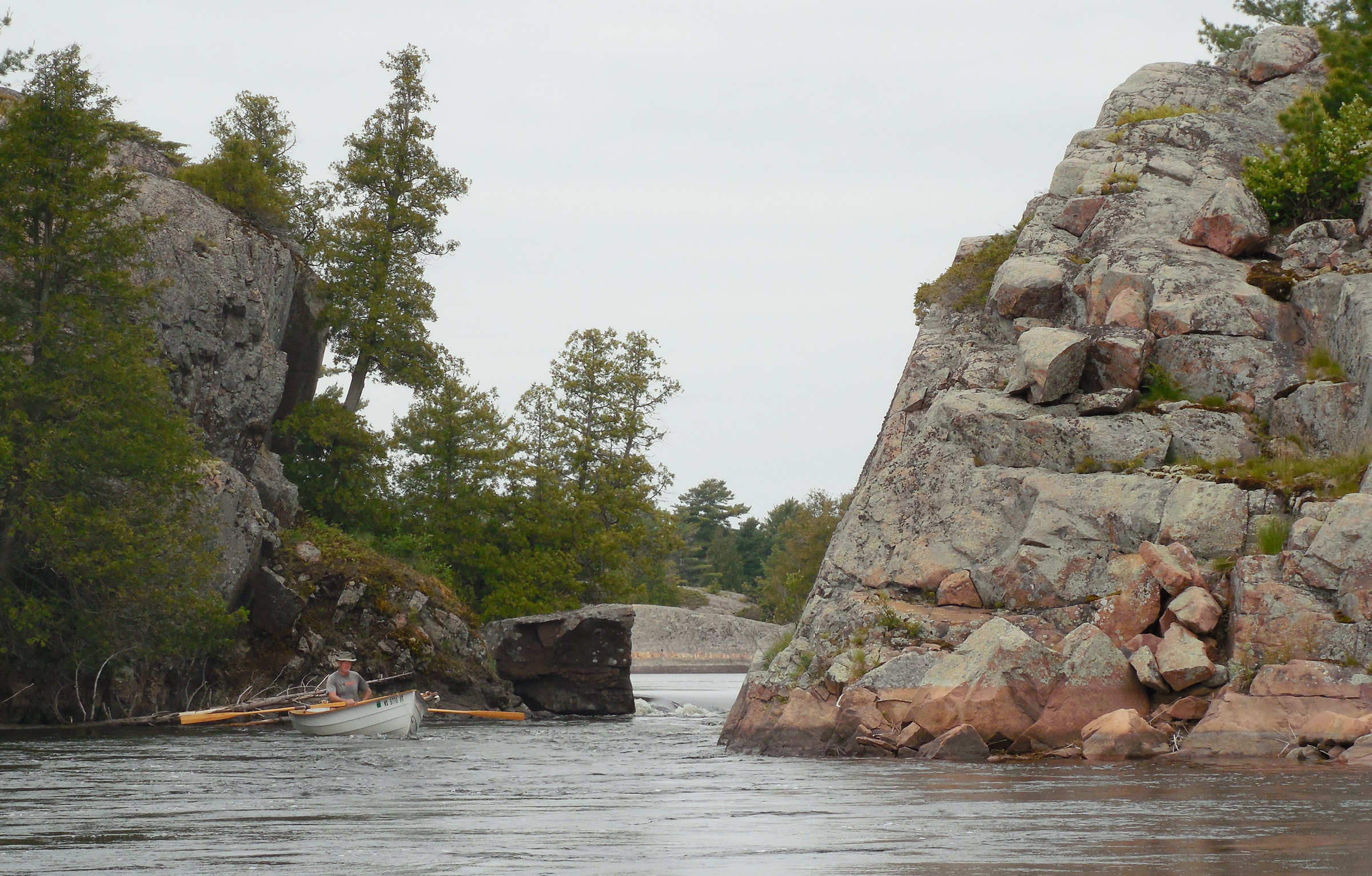
Our journey up the Bad River Channel ended at Devils Door Rapid, where fast-flowing current and a 3’ drop kept us from getting farther upstream. We briefly considered trying to line our boats through but decided that rowing up to the foot of the rapid and enjoying a quick ride back through the ripples and eddies was the wiser choice.
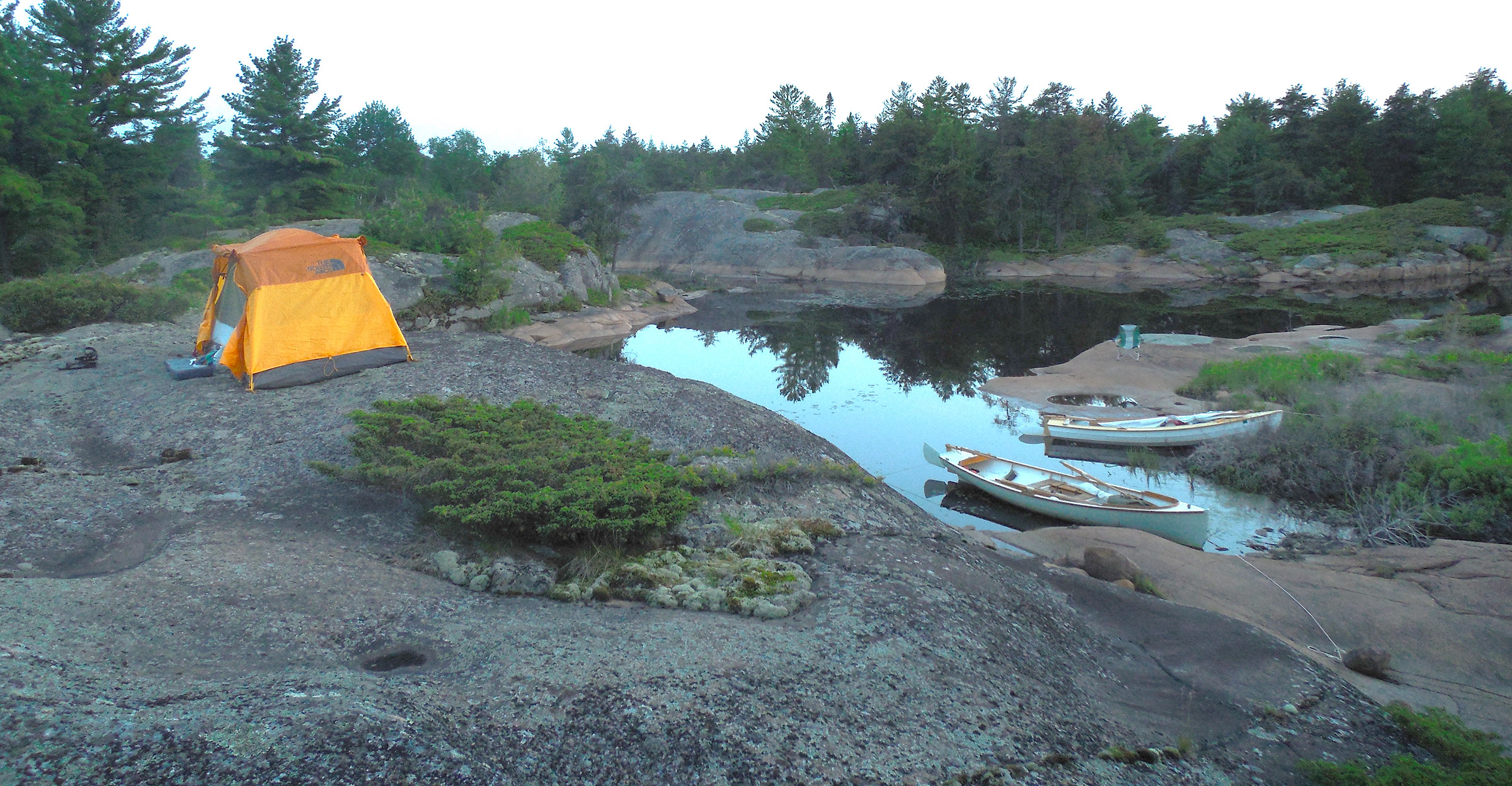
At our final campsite in the French River Delta, we pitched our tents on a rise of bare granite overlooking the cove where we had landed. We woke to an unexpected sight: the water level had risen significantly overnight, and the boulder I had tied FOGG’s painter to (lower right corner of the photo) had become an island in a shallow puddle of water.
At our fourth campsite, a slabby cove tucked into a dead end of a 4-mile seam in the bedrock of the Delta, we packed up and launched the boats with the sun still below the treetops. We rowed west down the bedrock seam to where it intersected the Bad River Channel, then turned south. It was 3 miles to open water from here, along a meandering course that wound its way through clusters of weathered rocks that rose from the water like the backs of whales. The southwesterly breeze was a stiff headwind for us here, but if it held, we’d be able to make good progress offshore, sailing a zig-zag course of asymmetrical tacks westward.
Thick gray clouds swept in while we rowed, and the wind grew stronger. At times the Phoenix III was completely hidden in the troughs of the waves, with only a splash of white spray to reveal its position. But as we rounded the Temple Rocks and hoisted our sails, the clouds faded to blue skies and sun, with just enough wind for good speed under full sail. We covered more than 8 miles by early afternoon, crossing tacks again and again far offshore, trading the lead back and forth—despite the difference in waterline lengths, my Alaska and Lance’s Phoenix III have proven to be perfectly compatible for this kind of sailing.
After a few hours aboard, I was ready for a break, and Hen Island was just ahead, not even half a mile off the direct route to Killarney. I steered toward it, and far behind me, Lance followed suit. I had barely made it to shore before he was rounding the island’s north end, the Phoenix III’s balanced lug rig closing the gap with surprising speed once headed a bit off the wind. We beached our boats between the drumsticks and headed inland for some shade; it was much warmer now that we were out of the wind.
Ten minutes later a wall of fog swept in off the lake, enveloping Hen Island in soggy gray mist that settled in so quietly that we didn’t notice it until we returned to the beach—the island’s interior remained completely fog-free, while the mainland, just a quarter mile to the north, was lost completely in the mist. We might have been a hundred miles offshore. A thousand.
And now we were faced with a tough choice. It was 25 miles to Killarney—a full day of sailing, assuming at least partially favorable winds—and Lance was up against a deadline to get back to work. It made sense to make another 10 or 15 miles today if we could. But could we?
We dawdled around the island watching the fog thicken and fade and shift from one direction to another. It had come so quickly that we knew it could easily catch us again if we guessed wrong. Blue skies to the west, a wall of fog to the east. Blue skies east, fog west. Fog everywhere, thick like wet cotton, fading to smoky wisps. And finally blue skies settled in all around, with the fog only a distant band of white across the open water to the south.
We agreed to give it a try, though I wasn’t particularly enthusiastic. The next leg of our route would take us along the southern edge of The Chickens again, and I didn’t want to get fogged in there. Still, it seemed like the best option—if I ignored the nagging thought that I’ve long considered an open schedule and complete avoidance of hard deadlines to be my primary safety measures for small boat cruising.
But it wasn’t the fog that almost got us; it was the huge swells sweeping in from the southwest, swells that must have been building all the while we had been on Hen Island, sheltered from the wind and oblivious to the developing conditions. As we rowed out into steepening waves, working for enough sea room to raise our sails, I was slow to recognize how bad conditions were getting. I told myself that the waves were only building so drastically here because of the underwater shelf at the edge of the shoals—a little farther offshore, they would calm down.
Twenty yards behind me I heard Lance call: “Are we about to do something stupid here?”
Yes, I thought. We are. But for me, it was already too late—I had hoisted the sail, tugged the downhaul tight, and sheeted in. Just as I heard Lance call, FOGG surged forward on a starboard tack, heading for a wall of a wave that seemed 10′ high. Behind it, row on row upon row of big waves swept in from the southwest, bigger waves than I had ever sailed in before.
There was no question of fear—it was too late for that. I immediately rejected the idea of jibing back toward Hen Island, or even lunging forward to drop the sail. I had tied a reef in before hoisting the sail, at least—that would help—but careful steering and constant attention to tiller and mainsheet would be my only hope of avoiding a rollover that could only end in the ugliest way, with FOGG washed up onto the rocks of The Chickens and pounded by breaking waves. Behind me the Phoenix III’s sail suddenly took shape and filled with wind. A moment later Lance and his entire boat, mast and sail included, disappeared into a trough. He was committed now, too.
I was surprised to find that I was able to manage without too much fuss, angling carefully up the faces of the waves, and easing the sheet as needed. After what I guessed might be 10 minutes—half a mile at this speed, maybe—I took my chance to come about onto a westerly course, hoping I had timed it well enough to avoid an unexpectedly big wave that might easily capsize us. And then we were headed west, the waves rolling in on FOGG’s port side now. All my attention was on the sheet and tiller.
I could just see Hawk Island, off in the distance, a low lump of green on the horizon. Six miles, maybe. All I had to do was hold this course for two or three hours, and I’d be able to sail into the lee of the island, back to the stony beach on its northern side where we had landed on the first day of the trip. I was sure that Lance had reached the same conclusion—it seemed like the only reasonable course of action. It would be nothing but stupid to try to land on a lee shore in these waves.
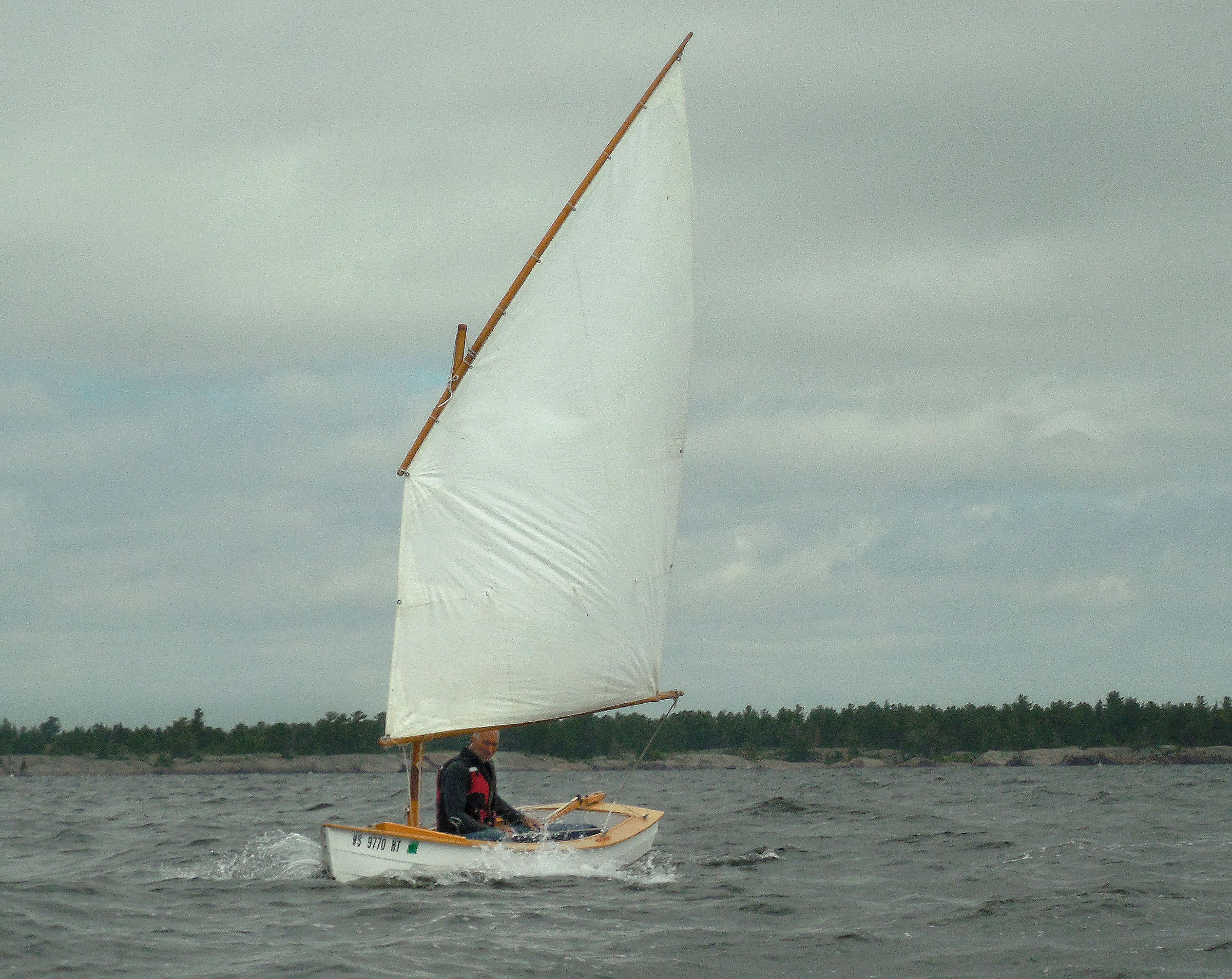
It was still blustery and cold when we hoisted sail at the mouth of the Bad River Channel for the westward passage to Hen Island. The Phoenix III, with its greater stability and smaller 76 sq ft balanced lug rig, was able to manage easily under full sail. I tied a single reef in FOGG’s 85-sq-ft standing lug, which was just about right for the conditions.
It was a harrowing ride for the first few miles. I was unable to let go of the tiller or sheet to bail, and the cold water sloshing around my feet was getting deeper. Every so often an outsized wave would rise up unexpectedly, its crest breaking over the port gunwale with a sudden splash. After a while the rudder kicked partway up, noticeably increasing the strain on the tiller. I tried to steer gently—a broken tiller would have been disastrous—but there was nothing else I could do.
Once past The Chickens and into deeper water, conditions slowly dropped from nerve-wracking to exciting to merely interesting. I managed to lower the rudder, and even bailed a few scoops of water. The waves kept dropping off, and eventually Lance and I were able to regroup. I sponged the boat dry as we sailed along side by side. After a few more miles, a sudden calm had us drifting aimlessly a mile out from Hawk Island, rocking gently while our sails flopped lifelessly overhead.
Lance dropped his rig and started rowing. I was about to follow his lead when a sudden strong westerly swept in, preceded by a ripple of dark catspaws on the water that gave me just enough time to be ready. When the wind hit, I sheeted in and was off on a port tack. It would be a dead beat to Hawk Island—half a dozen tacks, maybe—but after what we’d just come through, a dead beat would be nothing.
An hour later I sailed up to Hawk Island’s cobbled beach, cold, wet, and ready to be done with the wind. Lance was already anchored just offshore, proof that rowing directly to windward is faster than a long beat. I didn’t care. We were both safely ashore again, with The Chickens and their huge swells behind us.
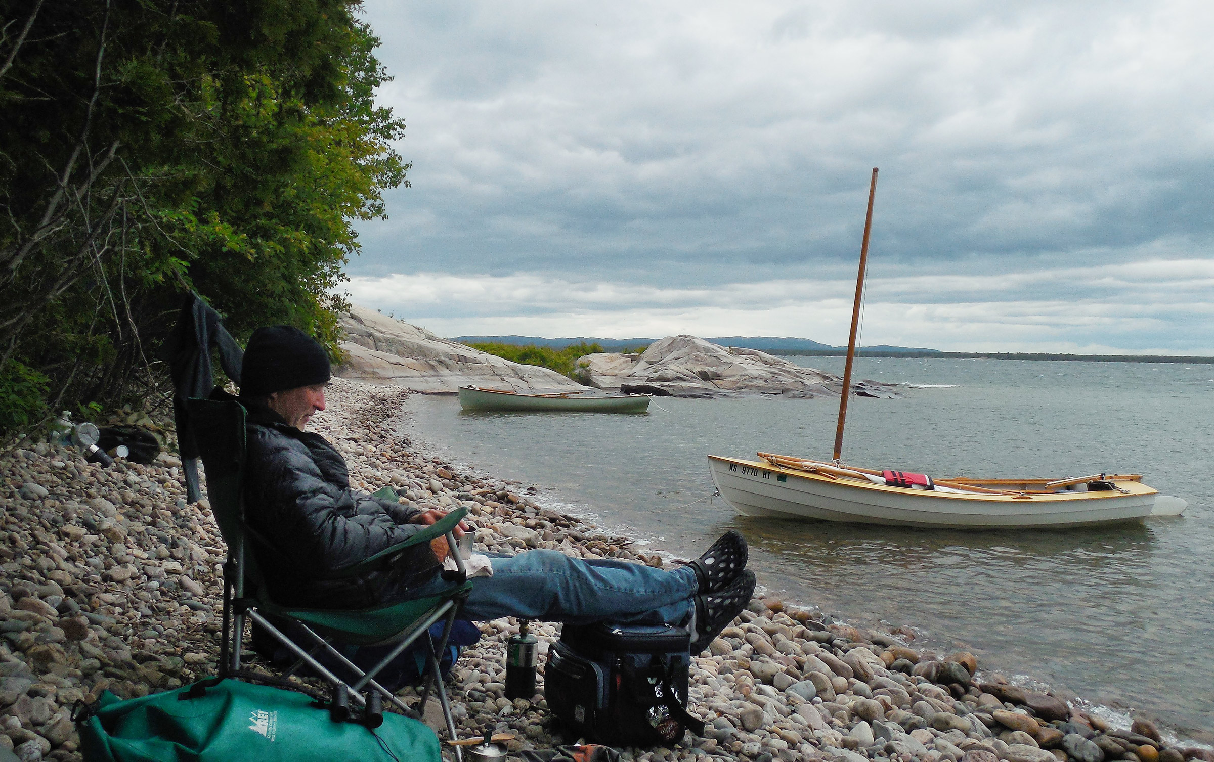
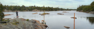
We spent much of our second day on Hawk Island huddled on the sheltered beach, hoping the wind would die down. Instead, it kept getting worse. Shortly after this photo was taken, we set off on our ill-advised attempt to make some more miles to windward, only to return to Hawk Island an hour later—tired, wet, and cold.

Our first campsite on Hawk Island was located on a broad ledge just below the summit dome, one of the only flat spots we found. The spectacular setting was worth the effort to make the long climb from the beach with our camping gear.
We spent our sixth day on Hawk Island, kept ashore by strong westerly winds. It wasn’t until evening that we made our attempt to leave the island to cover a few more miles back toward Killarney—the attempt that had landed us both back on the beach.
The wind veered to the north and the cobblestone beach where we had anchored would soon be exposed to breaking waves. Though we were cold and wet from our ill-advised attempt, we couldn’t leave the boats here overnight—the nearest campsite was high above the beach, far too distant to tend to the boats if conditions continued to worsen.
With few options remaining, we rowed to a marginally sheltered bay on the island’s south side, moving slowly in waves stirred up by two days of heavy winds. I rigged my 12-pound Northill off FOGG’s stern and buried a smaller Northill under a huge pile of boulders ashore for the bow. We were able to lift Lance’s boat onto a smooth slab of rock above the water. We spent the night on a narrow shelf of rock at the base of a cliff that overlooked the bay.
The next morning, we took a chance on an early departure under blustery gray skies, tacking westward against a double-reefing headwind. By the time we completed the 2-mile crossing to the Fox Islands, though, conditions had moderated to easy sailing. Another 8 miles of blue skies and bright sun brought us back to the ramp at Killarney. We left our boats in the marina and walked back to the Church of St. Bonaventure for the cars and trailers.
I wasn’t eager to begin the long drive home, knowing it would be at least another year before I’d be able to return. I hoped Lance would be able to join me again when I came back; I suspected that Georgian Bay was as much in his blood now as it was mine. But as for this summer, my sailing was pretty much done. I’d be moving to Europe for a new teaching job in just a few weeks.
I spent my last few Canadian dollars on a basket of fried fish at the Herbert Fisheries dockside restaurant, trying to delay my departure for as long as possible, then took a minute to make sure—one more time—that FOGG was on the trailer, strapped down and ready to go. Despite the challenges Lance and I had faced, I’d argue we’d had good luck. But I still didn’t know whether St. Bonaventure had offered us a blessing or a warning. Maybe both, I decided. ![]()
Tom Pamperin is a teacher, writer, and small-boat sailor with a long history of cruising the Great Lakes and smaller inland waters. He is currently based in Wrocław, Poland.
Tom has provided many more photographs from this cruise in a Google map.
If you have an interesting story to tell about your adventures with a small boat, please email us a brief outline and a few photos.
I LOVE IT!
Thank you for this vivid account!
Chris
Interesting account, great pictures, thanks!
Great stuff, as usual, Tom. If ’twere in my power I’d grant you Canadian citizenship, and a job, so you could continue to provide us with more explorations of Canadian waters.
Another great adventure story Tom! I’m trying to follow along on Google Maps, but it’s not easy as most of the island names do not show. Knowing you, there is no GPS track, either 😉
Rick, if you click on the diagram/map above it will enlarge. You can move that to a second screen if you have one and then track it on google maps.
I second all the positive comments.
Sounds like you had some challenging conditions! I’m curious, would you put your decision to go out in the bigger wind and waves in the “bonehead move” category or would you do it again? (I ask from the standpoint of an experienced bonehead-mover.) Was the chance of capsize/swamping quite low, or something that was very possible? Could you have recovered the boat from a capsize in those conditions, and if so, how? If one of you ended up in the water, would it be possible to get into the other’s boat without bringing it to grief? How long do you think you could have lasted in the water, given the clothing you had on and the condition and temperature of the water? Was self rescue your only option, or did you have access to emergency communications? Any precautions you took, or wish you had taken, that might be helpful for other readers to consider?
Thanks in advance.
OK, great questions from Andrew on safety and risk management. Here’s my thinking:
1. It was definitely the wrong move to go out in those conditions when we set out from Hen Island. The main reason we did was that Hen Island’s bay is completely sheltered from any direction but northeast, so we never noticed the southwest swell building all afternoon after we landed there. Had I known it was going to be such big waves, I would not have gone out.
In fact, I really didn’t even want to go out even before I saw the waves, because I was worried about how quickly the fog had come in. But we were under some time pressure on this trip. I think that’s generally a mistake; an open calendar and refusal to impose deadlines is, I’d argue, the best small boat safety measure there is. But reality is, Lance had to get back to work so covering more miles (if we could) seemed important. On my own, I probably would have camped overnight because of the fog risk. That would have been the smartest way to handle the situation. Then again, with the next day’s super-high westerly winds, we REALLY would have missed our deadline had we not gone on. Deadlines are dangerous. They cause us to underestimate risk, I think. Or accept a higher level of risk to avoid an inconvenience that’s otherwise certainly going to affect us.
2. Once out in these waves with the sail up, I thought there would be more risk NOT continuing than there would be in pressing on–trying to gybe (or tack) my way around to go back to Hen Island felt like it would have been a very risky maneuver. Trying to drop the sail seemed even riskier–with no mizzen, the boat would have turned broadside. And these waves were easily big enough to capsize us if we were beam-on to them. Also, where I hoisted the sail, I had very little sea room before I’d hit rocks–I kind of had to begin sailing immediately, and didn’t want to gybe without room anyway. (Maybe making sure you have more sea room in the first place would be wise!)
But it was immediately apparent that the Alaska (and the Phoenix III) were doing pretty well by taking the waves on a close reach, angling up the faces, and easing the sheet in gusts. So, knowing we had only to hold the heading for 2-3 miles before we’d be past the shoals (and theoretically past the big waves), I thought keeping on was the best choice at that point. The wind, interestingly, did not seem particularly strong. Lance wasn’t reefed in the Phoenix III, and I didn’t feel overpowered in the Alaska either. Even so, these were conditions where a mistake, or a moment’s inattention, or even a particularly unlucky big wave at the wrong moment, could have capsized either boat. But without pilot error, I think a capsize would have been unlikely even in these waves.
3. The water in Georgian Bay is significantly warmer than in the rest of Lake Huron, or Lake Michigan/Lake Superior. In July, I typically swim for an hour or more each evening. That said, it was colder on this trip (early June), so it definitely would have been a serious concern to capsize. I have a drysuit but the gaskets need repairing, so I didn’t bring it. My foul-weather pants and rain jacket would not have helped nearly as much.
4. I am confident about solo recovery of either boat–we’ve tested them in actual sailing conditions. That said, with these waves, I think it very likely they could have re-capsized before I could re-board and bail. Capsizing in high winds but smaller waves would be far less of a problem–in that case, I could drop the rig and re-board to continue under oars.
5. Self-rescue was our only option had we capsized–no VHF. I’m not opposed to them, but I think that the chances anyone would be in range to receive a distress call would be low. I’d rather put the time into attempting a self-rescue than in trying to call for help. And if I re-right the boat first and then take time to use the VHF, I wouldn’t need rescue anymore. So I don’t find myself thinking a radio would have been of much use. We only saw other boats on the first day of this trip, so it’s always best to assume you’re on your own.
I think either Lance or I could have rescued the other person had one of us gotten into trouble. Not so sure we could have helped much with the boat. We probably would have tried to stand by while the other person attempted to re-right the boat alone, and adjusted plans depending on how that turned out. Certainly there’s no easy way to coordinate two boats in serious conditions, or to work together on a re-righting.
Bottom line: Avoid deadlines. Stay ashore. And trust your boat and experience to see you through if you get into something bad anyway. A bit of luck when you need it doesn’t hurt either!
Tom
Thanks for all the comments; I really appreciate them. I’ll try to post some detailed responses soon. Great questions about the challenging conditions. I look forward to sharing my thoughts.
Tom
Thanks Andrew. On my phone the map image did not appear to show any tracks, but on a big screen I see Tom did use a GPS.
Actually, that’s not a GPS track–I don’t own one, and my brother didn’t bring his. The route from the map is the one I plotted after the fact on Google Earth so the illustrator had something to work with for the article. It’s as accurate as my memory, notes, and photos can make it, but it’s not GPS. Given how narrow some of those channels are, though—and how good Google Earth is—I’d expect the route as marked to be pretty precise.
Tom
Happy to hear you did not have a GPS, I was worried you had gone to the dark side!
Regarding the waves – were they breaking? On my very similar size Walkabout, I would resist letting the boat turn beam on in waves as it seemed more dangerous. Recently I’ve been more relaxed, and found it will ride over most waves from big swells to steep chop as long as they are not curling over. I sit near center and let it rock. Little boats can be better than big in many conditions.
Rick,
I suspect I will resist the “dark side” of electronics pretty strongly as long as I’m doing this kind of sailing! There are places where it makes sense for sure, especially if you’re dealing with significant currents, but that’s not the case on the Great Lakes at all.
As for the waves, mostly they were not breaking, though a few of them broke decisively, and many of them had breaking crests that would dump water in over the gunwale. So, as you say, my boat (small and light) might have handled them fine, even beam-on. I think the bigger danger (of dropping the rig without a mizzen to hold the boat head-to-wind) would have been of me falling out, or falling down and being injured. And while I suspect you’re right that a small boat can “floating-leaf” its way over most waves without trouble, these waves were big enough, and steep enough, that “better safe than sorry” seemed to apply.
That said, there were occasional waves (as always) that were much bigger than the average size, maybe one “rogue” every 2-3 minutes. I felt like 2 things were especially important for these waves:
1. Maintaining steerage—enough speed to have decisive control over the boat, so keeping the sail powered up (I was easing the sheet a lot, almost luffing, very often, but not when these bigger waves appeared).
and
2. Steering as close to directly up the wave face as possible without letting the sail luff.
I think what really helped was that, while the swell was still big (big enough for each boat to be completely hidden in the troughs), the wind was dropping off. I had a single reef tied in, and would probably have managed fine under full sail.
I was actually quite surprised by how well the boats handled it, as it certainly seemed scary to me. My conclusion is that, handled properly, the risk of capsize was pretty low in these conditions—but that a mistake could have quite easily resulted in a capsize. We were definitely paying attention! (And would not have gone out had we known what we were getting into).
Tom
Thanks for the details Tom. As always, it’s enjoyable to ride alone with you on your adventures. I’ve sailed 1x out of Little Current on a 32′ Cat with my brothers…hardly the same thing, but that trip has resulted in my bucket list addition of getting back out there with my Welsford Navigator.
A Navigator would be a great boat for Georgian Bay, for sure. It would be very hard to explore some of that inshore terrain in a bigger boat–maybe impossible.
Tom
Tom–What a great story! I love your adventures and I smile when enjoying your writing style, self-deprecating and all. Keep up the adventures and don’t forget to get around a boat or some water in Europe!
Jay, we still have to manage a sailing trip together at some point (what are you doing next summer?). It’s great to hear from you–thanks for commenting!
Tom
Great adventure (wonderful photos!) for sure but, I think I envy all that you and Lance have done together as “brothers” the most! That said, like everyone else I’ll be looking forward to your next article.
Stay well Across the Pond,
Rob K
Thanks for the comment, Rob. I agree, it’s great to have a brother interested in doing the same kinds of things–having another person along dilutes the potential for terror a bit. But solo trips are also good. Either way, I still need to get my hands on a boat somehow over here…
Tom