camping Archives - Small Boats Magazine

A Portage Too Far

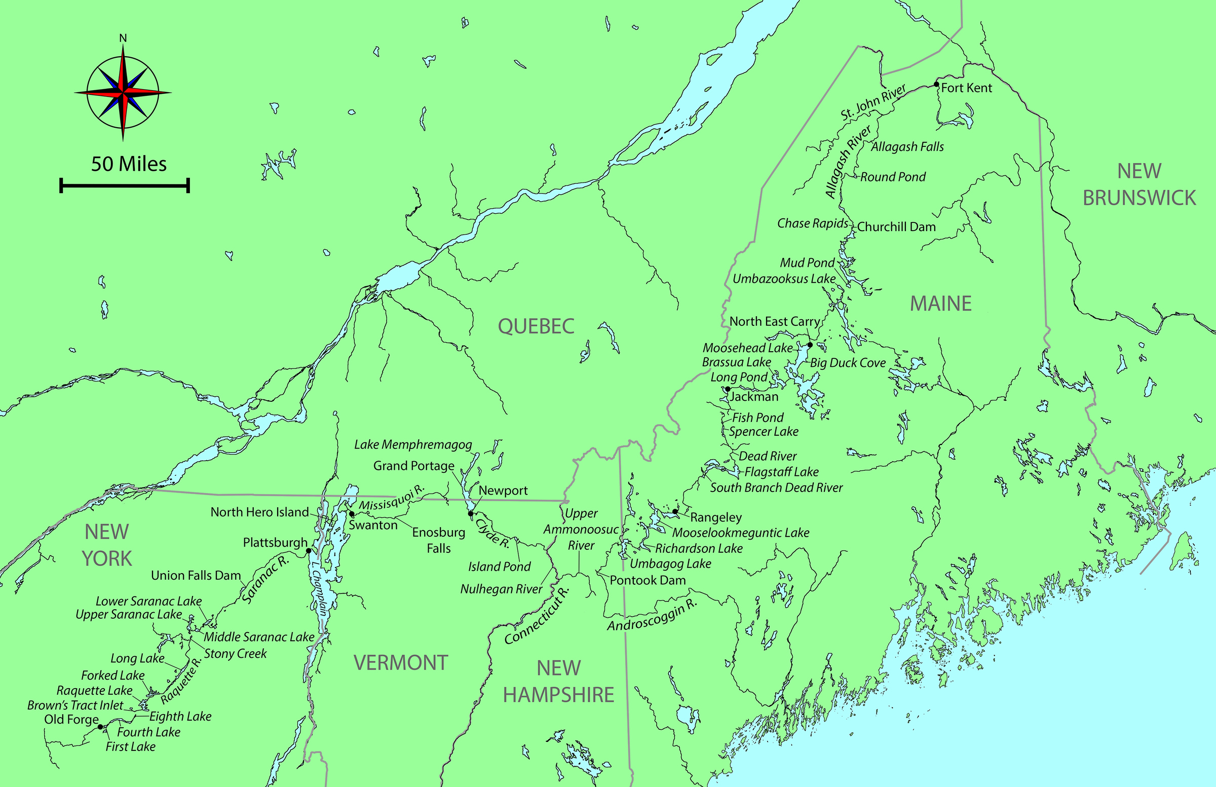
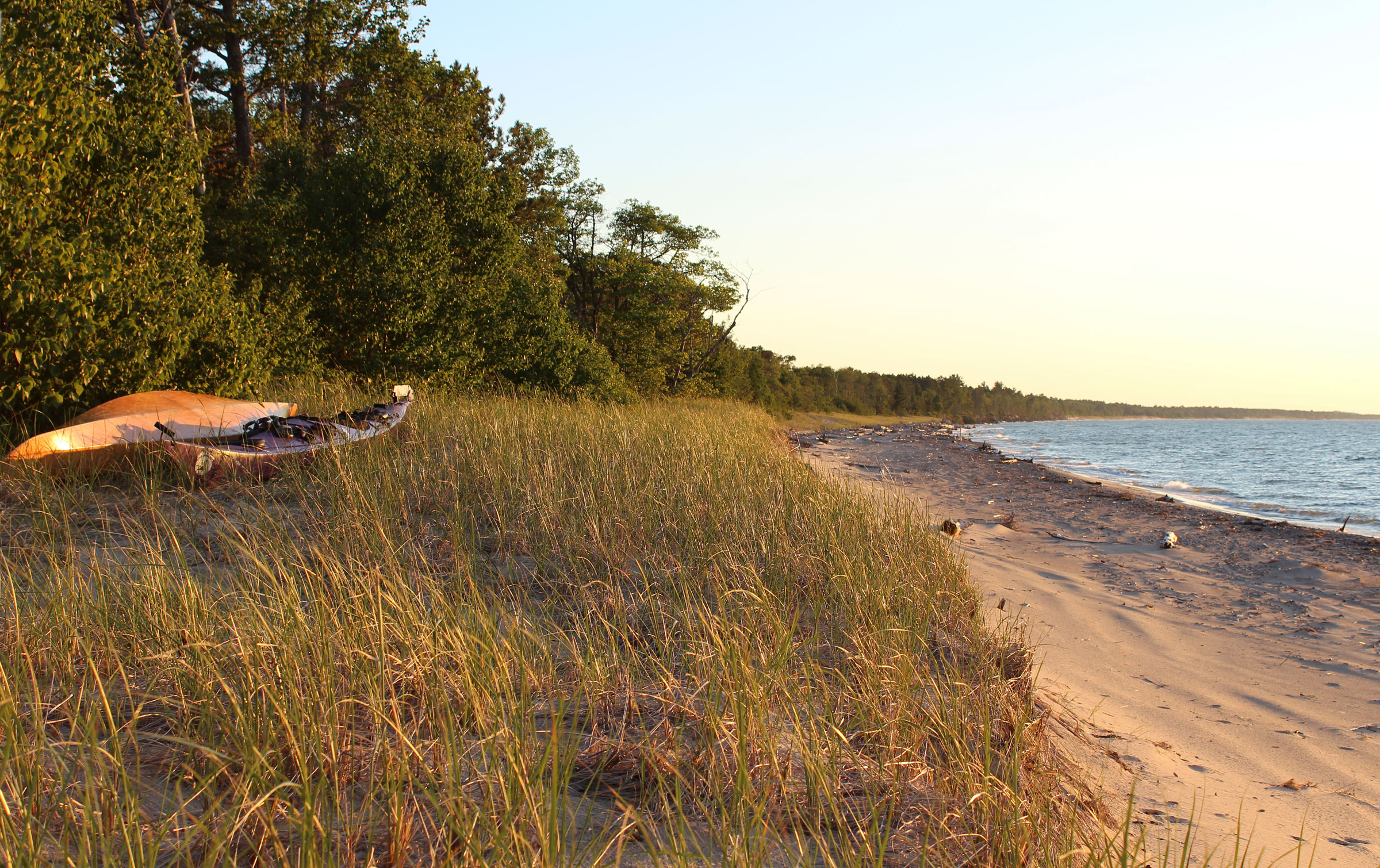
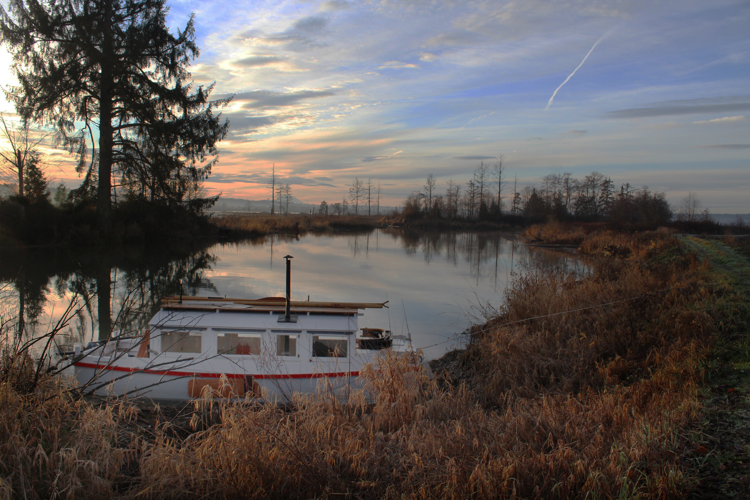
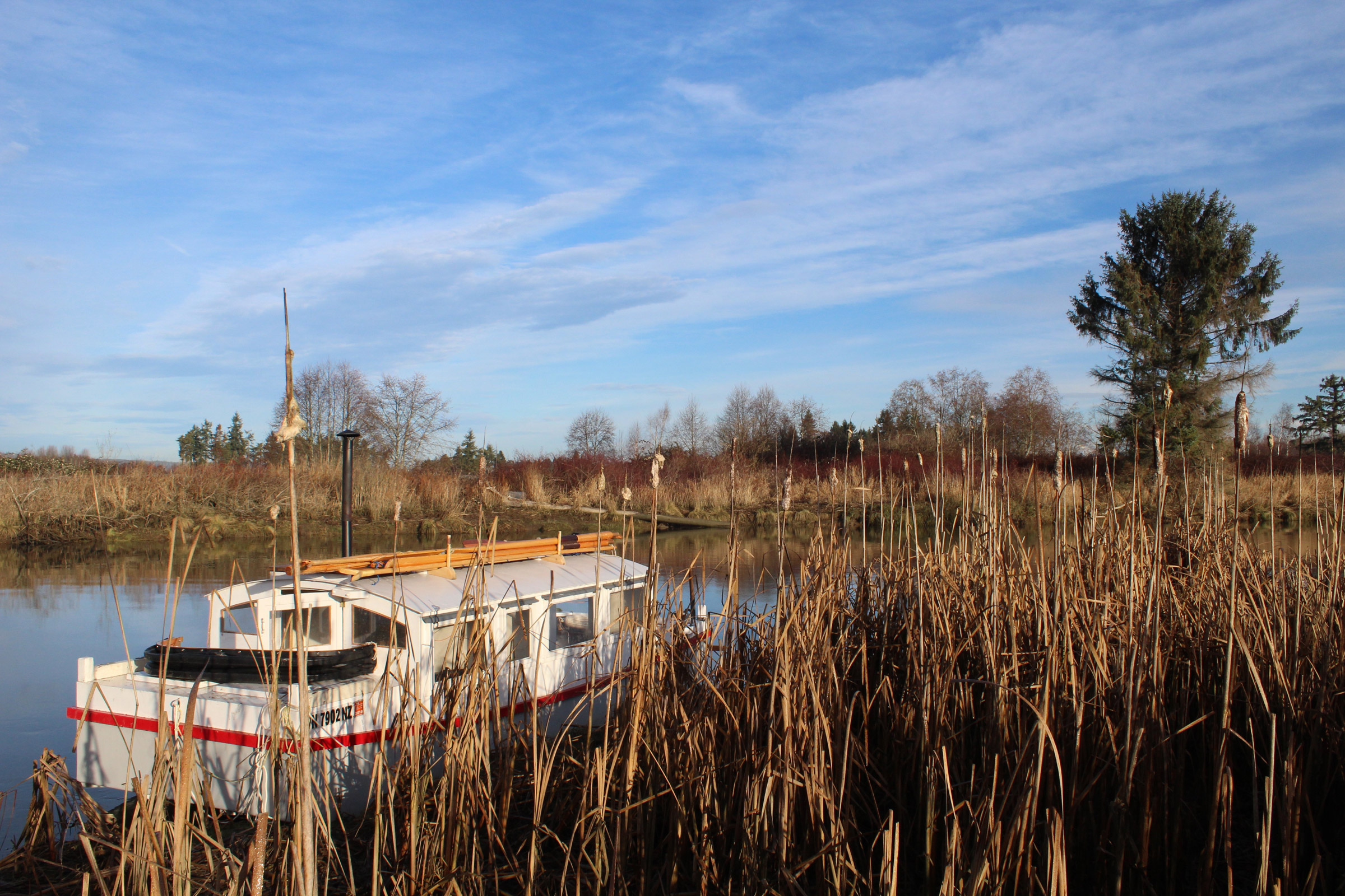
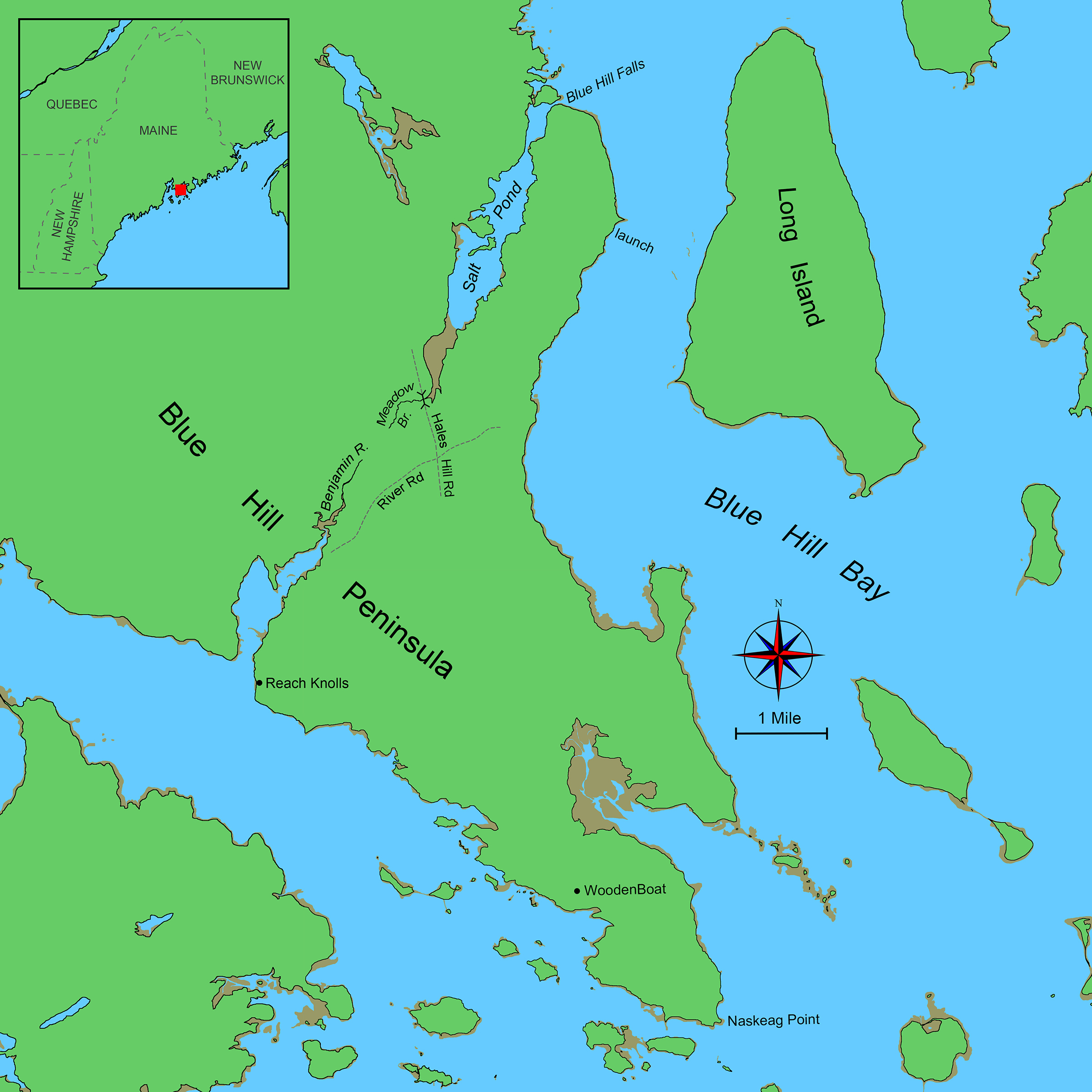
Our plan was simple: on Friday, April 30, 2022, Delaney and I would embark from Brooklin to make a 26-mile circumnavigation of the southern end of Maine’s Blue Hill Peninsula by way of Blue Hill Bay, Blue Hill Falls, and the Salt Pond and Benjamin River with a half-mile haul between the two along what once was an old Wabanaki portage. We were hoping that if we worked hard, we’d be able to make it back to Brooklin in three days, camping along the way on Long Island in Blue Hill Bay and at the Reach Knolls campground at the mouth of the Benjamin River.

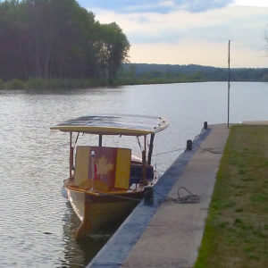
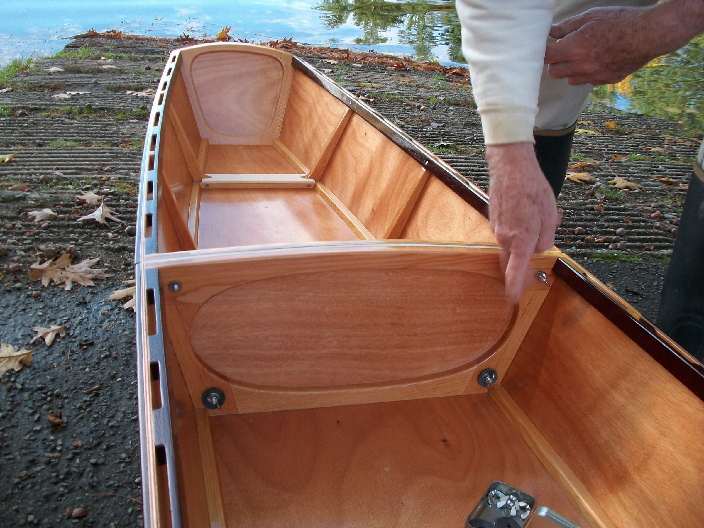
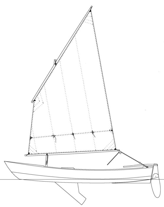
The trip was conceived only a week earlier as Delaney and I stood in my parents’ garage in Worcester, Vermont, and looked at the 17′ Chesapeake Light Craft Northeaster dory my father and I started building in 2014 in a one-week class at WoodenBoat School. He and I thought it would be a boat I could cut my teeth on for boatbuilding and rowing, but we had never finished it. Since the class it had been languishing in the garage for eight years. WHISTLER—as we named the dory for my propensity as a 13-year-old to whistle while building it—looked forlorn as I ran my hands over the dusty hull, but all it needed to be ready for the water was interior paint and varnish on the rail.
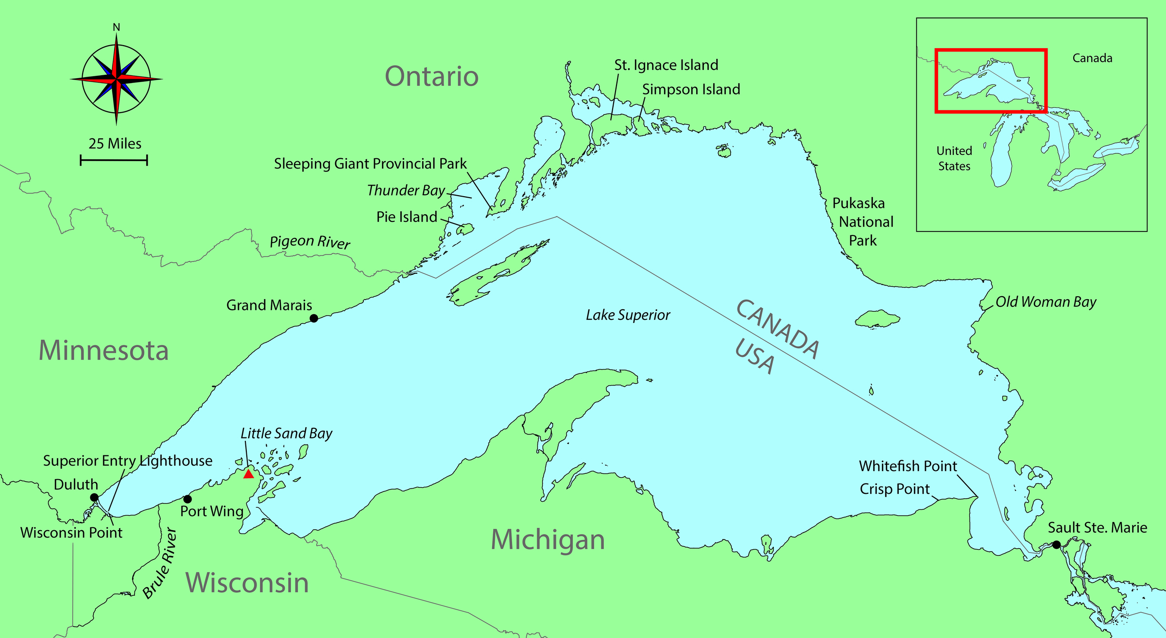
Roger Siebert

.

Last year, while working at WoodenBoat School, I’d heard the stories visiting Grand Canyon river guides had told about running dories through rapids, and while WHISTLER is a different kind of dory, I imagined running the Blue Hill Falls tidal rapids at the entrance to Salt Pond. Delaney liked the idea of running the rapids and taking on the circumnavigation, and we decided to cartop the boat, take it with us back to Maine, and get it ready to launch.

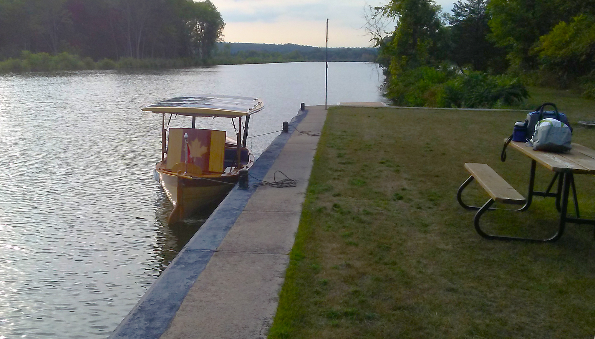
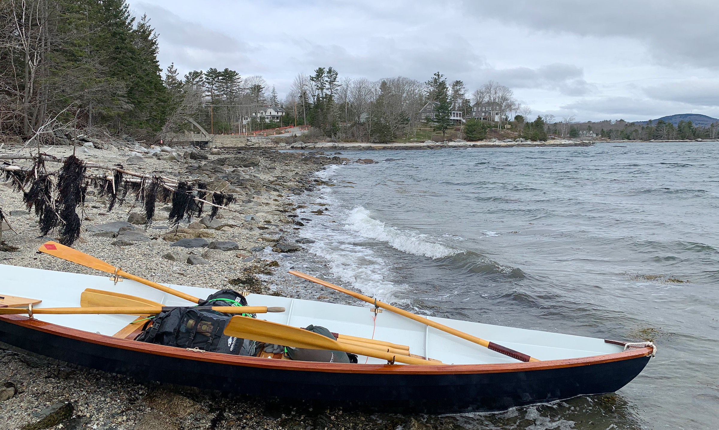
We worked on the boat in the shop at WoodenBoat the following week, and by Friday morning the paint and varnish we’d applied had dried. If we were going to do the circumnavigation, we had to start that day, as that last weekend in April was the only time we’d have together for several months, and the tides were perfect. The only problem: the wind was blowing 20- to 35-knots from the north, the worst possible direction for our row from the launch ramp at WoodenBoat School. Still, we were determined, until a small-craft advisory finally convinced us that launching to take on a 12-mile row from Brooklin to Blue Hill Falls would have been not only ill-advised but also rather dangerous. The new plan was to launch on Saturday from the South Blue Hill boat ramp 1-1/2 miles south of the falls.

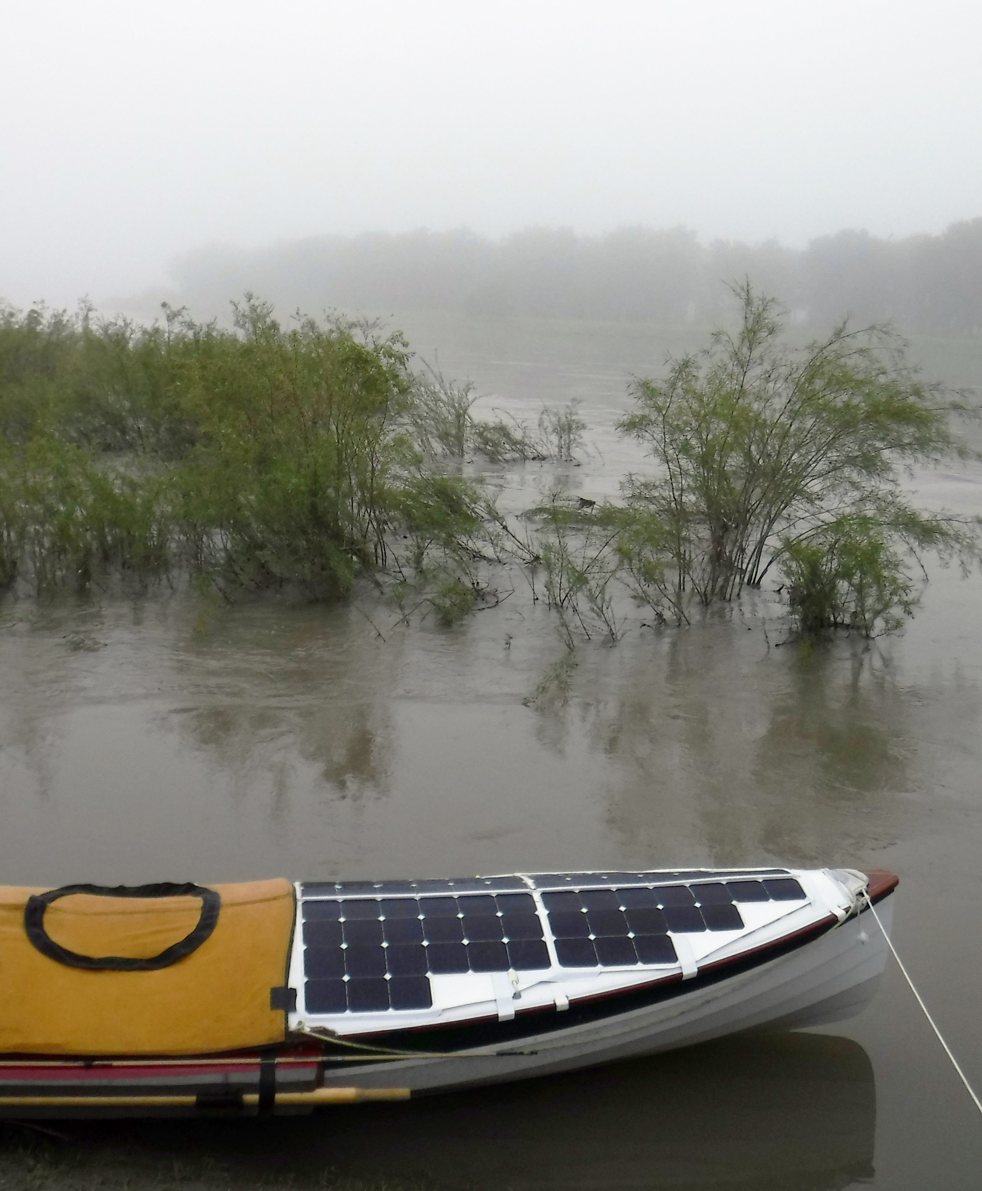
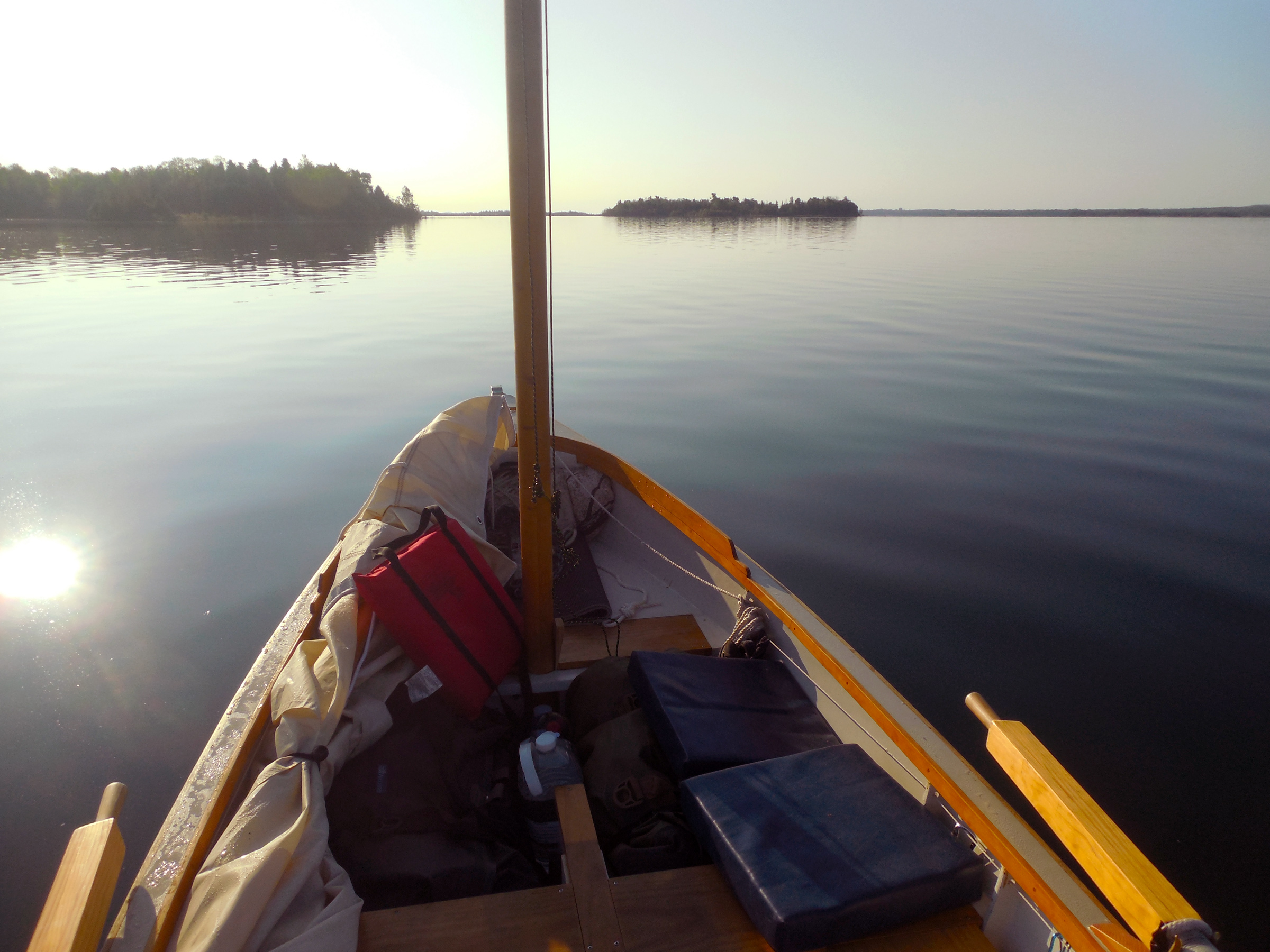
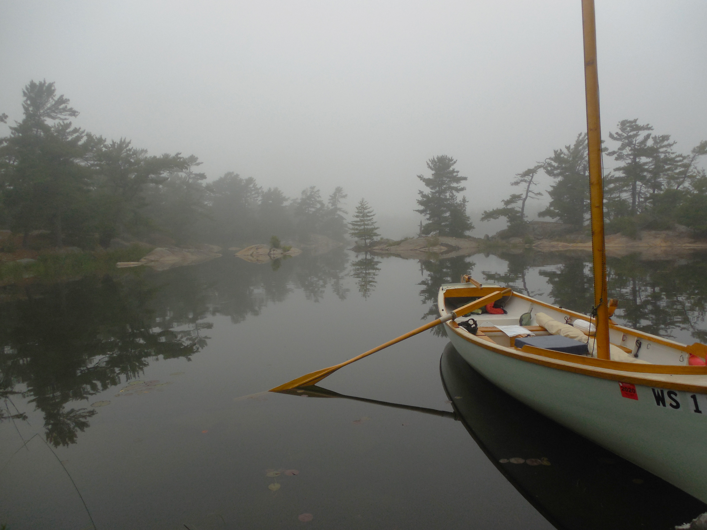
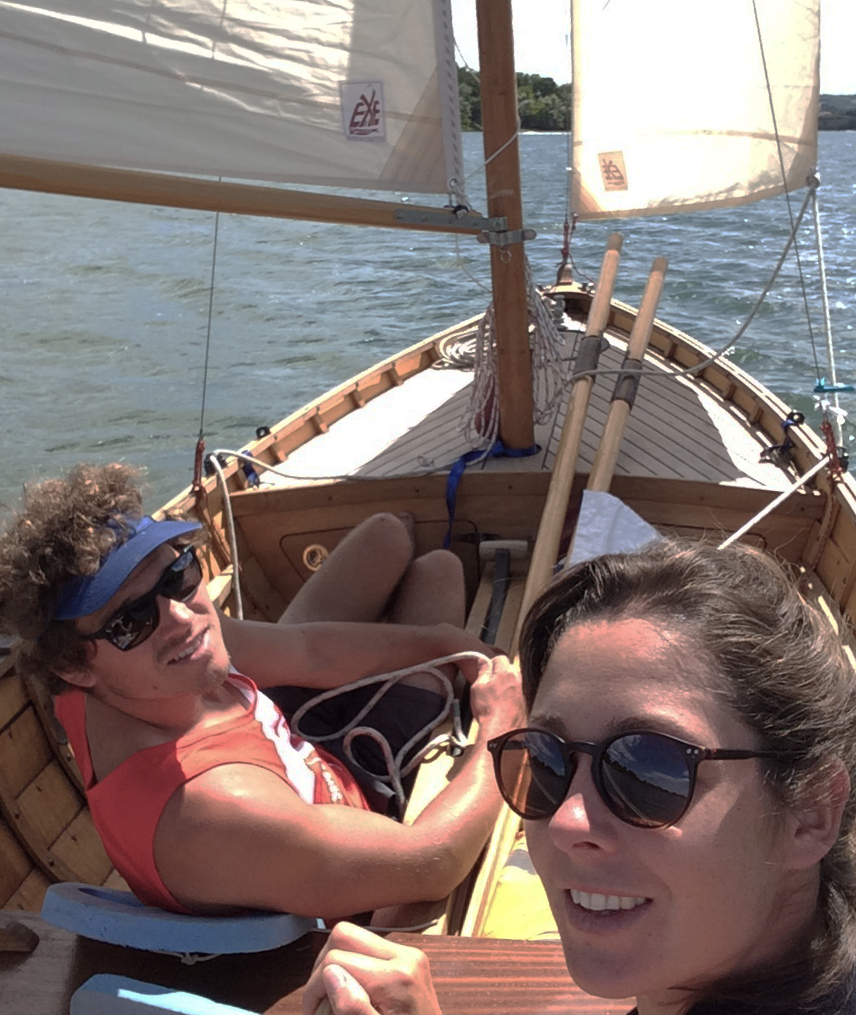
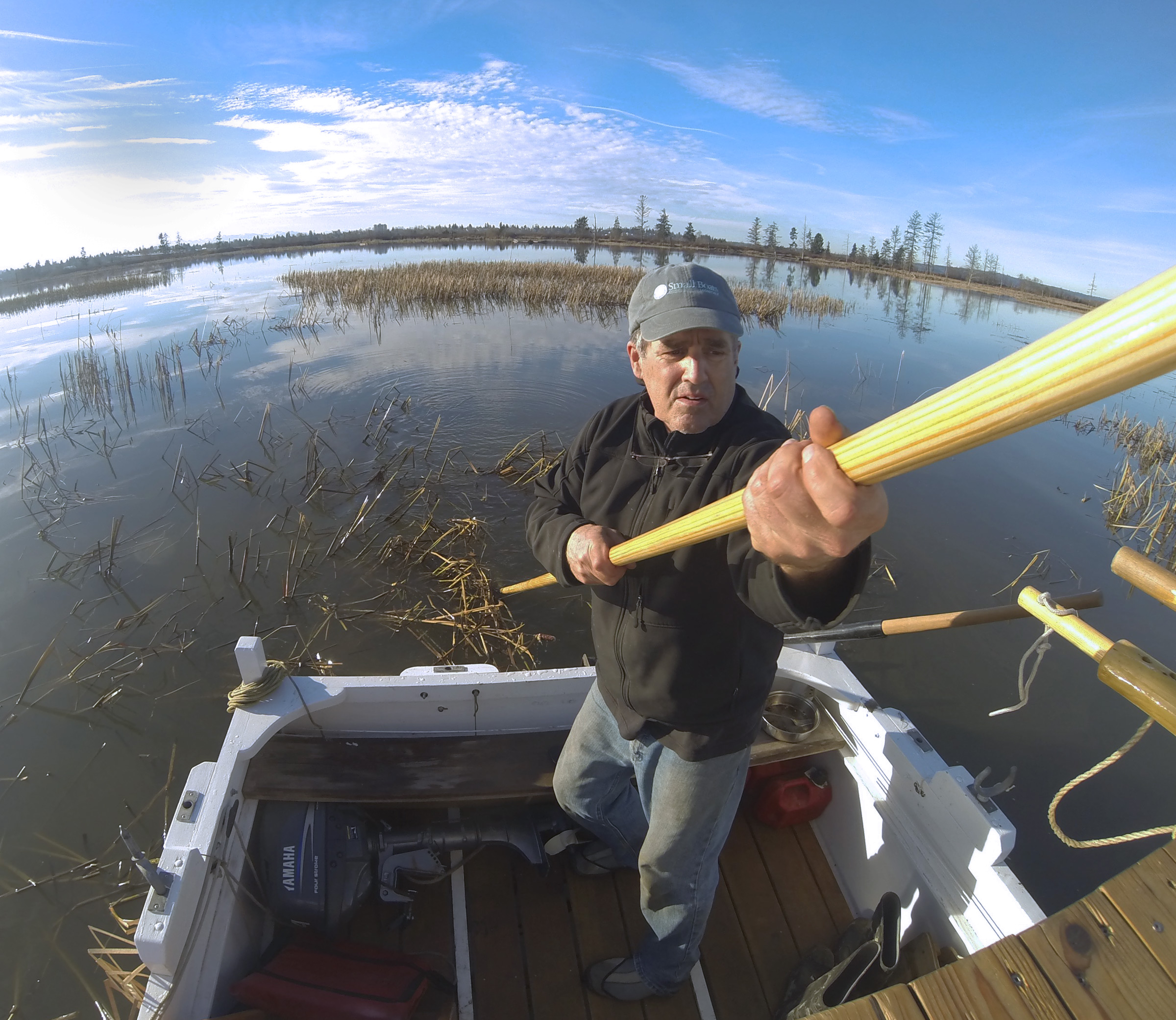
By 8:00 Saturday morning, Delaney and I were at the oars, bashing WHISTLER into steep swells. I was at the forward station, with Delaney at the aft thwart; we struggled against a 15- to 20-knot wind on Blue Hill Bay. The bow rose over a rolling 2′ wave and when the flat bottom slammed hard into the trough, I felt a painful pinch in my lower back as it compressed. A 20-knot gust brought us to a stop and tugged at my oars even though I had the blades feathered. Each stroke moved us forward only a few feet before WHISTLER butted against the next wave.

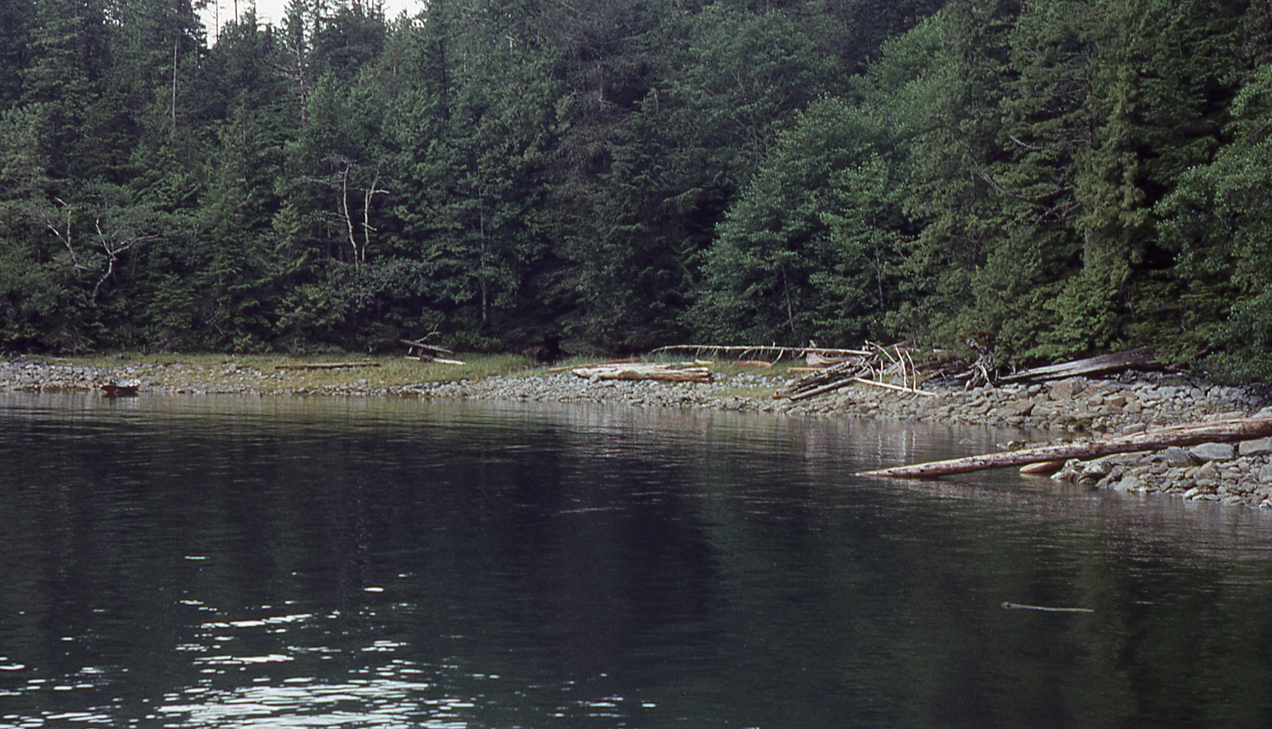
I could feel the burning in my forearms even though we had only made it ¼ mile under the steel-gray skies and whistling wind. “Need a break?” I shouted to Delaney. “Not a bad idea,” was the reply, and I turned us toward a patch of beach 50 yards to port with the promise of a calm resting spot drawing us in. We beached on a bed of baseball-sized rocks covered in dark green seaweed and dragged the boat out of the water so it wouldn’t get beaten by the knee-high swell breaking on the beach.

Photographs by Delaney Brown and Tom Conlogue

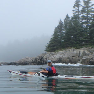
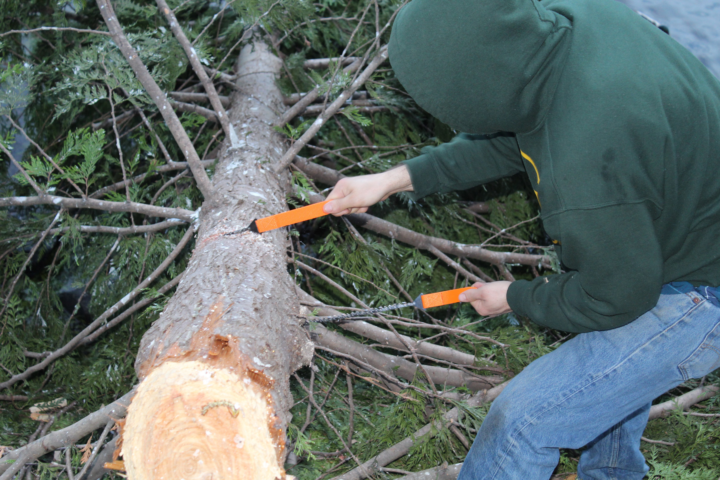
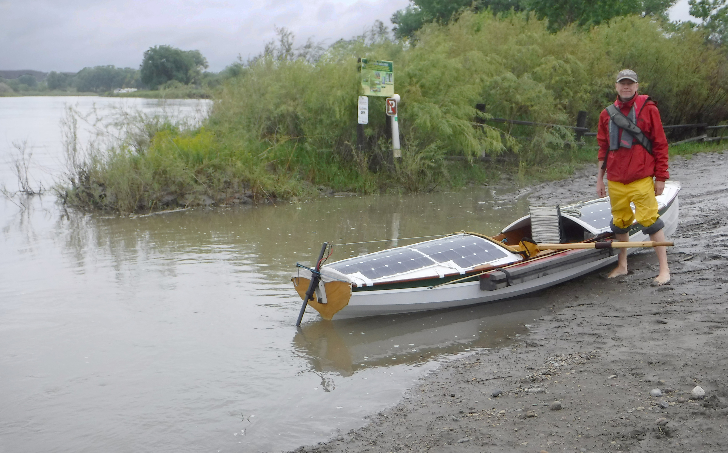
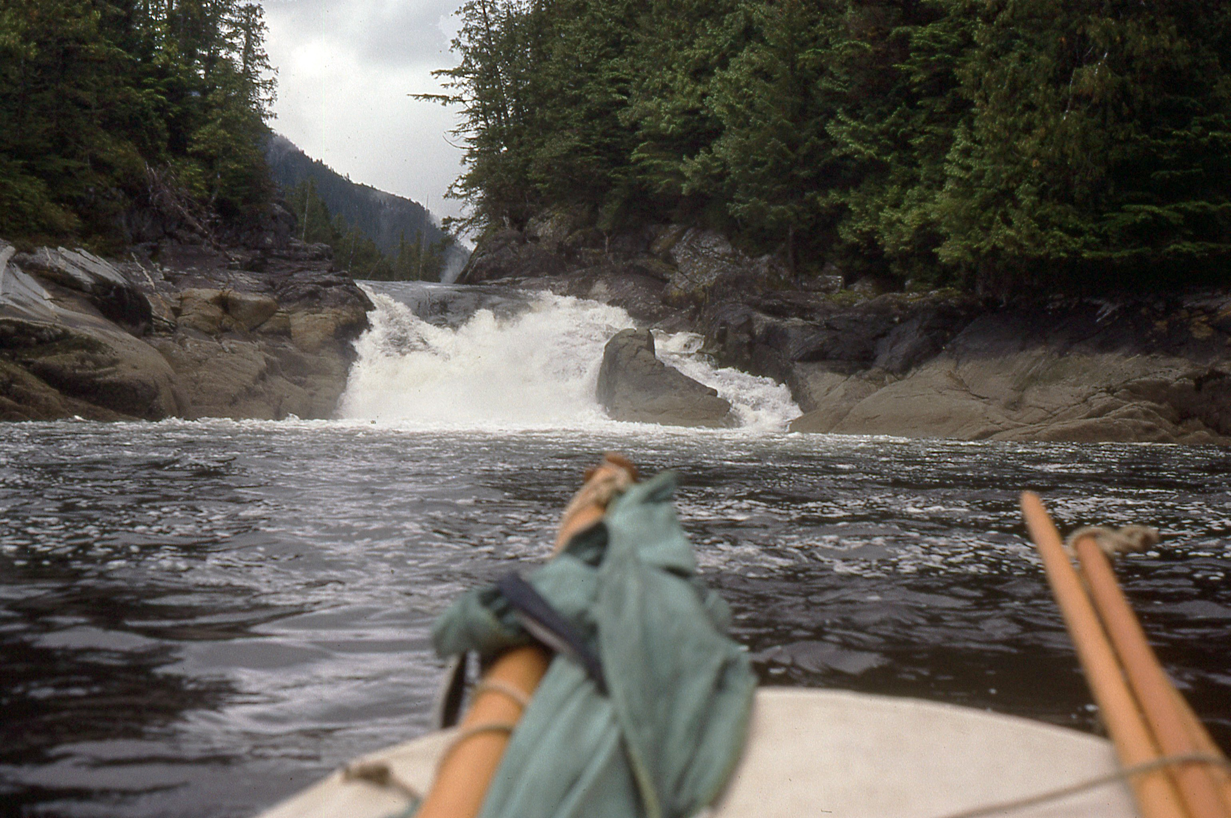
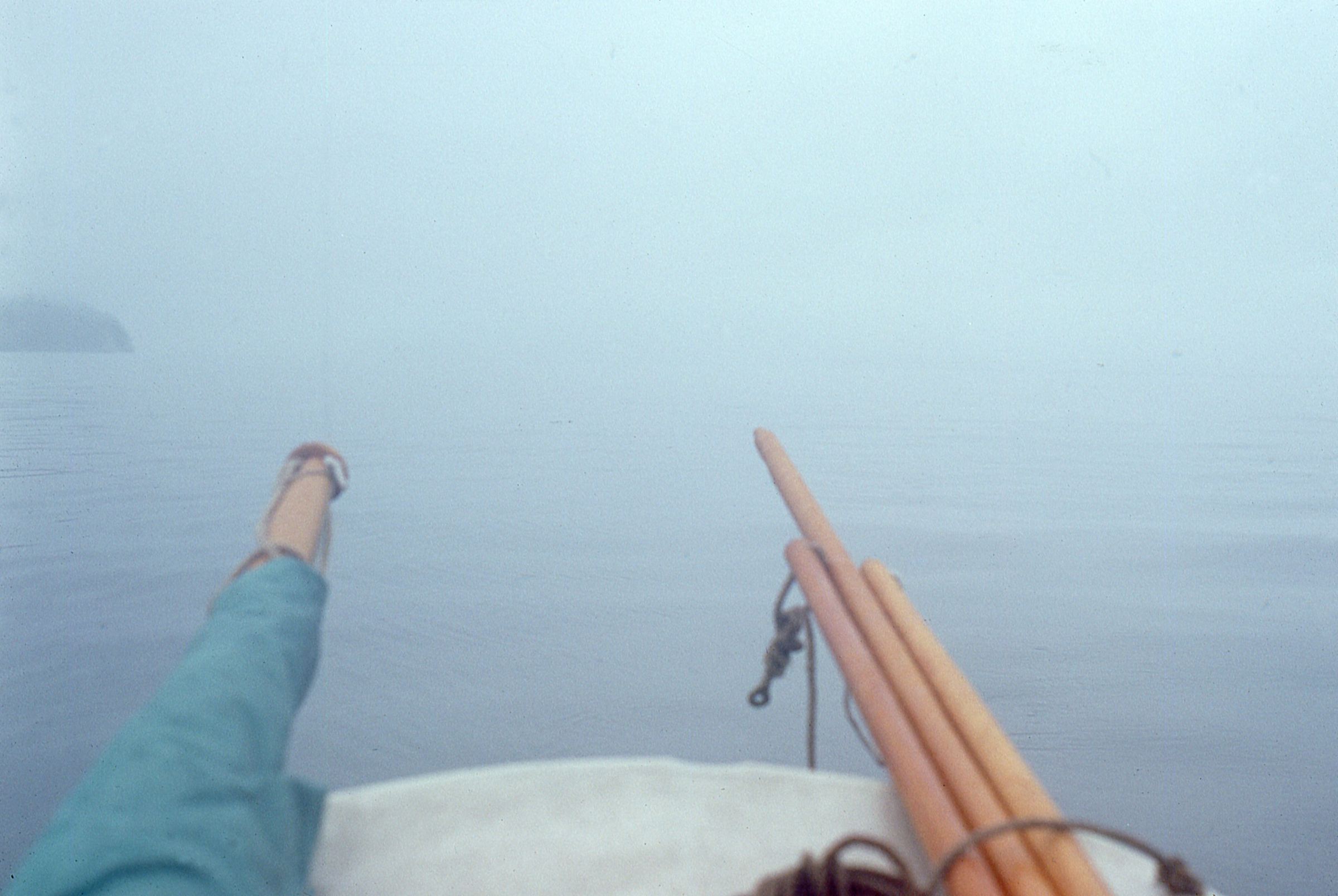
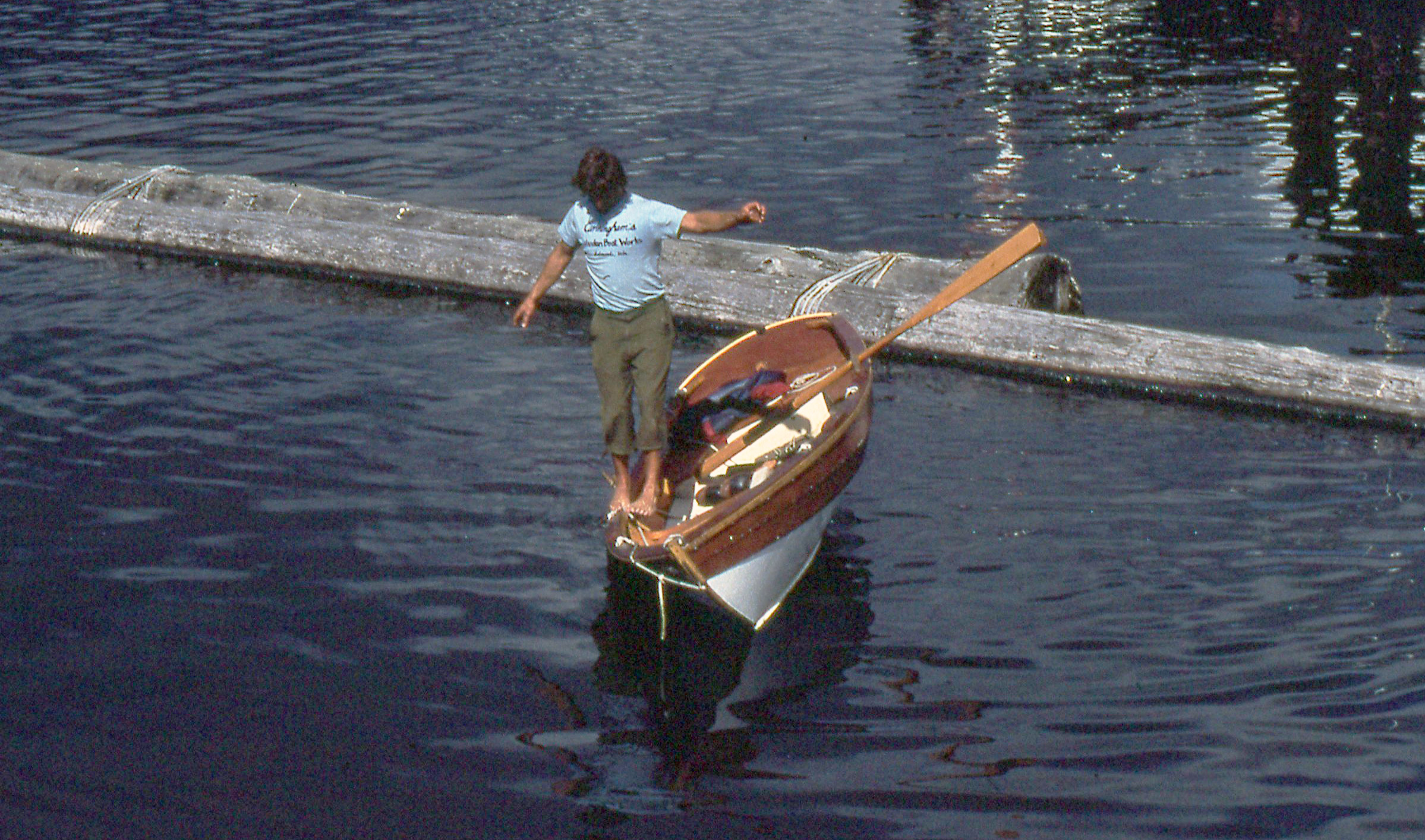
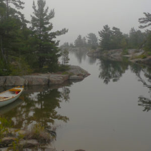
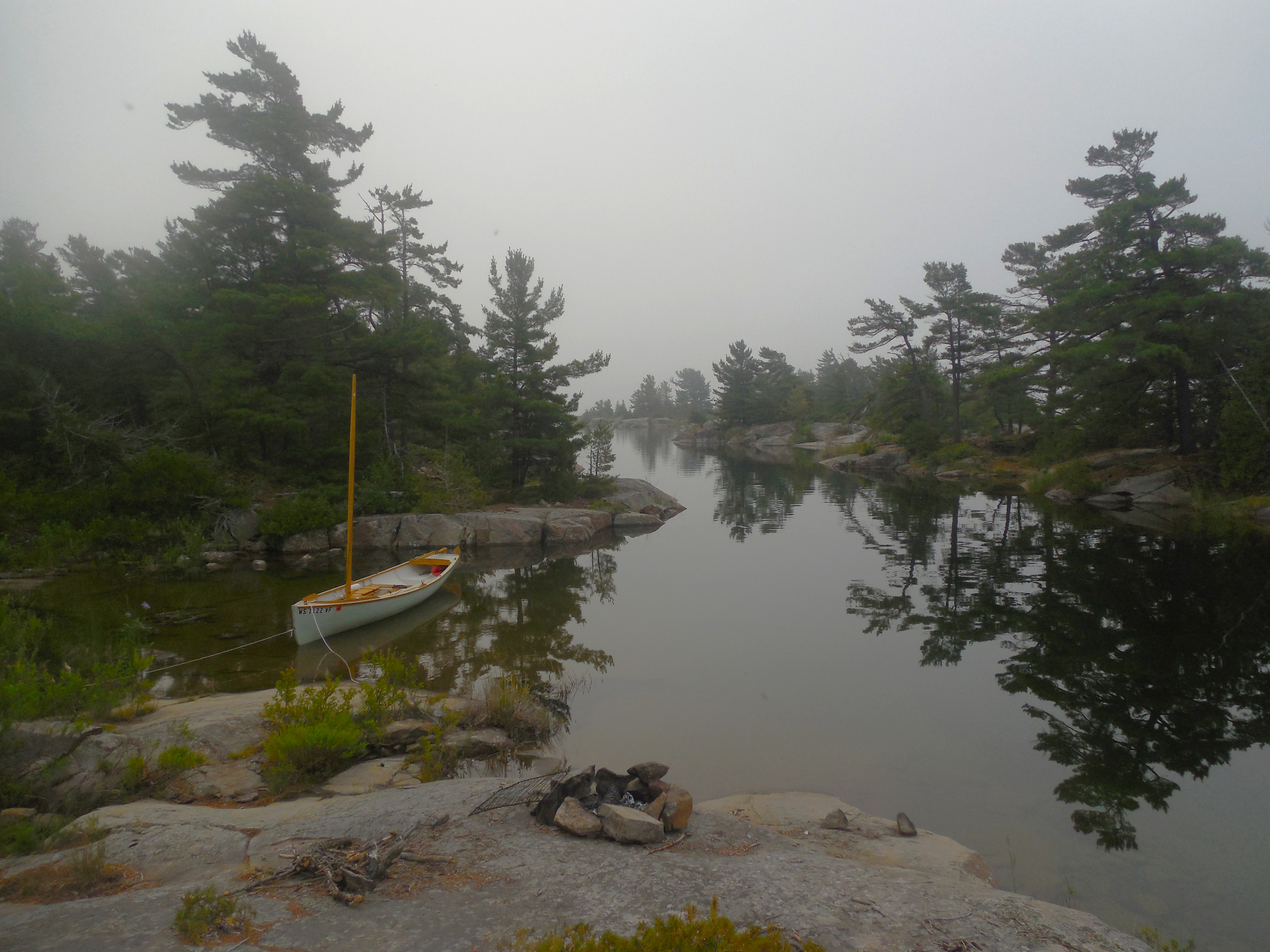
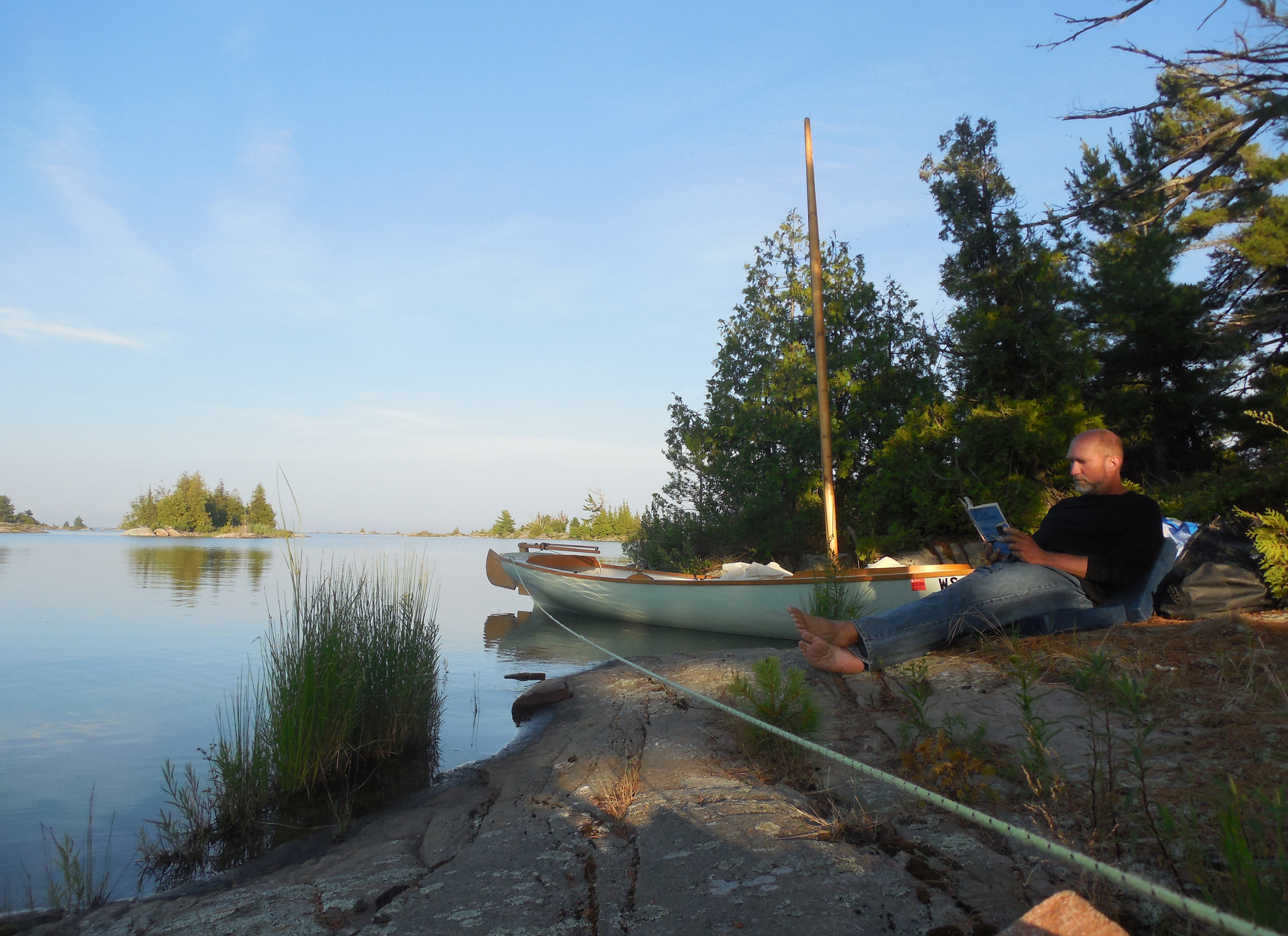
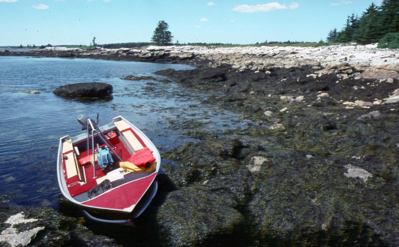
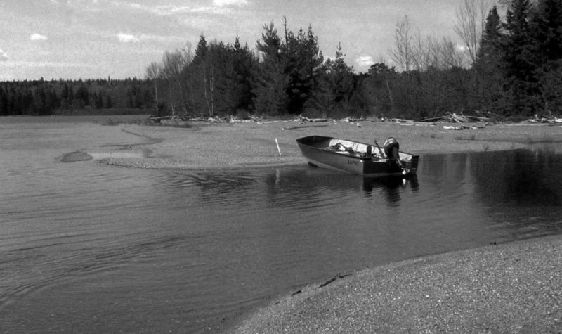
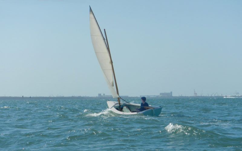
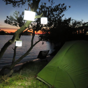
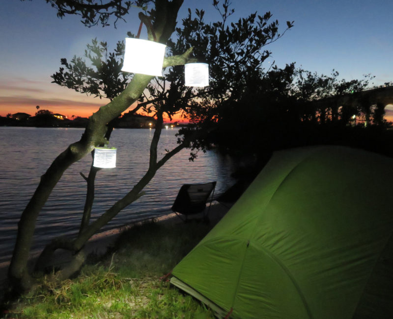
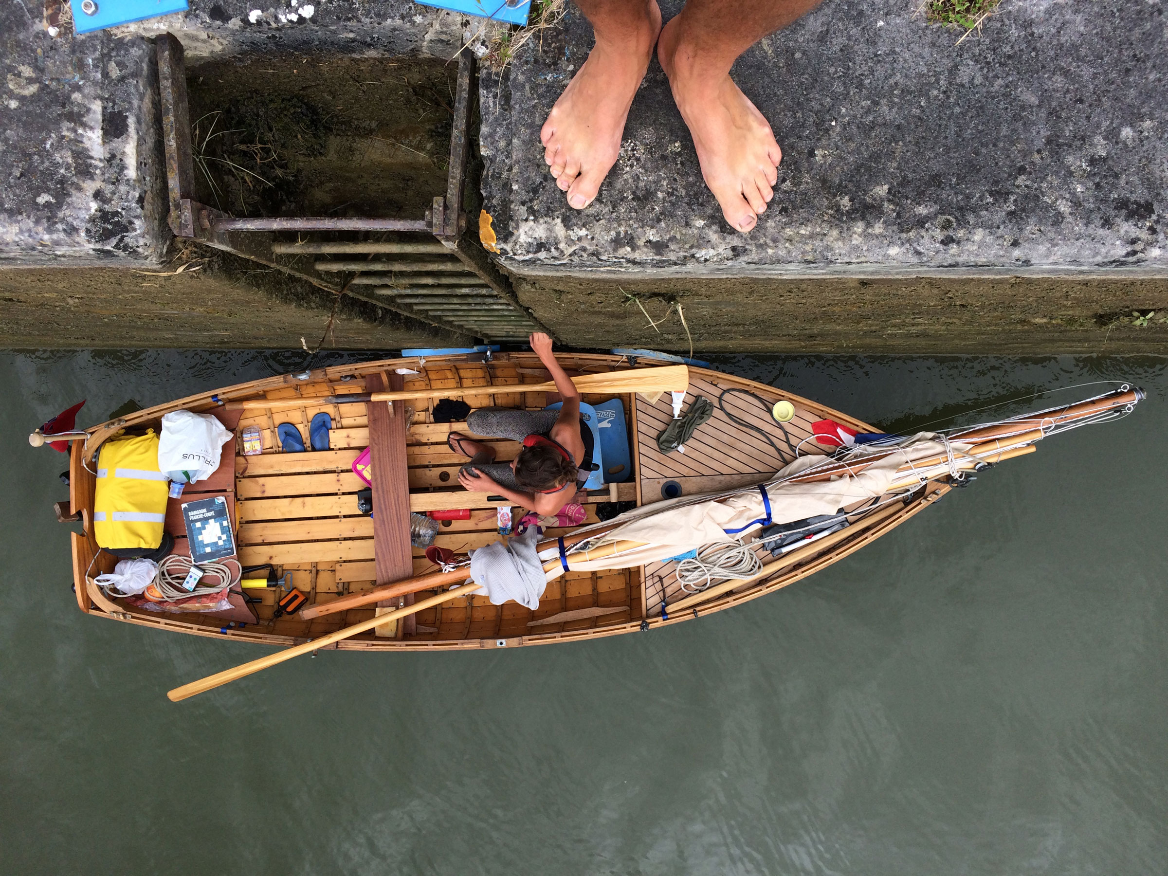
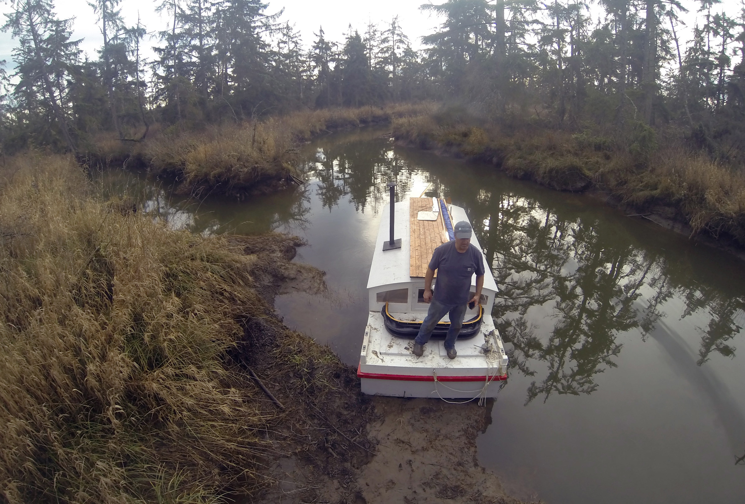
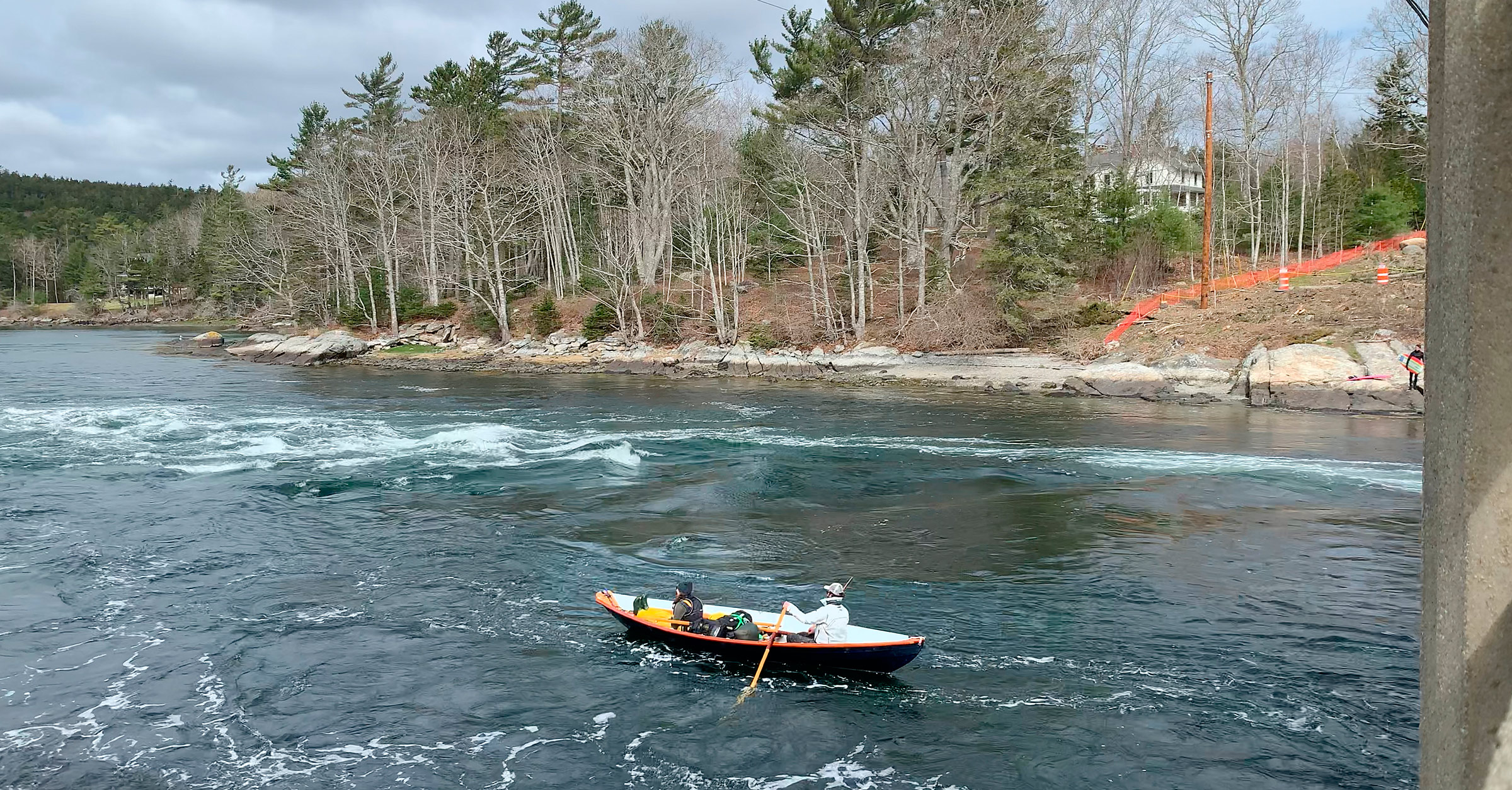
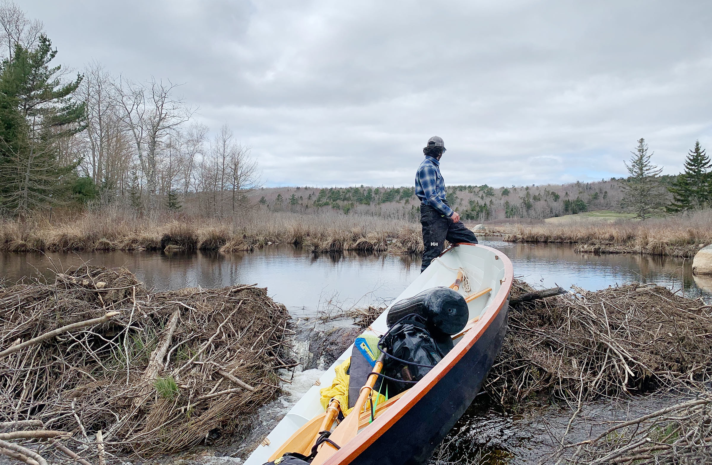
After backing WHISTLER onto the beach, we did a reconnaissance run to the bridge to scope out the falls. The north end of the Blue Hill Falls bridge is visible above the dory’s aft thwart.

We sat on a smooth, waist-high boulder, watching the whitecaps roll by for five minutes, and caught our breath before pushing back out into the grim, green-gray water, white streaks trailing from the wave crests. I took short tugs on the oars to get us moving as Delaney shoved off and boarded over the stern. My oar blades dragged through mats of tangled seaweed until we were two boat lengths from shore. Delaney settled on the aft thwart, slipped her oars out through the locks, and we fell back into our rhythm, working our way to windward at barely over 1 knot. We stayed 30′ from shore, away from the waves as they steepened and crested in the shallows but somewhat protected by the land. Spray flung by the diving bow pelted my back. The water was loud on the hood of my jacket, ran down my back, and pooled around my feet to slosh back and forth between frames.

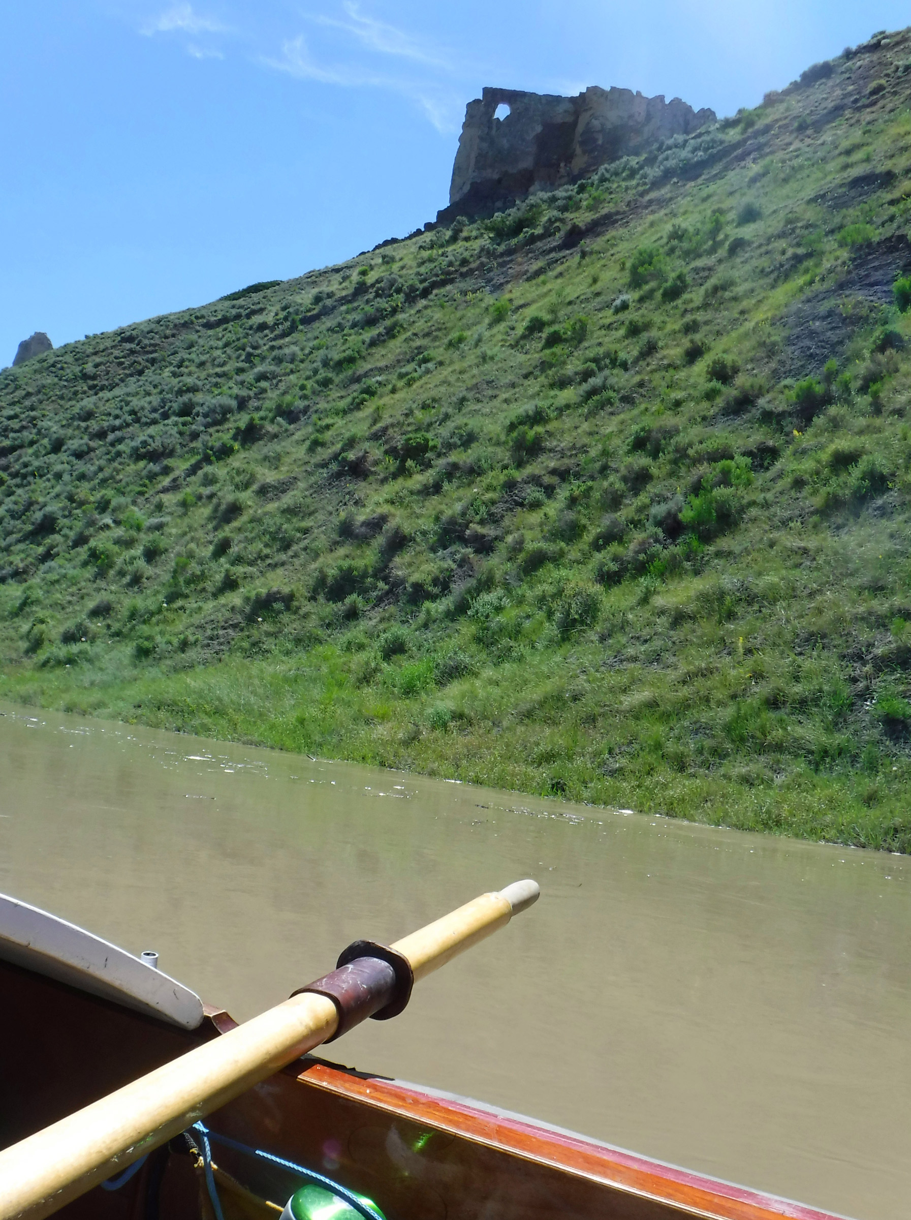
Delaney’s port oar dug in suddenly, as a wave crest caught the blade and sent it diving for the bottom. The grip was almost wrenched out of her hand as it tried to push her off the thwart. The oar dragged the bow around to port and we were no longer pointing into the wind. As the dory veered toward shore, I quickly pulled hard on my port side to correct our course while Delaney freed her oar from the water. A few strokes later it happened again, on the starboard oar this time. “I’m going to count how many strokes I can get in a row without catching a crab!” she yelled and began counting aloud as we continued to row. With Delaney chanting her stroke count aloud, we laughed every time she had to restart and cheered when she reached a new high score of uninterrupted strokes. After we had rowed for a half hour, I looked over my right shoulder and saw the sandy-gray arches of the Blue Hill Falls bridge, and we made for a beach just south of the bridge.

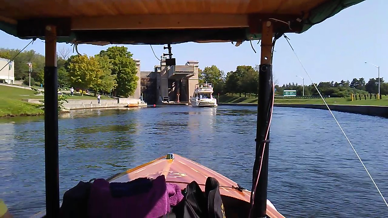
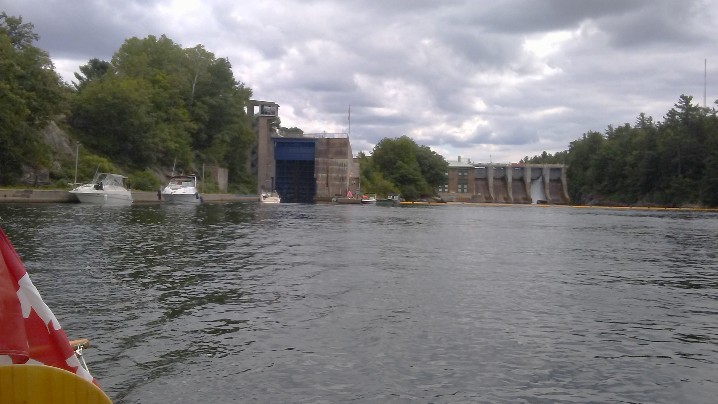
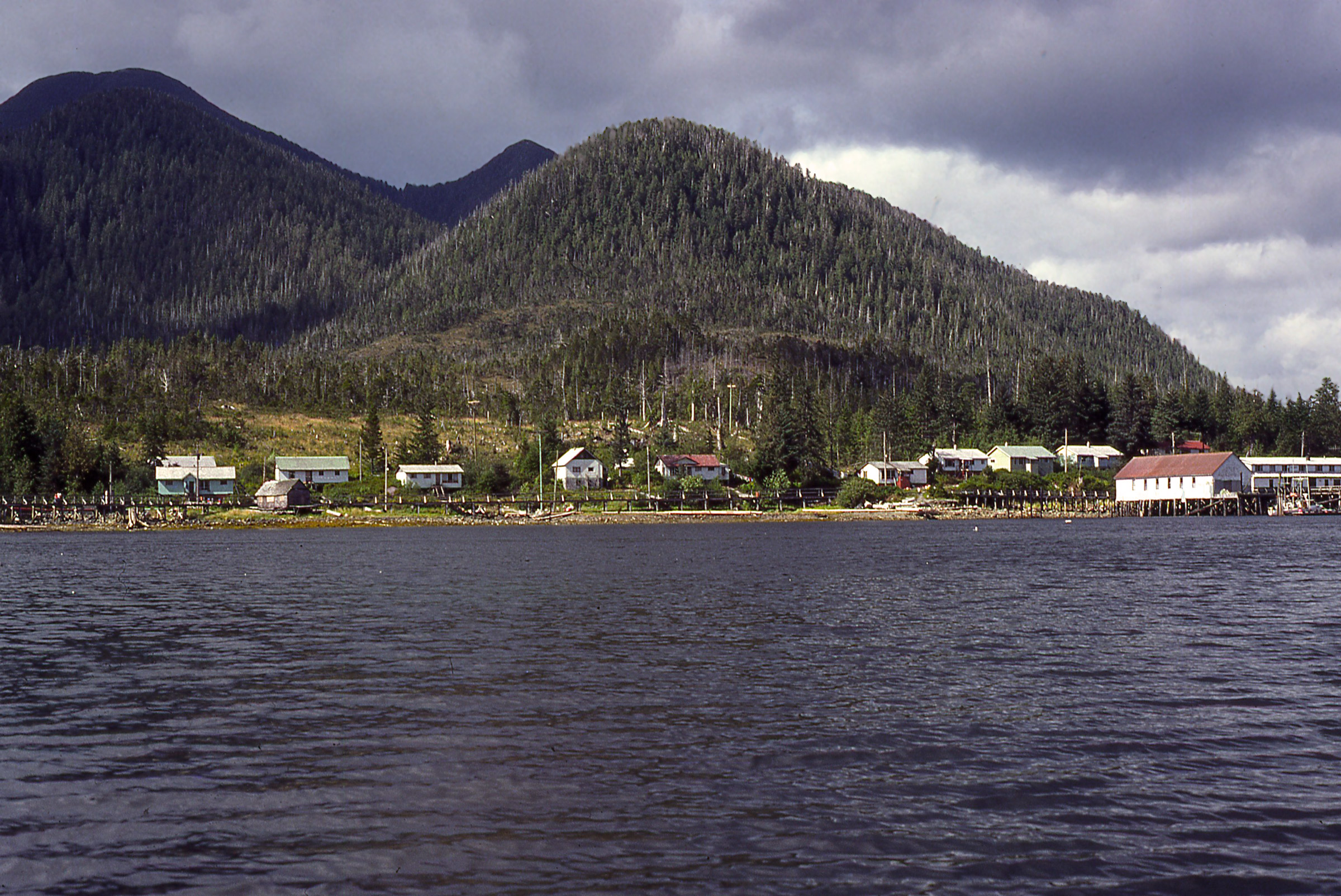
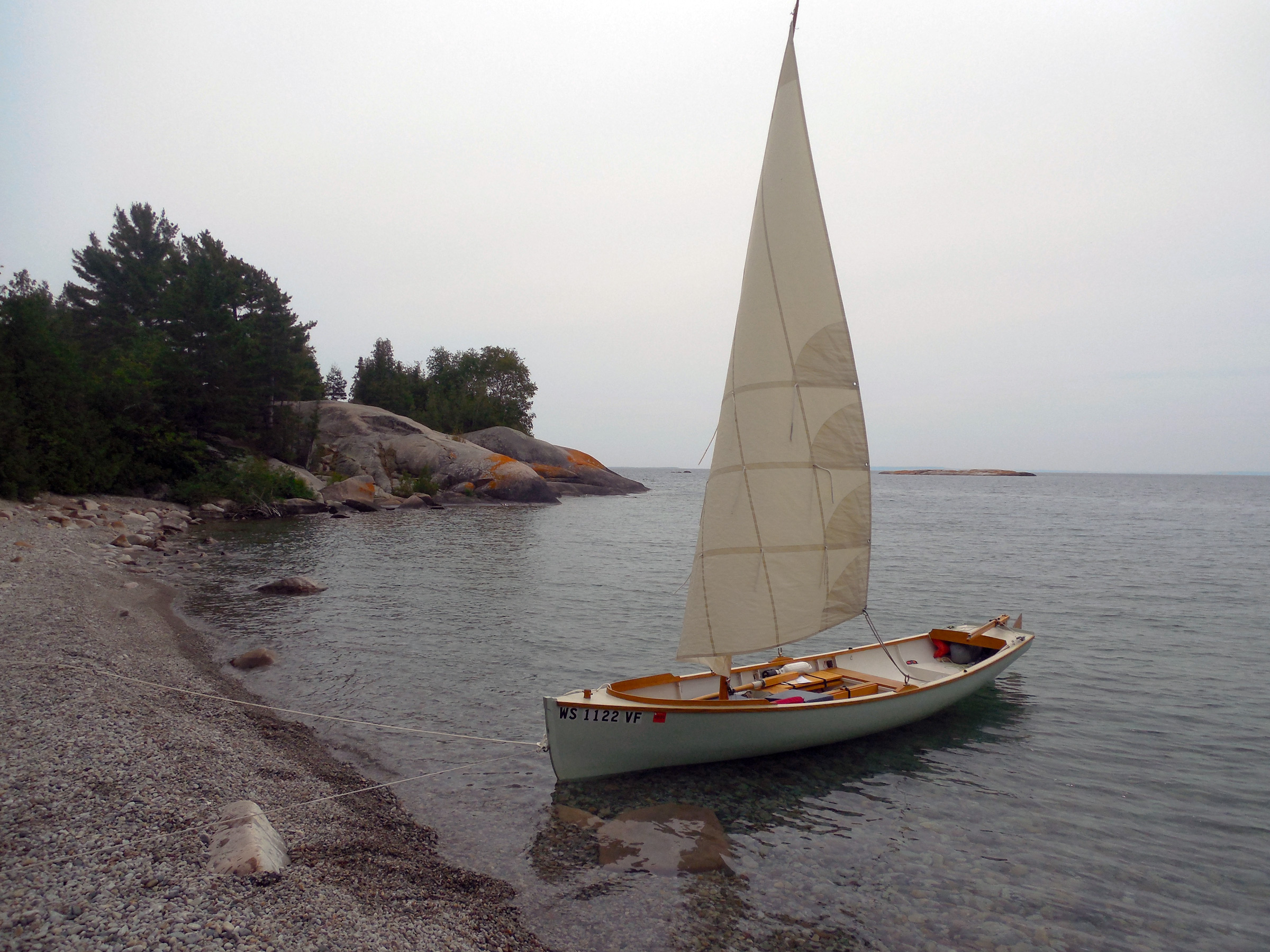
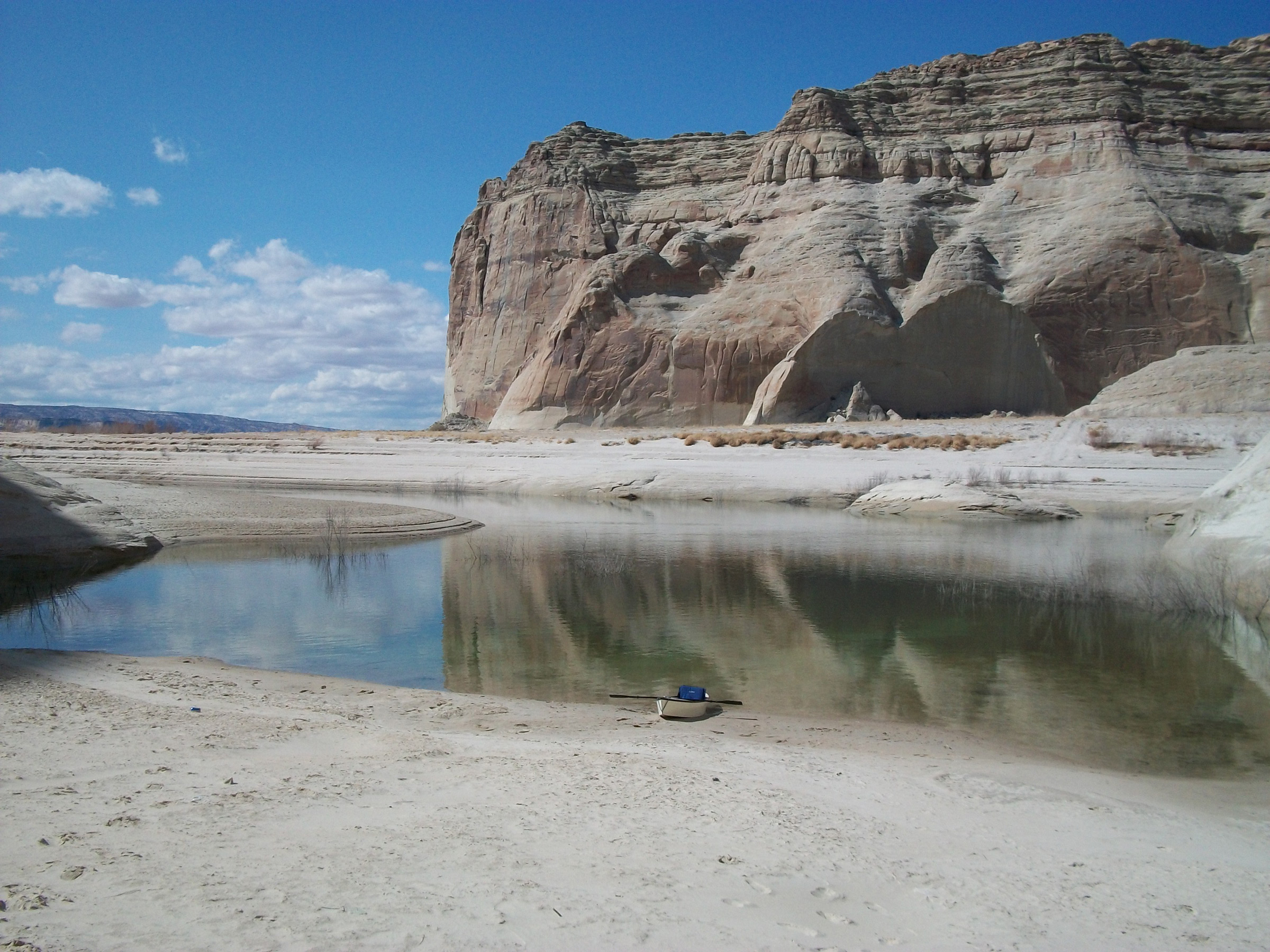
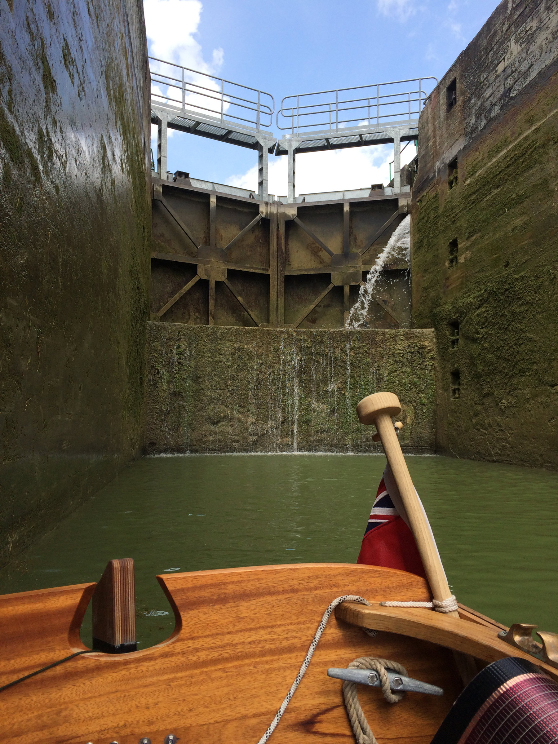
Blue Hill Falls is a short stretch of reversing tidal rapids at the entrance to Salt Pond. Four times a day water pours through the 100′-wide gap beneath the bridge, creating standing waves as the tide floods into and ebbs out of the 3-1/2-mile-long pond. While the safest way through is to wait for slack water, we had decided to go through at the peak of the flood when the current would be strongest and the rising tide would significantly shorten the portage at Salt Pond’s far end.

After beaching the dory and taking a quick water break, we walked over to the bridge to see what we had gotten ourselves into. After clambering up the scree slope at the side of the road and walking to the middle of the bridge, we looked down over its Salt Pond side at the flood tide’s standing waves. My worries about getting capsized instantly evaporated. While the rapid was moving fast, it wasn’t nearly as turbulent as I had remembered. On the north side, the water ran smooth and black under the bridge before plunging into a train of 3′ standing waves, but on the south side there was a straight shot through with only the occasional riffle disturbing the surface.

“This isn’t going to be nearly as exciting as we thought, is it?” Delaney said. “What do you think, should we go straight down the middle?” I replied, “Yep, let’s hit the medium-sized waves.” That approach would avoid the extremes, either too rough or too smooth. We climbed back down the rocks at the end of the bridge and walked gingerly among the softball-sized rocks along the shingle beach to the boat. We pushed off under a sky overcast with low steel-wool-gray clouds and maneuvered stern-first into the current upstream from the bridge.

Delaney took her seat and braced her feet on the sternsheets, and we let the dory get carried under the bridge. As WHISTLER picked up speed, the water turned from gray to dark green as it piled up on the bridge’s concrete footings on either side of us and funneled us through. Pulling occasionally on the oars to keep the stern pointed in the right direction, I steered us in between the fast, clean water off the starboard beam and the tumbling standing waves off the port beam. Below the bridge, we gently rolled over a smooth crest, then rose up the far side and crashed down. Looking past Delaney’s shoulder I saw just a tongue of water lap over the transom, and then we were past the waves and into the pond.

Choosing to take the middle route down provided a smooth ride, although in hindsight the line on the north side of the rapid would have provided a sportier experience.


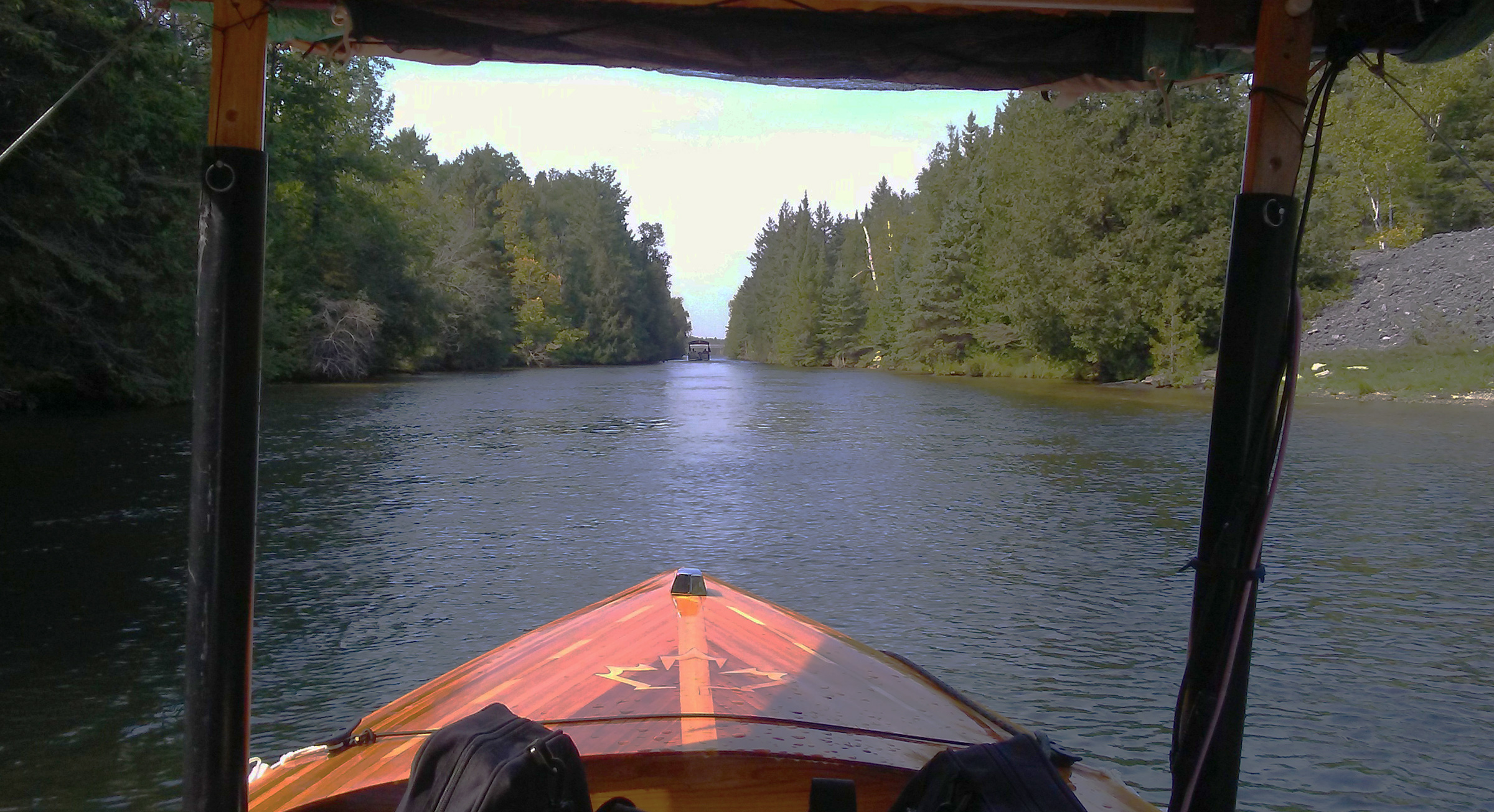
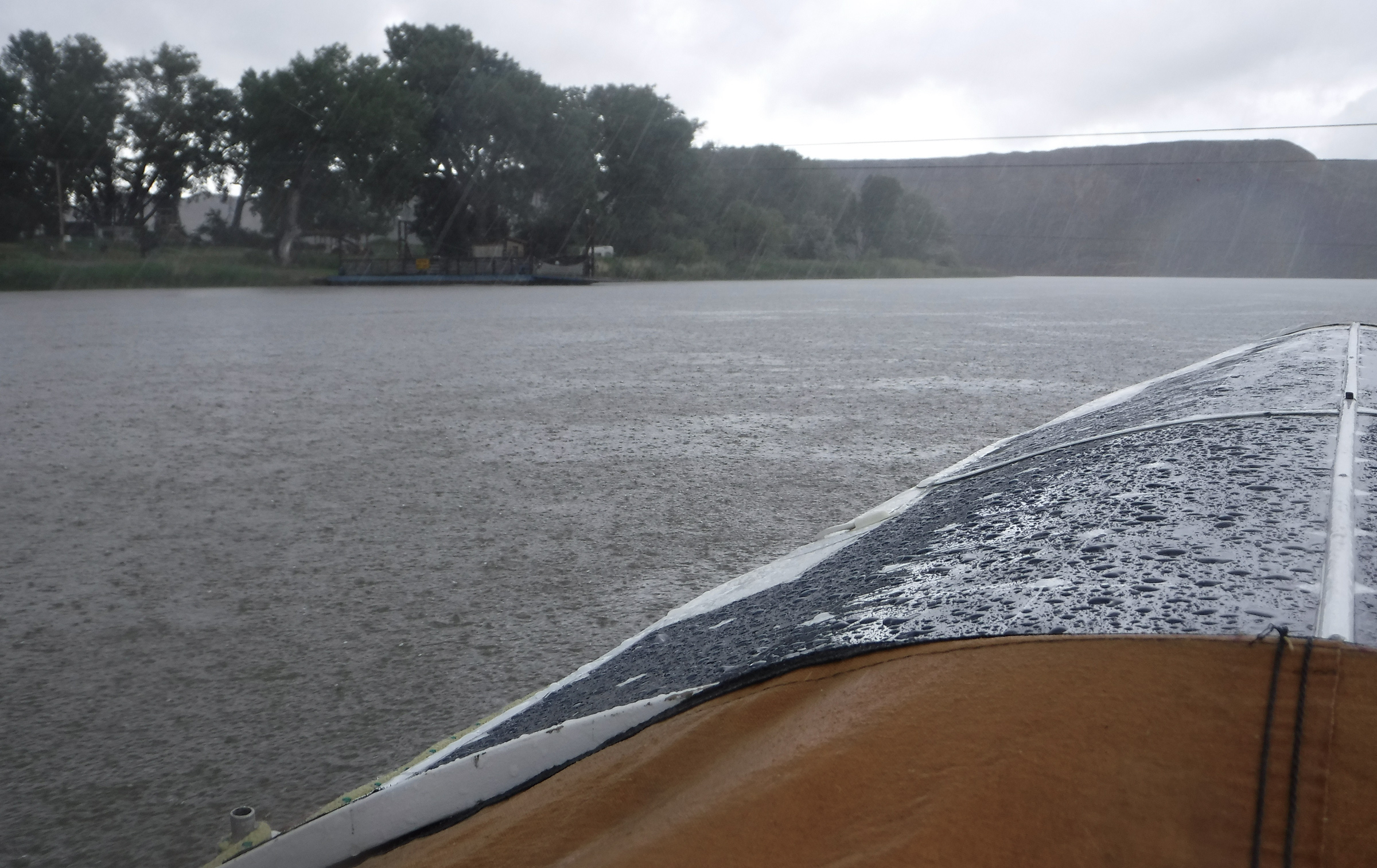
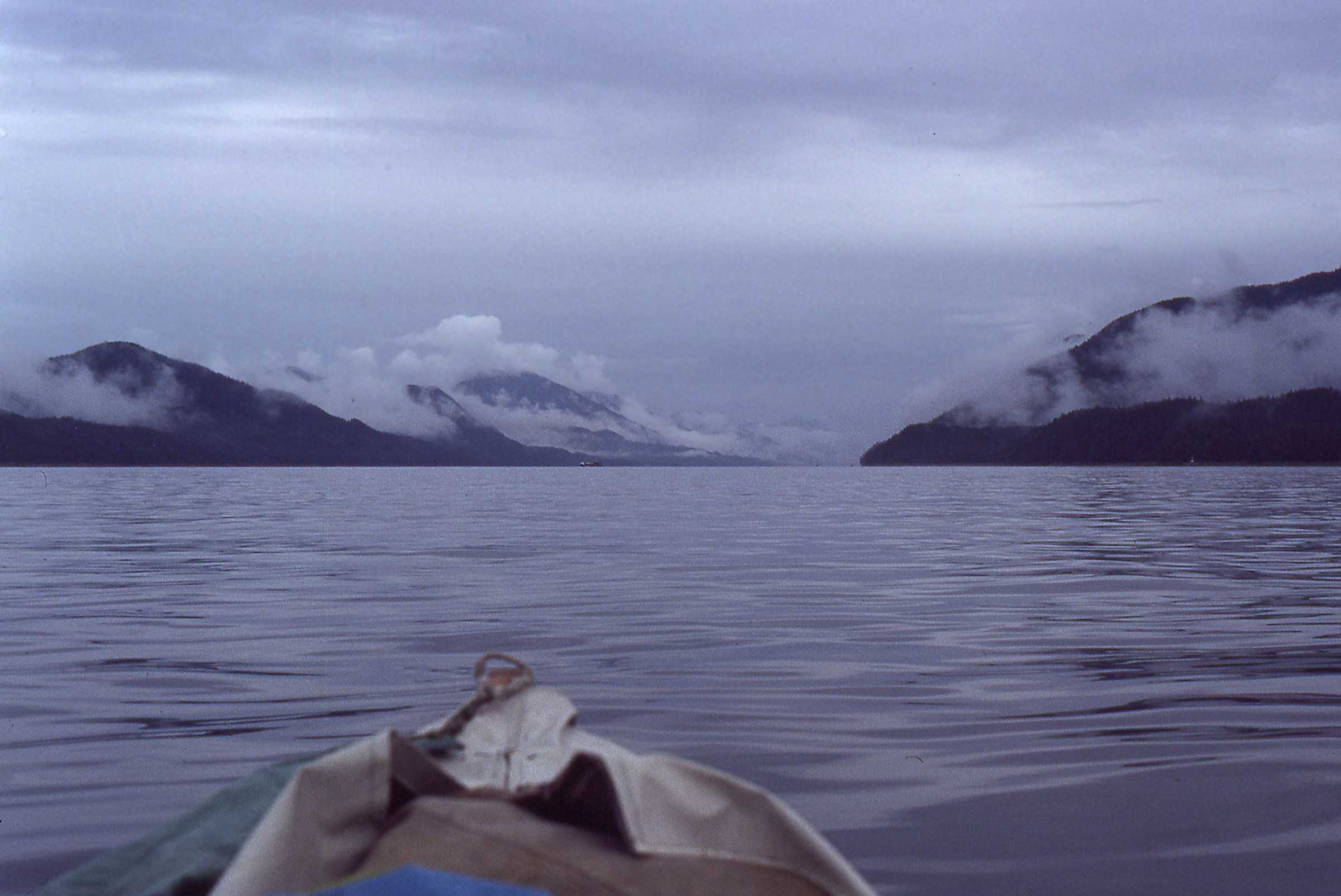
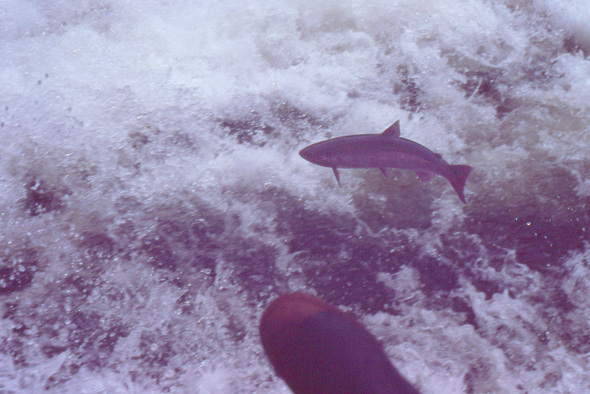
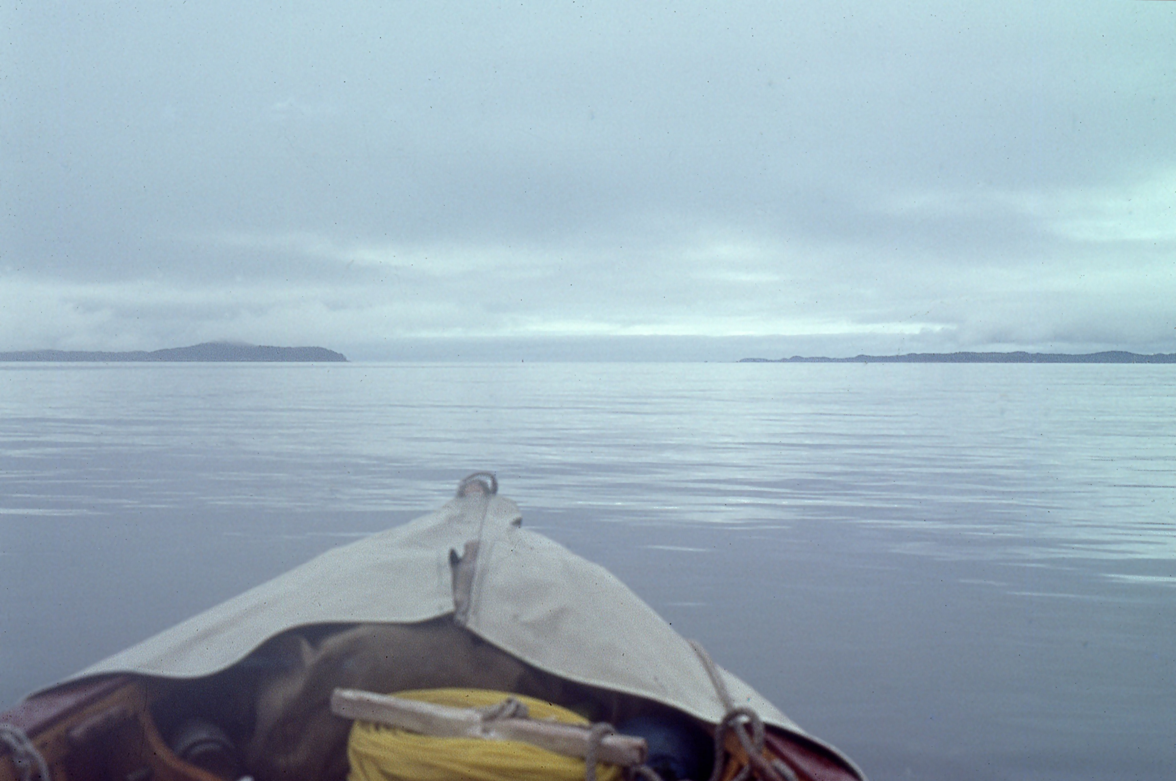
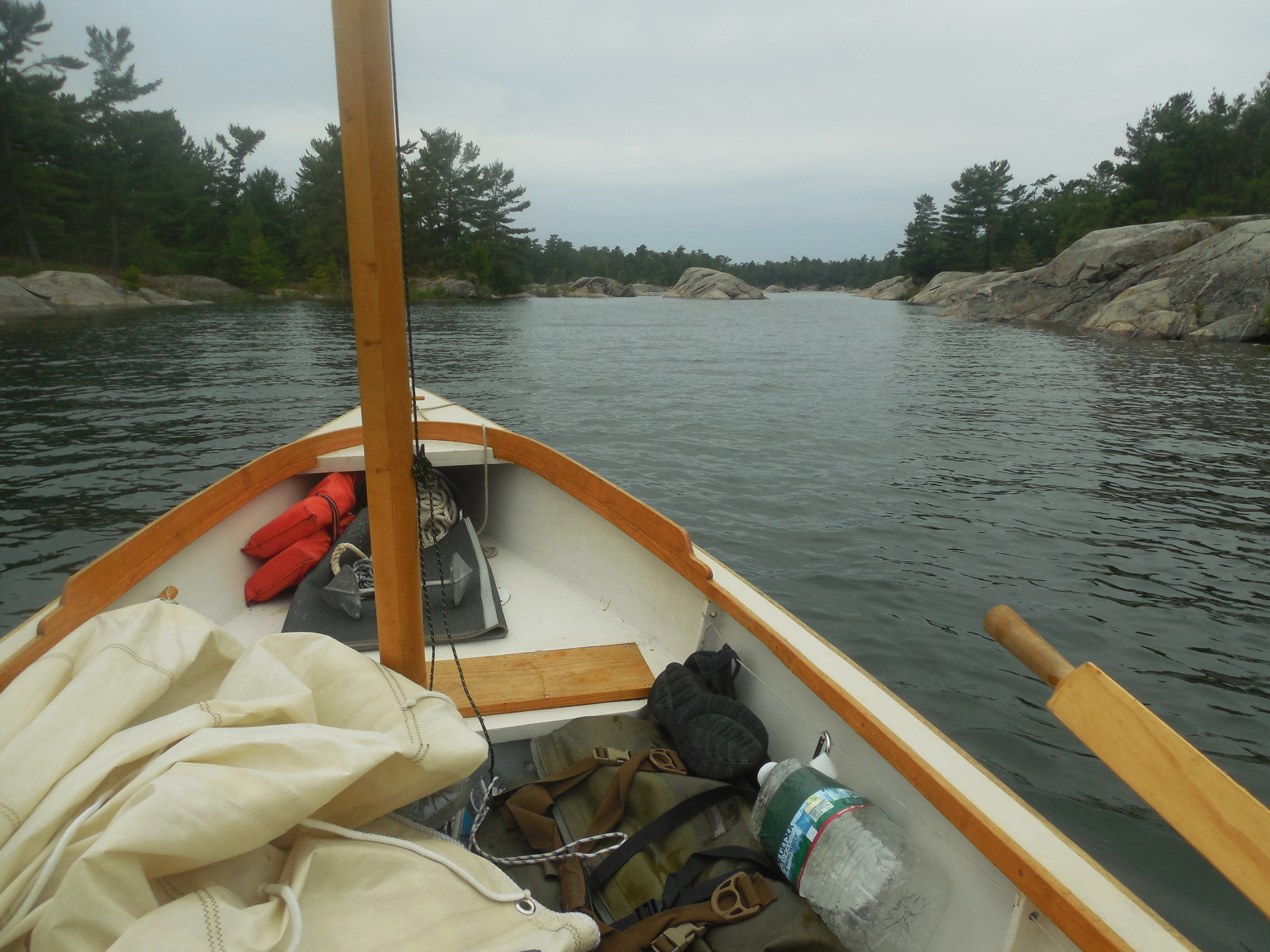
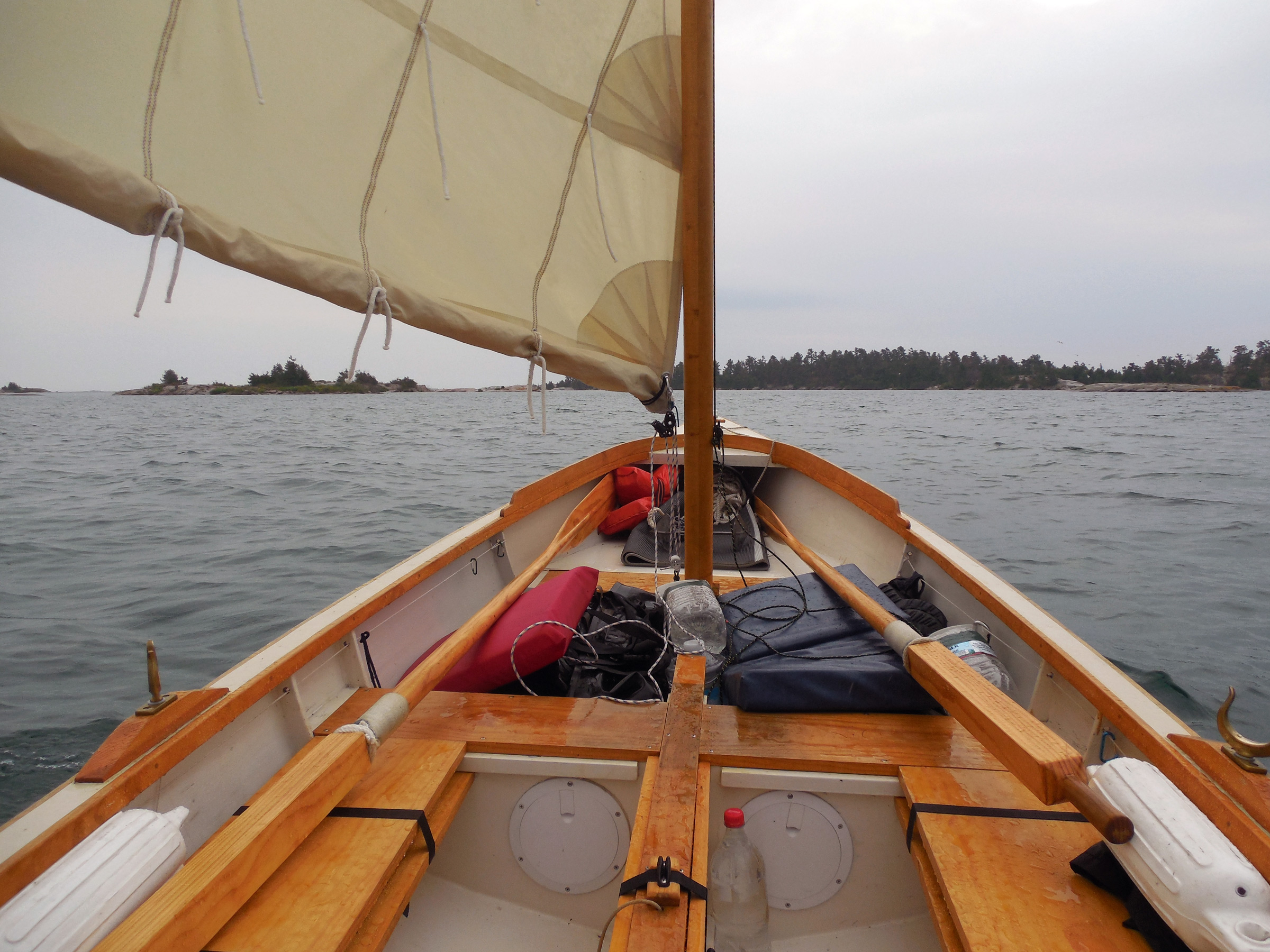
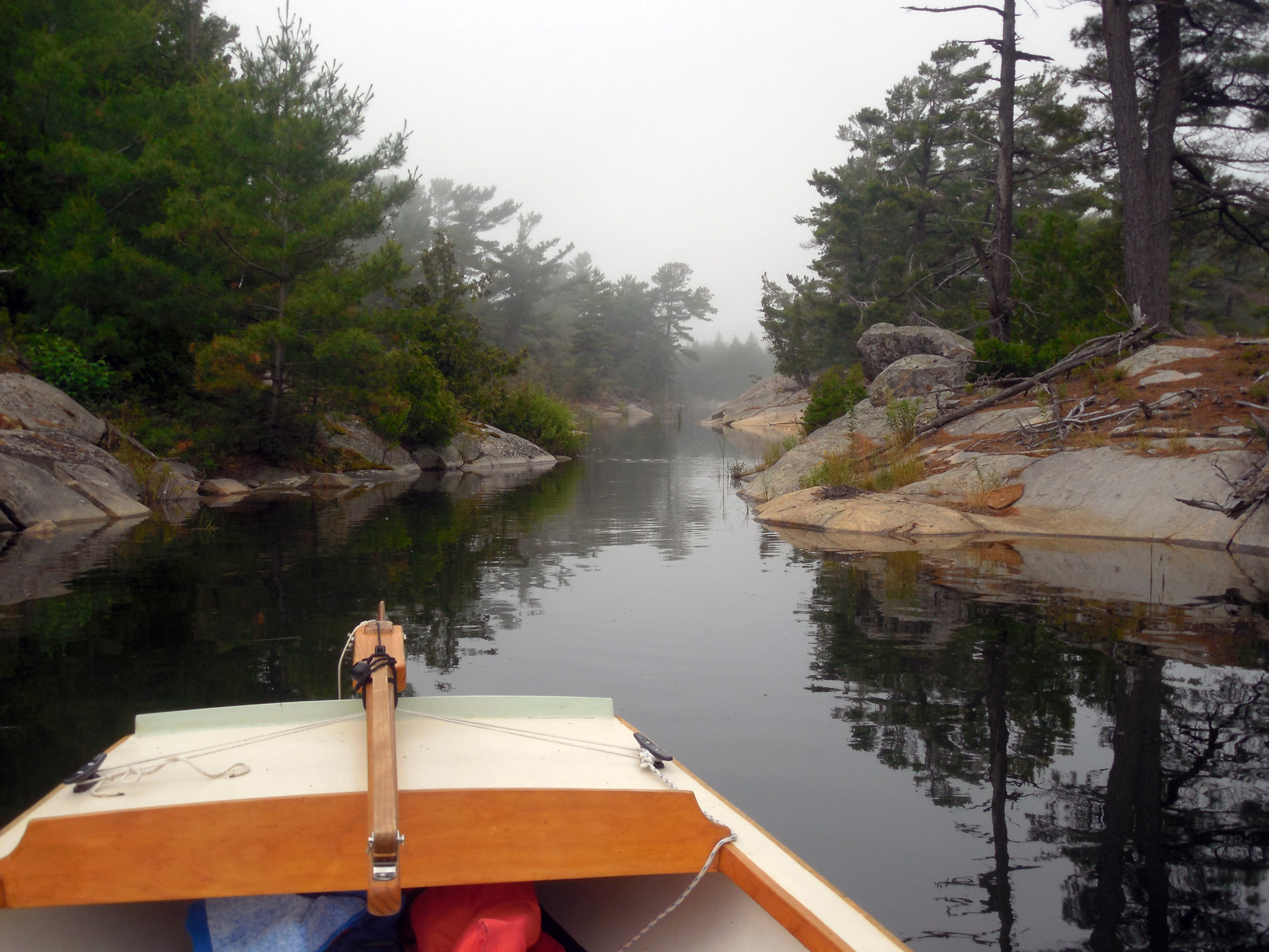
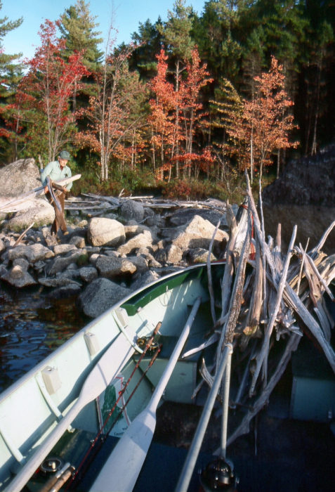
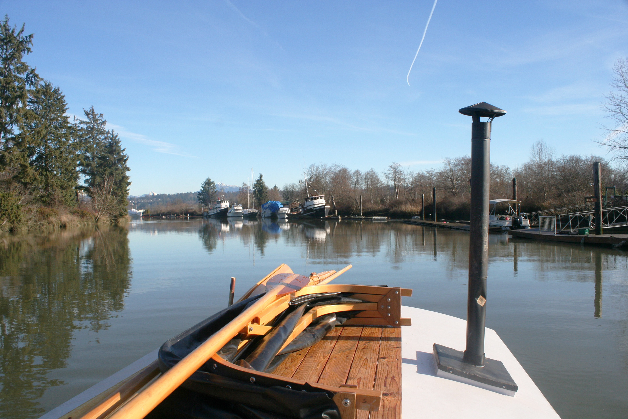
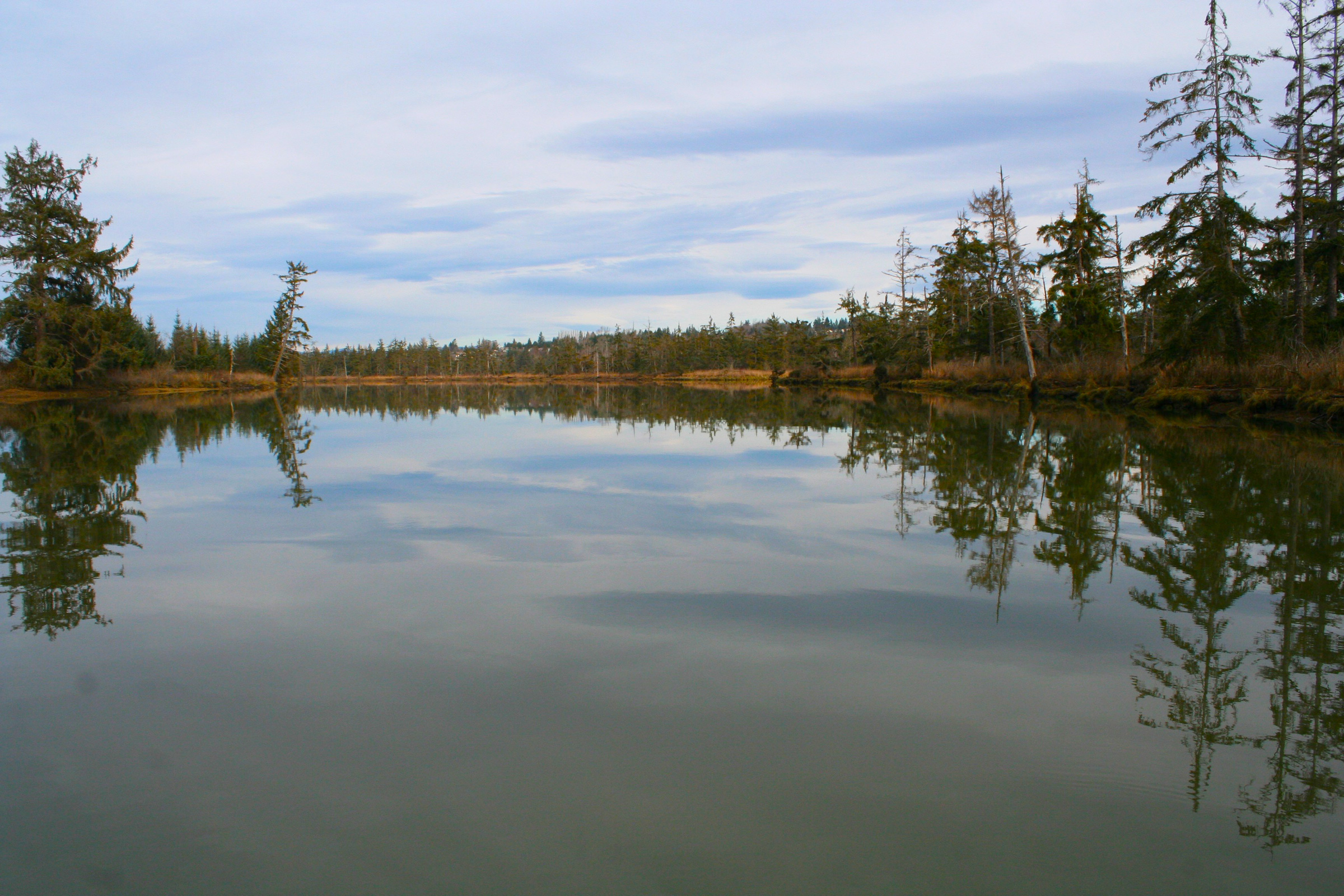
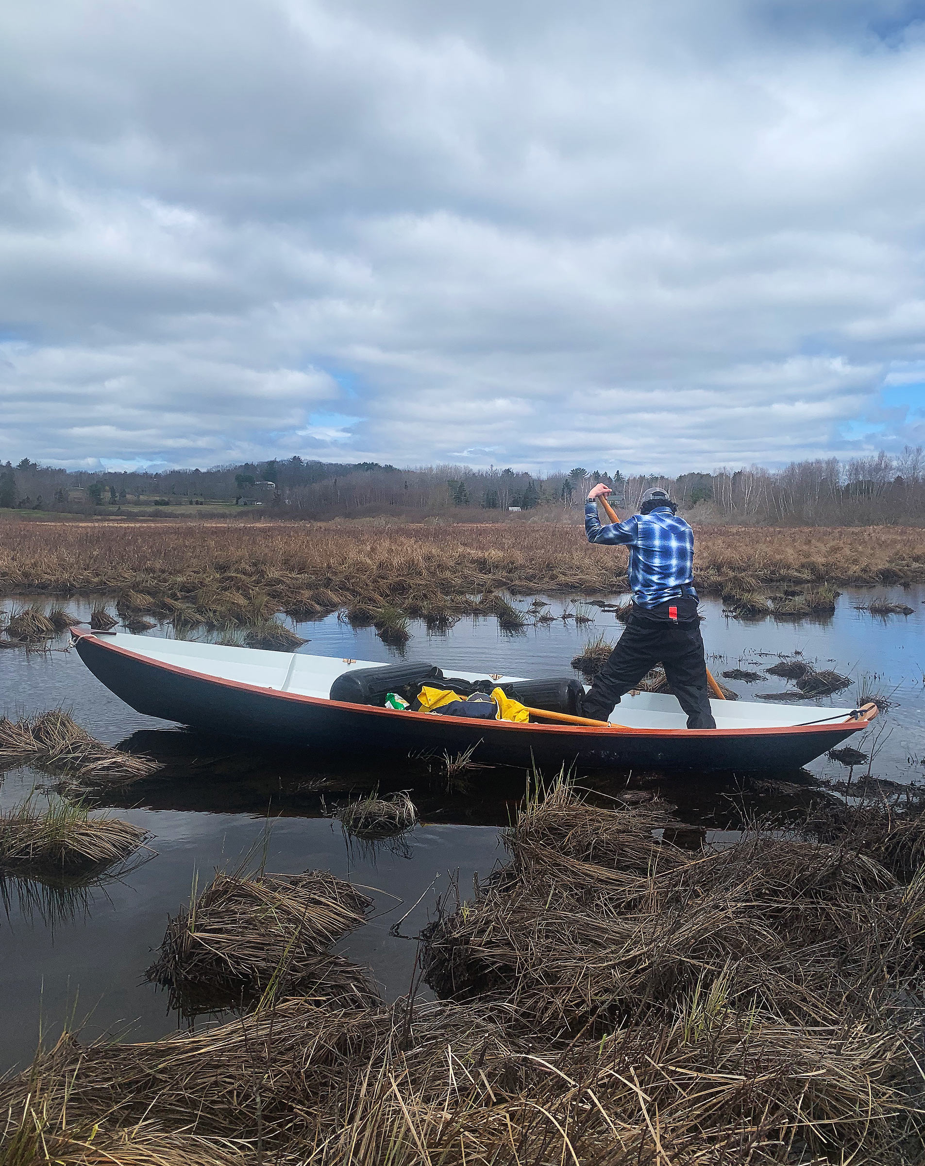
Just past the Blue Hill Falls bridge, visible at the far right, and onto the Salt Pond, Delaney provided directions and encouragement while I enjoyed the easy rowing, good view, and occasional warmth from the sun.

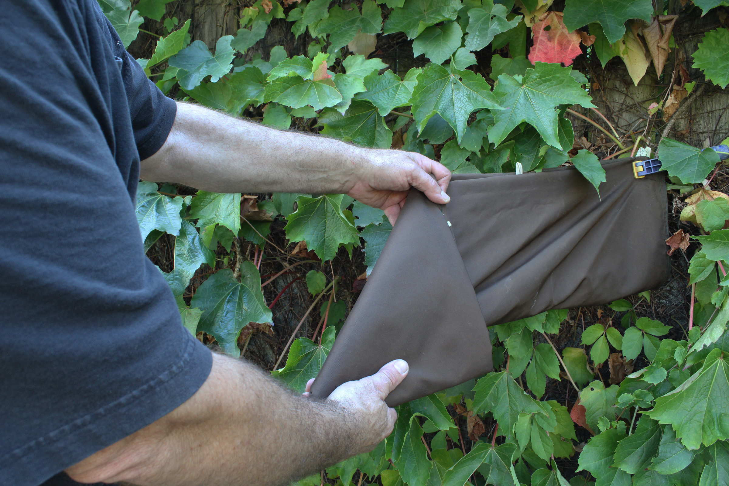
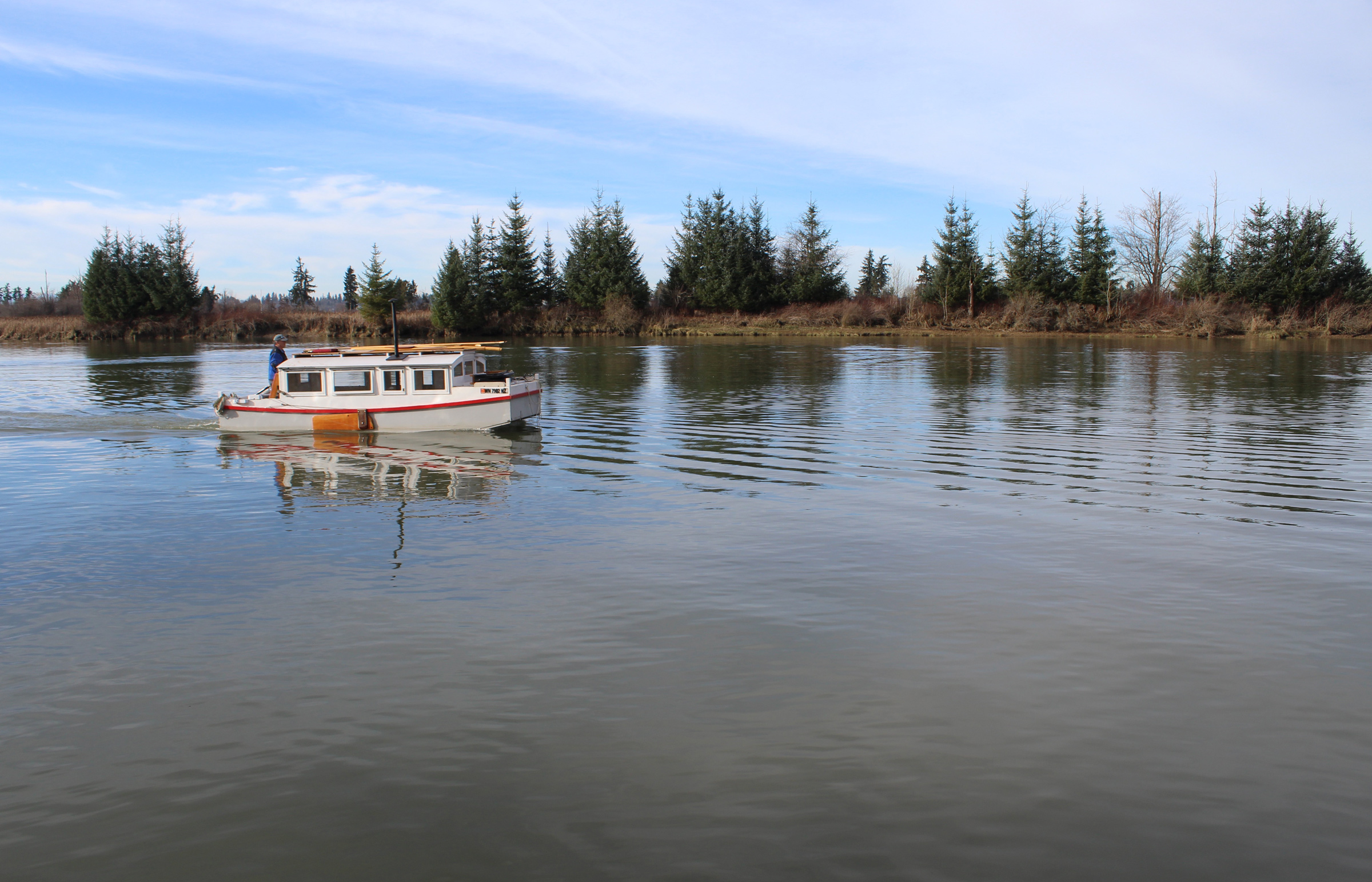
In its narrow entrance, the wind was calmer and with the sun coming out we needed to peel off some layers, so about 500′ beyond the bridge, we cut diagonally across the current and made our way to the beach. After we took off our spray jackets, we pushed back out and rowed across the upstream current of a back eddy where leafy seaweed on the bottom waved gently toward the bridge. When we reached the main current, it again carried us southwest. Delaney moved to the sternsheets to take a break and watch the scenery slide by as I rowed us down Salt Pond with the wind and current nudging us along at an effortless 4 knots.
A half mile farther along, we skirted a rounded granite boulder that splits a channel where the pond narrows from 1/5 mile to just 80 yards. A half mile farther we saw a field of buoys ahead, arranged neatly in long rows 20′ apart. At the first buoy, Delaney peered over the side into the water at the fuzz-covered ropes hanging straight down and disappearing in the olive-green murk. “Mussels?” she wondered out loud; I shrugged. She did a quick Google search on her phone, which revealed it was indeed a shellfish farm, growing oysters as well as mussels.

By noon we had made it to the head of the Salt Pond, where it turned into Meadow Brook, a channel 10′ wide with grassy banks on both sides. We had timed it perfectly, and arrived at high tide, but the brook was still too narrow for the oars. We climbed out and used the bow and stern lines to guide WHISTLER up the winding stream, our boots crunching softly over the dead grass on the bank.

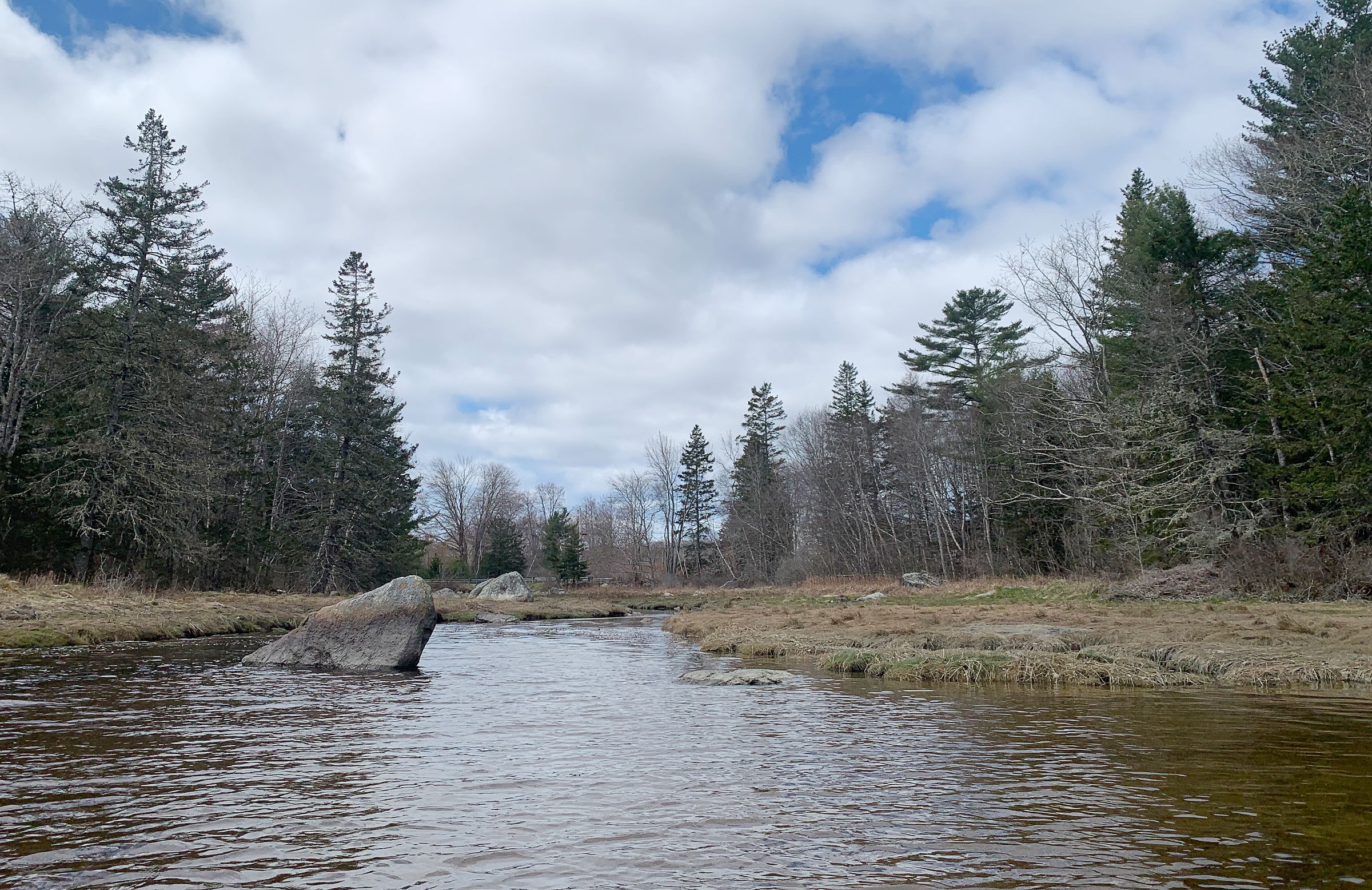
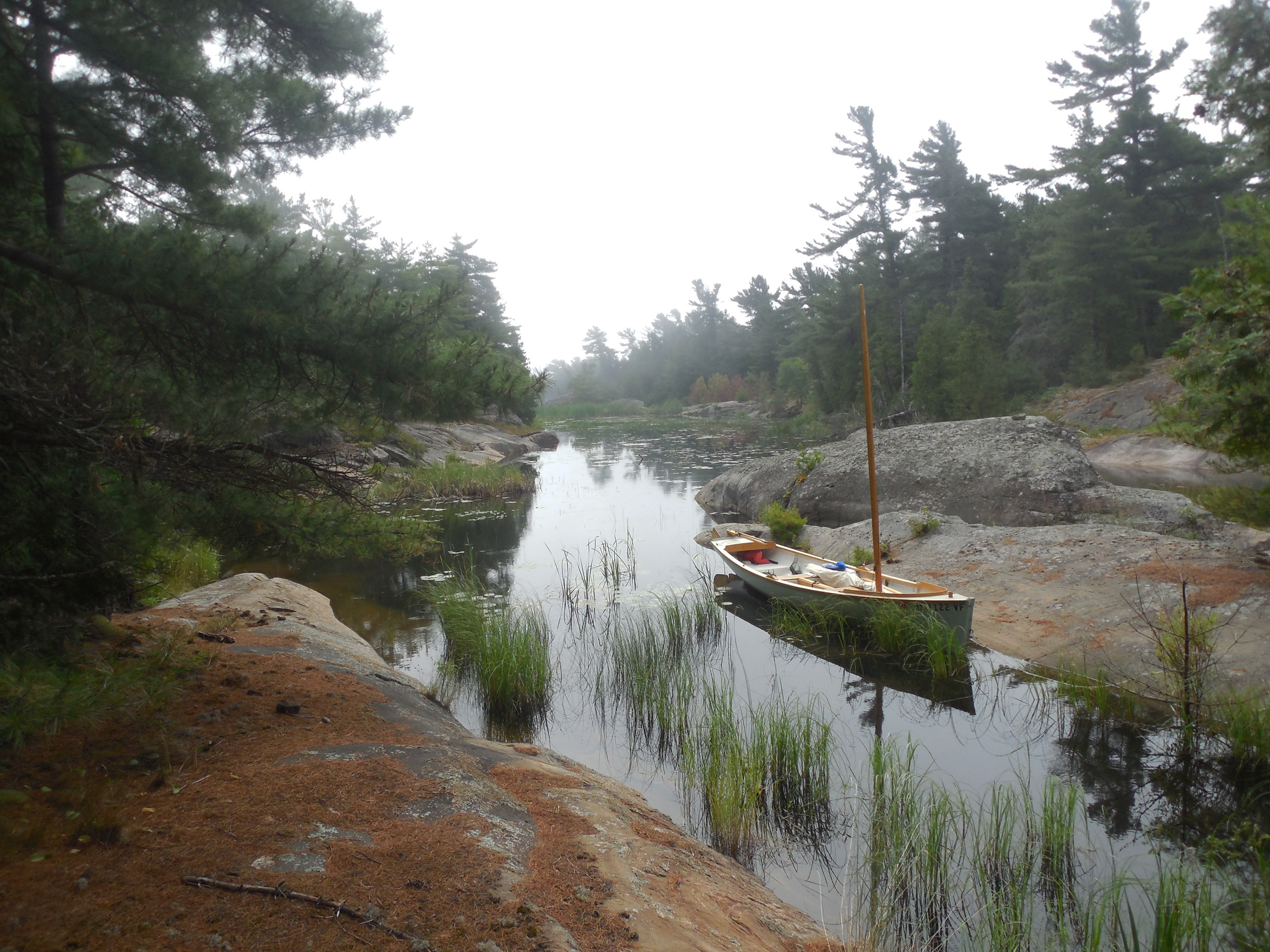
Nosing up to Meadow Brook, the channel became shallower and we dragged the dory over submerged rocks while avoiding the visible ones. The guardrail of the Hales Hill Road bridge was within sight, beyond the large boulder in the distance.


The brook quickly became too narrow for rowing, so Delaney and I hopped out and lined the dory up the last bit of the way to the beaver dam.

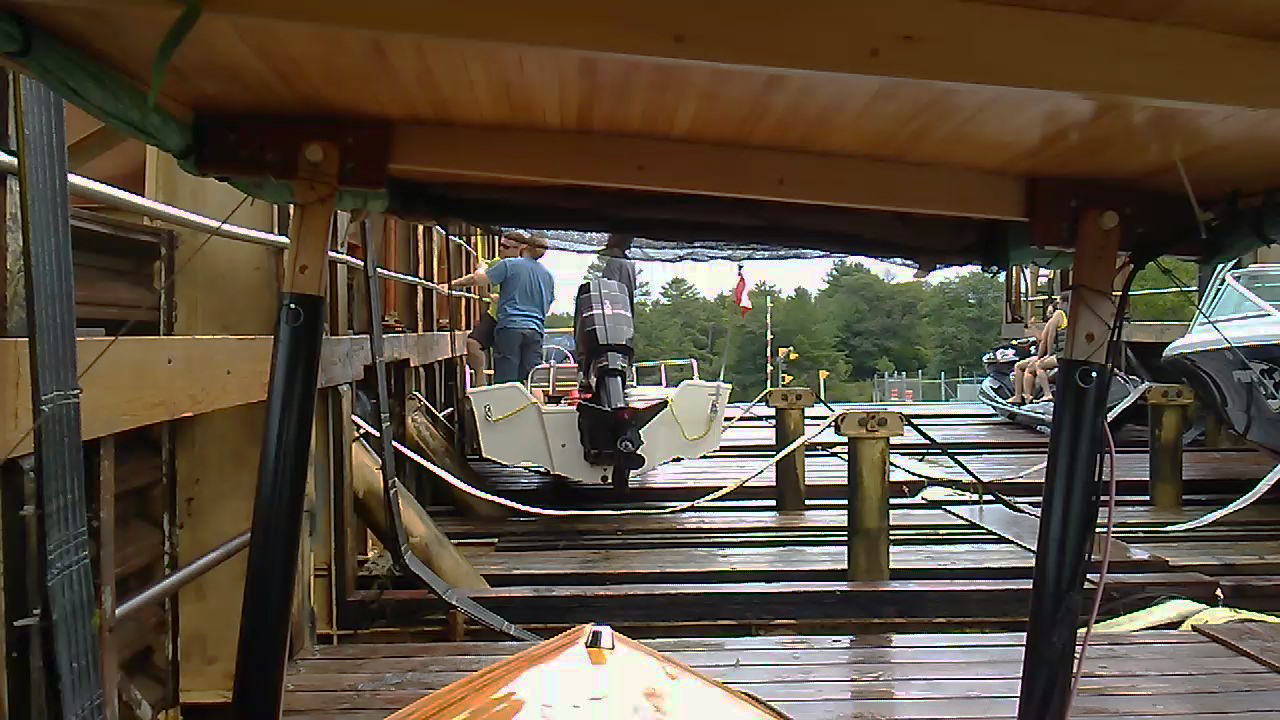
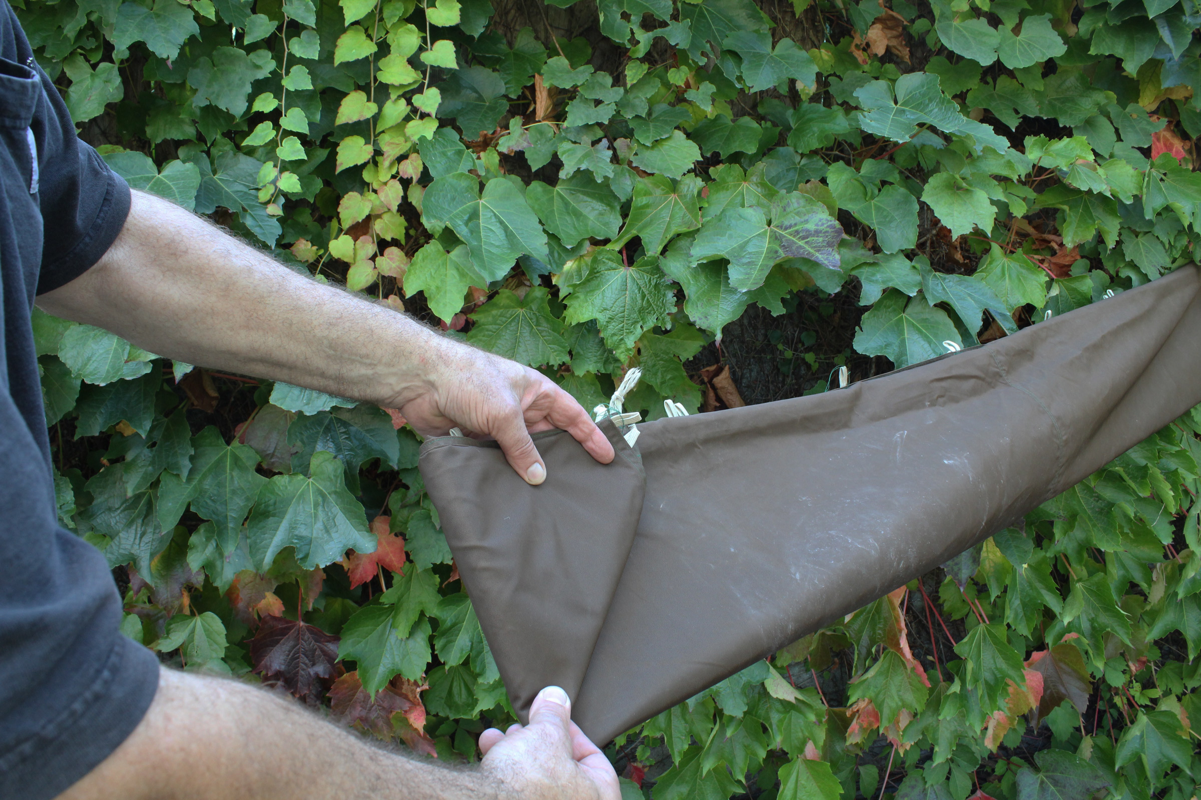
After navigating six bends in 60 yards and crunching the boat on a few submerged rocks, we were at the Hales Hill Road bridge. Its cement slab, supported by stacked rough-hewn stone blocks, spanned an opening just 6′ wide—barely enough room for the boat—and 4′ high, too low for us. The water running through the culvert was more than boot deep. Delaney scrambled up the embankment and crossed the road to the upstream side of the bridge, where she stepped over the metal guardrail, pushed through chest-high raspberry bushes, and poked her head and an arm over the edge above the water, ready to catch the boat. I gave WHISTLER a shove. The boat coasted smoothly upstream through the culvert for a few feet, before veering to port toward the rough-edged wall. Dangling as far out as she could without falling into the stream, Delaney grabbed the breasthook and saved the newly varnished rail from making contact with the rocks.

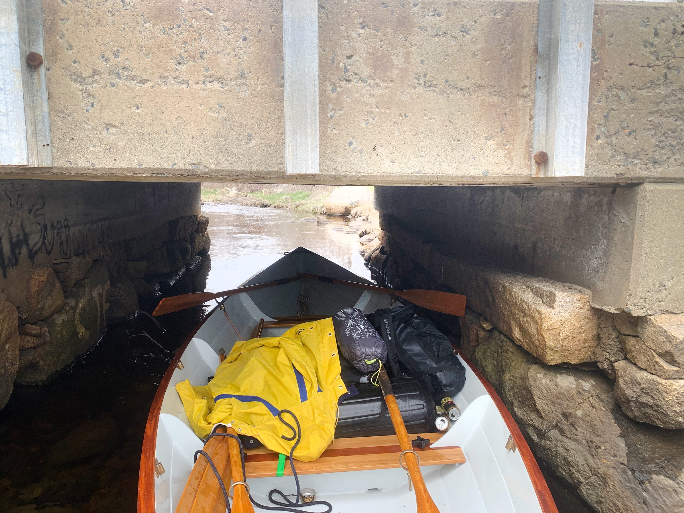
The water flowing under the Hales Hill bridge was especially deep, so we shoved WHISTLER through unmanned.

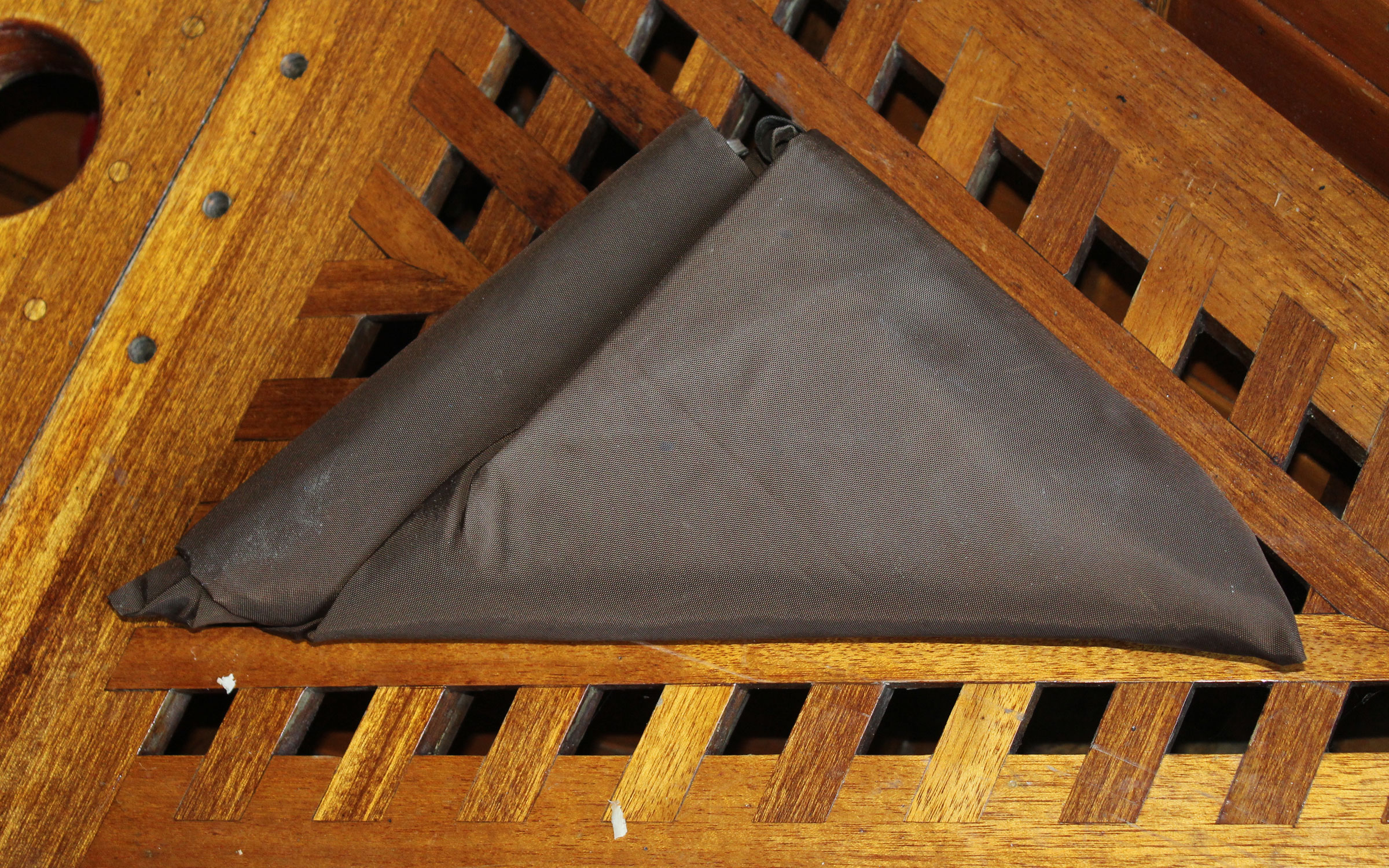
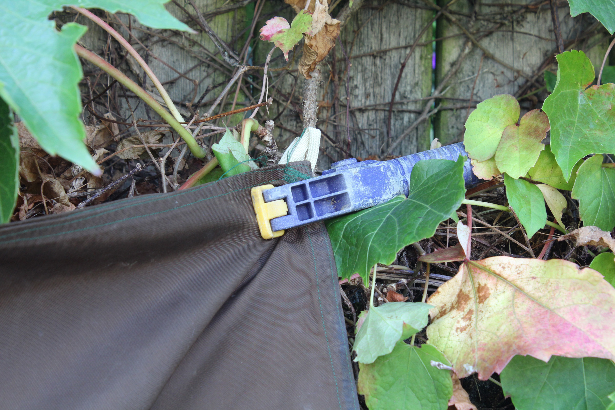
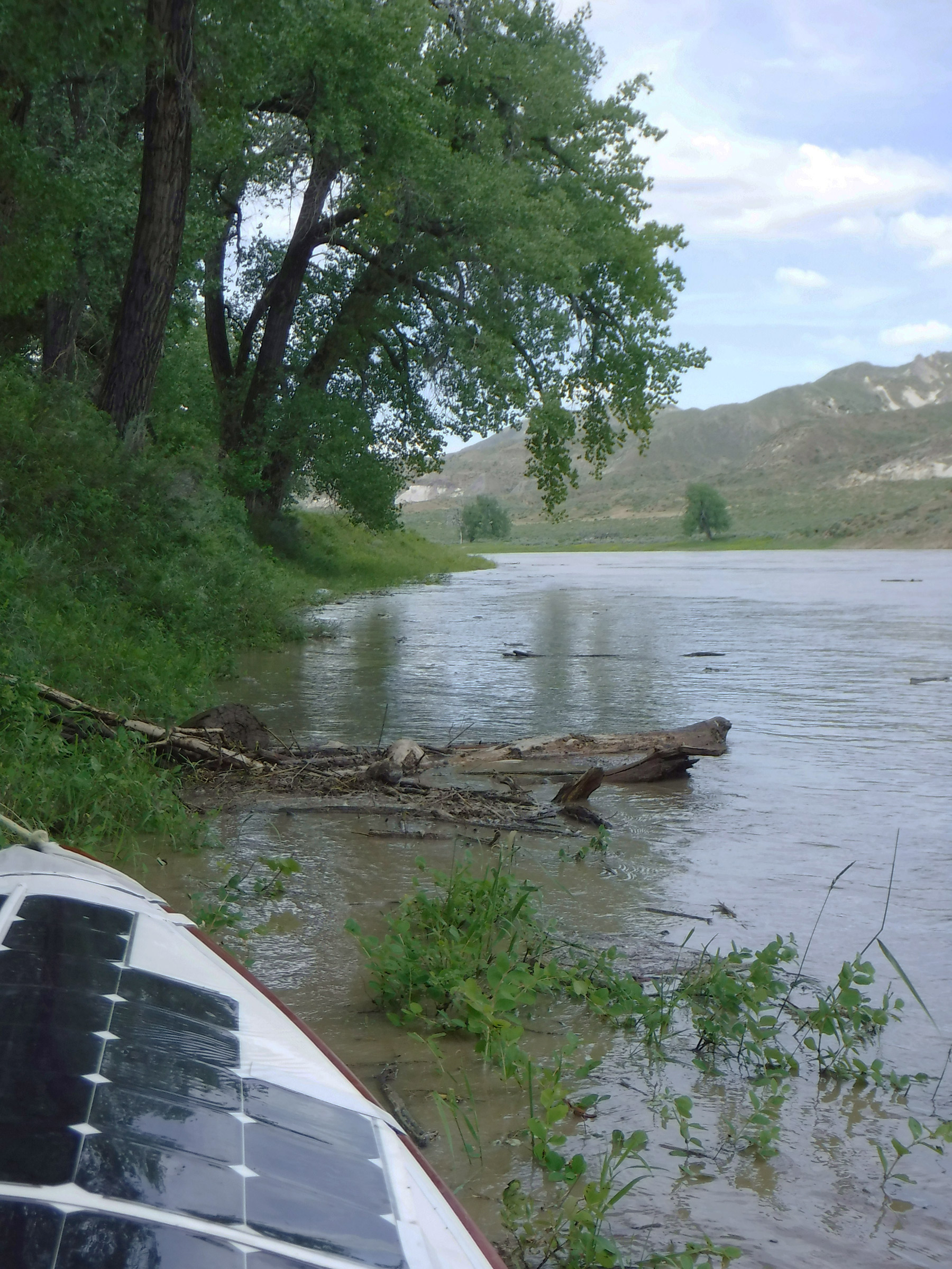
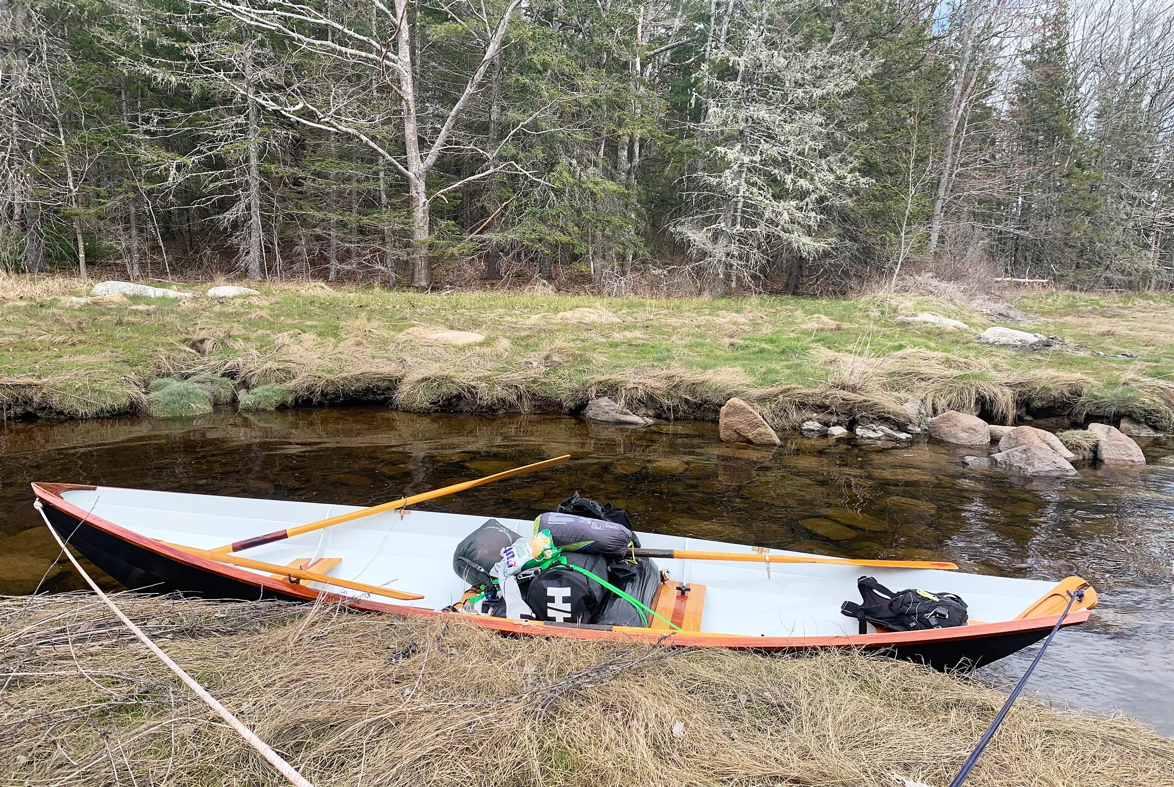
Just 50′ upstream from the bridge, we came to a 3′-high beaver dam of tangled twigs flanked by thick brush. Rounded granite boulders scattered around the dam had tan-colored bands marking the water level when the dam had been about 1′ higher. We had brought two large fenders to use as rollers for just such an obstacle as the dam and deployed them for protection from the rocks. We scooted WHISTLER safely over and into the still, pooled water upstream. Delaney crawled over the transom and stood up forward with an oar in hand, and we paddled canoe fashion up the beaver pond.

The rollers that we brought with us helped us clear the beaver dam with little struggle. Beyond the dam, the water was deep and clear, making the paddling easy.


As the water got shallower, poling became the only way to move forward. Despite the common knowledge that you should never push off the bottom with the blade of an oar for fear of it splitting, the width of the blade proved less susceptible than the handle to sinking into the muck below.

The smooth going was short lived. After only two minutes of paddling, the skeg started to drag in the mud below. We decided the best option was to drag the boat over dry land toward the tree line 1/4 mile away, and Delaney leaped from the bow for the streambank and landed on a tussock of grass. I thought she had made it, but then the tuft sank under her, and she splashed down into knee-deep water with a howl as her boots quickly flooded. She scrambled for firmer ground and eventually found a piece of grass that did not sink immediately. She stood up with a scowl.

I poled the boat a few more feet until the bow was nestled in grass, then gingerly stepped over the rail onto a firm-looking patch of grass. It shifted unsteadily below me. I knew we had to get the boat to firmer footing if we were going to drag it any farther. I braced my feet against two tussocks, grabbed the breasthook, and pulled firmly. The boat lurched forward no more than 1′, and then came to a halt with the screech of dry grass on paint.

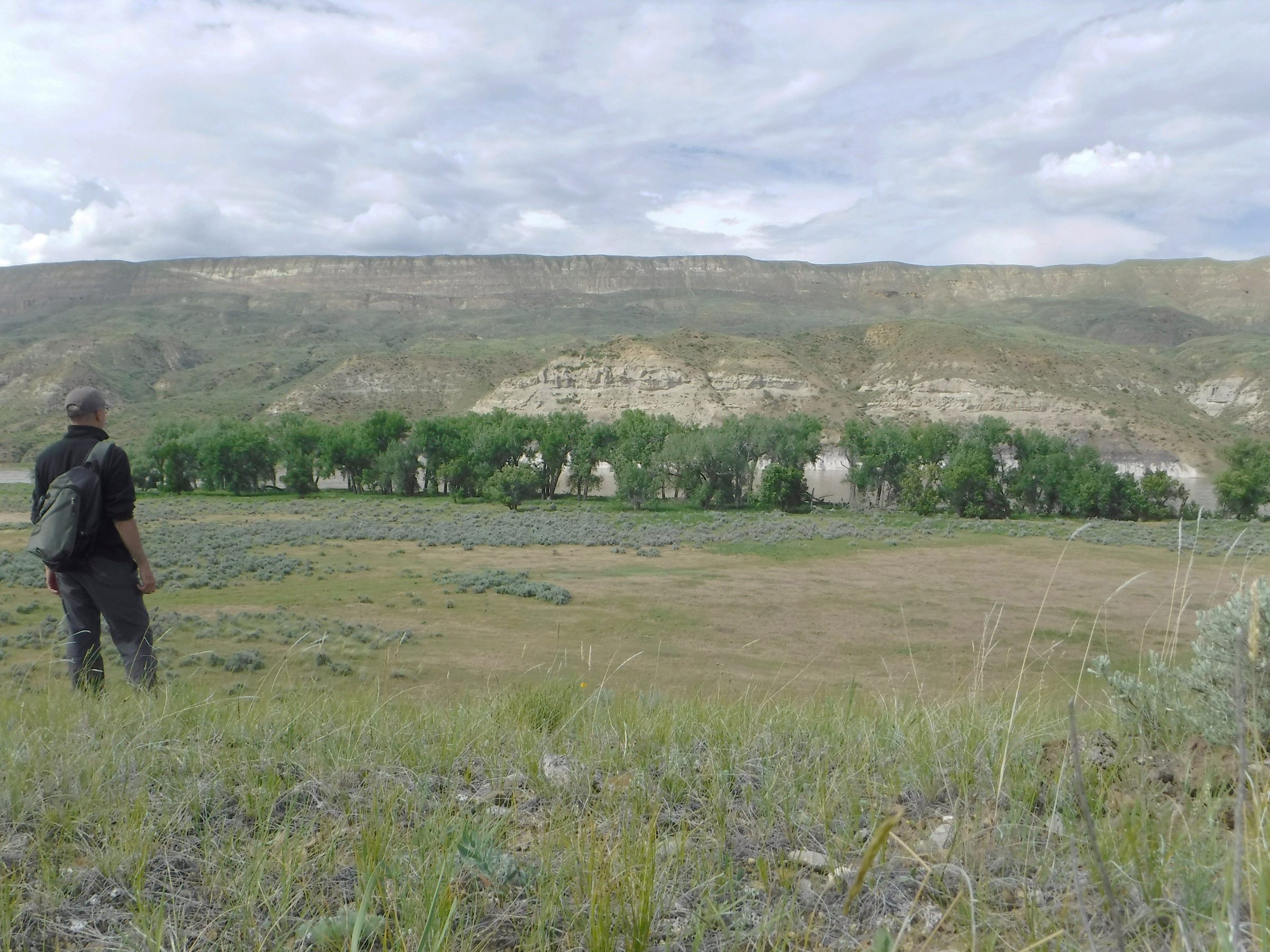
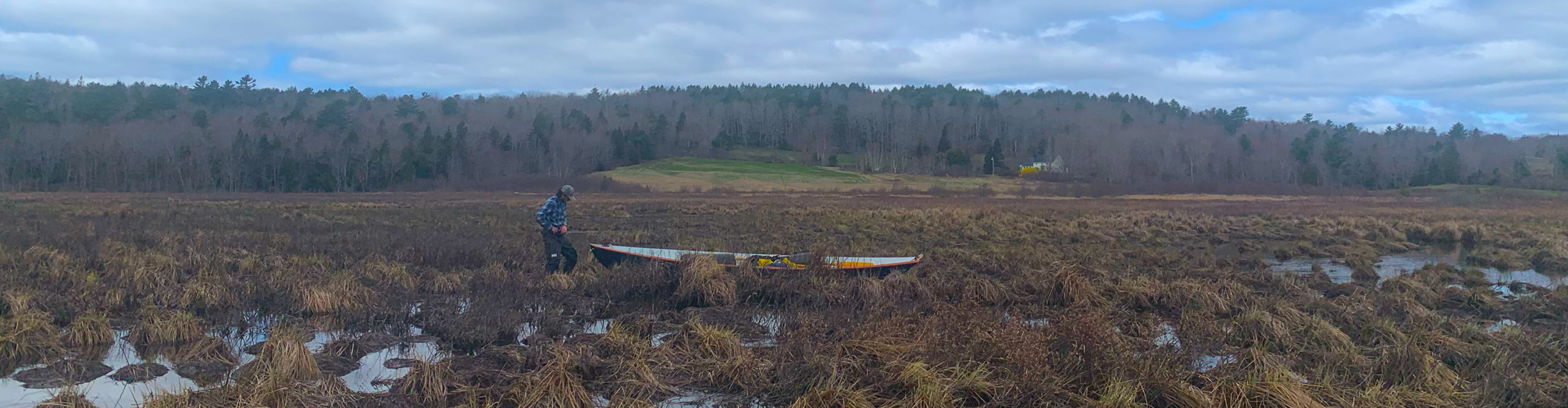
From where we had run aground, it was a half mile to where satellite images we’d studied seemed to indicate the portage should have started. Realizing that we clearly were not going to make it to the Benjamin River that day, our new goal was to get the boat to the portage before dark. It was only 12:30, and that seemed like a realistic goal.

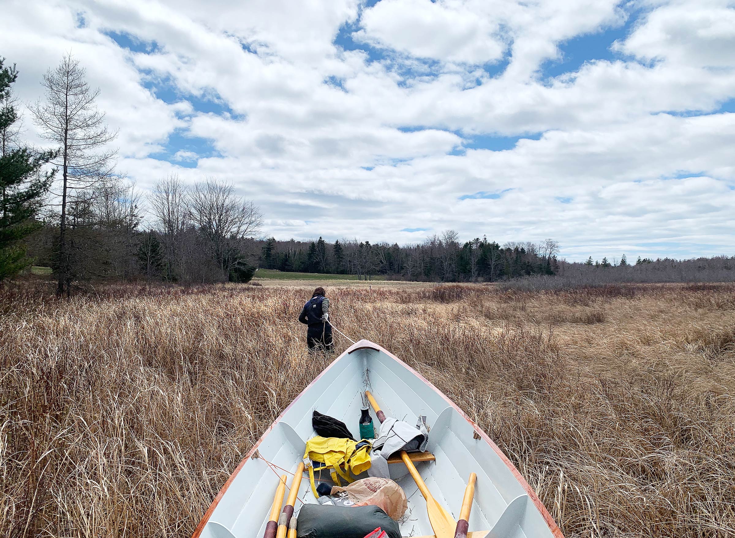
Abandoning what was left of the main channel, I began dragging the boat toward the tree line, hopping from one tuft of grass to the next to avoid the deep puddles scattered around them.


Getting ready to schlep the gear to lighten the boat, we took a quick break to feel sorry for ourselves before beginning the first long trudge to the tree line.

I began unloading some of the heaviest items: Delaney’s duffle, the cast-iron skillet, two 1-gallon jugs of water, and my dry bag backpack full of food and camping gear. Delaney worked her way toward me, lifting her legs over the tussocks and pushing through the chest-high grass, falling with almost every other step. Loaded down with gear, we scrambled toward a point in the tree line 1/4 mile away where we would stash everything and eat lunch before coming back for the boat. As soon as we set out, we knew we had made a mistake. What had looked like drier land was in fact just more tufts of grass, surrounded by water. Stepping from one clump to the next, I crushed each tussock down, throwing my balance off and sending me stumbling. Water poured into my boots, and thick mud beneath the water threatened to pull them off. My clothes were damp and sticky and my back prickled with sweat.

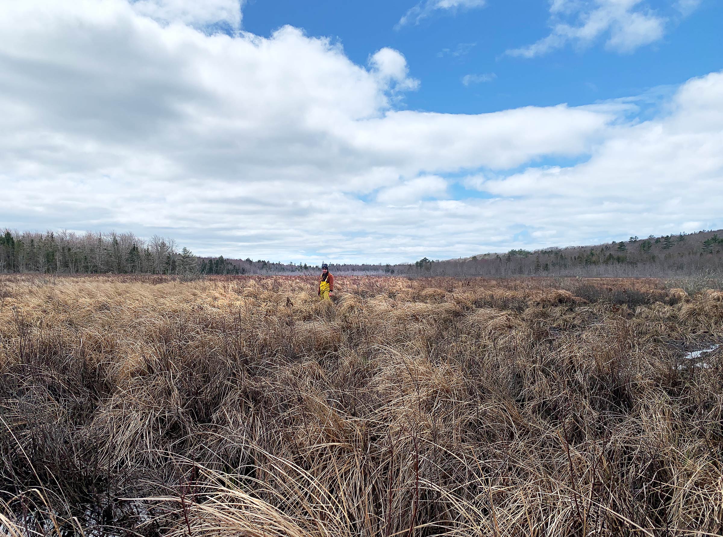
In most areas the grass reached Delaney’s chest. As we headed back to the boat after lunch, she gave me a distinctly displeased look amid the expansive grassy landscape.

Delaney, whose legs weren’t long enough to step up on the tussocks, slogged through the mud and water while carrying a gallon jug of water in each hand. Every few steps she fell from one puddle to the next and disappeared behind the tawny grass, but somehow remained smiling. By the time we had made it to the firm, dry ground at the tree line, it was 1:15. The carry with our gear had taken us 45 minutes to traverse a quarter mile, and we hadn’t even brought the boat.

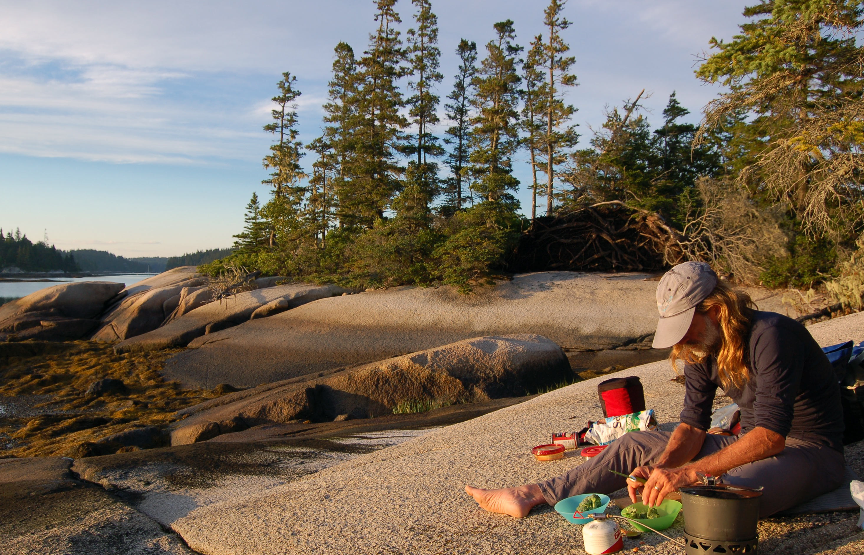
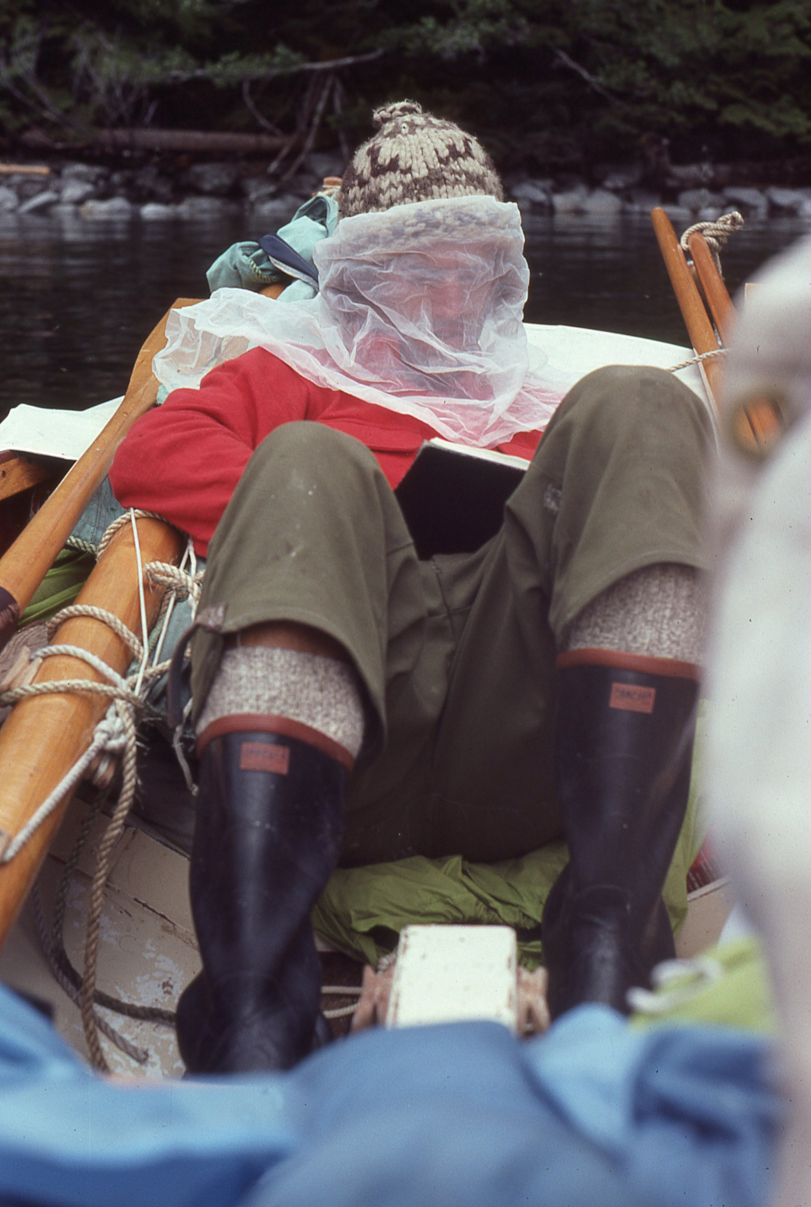
Delaney crawled into the trees leaving a trail of wet socks and spray gear. I pulled a wool blanket out of the duffle and stretched it out on some moss amid the trees, then made BLTs from homemade bread and Delaney’s favorite vegan bacon. Munching on my sandwich, too hungry to care about the fake meat, I looked out over the expanse of undulating golden grass, and my optimism began to increase. “This ain’t too bad after all,” I said, looking at Delaney. She offered a half smile, and I noticed she was shivering in the light early spring breeze blowing through the trees. I scrambled over to my backpack and pulled out the space blanket I had stashed for just such an occasion. She lay down on the wool blanket, I spread the space blanket over her, and tucked the upwind side under the backpack. I curled myself around her back; the shiny silver rustled over our heads. Through chattering teeth, she cheerfully said she would warm up in no time.

Ten minutes later, her shivering hadn’t stopped. “Time to move,” I said. Delaney grumbled but got up and put on her wet spray gear and socks as I packed up our gear and piled it by the edge of the trees. To warm us both up, I set a brisk pace back to the boat; soon we were both sweating again, and once she started cursing again I knew she would be okay. After reaching WHISTLER what seemed like hours later, we sprawled in opposite ends of the boat while we caught our breath. “This may have been one of the worst ideas I’ve ever had,” I said, feeling bad for dragging her on this adventure. “Maybe make the next one an easy trip?” she offered, and we got ready to drag the boat.

It was slow, brutal work. With me pulling and Delaney pushing, we moved the boat only 2′ at a time before it came to a halt or one of us fell into the mire. The sharp bottom edge of the breasthook dug into my hands and the grass under the boat turned from gold to black as it was crushed into the water. Working slowly, we inched toward the tree line, leaving a dark scar through the brush behind us. The effort made my arms burn and left me panting.

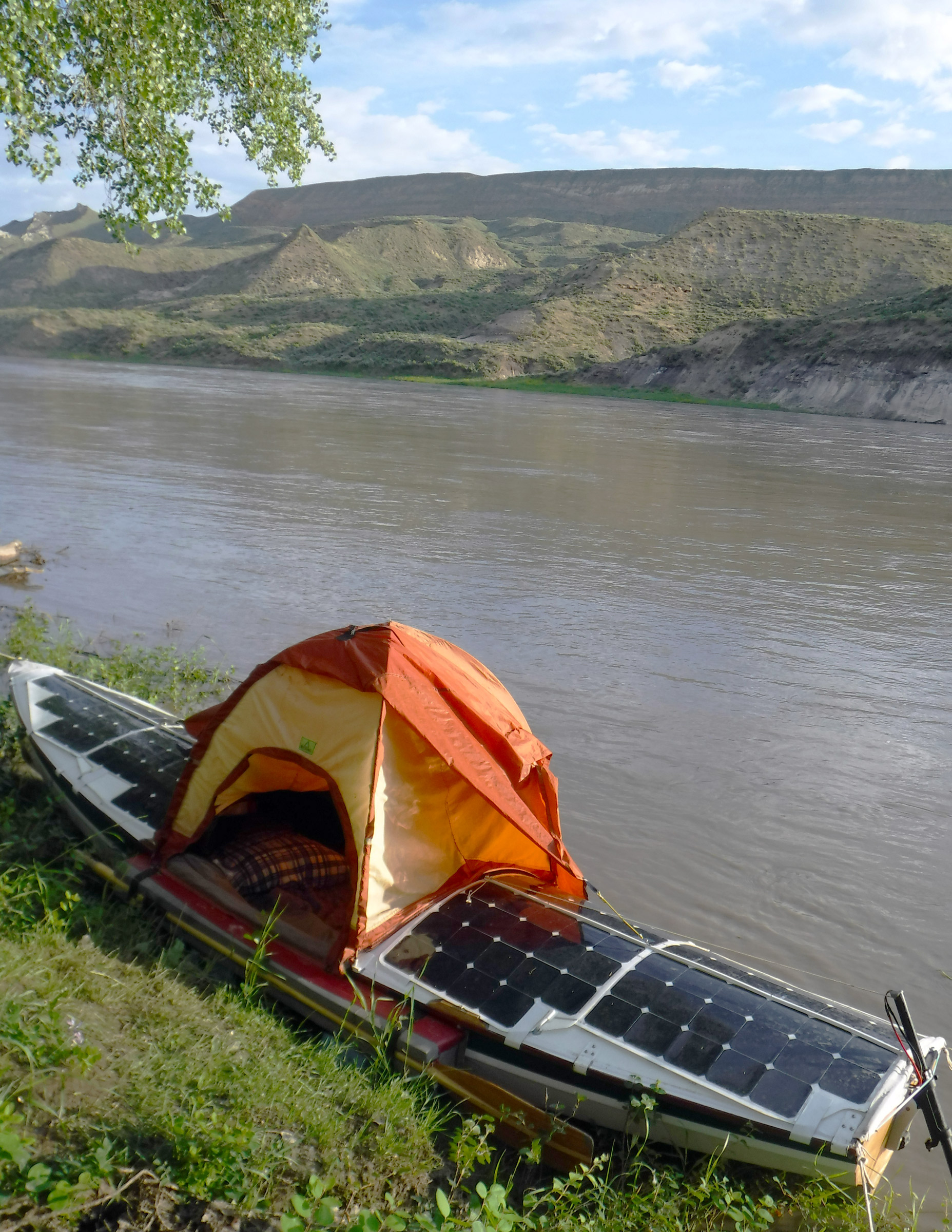
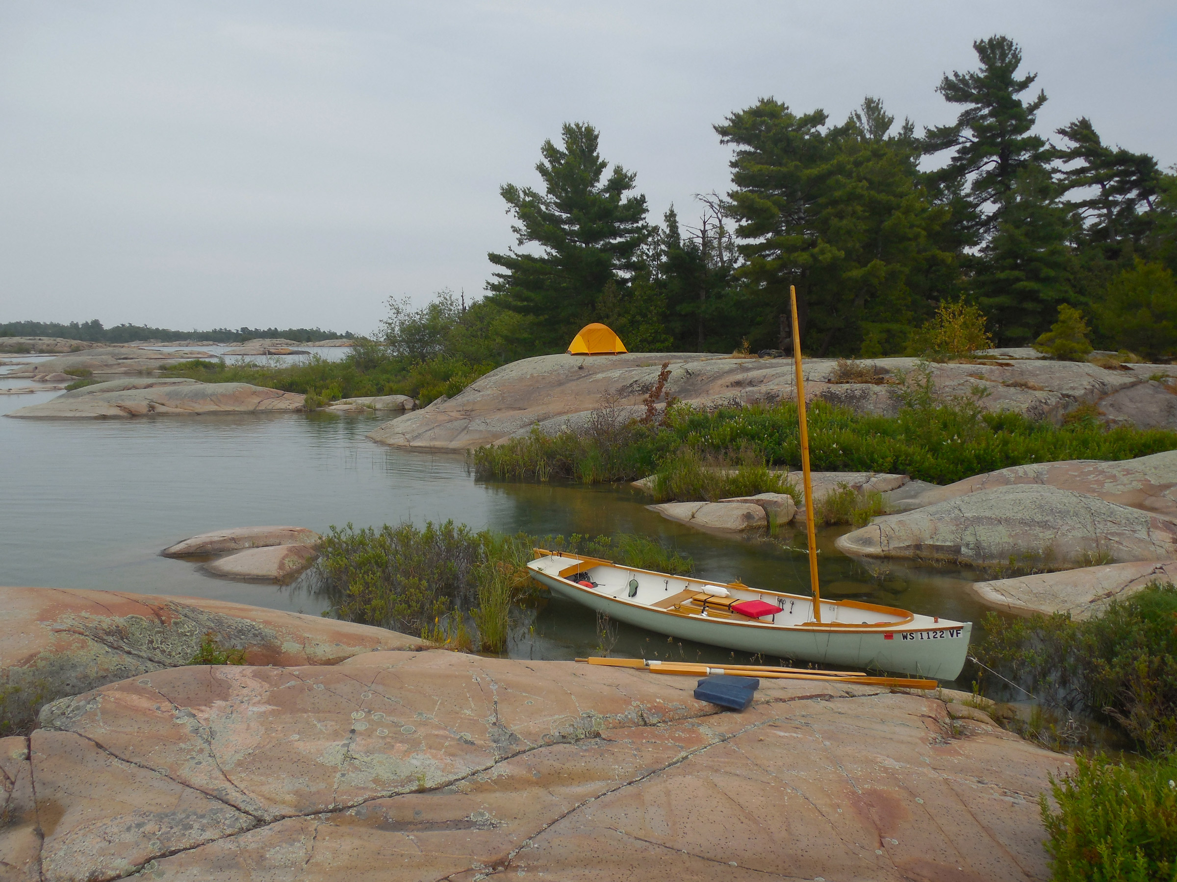
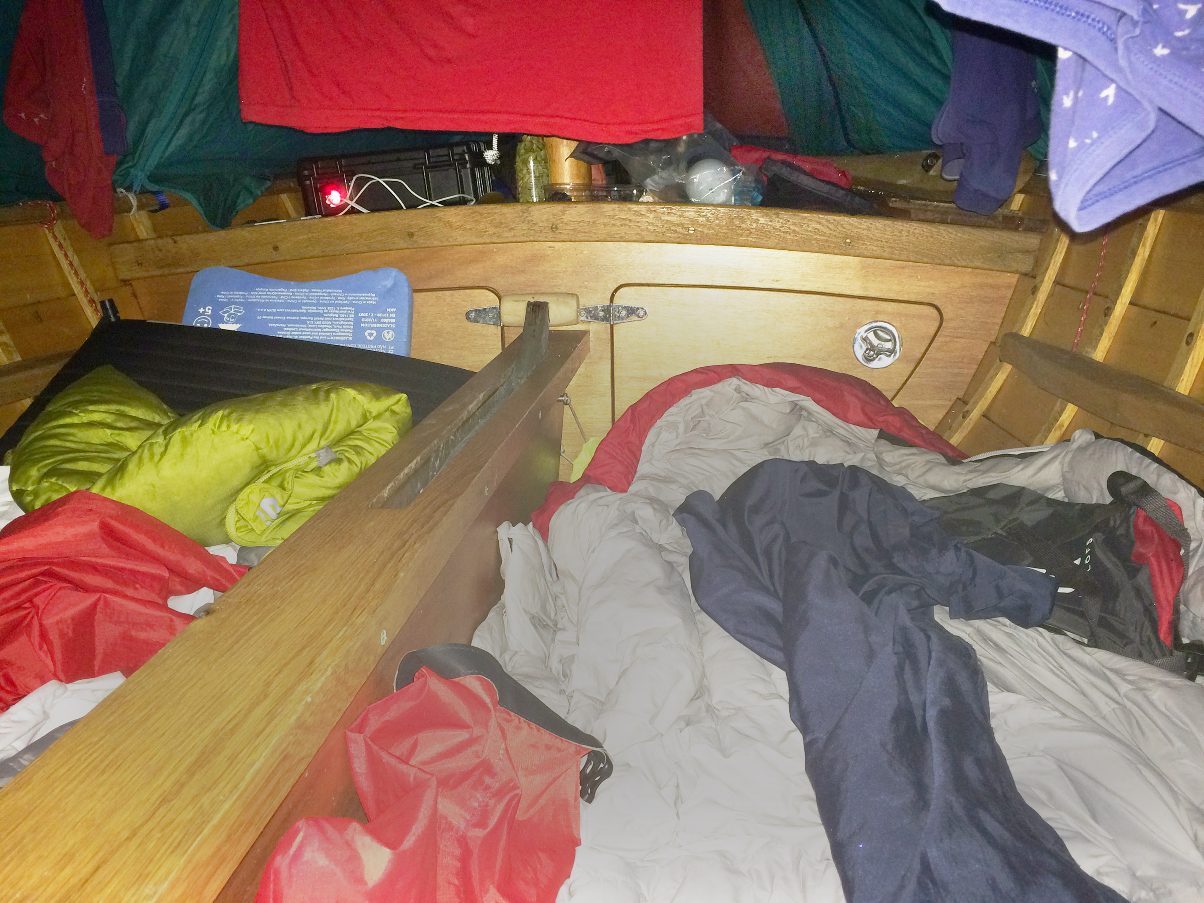
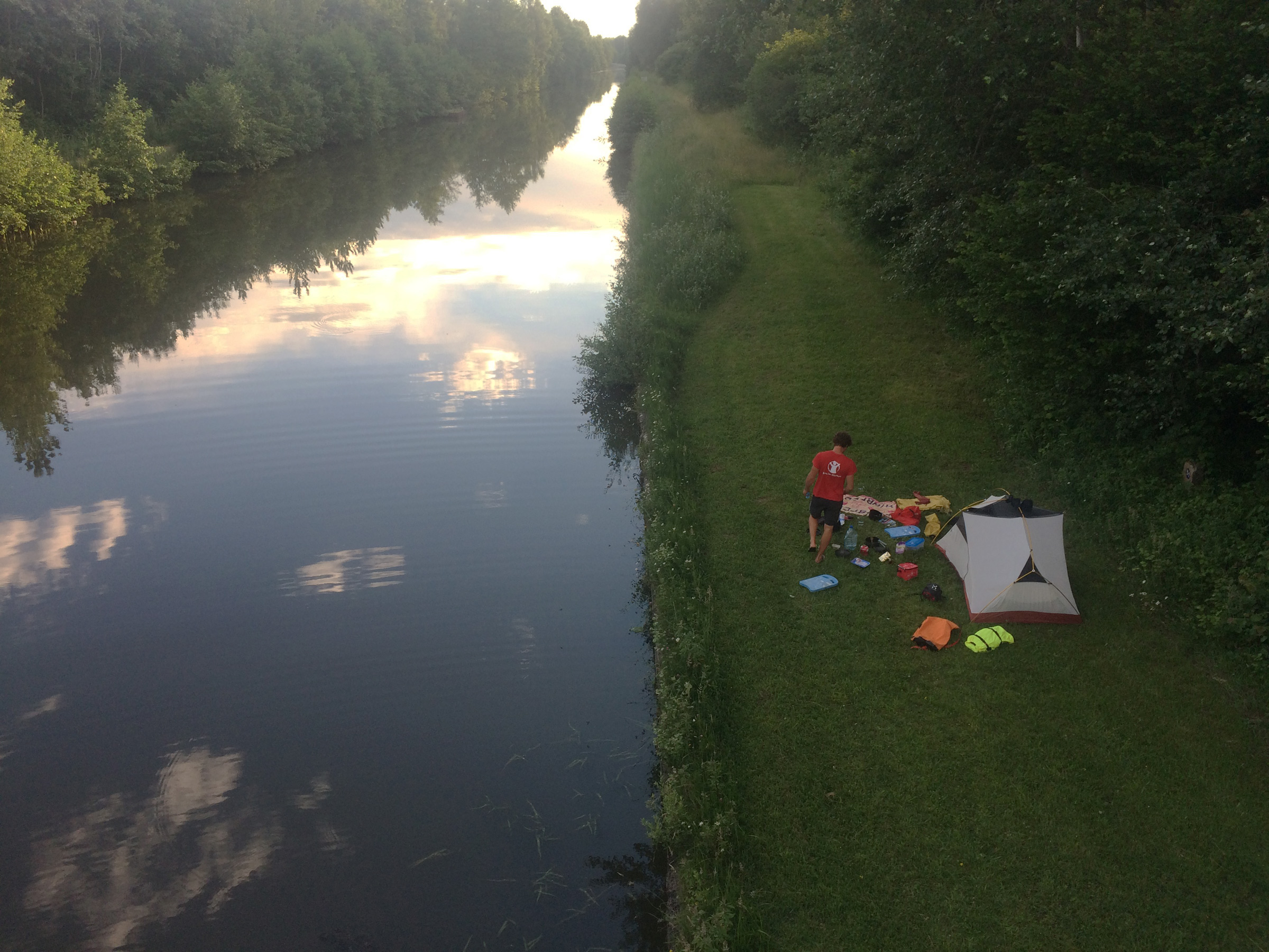
A little over an hour later, we made it to the trees. Gasping and saying little, we unpacked the last of the gear and looked for a place to set up the tent. Even though it was only 5:30 and there was plenty of daylight left, this was as far as we were going for the day. We were completely burned out and needed to get out of our wet clothes before we got chilled. We found a flat spot in the trees, and pitched the tent; I crawled inside, lying face down with the warmth of the smooth nylon sleeping bag tempting me to sleep. Delaney joined me, using my back as a pillow and we remained motionless for a while, waiting for our strength to come back so we could make dinner.

At the beginning of the day, while we were launching WHISTLER at the boat ramp, we had met a lobsterman who, after hearing our plan, had invited us to stay on his land if we didn’t make it as far as we hoped. His only direction had been “on the left beyond the bridge at the end of the Salt Pond.” We were unsure if we were in the right spot, but we started gathering wood for a fire, hoping this piece of the woods we had found was on his property.

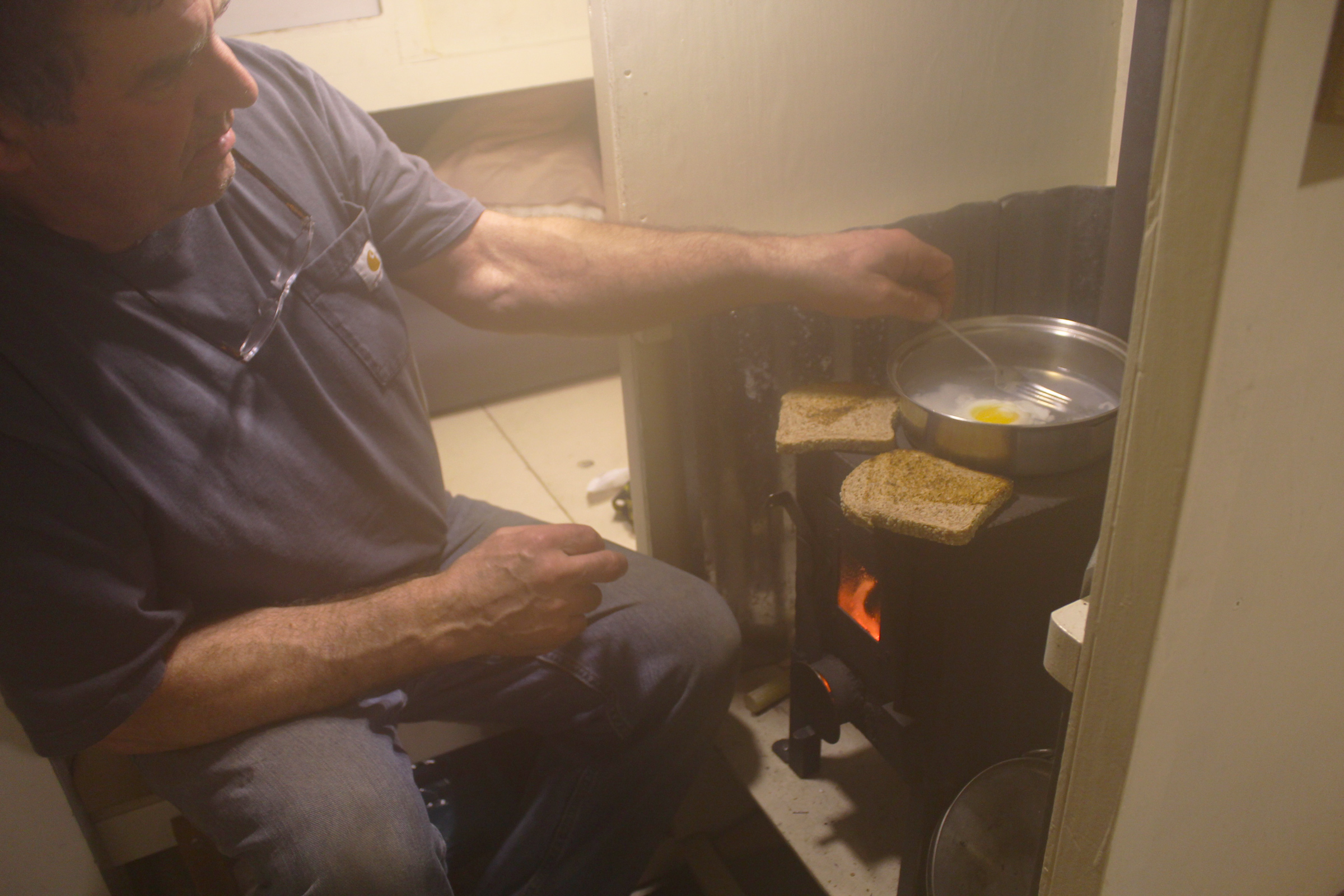
I kicked loose leaves and grass to the side and made a fire ring of soggy logs, and soon the warmth of the leaping flames provided a welcome relief from the chill of my damp clothes. We heated up dinner, an Indian rice affair, in a cast-iron skillet and scarfed it down as the dark crept in steadily. Fed, watered, and starting to warm, we sat by the fire for hours, socks spread around the flames like fallen flower petals. Around 10 p.m., Delaney did an especially jaw-cracking yawn, so we extinguished the fire and moved into the tent, with the pleasant scent of wood smoke clinging to us like an earthy perfume. In the dark, above the tent’s mesh panels, the sky had cleared to a kaleidoscopic view of stars, and we fell asleep to the sound of spring peepers.

I woke up late the next day, and, gingerly testing my muscles, was surprised to find I hadn’t locked up overnight. The weather began as the day before had with low puffy clouds, with occasional breaks that let the sun through. We packed up and were ready to get underway by 10:30, keenly aware of our dwindling time. Trying something new, we used two fenders as rollers, sticking as close to the tree line as we could where the ground was dry and the going a little easier. Delaney placed the fenders under the bow and pulled while I pushed and threw the fenders forward when they slipped out the back. It was slow going because fenders refused to roll over the hummocks and the dory bottom dragged across them. “Do you think we need these things?” Delaney asked, after half an hour of wrestling with the fenders. We threw them into the boat and dragged it, Delaney leading the bow with the painter while I pushed the stern.

It was a dramatic improvement. Compared to the day before, the sliding was much easier on the dry grass, and we could make it a full 10′ before I ran out of breath and had to take a break. Two hours later, after stopping for a half-hour lunch break in the trees, we had covered a quarter mile. We left the boat next to an abandoned cow pasture and walked up the remaining distance along the edge of the trees to where the portage proper should have started. It wasn’t good. Branches were tangled together in a thick wall and the trees were clustered close together; while a portage was definitely possible with a canoe or kayak, WHISTLER was far too wide to squeeze though. Our options were to go back the way we came, or try to cut up over to River Road, a quarter mile to the southeast.

Delaney led WHISTLER like a recalcitrant mule toward the cow pasture. As the ground evened out, it became easier to move the boat without the rollers and rely on strength and stubbornness.

Since retreating over the difficult ground we’d already covered was not an option—we had run out of time—we walked up the cow pasture toward the road, hoping to find a house with someone friendly enough to let us bring our car to pick up the dory. Walking up a gravel access road off one of the pastures, we strolled past a spent 12-gauge shotgun shell on the ground. Apparently, this was an unusual sight for a Florida girl, and Delaney grabbed my arm. “We’re going to get shot!” she said. “Relax,” I replied, “Most people at least have the courtesy to ask who you are before they shoot you.”

We crossed River Road and walked up to a farmhouse perched on the top of a hill, where a couple in their mid-forties were more than happy to help, insisting we have a drink of water before giving us a ride to our car.

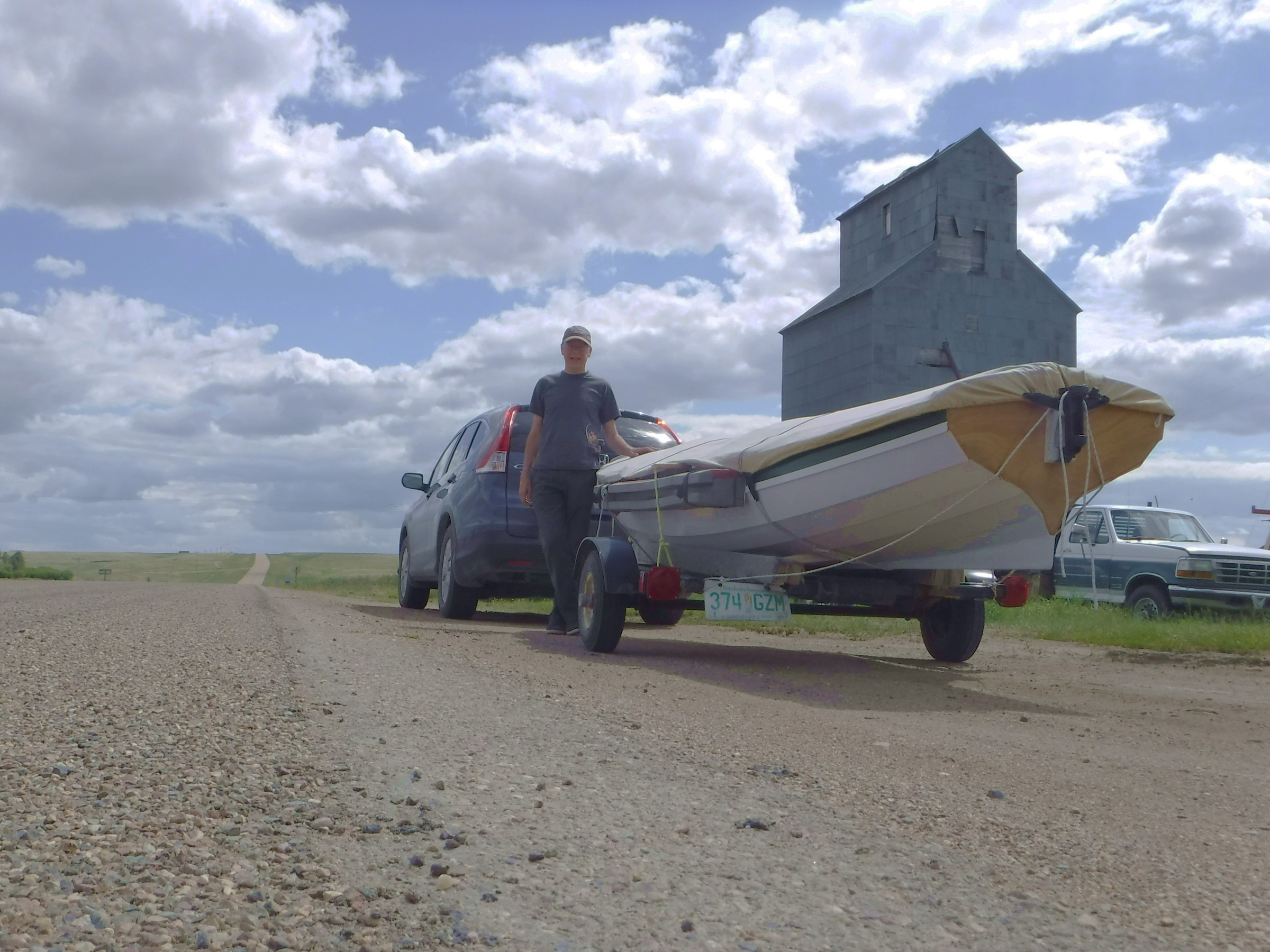
Delaney and I drove back to the cow pasture and threw gear into the car. When we rolled WHISTLER over to lift her onto the roof rack, twigs and grass poured out. The bottom of the boat was scarred where rocks had cut through the epoxy, graphite, and fiberglass, and the topside paint had long pale streaks from brush dragging along the side.

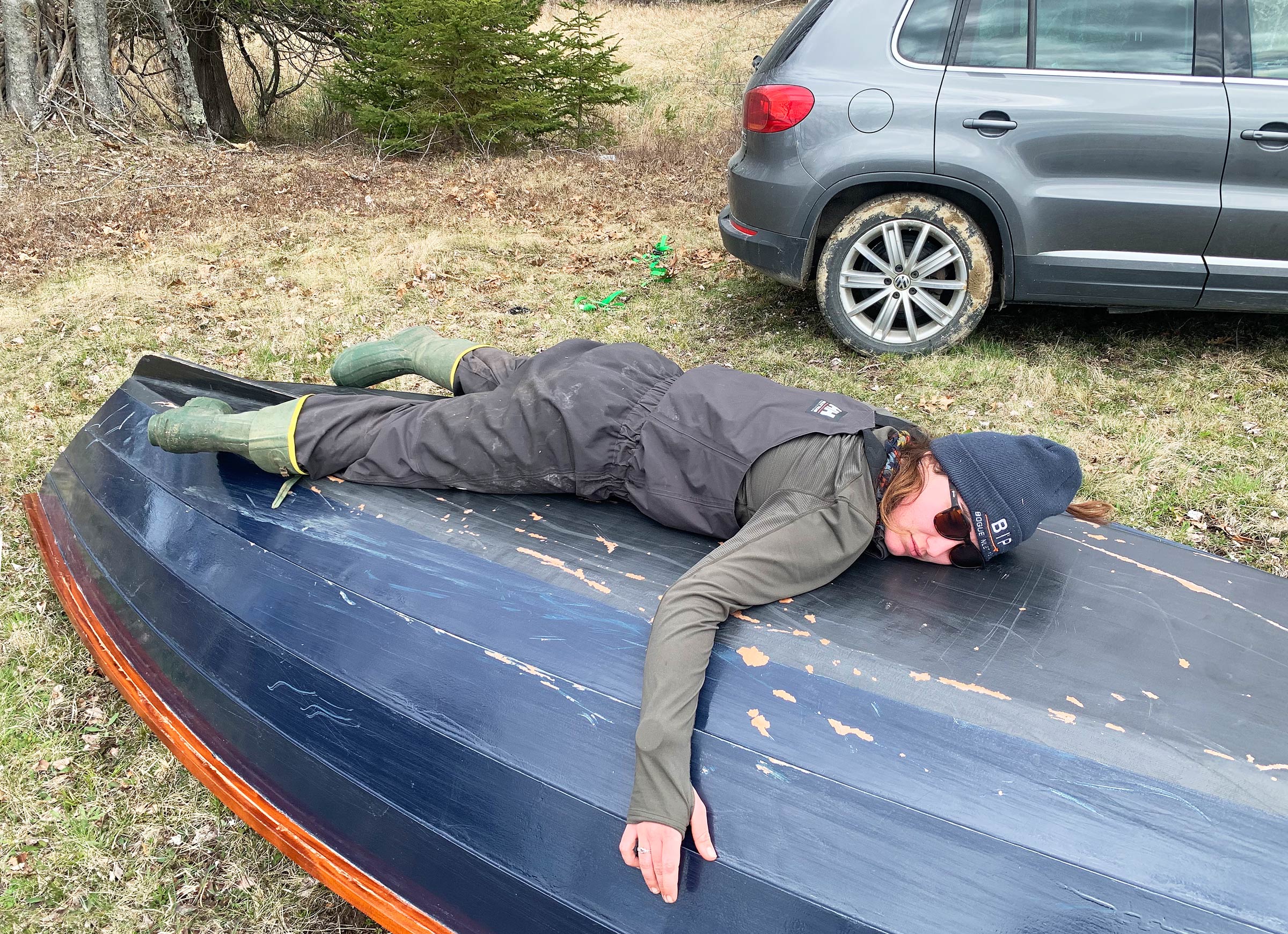
After securing permission from the property owners to bring our car to their field, we faced the last challenge of the trip: hoisting the 100-lb dory onto the roof rack. Delaney apologized to WHISTLER for the rough treatment. At the beginning of this adventure, the hull didn’t have a scratch on it.

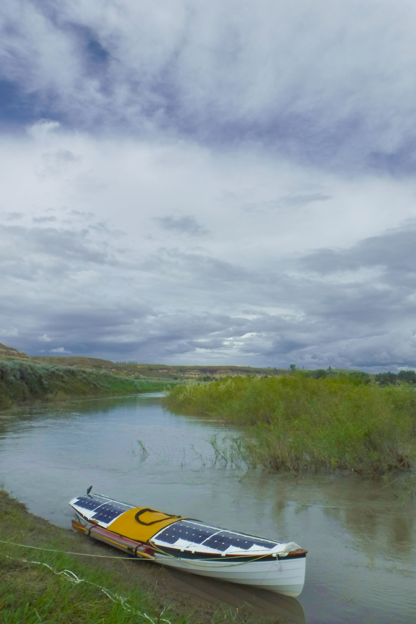
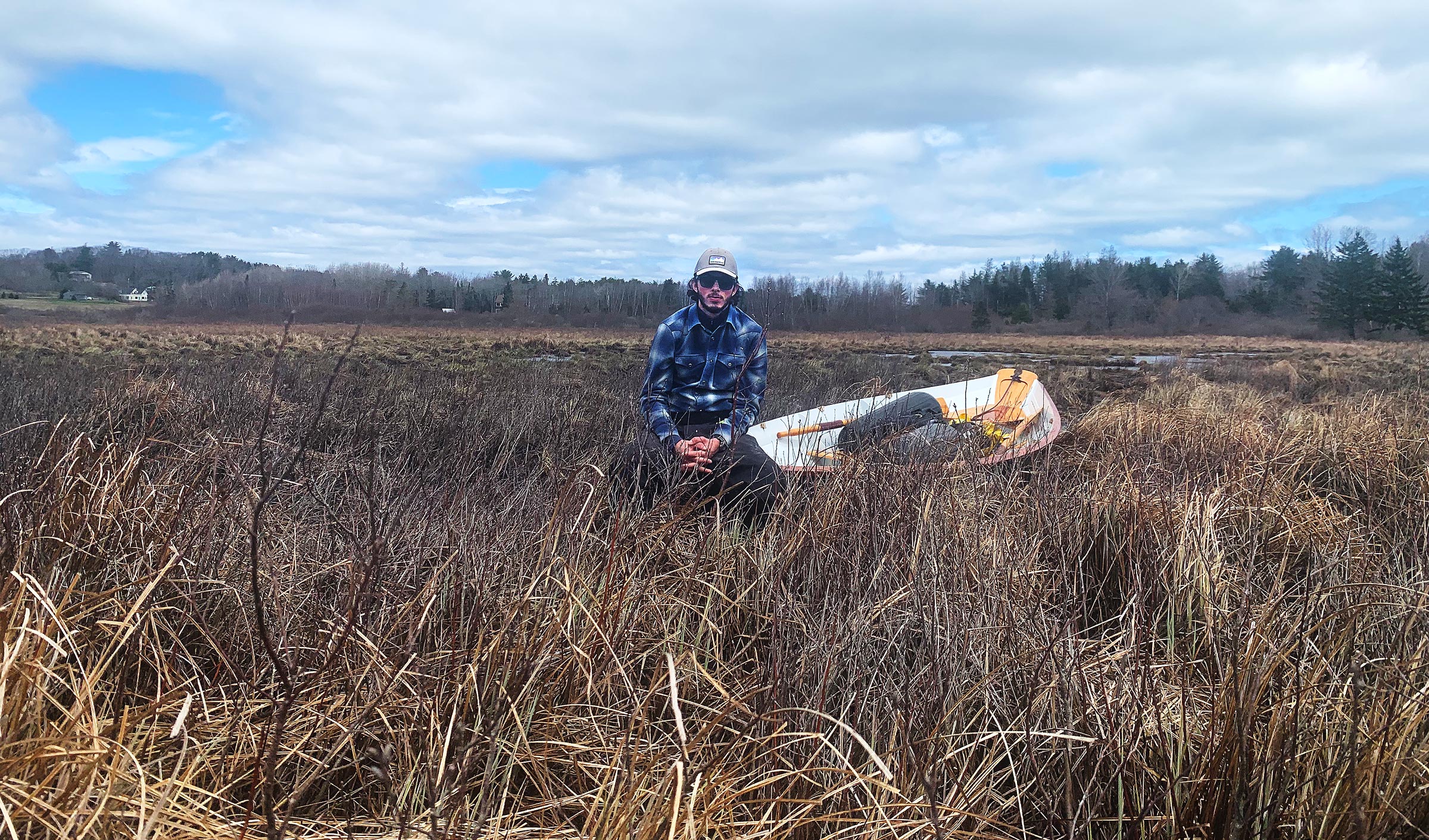
We had done only about 6 of the 26 miles of the circumnavigation of the Blue Hill Peninsula we’d set out to do, but we’d had more than our fair share of adventure. We might have made the whole loop if we’d had more time, or a more friendly weather forecast. We had underestimated the difficulty of hauling a 17′ dory to an ancient and inaccessible portage, and if we had done a little more reconnaissance, we might’ve known what we were getting into. But we had made an attempt, and managed to have a good time and keep each other going even while doing something that couldn’t be done.

Tom Conlogue is a former WoodenBoat School waterfront staff member who is currently feeding a crippling boat addiction as a student at Maine Maritime Academy. He can usually be found near some patch of water messing about in small boats.

If you have an interesting story to tell about your adventures with a small boat, please email us a brief outline and a few photos.

Dehydrating for Cruising Cuisine

Before I took to small-boat cruising in 1980, I did a lot of backpacking and was acutely aware of the weight of everything I had to carry. The longer I planned to stay out on the trail, the more food I needed to pack and the lighter it had to be. Ready-made backpacking meals in the ’70s were expensive and not very interesting, which is putting it mildly for TVP (textured vegetable protein), then a popular camp staple.

Fortunately, I could instead carry real food, thanks to the dehydrator my mother used to preserve some of the fruit and vegetables we grew in our backyard garden. For backpacking, I dried a lot of fruit, especially bananas, and my mother’s black-bean soup, which instantly came back to life with a bit of hot water.

Dehydrated black bean soup comes out of the dehydrator in a crumbly consistency Photographs by the author

Black bean soup—made of canned black beans, boxed vegetable broth, diced onions, minced garlic, cumin, salt, and pepper—takes 15 minutes to make, 30 minutes to cook, and a few hours to dry. Puréed and spread on parchment paper, it dries feather-light and is just as tasty when reconstituted.


A food processor makes quick work of pulverizing dried soup.


The smaller the particles, the quicker they can rehydrate.


Basmati rice takes about 5 minutes to rehydrate and the black-bean soup reconstitutes almost instantly. I chopped some dried onion and added it to the mix without rehydrating. The rice-and-bean pairing adds protein to the diet.

For cruising, the boat takes the load off my back, so I’m not concerned about the weight of the food I carry aboard, but there are many soft foods such as tomatoes, bananas, and strawberries, that don’t travel well even when packed in rigid containers to protect them. Those containers take up a lot of space, even when they’re empty, while resealable plastic bags filled with dehydrated food require minimal space and take up progressively less room as the contents are consumed.

A 16-oz jar of salsa can be spread out on a single parchment-covered rack. Dried, it becomes leather-like and can be reconstituted with lukewarm water in about 10 minutes, faster with hot water. It’s a rather tasty snack, albeit a bit salty, when eaten dry.

To dry foods that are largely liquid—soups, salsa, and pasta sauce—spread them on a sheet of parchment baking paper placed on the dehydrator’s racks. Metal cans and glass jars can be left at home and the dried contents consumed over the course of several days without requiring refrigeration. For the sake of the environment, use compostable unbleached parchment paper. The paper can be used repeatedly, so one roll will last for a long time. It doesn’t transfer flavors from one drying to the next, so you don’t need to keep track of what each sheet was used for.


An entire 25.5-oz jar of pasta sauce takes two racks to dry and the leather it produces folds to fit easily in a small resealable bag.


A bit of water and about 5 minutes on the stove is all it takes to turn these dehydrated ingredients—diced onion, tomato slices, precooked elbow macaroni, and pasta-sauce leather—into dinner.

Parchment paper works for rice and quinoa, too. When those grains have been cooked and dehydrated at home, they require shorter cooking times and use less camp stove fuel when reconstituted during a cruise. To rehydrate rice, for example, bring 1 cup of water to a boil, add 2/3 cup dehydrated rice, turn the stove off, and let the pot sit, covered, for 10 to 15 minutes while the rice absorbs the water. You can turn the stove on for a short while before eating to heat the rice to your preference.

Cooked quinoa dehydrates well on parchment paper. Fully dried, it makes a very crunchy snack.


If you don’t have a food processor for breaking up dehydrated food, a rolling pin works well. Here it’s breaking clumps of basmati rice into individual grains.

Some foods can be quite sticky and difficult to remove from the dehydrator’s trays. Watermelon, which becomes a delicious taffy-like candy when dehydrated, adheres to steel racks. A stiff-bristled fingernail brush (never used for fingernails) can push food off from the back side of the rack. Parchment paper can slow the drying a bit, but it makes it easier to remove sticky food.

If you find that some foods stick to the racks and are difficult to pry loose, a stiff-bristled brush can press them off from the back side of the rack. After this first try with 1/4″ slices of watermelon, I dried the next batch on parchment paper which made it easy to remove.

Dehydrators can also be used for meat—whether beef, chicken or fish—but in the form of jerky. I haven’t yet explored that possibility.  There are many books devoted to dehydrating, with instructions and recipes for making different kinds of jerky and drying foods of all kinds.


A sampling of dehydrator projects, from left to right, top to bottom: pasta sauce, salsa, strawberries, onions, homemade black-bean soup, deli Bombay potato soup, Roma tomatoes, bananas, watermelon, croutons, lemons, apple.

There are many makes and models of food dehydrators on the market with prices starting as low as $35. The less expensive ones are made of plastic, with many using BPA-free materials for the food trays. I prefer a stainless-steel type for durability and to minimize my use of plastics. The Cosori 267 I bought has a digital control panel for setting the temperature from 95 to 165 degrees F, and the time up to 48 hours. It has an automatic shut-off to prevent the unit from overheating.

A bonus to dehydrating foods during the cooler months: the dehydrator produces heat, and rather than let that go to waste, I keep it in my study rather than in the kitchen. When I’m at work at my desk, the dehydrator can take the chill off the room, and I don’t need to use a space heater. The only sound is the rush of air moving through the unit, a pleasant whisper of white noise that is not at all distracting.

The 600-watt Cosori dehydrator has six stainless-steel racks and works quietly at 48dB, the range of average room noise. If my house is cold, I’ll move the dehydrator into the study to take the chill off while I work and make it easy to grab an occasional bite to eat.

Dehydrating food will add some time to your preparations for a cruise, but it’s well worth the effort. Some foods, like black-bean soup, are every bit as good when reconstituted and others, like watermelon, are transformed and intensified by dehydrating. And you can save food that might otherwise go to waste languishing in the kitchen.


The banana bread I make with dates and walnuts turns into biscotti when dehydrated. It needed chocolate (of course) and I found I could warm semi-sweet chocolate chips in the microwave for 90 seconds, then apply the melted chocolate with a spatula. A half hour in the refrigerator cools and dries it.

Drying food has a long history, and the possibilities are virtually endless. Turning banana bread into biscotti was a delightful discovery; I’ll do that often, whether I take the biscotti cruising or enjoy it at home.

Christopher Cunningham is the editor of Small Boats Monthly

You can share your tips and tricks of the trade with other Small Boats Magazine readers by sending us an email.

The Kitchen Sink

If you ever pack more than you could possibly need for a cruise, you might say that you have everything but the kitchen sink, which is a good reminder of the one thing you don’t have: a kitchen sink. None of my boats have a built-in galley, so instead I have two well-appointed galley boxes, a compact one for solo travel, and a larger one to accommodate cooking for a crew. They each hold cookware, tableware (including a tablecloth), and a stove and its fuel, but while both are equipped with dish soap and a scrubby sponge, neither has had room for a sink for dishwashing. I’ve used a collapsible bucket for doing the dishes, but it’s not well suited to the task. It is awkwardly deep and awkward to work in, and even when it’s collapsed, it still has the same broad footprint and takes up valuable storage space.

When I happened upon Ortlieb’s 10-liter Folding Bowl at one of the Seattle marine hardware stores, I knew I’d found a better sink. (Ortlieb’s original name for it in German, is faltschüssel, folding bowl, but a better term for it would be from waschschüssel, washbasin or sink. I’ll refer to it as a sink.) The sink is made of PVC-coated polyester fabric with 1/2″-wide seams bonded by high-frequency welding, an electrical process that works in the same way a microwave does: it creates heat internally by vibrating molecules, so there is very little deformation of the material on the outside. The seam connecting the bottom to the sides is rounded at the corners, which will add to the life of the Folding Bowl by eliminating sharp points that become focal points of wear. Four semi-rigid rods set in sleeves at the top hold the sink open when it is in use. The 10L size has an opening 11-1/2″ square and is 5-1/2″ deep. The corners are flexible and allow the sink to be folded into a compact package—held snugly together by its webbing handles—that weighs less than 9 ounces.

Photographs by the author

Folded up, the sink takes up very little space and fits nicely above the stove in the smaller of my galley boxes. It can even be carried in a pants pocket.

The sink is a good size for dishwashing at camp or at anchor and makes the job much tidier. I’ve often used my cookpot as a sink, but it is too small to hold anything and soapy water gets all over the place, adding to the post-meal cleanup. The 10-L sink neatly contains the mess. If you cook ashore over a campfire, It can carry just over 3 gallons of water when you’re ready to extinguish the fire. The 10 L/2.6-gal rating is for the sink when set on a flat surface; when carried, the bottom adds capacity by turning from flat to rounded. A full load of water weighs 27 lbs, and the handles are just long enough to make it possible to carry that load with one hand.

The Ortlieb Folding Bowl is just right for washing dishes. I can wash them with soapy water in a cook pot, set them aside in the sink, and then rinse them. It’s very tidy and I don’t get water all over the seating areas.

On board, the Folding Bowl can help keep the boat tidy by providing a place for muddy footwear or a dripping anchor rode. Ashore, it can also serve well for foraging—I like to gather nettles in the spring and blackberries in the late summer. Hand-washing laundry is an option, too, though I don’t ever care much how dirty my clothes get while cruising.

The two webbing handles are just long enough to carry the sink, like a bucket, with one hand.

Now, when I pack for a cruise and look at the mountain of gear it takes to do even a three-day cruise, I can take some satisfaction in knowing that I’ve got everything and the kitchen sink.

Christopher Cunningham is the editor of Small Boats Magazine.

The Folding Bowl comes in four sizes: 5-, 10-, 20-, and 50-liter. Ortlieb is based in Germany and has retailers around the world, particularly outdoor stores and bicycle stores. I purchased the 10L from Fisheries Supplies in Seattle for $36.

Is there a product that might be useful for boatbuilding, cruising, or shore-side camping that you’d like us to review? Please email your suggestions.

Grayl’s Geopress Water-Treatment System

SBM photographs and video

Grayl has created a water-treatment system that is two reservoirs and pump all in one compact unit.

Unless you’re willing to risk a most unpleasant bout of giardiasis or worse on your backcountry ventures, some kind of water-treatment system is a necessity. I much prefer filters to chemical treatments or boiling, so I was immediately intrigued by Grayl’s Geopress, which offers an interesting alternative to the hand-pump type filter I’ve been using.

Unlike pump-operated filters, the Grayl Geopress combines a filter and water bottle in one unit. An inner bottle, with a replaceable filter attached, fits snugly inside an outer shell with a gasket providing a watertight seal between them. There are no moving parts likely to fail in the field, and very little opportunity for the kinds of accidental contamination that’s possible in pump-type filters, such as dropping an output hose into untreated water. Simply pull out the Geopress inner bottle and set it aside, then dip the outer shell in untreated water to fill it. Set it upright on a flat surface, reinsert the inner bottle, and open the pour spout’s threaded cap a half turn for venting air. Press the bottle down slowly and firmly into the outer shell. This forces the untreated water through the filter at the bottom of the inner bottle. It took me about 40 seconds to filter 24 ounces of water, much faster than pump-type filters I’ve used.

The filter at the bottom of the inner cylinder incorporates the gasket that forces the water through the filter. The replacement filters come with a new gasket to assure the watertight seal between the two cylinders.

The filter uses a combination of ceramic fibers for particulate removal, positively charged ions to bind pathogens, and activated carbon to adsorb chemicals and impurities. The manufacturer claims that the Grayl filter removes 99.9999% of bacteria, 99.99% of viruses, and 99.9% of protozoa, claims that have I found verified by independent laboratory tests for the similar Grayl Ultralight model. Replacement filters are available, and recommended after filtering 65 gallons of water (350 cycles), or when the time needed to press the inner bottle into the outer shell nears 25 seconds. The filters include the gasket, so that critical part is regularly replaced.

The Geopress is made of durable, BPA-free plastic throughout. The design is just right for easy drinking or spill-proof pouring. An arrow on the drinking cap clearly indicates open and closed positions, and the raised “Max Fill” line on the bottle is a useful feature as well, though a contrasting color would make it easier to see. A rigid plastic loop on the cap accommodates a carabiner for secure carrying.

The Geopress turned the murky stream water at left to the clear water at right. It’s best to filter the clearest water you have access to. The silt-laden water here was used to highlight a before and after difference. Many of the contaminants removed by the filter are invisible.

There are just a few things to consider. Those with small hands might find it difficult to pull the inner bottle from the outer shell—that’s an operation requiring a firm grip and a steady pull-and-twist. My wife, whose hand can comfortably span an octave on a piano keyboard, had some difficulty here. When drawing water from water too shallow to dip the outer shell, you’ll need a cup to fill it. The Geopress filters only 24 oz of water at a time, so while purifying a single bottle of water goes quickly, filtering larger amounts requires emptying the inner sleeve into a separate container and repeating the operation several times.

For best results, follow the instructions and position the Grayl on a low, stable surface so that you can slowly lean the full weight of your upper body on the top of the bottle, with your arms straight and locked, to force water through the filter. Kneeling on the ground with the Grayl between my knees worked best; in that position, it took me about 8 seconds to filter a full bottle of water. It’s also possible to operate the Grayl while standing by putting it not far above knee height and keeping arms straight to let body weight do the work. The Grayl is easy to operate ashore where there’s no shortage of solid ground, but because space is limited aboard my sail-and-oar beach cruiser, I found it a bit awkward to use onboard. Standing up and pressing down on the Grayl while it’s on the thwart can be a bit dicey in a round-bottomed boat with a beam of just 4′6″. If you have room aboard to kneel, though, it’ll be easy to filter water while afloat.

If what you need is a method of very quickly treating drinking water one bottle at a time, the Geopress shines; it does everything it’s designed to do, and does it very well. Pricing for the Geopress is comparable to popular pump-type filters, and I was impressed with its quality, simplicity, and ease of use.

Tom Pamperin is a freelance writer who lives in northwestern Wisconsin. He spends his summers cruising small boats throughout Wisconsin, the Great Lakes, and along farther afield. He is a frequent contributor to Small Boats Monthly and WoodenBoat.

The Geopress is available directly from Grayl for $89.95 and available from selected retailers. Replacement Purifier Cartridges are available for $24.95.

Is there a product that might be useful for boatbuilding, cruising, or shore-side camping that you’d like us to review? Please email your suggestions.

Running on Sunshine

In 2018, I left my home dock on the Napanee River in southeast Ontario and headed for the Trent-Severn Waterway, a 240-mile chain of rivers, lakes, locks, and canals leading all the way to Lake Huron’s Georgian Bay. My challenge would be to do this trip solo in SOL CANADA, a small wooden boat I’d built to be 100 percent solar-electric powered.

I knew of only one solar-electric boat that had traveled the full distance from Lock 1 in Trenton to Lock 45 in Port Severn, so they were the first. I’d be the first Canadian using only the sun to charge my batteries.

Photographs by the author

SOL CANADA’s canopy would not only keep me out of the sun and rain (mostly), but the four solar panels it carries would also generate all of the power I’d need for the trip.

SOL CANADA’s hull was based on the Greavette Dispro, manufactured by the Disappearing Propeller Boat Company from 1915 to 1958. An enclosed motorwell holds a Torqeedo Cruise 2.0 electric outboard, and in a compartment under the seats are four 6-volt batteries wired in series to provide 24 volts with a capacity of 221 amp-hours. I expected the boat to be capable of an average speed of 5.4 mph. The batteries are charged by four flexible solar panels on the canopy. They have a rated output of 860 watts.

At 7:30 a.m. on the morning of August 19, I motored away on what was supposed to be a sunny day with a light following breeze from the east. I headed down the 6-mile stretch to the mouth of the river, then along the Bay of Quinte to the city of Trenton—a distance of 31 miles.

There was a haze in the sky that cut the solar production by half, but on the bay, the easterly breeze was now a 12-mph tailwind and SOL, doing a bit of surfing, made good headway to the mouth of the Trent-Severn waterway at Trenton.

Two miles north upriver, the only boat heading upstream, I arrived at Lock 1 and went through immediately. The lockkeeper notified the next lock, just 3/4 miles away, that I was coming and its gate opened for me as I approached. There are three more locks in the first 6 miles of the Trent Canal, and all of them were expecting me with the gates open.

By the end of the first day of my trip, I had traveled 42 miles and had made it all the way to the top of Lock 5. With my home-made fabric walls rolled down into camping mode, SOL CANADA was ready for peaceful night’s sleep.

At 6 p.m. I motored out of Lock 5, well ahead of schedule. My total distance that day was 42 miles and my battery bank was at a 77 percent charge, good enough to carry me the next day if the conditions were poor. I was the only boat stopping for the night in a still-water cove above the lock. The lock master gave me a key to the staff washroom, kitchen, and the shower. Back at SOL, I prepared for the night by folding the seats down to make my bed and rolling down poly-tarp from the perimeter of the canopy. My enclosed sleeping quarters would get some peculiar looks, but they proved to be very comfortable.

On the morning of the second day, just north of Trenton at Lock 5, my good friends Ed and Sandy arrived by canoe to bring me a hot coffee and a homemade muffin. They just live 1/4 mile up river and frequently paddle this stretch of the Trent River.

The morning sky was clear, and the sun quickly warmed SOL’s enclosure. Ed and Sandy, old friends who live close by the lock, arrived by canoe bringing coffee and a muffin. After saying goodbye and packing my things, I rolled the curtains up and SOL was ready to go. It was such a sunny day, I figured I could maintain a good pace without drawing the batteries down. I got to Lock 6 at Frankford before the morning got busy with boat traffic.

All along the river, weeds choked the shallows, and islands of free-floating weeds ripped up by boats clumped together on the surface. I can see the power gauge jump when weeds get pulled in between the prop and the housing. Although I’d made a prop guard, weeds were still a problem, but I could throw the motor into reverse and almost always shed them. Sometimes I’d have to stop and tear them out.

When I emerged from Lock 6 at Frankford under a bright clear sky, the lock opened on water foul with weeds. Just 1/2 mile ahead they’d bring me to a stop.

Just past the Frankford lock, in a narrow quiet channel with cedar trees hanging over the bank, I felt the motor vibrate with weeds tangled in the prop. Shifting into reverse did not get rid of them, so I put the controller into neutral. As I removed the weeds, I did not notice that the breeze had pushed me close to shore. When I realized what was happening, I quickly twisted myself back into my seat to take control, and in my haste my elbow hit the throttle. The boat lurched forward into overhanging branches, and the 100-lb canopy came crashing down beside me. My shouts echoed across the channel. I should have pulled the magnetic kill switch before working on the prop.

I thought the trip was over. I made my way back to Lock 6 where two lockkeepers and a boater lifted the canopy up while I reinserted the front posts and drove screws back into the holes they’d been torn out of. One solar cable at the back had been pulled apart, and I had to splice it back together. After two-and-a-half hours, the boat was a bit battered but operational. I could keep going forward.

My packs containing my supper provisions and gas stove were on the picnic table as my boat was moored for the night at the top side of Lock 8, Percy Reach. After eating, I finished the repairs to the canopy supports.

I finished the day at Lock 8, a quiet site with campsites. I removed the screws that had been torn out, added glue to the holes, and reinserted the screws. I cooked up some spaghetti on my camp stove and was in bed by 9 p.m.


Morning came with heavily overcast skies; the forecast called for rain later in the day. So much for getting ahead of schedule.

I reached Lock 9 before its keepers arrived at 9 a.m. While I waited, I walked around the grounds. Set between farmlands to the east and a wooded island to the west, it would have been a very peaceful place to spend a night. Like many of the locks on the lower part of the Trent, this one was isolated from towns, their bridges, and their traffic. When the staff arrived, I spoke with the lock master; he mentioned he had a friend named Peter who was an editor and interested in stories for an online newspaper. I provided my phone number in case he wanted to do a story on my boat.

Just 1-1/2 miles upstream from Lock 9, I passed through Lock 10. Locks 11 and 12 were piggybacked one on top of the other for a combined lift of 48’. After about two hours on the water, with the rain pouring down and driving in from the starboard side, I got a call from the editor, Peter Fisher, and arranged to meet him the following morning. After seven locks and 12 miles in the rain, I arrived at the top of the two-lock flight of Locks 16 and 17. Lock 17 was not the nicest place to stay. The washroom was on the grubby side and the weather put me in a bad mood.

In the morning ,I had time to kill before meeting with Peter at 11 a.m. When he arrived, I invited him aboard for a ride on the boat as he interviewed me. I was back on my way at about 1 p.m., headed for Lock 18, 15 miles upstream.

Roger Siebert

.

The sky was overcast and the solar panels would not be generating much power. I’d have enough charge to get to Lock 18, in the town of Hastings, more than 14 miles upstream; but the following day, to cover 37 miles to Lock 19 at the outskirts of the city of Peterborough, I’d need to start out with fully charged batteries and have sun along the way.

As I was approaching Lock 18, a motoryacht, NEPENTHE, passed by and entered the lock ahead of me. After exiting, we both docked at the concrete wall on the north side of the river. NEPENTHE’s owners, Paul and Jill, and their passenger Tom, are “Loopers,” traveling the 6,000-mile-long Great Loop, a chain of waterways passing through the U.S. and Canada via the Mississippi River and the Intracoastal Waterway. Dale and Ann aboard UTOPIA, another yacht stopped for the night, were also Loopers. For dinner, the six of us walked to a nearby eatery . The yachters asked if I had seen a kayaker named Steve who was paddling the Great Loop. I hadn’t, but said I’d keep my eyes peeled for him.

When morning broke, the day promised to be mostly sunny, just what I needed to get to the Peterborough lock. I left just past 8:30 and headed 5 miles west to Rice Lake, a 20-mile-long shallow lake that can be very rough when a stiff westerly blows, exactly what I faced that morning. SOL crashed over the waves, and the wind howled and made the canopy sway. The quiet electric motor made noise of the elements seem so much louder.

After 17 miles on the lake, I turned north into the Otonabee River where  I found shelter from the wind, even though I was traveling against a strong current of about 2 mph. At the Bensfort Bridge, 7 miles upstream, I met with another reporter, Jason Bain, of the Peterborough Examiner. The riverbank where he was standing was rocky, so I anchored 30′ from shore for the interview. We talked for a while, and as I was getting ready to leave, I tried to pull the anchor up, but it wouldn’t budge. I had to cut the rode. Jason felt bad that I had to lose the anchor and promised to replace it.

It took me about 4 hours to make my way to Lock 19 into Peterborough and the lockkeeper there presented me with a new anchor and rode left for me, courtesy of the Peterborough Examiner. Jason called; I thanked him and told him the story of the anchor. In 1964, my father was working on a hydroelectric plant at Niagara Falls. A coffer dam constructed above the falls exposed the riverbed, and among the artifacts lodged in the rocks were two anchors. My dad brought them home and the one I’d lost  was one of them. Jason felt even worse that the anchor was a family heirloom, but month later, when I was back at home, Jason called again. Two SCUBA divers had heard about the missing anchor, found it snagged, and sent it to me.

Just 3/4 miles up from Lock 19, I stopped for the night at Lock 20 in the middle of Peterborough. My cousins Carl and Melba took me out to dinner.

With my cousin Carl aboard, we motored into the Peterborough lift lock, Lock 21. This is the largest of its type in the world, and lifts boats 65′ in a just a couple of minutes. At the top there is a panoramic view of the city of Peterborough.

In the morning, Carl joined me to ride up 65′ at Lock 21, the Peterborough Lift Lock, the largest hydraulic lift lock in the world. The locks are a side-by-side pair of 140′ by 33′ tubs called caissons, each sitting on top of a cylindrical ram, 7-1/2′ in diameter. When a caisson reaches the top, it stops a few inches below the water level of the upper canal and takes on water when the gates are opened. The additional water makes it the heavier of the two, and as it descends, water in its ram flows to the other ram to drive the lower caisson upward.

After the lift, I left Carl at the docking wall and chased after the other boats leaving the lock to join them in the 4-1/2-mile-long succession of five locks. If I fell behind I’d have to wait for the next opening, so I zipped along at 5 1/2 mph, figuring I could spare the extra batteries power.

About 14 miles from Peterborough, Lock 27 was the end of the Otonabee River and the entry to the Kawartha Lakes, a chain of a dozen lakes traversed by the waterway. The lock is in a park-like setting with a 200-yard-long island separating it from the rapids and dam where the Otonabee River rushes by.

After another good night I arose to yet another overcast day. I set out northbound on Clear Lake turned west at Stony Lake and passed through two of Lower Buckhorn Lake’s locks, finishing up at Lock 31.

By now, the interview with Jason had been published and I was hailed by boaters and people on shore. People in cars honked and waved at me.

At the west end of Lower Buckthorn, I arrived at the downstream side of Lock 31 and secured the last spot on the wall. It was a Saturday and there was a festival around the lock with live music. I made the rounds until the rain started and I retreated to SOL for the night.

On Sunday morning I headed south along Buckhorn Lake, a 1/2-mile-wide wooded corridor dotted with summer homes and bristling with finger piers. The water is utterly clear but looks black where it is deep. The land around the lake is blanketed with tall pine trees and dotted with granite outcroppings. The waterway turned west through a cluster of undeveloped islands and then north along Pigeon Lake. By midafternoon I reached Lock 32 at Bobcaygeon, a little town in the middle of cottage country. I’d only traveled 17-1/2 miles, but the next lock was another 18 miles away, more than I wanted to take on.

Bobcaygeon was a beautiful spot to stop for the night. There were lots of people around while I tied up the boat, many of whom had read about my adventure in the paper and asked about SOL. I took a walk around town and when I returned I saw a lone kayaker in the lock, his decks loaded with gear. I yelled down, “Are you Steve?”

“Yes,” he answered. I had found the kayaker paddling the Great Loop. After he left the lock, I gave him a hand unloading his gear and helped him set up camp. Steve Chard, 60 at the time, is from England, and had served in the ’70s on British nuclear submarines. We went out for supper and he told me about spending the Cold War years aboard a sub.

On Monday morning, Steve got a 30-minute head start on me, and it took me a couple of hours to catch up and pass him. We were both planning to go to Lock 35, in the rural community of Rosedale, for the night. I arrived at the lock well before he did and as I waited for the green light to enter, I heard the lockkeeper on the loudspeaker call out, “Come ahead, Phil.” Word of my journey had spread and I was now getting personal service.

I set up for the evening above the lock, which is far from any town and hemmed in by old trees, but not necessarily primitive: it had showers and free wi-fi. Steve arrived, set up camp, and we cooked supper together—a spicy Uncle Ben’s rice dish beefed up with a package of partly dehydrated steak chunks. Our meal was interrupted by our cell phones sounding a weather alert: there would be a tornado watch for the next few hours. When the rain started coming down, Steve and I took shelter. We soon had plenty of company. The all-clear notice came at midnight; Steve headed back to his tent and I got aboard SOL.

In the morning, I headed out onto Balsam Lake for a 5-mile crossing. The wind was blowing from the southwest at about 18 mph. The marked channel was exposed , so I veered north to take shelter in the lee of Grand Island, a mile-long, sparsely inhabited island in the middle of the lake. That was fine for half of the crossing, but west of the island, beyond the lee, whitecaps splashed over the bow. I slowed down to limit the spray. At the end of the crossing, with only 1/4″ of water in the bottom of the boat, I entered a quiet, 30-yard-wide canal.

After crossing the very rough water of Balsam Lake on my 10th day underway, I entered into a very long stretch of hand-dug canal where some of the original tailings still remain piled high on the banks. I was relieved to be out of the strong west wind that plagued me on the lake and have this peaceful canal all to myself.

Two long stretches of canal here—separated by the 1-1/2-mile crossing of Mitchell Lake—were dug by hand, straight as an arrow, just wide enough for two boats to pass. Mounds of stone piled by laborers along the banks well over a century ago are still there. I savored the solitude and silence. The only sound SOL makes is the murmur of her bow waves.

Lock 36 is the Kirkfield Lift Lock, slightly smaller than the one in Peterborough, and SOL, the only boat locking through, was dwarfed by the 140′-long caisson. After the gate closed, we dropped 49′, the first descent after gaining about 600’ in elevation since leaving Trenton. The rest of my journey would be downstream.

After I exited the Kirkfield lift lock, the caisson on the left took on two boats and had its gate closed behind them, ready to be raised.

UTOPIA was moored for the night at the downside wall, so I pulled in astern. Dale and Ann invited me aboard, and while we were swapping stories, Steve emerged from the lock and paddled over to join us for barbecued bratwurst.

Steve was in the lead as we approached the Gamebridge Lock 41, the last lock before heading out onto the sometimes treacherous Lake Simcoe.

Steve and I set out from Kirkfield and descended five locks over 11 miles of canal, stopping at Lock 41, which lies just 1-1/2 miles from Lake Simcoe. A sign at the lock warns boaters to be wary and check weather conditions prior setting out on the 14-mile crossing of the lake. Its shallow depth and broad fetch can make it extremely hazardous, with waves that can reach 6′. Steve and I planned to be on the lake by 7 a.m., before any wind came up. I’d follow the channel right out to the center of the lake; Steve would paddle along the shore, which would take considerably more time.

I entered the lake under a dark, overcast sky with a northeast wind already starting to blow. With SOL running at 4-1/3 knots it would take 3-1/2 hours to reach shelter in the waterway through the city of Orillia. As I made my way farther into the lake, the waves grew, probably only about 2′ high, but they pitched SOL back and forth. The canopy was swaying, and to stabilize it I braced with my legs and held on to it with my left hand, like a guy driving down the highway, holding a mattress on the roof of his car. I slowed down to about 3-3/4 mph to keep breakers from crashing over the foredeck. By the time I got to Orillia, my legs were like rubber, but SOL hadn’t taken on too much water.

Beyond Orillia, I navigated a narrow gap into Lake Couchiching, a 10-mile passage, but in that narrow lake the water was merely choppy. In just over two hours I was across and headed up 1-3/4 miles of canal to Lock 42, nestled in a dense forest of white pine, beautiful and quiet. The wind blowing through the trees rustled of the needles and imparted a fragrance to the air. Steve sent me a text saying his trip around Lake Simcoe had been slow and he would spend the night in Orillia.

After I passed through Lock 43 at Swift Rapids, I could see the magnificent structure of the lock and the hydroelectric dam adjacent to it.


Just 32 miles separated me from Lock 45 at Port Severn, the gateway to Georgian Bay. Going downstream now, SOL was at times making 6-1/4 mph. Only two locks remained. The towering Lock 43 at Swift Rapids lowered me 46′, and Lock 44 at Big Chute is not really a lock but a marine railroad. A huge flatbed car on train tracks rolled down a slope into the water, and I drove SOL over it, stopping over a pair of slings that cradled the hull. The car carried SOL and a handful of other boats 185 yards over a rocky hill to the other side and back into the water. The ride was a bit bumpy and not as fast as a lock.

The so-called Lock 44 at Big Chute is actually an overland marine railroad, the only one on the Trent-Severn waterway. The adjustable straps can securely hold almost any hull shape, but even so it is a bit of a bumpy ride. (This picture is from is my second visit, on the return part of the trip.)

I cruised the final 8 miles through a chain of irregular lakes to Port Severn, where I tied up for the night at one of the docks near the entry to the lock.

On a beautiful Saturday morning I lined up for the lock before 9 a.m., bound for Honey Harbor. After passing through, I entered the channel, threading between countless islets and rocky shoals on the fringe of Georgian Bay. A dozen miles north, I arrived at Honey Harbor, and after a stop for a lunch of a burger and fries, headed back to Port Severn. There I tied up near a harborfront restaurant for the evening. Thunderstorms were predicted, and while I was in the restaurant the storm hit. Forked lighting struck all around, one flash and thunderclap after another.

I waited until the storm passed before returning to SOL for the night.

My plan for the next day was to start my journey back home along the way I’d come. I was now about three days behind schedule, with unstable weather predicted for the next four days.

I headed out in the morning under an overcast sky and a destination of getting to Lock 43, Swift Rapids. The sky cleared and by the time I got there it was a sunny, hot day. I moored at the top side of the lock and set up camp. The weather forecast for the coming days was not encouraging, and I’d surely have trouble on Lake Simcoe on my return crossing. I decided I would go only as far as Washago at the north end of Lake Couchiching and have my son-in-law pick me up there at the Washago town dock.

SOL had navigated 337 miles in 16 days, and I had reached my goal of traveling solo up the entire Trent Severn Waterway from Lock 1 to Lock 45 using 100 percent solar energy—a first as a Canadian and a first for a solo skipper. I’m happily satisfied with that.

Phil Boyer retired in 2017 after working 38 years in R&D in the telecommunications industry. He now keeps busy teaching karate at two local clubs and building boats. He has been around boats his whole life, starting with paddling as a kid. At age 11 he built a sailing pram with a bit of help from his father. In 2006 he began building solo canoes and now has four of them, featured in the August 2019 issue. Phil’s interest turned to building SOL CANADA, his solar-electric boat, in 2015. His next build will be a solar-electric version of the Power Cat he read about in the March 2016 issue of Small Boats Magazine

If you have an interesting story to tell about your adventures with a small boat, please email us a brief outline and a few photos.

Four Practical Tips

A Mobile Thickness Planer
Photographs and videos by the author

My planer’s first set of wheels was a set of chair casters inserted in holes in the 2x2s attached to the base. Here one of the 2x2s is clamped to a dolly. The 2×4 being planed is pushing against the door at the back of the shop as the feed rollers drive the planer forward.

When I built my 19′ decked lapstrake canoe, my shop was in a cellar not quite 30′ long, so working with 20′ lumber for the keel and gunwales was a bit awkward. I could rip planks on my table saw by making a partial cut, stopping the saw, and flipping the plank around to finish the cut from the opposite end. A thickness planer can’t easily accommodate stopping, removing the lumber, and starting again, so I put mine on wheels. I’d start it up on the far end of the basement, feed the lumber in, and when the stock hit the wall, the planer would propel itself across the shop floor. It left a trail of chips behind it, but that was before I had a dust collection system so I had to sweep up anyway.


Coiling Tie-Down Straps

A figure-8 coil keeps tie-down straps in a compact, twist-free package.

Tie-down straps with cam buckles are very tidy devices for holding kayaks and canoes securely on roof racks, as well as a host of other applications, but they’re not so tidy when they’re piled in the back of the car waiting to be used. The 1″ webbing common to most straps doesn’t take as well to a loose coil as rope does, and winding them in a tight coil around the buckle requires something to keep them from coming undone. A better way to coil straps comes from the days when computers stored data on punched paper tape. Russ, a former Army intelligence officer turned kayaker, coiled tie-down straps the same way he had coiled paper tape by wrapping it in figure-8 turns around his extended thumb and pinky finger. The figure-8s have the advantage of alternating twists, so when the coil is undone, the webbing isn’t tangled up on itself.

Start by letting the buckle hang down about 3” from the inside of the pinky of your left hand. Feed the strap with your right hand and let the left hand do most of the work. Rotate your left hand, pulling the webbing around the outside of the pinky then keep rotating until you can dip your thumb under the webbing. Reverse the rotation, pulling webbing from your right hand until you can dip your left pinky under the webbing. That’s one figure-8. Repeat until you have all but about 18″ of webbing remaining. Remove the coil from your thumb and pinky and press the buckle into the hollow where your thumb was. Pinch the center of the figure-8s in the middle, fold the tail end at a right angle and take two or three tight wraps around the coil. Tuck the tail end under the last wrap and cinch it tight. That’s it.

Here’s a step-by-step look:

Hang the buckle from your pinky.


Pull the webbing around your pinky and lead it over your thumb.


Bring the webbing over the pinky, finishing the first figure-8.


Continue making figure-8s, always keeping the webbing flat and without twists.


Pull your thumb out and press the buckle into the recess.


Wrap the remainder of the webbing around the middle of the figure-8s.


Tuck the tail under the last wrap.


Cinch tight.


When you need to use the strap, pull the tail end free, undo the wraps, hold the buckle, and drop the figure-8s. The strap is ready to use.


Flag-Folding Tarps

The flag-folded tarp stays wrapped tight by tucking its end into a pocket in the folded triangle.

The method for folding a national flag into a triangle works quite well for camping and workshop tarps and ground-cloths too. The last step tucks the tail end away and the package will hold itself together. Two people can make quick work of folding a tarp, but if there’s no one else around, a spring clamp comes in quite handy. Fold one of the short sides of the tarp in half and clamp the corners to a fixed object. Move to the other end, pull the tarp tight and make the same fold, and then fold it in half again. Return to the clamped end and put a second and a third fold in, making the tarp 1/8th of its full width. Walk the unclamped end out, to tension the tarp again and put the third fold in that end.

Fold one corner in to form a triangle and then “roll” the triangle along the quartered tarp, drawing the fabric tight around the triangle. Stop when you have a leg of triangle (not the hypotenuse) crossing the fabric with at least a leg’s length of fabric remaining. If you have less, back up; if you then have more, fold the remainder to make it about as long as a leg of the triangle. Fold the remainder diagonally to make a mirror-image triangle and then tuck that triangle tight into the pocket formed by the wraps.

Here’s how that looks:

If you’re folding a tarp on your own, have a spring clamp lend a hand.


Start with the tarp folded in half and have the clamp hold the two corners, then fold the other end to halve the tarp.


A second fold quarters the tarp’s width.


The third fold decreases the width eightfold.


Fold one corner on a diagonal to form a triangle.


Flip the triangle along the length of the tarp.


Keep rolling the triangle until you’re close to the end and you have the triangle’s edge square to the tarp. Here there’s not enough tarp left to get to the next squared edge, so the remaining tarp will be folded toward the triangle.


Fold the tail end to make a mirror-image triangle.


Tuck the tail end into the pocket of the triangle.

Throw the flag-folded tarp in the boat if you like—it won’t come undone.


IKEA Slats for a Sleeping Platform

Resting on ledges on either side of the cabin passageway, the slats form a platform for a mattress. White polyester straps fastened to the bottom of the slats keep them together and evenly spaced.

One of our readers, Mike B., asked if I’d ever used IKEA bed slats to create a sleeping platform for overnight cruises. I hadn’t, but just happened to have a spare roll of 27-1/2″ (70 cm) slats for a double bed (Luröy), picked up free off a want ad, and a little canal boat that needed an upgrade for the bulky 3/4″ plywood panels we’d been using to create a sleeping platform in the cabin. The slats are slightly arched and made of 17 layers of hardwood veneer. The space for the slats is 24″ wide, so I had to trim them to fit. They’re joined by a pair of polyester ribbons, so I clamped the slats together and used a chop saw to take a bit off each end.

Stacked together, the slats take up very little room. The ledges for the slats are evident on the seats, on a beam spanning the gap under the table, and on the table itself when it’s lowered to create a queen-sized sleeping platform.

At night, the slats rest on ledges to either side of the passageway between the cabin’s side benches. Stops hold the slat at each end so the whole set is kept in place, just as they are on an IKEA bed, when a mattress is laid on top.

The slats are springy for comfort and are able to support a mattress and a sleeping crew member, just as they would in a bed frame. They’re easily stacked for storage, and take up much less space and weigh a lot less than plywood panels.

Christopher Cunningham is editor of Small Boats Magazine.

You can share your tips and tricks of the trade with other Small Boats Magazine readers by sending us an email.

An Uphill Battle

North Hero Island dipped out of sight as I looked up at two converging waves. Both were cresting, the southerly wind blowing spindrift over my head. My hands, already seized from a vice-like grip on the paddle to defy the wind, gripped even more tightly as I nosed the bow of my canoe into the slot between the waves. I began to wonder how long I could muster the strength to continue into this wind.

I had started several hours earlier in Swanton, Vermont. My wife, Viveka, had informed me that the weather was forecast to be the roughest so far: heavy rain and very strong southerly wind, the worst possible for paddling south on Lake Champlain. Her advice was to sit out the storm in the motel, but sitting still is not my style. Nor is getting behind schedule.

Peter Macfarlane

My canoe is one I designed for fast solo travel and built light for easy portaging. For the Northern Forest Canoe Trail, I added some extra fiberglass on the bottom to better survive the inevitable collisions with rocks. Even with the reinforcements, the canoe weighs just 37 lbs.

This was three weeks into my 2018 through-paddle of the Northern Forest Canoe Trail (NFCT). I had first paddled the trail five years previously, a solo trek of over 750 miles in 28 days, in a 14′ cedar-strip canoe that I designed and built. I was now paddling from east to west, from Fort Kent, Maine, to Old Forge, New York. If successful, this would be the first recorded backwards through-paddle. Of the trail’s 13 major rivers, the conventional direction–west to east–involves paddling nine downstream and four upstream. Nobody in their right mind would go “uphill” from east to west. Part of my motivation was to be the first. The challenge would involve many miles of paddling against the current, rapids, and prevailing headwinds.

On the eve of traveling to the launch at Fort Kent I spent the night in Shelburne, New Hampshire, with friends Ray and Hildy. When I woke and opened my eyes, the first thing I saw was the spine of one of the books on the shelf next to the bed: The Darwin Awards.

The long drive to Fort Kent that day, May 13, was not without trepidation. Just two weeks earlier, the St. John and Allagash rivers, the initial upstream run of over 90 miles, had been in spate with meltwater, and the Allagash had burst its banks. I had watched online as flow rates fell frustratingly slowly, while webcams showed an unusually slow retreat of ice on the lakes. When we reached the levee in Fort Kent, we climbed to the top for the moment of truth. Would we see the St. John at a navigable level? Or would we turn around and take the long road home? Although the river was still above the seasonal norm, it was no longer a raging torrent. The next morning, I launched under a cloudless blue sky, bade farewell to my support crew, and paddled west, ascending the St. John River.

Ray and Hildy Danforth

Leaving Fort Kent to begin my ascent of the St. John River, I was immediately focused on the first challenge: crossing the outflow of the Fish River, less than 100 yards upstream from the launch ramp. The black spike-like steeple rising above the far bank marks a church in the town of Clair, New Brunswick. For 16 miles upstream, the river separates the US from Canada.

The start, up the St. John and the Allagash to Churchill Dam, was against the flow, including several rapids. Where depth allowed, I used my long-bladed ash paddle. In shallower water, I turned to a shorter paddle with a wider blade. And where rapids started, I turned to my poles, a pair of ski poles. Kneeling to double-pole, I pushed off the rocky riverbed and propelled the canoe forward this way for several miles. On the first day, I ascended nearly 24 miles of the St. John. and on the next day I pushed upstream on the Allagash and made the first carry of the trip at Allagash Falls. The NFCT includes over 50 miles of portages around obstacles and over watershed divides. I continued on the Allagash Wilderness Waterway. At the end of the third day, I stopped not far from the foot of the Chase Rapids, the largest and most powerful on the Allagash. I had worked hard, putting in 12-hour days to reach here, in order to tackle the nearly 5 miles of rapids while I was fresh in the morning.

There had already been several hard frosts, and overnight the cold had turned my drinking water to ice and frozen my toothpaste and neoprene-lined boots. I had to boil extra water to thaw the boots; together with a pair of dry-pants, they were excellent for wading where the current was too strong for poling. I had slept well in spite of the cold. The hammock under-quilt I’d made from an old sleeping bag was highly effective.

Peter Macfarlane

By camping with a hammock I avoided the need to find even ground, and its absence of rigid parts made it easy to pack. My camp here on the bank of the West Branch of the Penobscot River, near the mouth of Pine Stream, was quite remote but furnished with a picnic table.

I was now down to one ski pole. I had lost the other while wading up the rapids downstream from Round Pond. It must have been flicked out by springy vegetation on the bank, and I could not face returning downstream on a likely wild goose chase. While my solitary pole was useless for propulsion, it kept me upright when wading on algae-coated rocks.

I launched into Chase Rapids and the initial eddy-hopping was a thing of great beauty, accelerating up one eddy behind a rock and crossing the flow to another eddy. Where the current was too powerful I waded, and where there were falls I heaved the loaded canoe up over them. I had been making astounding progress but about 1/2 mile from the top end of the rapids, I slipped on slimy rocks yet again and decided to take the portage trail rather than risk injuring myself.

I arrived at Churchill Dam at the top of the rapids ahead of schedule, having ascended two major rivers in under four days. As I then gained a few miles, the Allagash headwater lakes, rimmed with green conifers, glistened under bright sun.

Roger Siebert

.

The Mud Pond Carry, the next day’s challenge, is an historic portage between Umbazooksus Lake and Mud Pond, something of a rite of passage. Five years ago, I had avoided this 1.7-mile trudge through deep mud by taking an alternative route, and now was my chance to earn my stripes. I paddled on a compass bearing across Mud Pond to find a small inlet where I expected to find the portage. I’d been singling the carries, taking everything at once, so I loaded the pack on my back, lifted the canoe overhead, and set out on a floating bog that sank beneath my feet at each step. Soon I was on dry ground, thankful for the lack of spring rain, but the easy going didn’t last long. I arrived at a very deep bog and had to detour around it. The path I found soon became overgrown with young trees. I pushed the canoe into spaces that resisted my efforts to squeeze the canoe through, so I backed out. After a few such shunts, it was clear that I was not on the trail, and retracing my steps soon became impossible; pressing forward on a compass bearing was my best hope.

Finally, the saplings closed in so tight that the canoe would not fit through them. I was stuck and lost deep in the Maine woods. To make matters worse, my water bottle was nearly empty and it was the hottest part of the day. A wave of panic surged through me. I knew there were roads to the west and south, so I could rescue myself, but I’d have to abandon the canoe. That option was almost unthinkable and so I had nothing to lose by forging ahead.

I used brute force to ram the canoe mercilessly between saplings, splaying them apart. I kept at it, making a few feet with every effort, and suddenly emerged into a region of felled trees. In sheer relief I danced from trunk to trunk, before stopping to take stock of my situation. I discovered that my camera, which I’d strapped to my pack belt, had been torn away somewhere in the brush. Lost with it was the record of the trip up to that point. After filtering a little water from a post hole, I searched for the camera, but only briefly: losing track of the canoe and pack would have made a bad situation worse. I dejectedly resumed the trek, following the line of felled trees to a road, which led to the foot of Umbazooksus Lake.

I had singled the Mud Pond Carry, but at a great cost and not by the traditional route. The rite of passage I had hoped for had remained unfulfilled. I paddled with sadness down Umbazooksus Stream, the first short downstream for which I had worked so hard. Partway down this stream, I remembered that my phone could take photos, and if the sun kept shining, my solar charger would recharge it.

Peter Macfarlane

Launching through the breaking waves at the North East Carry into Moosehead Lake was the first challenge here; paddling against the wind was the next.


Headwinds had plagued me since the start at Fort Kent and, as I was ascending the West Branch of the Penobscot River, a strong southerly sprang up. After traversing the North East Carry, a 2-mile portage from the Penobscot, I arrived at the northern end of Moosehead Lake. At 33 miles long, it is the largest lake in Maine. The southerly wind was now blowing at 20 to 25 mph. I abandoned plans to aim for the exposed Seboomook Point, 3 miles to the west, in favor of a more sheltered campsite farther south on the eastern shore. Either site would require launching into substantial surf.

I enjoy the glide of the canoe and the rhythm of paddling, but there was none of that in this headwind. Every stroke required great effort and accelerated the canoe from a standstill. I inched south along the eastern shoreline just outside of the breaking waves. Blocks of broken ice at the water’s edge reminded me that ice-out here had only recently occurred.

At the end of another 12-hour day I pulled into a campsite in Big Duck Cove, exhausted, having covered 29 miles upstream and into the wind. It had been hard work to keep from going nowhere or even getting pushed backward.

Strong headwinds continued to haunt me. The next day, I headed west from Moosehead Lake up 3 miles of the Moose River to Brassua Dam. Emerging on Brassua Lake a strong northwesterly made paddling a struggle, and I ended the day on Long Pond beating into a 25-mph westerly.

Later a strong southerly would slow me on Fish Pond and Spencer Lake, and I would travel much of the 18 miles of Flagstaff Lake into another headwind just as strong.

When I reached Jackman, Maine, I took a half day of rest in the motel where I had mailed a food package, the first resupply of three. I took a shower, my first since launching eight days before—the frigid lake water temperature did not invite taking a dip to rinse the sweat and grime away. The skin on my hands had developed painful splits, especially on the exposed fingertips, despite wearing fingerless gloves for protection; furthermore, the extreme effort of paddling so many miles upstream and upwind was affecting my shoulders. At night, shooting pains radiated along my arms. And having to grip the paddle extremely hard for long days, merely to keep hold of it in the strong wind, my fingers were now seizing up overnight and required much coaxing to flex again. I needed a rest.

Peter Macfarlane

Most of the South Branch of the Dead River had too little water for paddling. The upper reaches had just enough water, but were obstructed by fallen trees.

From Jackman, my route took me farther up the Moose River before a carry to Little Spencer Stream, which, with its impoundments of the mile-long Fish Pond and the adjoining 4-1/2-mile-long Spencer Lake, led me down to Spencer Stream and the Dead River. More upstream work on the Dead River brought me to Flagstaff Lake, above which the South Branch of the Dead River is often bypassed due to low water. I ascended the first 3 miles of it, but there was not enough water to sink a paddle. The river was so low that I faced wading almost the entire length on slippery rocks; carrying along the Stratton–Rangeley road that paralleled the river was the better option.

I escaped to the road at the first bridge, and that day carried a total of over 17 miles, putting into the river only for the final 3 miles above Fansanger Falls. The last 4 miles of carry over the watershed divide to the town of Rangeley were to reward myself with a night in a B&B.

The struggle against headwinds continued as I traversed Rangeley, Mooselookmeguntic, and Richardson lakes. On Mooselookmeguntic, the wind made my ears vibrate with the ripping noise of a flag in strong wind.

Ray and Hildy Danforth

Tackling the Pontook Rapids on the Androscoggin River saved carrying for 1-1/2 miles along the riverside road, but colliding with a rock resulted in a minor split in the hull of the canoe. I sealed the crack with tape, a repair that lasted for the rest of the journey.

On my 13th day, I paddled into Umbagog Lake, which spans 10 miles of the New Hampshire border. I had almost reached the NFCT’s halfway point. Umbagog drains to the west into the Androscoggin River, my first major downstream run. It was raining, but the river was everything that I wished for: plenty of flow and wonderful rapids with clear channels. The quick run lasted less than a day, but I relished the power of deep, fast water pressing against my paddle. My hard work had earned this. Below Pontook Dam, Ray and Hildy collected me for pizza and ice cream—a welcome change from dried food—a spare pole to replace the one I’d lost, and a comfortable night at their home. I slept again with The Darwin Awards smirking by the bed.

Peter Macfarlane

The upper Nulhegan River offered some fine paddling through a flood plain, as well as some upstream navigation challenges where streams converge. Tight meanders ensured that this section took longer to paddle than a quick look at the map might suggest.

Ray drove me back to the Androscoggin where I had left off so that I could carry 4 miles to the Upper Ammonoosuc River where another day of downstream across northern New Hampshire brought me westward to the Connecticut River between New Hampshire and Vermont and the Nulhegan River in Vermont. For me, they were two more upstream runs, and a tough section of the Nulhegan has some challenging, rocky rapids. Rather than carry around them, I chose to tackle these rapids upstream, balancing on slippery rocks while hauling the laden canoe up the falls, all while trying to remain calm amid an onslaught of blackflies. As the river opened out into flat meander, I looked back on the very short but tough ascent with immense satisfaction.

From Island Pond, the high point of the trail in Vermont, I paddled downstream on the Clyde River, pushing between alders, negotiating deadfalls, crossing ponds, tackling shallow, rocky rapids, and carrying around dams, all under bright sun with a tailwind. The Clyde deposited me at Newport, a town on Lake Memphremagog, just 5 miles from the Canadian border. The wind remained at my back on the lake straddling the international border, and I checked in with Canadian Customs by phone. A half dozen miles farther north, I hauled out for the Grand Portage, another half dozen miles, this time by road west to the Missisquoi Valley. Here I declined a ride offered by the person who lived nearest the far end of the carry. I doubt he understands even now my desire to be self-propelled.

Peter Macfarlane

When I ascended the Missisquoi River five years previously, the water had been lapping at the tops of the banks. During my long descent on this journey, I scraped over many shoals.

On my two-and-a-half-plus-day descent of the meandering Missisquoi across Québec and northern Vermont I was paddling at low water between tall, steep banks, looking up at trees that I had fought through on my west-to-east journey when the same river was in flood and about 7’ higher. Farther down the Missisquoi I re-entered the U.S. and met Viveka at Enosburg Falls for a full day of rest.

At the end of the third week I was back on the Missisquoi, finishing this long downstream run. When I arrived at Swanton, 7 miles from the mouth of the river, I was ready to take on Lake Champlain, despite the weather forecast and advice to sit tight. I set out on the crossing, a mile-plus passage from mainland Vermont to North Hero Island, in a white-streaked sea of tumultuous waves. A southerly gale blowing almost 30 mph and gusting higher was tearing up both sides of North Hero, and drove waves that converged around the north end of the island to rise even higher.

The cresting waves slapped water into my canoe from both sides. It swirled around my knees as the little canoe pitched and rolled yet remained reassuringly stable; the challenge was to make progress into a 30-mph wind. I dropped my head and put maximum effort in every stroke, ferry-gliding alternately to east and west to vary the muscles in use. In this sawtooth fashion, I finally pulled exhausted into the lee of North Hero and uncurled my body, having made the hardest crossing I ever wish to make.

To have stayed there would have put me behind schedule, so, after some recovery, I continued south on the more sheltered west side of North Hero. The only overnight options were on the east, so at the Carrying Place, a mid-island neck of land only wide enough to support a two-lane road, I pushed through a 90′-long steel culvert and emerged into the full blast of the wind. Camping on Knight Island, a state park 1-1/2 miles to the southeast across open water, was now unthinkable, so I set my sights on North Hero Village, a mile alongshore to the south.

The headwind now brought me to a complete standstill. Paddling as hard as I could, I achieved nothing. Defeated, my only hope was to carry along the road. For the first 1/2 mile, a line of trees sheltered me from the wind, but beyond it the carry turned into a nightmare. I leaned the canoe strongly into the crosswind and frequently had to plant a leg wide just to remain standing. After an exhausting carry I finally arrived at an inn, booked a room, and collapsed on the bed.

The next day, feeling utterly beaten I completed the crossing of Lake Champlain in mercifully calmer conditions, coming ashore at Plattsburgh, New York. I received a text from Viveka about a body being found in this area of the lake. I replied, reassuring her by saying, “Still kicking!”

From downtown Plattsburgh I began the ascent of the Saranac River. It was flowing well but shallow and with almost continuous riffles. Paddling, wading, and poling, I completed a stretch of upstream work that I was proud of, but on my 24th day, I still had to carry around a section of tough rapids, part of another day with 17 miles of portage. This brought me to Union Falls Dam, just beyond the upper reach of the whitewater.

Peter Macfarlane

The eastern shore of Long Lake in the Adirondacks provided a campsite with a lean-to at the perfect time of day. Amid the hard work of the trip, this was a jewel of serenity.

After camping above Saranac Lake Village, I reached Lower Saranac Lake, where I experienced the most perfect paddling imaginable. With the rising sun at my back and smooth, glassy water ahead, I paddled with a sense of connection from the pressure of water on the blade through me to the flowing movement of the canoe. The experience was all the more exquisite for its rarity on this trip.

After a 2-mile transit of Middle Saranac Lake and another 2 miles across the south end of Upper Saranac Lake, I portaged to the ponds at the head of Stony Creek. Descending a looping 1-1/2 miles brought me to the Raquette River for a 12-mile upstream leg to Long Lake, an aptly named broadening of the river 14 miles long and less than a mile wide at its widest point. I ended the day cooking dinner on a sandy beach while the sun sank over the Adirondack Mountains to the west.

From the south end of Long Lake, I finished the ascent of the Raquette River to Forked Lake and Raquette Lake, where I spent the night on Big Island, a few miles ahead of schedule and poised to bring this trek to a close the following day.

Peter Macfarlane

The final morning of any long journey is a special and bittersweet moment. The mist covering Brown’s Tract Inlet leading from Raquette Lake added an atmospheric touch to this one.

The 28th day dawned misty. I paddled up an ethereal Browns Tract Inlet, a final short, sluggish upstream paddle delayed by beaver dams across the flow. After carrying to Eighth Lake, the uppermost of the Fulton Chain, I was on the home stretch, a countdown of lakes from Eighth to First Lake, under bright sun and blue sky.

Peter Macfarlane

For the last few miles on the Fulton Chain to Old Forge, Viveka, Ray, and Hildy, escorted me, paddling one of my canoes.

My support crew—Ray, Hildy, and Viveka—paddled out to meet me on Fourth Lake, served me a sumptuous lunch, and then escorted me to the finish at Old Forge. On the final approach, while my friends paddled to shore, I held back and reflected.

With the end drawing near, my canoe’s wake stretches over 700 miles astern.

It had been one thing to set up this challenge; quite another to see it through to successful completion. The hard work of this trip was beyond what I’d anticipated. I expected upstream to be tough, even relished the challenge, but the headwinds had taken the difficulty to another level. Through all the trials though, my trusted little canoe had once more been my faithful companion.

Following a career of teaching high school science in the U.K., Peter Macfarlane immigrated to Vermont to take up life as a musician. Playing and teaching the fiddle professionally has afforded him the time to indulge his passion for cedar-strip canoes, not only paddling them but also designing and building them as Otter Creek Smallcraft. The canoe pictured here is a Sylva, a solo touring canoe he designed, built, and paddled the full length of the Northern Forest Canoe Trail in 2013 and 2018.

If you have an interesting story to tell about your adventures with a small boat, please email us a brief outline and a few photos.

Dallying Downeast

We pointed offshore into a wall of fog, following a compass bearing until a steep hump of granite appeared, rising from the foggy sea, topped with spindly spruc—a sumi-e haiku illustration rendered with a few deft strokes. After pulling our kayaks onto the sand between the smallest islands, we carried our food bags up onto a slab of granite and made our lunch. The low-lying fog was dense enough that we couldn’t see beyond the ledges just offshore, but we could feel the warmth of the sun on our skin. As we ate, the chug of a motor slowly approached and a man’s voice, tinny in the still air, floated in the fog, describing the remains of a prehistoric village now submerged somewhere beneath the boat. He sounded vaguely familiar.

“Sounds like Garrett,” Rebecca said, and I recognized the Maine accent, the cheerful, curious inflection of the mail-boat captain with whom we’d often played Pickleball over the last winter.

I said, “Guess we’re all missing Pickleball today.”

“Summer.” Rebecca spread hummus on a cracker. “No one has time.” Normally we wouldn’t have had time either. We’d owned an art gallery in downtown Stonington for a dozen years, and during idle moments I’d stand by the window, gazing out at the archipelago, imagining a trip such as this: roaming the Maine coast in our sea kayaks, camping on the islands.

The boat passed unseen, Garrett’s voice overwhelmed by the motor, then that fading until we could no longer hear it either. Rebecca lay back against the granite. “I’d be happy to stay here tonight.”

“We could,” I said, but it was the second day of our trip and we’d only paddled a couple of hours and I still felt restless, wanting to put at least a few more miles behind us.

The fog finally dissolved, and the islands ahead were revealed like stepping stones. We launched before the haze could return.

We spent a couple of nights camped off of Stonington and on the Fourth of July, a summer day with fair-weather cumuli mirrored on the glassy swells, crossed East Penobscot Bay. Deer Isle lay behind us as we paddled four miles of open water toward the islands near North Haven.  Our kayaks, laden with gear, sat low in the water and were slow to turn, but once in motion their momentum made the miles go by quickly.

We landed on Calderwood Island and pitched the tent, and after dinner, we sat on a ledge as the sky grew dark, gazing over the bay we’d just crossed. Stonington was a dark shape on the horizon until a lone firework lit the sky, followed half a minute later by the faint report.

Another firework exploded, a brilliant magenta chrysanthemum, and then another. We sipped our tea, watching until the finale, a half-minute of bright, silent chaos, was reflected in streaks across the bay followed by a thunder that echoed long after the last explosion faded. I lay back and felt the warmth of the granite ledge beneath me. The stars shone, crisp and clear.

Roger Siebert

.


Rebecca and I wanted to paddle along as much of the Maine coast as we could. With no home or job to return to, we had all the time we wanted, and were limited only by the seasons and our bank balance. We’d decided our trip would be more about spending time in places we liked than covering miles.

Photographs by Michael and Rebecca Daugherty

Just off Vinalhaven, Ram Island is a tiny islet surrounded by granite ledges. It was one of the islands we visited twice, both as we headed west and later on our way back east. I busied myself with chips and hummus and dinner (most likely a curry) while Rebecca painted the trees behind me.

We’d started at Deer Isle, where we had lived and worked for 14 years, and we planned to paddle a big figure-eight: first down to Portland and back, and then up to the Canadian border before returning to Deer Isle. We’d have time to linger in our favorite places and visit many of them twice. It wasn’t until our sixth day of the trip though, when we decided to take a foggy day off and do no traveling at all—what we called a zero day—that it began to feel like the trip we’d imagined. On Ram Island, a tiny islet west of Vinalhaven in Hurricane Sound, I pitched my hammock between a couple of scraggly spruce trees while Rebecca dug her art materials from her kayak. The fog lingered, and the day passed like a dream, the church-like chime of a bell buoy tolling in the wakes of invisible ferries.

The spruce trees atop a granite ledge caught Rebecca’s attention for a 5” x 5” oil on panel, titled “Ram Island”. The scene here is the backdrop in the photograph above of me cooking dinner.

The next day we crossed West Penobscot Bay and traded idyllic solitude for a night at a campground, topping-off our drinking water, recharging batteries and getting our first showers in a week.

We meandered down the coast, camped on an island off of Tenants Harbor, and then on another in the middle of Muscongus Bay. We’d wake before sunrise, but we were often slow to launch, especially if the island had a good spot for a hammock. If it did, I’d linger with my coffee and catch up on notes and reading, while Rebecca roamed with her sketchbook. Hauling gear and boats down to the water took long enough that, by the time we launched, we’d be a little exasperated by the effort and eager to get moving. We’d paddle a dozen or so miles to the next island. We camped only at designated campsites, most of them stops on the Maine Island Trail.

After another zero day, tucked in the Damariscotta River on Fort Island, we paddled back out the river. Along the way we refilled water containers at the firehouse in East Boothbay, and picked up a few supplies at a convenience store. We could carry almost a week’s supply of fresh water with us, but we always had resupplying in mind. Each day we tried to find food and water along the way to our next camp.

A storm threatened as we crossed Sheepscot Bay on the approach to Reid State Park on Georgetown Island.

With a storm approaching, we let the flood tide give us a push up the Sheepscot River and camped beneath massive oaks on an islet no bigger than a tennis court off of Spectacle Island. The next morning, we headed out the Sheepscot in a cool, soaking rain. At Reid State Park, on Georgetown Island, we passed beneath the rocky bluff of Griffith Head, where a couple of coin-operated binoculars stood like massive silver Viewmasters anchored atop swiveling iron stands, pointing seaward. A few intrepid visitors were afoot up there, hunkered beneath raincoats. We passed below their perch, paddling, for a change, with the wind behind us.

Bangs Island, not far from the Portland waterfront, is one of many Casco Bay islands in with public campsites. Worried about ticks in the taller grass, we camped on the beach and worried instead about the rising tide. Neither the tide nor ticks turned out to be a problem. Despite worrisome news reports about rising populations of ticks and increasing incidents of tick-borne illnesses, we found only a few ticks all summer.

After two weeks of wandering down the coast, we arrived at Casco Bay, intent on getting a glimpse of the Portland waterfront before we turned around and headed back, but with the fog, there wasn’t much to see. The occasional rumble of a ferry out in the soup discouraged us from poking around blindly in busy channels, so we contented ourselves with a few zero days on islands near the city.

There are at least 15 Crow Islands along the Maine coast. This one is in Casco Bay, just off of Great Chebeague Island. Aside from the sandy beach that’s not swallowed up by the high tide, we loved the sprawling oaks, which gave me a good spot for my hammock.

Rebecca painted. I swung in my hammock. We finally made it to Fort Gorges, a granite-block Civil War-era fortress guarding Portland Harbor, and the fog cleared long enough for a glimpse of the city, but we were glad to get back to 100-yard-long Crow Island, with its sprawling oaks and a pair of sandy crescent beaches. And, having made it to Portland, we gradually lost that feeling that there was anywhere else we needed to be.

The water was less chilly here than it was Downeast, and during the afternoon we took occasional swims. I retreated to the hammock to dry in the sun, and we waited for a mid-day change of the tide to begin our trip back east.

This 5” x 7” oil on panel, “Low Tide Sandbar, Little Hen Islands,” is one of the small paintings Rebecca did on location with the intent of using them as studies for larger paintings.


We zig-zagged along the coast, up the New Meadows River for a visit with old friends. It felt good to rinse-away the salt and grime, to wear dry clothing, socks and shoes, and to eat in a restaurant, but I began to feel uneasy until we were back in our boats the next day, traveling once again. After a night on Ram Island in the Sheepscot, we paddled a long day to Muscongus Bay, and there spent three nights, each on a different island as a storm passed through and left us perfectly poised with calm weather to get out to Monhegan, an island community some 6 miles out to sea from the nearest coastal island.

Eastern Egg Rock, the island we floated alongside, was a treeless hump of rock, only a few acres, ragged with weeds and tangles of washed-up driftwood, and reeking of guano. A heap of lobster buoys lay beside a makeshift plywood sign: TRADE. Next to it stood another sign bearing a red drawing of a lobster. A young woman suddenly emerged from one of two tiny weathered outhouse-like buildings. Carrying a net, she raced down the ledges and swept it over a puffin that had just landed. A young man emerged from the other blind and helped her, kneeling over the captured bird.

A group of puffins swam away from the couple, toward us. The birds were always smaller than I expected, but their beaks looked too big for their bodies, and too brightly colored, like oversized masks colored by a child. We’d followed a string of islands pointing the way to this last solitary rock that separated the mouth of Muscongus Bay from the open Atlantic, and we floated in our kayaks, watching the puffins, sheltered behind the island from the bigger swells beyond. We had about 6 miles of open ocean between us and Monhegan, our next landing, and, at some point, I would need to pee. Landing on Eastern Egg Rock, a bird sanctuary, was prohibited.

We ventured from the lee and paddled into the swell. Monhegan lay on the horizon, but we veered southeast, toward Shark Island—a mile and a half distant— another treeless, fin-like rock pile rising from the depths where the open ocean swells reared and broke through a sieve of jagged rocks and boulders. By now, my plans for a bathroom break had turned into a desperate hope I could get there in time. There was no obvious landing spot, but I told myself I’d made surf landings on rocks before, though not in such a heavily laden kayak.

Rebecca asked, “Are you sure about this?”

I answered by putting my helmet on and aimed for a nook in the lee side of the island where the waves wrapped around and met in a jumble of slippery boulders. Getting out of the boat went well enough, but, ready to paddle again, my relaunching took a few tries as dumping waves filled the cockpit. Finally, I paddled back out, soaked and a little bruised, and came alongside Rebecca. We pointed our bows toward Monhegan.

The swells around us, glassy smooth, reflected cotton-ball clouds. Ahead, a pair of distant blue hills gradually resolved themselves into two islands. Storm petrels skimmed just over the waves, dipping into the troughs; gannets arrived and scared the other birds away.

Soon we could make out the lighthouse atop Monhegan, then the houses below it. Nearing the island, we paused at some ledges where we encountered a pair of kayakers: a boy, followed by his mother, who was paddling with a toddler on her lap. She asked, “Did you just paddle from the mainland?”

“Yeah.” Behind us the mainland was a low, dark line on the horizon above the broad stretch of ocean we’d just crossed.

She sighed. “I’ve always wanted to do that.”

I felt a little pride. I’d always wanted to do it too. And now I had.

After lunch in the village, we paddled around the island, beneath the 150′ cliffs and bobbed in the southeast swell, but we didn’t linger. We still had far to go. There’s no legit place to camp on Monhegan, and the lodgings were out of our budget. Besides, we were lucky to have the good conditions for paddling open water and that could change very quickly. At the north end of Monhegan, we aimed north, across six miles of open ocean toward Allen Island, and the protection of the coastal islands.

The conditions had indeed changed overnight. We woke on a scrubby islet called Griffin Island and rode fat, lively following seas into Port Clyde for a few groceries. We let the wind and waves push us another dozen miles to the campground where we’d stayed three weeks earlier.

By the next day, the weather was perfect again. West Penobscot Bay stretched ahead of us, an undulating plane reflecting a pale sky. Beyond it lay a group of low, dark shapes more than 5 miles away. We pointed our bows toward them and fell into our familiar rhythm.

The persistent mid-tide currents pushed us inland, to the north, but we attempted a straight line by pointing up-current, keeping a range on the faraway cliffs and lobster buoys ahead of us. When we reached a buoy, we’d line up our next range.

In the swells, Rebecca and I often paddled too far from each other to converse, but when she drew near she asked, “What do you want to do when the trip is done?”

I didn’t have a good answer. I’d been gazing at the mirages emerging in the steamy atmosphere. Islands beyond the horizon appeared as if floating in the air like clouds.

We had both worked long and hard to be able to take a summer off and take a trip like this one, but we hadn’t talked much about what we would do afterward. September hung beyond the horizon like an island we couldn’t yet see, and most of the time we just focused on what was in front of us.

“Right now,” I said, “I don’t want this trip to end.” Rebecca smiled.

Goose Rocks Light, built in 1890 at the entrance to Fox Island Thorofare, north of Vinalhaven, is one of several “spark-plug” lighthouses seen along the Maine coast. It is still an active navigational aid maintained by the Coast Guard, but it’s now owned by a non-profit that maintains it with funds generated by nightly rentals.


We spent three nights camped on islands around Vinalhaven, and then took the long way back to the Stonington archipelago, crossing the mouth of East Penobscot Bay and circling Isle au Haut, before paddling 1-1/2 miles to Harbor Island, a 6-acre knot of woods fringed by gentle slopes of gray granite. From our camp we could see the familiar glow of Stonington in at the northern edge of the night sky.

South Little Hen Island lies off Vinalhaven in Seal Bay, a popular anchorage. We took a zero day here and idly watched cruising boats come and go.

The next day, paddling toward our home town after a month of kayaking reminded me of so many other times I’d returned home from countless shorter paddling excursions. But we weren’t returning home. We were stopping only briefly for fresh water and whatever groceries we could scrounge from the shoreside convenience store. We dropped in at the library, just across the street from the water, to say hello to the librarian, a friend of ours, and she passed along a massive zucchini that someone had left her—a dubious gift in summer when everyone with a garden has more zucchini than they need—but it would feed us for the next couple of days.

After another night in the Stonington archipelago, we crossed Jericho Bay in the fog to Marshall Island, the largest uninhabited island on the eastern seaboard. We camped with some friends, and the next day paddled with them north. We left them finally and turned toward Greenlaw Cove, where we’d begun our trip more than a month earlier. We spent the next couple of nights in the guest room of the friends who’d loaned us their cabin over the previous winter. In between rinsing our gear and picking up groceries, we were immersed in our hosts’ busy summer social life, taking another guest for a paddle, and chatting for hours over brunch. I became increasingly restless, and when Rebecca and I were finally on the water again, it felt like a miracle. We hurried the 10 miles across Blue Hill Bay, island hopping to the south end of Mount Desert Island.

A crowd lined the rails of the walkway below the lighthouse at Bass Harbor Head, and farther down they dotted the steep rocks with splashes of color like confetti, which, as we paddled closer, turned out to be visitors at Acadia National Park. We paddled close to shore, alert to waves that lifted us as they passed and crashed into the rocks. People waved at us as we passed and Rebecca, always polite, waved back. I felt awkward, as if I’d joined a parade, and focused on my paddling.

Beyond the lighthouse, there were no crowds and on an isolated stretch of the bare granite shoreline we saw a man, alone, stepping from rock to rock. He shielded his eyes from the sun to watch us pass. I thought of him as a traveler like us, and waved.

Some islands have only a thin layer of soil supporting a dense spruce forest, like this one in Pleasant Bay.

Beyond Mount Desert Island, the coast was more remote, with geographical features named for the ships or sea captains who had foundered on them. Halifax Island, 7 miles northeast of Jonesport, was named for the British schooner that broke-up on the rocks there. Baileys Mistake, a harbor 6 miles from the Canadian border, was named after a Captain Bailey who ran his lumber schooner aground at the harbor entrance; rather than face his employers back in Boston, he and his crew settled there, building homes with the ship’s cargo. This coast is steeped in such mythology. The lighthouses along this stretch of the coast speak of fog, shipwrecks and loneliness. The tides and currents are more extreme, and the sea is less predictable here and intimidating, but this coast felt larger than life and there was something about it that resonated with me. I felt at home.

Campsites were scarce, and we paddled longer days to get to them. We rounded peninsulas that jutted into the sea far from the villages that lay at the heads of long estuaries. In Jonesport we filled water bags and bought what useful things we could find at the shoreside variety store. Everyone we met looked right at us, smiled, and said something encouraging. We paddled 11 miles to Ram Island, a grassy hilltop barren of trees, inhabited by a pair of black-faced sheep who tolerated us from a distance. From our camp on this 1/4-mile long speck of land, the broad expanse of the Atlantic stretched to the south beneath a vast, empty sky. We watched the sun dwindle into the horizon clouds and almost immediately the fog appeared, further separating us from all we’d left, reducing our world to a hump of grassy rock.

As the sun set on Ram Island, Rebecca painted the islet’s moss-draped trees. The longer we spent in a place, the more Rebecca found to paint.

At around noon, the fog surrounding Ram Island finally cleared and we could see Cross Island, four miles distant and rising from the peninsula beyond it north, of 26 radio towers, some nearly 1,000′ high, built by the Navy to communicate with submarines operating in the Atlantic.

We got to Cross after an easy paddle: a welcome break, since our next day would be the toughest. Cross Island was the last stop before the Bold Coast, a 20-mile stretch of formidable, cliffy shoreline overlooking the Grand Manan Channel, known for its tricky currents and lack of places to land. From our campsite, we planned our moves for the next day and stared out across the narrows, where the fog had obscured all but the tops of the enormous radio towers, their red lights pulsing through the gloom.

In the morning, already shivering from a steady rain, we paddled across the narrows and headed northwest along the Bold Coast, passing seals flopped upon ledges like beanbag toys. The current was against us, so we stayed near shore, following a twisting path of rougher water where the back eddies could help us along. The near-shore rocks formed rockweed-draped mazes; cliff-lined slots rose up into the clouds. “You warm enough?” Rebecca asked.

“Yeah,” I said, but mostly out of habit. I was looking forward to our break. After nearly three hours in our kayaks, we finally landed at a cobble beach just before Moose Cove – just long enough to get into dry clothes and eat.

By now, the tide had turned and the flood’s current would be in our favor, but strongest well offshore. We lingered below the cliffs that rose straight up from the sea to disappear into a layer of fog. At the head of a rock-strewn cove lay an old wreck of a fishing boat. Layers of orange-red paint had peeled away from a bow and its stern had been torn off, presumably by the storms that pummel this shore. A quarter-mile offshore a whistle buoy hooted; we could barely see it.

The fog was always thick when we passed through Quoddy and Lubec Narrows. This time we had a strong current behind us that buoyed us quickly past the Lubec Channel Light.

We finally left the shore and paddled east into the fog to catch the current, leaving the cliffs in the mist behind us. The lighthouse at West Quoddy Head lay invisible five or six miles distant. The lobster buoys showed us the direction of the flow, and we aimed toward the ones with the most vigorous wakes. Occasionally we could hear waves beating the shore, and we steered more seaward. The grumble of a distant lobster boat reached us, but we saw only the gunmetal surface of the sea beneath the fog. After an hour, pushed by the 3-knot current, we arrived at West Quoddy Head.

The lighthouse there sits on the easternmost point of the United States; it is painted in horizontal red and white stripes, but without the red it would have invisible through the fog.

The hidden sun infused the fog with a pale, amber glow as we followed bearings from the lighthouse northwest into Quoddy Channel and then struggled against the ebbing current in Lubec Narrows, the 300-yard-wide gap between the Maine mainland and Canada’s Campobello Island. I’d powered past the breakwater, but Rebecca went to the Canadian side to ride an eddy and hugged the shore until the current lessened, and we met at an island up-current. Surrounded by fog, we searched out eddies to help us on our way.

Shackford Head was a shoreline of dark cliffs that we kept close by to avoid the standing waves just offshore. I’d hoped then we’d be able to see Sumac Island, where we’d camp, but the fog was still too thick. I would need to dig another chart out of my day hatch to get a bearing. It was only a mile away. We drifted for a moment, sipping water, and then, just like that, the fog lifted. One moment we looked out into a dense wall of it, the next we easily identified the small island where we would camp.

I put my water bottle away and took a bearing off the deck compass, in case the fog returned, and we dug in for one last stretch– our 34th mile for the day.

Sumac Island has about as much area as a two-car garage, with barely room for our tent amid the trees and fragile vegetation, but it would be home for a needed rest day. In the morning, we lingered in the tent, listening to drips of condensed fog falling from the trees and tapping on the fly. I opened the vestibule and gazed out at the miniature terrarium world of the forest floor, the princess pine and British soldier lichens, and plush, bright mosses. Beyond that was dense fog. I crawled outside and stretched.

After two nights on Sumac Island in Cobscook Bay, we went into Eastport, hoping to continue across to Deer Island, in Canada. Unfortunately, the customs office there had closed—but we were happy enough to return for a third night on Sumac, before turning around for the last leg of our trip.

With the tide out, Sumac Island stood like a small mountain of dark, angular rock, draped with rockweed. Atop it lay about 4′ of black, loamy soil, held in place by roots; in its interior is a secret garden thick with delicate, ankle-high flowers and greenery sprouting from the pine-needle duff. We tiptoed carefully around it, stepping only on logs and rocks.

I climbed into the hammock with my coffee. A metal skiff motored past, then pulled up onto the ledges. The skipper stepped ashore and wandered among the seaweedy boulders, bent over at the waist, collecting periwinkles. A beat-up aluminum canoe arrived next, with a man sitting in the stern steering with a small outboard motor. Black handles of clam baskets arched above the gunwales. It was Sunday morning. The fog gradually thinned, revealing houses and low, rolling pastures on shore.  Later, we paddled the 3 miles to Eastport, where we spent the day replenishing supplies.

The next morning we paddled into a thick wall of fog at Shackford Head and caught the ebb that carried us back beneath the Roosevelt International Bridge in Lubec, where the din of the rushing current echoed through the quiet town. We let the tide take us past West Quoddy Head Lighthouse, and out into Grand Manan Channel. The land soon disappeared behind us in the fog. Heading back down the coast, we’d begun the last leg of our trip.

Miles from an invisible shore, we watched the water surface for clues, looking for the strongest current to push us back down the Bold Coast. But we had different ideas about which way we should go. I favored the magnetic bearing that roughly paralleled a route south along the coast. Rebecca, wanting as much help as possible from the current, veered seaward, paddling away from me until she nearly disappeared into the whiteness. With more than 30 miles to paddle that day, we needed help from the current, but I worried about getting too far out to sea. Still, with my wife about to disappear altogether, I abandoned my bearing and followed her. Together we watched for lobster buoys, the only indicators of the speed and direction of the current, and every now and then we’d hear the muffled thunder of surf and adjust course to paddle farther offshore. A lone puffin found us and circled overhead a while before flying off into the fog.

Rebecca paused and cocked her head. “Hear that?” I couldn’t, but she described the hooting of the whistle buoy off of Baileys Mistake, a 3/4-mile-wide bay on the mainland. A mile off maybe? Two? Again, we adjusted our heading offshore and we encountered great floating rafts of rockweed and other surf wrack, and guessed that it had drifted out of Baileys Mistake. After a while, we paddled into another patch of debris, and it made sense that it had probably floated out of Moose Cove. The current had slowed though, and we soon found lobster buoys bobbing over slack tethers. We’d paddled into Grand Manan Channel nearly three hours earlier, and now the tide was changing direction. We took a bearing toward shore.

Ram Island in Machias Bay feels far more remote than it is, only 1-1/4 miles off the nearest mainland point. Now owned by Maine Coast Heritage Trust, the island’s vegetation is kept in check by a pair of semi-wild sheep. In the distance to the east, Libby Island Light is one of the foggiest in Maine, and the site of numerous shipwrecks.

We camped again on Cross Island, our second night gazing across the channel at the slow pulse of red lights marking the grid of the Navy’s radio towers, and in the morning, foraged blueberries in the meadows around the old lifesaving station. Any island we camped on for more than a night became a favorite, hard to leave, but we finally set-out, across Machias Bay and into Little Kennebec Bay, borne inland on a bumpy ribbon of quick current, finally following a narrowing maze of channels into a secluded tidal pond. Here we would spend another two nights, taking shelter from strong winds and seas, and visiting Dickinsons Reach, a now vacant community of remote wooden yurts built by simple-living guru Bill Coperthwaite and his like-minded friends.

The current carried us back out to sea, and we wove through the Roque Island archipelago on our way to Jonesport, where we again resupplied at the variety store and, as a downpour began, let the current buoy us down Moosabec Reach.

The next morning, on Sheep Island, we sat at the picnic table, gazing at the chart spread before us with rain pattering down on the dining fly over our heads. We were having our second round of coffee. Fog had been coming and going, sometimes enveloping us completely, but then drifting away to reveal the shore of Cape Split or the distant islands. But it was dry beneath the rain fly, and even a little warmer, and we had enough water to make hot drinks all day long.

It was Saturday morning, and we could see all of the probable moves to get us back home to Stonington by Thursday or Friday. We measured the distances on the chart with a string, guessing where we might paddle each day, and which campsites we might get to each evening. We stared at the chart. I wanted to finish what we’d set out to do, but I didn’t want the trip to be over.

“Well,” Rebecca said. “We can come back any time.”

“Sure.” But our schedule wasn’t the only thing that would change. The air already felt cool, as if autumn were upon us. This trip would soon be in the past. Maybe that’s why we were taking another zero day. We could have paddled in the fog and rain, but we liked the island; we even had a privy and a picnic table. Most of all though, we wanted to preserve this feeling of being in our own world and feeling at home in it. Over the last 50 days we’d fallen into a rhythm that doesn’t come on a weekend outing. And the feeling of home came easier when we had no home elsewhere.

Not much more than a ledge, Dry Island in Gouldsboro Bay was true to its name the night we were there, and remained dry, though I woke before high tide just to be sure. Legit camping options are scarce between Frenchman Bay and Petit Manan Point, so we took what we could get.

A group of paddlers in orange and yellow tandem kayaks came around the end of Sheep Porcupine Island, flying along downwind, some with their paddles held aloft to catch the breeze. The frontrunners came abreast of us, shouting like kids on a carnival ride.

Mammoth cruise ships lay at anchor off Bar Harbor, their shuttles zipping back and forth, and a couple of bloated motor yachts were parked in slips at the public dock.

Though Bar Harbor is known for its cruise ships and crowds of tourists, we could usually find a stretch of steep shoreline not far from town for ourselves, like this one along Long Porcupine Island.

We pulled the kayaks onto the sand and headed into town. Rebecca and I had lived outdoors for the summer, crouched on rocks while we cooked, and slept on the ground. My clothes were stiff and streaked white with salt; my tan tinted with grime. The sidewalks were filled with ambling tourists flowing in and out of restaurants, gazing into shop windows. When they caught sight of me, they quickly looked away.

I longed to get back on the water, and I dreaded the end of our trip.

We spent our last night on The Hub, a tiny island, lying out on the warm granite slabs, watching stars and satellites until we could no longer keep our eyes open

On the hottest day of the summer, we paddled across Blue Hill Bay and back into the orbit of Deer Isle, closing the loop that had taken us over 600 miles and nearly two months. As we approached our take-out at Stonington, the heat was replaced by a cool north wind and we paddled hard just to stay warm, as if the season had turned the corner in a single day. We lingered in our boats and pulled alongside each other. We were looking forward to showers at the campground, clean clothes, and a dinner at a restaurant in town, but we were in no hurry. We’d lost whatever sense of hurry we’d had at the beginning of the summer, but knew that would begin to change the moment we landed. We looked at each other. We were both salty, dirty and exhausted, a little gaunt around the cheekbones, but all that only made our smiles brighter.

Michael and Rebecca Daugherty are back in Stonington operating a kayak guide service. Michael is the author of AMC’s Best Sea Kayaking in New England, and Rebecca has a studio and gallery. They paddle out to the islands as often as they can. A book-length version of this story, illustrated by Rebecca, will be available soon.

If you have an interesting story to tell about your adventures with a small boat, please email us a brief outline and a few photos.

Pocket Chainsaws

The LivWild saw has teeth on every link and highly visible straps.Photographs and video by the author

The LivWild saw has highly visible straps and a cutting tooth on every link.

It’s my father’s fault. For years, during my summer vacations from grade school he’d load our station wagon, a 1956 Ford Ranch Wagon, with a 42″ one-man crosscut saw, a splitting maul, and a half-dozen wedges, and we’d head for the beach. Back then, rafts of logs were towed by tugs up and down Washington State’s Puget Sound, and a lot of logs got loose. The beaches were thick with driftwood that never made it to the sawmill. Dad and I went after the red cedar, sawing it to length and splitting it for fence rails and slats. After a few summers, the whole lot around our home was surrounded by red cedar, over 150 yards of it.

So, I picked up an unshakable habit of combing beaches for useful driftwood. I gather red cedar, yellow cedar, Port Orford cedar, Douglas-fir, and spruce, and use it in my boatbuilding and making everything from musical instruments to Shaker boxes. I have my father’s crosscut saw, but it’s not practical to carry aboard a small boat. That’s when I take a pocket chainsaw. It’s compact enough to carry even when I’m out kayaking—if I find something good, I’ll tow it. I once sawed an 8′ length of yellow cedar from an especially fine-grained log, and towed it 1-1/2 miles by kayak back to the launch site.

Back in the ’60s, I used twisted-wire pocket saws for backpacking and they were fine when I only needed wood for campfires and to do some whittling. They didn’t last long before they broke. I now use chain-style saws, and the latest version, the Camping Pocket Chainsaw from LivWild, works great. It has a 28″ chain with 37 teeth, the same kind used on motor-driven chainsaws. Every link is a cutting tooth, with adjacent teeth facing in opposite directions. The handles are bright orange 1″ webbing, lessening the likelihood that I’d inadvertently leave it behind.

The early versions of the pocket chainsaws had teeth facing in both directions, but, like a power chainsaw chain, had gaps between teeth and fins on the back the were meant for a motors drive gear.

Some versions of the pocket chainsaws, like the Saber-Cut, have teeth facing in both directions, but, like a power chainsaw chain, have gaps between teeth.

I put the LivWild saw up against the two other pocket chainsaws I’ve been using. The Saber-Cut Chainsaw from Ultimate Survival Technologies has a 25″ chain with 11 cutting teeth, one every third link. The backs of the intermediate links have the fin-like extensions meant to engage the drive-sprocket teeth of a power chainsaw. They serve no purpose in a pocket chainsaw.

The Pocket ChainSaw has wore loops that use bits of driftwood for handholds.

The Pocket ChainSaw has wire loops that use bits of driftwood for handholds.

The other saw, the Pocket ChainSaw from Supreme Products, is 28″ long and has its own style of links and teeth. Each of the 62 links has two symmetrical teeth, bent to the outside to provide clearance in the kerf. The teeth are stamped but not filed, so they have chisel edges like a ripsaw’s. I took a triangular file to the teeth to give them a sharp-points like the teeth of a crosscut saw. Pocket ChainSaw cuts a kerf that’s 1/8″ wide, half that of the other saws. To make the saw fit into its can, the loops that attach to the end of the chain are removable and require small foraged sticks for handgrips.


In recent beach trials, the LivWild saw got through a 2-1/2″ driftwood limb in 17 seconds and the Pocket ChainSaw took 14 seconds. The Saber-Cut did fine for 8 seconds, but then started to grab. I gave up on it after 37 seconds. That last bit of the limb had a tight radius, about ½”, and the widely spaced teeth got hung up on the sharp turn. The Saber-Cut has fared better on larger logs where the last bit of wood to cut through is small enough to be broken, but doesn’t cut as smoothly as the LivWild.

Having ruled out the Saber-Cut for general use, I compared the LivWild and Pocket ChainSaw on the end of a log about 7″ thick. The LivWild got through in 50 seconds, including a break to get myself positioned more comfortably. It took me 127 seconds to get the job done with the Pocket ChainSaw, including a half dozen breaks to catch my breath. It seemed that the saw couldn’t clear the sawdust quickly and it clogged the kerf, adding a lot of resistance.

Beavers chewed this red cedar down, but the LivWild saw couldn't take much of a bit out the wet wood.

Beavers chewed this red cedar down, but the LivWild saw couldn’t take much of a bite out the wet wood.

On a recent rowing outing I found a red cedar that had been felled by beavers. The trunk was about 10” in diameter and the wood was still green and wet. The LivWild easily cut branches about 3″ thick, but on the trunk it only got through the bark and about 1/4″ of sapwood. After the chain was buried in the kerf, the teeth began to grab and it wasn’t worth the effort to continue. I don’t often find freshly fallen trees, so I wasn’t overly disappointed by the LivWild’s limitation. It works well on driftwood large and small and will be my steady beachcombing companion.

Christopher Cunningham is the editor of Small Boats Monthly.

The LivWild pocket chainsaw, with nylon pouch, survival booklet, and mylar blanket, sold through Amazon for $22 was not available at the time of publication. There are a number of nearly identical saws with teeth on every link: a 24″ 33-tooth with pouch and survival bracelet, a 24″ 33-tooth with pouch, and Jusstech’s 24″ 33-tooth with pouch, fire starter and two paracord bracelets. The Pocket ChainSaw with storage can and handgrips is available for $24.

I ordered the Justech kit to confirm that the saw would be a good substitute for the LivWild saw. The saw is 4” shorter—not an issue for any logs up to 8” in diameter—and cuts just as well. The saw comes with a pouch, a 2-3/4” ferro rod with steel scraper, and two 9” paracord survival bracelets, each with a whistle, compass, and fire starter built into the buckles. Both the large and small fire starters ignited dry paper tinder with a few scrapes of the rod.

I ordered the Justech kit to confirm that the saw would be a good substitute for the LivWild saw. The chain is 4” shorter—not an issue for any logs up to 8” in diameter—and cuts just as well. The saw comes with a pouch, a 2-3/4” ferro rod with steel scraper, and two 9” paracord survival bracelets, each with a whistle, compass, and fire starter built into the buckle. Both the large and small fire starters ignited dry paper tinder with a few scrapes of the rod. At $17 for the kit it’s a good value.

Is there a product that might be useful for boatbuilding, cruising, or shore-side camping that you’d like us to review? Please email your suggestions.

A Superior Circumnavigation

Sometimes Lake Superior feels like an inland sea, and sometimes, just a lake. In this muddy campsite, hemmed in tight by pines, maples, and birches, it felt like the northern Wisconsin lakes that Sophie and I had canoed when we were growing up. Superior is usually separated from the forest by yards of stones or sand, but today a thin, pebbly beach only a few feet wide separated our little clearing from the roiling lake. Paddling along the shore, we had seen a narrow gap in the trees and suspected it might be a pathway to a campsite. Beneath the tangle of undergrowth, clayey ground had turned soupy with mud. We found a little cleared patch in the woods with a stone fire ring and a few stumps for sitting. A short pathway led from the clearing down to the water.

Sophie stretched out her back after the first day we had spent padding from breakfast until dinner. We bunked down here on a tiny spit of wooded land near the Brule River in Wisconsin. There was a rest area just through the trees, and we could hear cars occasionally whizzing by on the county road. This little beach’s wealth of firewood would have made a fantastic bonfire, but we intended to keep our presence under the radar.photographs by Uma Blanchard and Sophie Goeks

Sophie stretched out her back after the first day we had spent padding from breakfast until dinner. We bunked down here on a tiny spit of wooded land near the Brule River in Wisconsin. There was a rest area just through the trees, and we could hear cars occasionally whizzing by on the county road. This little beach’s wealth of firewood would have made a fantastic bonfire, but we intended to keep our presence under the radar.

This meager clearing was where we would have to weather the first big storm of our 1,200-mile circumnavigation of Lake Superior. Sophie Goeks and I, like idiots, had set out on May 25, 2016, from Little Sand Bay on Wisconsin’s Bayfield Peninsula, only a week or two after the ice had cleared. We had finished our final papers and exams in college during the early days of May before putting in. Now, 10 days into this journey, we prepared for the windy hail and rain storm the weather report said was coming our way. We pulled in around 10 a.m., just before the weather got nasty. We set the tent up in the middle of the scrubby clearing and ate a few handfuls of fatty nuts before crawling into our sleeping bags in our tent to try to get warm. Temperatures were in the low 40s, and it had been drizzling since we retired to our tent—I was chilled to my core.

I did a mid-morning slide onto a beach for break just outside of Port Wing, Wisconsin. The airy blue patches peering around the spring’s lurking thunderheads were a merciful break from May’s relentless thrashing.

I did a mid-morning slide onto a beach for break just outside of Port Wing, Wisconsin. The airy blue patches peering around the spring’s lurking thunderheads were a merciful break from May’s relentless thrashing.

From one of the dry bags Soph pulled out one of the half dozen novels we had in our library. It was a battered romance novel featuring chefs at competing Italian and French restaurants who inevitably fall in love, and predictably, spatulas fly. Soph and I traded off reading aloud in half-hour segments. It was our version of watching soaps all day.

Sophie waded her boat in ahead of surf to a thin strip of beach at Wisconsin Point. It was the last Wisconsin beach we could land on before passing Superior Entry Light, here in the distance just above the kayak’s bow, and entering Minnesota. The reddish hue of the water is our last reminder that we were still in Wisconsin—where the clay soil dissolves into the water.

Sophie waded her kayak, an Pygmy Arctic Tern 17 that she built for the trip, ahead of surf to a thin strip of beach at Wisconsin Point. It was the last Wisconsin beach we could land on before passing Superior Entry Light, here in the distance just above the kayak’s bow, and entering Minnesota. The reddish hue of the water is our last reminder that we were still in Wisconsin—where the clay soil dissolves into the water.

Around 2 p.m. we crawled out of the tent, Soph fired up the stove while I coaxed smoke from a smoldering pile of soggy sticks in the fire ring. With butter melting in the pan, Soph wrapped thick chunks of cheese and venison in tortillas and fried them in butter. I made peanut-butter and Nutella quesadillas to complement. Out in the cold, I had abandoned all of my nutritional standards. I knew we should have been eating a balanced diet with fibers, proteins, and complex carbs, not just fats, but it was body over mind, and my cravings had nothing to do with fruits or vegetables.

Superior Entry Lighthouse marked our first border crossing of the trip—it became ceremony that occasions such as these were celebrated with a Snickers bar. In the background, a ship prepares to finish a journey to Duluth across the treacherous middle of the lake.

Superior Entry Lighthouse marked our first border crossing of the trip—it became ceremony that occasions such as these were celebrated with a Snickers bar. In the background, a ship prepares to finish a journey to Duluth across the treacherous middle of the lake.

We gorged ourselves, crawled into the tent only to emerge every two hours to repeat the process. I was so, so cold. I had only three pairs of wool socks to my name out here: one pair that I wore with my drysuit, now crusty with dried sweat, another one pair for wear around camp, and a pair I used only when I’m settled in the tent. But the day before, my camp socks had been so miserably wet and icy, I stepped outside wearing my tent socks and my soggy tennis shoes drenched them. The air was too cold and too humid to evaporate moisture; I resigned to my chilled and clammy state.

We went on like this for three days as the storm hovered over us. We had run out of books to read and had talked about everything under the cloud-blindered sun. We even wondered aloud why we hadn’t quit the trip even though it had been the least fun I have had in a long time. We decided that if we could just hang in for a month or so, things would get better, and we’d be able to carry on for the entire 1,200-mile circumnavigation of the lake.

Roger Siebert

.


Minnesota

Early in June, we forged along through the chilly weather. Leaving Wisconsin’s familiar, muddy ledges behind, we spent a harrowing day paddling past Duluth’s dozens of miles freeway-lined shore.

By the time we settled into Minnesota’s North Shore, the wild storms of the late spring had given way to kinder days. A day or two before reaching the northern outpost of Grand Marais, we slept easily in the crisp cold of a clear star-speckled sky. We woke at 5 a.m. to the beep of my watch alarm and before I pressed the button to turn it off, Sophie was already out of her sleeping bag and stuffing it into its compression sack. The long, loud hiss of air by my ear as she rolled and deflated her sleeping pad drove me out of my bed.

At nightfall on a cold Minnesota evening, we ate dinner while gazing across the lake at an ever-so-faint strip of land that was the Wisconsin shore we’d been traversing a week ago.

At nightfall on a cold Minnesota evening, we ate dinner while gazing across the lake at an ever-so-faint strip of land that was the Wisconsin shore we’d been traversing a week ago.

Dressed and busying herself outside, Sophie unrolled the tarp burrito that contains all of our kitchen equipment and “smellies.” I emerged to pack up my gear and take down our tent. Two weeks into the trip, we were a quick team. While she boiled water and unearthed our plastic sacks of oats, nuts, dried fruit, and brown sugar, and I piled all our gear near the water. By 5:25 a.m. we were sitting down for a breakfast of oatmeal and watching the newly risen sun’s rays grow brighter over the lake. A few dozen gulls squawked and wheeled above the treetops at the waters’ edge. With everyone else still slumbering, they were free to play. Breaking the silence, I said to Sophie, “I’ve never felt so in touch with birds, as being awake and near the water at this hour.”

In 20 minutes’ time we had packed our boats in exactly the way we did each morning. Every space inside my hatches was tightly packed with gear. A large nylon bag held neoprene gloves, sunscreen, and a woolen hat was attached to my front deck. On my stern deck a large Pelican case kept our camera safe, and a 3′ PVC tube strapped across my rear hatch cover held the rolled maps for the lake’s whole coast.

By 6 a.m. we were slipping across exceptionally glassy water, paddling in silence. The water felt frictionless. The shore was lined with cliffs, with homes perched on the ledges high above the water. At this hour, yards and decks were quiet, and there was no one to be seen. After an hour an intermittent breeze dragged dark patches across the silvery water. Soph and I were reluctant to break the silence, and kept to our routine of paddling fastest before taking our first snack break.

Massive, decadent homes—some surrounded by well-appointed lawns, hedges, and flower gardens, others nestled deep into the trees—dotted the shore, and while they were separated by enough land to give their residents privacy, there was nowhere we could get off the water without stepping in someone’s yard. We found one strip of beach along Highway 61 and paddled ashore for a break. We had our lunch on a park beach that was crawling with picnickers. There was no outhouse and I hadn’t found anywhere to duck out of sight, so by the time we got back to the kayaks I was doing a little bathroom jig.

The wind picked up, as it almost always did right after noon. It had become customary for us to get off the water by 2 p.m., and by 1 p.m. it was already clear we wouldn’t making much headway, so we began looking for a beach to hide ourselves away. After an hour of searching we rounded a steep point of land ragged with fissured rocks and found a little beach pushed up against between a 50’ sheer cliff and an equally high, steep wooded hill. It was the first spot with no vacation home in sight. While Soph held the kayaks, I scampered into the woods to relieve myself. After we carried our heavily loaded boats out of waves’ reach, I explored the crevices and overhangs under the cliff. Sophie scoped out the shore in the opposite direction.

We paddled into a quiet evening in the calm after the storm. The sunset against a speckled sky took our breath away as we drifted toward Grand Marais, Minnestota, to resupply. The distant, lumpy landscape casts a contemplative spell as we prepare for the rugged Canadian portion of our journey.

We paddled into a quiet evening in the calm after the storm. The sunset against a speckled sky took our breath away as we drifted toward Grand Marais, Minnestota, to resupply. The distant, lumpy landscape casts a contemplative spell as we prepare for the rugged Canadian portion of our journey.

“Oh crap! There’s a staircase!” Sophie’s voice came from around the corner on the side of the beach backed against the wooded slope. I joined her at the base of the wooded slope and saw in dismay a steep, wooden staircase, nearly ladder-like, climbing up the slope. These treacherous staircases are common on the north shore where people build on properties looking out over the lake. Storms pound these stairs in the winter, and we had seen many smashed staircases splintered on the beach. Sophie and I climbed the stairs to ask permission to camp on the beach.

A climb that had us breathless led us to a striking modern house, hidden in the pines. It was built almost entirely of glass, and inside we saw tables and ceiling beams clearly made from reclaimed wood, sprawling marble countertops, and sculptural Scandinavian furniture. As we peered in to admire the deluxe interior, I noticed a squirrel perched on his hind legs on the deck staring in with us. With my wild hair and stinky armpits, I felt as if I were just another curious animal. Sophie and I checked the other side of the house and discovering faint tracks in a crushed gravel driveway. The residents were likely weekenders only, but to be on the safe side I left a note sharing the details of our journey and thanking them in advance for the privilege of spending the night on their beach.

We descended back to the lake level and began unpacking. From the after compartment I pulled out our 2-quart Dutch oven—still crusted with last night’s devil’s food cake—the hard little ball of my compressed sleeping bag, and the tent poles. I slid each arm through the handle-loops of a few dry bags, hooked fingers on a Nalgene-bottle loop and stuff-bag strings, and trudged up the rocky shore, placing each step with care to find solid footing. Sophie and I liked the challenge of carrying all of gear from the kayaks in a single load. Halfway up the beach, the bags on my left side start sliding off. I lifted my left arm and rushed toward the campsite, moving as fast as I could while battling to keep my hold on the pieces of gear piled on and hanging off my body.

After setting up camp, we kept out of sight in the woods until darkness, hoping that the homeowners wouldn’t come home and decide to walk down to the beach. Like many nights on this populated stretch, I never quite settled into a deep sleep during the night, waiting for morning to get away before our trespassing was noticed.

The North Shore, Canada

We left Minnesota behind on a humid, overcast day, and paddled up the Pigeon River, a muddy meander that separates Minnesota from Western Ontario’s inconspicuously similar wooded border. We made a short hike up to the highway, had our passports scanned, and carried on to the Canadian part of the trip.

My rugged kayak rested on the rocks at the only accessible stopping place during this late afternoon paddling along wild St. Ignace Island’s southwestern side. Spindly pines, lichen-spattered basalt, and clean, clear water were the norm in the north reaches of the lake.

My rugged kayak, a Perception Shadow, rested on the rocks at the only accessible stopping place during this late afternoon paddling along wild St. Ignace Island’s southwestern side. Spindly pines, lichen-spattered basalt, and clean, clear water were the norm in the north reaches of the lake.

“Sorry, Sophie! I broke the rule again!” Sophie paddled ahead of me and, intently focused on keeping her momentum against the gusts, ignored my apology. We both knew this wind was my fault. It came in walls, and ragged chop broke just over my kayak’s bow. Desperate for a moment’s rest, I set my paddle shaft across the pool of water sloshing across my spray skirt and leaned forward to steal a drink from the water reservoir on my deck. A solid gust caught the blades of my paddle and thrust the shaft against my gut and the swallow of water went right down my windpipe. I hacked it up with a few wracking coughs, and in those few seconds, I’d been pushed backward at least 15 yards. Sophie, a full 100 yards down shore, gestured emphatically toward a rock the size of a modest RV and whitewashed with guano. It looked like the only possibility to tuck into a lee and regroup.

We spent days sitting on the Canadian Pie Island waiting to do the 6-mile crossing of Thunder Bay to the majestic Sleeping Giant. It is said that that the formation looks like a giant sleeping on its back. Looking from right to left, we could see the outline of a head, followed by shoulders, down to a hip, bent knees, and feet. The formation rises over 1,800’ high, and even across 6 miles of water it is an imposing figure.

We spent days sitting on the Canadian Pie Island waiting to do the 6-mile crossing of Thunder Bay to the majestic Sleeping Giant. It is said that that the formation looks like a giant sleeping on its back. Looking from right to left, we could see the outline of a head, followed by shoulders, down to a hip, bent knees, and feet. The formation rises over 1,800’ high, and even across 6 miles of water it is an imposing figure.

I strained toward it. The waves were pushing higher, lapping at the horizon and often obliterating Sophie from sight. With the passing of each peak, I sucked in a breath for the dizzying roller-coaster drop into the trough. Each of the steep-sided crests held my kayak in a moment of teeter-totter equilibrium with the ends suspended in the air before my bow smacked down with a force that vibrated through my legs and shot spray up into my face. When I reached the lee of the seagull-infested rock, the air was still but rank. On its windward side, the rock’s height stood 10’ above the water, with a sheer vertical face standing bold against the wind. Its leeward side pitched downward to the nearly flat shelf of rock which ended in a gentle slope into the water. Protected from the wind, I dragged my nearly swamped kayak ashore and plopped down on an ottoman-like rock next to Sophie. Bursts of wind cresting over the top of the windward side of the rock just skimmed the top of my head, tugging at locks of hair.

“When will you learn?” she sighed. If the old mariner’s superstition about commenting about fine weather is true, I was to blame for the wind we had been struggling against.

We’d had three days in a row of nearly tropical weather on Lake Superior with only a gentle breeze, just enough to cut the heat from a blazing sun unimpeded by clouds. The still water was unclouded and rocks 50’ beneath us radiated kaleidoscopic color. Ripples lapped against round basketball-sized cobbles piled on steep slopes. Those rocks at the water’s edge were milky white, speckled in gray, and black. Higher up pumpkin-colored lichen dotted the stones. We’d had a few days like this; it was easy to forget that headwinds, rain, and storms were possible; and soon after I had commented on the fair weather, “Well, this is just about as amazing as it could get.” What had been a light breeze became a stiff wind and the summer haze blurring the horizon turned into a thick slate-gray roll of clouds.

Cooking and eating good food allowed us to settle into life along the lake’s perimeter rather than hold our breath until it was over. We mixed warm water and flour to create thin dumpling wrappers, which we filled with spiced and sauced mixed vegetables and textured vegetable protein. We didn’t hold back on the oil.

Cooking and eating good food allowed us to settle into life along the lake’s perimeter rather than hold our breath until it was over. We mixed warm water and flour to create thin dumpling wrappers, which we filled with spiced and sauced mixed vegetables and textured vegetable protein. We didn’t hold back on the oil.

The rock Sophie and I were sitting on lay at the midpoint of the mile-wide opening to a horseshoe-shaped bay. A quarter mile away, the spindly spruce and fir trees lining the bay were tightly huddled together in a forbidding palisade. The spaces between tree trunks would be too small to walk through let alone set up a tent. We’d have to land on the cobblestone beach that lay downwind of us and find a place to make camp. A wall of billowy thunderheads charged toward us; it was time to make a dash to shore and hunker down.

Superior was showing her wild side while we weathered a fantastic storm on Simpson Island.

Superior was showing her wild side while we weathered a fantastic storm on Simpson Island.

With the wind and waves at our backs we made good speed surfing toward shore, even though we did as much work bracing to avoid broaching as we had while paddling. But reaching the beach buried in the bay appeared to be easy compared to the landing that was ahead. Soph and I perched 40′ offshore. About every four seconds a tall wave pounded the line of imposing rocks, washed up the beach, and receded. The thump of water on rock reverberated in my chest. I tried to coordinate the best landing procedure with Sophie, but the wind carried my words away. I shouted that I would go in first and then catch her as she approached. Swallowing my fear, I rode swells in, sharply inhaling each time they lifted my stern above my head. I landed with a thump on the rocks, bolted out of the cockpit, and dragged the kayak up the shore, a 40′ slope that resembled a rock slide.

We spent a night perched on an uneven rock plateau high above the water in Pukaskwa Provincial Park. With no beaches in sight we had clambered up the vertical and jagged rock pile. After passing items up one by one then slowly lifting empty boats up upon the rock, we pitched our tent on the least lumpy patch of rock.

We spent a night perched on an uneven rock plateau high above the water in Pukaskwa Provincial Park. With no beaches in sight we had clambered up the vertical and jagged rock pile. After passing items up one by one then slowly lifting empty boats up upon the rock, we pitched our tent on the least lumpy patch of rock.

I rushed back into the breaking waves. Chest-deep in froth, I felt my legs squeezed by the water. I gave Sophie two thumbs in the air. She reached forward with her paddle and surged forward. A wave hurled her straight for me and I darted to the right, threw myself over her front hatch. I grabbed her deck lines. While I steadied the kayak, she popped her spray skirt, and hopped out. Together we carried her kayak up the ankle-breaking cobbles.

With both boats safe from the waves, we climbed up the hill to scout a place for the night, and perhaps for a few days to come. I hopped from rock to rock, ever ready for those that might roll underfoot and make me fall. Tearing a ligament or cracking a bone would end the trip. At the top a nearly level plateau, lichen-splattered rocks spanned a few dozen yards to a forest of spindly trees. We made our kitchen in a spot with juniper bushes to shield us from the wind and a few trees to support a tarp over our heads. A few dozen yards from the kitchen, we found a patch of rocky ground for the tent. While I was stretching the kitchen tarp tight, Sophie began setting up the tent. Moments later she yelled, “The tent’s got me!” The wind had wrapped it flapping around her head and torso and then picked up the fly and sent it tumbling like a plastic bag blown down a city street. I ran after it and snagged it before it got away. I got Sophie untangled and the two of us got it set up. There was little sand or soil for staking it down, so we collected a few heavy rocks and tied the tent’s corners to them. With the wind now gusting at 30 knots, we took shelter under the wildly flapping tarp over the kitchen and hurriedly prepared a dinner of dried vegetable alphabet soup. Eager to escape the violence of the storm, we ate quickly and tightly wrapped our food bags and cooking equipment in a tarp and weighted the bundle down with rocks. Sophie ran for the tent ahead of me, and we plopped down on the hard, lumpy tent floor.

Goofing around in our little tent, we laughed until bedtime rolled around at 7:30 p.m., well before the sunset. We were joined by Kayaking Barbie, given to us by a dear kayaking friend. Though she could not join us, her Barbie, with plastic kayak, was with us the whole trip, sometimes shoved far up a bow hatch, sometimes bungeed proudly on a foredeck.

Goofing around in our little tent, we laughed until bedtime rolled around at 7:30 p.m., well before the sunset. We were joined by Kayaking Barbie, given to us by a dear kayaking friend. Though she could not join us, her Barbie, with plastic kayak, was with us the whole trip, sometimes shoved far up a bow hatch, sometimes bungeed proudly on a foredeck.

Over our heads, the dome of the tent was pressed sideways by the wind, and its wall edged toward Sophie’s head. Seeing the fabric quivering violently over her face I her I started to giggle; Sophie rolled over, laughing into the tent floor.

When we listened to the weather report on the radio, we heard: “Severe storm alert. Mariners seek cover. Squall warning. Winds gusting 45 to 55 knots.” We nestled into our sleeping bags and I spent the night drifting toward sleep, only to have cracks of thunder send adrenaline surging through me.

On a sunny bluebird day, the cliffs in in Ontario’s Lake Superior Provincial Park towered over Old Woman Bay. Gentle swells lapped at the wall of rock, making a rhythmic thunking sound.

On a sunny bluebird day, the cliffs in in Ontario’s Lake Superior Provincial Park towered over Old Woman Bay. Gentle swells lapped at the wall of rock, making a rhythmic thunking sound.

I slept, on and off, for 16 hours that night, and Sophie and I stayed put, pinned down by the storm for two days. In the wee hours of the morning on the third day Sophie was awaken, perhaps by a sudden silence. She peeked out the tent door and saw a rippled lake. The weather report was for “winds light and variable, building to 15 knots northeast by 10 a.m.”

“Screw it,” Sophie said, “we’re going.” We packed in the dim predawn light and were back on the water, underway again, spooling miles along the Lake Superior coast.

The Upper Peninsula, Michigan

As the summer days ticked by, Sophie and I grew stronger. When the weather would allow, we’d do 30-mile days. The small, widely spaced communities and uncertainty of finding nutritious dried food at their stores meant we had to carry two to three weeks’ worth of food in our boats. With heightened metabolisms, our food disappeared quickly. With full bellies and ever lightening boats, we took advantage of the warm winds and made quick time back to the American border.

We made a sunrise departure along the St. Marys River, eager to leave gritty Sault Ste. Marie, just a few miles east, in our wake.

We made a sunrise departure along the St. Marys River, eager to leave gritty Sault Ste. Marie, just a few miles east, in our wake.

We rounded the corner at Sault Ste. Marie, crossing back into the U.S., and suddenly our months of traveling east into the morning sun were behind us. It was late July now, the weather had become hot, and the prevailing westward wind had begun, blowing into our faces all day long. The landscape had changed too, from sheer rock cliffs to endless sand dunes. The gentle slopes of the beaches were so gentle that we spent all day paddling 50′ offshore, floating above endless rippled sand with only inches of water between my rudder and the bottom. Mild wind in these extensive shallows meant dumping surf nearly every day and for the first time, our landings and launchings were determined by how manageable the shore break was.

We stopped to eat lunch while watching a lazy August storm roll by. An unusual layer of pebbles covered the hardened sand on this beach that has extended, uninterrupted, from Crisp Point Light on the Upper Peninsula of Michigan for days of paddling.

We stopped to eat lunch while watching a lazy August storm roll by. An unusual layer of pebbles covered the hardened sand on this beach that has extended, uninterrupted, from Crisp Point Light on the Upper Peninsula of Michigan for days of paddling.

After we had rounded Whitefish Point, a dagger of land pressed into Lake Superior’s eastern neck, and we paddled far out from land where lurching rollers pushed us forward. In the morning, we had come ashore at Whitefish Point Lighthouse, making our first human contact in a week, and a few miles farther on decided we needed to stop for lunch. We assessed the miles of beach ahead. The beach ran as a 50’ flat before rising sharply into a grassy dune-wall that climbed steeply 30′ to what looked like open, sunny woods full of towering pines.

I looked for a stretch of shore where the shore break was less violent. The sun warmed my skin and the light wind carried the scent of pine. Sophie, bobbing next to me in the gently rolling waves, was smiling as her whimsical spiky hair danced in the breeze. On this beautiful summer day, the white churning surf skirting the edge of the beach reminded me of the tumbling water I loved to roll around in as a kid at the beach. I turned to my grinning paddling partner, “What the heck, I don’t think there’s really an ideal landing zone here, and sand is a gentler reception than the rocks we’re used to. Shall we go for it?”

Sophie cooked a sumptuous lunch of blueberry pancakes on our blissful “vacation” day on the Upper Peninsula of Michigan. Although she has scabs on her legs and sunburnt patches on her neck, she has a smile on her face.

Sophie cooked a sumptuous lunch of blueberry pancakes on our blissful “vacation” day on the Upper Peninsula of Michigan. Although she has scabs on her legs and sunburnt patches on her neck, she has a smile on her face.

I am usually the more conservative paddler, and conditions I would describe as gut-wrenching, Sophie calls a good time. Pleased by my unusually gung-ho attitude, she agreed and we approached our landing. It was fine until a few boat lengths from shore and my stern was kicked high and my bow was plowing into the sand. I ripped my spray skirt off the coaming, shimmied out of the cockpit, and rolled my body tightly out the side, landing hard on the sand beneath the swirling foam. I leapt up and hauled my boat to dry ground.

Sophie, about 100′ up the shore from me, was riding a wave in. As she got into shallow water, another wave hurled itself on her as she was slipping out of her cockpit. Soph and her kayak were tossed upward and dumped on the hard sand beneath the wash. She got to her feet and dragged her kayak out of the water.“

So, I guess we are sleeping here, huh?” Neither of us would dare venture back into that surf to leave anytime soon. Sophie, sitting on the sand, only grunted in reply, clearly hangry and annoyed by our circumstances. I set her up with a bag of pecans and raisins, and trudged up the high dune to scout the woods above.

As the sun set on our “vacation” day, the boats took a well-deserved rest. The surf that marooned us here had calmed down for the evening and stayed that way through the twilight hour. This was what we had come to know as the evening lull—a time each day when the lake seems to relax, the tension eases, and waves begin to lap, rather than slap, the shore.

As the sun set on our “vacation” day, the boats took a well-deserved rest. The surf that marooned us here had calmed down for the evening and stayed that way through the twilight hour. This was what we had come to know as the evening lull—a time each day when the lake seems to relax, the tension eases, and waves begin to lap, rather than slap, the shore.


Tall pines with sparse branches stood dozens of feet above me toward the sky, and the hard-packed sandy forest floor was carpeted with umber needles and dappled with sunlight. A broad open space was covered with low scrubby bush. Jackpot. Under each leaf hung clusters of dark little wild blueberries. Deeper in the forest I found fields of blueberry bushes. I sprinted back toward the lake, vaulted over the dune ledge, and tumbled down through the sand to tell Sophie about our home for the night.

All along the Michigan shore, these little blue zingers abounded. We ate them by the handful and made blueberry pancakes, blueberry scones, blueberry crumble, blueberry bread, blueberry cake, blueberry jam, and blueberry granola.

All along the Michigan shore, these little blue zingers abounded. We ate them by the handful and made blueberry pancakes, blueberry scones, blueberry crumble, blueberry bread, blueberry cake, blueberry jam, and blueberry granola.

Sophie and I shuttled all of our gear up the dune-ledge, kayaks included, and set up our tent on a patch of bare ground nestled among blueberry bushes. I hoped that any bear in the area would find plenty of berries to eat without having to harvest those near us. Sitting by the edge of the bluff looking out over lapis lake waters, we made a lunch of blueberry-packed pancakes fried in butter. Under a cloudless sunny sky, cooled by a steady west wind, we lazily cleaned our plates and put a pot over our leftovers on the camp stove to fend off nosy chipmunks. I put on my wetsuit and Sophie retrieved a book before heading down to the beach. She sat down, curled her toes in the sand, and opened her book to read. As I headed to the water to play in the surf, she called after me, “Go easy or you’ll get a cramp!” For these three months, we had been each other’s family. We were best friends, sisters, and parents to each other.

When we returned to our camp, I tied my hammock between two broad-canopied pines, climbed in, and lost myself in a Barbara Kingsolver novel while the wind rocked my nest. Sophie disappeared into the blueberry bushes, re-emerging nearly an hour later with our dented tin pot full of blueberries. She set herself up in our kitchen, and with her sun-cracked hands, kneaded together chunks of butter, flour, oats, some baking powder, and sugar until she had a soft, sticky mound of dough. As she folded in the tart berries, the dough became streaked with purple berry juice.

Together we baked the scones in the Dutch oven over a little fire. In about two weeks, we would return to where we started, Little Sand Bay, completing an 86-day, 1,200-mile circumnavigation of Lake Superior. We’d leave this camp behind, but we’d have a lifetime to savor the memory of sharing sweet, fresh-baked scones at the edge of a lake that spans the horizon. 

Uma Blanchard is a guidance counselor who works with high-achieving teens who will be the first in their family to go to college. As a Chicago resident, Lake Michigan is Uma’s new playground and she spends her weekends either teaching kayaking classes or out and about on her own Midwestern outdoor adventures. She is longing for the day when she has a garage, and is able to begin amassing a healthy collection of boats. 

Sophie Goeks is a second-semester senior at Northern Michigan University, where she studies mathematics. She is spending her free time admiring the ice on Lake Superior and dreaming of new adventures when the weather warms. She hopes to spend some quality time in the Boundary Waters this coming summer, breaking in the canoe she is currently building. 

If you have an interesting story to tell about your adventures with a small boat, please email us a brief outline and a few photos.

Missouri Breaks

On the rusty old trailer behind my car was NEWT, a 15′ solar-powered micro cruiser that would be my little floating home for the coming week. NEWT had proven herself last summer during a month-long cruise through Washington’s Puget Sound, among cities, restaurants, museums, and crowds of luxury yachts. This year, I was looking forward to a much more solitary and rural river trip in the Missouri Breaks National Monument.

With NEWT in tow, I drove about 450 miles from my home in Saskatoon, Saskatchewan to get to the Missouri River. I stopped in Cadillac, a shadow of the boom times 80 years ago. The dilapidated buildings, wrecked cars, and abandoned grain elevator slumber along a highway that runs from horizon to horizon through the yellow and green fields of grain. I was happy to get a tank of gas from the part-time proprietor/farmer wearing a John Deere hat.All photographs by the author

With NEWT in tow, I drove about 450 miles from my home in Saskatoon, Saskatchewan to get to the Missouri River. I stopped in Cadillac, a shadow of the boom times 80 years ago. Dilapidated buildings, wrecked cars, and an abandoned grain elevator slumber along a highway that runs from horizon to horizon through the yellow and green fields of grain. I was happy to get a tank of gas from the part-time station proprietor/farmer wearing a John Deere hat.

I arrived at Fort Benton, Montana, the usual starting place for drifting down the Missouri River, late in the evening. It was dark and raining hard as I pulled into the local campground. With NEWT still perched high on her trailer, I set up the cockpit tent, which was quickly soaked, and the interior soon became equally wet as I awkwardly crawled in over the gunwale with soggy clothing and muddy shoes. Getting things sorted out and arranged for the night was like playing Tetris in a leaky garbage can. As I drifted to sleep, I was hoping that the weather in the morning would be better.

When I woke up the sky was still gray and foreboding, but it was time to go. The squishy, wet cockpit tent made a gurgling noise as I rolled it up and shoved it into its sack. The car was dry and the fast-food breakfast was hot as I drove about 18 miles downriver to launch at Wood Bottom Campground. It had begun to rain again and the boat launch was quite uninviting—gray, muddy, and deserted.

.Roger Siebert

.

NEWT would have made an odd sight—if there had been anyone to see—as I backed the trailer down the slippery ramp. My daughter and I had built the hull several years ago, a Chester Yawl kit from Chesapeake Light Craft. In preparation for my Puget Sound trip, I had modified it with arched decks fore and aft, leaving space for a small cockpit in the middle. The decks are covered with high-efficiency solar cells that can generate 400 watts, enough electricity for a customized trolling motor to drive the boat indefinitely at about 5 mph on sunny days. Lithium phosphate batteries provide about 4 hours cruising in reserve for cloudy days and early mornings. A small tent covers the cockpit to provide a small but cozy sleeping area.

I launched in the rain at the Wood Bottom campground. When I returning at the end of the week, I found the road barricaded and the parking lot flooded. I just barely retrieved my car and trailer.

I launched in the rain at the Wood Bottom Campground. When I returned at the end of the week, I found the road barricaded and the parking lot flooded. I just barely retrieved my car and trailer.

I slid the boat into the swampy water and parked the car and trailer in a corner away from the river, hoping that the favorable weather forecast for the rest of the week would prove accurate. The forecast for the river conditions, however, was not at all favorable. The ranger in the campground’s interpretive center warned me that the river flow, controlled by an upstream dam, was three times above normal for this time of year. This would cause very strong currents, water levels 3′ or 4′ above normal, and there would be plenty of debris in the water, everything from small grass and weed that would foul my propeller to huge tree trunks that could put a hole in my boat. The high water had brought the normally busy guiding and touring business to a standstill, and I would be all alone on the river for the week.

I waded into the turbid and swirling water, climbed into NEWT, and pushed off. The power of the current was immediately evident; before I could even get an oar in place, it pulled the boat toward the soggy and flooded shoreline. A few hard pushes got me out to the middle of the stream, and before I knew what was happening NEWT was swept under a bridge 3/4 mile downstream. As I flew by it, I caught a glimpse of hundreds of swallow’s nests—circular, muddy, smooth caves underneath the bridge.

After a few minutes, things settled down and I began to notice the landscape around the river. The banks were low, grassy, and dark green under the cloudy skies, backed by low rounded hills in the distance. The water was murky brown with small vortices visible throughout the entire surface. With my throttle set for cruising, I was heading downriver at about 10 mph. This was going to be a fast trip.

It was also going to be a wet one. Although I have a spray cover for the cockpit and decent waterproof gear, the rain was so heavy and steady that after just an hour I was wet and cold. My feet were still soggy from the launch, and every time I moved new rivulets of water would trickle down my back or neck. Water beaded on the solar panels. There would be no solar power today.

Fortunately, I have a cheap little electric hot-water heater in the boat. It’s so poorly made that I regard it as a fire starter, but it worked this time. Some hot tea and cheese crackers made life a little bit warmer and nicer. My mood was further improved by seeing a flock of great white pelicans, standing motionless, facing upstream, up to their bellies in the water a few yards downstream of a narrow muddy spit of an island stranded in the middle of the river. I wasn’t alone putting up with the rain.

With water above and water below, I cowered under my spray skirt trying to stay dry. I approached the Virgelle Ferry, here idle on the far bank, and passed beneath the overhead cable it travels along, just visible through the rain.

With water above and water below, I cowered under my spray skirt trying to stay dry. I approached the Virgelle Ferry, here idle on the far bank, and passed beneath the overhead cable it travels along, just visible through the rain.

As the dark gray and green landscape flowed by I ducked under the spray skirt. NEWT’s dim interior was infused with an orange light filtering through the wet fabric. Every cubic inch not occupied by me was stuffed with food, water, and gear for a week. A very gentle whirring noise from the stern of the boat was the only indication that the boat was under power. In the turbulent current, a constant tending to the steering lines was required to keep the bow pointing downstream. Two hours of navigating got me to my first stop, Coal Bank Landing, a boat launch and campsite on the north shore of the river.


Steering around the half-submerged bushes straining to keep hold of their roots in the strong current, I made it to the launch area, the bow grating on the gravel boat ramp as NEWT came to rest. The mud squished around my already wet feet as I scrambled out of the boat. The surging river tugged at the boat, scraping it against the bank. The only place to moor was along a marshy, grassy bank adjacent to the boat ramp.

NEWT, buttoned up and protected from the river's main current, would spend the night at Coal Bank on her own.

NEWT, buttoned up and protected from the river’s main current, would spend the night at Coal Bank Landing on her own.

The rain continued to drizzle down as I trudged up the gravel path, the sharp stones of the boat launch stinging my bare feet. At the top of the bank there was the new log-built camp station. When I opened the door, a warm dry waft of air wrapped around me, followed by a warm greeting from Casey, the campground host. Casey was tall and thin, with a grizzled face and granny glasses that made him look like an academic. A retired IBM hardware engineer, he was working the summer to get a free park pass for the fall season while staying in the riverside campground.

My five-star accommodation at Coal Bank Landing was utility room that Casey, the camp steward, let me use for the night. The concrete floor, as hard and as cold as it was, was better than a soggy tent in the rain.

My five-star accommodation at Coal Bank Landing was a utility room that Casey, the camp steward, let me use for the night. The concrete floor, as hard and as cold as it was, made for a better accommodations than a soggy tent in the rain.

After talking about the rain and the flooding, he rescued me from what seemed to me the inevitable misery of another wet night. I could spend the night in the camp station, and while the hard floor surrounded by tools and supplies for the campground seemed a little industrial and exposed, it was nothing compared to the specter of a soggy night in the boat. I took him up on his offer. After I set my pad and sleeping bag, I crawled in and was lulled to sleep by the sound of a refrigerator rather than the rain on the tent I had been expecting.

After my night in the utility room at Coal Bank Landing I woke up and checked the extent of the rising river’s flooding, as well as the foggy morning I had ahead of me.

After my night in the utility room at Coal Bank Landing I woke up and checked the extent of the rising river’s flooding, as well as the foggy morning I had ahead of me.

On waking the next morning, all I could see through the multi-pane window of the camp station was fog and mist. My little boat was a gray smudge at the bottom of the boat ramp, surrounded by half-downed trees and the gray river fading away toward an unseen far shore.

This was not the weather that had been forecast, but, rain or shine, it was time for breakfast. About three-quarters of the way through my steaming bowl of porridge the sun finally arrived, sending light streaming through the window. Suddenly the sky was bright blue, filled with puffy white clouds, and the water was at least a lighter shade of muddy brown. This was more like it. Time to go.

Casey waved from the shore as I headed out into the strong and swirling current. Motoring downstream, the landscape was looking much less like the flat, bald prairie lands that surround my home. The riverbanks transformed from low, green, and rolling to high, gray, and steep. Bone-white sandstone cliffs, rising straight up from the river, were scarred with meandering, dark rivulets descending into the chocolatey water below. Lone black and ochre granite spires appeared, each pushing up into the now clear deep blue sky. I let the boat drift and slowly spun with the current, providing me with an ever-changing panorama of geography laid bare by time, wind, and water. I was certainly not in Saskatchewan anymore.

Citadel Rock is a granite spire that rises above the softer sandstone that surrounds it. The churning brown water is littered with the debris that the river has plucked from its banks.

Citadel Rock is a granite spire that rises above the softer sandstone that surrounds it. The churning brown water is littered with the debris that the rising river has plucked from its banks.

The current grew stronger as the river narrowed. NEWT, still just drifting with the current, was moving very fast, and I was soon approaching the region where I was hoping to stop for the night. A little bit before reaching the next campground, I noticed a small inlet on the right side of the river, not marked on the map. Some quick thinking and deft motoring got me through the strong current next to the narrow entrance, into a still backwater stream.
Just as I entered, I looked up and saw four deer standing on the bank, only 10′ away and staring down at me. I reached for the camera and, of course, scared them away. Disappointed, I proceeded up the inlet and found some consolation in a narrow stretch of water nestled between a low grassy meadow and steep rocky cliffs. It was so quiet and calm that I was suddenly aware of the low hum of the motor pushing me slowly along the nearby shore.

Tucked into a snug backwater inlet with snacks and a good book was a great way to spend an idle afternoon.

Tucking into a snug backwater inlet with snacks and a good book was a great way to spend an idle afternoon.

I moored up against the grassy bank and tied lines fore and aft to some half-drowned shrubs. Stepping ashore, I waded through the fresh green grass that poked up through the dusky brown mat of last year’s dried remains. In the distance, old black cottonwoods rose above the peak of the small island between the stream and the river. Across the narrow water was a high and jagged sandstone cliff, studded with protruding boulders and spindly trees clinging to cracks in the rock.

Homemade French bread with canned tuna and mustard was one of my favorite lunches. The scenery certainly helped make the meal fine cuisine.

Homemade French bread with canned tuna and mustard was one of my favorite lunches. The scenery certainly helped make the meal fine cuisine.

I decided this would be a nice spot for the night. I had made such good time and arrived quite early in the day—about noon—so I had lunch, and did absolutely nothing for the entire afternoon. I reclined in NEWT, wiggled my feet in the water, and read my book.

When evening approached it was time to transform NEWT into her sleeping mode. Getting the boat ready for night is a bit of a chore. To lie down in the boat, I need to clear a space that is normally occupied by gear. Anything that can go on shore I put there, and everything else gets stuffed under the deck in the bow. I set up the tent (a backpacker’s tent less its floor) over the cockpit with the zippered door facing the shore. If it bodes rain I’ll add the rain fly.

Rain wasn't threatening so the tent went up without the rainfly. The rock on the opposite bank would be a good way to keep table on the river's water level.

Rain wasn’t threatening so the tent went up without the rainfly. The rock on the opposite bank provided a good way to keep tabs on the river’s water level.

Getting in from shore is kind of like crawling into a small cave and can be difficult if the bank is steep or muddy. Once inside, my head and torso are in the tent portion, and my legs stretch out under the deck into the stern between the batteries. I have pockets lining either side of the boat as a ready place for phones, tablets, chargers, granola bars, and my glasses. This particular evening promised to be dry, so I did not bother with the rain fly and snuggled in for a very quiet and peaceful night.

Across from a primitive but popular campground at Eagle Creek, white cliffs tower over the riverbanks.

Across from a primitive but popular campground at Eagle Creek, white cliffs tower over the riverbanks.

I looked out of my tent after waking to find the shore 4′ away, rather than right next to the boat where I’d left it last night. Across the inlet, a rock that had been prominently above the surface last night was now awash. Overnight, the water level had risen about 2′. That was a little alarming. It looked like I was at the mercy of engineers at the dam upstream with their hands on the valve. Luckily, I had tied the boat firmly to trees on shore, so all was well.

After a breakfast cooked on the bank, it was time to go again. As I headed down the river, sometimes under power, sometimes drifting with the current, I came to the start of the continuous wall of sandstone cliffs, with large sculpted features appearing individually along the shore, poking up from dark green shrubbery. One of the most famous is “Hole in the Wall,” a sandstone cliff pierced through just beneath its peak, showing a small prick of light from a long way off.

I pulled ashore at Hole in the Wall, a pierced sandstone cliff set back from the river’s edge. I tried to climb to the cliff, but wasn’t able to scramble up the steep and crumbling slope.

I pulled ashore at Hole in the Wall, a pierced sandstone cliff set back from the river’s edge. I tried to climb to the cliff, but wasn’t able to scramble up the steep and crumbling slope.

Lewis and Clark, passing upriver here in May 1805, described the scene:

The hills and river cliffs which we passed today exhibit a most romantic appearance. The bluffs of the river rise to the hight of from 2 to 300 feet and in most places nearly perpendicular; they are formed of remarkable white sandstone which is sufficiently soft to give way readily to the impression of water…. The water in the course of time in descending from those hills and plains on either side of the river has trickled down the soft sand cliffs and worn it into a thousand grotesque figures, which with the help of a little imagination and an oblique view at a distance, are made to represent elegant ranges of lofty freestone buildings, having their parapets well stocked with statuary….

Settled comfortably in my boat, drinking tea and eating snacks, I watched the scenery go by. I got better at avoiding the weeds and large debris to keep my propeller clean and running efficiently. The flood was washing the manure left by grazing cattle on the banks down into the river. The ranger at the interpretive center had warned me not to drink or even filter the water for drinking. Looking at the murky brown water, I wasn’t about to try.

In the late afternoon of the third day I arrived at Flat Rock, an undeveloped camp along the south bank lined with a stand of cottonwood trees stretching along the river, many with branches arching out over the water. I’d been warned to avoid the big trees since they often drop dead limbs, so I chose a spot along the riverbank that was not directly underneath any large overhanging branches. Normally, there’s a broad, sandy flat here where it’s easy to beach a boat and camp, but the flooding put it all underwater.

I’m standing on the eponymous flat rock at Flat Rock; it’s normally surrounded by a sandy beach and used as a camping table, but was almost awash in the high water.

I’m standing on the eponymous flat rock at Flat Rock; it’s normally surrounded by a sandy beach and used as a camping table, but was almost awash in the high water.

I nestled the boat in the inundated grass at the foot of a steep bank, and struggled to step out of the boat, grabbing at the scrub to keep from slipping into the water. I tied the bow and stern lines to trees high on the bank, and the current pressed the boat against the grassy shore. Downstream about 30 yards was a lone, flat rock that gives the place its name. Normally used as a dinner table by boaters, it was nearly awash. Pressed against its upstream side was a tangle of gray driftwood caught in the flood: broken tree trunks, planks, a fencepost, and mud-coated dead reeds. The sun was still high in the cloud-mottled sky and I welcomed the shade of the trees.

About 150 yards across the debris-filled river, tawny cliffs above bands of black and white rock rose high above the water’s edge. On this side of the river, there was little evidence of the camp: a disused fire pit, fallen branches, and overgrown cow paths dotted with manure that wound through the tall cottonwoods.

At Flat Rock, I had NEWT nestled against the shore, and hiding from the debris behind a small dam that I built to deflect the larger logs. That didn’t keep me from being rocked by the turbulent current during my stay that night.

At Flat Rock, I had NEWT nestled against the shore, and hiding from drifting debris behind a small dam that I built to deflect the larger logs. That didn’t keep me from being rocked by the turbulent current during my stay that night.

Beyond the shade of the trees was a wide dry plain of grass and chest-high sagebrush that extended to the adjacent hills. The land is used by cattle ranchers, and while there once was a fence to keep the cows out of the camp, there’s little left of it now. I packed some water and snacks, then headed out for a hike to gain perspective from higher ground. After an hour of walking over the plain and up a dusty slope, the view was impressive, with the grassy hills and bare cliffs stretching upstream and down, the gray and green plain bordered by the long lush cottonwood grove next to the river.
As I walked back to the boat, a herd of cows with sooty black hides and red and yellow tags in their left ears trotted toward me. They did not seem happy with my presence. Normally, a yell and an arm-wave would scare cattle away, but not these. They continued to advance and I noticed a few of them looked like bulls. I was happy when I regained the cool, dark protection of the cottonwoods in the camp.

After I braved the herd of aggressive cattle, I had an expansive view of the river valley. My campsite is in the center, nestled among the cottonwood trees.

After I braved a herd of aggressive cattle, I had an expansive view of the river valley. My campsite is in the center, nestled among the cottonwood trees.

As the sun settled and the shadow of the ridge surrounding the river crept up the cliffs on the opposite bank, I set the tent up over the cockpit and settled in for the night. The turbulence of the flooded river gurgled along the hull and caused a surprising amount of rocking while I was trying to get to sleep. I eventually dozed off, but in the middle of the night I woke up to the sound of wind rushing through the cottonwood trees above. After such a hot day, a rising wind and storm was to be expected.

Poking my head out from the cockpit tent and looking up into the dark, windy night, I assured myself that I was not going to be crushed by a falling branch. The western horizon was blanketed in the black of the storm but the rest of the sky was clear and starry. As my eyes adjusted to the darkness, I could see the cliffs across the water glowing white in the starlight. There was, in spite of the storm, beauty all around me. It was time for some more sleep, so I crawled back into my little tent and listened to the wind with more contentment than concern.

NEWT was still in camping mode as I got ready for the final run to the take-out at Judith Landing. The gentle slope of the bank here made it quite easy to get in and out of the boat, so I was able to get away quickly.

In the morning, NEWT was still in camping mode as I got ready for the final run to the take-out at Judith Landing. The gentle slope of the bank here made it quite easy to get in and out of the boat, so I was able to get away quickly.

I woke to a calm and sunny morning, with the perspective again back to a friendly, bright river scene—the cliffs were the proper tawny gray and the sky was blue. It was a short hop to my final destination at Judith Landing, less than 10 miles downriver. It must have been a slow day at the campground, because both of the rangers there to greet me as I ran the boat ashore for the final time on the Missouri River. I grabbed some lunch and my phone, then trudged up the gravel slope to a picnic table nestled in a grassy spot at the top of the boat launch.

When I got to the end of the trip it occurred to me that I hadn’t taken my red sweater off the entire week. It was time for a shower.

When I got to the end of the trip it occurred to me that I hadn’t taken my red sweater off the entire week. It was time for a shower.

As I sat having lunch and waiting for the shuttle to take me back to my launching point, my phone connected to a Wi-Fi signal emanating from the nearby camp house. It began to beep and boop just like R2-D2 of Star Wars. The isolation had come to an end, the trip was over, and it was time to head home.

Rick Retzlaff is an Engineer, professor, and entrepreneur living (sometimes frustratingly) in the landlocked center of the Canadian prairies. He has owned and sailed many boats, the smallest being NEWT, the largest a Beneteau 40 kept on the Canadian Great Lakes. He has recently left the academic world to develop high-performance solar panels, a pursuit sparked by the success of NEWT. He can be reached at [email protected].

If you have an interesting story to tell about your adventures with a small boat, please email us a brief outline and a few photos.

Sea Trial

It was still dark when I woke, and all of Calvert Island and the anchorage it surrounded were eerily still. I shifted my weight and GAMINE moved with me. We were still afloat. Above the gunwales, the faint light of early dawn had just separated the sky from the silhouettes of the forested hills. I drifted in and out of sleep for another hour and when I sat up, beads of dew trickled off my bivi bag. With RAINBOW gone, I was alone in Pruth Bay, a cruciform inlet with three half-mile-long coves at the head of its entrance to the east. I was cold and rowing would be the quickest way to warm myself, so I prepared to get underway before breakfast. As I reeled the anchor in, the rattle of the chain against the gunwale echoed across the bay.

Ward Channel was quite still and GAMINE's wake was the only thing disturbing the water. I couldn't bring myself to row fast any more than I'd break into a run in a cathedral.Photographs by the author

Ward Channel was quite still and GAMINE’s wake was the only thing disturbing the water. I couldn’t bring myself to row fast any more than I’d break into a run in a cathedral.

The 4-mile row to the north end of Calvert Island brought me to Hakai Pass, its waters rising and falling with the ocean swell as gently as the chest of someone still asleep. I made the crossing in about an hour and entered Ward Channel, a 1-1/2-mile-long alley just a few hundred yards wide. The swell diminished and the black water along the shore mirrored the band of gray rock beneath the trees; the closer to shore I rowed, the harder it was to distinguish the presence of water from emptiness. A raven flew by dozens of yards away; I could hear the faint crinoline rustle of its feathers.

I entered Fitz Hugh Sound where it was about 5 miles across to the mainland shore, and felt the beginnings of a southerly breeze. It filled in, pleating the water a darker blue, and I raised the mast and set sail in the first following wind I’d had in two weeks. I was making fair progress with the main and jib set, but I thought I could do better by raising the light nylon boom tent as a spinnaker. I had threaded the end of a halyard through the webbing loops on one end of the tarp when I heard the hollow rush of a whale’s exhalation.

Forty feet to port, a long, low streak of black broke the water’s surface. A low knuckled fin, traveling the length of the streak before submerging, identified the whale as a humpback. I pulled the tarp aloft and it bellied forward opposite the main. The wind continued to freshen and GAMINE churned northward, making quick work of Fitz Hugh.

Roger Siebert

.

I turned west into Lama Passage. There the wind was against me, but I felt strong even rowing 5 miles against the chop to Canal Bight, a twin-lobed cove on the north side of the pass. I’d covered more than 33 miles since leaving Calvert, but I’d sailed most of the way and had had a long break from rowing with my stay at Port Hardy and sailing with RAINBOW. I put GAMINE ashore to cook dinner and thought I’d spend the night at anchor, but the bight was not protected from southerlies. There were two nooks tucked around corners that would be safe if the wind came up during the night, but both would dry out with the early- morning low tide. The air was still and to the west the warming amber tones of sunset silhouetted the lacy fringe of tree line that surrounded me.

It was almost 9 p.m., but only 5 miles lay between me and Bella Bella. The tide would carry me northward and the gibbous moon, gleaming in the indigo sky to the east, would light the way. I rowed around Twilight Point, appropriately, at twilight and as I turned north the moon’s reflection splintered in the ripples of my wake. A seiner, southbound, slowed and came alongside; the skipper, having seen my light, asked if I was okay. I replied, “Yes, thanks, I’m doing great.”

When I reached Bella Bella, I tied up at the end of one of the two docks, hiding beneath the ramp to the pier a dozen feet above. I thought I’d be safe there, tucked out of the way, but after I had rearranged the boat for sleeping, a group of teenagers, judging by the sound of their voices, tromped down the ramp. Two of the boys among them were there to have a fight; the rest came to watch. All the shouting and goading was making me a bit anxious, so I quietly packed up, slipped my lines, and rowed away through the pilings beneath the pier.

A few dozen yards to the south, I found a mooring buoy and gambled that the owner wouldn’t be needing it that night. Dew was beading up on the boat and my gear, but I warmed up as soon as I was in my sleeping bag. The fights on the dock were still going on and I heard another similar commotion to the north. Around midnight the waterfront lapsed into silence and I was able to sleep until 4 a.m., when there was yelling and swearing again coming from the pier.

At daybreak, Bella Bella was at peace as a man in a red-and-black plaid coat rowed a diminutive plastic dinghy out to one of the fishing boats moored near GAMINE. I said good morning and introduced myself; he returned the greeting, identified himself as Kelvin, and invited me to come ashore for a cup of coffee. He rowed over to pick me up, but when I stepped aboard the dinghy, which was full of holes, it started filling with water. I tied a long line to it so he could go ashore first and I could pull the dinghy back out for my turn.

Kelvin’s house, built on slender stilts over the intertidal, was a short walk along a weathered boardwalk with several planks missing. His living room was well kept, with shag carpet and dark paneled walls, decorated with only a framed photograph of a young girl—his daughter—and a painting of Jesus. As we sat at the kitchen table with a plate of homemade bread his wife had made that morning, the washing machine, running just outside of the kitchen, went into a spin cycle and the whole house shook as if an earthquake had rumbled under Bella Bella.

The southerly that had helped me get to Bella Bella brought clouds, and when I left it began to rain. I sailed under the boom-tent spinnaker to Seaforth Channel.  Visibility in the rain and mist was poor, but I was always able to steer clear of fishing boats and cruise ships and make out the landfalls along the north side of the channel. GAMINE was moving well, but sitting in the stern, inactive, I was getting chilled. My nylon rain jacket was saturated with rainwater and pressed heavily against my back and shoulders. The cold seeped through, at first numbing my hands and arms, then making me shudder. I lowered the rig, set the oars between the tholes, and began to row, waiting for the exertion to warm me.

Port Blackney wasn't the refuge I'd expected it would be. GAMINE is tethered at the far left and somewhere behind the thick wall of trees there is a cabin being consumed by the rain forest.

Port Blackney wasn’t the refuge I’d expected it would be. GAMINE is tethered at the far left and somewhere behind the thick wall of trees there is an old log cabin being consumed by the rainforest.

After 3 miles under oars I turned north-northeast into Reid Passage, a 170-yard-wide channel separating Cecilia Island from the mainland peninsula it parallels. At the north end of the passage was a place marked on my charts as Port Blackney. I expected to find a harbor of some sort where I take shelter and warm up. What I found there, nearly invisible in the dark woods along the south side of the cove, was a one-room cabin, its log walls cinder-black with decay and its roof swaybacked under a thick layer of moss and duff fallen from the cedar trees that loomed over it.

My hands showed the effects of spending 10 hours in the rain. My sense of touch was quite dulled, and in the evening I had to dry the skin over my camp stove before I could use my hands less clumsily.

My hands showed the effects of spending 10 hours in the rain. My sense of touch was quite dulled, and in the evening I had to dry the skin over my camp stove before I could use my hands less clumsily.

Worried that the cabin might yet appeal to bears or wolves, I resumed rowing along the mainland shore and made my way to Mathieson Channel. I had covered about 25 nautical miles when I pulled into Tom Bay to anchor for the night. It had been raining the entire time I’d been underway, and my hands had been wet for 10 hours. My palms were as rough and almost as white as raw cauliflower. Every fingerprint ridge was in high relief, and where rowing had peeled away a layer of skin there were craters surrounded by ragged edges. I could scarcely feel anything with my fingers, and I fumbled with the tarp, getting it stretched over the cockpit. Before I cooked dinner, I held my hands above the stove until the heat rising from its blue flame brought them back to normal.

Klemtu was a small native village, home to about 200 people and accessible only by boat. Running in front of the houses at left up to the white building at right is the elevated boardwalk that served as the main street.

The ride up Mathieson Channel went quickly with a benevolent tailwind, though the rain and gloom were dragging me down.


In the morning I woke well before sunrise as the first light was sifting through the fog and drizzle. I was under way at 5 a.m., dreading another day of being cold and wet, but again needing to get moving to warm up. There was a good following wind in Mathieson Channel, strong enough that I set only the mainsail to drive GAMINE north the 7 miles to Jackson Passage. Flanked by 1,000’-high ridges, the nearly 6-mile-long east–west passage spans not quite a half mile in a few places, but most of it is just a few hundred yards wide.

After being rained on for the best part of two days, the mist began to lift over Jackson Passage. During the trip, I took vert few photos of myself from a distance. The camera's self timer gave me only 10 seconds to get into the frame; running across seaweed-covered rocks in this little cove off the passage was flirting with injuries I could ill afford.

After I’d been rained on for the best part of two days, the mist began to lift over Jackson Passage. During the trip, I took very few photos of myself from a distance. The camera’s self timer gave me only 10 seconds to get into the frame and running across seaweed-covered rocks in this little cove off the passage was flirting with injuries I could ill afford.

There was no wind in the steep-sided landscape, so I brailed the main and rowed. Cedar trees, growing thick just above the water, had their lowest boughs evenly trimmed by the tides, like an orchard grazed by deer. The rain had stopped, and the water was dark and as smooth as oil. While the sky was still overcast, far to the west, beyond the end of the passage, the sun had reached through an unseen gap in the ceiling, setting the overlapping ridges of Swindle Island aglow and dappling them with the shadows of clouds.

When I entered the channel that lead to the village of Klemtu, I found a cove that seemed to be where fishing boats past their usefulness were left to die.

When I entered the channel that led to the village of Klemtu, I found a cove that seemed to be where fishing boats past their usefulness were left to die.

When I emerged from Jackson Passage there was a westerly on Finlayson Channel, so I dropped the bundled mast, mainsail, and sprit and began rowing across to Swindle. In mid-channel I passed a blue plastic tarp floating at the water’s surface. Thinking it would help me get through another spell of rain more comfortably, I fished it out of the water and tucked it away.

Klemtu was a small native village, home to about 200 people and accessible only by boat. Running in front of the houses at left up to the white building at right is the elevated boardwalk that served as the main street.

Klemtu was a small native village, home to about 200 people and accessible only by boat. Running in front of the houses at left and toward the white building at right is an elevated boardwalk that served as the main street.

Klemtu was a small village with a single row of white clapboard houses arrayed along the curve of the shoreline, and a boardwalk set on pilings over the intertidal zone and serving as the village’s main arterial. I stopped long enough to buy some apples and cookies at the grocery store, and was underway again at 3 p.m.

In the late afternoon a northwesterly arose briefly, staying only long enough to sweep the dull gray overcast. With the sky cleared and the air stilled, I kept rowing well into the evening. The moon rose above Sarah Island and lit my way along Tolmie Channel to a narrow inlet on Princess Royal Island. About 200 yards in, I stopped rowing and GAMINE slowly drifted backwards in what had to be the outward-flowing current of a river. I could hear fish jumping and guessed that salmon were heading to the river to spawn.

It had been a very long day—I’d covered 33 nautical miles since leaving Tom Bay—and I needed a good night’s sleep, but when I settled into my sleeping bag it was still wet from the rain two days ago. It took a long time to get warm, and I kept worrying that GAMINE would drag anchor and drift into the traffic in Tolmie Channel. The repeated knocks of salmon running into GAMINE’s hull made it that much harder to get to sleep.

I did nod off eventually and slept so soundly that I missed my alarm in the morning. When I woke I could still hear the salmon on the move, but instead of splashing, they were making a swishing sound like an oar blade pulled only half submerged. Then a sharp rap of wood against rock shook the boat. I bolted upright and saw the water was only inches deep; the salmon barely had enough to cover their backs. I was surrounded by fins. I got dressed quickly in the chilly morning air, hauled the anchor aboard, and let GAMINE drift into deeper water.

I’d rowed only about 4 miles to the north when several packs of 10 to 15 southbound commercial trollers rushed by, pushing piles of white foam at their bows. I took some wakes bow-on and rowed through them, but others were so high and steep that I had to lunge for the stern sheets to raise the bow enough to keep from spearing through them.

I stopped to stretch my legs at Swanson Bay on the mainland side of Graham Reach. There had been a pulp mill there, built around 1900. All that was left were a towering square brick chimney and the ruins of two concrete buildings, one with a pair of squirrel-cage fans 8’ in diameter at the base of rusted metal bars five stories high.

Marked on my chart was the point where the tides meet behind Princess Royal Island, and I rowed toward it from Swanson with the last of the flood, anticipating the ebb would carry me the remaining 10 miles to Butedale. But a northwesterly wind had given the flood tide flowing in from the north end of the island enough momentum to continue flowing south during the ebb. With wind and current against me, I had a long hard pull to get to Butedale.

I hiked to Butedale Lake on the steep boardwalk built alongside the wooden pipe that carries water to the generator that provides electricity to all of the buildings. A wrapping of wire kept the tarred staves from bursting under the pressure of the water.

I hiked to Butedale Lake on the steep boardwalk built alongside the wooden pipe supplying water to the generator that provides electricity to all of the buildings. A wrapping of wire kept the tarred staves from bursting under the pressure.


Tucked in a 1/3-mile-wide cove and built up against the steep slope of Princess Royal Island, Butedale was built as a cannery and was in operation for three decades before being shut down in ’50s. When I arrived, almost all of the buildings for fish processing and the residences for the workers were empty, but the general store, a two-story white clapboard building at the top of the ramp angling up from the dock, was still open for business. Dan, the man running the store, was a Seattlite like me, and he had just bought Butedale, all 72 acres along with the houses, the dining hall, a bunkhouse, the fish-packing buildings, and the hydroelectric plant. I bought an ice cream sandwich from him, and he invited me to spend the night in the bunkhouse.

I brought my gear up from GAMINE, took a long, hot shower in the bunkhouse, and made myself at home in the dining hall. I was the only one in the building, but the steam radiators were keeping it warm and the air was redolent with the aromas of old wood, paint, and linoleum. I didn’t need to use my camp stove for cooking, as I had a working institutional kitchen at my disposal.

I woke in the bunkhouse clean, dry, and well rested. A southeaster had moved in during the night, bringing rain. I was in no hurry to leave and the tide wouldn’t be in my favor until midday, so I took a walk around the village. Lights were on everywhere, even in the unoccupied worker houses. The turbine driving the electrical generator was always spinning, driven by water from Butedale Lake descending through a tarred wood-and-wire pipe 3′ in diameter. To keep the turbine at a safe rate there had to be a constant load on the generator from the electrical grid.

At noon, I left Butedale and rowed into a confusion of chop as two sets of waves were met at right angles to each other and bounced off the shore’s near-vertical slabs of bare rock. In Fraser Reach, a 12-mile-long furrow between ridges on either side rising from the water in uninterrupted slopes as high as 4,000 feet, the wind picked up, so I set the main and jib. GAMINE took off down the channel. Rain was seeping through leaks in my foulweather gear, so I wrapped myself in the blue tarp that I’d picked up in Finlayson Channel.

As I was settling in on the stern sheets, an errant gust slipped in behind the main. I ducked under the boom as it slammed across, but the sheet snapped tight across the back of my neck and pinned me on the now leeward side. Wrapped in the slippery wet tarp, I couldn’t get much traction and had to scramble to get my weight to windward. I managed to get to the high side before any water could come pouring over the rail; when I got GAMINE settled on the new tack, she made great speed, and the white-veil waterfalls draped over the steep flanks of Princess Royal Island raced by.

I rounded Kingcome Point at the intersection of Fraser Reach and McKay Reach and coasted into the island’s lee. A 1-mile row brought me into a cove that would be protected as long as the wind didn’t swing around to the north. It was only 5:30 p.m. and I had covered just 15 miles, a short day. The fog had lifted, the water was silky-smooth for as far as I could see, and although I had fallen into the habit of making miles whenever I could, the next safe haven was a long way off. A mooring buoy in the cove would simplify settling in for the night and set aside my anxiety about dragging anchor, so I settled in my nest on the floorboards dry, warm, and happy.

In the wee hours of the morning, I was awakened by a dull thud that shook the boat. A drifting log had struck GAMINE and stuck, balanced across her stem. It took several hard pushes with an oar to slip it free.

The gap in the hills ahead is the Entrance to Grenville Channel, a 45-mile-long corridor that funnels winds and tides.

The gap in the hills ahead is the entrance to Grenville Channel, a 45-mile-long corridor that funnels winds and tides.


I got up at 4:30 and was under way at 5:00 under clear skies and on calm seas. I rowed with the tides in my favor and made good speed covering the 20 miles from McKay Reach and across Wright Sound. Two miles into Grenville Channel, a 45-mile-long ice-age-plowed trench between Pitt Island and the mainland, I was feeling fatigued and pulled into a narrow notch in the north shore to wait out the worst of the ebb; it would reach speeds upwards of 5 knots and make progress impossible. It didn’t take long for gnats to find me at anchor. I wrapped some netting around my head, pulled my bivi bag over the rest of me, wrote an early journal entry, and eventually lay down for a nap.

Waiting out an adverse tide on Grenville Channel, I had to wrap up in a piece of netting to keep the bugs off my face while I wrote in my journal. In cool weather I dressed in wool: heavy socks, Army surplus pants that I had turned into knickers for backpacking, a long-sleeved shirt, and a Cowichan knit hat that I'd found half buried in the intertidal sand on a Puget Sound beach.

Waiting out an adverse tide on Grenville Channel, I had to wrap up in a piece of netting to keep the bugs off my face while I wrote in my journal. In cool weather I dressed in wool: heavy socks, Army surplus pants that I had turned into knickers for backpacking, a long-sleeved shirt, and a Cowichan knit hat that I’d found half buried in the intertidal sand on a Puget Sound beach.

When I woke an hour or two later, the backs of my hands were dotted with pinhead beads of blood and GAMINE was crowned with erratically circling gnats. I rowed out of the inlet as fast as I could, swinging at the bugs tucked into my slipstream. It took a mile of hard rowing to leave them all behind.

I’d been getting used to the fatigue—rowing was just what I did every day, often all day—and my hands had toughened up, but my mind was feeling the wear and worry of the travel, especially in the long channels where anchorages were scarce and adverse currents and winds were a daily struggle. September was just a few days away, and the crests of the ridges and peaks that surround the Inside Passage were now being dusted with snow. In another week I could cross the U.S. border, but as appealing as it might have been to say I had rowed to Alaska, as a goal, it had become meaningless. The scope of my concern was much narrower and more practical. Keeping warm and getting safely from one anchorage to the next were the only things that mattered.

Nettle Basin, in the farthest reach of Lowe Inlet, is quite remote but I found lots of good company there. The couple aboard the St. Pierre dory (left) was quite generous. They brought e aboard for breakfast and before they left they gave me three big Dungeness crabs they'd caught.

Nettle Basin, in the farthest reach of Lowe Inlet, is quite remote but I found lots of good company there. The couple cruising with the St. Pierre dory (left) was quite generous. They brought me aboard for breakfast and before they left they gave me three big Dungeness crabs they’d caught.

I rowed another dozen miles along Grenville, and in the mid-afternoon I entered Lowe Inlet, a 1/4-mile-wide gap in the 2,000′ ridge on the north side of the channel. Two miles into Lowe, I came to Nettle Basin, where a waterfall tumbled out of a valley in the farthest reach of the inlet. The top of Verney Falls was nearly level with the band of blackened rocks that separated the forest from the intertidal, and, with a spring high tide, the falls would be no more than tongue of dark jade water slipping quietly into the inlet.

The tide was rising when I arrived at Lowe Inlet and salmon were gathering in Nettle Basin, waiting for the peak of the tide before attempting to swim up the waterfall.

The tide was rising when I arrived at Lowe Inlet and salmon were gathering in Nettle Basin, waiting for the peak of the tide before attempting to swim up the waterfall.

I beached the boat, carefully picked my way across the rock slope, and sat down at the edge of the falls. I had seen salmon surfacing at the base of the falls when I had approached with GAMINE, and suddenly dozens of them were darting out of the water in low arcs above the rush of whitewater, flexing their tails rapidly even though airborne. They had been waiting for the peak of the tide to help them get past the falls to their spawning grounds farther inland. Some of the salmon, attacking the falls on my side, flew by inches from my boots.

I sat watching salmon at Verney Falls for the best part of an hour. As I was doing research for this article I found a photograph of a black bear waiting to catch a fish at the very spot where I had been sitting, with my back to the woods.

I sat watching salmon at Verney Falls for the best part of an hour. As I was doing research for this article, I found a photograph of the waterfall showing a black bear waiting to catch a fish at the very spot where I had been sitting with my back to the woods.

Nettle Basin was a popular anchorage for working vessels and pleasure craft. GAMINE, by far the smallest boat there, drew a lot of interest and generosity. A couple aboard a St. Pierre dory gave me two slabs of salmon that I cooked for dinner; the skipper of the tug LADY JODY let me spend the night in the fo’c’s’le. In the morning I was invited aboard the dory for breakfast and given three Dungeness crabs. A woman aboard a motor cruiser handed me some cookies and a banana, and a family of nine Tsimshian First Nations people invited me to join them for a beach picnic of spareribs and crab cooked over a campfire.

That second night in Nettle Basin was quite still, and rather than get ready to sleep, I started rowing out of the inlet, planning to take advantage of the nighttime tides in Grenville Channel. I rowed about a mile and had misgivings about spending the night underway; I and turned around and spent the night at the anchorage.

When I woke the next morning, black flies had found me. They were as big as raisins and their bites were quite painful. I had to wait until noon for the tides, so I pulled the bivi bag over my head while I had breakfast in bed.

I shared Grenville Channel with yachts, fishing boats, and cruise ships like the PACIFIC PRINCESS, star of the TV series "The Love Boat." After stardom, she got caught up in a drug smuggling ring in the Mediterranean and was ultimately scrapped in 2014.

I shared Grenville Channel with yachts, fishing boats, and cruise ships such as PACIFIC PRINCESS, featured in the TV series “The Love Boat.” After stardom, she got caught up in a drug smuggling ring in the Mediterranean and was ultimately scrapped in 2014.

I reentered Grenville Channel and rode the ebb tide, sailing wing-on-wing in a moderate wind. For hours I sat on one of my 5-gallon paint buckets with one hand on the tiller; I passed Klewnuggit Inlet, 11 miles along, where I got my first glimpse of the end of Grenville Channel, still some 20 miles away. I stopped in Kumealon Inlet on the north side of the channel after covering 25 miles. The anchorage was deep and the tides were running 15’ between high and low, so I asked a couple aboard a sailboat already anchored there if I could spend the night with a long painter tied to their stern, assuring them I’d be on my way at dawn. They agreed, and I made preparations aboard GAMINE for cooking dinner. I boiled the three Nettle Bay Dungeness crabs, one at a time, and ate all of them, picking them clean in 45 minutes. For dessert I had a peanut butter sandwich and two bowls of cereal.

I cast off from the sailboat at 6:00 a.m. and rowed back out to Grenville Channel. It was still early in the morning when a southeasterly funneled between the steep mountain slopes flanking it. I set sail and GAMINE again made good speed with the main and jib set wing-and-wing. The wind stiffened, making it harder to steer against the turning force of the mainsail. At the mouth of Grenville, just as I drew abreast of Gibson Island, the wind caromed off the island got behind the main; I saw the leech curl and dove for the floorboards as the boom slammed over to port. The sprit had crossed forward of the mast, raising the foot of the sail and pulling the boom jaws off the mast. Nothing had broken, and the self-scandalized sail reduced its area by at least a third and made it easier to steer.

I turned into the lee on the north side of the island to put things back to rights. I rowed the patch of slick water to a beach of rocks the size of bowling balls. After I put the boom jaws back on the mast and removed the sprit, I folded the mainsail from clew to throat, making it a low triangle with less than half the area. The next landfall, Porcher Island, was obscured from sight by the rain and low clouds, but I saw few whitecaps outside of Gibson’s lee, so it appeared that the wind had moderated.

I pushed off and drifted slowly out of the lee. A hundred yards out, the wind slammed into the sails and they turned as rigid as if they’d been made of steel. The mast bowed and GAMINE accelerated out from under me, rolling me into the stern. Both sheets were cleated on the centerboard trunk and now out of reach; I dared not go forward to reduce sail or round up to the wind, fearing the dory would pitchpole or capsize. GAMINE climbed up the backs of waves and stuck her bow out over the maws of deep troughs before dropping into them. There was no wallowing in the troughs pausing for following seas to lift the stern. GAMINE was outrunning the waves. After surfing the face of one wave, she just plowed into the next. As the bow drove forward into the back of a wave, I pushed myself tight against of the crown of the transom to keep the boat from being swallowed by the berms of green water raised up on either side.

The mainsail was set to port, and even though it was a fraction of its full size, it still overpowered the jib, set to starboard. I had to pull the tiller with both hands to keep the main from shoving the bow into a broach and a capsize. My arms and shoulders burned with the effort. Water around the dory rushed by in a blur that I could not bring into focus. I stole glances at the chart only to find that the part of Porcher Island I was headed for ran along a fold in the chart where the paper that had worn away. I had no choice but to aim straight at the land and accept that I might be driven against an abrupt rocky shore. Even that, I reasoned, gave me much better odds than a capsize mid-passage.

Beneath the stern sheets was the orange bag that contained a survival suit; I visualized grabbing it if I capsized. GAMINE plowed into one wave so sharp that it couldn’t support the weight of the boat amidships and poured water in over the gunwales. Gusts tore the tops off the waves, streaking them with spume. The rain and spray that hit my face stung so painfully that I had to stop looking aft to protect my eyes.

In spite of the speed, the dory skiff never broke loose on plane. If that had happened, the rudder, only as deep as the skeg, would have lost its grip and I’d have surely capsized. Water was boiling up astern, covering the transom nearly up to the gunwales and completely burying the rudder blade.

As I quickly closed on the land ahead, I saw a deep recess in the shoreline. It was dead ahead, but with each gust GAMINE veered to starboard, pushing my course toward the rocks on the east side of the gap. If I inched carefully back to port, I risked a jibe that I feared would, at the very least, break the mast.

Racing into the gap, GAMINE tore through a kelp bed without the least indication of slowing down. Kelp hammered against the bottom and the ends of wrist-thick stalks cut by the centerboard flailed up through the frothy white wake. The band of bare gray rock at the edge of the passage streaked by scarcely more than a boat length away.

After the crossing, GAMINE rests in Kelp Passage. With the sprit removed, the main is much smaller, but I'd have better off running under bare poles, better still waiting for a better day.

After the crossing, GAMINE rests in Kelp Passage. With the sprit removed, the main is much smaller, but I’d have been better off running under bare poles, better still waiting for a better day.

The wind, weakened by its collision with the land, eased and GAMINE slowed. A quarter mile into the narrow gap I’d chanced upon—Kelp Passage, separating Porcher Island from Lewis Island—I turned to starboard into a 100-yard-wide cove. The sails and sheets went slack, and the dory coasted to a stop with the bow nudged against the shore. I stepped over the side and felt the cool, comforting squeeze of the mud around my boots.

I made it ashore in one piece but I was deeply shaken by the crossing from Gibson Island. The decision had been made for me; it was time to bring an end to this voyage and go home.

I made it ashore in one piece but I was deeply shaken by the crossing from Gibson Island. The decision had been made for me; it was time to bring an end to this voyage and go home.

It was only 10:00 a.m., but I was certainly done for the day. The tide was nearing low slack. I left GAMINE where I’d come ashore and let the water slip out from under her. I dropped the rig, set up the boom tent, and heated a bowl of soup for an early lunch.

My accommodations were spartan at best. I slept on the floorboards with my legs tucked along side the centerboard trunk. To roll over, I had to pull my legs back, lift them over the thwart, and tuck them on the other side of the trunk. All that required waking up. The tide here is rising as my last night of the voyage approaches.

My accommodations were spartan at best. I slept on the floorboards with my legs tucked alongside the centerboard trunk. To roll over, I had to pull my legs back, lift them over the thwart, and tuck them on the other side of the trunk. All that required waking up. Here in Kelp Passage, the tide is rising as my last night of the voyage approaches.

I spent most of the day aboard the boat, and once she was afloat, she kited back and forth at the end of the anchor rode. The wind was blowing unabated and howling in the trees surrounding the cove. Tide would rise more than 20′ from the low and would lift me out of the lee, so in the afternoon I rowed deeper into the passage and anchored in larger cove better sheltered from the wind.

I spent the rest of the day aboard the boat tidying up, eating, and resting. At dusk, as I was settling in for night, the falling tide set GAMINE gently on a muddy plain. Grounded, I’d sleep well and be afloat in the morning. I awoke just before midnight and looked out from under the boom tent. The gibbous moon, just four days past full, was illuminating the landscape; as far as I could see, there was no water anywhere in the passage.

To the south, the islands were being swallowed up by fog.

To the south, the islands were being swallowed up by fog.


When I woke, GAMINE was afloat and the air was still. I packed up and left in a hurry, not wanting to waste good rowing weather. As I headed north, Kelp Passage broadened and became Chismore Passage. Clear of Chismore’s north end, I set a course across Arthur Passage toward Smith Island, 4 miles away to the northeast. To the south, islands were turning pale and then disappearing as they were being enveloped by an approaching fog bank.

The horizon had disappeared behind a chalky haze, and when two pilot whales rose in tandem, their hooked black dorsals were the only marks on a dimensionless amalgam of sea and sky.

GAMINE's bow is aimed at Alaska, hidden in distant fog bank beyond the gap between the northernmost islands of British Columbia.

GAMINE’s bow is aimed at Alaska, hidden in distant fog bank beyond the gap between the northernmost islands of British Columbia. It would remain out of reach.

I rowed hard as fog wrapped around the south end of Smith Island and veered north by degrees, completing the crossing just before losing sight of the island. I crossed to Lelu Island and found my way along its western shore blocked by a sandbar that had been uncovered by the low tide. The bar stretched all the way to Kitson Island, a full mile to the southwest.

Prince Rupert is a busy port and I didn't know where I'd be able to come ashore. In the midst of all of the oversized commercial facilities I found the Prince Rupert Rowing and Yacht Club. I was welcomed there and allowed to stay for several days while I made arrangements to take GAMINE back home.

Prince Rupert is a busy port and I didn’t know where I’d be able to come ashore. In the midst of all of the oversized commercial facilities, I found the Prince Rupert Rowing and Yacht Club. I was welcomed there and allowed to stay for several days while I made arrangements to take GAMINE back home.

After I rounded Kitson, the fog cleared, and to the north I could see the last of the islands on the British Columbia coast stretched out along the horizon; beyond them lay Alaska. As close as I’d come to it, the weather had made it clear that it was time to stop. As I made my way to the port city of Prince Rupert, the sun broke through a ceiling of clouds the color of tarnished silver. I rowed the last 7 miles bathed in sunlight.

Epilogue
Wanting it to be over

Wanting it to be over

I took this picture of myself during a break from rowing Grenville Channel. Thinking that I’d look back on this experience in a few years with fondness, I wanted to have something to remind me how difficult it was and how often I was either wet, cold, tired, hungry or all four.

After 31 days, having travelled over 700 miles aboard GAMINE and almost 100 miles with RAINBOW, I was relieved to be in Prince Rupert and on my way home. I hitched a ride back to Seattle; GAMINE came along on top of the van. I never did another cruise aboard her and eventually sold her.

I spent several days in Prince Rupert waiting for a ride back home to Seattle. No longer burdened by cruising, GAMINE and I both felt a bit lighter.

I spent several days in Prince Rupert waiting for a ride back home to Seattle. No longer burdened by cruising, GAMINE and I both felt a bit lighter.

For a while I gave up on cruising, but when I saw maps of other inland waterways, the same stirring that had compelled me to build and sail GAMINE came over me. Between 1982 and 1987 I built three more boats for three more inland cruises. The first of those cruises was longer—2,500 miles over the course of 4 ½ months— and the one that followed was more challenging—2,400 miles in 2-1/2 months in the middle of winter. Eventually I returned to the Inside Passage and made it to Alaska.

During all those cruises I never came up with a good answer to the question—”Why?”— posed to me by young Bergie while I was aboard GAMINE in Nanaimo. I had no goal, at least not one that I could find within me, let alone express. To be sure, I had many memorable experiences, but they took on meaning only in retrospect and even the sum of them couldn’t account for whatever it was the kept me coming back to travel by boat. If I had known what I was looking for, I might have taken the quickest path to it and, having achieved it, set out for something else. When I was looking at maps of the British Columbia coast I must have seen the convoluted course of the Inside Passage not merely as a waterway leading north, but as a path I could follow to explore what I was capable of and perhaps discover something about myself.

Christopher Cunningham is the editor of Small Boats Monthly.

If you have an interesting story to tell about your adventures with a small boat, please email us a brief outline and a few photos.

Jetboil Flash

Cooking at anchor aboard a small sail-and-oar boat can be a challenge. Some make dedicated boxes to hold their stove, fuel, and cooking utensils, and while they may be convenient, finding a place to stow them can be difficult, especially in a boat already crowded with gear for a long trip. In my boat, FIRE-DRAKE, my critical gear goes through 9″-diameter hatches into the watertight compartments, so a galley box is out.

With the pot locked on the stove and a folding tripod base clipped to the fuel tank, the Jetboil system behaves it self while cooking at anchor with the boat rocking.photo and video by the author

With the pot locked on the stove and a folding tripod base clipped to the fuel tank, the Jetboil system behaves itself while cooking at anchor with the boat rocking.

Jetboil’s Flash Cooking System is pot, stove, and fuel all in one tidy package that stows easily. Since acquiring mine a couple of years ago, I use it for 99 percent of my cooking. It is very quick to boil water and simmers well enough for the meals I make with it. My cooked meals are generally simple: porridge in the morning and dried pasta or rice for the evening meal, with soup occasionally.

The pot is a 1-liter aluminum cylinder with nonstick coating and a base that connects it to the burner. It has a neoprene insulating sleeve to retain heat and a webbing handle so you don’t need a pot gripper. Welded to the bottom of the can is a corrugated aluminum heat exchanger that greatly increases the efficiency of the heat transfer from the flame to the pot, so much so that the flame doesn’t melt the neoprene. The burner has a built-in piezoelectric lighter; its isobutane fuel canisters are available in 100g, 230g, and 450g. The insulating sleeve has a window with an indicator that changes color as the water comes to a boil. It works, but you can hear when the water boils.

Disassembled, the stand, burner, and a 100g fuel canister all fit neatly inside the pot, kept in by a silicone lid. There is also a plastic measuring cup that fits on the bottom to protect the burner.

Assembled, it looks a little unstable, but having the stove and pot connected make cooking much less precarious, and a fold-out base with sticky feet, snapped to the fuel canister, steadies the stove. If you fill the Jetboil to no more than the recommended fill line (500ml, or 2 cups) it seems to be adequate for the normal motion of an anchored boat. I did accidentally kick mine once and partially knock it over, but that is a risk with any stove used in confined quarters.

It only takes about 50 seconds to assemble the stove and get the flame lit. Then in just over 3 minutes, 2 cups of water will come to a boil.

For most of my meals I boil the water, add the ingredients, partially cook it at reduced heat, then shut the stove down, put an additional stove insulating cap (made for another stove but it fits the Jetboil Flash nicely) over the top, and let it finish cooking. The method saves fuel, and the extra insulation keeps the food hotter. By turning the stove off before cooking is complete, a 100g canister will last about a week.

Should you want to cook anything in a pan, Jetboil makes a pot support that fits on the burner assembly.

I’ve used the Jetboil Flash for over 80 cruising days now, and it has performed flawlessly every time.

Alex Zimmerman is a semi-retired mechanical technologist and former executive. His first boat was an abandoned Chestnut canoe that he fixed up as a teenager and paddled on the waterways of eastern Manitoba and northwestern Ontario. He started his professional career as a maritime engineer in the Canadian Navy, and that triggered his interest in sailing. He didn’t get back into boatbuilding until he moved back to Vancouver Island in the ’90s, where he built a number of sea kayaks that he used to explore the coast. He built his first sail-and-oar boat in the early 2000s and completed his most recent one in 2016. He says he can stop building boats anytime.

The Flash Cooking System is available from Jetboil for $99.99 and from many outdoor retailers.

Is there a product that might be useful for boatbuilding, cruising or shore-side camping that you’d like us to review? Please email your suggestions.

AR-Tech LED Flashlight + Lantern

Last month, when Tropical Storm Gordon was drawing near our home in the Florida Panhandle, we went shopping for a few additional flashlights and happened upon the AR-Tech LED Flashlight + Lantern by Life Gear. We bought two, and they have turned out to be great additions to our boating adventure kit. Lightweight and battery friendly, the AR-Tech is packed with useful features.

If the flashlight gets dropped overboard it will float and automatically start flashing the red light in its handle.Kent and Audrey Lewis

If the flashlight gets dropped overboard, it will float and automatically start flashing the red light in its handle.

The flashlight is 7.8″ long and weighs in at a very light 6.25 oz. The body of the flashlight is water resistant and impact-rated for a drop from 1 meter. A flange on the front end keeps the flashlight from rolling and has two holes for a lanyard. The flashlight’s LED puts out 100 lumens, sufficient illumination for walking our dock and shoreline, or to find items in and around our boat. The beam will also illuminate objects 50′ away and can be seen from several hundred yards.

The translucent handle is a 50-lumen lantern that provides all-around, softly diffused light; very handy for sorting through gear prior to a dawn launch or when tending to camp duties before turning in during an overnight cruise. The handle can also glow red, good for illuminating a boat without compromising our night vision. One button cycles through the AR-Tech’s five functions, which, in addition to the lantern and flashlight functions, include a red flasher and flashlight plus the flasher.

The inner workings, removed by unscrewing the flashlight's bezel, hold three AA batteries. The two bright dots in the black housing are the electrical contacts that activate the red flashing light when submerged. Holding the flashlight under a bathtub's shower didn't activate the red light. If it does happen to go on, pushing the button turns it off. SBM

The inner workings, removed by unscrewing the flashlight’s bezel, hold three AA batteries. The two bright dots on the black housing are the electrical contacts that activate the red flashing light when submerged. Holding the flashlight under a bathtub’s shower didn’t activate the red light, but If it does happen to go on, pushing the button turns the light off.

The flashlight and lantern use energy-efficient Light-Emitting Diode (LED) technology, and three AA batteries provide 20 hours of lighting. After one hour, the light will automatically turn off to help conserve battery life.

The AR-Tech won’t sink, floats horizontally, and rides half out of the water if dropped into the drink. If the flashlight goes overboard at night, it will be easy to find. Two electrical contacts sense the contact with water and automatically turn on the red flasher with water contact. This function could be a lifesaver in a capsize, leading the rescuers to a swimmer.

For our adventures in small boats, we need lightweight, multifunctional gear. The AR-Tech flashlight has a price that comes under $11, including batteries, and helps us see and be seen.

Audrey and Kent Lewis maintain a fleet of small boats and enjoy messing about in the Florida Panhandle’s bays and bayous. They chronicle their adventures on their blog.

The AR-Tech Flashlight + Lantern is sold at many major retailers, and can also be ordered directly from Life Gear.

Is there a product that might be useful for boatbuilding, cruising or shore-side camping that you’d like us to review? Please email your suggestions.

Fogbound

The east side of the Bustard Islands was all shoals and breakers, with a broad band of granite shelves and outcroppings stretching half a mile or more offshore. Typical for Georgian Bay, I knew, where the safest routes run well outside to avoid the rocks, or follow the well-buoyed passages of the charted small-craft route that traverses Georgian Bay’s eastern shoreline.

Here in the Thirty Thousand Islands region, only kayaks and canoes—or a sail-and-oar cruiser with her board and rudder up—can manage to sneak through to the shore in most places. And even boats like my as-yet-unnamed Don Kurylko–designed Alaska beach cruiser have to pick their way carefully. Passing through the northern end of the Bustard Islands on my approach from the west, I had seen a few cottages and sailed past half a dozen larger boats in the main anchorage between Tie Island and Strawberry Island. Out here on the east side of the Bustards I was completely on my own.

Like most of Georgian Bay’s eastern shore, the Bustard Islands are a compact collection of long narrow channels running parallel to each other, divided by low ridges of the Canadian Shield’s exposed granite topped by mature white pines. After I made it through the wide band of rocky shoals offshore, I threaded my way into Tanvat Island’s east side.photographs by the author

Like most of Georgian Bay’s eastern shore, the Bustard Islands are a compact collection of long narrow channels running parallel to each other, divided by low ridges of the Canadian Shield’s exposed granite topped by mature white pines. After I made it through the wide band of rocky shoals offshore, I threaded my way into Tanvat Island’s east side.

Holding a close reach well offshore, I eased the sheet until we were barely moving, fore-reaching along at half a knot. From a mile away it was almost impossible to identify any features of the low-lying islands behind the band of shoals, but I made my best guess at identifying an inlet that might mark the channel I wanted and took a bearing with my hand compass. Things would become clearer as I got closer, but I wanted to have at least some idea where I was headed before starting in.


Roger Siebert

.

On the chart, Tanvat Island is a spiderweb of long-fingered inlets and peninsulas reaching out to the north, south, and east; long ridges of pine and granite surrounded by hundreds of smaller islands that made it difficult to recognize the underlying shape. It looked like I should be able to skirt along the northern edge of the shoals and work close to shore in mostly open water. Worth a try, at least. I sheeted in to gather speed and pushed the tiller over to put the boat on a port tack, then steered toward the east side of Tanvat Island, watching the compass closely. I was trying for a course just south of west, but soon I was detouring around slabs of granite lying just beneath the surface and dodging half-submerged rocks almost completely hidden in the waves. After a few minutes, I gave up. “Mostly open water” or not, it would be foolish to try to sneak in any closer under sail. Turning into the wind, I dropped the sail and unclipped the halyard. It would be oars from here.

I pulled up the centerboard and rudder and slid the oars into the locks, then glanced again at the chart as we drifted slowly toward shore. I had managed to judge my entry well, despite my somewhat rough combination of eyeball navigation and compass bearings. At least, I thought I had judged well. But the chart might as well have been an inkblot test, a convoluted scrawling of rocks, islands, and narrow channels that twisted around each other like snakes crawling through a maze. When I put the tip of my finger down about where I thought I was, it covered more than a dozen islands. I wasn’t about to put any money on which one was which.

It didn’t really matter, anyway. I was almost through the reefs and safe along the east side of Tanvat Island—if I could manage to figure out which one it was. The narrow passage opening before me was lined with tall pines and granite slabs, and surrounded by a chaotic jumble of rocks, islands, hidden bays, and gnarled peninsulas. Was this the channel I had hoped to hit? I’d find out soon enough. Either way, I had reached the Bustards. It had taken me four days and a hundred miles, but finally, I was here. I moved to the aft thwart so I could row while facing forward—an advantage in avoiding the countless uncharted rocks and shoals I knew I’d encounter here—and made my way slowly deeper into the maze.


I had launched in the center of the North Channel, at the municipal marina in the small town of Spanish, Ontario, a ten-hour drive from home. Another four or five hours in the car would have gotten me to Georgian Bay two days sooner, but from my previous visits I knew Spanish had what I needed: a good ramp, showers, a laundromat, and, most important of all, hassle-free parking for a car and trailer for weeks at a time. Although I wanted as much time in Georgian Bay as I could get, that alone made Spanish a worthwhile trade-off.

After spending the first night on East Rous Island I woke to the flat calm of a typical North Channel summer morning. Three hours later, after rowing 6 miles and stopping briefly in the town of Little Current, a slight breeze arrived and I could stow the oars and raise the sail.

After spending the first night on East Rous Island I woke to the flat calm of a typical North Channel summer morning. Three hours later, after rowing 6 miles and stopping briefly in the town of Little Current, a slight breeze arrived and I could stow the oars and raise the sail.

I had covered 60 miles in the first two days, broad-reaching on the starboard tack for hours on end, bypassing towns and marinas and overnighting in out-of-the-way backwaters, places too shallow or too small to see much traffic. At East Rous Island, a few miles west of Little Current, I anchored in knee-deep water outside the crowded main anchorage and slept on the Alaska’s full-width sleeping platform; at Thebo Cove a mile outside Killarney, I tied to shore and set up a freestanding tent on a granite slab.

This rocky beach on the west side of West Fox Island, 7 miles east of Killarney, offers a convenient place to land a boat, but lies completely exposed to the prevailing westerlies. Overnighting is best left to kayaks and canoes—lightweight boats that can be carried up the beach. I had lunch here and headed north to spend the night in better protected waters.

This rocky beach on the west side of West Fox Island, 7 miles east of Killarney, offers a convenient place to land a boat, but lies completely exposed to the prevailing westerlies. Overnighting here is best left to kayaks and canoes—lightweight boats that can be carried up the beach. I had lunch here and headed north to spend the night in better protected waters.

The third day had brought me 7 miles east of Killarney to the Fox Islands, a favorite destination from earlier trips. Here, finally, was Georgian Bay, wild and rocky and filled with possibilities: high granite domes rising from the water, broad smooth slabs of Canadian shield granite sweeping up to jagged skylines of tall pines, trees that have withstood the prevailing westerlies for so long that they remain forever bent and twisted toward the east as if reaching out in supplication to some unseen power. After a lunch ashore on West Fox, I set out again, ghosting along in winds so light that I could barely feel the breeze.

A mile north of West Fox Island, the cluster of islets around Anchor Island and Solomons Island offers dozens of protected campsites for small boats. With an open boat, sleeping aboard is a good option only if you have foolproof mosquito netting.

A mile north of West Fox Island, the cluster of islets around Anchor Island and Solomons Island offers dozens of protected campsites for small boats. With an open boat, sleeping aboard is a good option only if you have foolproof mosquito netting. I opted to spend the nights in my tent.

Well, so be it. I’ve learned to enjoy what the day gives you rather than worrying about what it does not. This would be no 30-mile day. Instead, I worked my way slowly northward toward a cluster of islands only a mile away. With the wind behind me, and rocks all around, I sailed carefully, centerboard up, through cliff-lined channels less than a boat-length wide, sneaking through passages barely deep enough for my boat’s 7″ draft. And there, in a tiny shoal-draft backwater tucked in between Anchor Island and Solomons Island, I tied the boat to shore and unloaded my gear. This would be camp for the night. An afternoon ashore, scrambling among the rocks and climbing to the island’s tall summit, a long swim in the pleasantly cool water, and a quiet night at camp. After two days in the boat, it was exactly what I needed.


But now, 30 miles farther on and ready to make my landfall in the Bustards, I needed to figure out where I was. With no GPS—I try to avoid machines that purport to do our thinking for us—that might not be easy. But I knew it was almost always possible, even in a complicated setting like this. Here. The channel I was following split into two branches, then split again. I looked closely at the chart, turned it to align with the compass. A cluster of rocky islands here, a lone rock there. This was it—I had managed to find the passage I had been looking for. All I had to do now was follow the channel’s right-hand shore—Tanvat Island, I was fairly sure—through every twist and turn, as if working my way through a labyrinth with one hand on the wall. I kept rowing. A few more rocks and islands that matched the chart precisely confirmed it. Amazingly enough, I knew exactly where I was.

My fourth day began with cold rain and a strong breeze. Fortunately, the boat’s boomless standing lugsail is easily reefed: simply roll up the foot and tie it in place. With the first or second reef tied in, the boat performs well to windward; the deep third reef keeps things in control when running for shelter.

My fourth day began with cold rain and a strong breeze. Fortunately, the boat’s boomless standing lugsail is easily reefed: simply roll up the foot and tie it in place. With the first or second reef tied in, the boat performs well to windward; the deep third reef keeps things in control when running for shelter.

Twenty minutes later, rowing along a long narrow bay that ran between two ridges of granite topped with dark pines, I found my campsite: a broad smooth slab of gray stone that swept up from the water to a stand of gnarled pines above. Behind the trees, the ridge dropped down again to a dark pond dotted with white-flowered lily pads. The water here, so deep inside the maze, was perfectly calm with only the slight wake from our passage rippling through the reflection of the rock and sky and trees. I shipped the oars 10 yards out and let the boat glide slowly into shore, then stepped out into knee-deep water and tied the painter to a beaver-chewed stump at the water’s edge.

It had been another long day—30 miles of non-stop sailing on a close reach, and a half-hour of rowing.  There was plenty of daylight left, but I felt no need to go farther. Instead, I stood barefoot on the stone and felt the rough texture of the granite, the curling lichen underfoot. Breathing deeply, I listened to the world around me. It was not silence, not completely, but a quiet stillness that seemed to hang heavy in the air. A whisper of shifting branches overhead, the faint ripple of water. And somewhere, a moment later, the call of a loon. I unstrapped my dry bags from the boat and carried them to shore.


I woke the next morning to a world blurred by gray mist and shrouded in silence. The water was still and dark at the foot of the rocks, a liquid mirror unruffled by the faintest hint of motion. Far out at the eastern edge of the islands, fog lay so thick on Georgian Bay that there was no horizon, no up, no down. It was no day for offshore sailing, but it would be perfect for exploring the maze of backwaters, narrow passages, hidden coves, and islands that made up the east side of the Bustards.

Moving as quietly as I could, I got my raincoat and water bottle and set them in the boat, then untied from shore. I stepped aboard with a gentle push, easing myself onto on the rowing thwart as the boat slid away from shore. As I lowered the oars gently into the water, I realized that I hadn’t even bothered with breakfast.

The fog held through the morning, painting the world in a palette of muted grays and blacks all around me as I rowed. A hundred oar strokes, a hundred paintings. The foreground of each scene came into sharp focus as I moved through it, the background forever hazy and indistinct. A vague darkness of pines; an oddly serrated slab of rock revealed itself to be a line of gulls standing and muttering to themselves as I rowed closer. From overhead came the rattling cry of a sandhill crane.

Hidden in the complex web of Tanvat Island’s surrounding maze is a wealth of potential campsites and anchorages. This perfectly sheltered inlet, my base camp for two nights, was tucked well back inside the Bustards, more than half a mile from the open waters of Georgian Bay.

Hidden in the complex web of Tanvat Island’s surrounding maze is a wealth of potential campsites and anchorages. This perfectly sheltered inlet, my base camp for two nights, was tucked well back inside the Bustards, more than a half mile from the open waters of Georgian Bay.

My 18′ Alaska had been designed with exactly this in mind. With its Whitehall lines and narrow double-ended waterline, it was a decent sailer, but a flawless pulling boat. Built of 1/2″ planks, edge-nailed and glued—traditional strip planking—she was heavy enough to hold the momentum of each stroke. The oar blades dropped silently into the water, again and again, and glided through the maze with little effort and even less noise. At times the channel I was following pinched down to a passage so narrow there was no room to row, but the Alaska glided through easily, the hull’s weight preserving forward motion while the long keel kept her straight.

The layout of the maze become clearer in my head as I explored, my perceptions shifting to bring the chart and the world around me in line with each other. I had camped in the center of a long irregular peninsula that stuck out from the east side of Tanvat Island like a pair of weirdly twisted, frog-like legs. North of the peninsula was a large bay filled with so many islands that it was hard to recognize that it was, in fact, a large bay. By lunchtime I had explored it thoroughly under oars, making the discovery that the “peninsula” I had camped on was, in fact, an island—water levels were so high that a small circular inlet just west of camp had become a passage through to the other side. At least, a passage for boats with extreme shoal draft. Even the Alaska managed to scrape her keel as I slipped past.

A foggy morning on Tanvat Island’s east side inspired a lengthy rowing expedition before breakfast. On the chart, this bay was a dead end, but high water levels on Lake Huron and Georgian Bay allowed me to row all the way through and out the other side.

A foggy morning on Tanvat Island’s east side inspired a lengthy rowing expedition before breakfast. On the chart, this bay was a dead end, but high water levels on Lake Huron and Georgian Bay allowed me to row all the way through and out the other side.

I returned to camp for lunch, a meal of red beans and rice I had prepped in my Thermos the night before. After eating, I set out again, this time following the southern edge of the peninsula. The day was still hazy and windless, the water flat and dark. I followed the shoreline of the peninsula until I reached its base, where I rowed far back into a fish-hook bay filled with lily pads, the shores strewn with beaver-gnawed branches. I had rowed 2 miles to get here, but the hook of the bay was dug so deeply into the island that a ridge of granite a few yards wide was all that separated me from the north side where I had spent the morning exploring. I had rowed for several hours and was barely a quarter of a mile from my campsite.

The Bustards, I realized, were a world of infinite possibilities.

Two hours after leaving camp, rowing steadily all the while, I was still less than a mile from camp as the crow flies. The Bustard Islands hold more possibilities per mile than any other cruising area I've experienced.

Two hours after leaving camp, rowing steadily all the while along a circuitous route, I was still less than a mile from camp as the crow flies. The Bustard Islands hold more possibilities per mile than any other cruising area I’ve experienced.


One of the great joys of traveling by one’s self, I’ve learned, is that much of the need to plan ahead is negated. The solo traveler—the solo sailor—is free to act on a whim, and can keep all options open. By the time I had eaten a quick bowl of oatmeal the next morning, I still had no idea how I would spend the day. I suppose that many people would find that level of uncertainty unsettling, or annoying. Perhaps even foolish. I find it liberating.

I loaded everything into the boat—tent and gear, food and sailing rig—to keep my options open. First I’d row out to the mouth of the bay, where I could get a look at conditions on Georgian Bay proper. If the wind was good to continue south and east along the coast, I’d be ready to sail. If not—

Well, if not, I’d find something else to do. Just to be on the safe side, I surveyed the crew about my plan’s lack of specificity. No one objected. Taking a last look around camp to make sure I hadn’t forgotten anything, I rowed slowly out the channel toward the open water beyond. After ten strokes, the granite slab where I had set up my tent had vanished into the mist.

My technique for rowing the channels in the Bustard Islands was to keep her straight and go fast enough to coast through the narrow spots.

My technique for rowing the channels in the Bustard Islands was to keep the boat running straight with the help of a bungee-and-cord tiller tender and go fast enough to coast through the narrow spots.

As soon as I reached the edge of the bay, I knew that I wouldn’t be heading offshore. Fog had settled so thickly on the open waters of Georgian Bay that I doubted I’d be able to see the faintest hint of the Bustards from a hundred yards offshore. A chart and compass would suffice to get me to the next landfall, I knew—the ominously named Dead Island 3 miles to the east, where First Nations tribes had long ago interred their dead in the treetops, according to some sources I’d read—but it wouldn’t be the height of good judgment.

Besides, I was far from done here. On my only previous trip here, I had only stayed one night. This time I wanted more. But more what? I had already explored most of the eastern side of Tanvat Island, and retracing yesterday’s paths seemed less interesting than trying something new. I pulled out the chart. Tanvat Island, the largest in the Bustards, lay spread out across the page in two monstrous, squid-like lobes separated by a narrow isthmus where a deep bay cut into the shore on the western side. The area around Burnt Island just to the west housed a number of cottages, and the Bustard Island Headquarters for French River Provincial Park. There’d be other boats, other people. Burnt Island was, in other words, better to avoid.

The pond behind my Tanvat Island campsite—you can see my yellow tent through the fog—was too shallow for the boat’s 7” draft, and the entrance too narrow for the hull. It was a rare dead end.

The pond behind my Tanvat Island campsite—you can see my yellow tent through the fog—was too shallow for the boat’s 7” draft, and the entrance too narrow for the hull. It was a rare dead end.

But Tanvat Island itself? Possibilities. Tracing my finger around its convoluted outline, I wondered about a circumnavigation. But Tanvat’s northern end was pinched so tightly together with Strawberry Island that their outlines on the chart were touching. And Tanvat’s southern end was an endless scattering of rocks and shoals. Then too, there was a wide band of blue—the color used to indicate depths too shallow to bother marking—surrounding the entire island. I knew from yesterday’s explorations that not even my Alaska could always float across that blue band, and at 250 lbs for the empty hull, I wasn’t going to portage her. With water levels as high as they were, I thought my chances were good, but there would be no guarantees.

Gripping the oars lightly, I turned the boat north along the east side of Tanvat Island to begin—a counterclockwise circumnavigation. Or an ignominious failure. Either way, it’d be a good day.

The interior waterways of the Bustard Islands seem far removed from the open waters and offshore passages of Georgian Bay, but a good sail-and-oar cruising boat is equally at home in either world.

The interior waterways of the Bustard Islands seem far removed from the open waters and offshore passages of Georgian Bay, but a good sail-and-oar cruising boat is equally at home in either world.


By late afternoon I had returned to the east side of Tanvat Island and pulled into the wide bay just south of my previous campsite, circumnavigation complete. I had seen no one. No one, that is, except for a few beavers, a pine marten (the first I’d ever seen in the wild), a northern water snake, a blue heron, a curious mink who swam out to the boat to stare wide-eyed at me for a moment before vanishing underwater, and an eastern massasauga rattlesnake that sidewinded its way across the surface of the water and crawled up onto the rocky dome where I had stopped for lunch.

The best thing about a long cruise is that there’s never any reason to hurry. With the fog gone, I enjoyed a quiet evening in camp after my all-day circumnavigation of Tanvat Island.

The best thing about a long cruise is that there’s never any reason to hurry. With the fog gone, I enjoyed a quiet evening in camp after my all-day circumnavigation of Tanvat Island.

In the center of the bay I made camp at a cluster of three islands—in my head I had taken to calling them the Three Brothers—and rigged lines to keep the boat in shallow water without banging against the rocks. After a long swim and another Thermos-cooked supper, followed by a second course of instant mashed potatoes, I set up my tent on the island’s eastern summit, a bare granite dome overlooking the bay from ten feet above.

On my last night in the Bustards, I chose a tent site that faced east over relatively open water. As a result, the morning light woke me well before the sun cleared the horizon.

On my last night in the Bustards, I chose a tent site that faced east over relatively open water. As a result, the morning light woke me well before the sun cleared the horizon.

The sun was setting behind me, and the sky filled slowly with pinks and blues and wisps of purple clouds. The reflection in the still waters below was no less vivid. A sandhill crane flew past, wide wings flapping silently. Its rattling call was answered by another from deep within the dark pines of Tanvat Island. And then, silence.

: Looking east from camp on my final morning in the Bustard Islands, it was easy to see a clear route out to the open waters of Georgian Bay to continue my journey.

Looking east from camp on my final morning in the Bustard Islands, it was easy to see a clear route out to the open waters of Georgian Bay to continue my journey.

I stood for a long time watching the sky grow slowly darker, until the first stars began to appear overhead. Tomorrow would be a fine sailing day and in the morning I’d be heading south along the shores of the Thirty Thousand Islands, sailing deeper into Georgian Bay. Being fogged in among the Bastards had seemed like an interruption at first, but the delay had forced upon me a mist-muted world where time and distance had become irrelevant, ambiguous, uncertain. For three days I had moved through a veiled, endless now, where each stroke of the oars only held me more firmly in place in the moment. Whatever lay beyond the mist remained out of reach no matter how far I rowed. When I woke the next morning to blue skies and bright sunlight, the Bustards felt like another world entirely, one made finite by its startling clarity.


Tom Pamperin is a freelance writer who lives in northwestern Wisconsin. He spends his summers cruising small boats throughout Wisconsin, the North Channel, and along the Texas coast. He is a frequent contributor to Small Boats Monthly and WoodenBoat.

If you have an interesting story to tell about your adventures with a small boat, please email us a brief outline and a few photos.

Nesting Boats

Hepp's boats are small, but they took him into grand landscapes, like the Glen Canyon cliffs surrounding Lake Powell.photographs by Tom Hepp

Tom’s boats are small, but they carried him into grand landscapes, like the Glen Canyon cliffs surrounding Lake Powell.

Boats have always been a part of Tom Hepp’s life. He grew up on the banks of a river in Ohio, served in the Navy, and embarked upon a career as a merchant mariner. During his vacations he often traveled along the East Coast by car, visiting the port cities where he had worked. Being landbound didn’t sit well with him, and he longed to have a boat he could take with him.

Trailering a boat comes with its own set of limitations, and cartopping a boat on his van didn’t appeal to him either, but a nesting sectional boat could go in the van, stored safely until he found an opportunity to get afloat. He checked the Internet for nesting boats and didn’t find much, just a two-piece 8′ dinghy and a kayak.

To get the boat he wanted, he’d have to create it. Pirogues that he’d seen in WoodenBoat seemed like a good starting point. The simple design would be easy to adapt, quick to build, and lightweight.

While many pirogues are open boats, meant for the protected waters of Louisiana swamps, marshes, and bayous, Tom expected he’d have to contend with boat wakes if not wind-driven chop on the more open bodies of water he wanted to explore, so he drew up lines for a 9′6″ pirogue with airtight decked ends for flotation and a generous freeboard of 13″ and beam of 30″. The length of the center section of his three-part boat was determined by the distance from his lower back to his heels while he was seated. That turned out to be 51″. The bow and stern sections would have to fit in the center section.

Both of the watertight ends had to fit in the open center section, limiting overall length to 9' 6".

Both of the watertight ends had to fit in the open center section, limiting overall length to 9′ 6″.

He developed the shape using a half-hull model and then used scaled-up dimensions from it to build the bulkheads and frames. With those parts and the stems set up on a strongback, he faired the hull and planked it with plywood.

The first nesting boat was fashioned along the lines of a priogue. The bow and stern sections were built watertight to provide flotation in the event of a swamped cockpit.

The first nesting boat was fashioned along the lines of a pirogue. The bow and stern sections were built with decks and watertight hatches to provide flotation in the event of a swamped cockpit.

He finished the boat in January 2010, a bad time for sea trials in the waters of Maine near his home in Appleton, so he packed the boat in his van and drove south to the Gulf of Mexico. The sea trials were successful, and Tom was ready to take the boat with him on his next vacation.

Tom took the first nester to the Southwest and used it to explore the Granite Dells made boat-accessible by the reservoir waters of Arizona's Watson Lake.

Tom took his first nesting boat to the Southwest and used it to explore the Granite Dells, which have been made boat-accessible by the reservoir waters of Arizona’s Watson Lake.

His first trip was to Arizona—Lake Watson and Lake Powell—and then to Texas and the Rio Grande. Travel in the years to come took the boat to the East Coast and back to the Southwest.

The first nesting boat provided a drier ride than expected, so the second had only one sealed compartment.

The first nesting boat provided a drier ride than expected, so this second boat had only one sealed compartment. The two open sections allowed a longer boat and the same compact nesting as the first.

That first nesting boat turned out to have more than enough freeboard for the waters Tom paddled, so he imagined building a pair of narrower nesting boats—one for a paddling companion—that would fit alongside each other in his van. He started with the same 51″ length for the center section, and opted for an open stern section.

With open sections for the cockpit and stern, the nesting configuration allowed an overall assembled length of 12'.

With open sections for the cockpit and stern, the nesting configuration allowed an overall assembled length of 12′.

Rather than have both ends nest in the middle, the bow section could fit in the stern and it would nest in the middle section. The new scheme allowed the boat to be 12′ long. With the greater length, Tom could reduce the beam from 30″ to 23″. He worked out the geometry on paper first, and then made a full-scale cardboard model. He built one boat to the design for sea trials. The boat performed well, so he built a second. Both fit behind the second row of seats in his van.

The first 12-footer fit in Tom's van with plenty of room left for other gear. Tom would later build a second 12' boat and find room for it in the van.

The first 12-footer fit in Tom’s van with plenty of room left for other gear. Tom would later build a second 12′ boat and find room for it in the van.


Assembly at the water's edge takes just a few minutes. After Tom tightens the eight wing nuts on the bolts in the bulkhead corners he's ready to launch.Vern Spenosa

Assembly at the water’s edge takes just a few minutes. After Tom tightens the eight wing nuts on the bolts in the bulkhead corners he’s ready to launch.


Bolts with wing nuts hold the sections together. Rubber washers make the fittings watertight.

Bolts with wing nuts hold the sections together. Rubber washers make the fastenings watertight.

Since launching the 12-footer he has logged 860 miles in it, and has paddled in every state on the East Coast. The only change he would make to the design is an accommodation for a window in the center section for underwater viewing in the clear waters of Florida’s springs.

Have you recently launched a boat? Please email us. We’d like to hear about it and share your story with other Small Boats Monthly readers.

Ilur

The French term voile-aviron translates to “sail and oar,” and describes a type of small cruising boats with a devoted following. French naval architect François Vivier has created an extensive portfolio of voile-aviron boats, and the Ilur is his most popular—many hundreds of them sail in France and a growing number are being built in North America. With a quiet, robust beauty, the Ilur’s current iteration represents an impressive marriage of classic form, 21st-century computer-assisted design, and modern plywood-and-epoxy glued lapstrake construction.

The Ilur arrives on pallets as a precut kit with CNC-cut components, including a strongback on which the hull is built. One of the key aspects of the kit-built method is the use of sawn bulkheads and interlocking longitudinal stringers that, as Vivier brilliantly executes, form both the building jig and the majority of the internal furnishings, so that after the hull is planked and flipped, much of the interior has already been completed. The result is an extremely strong hull that can be accurately and quickly executed by professionals and amateurs. The bulkheads and frames are 3/4″ marine ply, the planks are 3/8″.

There are two rowing stations on this Ilur. The aft station's thwart is removable to open up the cockpit for sleeping aboard.John Hartmann

There are two rowing stations on the Ilur. The author made the aft station’s thwart removable to open up the cockpit for sleeping aboard, and he now usually sails without it.

With 10 strakes per side, there are a lot of rolling bevels to cut at the laps, and gains at bow and stern, but the work is pleasant, and not difficult. The builder will need to source lumber for the keel and keelson, floorboards, benches, thwarts, and spars. The plans are extremely detailed, and Vivier is quick to respond personally to emailed questions. Instructions are included for construction of rowing and sculling oars, and for hollow, four-sided spars. Vivier suggests about 400 hours to assemble the CNC kit; I took me almost twice that long, but the extra time went into items not covered in the plans, such as constructing hollow bird’s-mouth spars and casting a bronze mast partner.

The finished boat looks like a classic, traditional lapstrake boat. It also has ample storage with room below the cockpit sole for two pairs of 9-1/2′ oars, an anchor locker ahead of the forward thwart, and a large lazarette at the stern. For a boat less than 15′ long, it feels like a much larger boat. The hull shape is quite full, and the bilges are firm. As a result, the Ilur is very stable—I can stand or sit on the gunwale, and there are still three strakes of freeboard above the water.

The mizzen and boomkin are set to port to keep clear of the tiller. This boomkin is hollow, allowing the mizzen sheet to run through it. The arrangement helps the stern a little less busy and keeps the sheet from fouling on the tip of the boomkin when coming about.John Hartmann

The mizzen and boomkin are set to port to keep clear of the tiller. This boomkin is hollow, allowing the mizzen sheet to run through it. The arrangement helps keep the stern a little less busy and prevents the sheet from fouling on the tip of the boomkin when coming about.

Under sail, the firm bilges show their worth in a wide range of conditions. As the breeze freshens, the boat will heel until the turn of the bilge buries, and the boat stiffens up and accelerates under its ample press of sail. In ghosting conditions, I sit to leeward, and the boat offers a sweet spot with minimal wetted surface area, while the full, curvaceous midsection of the hull maximizes waterline length for potential speed.

Though the Ilur’s measured waterline length is just over 13′, it is sneakily fast, and will happily sail in company with much longer boats such as Oughtred double-enders or Sea Pearls without struggling to keep up. In all conditions, the boat communicates clearly, gently, and progressively—there is simply nothing twitchy about her. Vivier designed the boat with built-in flotation in compliance with EU regulations, and it can be righted singlehandedly in self-rescue situations. Once upright, the water level inside the boat is below the top of the centerboard case, further improving the odds of a complete recovery.

This Ilur carries the boomless Misainier rig. The lugsail, reefed here, has an area of 131 sq ft.John Hartmann

This Ilur carries the boomless Misainier rig. The lugsail, reefed here, has an area of 131 sq ft.


There are four rigs available, including a large, boomless standing lug, a balanced lug, a lug sloop, and most recently, a lug yawl, the rig that I had asked Vivier to create for the Ilur I built. The boat is well balanced under sail in all those configurations, and the weather helm is mild. It is surprisingly close-winded, and tacks through 90 degrees.

The full forward sections and generous freeboard provide a pretty dry interior when conditions are choppy, and any spray coming aboard drains to the bilges, so the crew is high and dry on the cockpit sole. In light wind, my favorite place to sit is on the sole, with my feet up on the leeward bench. My weight is low, the sail is well overhead, and the view over the gunwale is unobstructed. It is a delightful and cozy place. Likewise for the crew, a seat on the sole allows the gentle curve of the hull to form a very comfortable backrest, and the boat is roomy and secure.

The helm takes just a finger on the tiller, and often, using the mizzen to balance the helm, the Ilur can be trimmed to self-steer. As the winds strengthen, I sit up on the bench. Hiking out is rarely required. By the time whitecaps are widespread and the winds are in the 12–15 mph range, it is time to tuck in a reef. With the yawl rig, this couldn’t be simpler: turn the boat head to wind, sheet the mizzen in tight, and drop the tiller. The boat stays calmly hove-to, with the mainsail quietly at rest over the centerline of the boat. I walk forward and lower the sail while the boat tends itself. I move the tack downhaul up to the first reefpoint on the luff, then I move to the clew end of the sail. The mainsheet is reattached at the new reefpoint, and the sail is rolled into a neat bunt as I tie in the reef nettles while working my way forward. Back at the bow, I raise the main, then move aft to retighten the tack downhaul. After I release the mizzen sheet I can fall off onto my new heading. The whole process takes two or three minutes, and can be handled solo without any drama, even when conditions are boisterous.

The Ilur has stations for two rowers, but the glued-lap construction makes the boat light and easy to propel rowing solo in calm conditions. Even when the boat is loaded with a week’s food and dunnage, I can maintain 2-1/2 to 3 mph at an all-day pace. I drop the spars to reduce windage. The sail, yard, and mizzen fit inside the boat; the mainmast is taller than the boat is long, and is stowed with several feet overhanging the transom. The plans describe arrangements for fitting a small outboard to one side of the rudder. A long shaft is preferable, so no transom cut out is needed, just protection on both inner and outer faces of the transom for protection from the outboard’s clamps. I have not felt the urge to equip my Ilur for power, given how easily it is driven by sail or “ash breeze.”

The sprit boom is self-vanging, a useful attribute when running downwind.Gabrielle Hartmann

The lug yawl rig carries 134 sq ft of sail. The sprit boom on the main was suggested by the sailmaker, Stuart Hopkins of Dabbler Sails. With its forward end set high it is self-vanging, a useful attribute when running downwind.

Ilur owners who cruise with their boats can sleep aboard under the shelter of a boom tent. The CNC kit boat’s full-width sawn frames are rigid enough without being braced by a thwart, so the rear thwart can be fitted to lift out of the way, creating a tremendous open area for spreading out bedrolls. Here again, keeping the weight low in the boat pays benefits. The Ilur, like many boats designed for oar and sail, is designed with a relatively narrow waterline beam to improve its rowing qualities, and if the sleeping platform were at thwart height, the boat would feels “tiddly.” With the floorboards at the waterline, the Ilur is anything but tiddly with the crew sleeping there, and a restful night’s sleep awaits.

On a recent overnight outing on Lake Champlain, I anchored in a protected bay after a fine day of sailing. I watched an osprey catch its dinner a few yards from my anchored Ilur, and as evening fell, I was surrounded by a flock of several hundred Canada geese that shared my mooring area for the night. In the morning, as I was readying the boat and storing gear, and was investigated by a family of four otters that swam up to check me out at close quarters. Experiences like these are what I love about voile-aviron boats—they get you to beautiful places slowly and quietly enough that you join the neighborhood of wildlife without scaring it off. The Ilur is perfect for the task—capable, commodious, and comfortable.

John Hartmann lives in central Vermont. He built his Ilur, WAXWING, to sail the 1000 Islands region of the St. Lawrence River, Lake Champlain, and along the coast of Maine. You can see his Ilur flying a mizzen staysail in “Mizzen Staysails Add Power” in our August 2017 issue.

Ilur Particulars

[table]

Length/14′8″

Waterline length/13′5″

Beam/5′ 7″

Draft, board up/ 10″

Draft, board down/3′

Displacement/930 lbs

Sail area/129 to 151 sq ft, depending on rig

[/table]

Plans for Ilur are available from François Vivier; kits in North America are available from Chase Small Craft or Hewes & Co. Marine Division.

Is there a boat you’d like to know more about? Have you built one that you think other Small Boats Monthly readers would enjoy? Please email us!

TORNGAT

The year was 1979. My friend Geof Heath and I needed a special boat for a special project—a climbing expedition along the wild and mountainous coast of Labrador. The boat had to meet conflicting requirements: it had to be large enough to carry us, our food supplies, extra fuel, and climbing and camping gear, all while being reasonably safe in the open ocean. It also had to be light enough to be trailered hundreds of miles, often over gravel roads, and light enough that the two of us could drag ashore on rocky landings. Then there was the biggest factor—we didn’t have a lot of money. Now, nearly 40 years later, I am still amazed that not only did we find the right boat for our expedition, but that the little craft later proved adaptable for any number of demanding projects and today is still ever ready for whatever task we might call for. It proved the maxim, simplicity pays, both on land and sea.

And how did we find this floating marvel of versatility? Well, it took a considerable amount of searching and was not where one might expect. Geof was a former mountain guide in the American West and in Europe but at the time was busy working at a commercial boatyard. In his spare time, he was building a 15’ Friendship sloop, a very small version of a handsome and once-common fishing sailboat along the Maine coast. He lamented the fact that his boat would be too small and slow for our needs, could not be easily transported, and would require a tender to get us ashore.

So we turned to combing the boat catalogs, which was a frustrating job, given our unusual requirements. We soon ruled out fiberglass because of its cost, weight, and need for more power than we could afford. Wood seemed a possibility for a while, but time, expense, and weight put an end to that idea. A strong case could be made for aluminum—it is light and durable—but all the open skiffs we saw were too small, the longest around just 16′. The next larger series of aluminum boats call for larger motors, decks, floors, wheel steering, windshields, center consoles, cuddies, you name it, and were bigger and heavier than we could handle.

Then, in the back pages of a catalog from Lund Boats, I found the answer. One of their 18’ boats, with the soul-stirring name of S-18, was a plain-Jane aluminum skiff, just another “tin boat,” as scoffers were apt to deride its type. But aluminum is not tin; rather, it’s a metal that gets along very well with salt water, to say nothing about its remarkable strength, light weight, and workability. These last three features were the core of what we were looking for.

On delivery day in Ohio, TORNGAT all but dwarfed our little VW tow car. During her working life, TORNGAT was often towed by a VW loaded with camping gear and tools, along with four husky men.Photographs collection of the author except as noted

On delivery day in Ohio, TORNGAT all but dwarfed our little VW tow car. During her working life, TORNGAT was often towed by a VW loaded with camping gear and tools, along with four husky men.


I called the Lund headquarters in Minnesota and had a pleasant chat with a company official, who showed interest in our project right away. He answered my questions knowledgeably without trying to sell me a boat; his mainly positive replies were genuine. I asked how the boat was in rough water. “We sell most of our S-18s to Canadian fishing camps and Alaskan commercial fishermen who see plenty of nasty going.” What is the lowest-powered motor that would be enough for us? “The boat is rated for 55 horsepower, but a 25 should do the job in your circumstances.”

I was getting really interested, but then came the big question: How much will it cost? “You can have it delivered to our warehouse in Columbus, Ohio, for $1,400.” That was a sizable sum for our slim pocketbook but still a figure much less than expected. Columbus was a long distance from my home in midcoast Maine, and there was a major gasoline shortage in the Northeast, driving up the cost of filling the tank. Trusting my wife Dorrie would still speak to me when I told her what I’d bought, I said, “I’ll take it.”

All ready for the North Country, the three companions—Geof Heath, left, the author, right, and TORNGAT—pose for a family shot. With all of our modifications, our boat has lost its skiff appearance.

All ready for the North Country, the three companions—Geof Heath, left, TORNGAT, and I—pose for a family shot. With all of our modifications, our boat has lost its skiff appearance.

Dorrie and I were soon on our way to Columbus, by way of Rhode Island to borrow a boat trailer big enough for an 18-footer, and several days later arrived at the Lund warehouse. The S-18 looked awfully big behind my diminutive Volkswagen Golf, but it weighed only 400 lbs, so the little four-cylinder car engine had no trouble hauling the “whale” back to Maine.

When you catch a big fish, you take a photo. When you pass a grounded iceberg, you do the same. The notorious Iceberg Alley passes down the Labrador coast just a few miles offshore; ’bergs often drift from the current and go aground on Labrador shallows. Geof and TORNGAT check one out.

When you catch a big fish, you take a photo. When you pass a grounded iceberg, you do the same. The notorious Iceberg Alley passes down the Labrador coast just a few miles offshore; ’bergs often drift from the current and go aground on Labrador shallows. Geof and TORNGAT check one out.


Geof and I named the boat TORNGAT, after the range of mountains we were seeking in Labrador, and spent the rest of the year modifying the boat. I tested several different motors large and small and settled for a 25-horse Mariner, built by Yamaha in Japan. It proved a good choice then and for years afterward. Geof, skilled boat carpenter that he was, built a raised foredeck of plywood, pine, and fiberglass that bolted neatly into wooden channels he had fastened to the hull. Aft of this were fittings for three steel arches to support a light nylon canopy that would serve as our cabin. Our additions covered nearly half the length of TORNGAT.

I made and installed what turned out to be a tremendously valuable shoulder-high grabrail made of 3/4″ galvanized pipe. It offered support for safe passage while stepping over piles of gear and fuel containers between the helm and covered area. Grab rails, I knew from experience, are of great importance in rough water for both safety and comfort. Jarring boat seats can be torture to one’s bottom, but to stand in a bouncing small boat you need something solid to hang on to.

Carefully moored in Labrador’s Port Manvers wilderness, TORNGAT rested for a couple of days while Geof and I climbed nearby mountains. This was the farthest point we reached, 400 miles up the coast but still a bit shy of our goal. The melting snowdrifts in the background are evidence that we are in the land of short summers.

Carefully moored in Labrador’s Port Manvers wilderness, TORNGAT rested for a couple of days while Geof and I climbed nearby mountains. This was the farthest point we reached, 400 miles up the coast but still a bit shy of our goal. The melting snowdrifts in the background are evidence that we are in the land of short summers.

Building and rigging our exploration vessel—accomplished between working regular jobs for a living—carried through the winter of  1979–80. In July we set off on our venture in my International Scout with the boat and trailer in tow. This apparent late start was necessitated by the possibility of drifting ice. After leaving Maine, we towed our expedition boat across New Brunswick and Nova Scotia, ferried across Cabot Strait to Newfoundland, drove to the coast of the Strait of Belle Isle, ferried to Québec province, and then drove 60 miles of gravel road to Red Bay, Labrador, at the time the last coastal community north.

We parked the Scout in a fisherman’s field and launched from his rough log ramp. No trumpets, no sad farewells, only a “Have a good trip” from our fisherman friend, who stood at the top of the ramp shaking his head as we fired up the motor and headed out of the bay into a wall of fog.

For the next two weeks we motored up a coast that was fascinating but confusing, a jumble of islands, great headlands, deep bays that disappeared into the interior, and lovely “runs,” as long straits are called there, through miles of protected waters. We stopped at the very few isolated settlements for fuel, all the time enjoying a wild and beautiful country. Our speed averaged 10 to 12 mph, a reasonable pace in unknown and poorly charted waters but not with the zip to match modern go-fast craft. The Mariner 25 purred faultlessly at our usual three-quarters throttle setting. At that speed the motor used less fuel, the ride was more comfortable, and gave us the opportunity to take in our surroundings.

The coast in the early miles seemed to be an endless barrier of waves crashing against high ledges, rock-strewn flats, wall-like cliffs, and foaming reefs. But what a change when we came up on the Wonderstrand—more than 30 miles of vast sand beach backed by low forest. Though marked on the chart with two sweeping curves, we were still unprepared for this spectacular feature so far from the sun-warmed beaches of the U.S. east coast. We found this seemingly peaceful scene of broad sand beach washed by combers of the Labrador Sea to be as intimidating as the cliffs and reefs behind us. For mile after mile there was no place to land, and the threat of taking a heavily laden small boat through a hundred yards of humping and breaking waves caused us to listen intently for the slightest miss in the outboard motor. It didn’t fail us.

We never did reach our goal of climbing in the Torngat Mountains, although we did make it 40 miles north of Nain, the last year-round village on the coast. We just ran out of time while cruising 400 miles along a coast that seemed far larger than it appears on a map, dramatic and attractive in its variety. Our return down the coast was as interesting as the trip up, and we returned to Maine thoroughly satisfied with our adventure.

In her expedition mode, TORNGAT shows her long-distance layout. This photograph was taken after her return from Labrador—where she best fits, snugged up to shore on a Maine island.

In her expedition mode, TORNGAT shows her long-distance layout. This photograph was taken after her return from Labrador—where she best fits, snugged up to shore on a Maine island.

For the Labrador expedition, we had transformed a simple hull into a capable cruiser with very little cost. The foredeck required a fair amount of boatbuilding skill, but all of the rest was straightforward cutting and bending of pipe and standard hammer-and-saw construction. Geof and I derived a lot of satisfaction in doing it ourselves and getting exactly what we wanted for our exploration of coastal Labrador.

It wasn’t the only transformation TORNGAT underwent.

After Labrador, TORNGAT went into local use, and here she’s unloading a sea-duck hunter on a Maine coast ledge. The big skiff was always welcome transport in late autumn’s blustery days.

After Labrador, TORNGAT went into local use, and here she’s unloading a sea-duck hunter on a Maine coast ledge. The big skiff was always welcome transport in late autumn’s blustery days.


For the next few years, except for rare day outings along the coast, TORNGAT lay idle in my backyard much of the time while Dorrie and I were involved in other activities. Then, in the mid-’80s, I began part-time work with the Island Institute, a nonprofit organization that concentrates its work on the larger coastal islands of Maine where people live year-round. TORNGAT and I went to sea again, carrying work parties and supplies to various projects. The only major change we made from her expedition layout was to cut down the high grabrail to waist height. We usually left the three arches and the nylon canopy ashore because the frequent landings on rough shores required a person to slide over the foredeck onto rocks or ledges.

At relatively low cost, the S-18 as a pleasure boat serves well on ocean waters. Stuart and Ellen Dawson, associated with the Island Institute, give their Lund a workout in choppy going.MITA

At relatively low cost, the S-18 as a pleasure boat serves well on ocean waters. Stuart and Ellen Dawson, associated with the Island Institute, give their Lund a workout in choppy going.

At this time, the State of Maine, and had sold scores of larger islands to private owners but still owned approximately 1,500 small islands. Wondering if there might be some recreational value in the islets it was still stuck with, the state hired the Island Institute to check them out.

The first year, Institute staffers visited islands from Portland to Rockland using a boat that was considerably larger than a skiff. They soon found that greater care was required to navigate in the shallows among the reefs and ledges; anchoring off and using a small skiff to go ashore was a time-eating drawback. Believing that a smaller craft might be more efficient, the Institute again hired me and TORNGAT to inspect state-owned islands from Penobscot Bay all the way to the Canadian border.

Not a wreck but just resting, an SSV-18 of the Maine Island Trail Association is grounded out while her crew works on an island campsite. The tough aluminum boats are ideal for this sort of work. MITA has had a fleet of four of them for 10 years and expects at least another decade of service each of these boats.MITA

Not a wreck but just resting, an SSV-18 of the Maine Island Trail Association is grounded out while her crew works on an island campsite. The tough aluminum boats are ideal for this sort of work. MITA has had a fleet of four of them for 10 years, and expects at least another decade of service each of these boats.

This sort of work was old hat for a boat used to “wild dockage,” that is, dealing with all sorts of shore landings. In the course of a day, I might target three or four islands. Some that appeared attractive from the water lacked good landings and were rejected as unsuitable for public use. But occasionally real surprises waited in the rubble: small, even tiny, gems of rock rising out of the sea had narrow sand beaches and grassy flat spots where a small boat, canoe, or kayak could make a safe landing. A tent or two could be pitched under a windbreak of storm-toughened spruces and firs.

TORNGAT did her job without effort. Steering the outboard with its tiller assured instant maneuvering among rocks and weed, and the tough aluminum hull absorbed bumps without harm and could be grounded out for hours or overnight through the rise and fall of the tide without having a rock wear a hole in the bottom. And there was still  room for camping gear and food. I spent countless nights on the islands and was not without a few creature comforts.

As the count of attractive, accommodating, and user-friendly state islands climbed, I was reminded of similar spots in Labrador. What a wilderness treasure right in our front yard! Scattered along much of the Maine coast, owned by the state and therefore safe from private sale and development, were many islands well protected from the open ocean by a barrier of other islands, and these new discoveries sired an idea: why not set up a “trail” of islands where boat travelers—especially small-boat adventurers—could overnight as they worked their way along this water trail? The Island Institute published a handsome annual magazine and, as one of the contributors, I wrote an article in the 1987 issue proposing such an island-studded waterway. The idea caught on.

Institute Director Philip Conkling and I discussed the possibility of setting up an organization of interested boat people within the Institute. I was given the task of setting it up, choosing islands, establishing campsites, etc., along midcoast Maine. Initially, TORNGAT was the only boat in the budding Maine Island Trail Association (MITA), and I was at work almost every day, often helped by a volunteer or two. We usually trailered TORNGAT to a boat ramp as near to the work site as possible. Loading food and hand tools in the boat, we would run to the island of choice, clear a simple campsite in a copse of spruce or fir, always trying to balance protection from harsh weather against locations with the best views. With TORNGAT so easily trailered, we rarely had to spend the night on an island, and her large size for her type meant that she could handle snorting afternoon southwesterlies without need for holing up for the night.

By the second season, it was clear we’d need more help and a second boat. The Institute purchased another S-18 to work alongside TORNGAT. Meanwhile, membership growth of the organization was rapid, and a full-time director came on board. In 1990, MITA spun off from the Institute and became its own nonprofit entity. We opened offices in Portland and Rockland, hired a field staff of three or so part-time assistants, and procured two Lund skiffs just for MITA. The organization was now ready to serve the growing number of islands in its care.

Two MITA SSV-18s pick up a load of washed-up island trash for disposal ashore. The four large-capacity open boats do yeoman service along the length of the Maine coast on both state-owned and private islands in the trail.MITA/Eliza Ginn

Two MITA SSV-18s pick up a load of washed-up island trash for disposal ashore. The four large-capacity open boats do yeoman service along the length of the Maine coast on both state-owned and private islands in the trail.

Lund altered the basic design of the S-18 in the ’90s by changing to a shallow-V bottom and making a slight increase in beam, all of which added about 60 lbs of weight. This SV-18 then morphed into the SSV-18, but the original simple layout remained with only minor changes. MITA today has a fleet of four SSV-18s and has modified the boats with grabrails of various designs, side seats, lockers, and flat wooden floors. The grabrails are made and installed by MITA and the rest are added while the boats are being built at the Lund factory. Power for the skiffs is now 60-hp, tiller-steered Hondas.

All of these boats have been worked hard for a decade or more. Kept in top shape and manned by specially trained volunteers, these descendants of TORNGAT are not only used for regular island visits but also serve as waterborne pickup trucks during island cleanups, carrying ashore storm-wrecked lobster traps and other washed-up trash of all shapes and sizes for disposal. The open layout of the boats and their capacity of some three-quarters of a ton make them ideal for the job.

As a family fun boat, TORNGAT is often pressed into service for camping and fishing on Maine's big northern lakes. Driftwood abounds along these shores, and a regular chore of setting up camp is gathering a good supply of firewood.

As a family fun boat, TORNGAT is often pressed into service for camping and fishing on Maine’s big northern lakes. Driftwood abounds along these shores, and a regular chore of setting up camp is gathering a good supply of firewood.

Although my boat and I were no longer busy with the work of MITA, I remained interested in its development. Then, in a move I eventually regretted, I sold TORNGAT to a MITA member and bought a 16’, lighter-weight Smoker Craft aluminum skiff and outfitted it with a 15-hp Yamaha four-stroke outboard. Its simple layout, like most tin skiffs, served me well for several seasons of lake fishing and camping. I had no complaints except, through no fault of the new boat, I missed TORNGAT. The feeling must have been mutual, because at a MITA stewardship party in Rockport I heard the siren call again, and off in a corner of the yard was a familiar hull sitting on a trailer. It was TORNGAT, showing the signs of her long life in paint scratches, dings and dents, and an overall scruffy look. I made a closer examination and found a sound body beneath time’s tarnish.

MITA Director Doug Welch said TORNGAT had been given to the organization by one of the association’s members, and he didn’t quite know what to do with the aging boat. He was readily agreeable to an even swap, my much newer Smoker Craft for TORNGAT. The younger boat could be sold for a good price to benefit MITA—and I could have the hulk of TORNGAT to do with as I saw fit.

Recently restored to her former self, TORNGAT shows few traces of her working days. Gone is the pipe grabrail, which was to be replaced with a much smaller but very strong “chicken post” fastened to the seat in front of the boat driver. This is her current layout, roomy and open, as she is mainly used for freshwater activities.

Recently restored to her former self, TORNGAT shows few traces of her working days. Gone is the pipe grabrail, which was to be replaced with a much smaller but very strong “chicken post” fastened to the seat in front of the boat driver. This is her current layout, roomy and open, as she is mainly used for freshwater activities.

Once TORNGAT was in my barn, I stripped her clean of grime and old paint and gave her a coat of dead-grass-colored paint on the outside. Inboard, I made removable plywood floorboards between the seats and took out the pipe grabrail, replacing it with a “chicken post” that I could hang on to while at the helm. I finished off the interior with gray paint. A question in my mind was what the 15-horse Yamaha, retained from the Smoker Craft, could do on an 18’ boat loaded with Dorrie and me and our camping, fishing, or sea duck hunting gear. Surprise. The motor can plane the big skiff with a sizable cargo or whisper at trolling speed while sipping fuel.

Despite her nearly 40 years of hard work, TORNGAT continues to serve on lake and sea. We have grown old together, but I can’t be restored with a coat of paint, so I have turned her over to my son-in-law so we can continue to fish and camp together.

Hauled out on a gravel beach on Maine’s sprawling Chesuncook Lake, TORNGAT probably qualifies as a still-active dowager. Many years ago I traveled this same lake’s 25-mile length in a lumberman's bateau powered by a smoking, old 5-hp Johnson outboard that seemed as ancient as the boat. How times have changed!

Hauled out on a gravel beach on Maine’s sprawling Chesuncook Lake, TORNGAT probably qualifies as a still-active dowager. Many years ago I traveled this same lake’s 25-mile length in a lumberman’s bateau powered by a smoking, old 5-hp Johnson outboard that seemed as ancient as the boat. How times have changed!

As for TORNGAT today, she can look back to some significant events. She is the boat that sparked the Maine Island Trail, the first of the modern water trails, which in turn inspired the development of some 500 other water trails in North America. As we say in Maine, that’s a “decent” record for a plain tin skiff that first proved her worth in the Labrador Sea.

David R. Getchell, Sr. is a former editor of the Maine Coast Fisherman and National Fisherman, a writer and editor of several other publications, an active outdoorsman, and co-founder of the Maine Island Trail. An important partner in his work to establish the Maine Island Trail was Ray Leonard, an ecologist and field scientist, who was invaluable in evaluating details of the islands. Much of David’s writing has centered on boats and bicycles. He and his wife Dorrie live in a cottage they built by a pond in Appleton, Maine. 

If you have an interesting story to tell about your adventures with a small boat, please email us a brief outline and a few photos.

Blackbird XLC and Thunderfly

The Blackbird XLC and the Thunderfly are a good match for a steep shoreline and a narrow beach.Photographs by the author

The Blackbird XLC and the Thunderfly are a good match for a steep shoreline and a narrow, tide-swept beach.

To preserve beautiful wild places for the future, visiting the wilderness is best done with minimal impact. The Blackbird XLC hammock by Warbonnet, a Colorado-based, family-owned business, is a flexible, all-weather camping system that leaves no mark on the landscape. It’s comfortable, too.
The hammock is available in a lightweight version, designed for backpackers looking to save every possible ounce of carried weight, and a heavier version, with a double layer of fabric which increases its weight-bearing capability. The Blackbird is an asymmetric design, so that a sleeper lies on the diagonal. Initially a little counter-intuitive, the arrangement creates a sleeping position that is fairly flat. It is easy to sleep on your back, or roll from side to side, but the hammock isn’t quite flat enough to allow sleeping on your stomach. It takes an overnight or two to find the sweet spot, but once you do, it becomes second nature, and then the Blackbird is a wonderfully comfortable place to bed down.

For mild conditions in mosquito country, the zip-on net lets the breezes flow through and keeps the mosquitoes out.

For warm, mild conditions in mosquito country, the zip-on bug net lets the breezes flow through and keeps the mosquitoes out.

A nice feature is a built-in shelf at the head end. If you like to read before turning in, you can stash a book and flashlight within easy reach, and they won’t wind up underneath you in the night. There is a full-coverage bug net that zips to the perimeter of the hammock. In cold weather, the net can be swapped for a top cover, which Warbonnet says increases the temperature rating by about 10 degrees, with small areas of netting at head and foot ends to provide ventilation.

For cold weather and light rain, the bug-net top can be removed and replaced with the Warbonnet Winter Topcover. Its breathable water-resistant fabric retains warmth and panels of mesh provide fresh air.

For cold weather and light rain, the bug-net top can be removed and replaced with the Warbonnet Winter Topcover. Its breathable water-resistant fabric retains warmth and panels of mesh provide fresh air.

Another consideration for cold-weather camping with a hammock is heat loss from below. The double bottom of the XLC is designed for slipping a closed-cell foam sleeping pad between the layers. This is sufficient insulation for me for three-season camping. For winter camping, Warbonnet makes an insulated underquilt that provides even greater warmth and becomes part of an integral weatherproof cocoon. For rain, the company offers several sil-nylon or sil-poly tarps, ranging from minimalist to maxi in coverage. I opted for the middle size, the 11′ x 8′7″ Thunderfly. All the flies have fold-away flaps, which deploy to form a secure hood at each end to keep out wind-driven rain.Warbonnet offers several different suspension systems; I chose nylon climbing slings and carabiners for anchoring around a tree limb or trunk (which is less likely to injure the tree than cord attachments) and a webbing-and-buckle system to attach the hammock to the slings. Adjustment is simple, intuitive, and practically bombproof, and it only takes a couple of minutes to set up or take down. Lightweight, easily packed or stowed, simple to set up, weatherproof, and well-made of durable materials, the Blackbird XLC is well worth a look if you are searching for a leave-no-trace option for sleeping.


John Hartmann lives in central Vermont. He built his Ilur dinghy, WAXWING, to sail the 1000 Islands region of the St. Lawrence River, Lake Champlain, and along the coast of Maine.

The Blackbird XLC ($180 to $230 depending on style) and the Thunderfly ($130 to $155 depending on weight and material) are available from Warbonnet

Is there a product that might be useful for boatbuilding, cruising or shore-side camping that you’d like us to review? Please email your suggestions.

First Mate

The crackle and pop that mangroves make on a falling tide has faded astern, and the sounds of wind and open water surround me. I’m reclined aboard a Ross Lillistone First Mate, embarked upon another Friday-evening solo micro-cruise, to Outer Newry Island, just off Australia’s Queensland coast, the kind of outing the boat is admirably suited for. Rigging it is a quick, one-person job, and I was on the water minutes after arriving at the ramp. I have a brisk breeze for a quick passage, and in barely an hour I’ll be tucked in behind the island to enjoy the last of the daylight, a rising full moon, and a comfy night’s sleep. An easy dawn sail (or more likely, row) will get me home before the family has stirred much beyond breakfast. These brief overnight getaways give me the feeling I’ve been on a proper trip, and I still have most of the weekend ahead.

Of the various sailboats I’ve owned over the years—the largest a 26′ Folkboat and the smallest a lovely 11-1/2′ Bolger Cartopper—the 15′ First Mate is by far the most versatile. For me, it has been the answer to the Goldilocks Equation: not too large, not too small, just right, The younger sister of Ross Lillistone’s Phoenix III, it has the same interior and the same rigs, but has been adapted from glued-lap plywood to a stitch-and-glue, taped-seam construction that is robust, elegant, and easy to build.

The search for a boat to build, which ultimately led me to the First Mate, started with a list of requirements. The boat had to have straightforward construction that is quick and economical. At the launch ramp it had to be quick and easy to rig, launch, and retrieve singlehandedly. Afloat, it had to be, above all, a rewarding boat to sail, but also a pleasant and capable rowing boat serving as a comfortable cruiser able to look after itself and the crew. And I required, of course, elegant good looks. In the First Mate, Ross achieved all of this in spades.

The cockpit's removable side benches can be moved to the center to serve as a sleeping platform; an extra pair would make a broader surface. The main sheet has taken up residence in the motor well.Ian Hamilton

The cockpit’s removable side benches can be pushed to the center to serve as a sleeping platform; an extra pair would make a broader surface. A line keeping the yard and boom from swinging has taken up residence in the motor well.

The plans for the DIY-builder are brilliant. They include 30 pages of scale drawings, showing all of the various pieces, including sails and spars for the three sailing rigs: a sprit sloop with an 81-sq-ft main and a 23-sq-ft jib, a balance lug with 76-sq-ft main, and a Bermudian sloop with a 67-sq-ft main and a 22-sq-ft jib. An illustrated manual provides 70 pages of detailed, step-by-step instructions.

Ross built my First Mate. Originally, he only wanted to go as far as cutting out the hull panels to check the expansions before releasing the plans to the public, but then just kept going and finished the boat for me. He drilled holes 4” apart for the cable ties and only needed to use a fraction of them as the panels came together so easily. No lofting or strongback is required. He thinks the project took about 250 gently paced hours of his time, including spars. There are many detailed construction photos in the First Mate gallery on the Lillistone website.

The First Mate is quite small for her length, with slender lines to address the rowing part of the equation. Some folks who are used to beamier boats may think her tender, but I don’t. She is a fine daysailer for two; three would be okay, though I haven’t tried it. For me, First Mate is primarily a solo boat, and is set up accordingly. I’ve read about lengthy cruises aboard the smaller Phoenix III design, with two sleeping aboard using the same accommodations that the First Mate offers. They must have been cozy.


What I like best about the First Mate are the many small details. Let’s start at the stern and work our way forward. The outboard well is a beauty. It’s small, self-draining, and puts the outboard on the transom where it should be. No messing with a bracket. A 2-hp outboard is more than sufficient.

The cockpit is completely uncluttered, except for the twin self-bailers, which don’t get in the way and are worth their weight in gold. Only a few store-bought fittings are required for the rig, yet all the necessary controls are there. I sail sitting on the bottom (there are no floorboards), leaning against the sides of the hull. It may be counterintuitive, but resting against the turn of the bilge is far more comfortable for my aging bones than sitting on a thwart. Even in a strong wind, I haven’t needed to hike out. The plans detail a pair of movable side seats that rest on cleats mounted on the thwart and stern seat edges. I stow them aft, lying across the stern seat (they are the only things in the boat, other than myself, which aren’t tied in), and I usually only use them as my sleeping platform, or to sit on slightly offset from center while cooking my dinner. With additional pieces, you can make the sleeping platform as wide as you wish.

The author prefers stowing the side benches and sitting on the bottom of the boat with the hull sides as his backrest.Ian Hamilton

The author prefers stowing the side benches and sitting on the bottom of the boat with the hull sides as his backrest.

Moving forward, we come to the centerboard trunk, which has a shape similar to those in traditional sailing dories. The lowered aft portion accommodates a thwart for a rowing station and the taller portion forward houses a broad upper half of the centerboard, which provides more lateral resistance and fills more of the slot when deployed, reducing drag and fluttering. This arrangement caused the only disagreement Ross and I had over the design of the boat: I wanted to mount the compass on the angled aft edge of the case, right where he put the cam cleat for the centerboard. I would have preferred a weighted board lowered with a lanyard, but Ross turned out to be right. The rigid rod effectively solves the problem of grit jamming the board, and more importantly, indicates how deep the board is set. I had been in the habit of sailing with the centerboard either fully up or fully down, but now I make fine adjustments, and my sailing has consequently improved. I mounted the compass on a board held in position with bungee cord so I can move it to one side if I’m on a very long tack, or I can place it on the aft seat to serve as a rowing compass.

The forward end of the trunk is braced by a half bulkhead that also serves as a “bin” to organize cruising gear. I particularly like the arrangement for stepping the mast. The hollow mast is light and short, and even my sadly arthritic hands have no problem raising it into position. Standing beside the trailer, I lift the mast to the vertical, drop the heel in the step, and hold it in the partners with one hand while lashing it in place with the other. Securing the mast with a lashing is easy and bombproof and avoids the need for a rattly gate.

Splashboards top the foredeck to keep water out of the cockpit. Under the foredeck is a 6.45-cu-ft flotation compartment. Together with the 5.72-cu-ft aft flotation compartment, the First Mate has 755 lbs of buoyancy in fresh water, 779 lbs in salt water. Both of the airtight compartments fore and aft have small access ports, but I leave the compartments empty and the ports sealed while I’m out cruising. The buoyancy of the hollow mast and yard keep the boat from turning turtle after a capsize. The built-in flotation gives me great confidence in open water.

My requirement for a boat with pleasant rowing ability has certainly been met. Under oars, the First Mate is easy to move and balances well in wind from any direction. I happily leave the rig at home to use her as a fishing and crabbing boat, and enjoy trolling as I row. For solo rowing, the boat trims properly and performs well. With three aboard, maintaining trim is easy as the two passengers can sit in the ends, but rowing with two aboard poses a problem for trim if the passenger takes a seat forward or aft. Ross trimmed the First Mate with me sitting on the bottom at his feet while he happily rowed it 6 nm on the Clarence River. If I were going to carry a crowd, I would ship the oars, fire up the outboard, and be done with it.

The First Mate makes a fine launch with an old 3-hp Johnson I have. Since the engine sits on the transom and the aft deck is quite narrow, getting to it from the aft seat to raise and lower it is easy. For steering, I prefer to lock the motor with the steering friction adjuster, and steer with the boat’s tiller. It’s long enough to let me sit forward to trim the boat. It’s a bit quieter too. While it is possible to hit the prop with the rudder, I’d have to try pretty hard. When sitting on the port side seat, the tiller stops at my ribs before the rudder hits the prop. If sitting farther forward, you would need really long arms to push the tiller far enough.

In calm conditions, the motor, running barely above idle, easily gets the First Mate up to hull speed. When our kids were using the Phoenix III as a fishing launch, they would leave the sailing rig and the rudder at home and steer with the outboard’s tiller from the aft seat. They found that flat out, she runs a good bit faster than they might have expected. (No…I don’t know how fast!)

The balance lug rig is the smallest and simplest of the three rigs detailed in the plans and a good choice for windy coastal waters.Ross Lillistone

The balance lug rig is the smallest and simplest of the three rigs detailed in the plans, and is a good choice for windy coastal waters.


The Central Queensland coast is windy, so I opted for the smallest of the three rigs, a balance lug of 76 sq ft. I am no racing sailor—some might say I’m not any sort of sailor—but over the years I have managed to sail most of the Queensland coast and have only drowned a little bit. Overall, I’m extremely happy with the rig and the handling of First Mate. It’s fast, responsive, dry, points up nicely, and requires little effort to sail well. The First Mate moves along fine in light air, but really shines when it blows.

On my second day out in the new boat, I caught the edge of a thunderstorm while sailing on a large freshwater reservoir. I hadn’t yet set the rig up for reefing, so I should’ve dumped the rig. With a balance lug, the whole thing will instantly and reliably lower in any conditions, so I should have dropped the sail. But I didn’t, and off we went, skittering away, depowering in the gusts, with rain pouring off the foot of the sail, to be sucked away by the self-bailers. I stayed in control, didn’t ship any water, and was very glad to have been on a lake and not the open sea. I may not have gotten off so easily with a larger, more complex rig. Guess what I fitted up the next day? Haven’t needed to use that reef since!

The cockpit's removable side benches can be moved to the center to serve as a sleeping platform; an extra pair would make a broader surface. The main sheet has taken up residence in the motor well.Ross Lillistone

This crew of three has also opted to sail without the side benches, using the side decks instead as seating.

For cruising, I have ample space for all the gear I need. My panic bag stows securely on the aft seat. My overnight gear and galley equipment live in waterproof duffels on the port side of the centerboard trunk. Eventually, I’ll build the galley box shown on the plans. It is designed to stow neatly under the thwart. Anchors stow to starboard and water bottles fit in the forward bin either side of the mast. This arrangement gives me room to scramble up the starboard side to deal with mast, sail and anchor.

I prefer sleeping aboard: there’s nothing to cart ashore, I can bug out at a moment’s notice, and crocodiles are more likely to leave me alone than if I am sleeping on the beach. On my full-moon trips, the tides are typically 20′. A low tide would leave a lot of exposed sand. I often arrive near the bottom of the tide and anchor way out on the flats.

Compared with the sleeping accommodations aboard my little cartopper, the First Mate seems commodious. That’s not saying a lot, but there is plenty of room for one. I haven’t constructed any sort of fancy tent, so my setup is pretty basic, but I have a place to sit, a place for my little camp stove, and a place to sleep in comfort.

I have yet to make an extended passage in this boat, but, based on my experience with her so far, and bearing in mind some very successful cruises undertaken in Phoenix III, I am confident that she’ll do very well under both sail and oars. I should be shortly taking her on a decently long and exposed trip up to the famous Whitsunday Passage, but life keeps getting in the way. Until then, thank goodness for Friday micro-cruises.

Ian Hamilton is a recently retired teacher living in Mackay, Queensland, who was born into a family of surf lifesavers and fishermen. He built his first boat, a tin canoe, as a kid up in the Torres Straits, and consequently learned to swim well. Since then he has always owned a selection of paddle, oar, sail, and power craft in various and sometimes quite isolated parts of Queensland. He is currently operating a Bolger Sharpshooter and a Lillistone First Mate.

First Mate Particulars

[table]

Length/15′

Beam/5′1″

Draft, board up/5.5″

[/table]

Balance lug

Sprit sloop


Bermudan sloop

Gunter Sloop

Gunter Sloop

Plans for the First Mate are available from Ross Lillistone ($150 AUS for PDF and $165 AUS printed) and Duckworks ($135 USD for PDF and $171 USD printed).

Is there a boat you’d like to know more about? Have you built one that you think other Small Boats Monthly readers would enjoy? Please email us!

Luci and LuminAID Lanterns

When we’re camp-cruising, anything that requires electrical power can pose some questions: How can I charge my phone, camera, or iPod? Did I bring enough batteries for my flashlight or headlamp? Solar panels are quickly becoming more compact and efficient, and provide some intriguing solutions. Kyle and I used a pair of inflatable solar-charged lanterns during our three-month Mississippi River trip. They proved to be reliable and durable, and we used them every single night both around camp and in the tent.

There are two popular brands of inflatable lanterns: Luci and LuminAID. These inflatable lanterns have some common features: they float and are waterproof (rated IP67, submersible to 1 meter for 30 minutes), compact for storage, and self-supporting when in use. The diffuse light they create is ideal for cooking, working on a boat, or playing games in a tent—a great advantage over the small beam of light created by a flashlight or headlamp. The latest models of inflatable lanterns have the ability to top-up batteries on electronic devices via a USB port. The lanterns we used on the Mississippi were Luci Original Outdoor 2.0s without USB ports for charging themselves or other devices, so we recently added two new lanterns with charging ports: a Luci Pro Series Outdoor 2.0 and a LuminAID PackLite Max 2-in-1 Phone Charger.

We've been using the LuminAID Packlight (upper left), the Luci Pro Series: Outdoor 2.0 (upper right), and the Luci Outdoor 2.0 (bottom, deflated and showing LEDs).Photographs by the author

We’ve been using the LuminAID Packlight (upper left), the Luci Pro Series Outdoor 2.0 (upper right), and the Luci Outdoor 2.0 (bottom, deflated and showing LEDs).

Luci’s Pro Series Outdoor 2.0, like the Original Outdoor 2.0, is a 5″-diameter, 4.25″-tall cylinder. It weighs 5.5 oz and when deflated is a compact 5″ x 1.5″ disc. The lantern has four modes—high (150 lumens, twice as bright as the Original), medium, low, and flashing—as well as a four-LED indicator that displays battery level. The inflatable PVC cylinder provides great diffusion for the 10 warm-white LEDs. The two-way USB port charges the lantern’s battery in just two hours. When away from home, the built-in solar panel will, according to the manufacturer, fully charge a depleted battery in 14 hours of direct sunlight. In Florida at this time of year the sun isn’t shining in clear skies; I left the Luci out for a couple of partly cloudy days and that worked to top off the charge. When the lantern was fully charged and in direct sunlight, it topped up my smartphone battery from 50 to 100 percent in two hours and the battery level went down from four to one indicator lights. On the river, we found that our Original 2.0 always had a useful charge as long as we remembered to set it out every day or two for a couple hours in the sun.

The LuminAID PackLite Max 2-in-1 Phone Charger is a 6” cube when inflated. It weighs 8.5 oz and measures 6″ x 6″ x 1″ when collapsed. The lantern has five light settings: turbo (150 lumens), high, medium, low, and flashing. The material is PVC-free and made from thermoplastic polyurethane (TPU) which is translucent, providing notable diffusion of its eight LED lights. As with the Luci lantern, LuminAID states theirs will charge in 14 hours of direct sunlight or one to two hours via USB port. The LuminAID PackLite Max Phone Charger topped up my smartphone battery from 50 to 100 percent in two hours and lost three of its four battery-level indicator lights when in direct sunlight.

Both the LuminAID PackLite Max Phone Charger and the Luci Pro Series: Outdoor 2.0 have handles that snap open and closed, making it easy to hang them from trees, on a boat mast or boom, or on a stick propped up over the camp fire. When using our inflatable lantern inside our boom-tent, we use a line tied fore and aft to hang the light above us. Their warm light is diffused evenly, creating a broad illuminated area that makes it easy to cook, play games, and read. All three lights we own are lightweight and compact, allowing easy storage in small lockers or bags.

The lanterns all provide a board area of diffused white light.

The lanterns all provide a broad area of diffuse white light.

During our three-month river trip, we always kept our lights easily accessible so that we would remember to leave them out to charge while we traveled during the day. Sometimes when it was calm and warm, we would row late into the evening, two Luci lights hung around the boat or camp allowed us to easily cook while afloat and set up our tent in the dark. Occasionally we would use the lantern as a 360-degree white anchor light. Now that the newer Luci Pro Series and LuminAID PackLite Max lights have batteries with higher capacities (both at 2,000 mAh, 50 hours on low, twice that of the Original), they could easily be used as a weekend anchor light without much need of sunlight or additional batteries.

Kyle and I have been impressed with the performance of all three inflatable lanterns. They have proven to be both durable and reliable, and we find them a very useful addition to our camp-cruising gear. They brighten our campsites and our tent, and the two new models provide a very effective means of charging our electronics.

Danielle Kreusch grew up in Salt Lake City, Utah and spent a lot of time hiking and camping in the mountains. After moving to Florida to finish her BA in Psychology and Child Development, Danielle met Kyle Hawkins, who took her sailing on their third date. For the last few years they’ve been living aboard their 35’ Ben Bow cutter and cruise with it whenever possible. Their Mississippi River trip was their first small-boat excursion, and they have both fallen in love with the idea of continuing to travel in small boats.

The Luci Outdoor 2.0 is priced at $ 19.95, the Luci Pro Series Outdoor 2.0 at $34.95, and the LuminAID PackLite Max 2-in-1 Phone Charger at $49.99. The  lanterns are available from the manufacturers and online retailers.

Is there a product that might be useful for boatbuilding, cruising or shore-side camping that you’d like us to review? Please email your suggestions.

From the Channel to the Med

When my husband Mat and I set off from Sidmouth, England, our destination was the Mediterranean, roughly 870 miles (1,400km) south. We planned to reach it through the inland waterways of France. We had two months off work and arranged for friends to meet us with the boat trailer in the port of Sète on August 5, 2017, to bring us home. We estimated we’d need to row at least six hours every day to make it. With just weeks to go before we planned to depart, Mat finished our boat, DUNLIN. The lapstrake dinghy, 13′ 7″ long with a 4′ 6″ beam, was the first boat he’d built and is based on a traditional workboat designed for both rowing and sailing with a gaff sloop rig.

As our families waved goodbye from Sidmouth beach, we clumsily zigzagged east along the English Channel coast, unable to row in a straight line. We had only rowed DUNLIN together for the first time a few days previously and we weren’t helped by a poor distribution of gear that had disrupted the proper trim. That morning we’d stuffed the tiny lockers with camping gear, a gas stove, a solar panel, some clothes, and emergency canned food, all inside waterproof bags. Stowed under our seats were water bottles, inflatable rollers, and swimming floats, which made cheap, compact fenders.

.Roger Siebert

.

With one oar each, we kept practicing in different positions until we settled on Mat to starboard on the aft thwart and me to port on the forward thwart. We eventually learned to keep our strokes rhythmically consistent to row in a straight line. With Mat setting the pace, I had to ensure the blade of my oar would catch the water to start the stroke at exactly the right moment. We counted aloud together, aiming for a long reach and fluid movement. We kept the retractable rudder out of the water while we rowed.

We planned to row as far east as possible before having to put DUNLIN on a ferry for crossing the Channel to France. We had wanted to make it to France ourselves by oar or sail, but found out this would be illegal since the French classified DUNLIN as an “unorthodox vessel” and not permitted to make the crossing

For the first few days along the south coast of Devon and Dorset there was not a breath of wind, so we rowed until we saw somewhere to stop then set up camp on the beach.

At Hive Beach, near Burton Bradstock, Dorset, we used our inflatable boat rollers to push DUNLIN up the beach. We pitched the tent and cooked canned macaroni and cheese on our multi-fuel stove. There weren't many people on the beach, just us and a few fishermen.photographs by Polly and Mat Hilton

At Hive Beach, near Burton Bradstock, Dorset, we used our inflatable boat rollers to push DUNLIN up the beach. We pitched the tent and cooked canned macaroni and cheese on our multi-fuel stove. There weren’t many people on the beach, just us and a few fishermen.

We slept well on Hive Beach, Dorset, and awoke at 6:30 a.m. to a perfectly still day. The sun was warm; there was no chill in the air despite the early hour. We launched DUNLIN and rowed more harmoniously than before as we gained practice, gliding through the glassy sea. We had soon shed layers and felt warm in T-shirts.

We were heading east along the south coast approaching Chesil Beach, an 18-mile-long pebble ridge reaching 40’ high and 175 yards wide. By 7:30 a.m. a Force-3 wind had picked up, rain fell, and we threw on waterproofs and we beat up wind, bashing through gray waves, searching for a spot to land on Chesil beach.  Mat had decided we would drag up over the bar of the mountainous shingle beach, sail up through the shallow fleet lagoon behind it, then sneak under the low bridge into Portland Harbour to ensure we could reach a safe place to sleep for the night, instead of wasting hours waiting for the right conditions to go around Portland Bill, a rocky point notorious for its ferocious tidal race.

We emptied DUNLIN to reduce the weight before we started heaving her up over Chesil Beach, a pebble and shingle tombolo that connects the Isle of Portland to the mainland, to avoid having to face the turbulent waters at Portland Bill at the isle's southern extremity. We found a shovel to dig holes in the pebbles to bury the anchor and used a makeshift block-and-tackle pulley system to ease the load as we dragged the boat up the beach.

We emptied DUNLIN to reduce the weight before we started heaving her up over Chesil Beach, a pebble and shingle tombolo that connects the Isle of Portland to the mainland. We did the portage to avoid having to face the turbulent waters at Portland Bill at the isle’s southern extremity. We found a shovel to dig holes in the pebbles to bury the anchor and used a makeshift block-and-tackle pulley system to ease the load as we dragged the boat up the beach.

From our position on the water, the landing on Chesil Beach appeared as a vertical, rock solid wall, a few feet high, that we would collide with head-on—not a soft landing. As we sailed closer, it became no less intimidating, so just before we reached it I clumsily hauled myself over the side to avoid collision while Mat landed on the not-quite-vertical ledge.

We spent the next three hours dragging and pushing our quarter-of-a-ton, solid wood boat up and over the steep pebble ridge. We blew up our inflatable boat rollers, and Mat rigged up a block-and-tackle system using the sheets, pulleys, and the anchor. We even found a shovel on the beach, which helped us bury the anchor. The clouds and wind had disappeared and the sun beat down on us again while we slowly, with exhausting effort, pushed DUNLIN 40’ up the steep mound of pebbles. By the time we reached the top we had run out of water to drink and were parched.

Sliding the boat down to the lagoon was easy, and we were soon sailing through the shallows toward what we prayed would be somewhere we could get some water. We landed on a little muddy beach and walked up to a stately Georgian Manor Hotel, where we filled our bottles and gorged on afternoon tea under the shade of a calico umbrella.

We had a lovely sail around Durdle Door, a hammerhead peninsula on the Doset coast and arrived here at Lulworth cove, where Mat's parents would arrive the following day with DUNLIN's trailer and drive us to the ferry that would take us across the English Channel. We camped on the beach opposite the village of West Lulworth, expecting to have a quiet stay, but an Army firing range was active through much of the night and made too much noise for us to sleep.

We had a lovely sail around Durdle Door, a hammerhead peninsula on the Dorset coast, and arrived here at Lulworth Cove. Mat’s parents would arrive the following day with DUNLIN’s trailer and drive us to the ferry that would take us across the English Channel. We camped on the beach opposite the village of West Lulworth, expecting to have a quiet stay, but an Army firing range was active through much of the night and made too much noise for us to sleep.

The next day we rowed and sailed to Lulworth Cove, a quarter-mile wide natural harbor, where we rendezvoused with Mat’s parents, Gill and Dave, who drove us, with DUNLIN on the trailer, to the ferry landing at Newhaven.

After the four-hour crossing of the English Channel, the ferry dropped us in France at Dieppe. Gill and Dave drove us to Saint-Valery-sur-Somme, a village at the head of the Baie de la Somme where we found the first spot we could launch into the canalized river. It was flooded and fast-flowing. We had to fight against the current and made painfully slow progress rowing as hard as we could.

After a few hours’ rowing we made it to Abbeville, made a right turn, and headed to our first lock. Floodwater spilled violently over the gates. There was no lock keeper around. A local explained in broken English that the locks were closed because of flooding. We rowed back to the river up a dead-end toward the town center and docked against a towering old ship’s wall. A rusty ladder gave access to the street. It was getting dark, and this was no place for putting up the little tent we’d slept in on the beaches, so we pulled out the boat tent.

Our sleeping arrangements aboard DUNLIN under the boat tent were quite snug but we usually slept well. Mat made all of the thwarts removable so that we could take them out at night and lie either side of the centerboard. We both had inflatable sleeping pads and good sleeping bags which we stored rolled small in waterproof bags in the lockers during the day. There was no space for pillows. Clothes that got wet in the rain would hang overnight above us.

Our sleeping arrangements aboard DUNLIN under the boat tent were quite snug but we usually slept well. Mat made all of the thwarts removable so that we could take them out at night and lie on either side of the centerboard. We both had inflatable sleeping pads and good sleeping bags, which we stored in waterproof bags in the lockers during the day. There was no space for pillows. Clothes that got wet in the rain would hang overnight above us.

In the days before our departure Mat had raided his parent’s attic, where he found an ancient tent and set to it with scissors and a sewing machine. He reshaped it to fit snugly over the top of DUNLIN, with the poles hooking into clips he attached to the gunwales, and with Velcro doors at both ends. The mast had to be in place to put it up, so Mat would balance precariously on the tiny foredeck while I directed the foot of the mast into the step. With the cockpit covered, we settled into our coffin-like beds in the bilges, which were surprisingly comfortable once inside a sleeping bag on a pad.

When we woke from the first sleep aboard DUNLIN we heard the hiss of rain outside. We headed to Abbeville tourist office with Mat’s parents, who had slept in their campervan, knowing they would need to help us get past the flooded locks.

We were told we’d have to row back to Saint-Valery-sur-Somme where we had launched DUNLIN the previous day. Though it was disheartening to go back over previously covered ground, it was a rapid passage aided by the flow of floodwater. The four of us hauled DUNLIN out on to the trailer, drove upstream past the closed locks to the village of Long, 11 miles to the southeast, and launched where the canal was open.

Gill and Dave headed home with the trailer.


Mat and I spent the next week rowing 80 miles against the strong current of the Somme. I slathered my hands in Gurney Goo—a parting gift from my mum—which helped keep blisters away.

At the slightest hint of wind, Mat would hustle to put down his oars, grab the mast (which lay between us while we rowed), and teeter on the foredeck trying to put it in place, then unpack the sails and rigging from the lockers, and get everything ready to sail, while I took both oars and rowed alone against the current.

The wind was always too short-lived to make any progress under sail. The waterway was lined with trees, which allowed the occasional gust but sheltered us from most wind. We would pick up our oars again and row with the sails up and I’d bang the back of my head on the mast at the end of every stroke until we took it all down again.

When we reached Péronne, the pastoral, serpentine Somme joined the canal du Nord, a busy, often arrow-straight, 59-mile-long commercial waterway carrying hundreds of péniches—huge commercial barges, some weighing thousands of tons. It was our only route to the Med; the way to the alternative route via the Canal de Saint Quentin was closed, and in need of restoration.

Each new canal had a new type of lock to get used to. This is one of the smaller locks on the waterways in the north. On one stretch you're accompanied by a youngster on a moped, usually a female student, who rides along the towpath and works the locks ahead of you. This was a luxury.

Each new canal had a new type of lock to get used to. This is one of the smaller locks on the waterways in the north. On one series of locks you’re accompanied by a youngster on a moped, usually a female student, who rides along the towpath and works the locks ahead of you. This was a luxury.

Violent thunderstorms and heavy rain began to arrive daily. On a supply run to a grocery store in Noyon we saw newspaper headlines: “Storms & heavy rain batter continent,” “More than 330,000 lightning strikes hit Europe in just eight hours,” “Extreme lightning strikes, killing and seriously injuring dozens of people.”

We spent the next 12 days dodging thunderstorms, rowing 120 miles southward on a network of canals: Canal du Nord, Canal de l’Oise à l’Aisne, Canal lateral l’Oise a l’Aisne, Canal de l’Aisne à la Marne, and Canal lateral à la Marne.

Near Saint-Christ-Briost, on the Canal du Nord, we spotted a place we could moor just as tar-black storm clouds darkened the sky. We hastily erected our little yellow tent under a tree on sharp gravel, dotted with dog crap and brown puddles. We dived into the tent as sheets of heavy rain hit the canvas; the noise was so intense we were shouting to hear one another despite being huddled like two Antarctic penguins trying to keep warm. A violent crack of thunder pierced the air around us at the same time that lightning flashed, so intense it burned your eyes before they clamped shut. I flinched every time, certain that lightning so close couldn’t miss us. We huddled for an hour while fierce thunder clapped every few minutes. When the rain eased, we carried on.


We were careful not to get in the way of barges. When big ones overtook us, we could surf the bow waves which sped us forward. On narrow straits, barges approaching from the opposite way pulled the water ahead of them and dragged us toward the wake coming off the bow. We had to row hard to avoid collision.

At the 1200-yard-long Panneterie Tunnel on the Canal du Nord, we had to wait our turn while a commercial barge emerged heading in the opposite direction. Many of the tunnels in France are too narrow to allow boats traveling in opposite directions to pass by each other and are manned by lock keepers who control a traffic light system at both ends of the tunnel. It was always a little nerve wracking waiting for a green light to give us the go ahead since our guide book told us that boats without engines would not be allowed through, but as we'd hoped, we were given the green light to pass through all four of the tunnels along our route.

At the 1200-yard-long Panneterie Tunnel on the Canal du Nord, we had to wait our turn while a commercial barge emerged heading in the opposite direction. Many of the tunnels in France are too narrow to allow boats traveling in opposite directions to pass by each other; lock keepers who control a traffic-light system at both ends of the tunnel. It was always a little nerve wracking waiting for a green light to give us the go ahead, since our guide book told us that boats without engines would not be allowed through. But, as we’d hoped, we were given the green light to pass through all four of the tunnels along our route.

The Canal du Nord has no accommodations for pleasure boats, so finding a suitable camp for the night wasn’t easy. The first night we rowed until it was too dark to continue, searching for a suitable place to stop. Sleeping in the boat wouldn’t be safe, as the wake from any passing barge could capsize us while we slept. At about 9 p.m. we had put on headlamps, devised a way to secure the boat to the canal bank using an anchor attached to the bow line, and then tried to decide where to put the tent. The bank sloped toward the canal, then dropped 2′ straight down to the water. Between the canal and a stagnant swamp, humming with insects, on the opposite side, there was even ground about 6′ wide, just enough space to pitch our tent, but tire tracks running along it suggested it was occasionally used as a road. It was dark and drizzling and we were hungry. We put up the tent on the slope, on the edge of the canal, overlapping the tire tracks as little as possible.

We warmed canned dauphinoise potatoes on the camp stove, then turned in and fidgeted on the sloping ground in our sleeping bags until exhaustion forced us to sleep. A few hours later I was awakened abruptly staring straight into the glow of two headlights that illuminated the yellow canvas of our tent as they sped toward us. I thought we were about to be run over, trapped inside the two zipped doors of our tent with no time to escape.  I let out a terrified scream that tore through Mat. Still half asleep, he leapt up out of his sleeping bag, wildly thrashing about as if trying to tear his way out of the tent. We were inches from the water’s edge, on the brink of toppling in. My fear of falling into the canal while zipped inside the tent surpassed that of being run over. I yelled at Mat, “Wake up! Wake up!”

The car inched past us just as Mat awoke from his sleepwalking state. He had snapped a tent pole and now the canvas was sagging. The sound of drizzle pattered on the tent and at 3 a.m. we quietly packed up our things and re-pitched our tent on a hummock in the swamp in a dense cloud of insects that swarmed and glowed in the light of our headlamps.

We had not intended to camp here on the Canal de l'Oise à l'Aisne, but the locks are remote-controlled and stop allowing pleasure boats through at 6 pm. We missed getting through the lock (where I was standing to take this photo) by seconds after rowing as hard and fast as we possibly could for the previous hour. We didn't reach the place with showers or toilets we were aiming for, but this spot was beautiful.

We had not intended to camp here on the Canal de l’Oise à l’Aisne, but its locks are remote-controlled and won’t allow pleasure boats through after 6 pm. We missed getting through the lock (where I was standing to take this photo) by seconds after rowing as hard and fast as we possibly could for the previous hour. We didn’t reach the place with showers or toilets we were aiming for, but this spot was beautiful.


We rowed as fast and long as we could on the Canal du Nord and covered the roughly 27 miles to the Canal de l’Oise à l’Aisne in under three days. After that we usually found places to moor at night. Occasionally we made it to towns on the river with toilets, showers, and Wi-Fi.

We rowed into the Champagne region of northern France, where the murky green-brown water we’d become accustomed to became a translucent, chalky blue. We could see shoals of fish dart and dive to avoid our oars. So far we had passed through over 30 locks, all lifting us higher into the French countryside. We began to see the surrounding hills; a neat patchwork of vineyards, dotted with chateaux.

The Canal de L’Aisne à la Marne carried us up 24 more locks on its 36-mile (58km) length from Berry-au-Bac to Condé-sur-Marne and through the centers of beautiful old cities like Reims and Chalons-en-Champagne. We bought fresh food from bustling markets piled high with brightly colored fruit and vegetables. We explored narrow streets and ate lunch in shaded parks. But sleeping aboard the boat near a city center had its drawbacks. In St-Dizier we were awakened repeatedly by drunks. At around 2 a.m. someone cast off our bowline while we were asleep and we were awakened only when DUNLIN crashed into the quay, tearing a fender. The following morning the lack of sleep didn’t help as we tried to row through thick weeds in the canal. The plants clung to the bow with an enormous dead weight that dragged us to a near halt; it hung in long strands over our oars as we tried to heave them out of the water.

We docked DUNLIN in Châlons-en-Champagne, a city 90 miles due east of Paris. We were able to pass under several low bridges and get right to the city centre. It had been raining so we got the boat tent up as soon as we arrived to give the sleeping area a chance to dry.

We docked DUNLIN in Châlons-en-Champagne, a city 90 miles due east of Paris. We were able to pass under several low bridges and get right to the city center. It had been raining, so we got the boat tent up as soon as we arrived to give the sleeping area a chance to dry.

We climbed through 71 locks to the summit of the 140-mile-long Canal entre Champagne et Bourgogne. Every day we’d row for nine hours, three of which were spent sitting in locks. They lifted us to an elevation of 1,115’ above sea level, where we arrived at the 134-year-old, 3-mile-long Balesmes Tunnel, near the town of Langres.

We had read that only motor-driven vessels were allowed to pass through tunnels, which were controlled by a traffic-light system. To our relief, we had already been allowed to pass through one such tunnel, so with fingers crossed again we put on our life jackets, switched on our tiny navigation lights, and waited for the red light ahead to turn green…and waited some more. There was no alternative to the tunnel.

Twenty minutes later as we began to lose hope, a double-length péniche came squeezing out of the tunnel, like toothpaste from a tube. We watched as it glided slowly past us. When we looked at the traffic light again we had a green!

The shade of the tunnel was a relief from the heat outside, cold slimy drips fell on us from the ceiling, it was pitch black— no light at the end. When we entered, our boat should have triggered a sensor that turned the lights along the ceiling on, but being so small we’d failed to trigger them. We rummaged around for our headlamps.

About halfway through the tunnel we began to hear the low rumble of a distant engine and smell faint diesel fumes. We were counting aloud to keep our rowing strokes in time, after a month rowing all day, every day we could row in a perfectly straight line. We were both reluctant to disrupt our smooth progress by acknowledging that it smelled and sounded like a péniche was coming toward us. The rumble of the engine grew louder. Just as we thought we would choke on the fumes, we could make out a pale glow at the end of the tunnel. As we rowed closer we could see a maintenance barge but it was only partially obstructing the view out and we’d have room to row around it. We burst past into the hot, bright day and breathed a simultaneous breath of fresh air and sigh of relief. The barge had not been about to motor into the tunnel; it was parked at the entrance, working on reconstructing the façade.

Mat stood on the wall of one of the many small locks we transited while I descended aboard DUNLIN. Dealing with the locks in such a small boat was very easy compared to being in a big, heavy barge, as we could easily hold ourselves in position holding on to the ladders built in to the walls.

Mat stood on the wall of one of the many small locks we transited while I descended aboard DUNLIN. Dealing with the locks in such a small boat was very easy compared to being in a big, heavy barge, as we could easily hold ourselves in position holding on to the ladders built in to the walls.


With the tunnel behind us we began the downhill leg of the journey. Just 43 more locks until we reached the river flowing to the sea. The remainder of this canal was a series of automated locks. I ran along the bank while Mat rowed so I could manually trigger the sensors that opened and closed the locks because DUNLIN wasn’t substantial enough to trigger them. It was a great relief to be running instead of rowing through the French countryside, passing golden fields dotted with straw bales and white Charolais cows, and picking sweet wild cherries along the way to feast on while we were waiting at the locks.

At the end of the canal we reached the Petite Saone, then the Saone, a wide, open river bustling with rental boats. After weeks of traveling straight, narrow, stagnant canals the feeling of space and fresh water was extremely refreshing. The wind could reach the water, and for the first time since we’d arrived in France, we could sail! We zoomed with ease at twice the speed we had been rowing. It was glorious, but we had to keep an eye out for giant river cruise ships, 360’ long and three stories high, charging up and down the river with their onboard swimming pools and cinemas.

We found this bucolic camping spot on the banks of the Canal Latéral à la Marne, which we joined at Condé-sur-Marne and left at Vitry-le-François, where it joins the Canal entre Champagne et Borgogne. This canal featured very long, straight, relatively uninteresting sections. We passed many péniches that use this route to transport goods from Vitry-le-François to Paris.

We found this bucolic camping spot on the banks of the Canal Latéral à la Marne, which we joined at Condé-sur-Marne and left at Vitry-le-François, where it joins the Canal entre Champagne et Borgogne. This canal featured very long, straight, relatively uninteresting sections. We passed many péniches that use this route to transport goods from Vitry-le-François to Paris.

We sailed more than we rowed on the 130-mile length of the Saone, sometimes covering over 25 miles a day. The next river, the Rhône, wouldn’t be so accommodating; we had been warned and read that DUNLIN would not be permitted in the locks and on much of the river’s length because we didn’t have an engine. It wasn’t possible to lift DUNLIN past the locks, but we could still make it to the Petite Rhône where we would row out to the sea, if we could find a boat with an engine that was willing to raft DUNLIN alongside to get us past both the locks and through long sections designated as dérivations, on which we were not permitted alone.

A couple of days previously, ashore in Lyon, we had a met Malté and Aladino, two friendly Swiss guys, who were motoring their 30’ sailboat, JULIETTE, to the Med as quickly so they could to sail in Sardinia for the summer. We pulled up onto a slipway at the edge of the Rhône just upriver from the first lock and kept watch over the wide stretch of water. We knew they would pass eventually, and just a couple of hours later we caught sight of JULIETTE. We waved and shouted, leaping about madly to get their attention from 200′ away. Aladino and Malté steered over to us and said they were happy to have us aboard with DUNLIN rafted through the locks and in tow along the dérivations.

Rowing through the French countryside, we were aiming to village of Froncles, and a halte fluviale, a "river stop" that accommodates boaters. Our waterway map indicated it had hot showers. It was just under 20 miles along the river but we were making slow progress fighting with weed for much of that distance. I hopped out on to the bank for a moment to stretch my legs while Mat continued rowing.

Rowing through the French countryside, we were aiming for the village of Froncles, and a halte fluviale (river stop) that accommodates boaters. Our waterway map indicated it had hot showers. It was just under 20 miles away along the river but we were making slow progress fighting with weeds that tangle our oars for much of that distance. I hopped out on to the bank for a moment to stretch my legs while Mat continued rowing.

Being aboard JULIETTE was good fun but after three long days motoring 150 miles we couldn’t wait to be back aboard DUNLIN, sailing and rowing as we’d planned. Motoring felt like cheating.

With just one more lock on the Rhône separating us from the wild, shallow Petit Rhône, the western arm of the Rhône Delta, Aladino and Malté cast us off. All the motoring put us ahead of schedule, so we decided to row up the arm of the Rhône that leads to the center of the historic city of Avignon. The current was flowing fast, so we tucked into an eddy that helped us make our way upstream. We rowed under the world-famous bridge, the Pont d’Avignon, then spent a day wandering within the city walls and doing chores. The next day, we sailed downstream from Avignon with just the jib on a strong mistral wind for over 10 miles, steering well clear of an 850’ cargo ship and carefully navigating its bow wave.

Just downriver from the bustling medieval town Verdun-sur-le-Doubs, we took shelter under the shelter of a tree to wait for a storm to pass. DUNLIN sits tied to the bank of the Petite Saone at the edge of a cow pasture. A strong wind was blowing directly against us and the river here was too narrow and too shallow at the edges to tack to weather. We could have taken to the oars but in the muggy heat we'd get wetter rowing in rain gear than sitting in a thunderstorm, so waiting for the rain to blow over was a good option.

Just downriver from the bustling medieval town of Verdun-sur-le-Doubs, we took shelter under a tree to wait for a storm to pass. DUNLIN sat tied to the bank of the Petite Saone at the edge of a cow pasture. A strong wind was blowing directly against us but the river here was too narrow and too shallow at the edges to tack to weather. We could have taken to the oars, but in the muggy heat we’d get wetter rowing in rain gear than sitting in a thunderstorm, so waiting for the rain to blow over was the best option.

We stopped at a little river port run by a memorable ex–fighter pilot named Olivér. We also met Roger and Mary, a retired Australian couple, who were heading south the following day on their barge. A plan was formed. The next morning, we set sail toward the lock where Roger and Mary caught up with us just before we reached it. They threw us a line. We rafted alongside their 50′ barge without stopping, then climbed aboard. They let Mat take the helm for a while, while I kept an eye on DUNLIN, then reclined on their sofa reading the paper. Mary prepared lunch which we enjoyed while waiting for the lock to open. We passed through smoothly, said thanks and farewell, and jumped back aboard DUNLIN. We had passed through the 202nd and final lock of our journey.

We kept to the right bank and entered the distributary of Petit Rhône. It felt wild and secluded and it was good to be rowing again. It was much narrower than the Rhône and flowing slowly, just a third the speed of the Rhône. We found an idyllic little sandbank to set up camp and lit a fire for cooking and keeping mosquitoes away.

We awoke full of excitement, knowing that roughly less than 30 miles downstream the river spilled into the Mediterranean Sea. Mat relit our campfire and cooked omelets for breakfast while I packed away the camping equipment. After wolfing down omelets, which tasted a lot like wood smoke, we pushed DUNLIN off the sand, jumped in, and continued rowing downstream. There was not a single cloud in the radiant blue sky and the riverbanks, dense with trees, were alive with birdsong.

We rowed hard for 18 miles, with the heat of the Mediterranean sun building. By 1 p.m. we were desperate to find shade and replenish our energy stores. There were no convenient places to stop along the banks, so we grabbed an overhanging branch and tied our bowline to it, then dropped a stern anchor to keep us from swinging under low branches. We refueled on stale baguette and bottled water that had become hot in the sun and tasted strongly of plastic.

When we were ready to get under way again and tried pulling up the anchor, it was stuck. Mat dove  in and I watched him swim down until his feet disappeared in to the murky water. He untangled the anchor from roots on the riverbed and we set off toward the Camargue, a marshy lowland island separated from the mainland only by the two slender branches of the Rhône. The river began to widen and groups of tourists paddled past in brightly colored kayaks.

We found perfect sailing conditions on the south-flowing Saone river in east central France. With the oars are stowed we sailled goose-winged downstream.

We found perfect sailing conditions on the south-flowing Saone River in east-central France. With the oars are stowed we sailled goose-winged downstream.

Soon after we’d had lunch, a strong breeze picked up, causing a loud rustling in the trees and carrying the smells of hot sand and seawater. Instead of continuing to row directly in to it, we hurriedly stowed the oars, hoisted the sails, and began tacking into the sea breeze. The Mediterranean felt close. DUNLIN was heeling at an unnerving angle, so we leaned out over the windward gunwale as we pushed our way onward. The outhaul block on the boom suddenly came loose and the main flapped wildly. We quickly took down both sails, grabbed the oars, and resumed rowing. After another hour of rowing against the wind, we arrived at vast open plains where wild, white horses and black bulls wandered among grasses, and pink flamingoes on stilt-like legs waded in shallow ponds. Reaching the wetlands of the Camargue felt like rowing into a new continent and promised we were close to the sea.

We rowed around a couple of big meanders, past a charging 60′ paddle cruiser, with a foaming white wake spreading out from its bow, and all of a sudden we could see the sea. The prospect of rowing out into saltwater swell and open sea now seemed a little daunting. For me, a slight panic crept in, but we rowed on, pausing to take in that surreal moment when we were out in the sea looking back up the river. We’d come out at the other end of France! We made it to the Med! The sun was just beginning to sink from view and a pink hue lay along the horizon. We took turns to dive off the boat. The seawater was shockingly cold compared to the warmth of the river we’d become accustomed to bathing and swimming in. When we got back aboard we could feel the salt clinging to our skin.


We had been underway for 52 days since leaving Sidmouth—I had not dared to believe we would actually make it to the Mediterranean. We looked in both directions along the coastline for sign of ports, rechecked our chart, then rowed a mile east through the small, rolling swell to Saintes-Maries-De-La-Mer for the night. We rowed in to Port Gardian, a marina on the west side of the town, and looked for an open spot along the docks among the huge white yachts. The staff didn’t know what to do with us and our tiny wooden boat, they had us move three times before deciding on a place we could stay. Mat rummaged in the locker and pulled out the bottle of champagne we’d bought a month earlier, which we had stowed away for this very moment.

Polly Hilton lives in Devon and founded Find & Foster, a small fine cider company. She has always loved being in and on the water and she kayaked growing up, but was not interested in boats before Mat built DUNLIN and had never sailed before meeting Mat. She has become a keen rower since the trip through France.

If you have an interesting story to tell about your adventures with a small boat, please email us a brief outline and a few photos.

Uncertain Ground

I left the launch ramp at Marysville at the peak of a midwinter high tide when flood had slowed the downstream current in Ebey Slough to a crawl. I put the outboard in neutral and eyed the swing bridge that spanned the slough a few dozen yards downstream. From my eye level, all I could see of the bottom of the bridge was a thin dark line, but that was enough. The high water left me just enough room to motor BONZO, a 19′6″ Escargot canal boat that my son had built, under the railroad’s 111-year-old swing bridge. I didn’t have to crouch to keep from hitting my head on the black, rivet-blistered steel plates, but it was good that I hadn’t put the stovepipe in place; it would have been knocked off.

The parallel concrete bridges another 100 yards downstream stood high above the slough, carrying the north- and southbound lanes of an interstate highway. The guardrails masked the cars from view, and I could see only an intermittent stream of boxy trailers hauled by semis, but the hum of engines and hiss of tires on pavement was constant. As I left the bridges behind, distance muffled the rush of traffic until it began to sound like wind-driven rain.

I dropped the anchor near the line of wrecks, just visible to the right, that were scuttled to form a breakwater to protect rafts of logs tied to the pilings that surrounded the mouth of the Snohomish River. Phil Thiel, the designer of the Escargot, never intended it to be sailed, but any boat can be sailed downwind. I installed the leeboard to make BONZO more maneuverable when under power, but it also allowed her to do a bit of broad reaching. Sailing has always been slower than motoring, but it is also quieter, so I raised the sail when I had a chance.Photographs and video by the author

At the mouth of Ebey Slough I took advantage of a light breeze to sail the last 1-1/2 miles to the line of wrecks where I’d spend the night.

I kept to what I knew from the chart to be the main channel of the slough, but it was evident only by the absence of pilings. The separate streams of Ebey Slough, Steamboat Slough, and the Snohomish River were united by the apex of the tide. A following breeze came up, only enough to dimple the water, but I was in no rush and welcomed the chance to silence the outboard and set sail. I stepped the mast, an irregular 14′ spar I’d made from a spindly sapling by doing little more than removing the bark and drilling a couple of holes at the top for halyards, and raised the square sail. BONZO ghosted along leaving a softly pleated wake. When the wind shifted to the northwest I angled the sail and lowered the leeboard, putting BONZO’s course on a broad reach. The leeboard wasn’t meant to turn a boxy boat into an able sailer, but it does keep the bow from falling off when motoring in a crosswind.

I sailed along the edge of Possession Sound toward a breakwater made of six wrecked ships set bow-to-stern in an orderly line one-third of a mile long. With the tide up, only the ragged ends of frames and some of the diagonal planking were visible, blackened with age and bristled with the iron rods that once held the ships together. About 50′ from the line of wrecks I dropped the anchor, dragging it along under sail until the flukes set and brought BONZO to a stop.

I dropped the anchor near the line of wrecks, just visible to the right, that were scuttled to form a breakwater to protect rafts of logs tied to the pilings that surrounded the mouth of the Snohomish River. Phil Thiel, the designer of the Escargot, never intended it to be sailed, but any boat can be sailed downwind. I installed the leeboard to make BONZO more maneuverable when under power, but it also allowed her to do a bit of broad reaching. Sailing has always been slower than motoring, but it is also quieter, so I raised the sail when I had a chance.

I dropped the anchor near the line of wrecks, just visible to the right, that were scuttled to form a breakwater to protect rafts of logs tied to the pilings that surrounded the mouth of the Snohomish River. Phil Thiel, the designer of the Escargot, never intended it to be sailed, but any boat can be sailed downwind. I installed the leeboard to make BONZO more maneuverable when under power, but it also allowed her to do a bit of broad reaching. Sailing is slower than motoring, but it is quieter, so I raise the sail whenever I have a chance.

It was 3:30 p.m. and I had an hour to go before sunset—time enough to get ready to spend the night. The tide had dropped only 2’ since I’d launched and would drop another 8’ to the low at 9:00 p.m.

I tidied up, rolling the sails up on the spars, coiling line, and setting FAERIE, my folding coracle tender, on the cabin catwalk. The boat settled near the outer end of the line of wrecks, which didn’t offer as much protection as a position farther upstream. I pulled the rode and got the boat moving forward, coiling it around the port post. The anchor came up with sticky, fine black silt. I set it on deck and used my 14′ push-pole to gain a bit more ground. The depth stayed a steady 6′ until I strayed close to the wrecks and found water too deep for the pole. I’d seen photos of the wrecks during a low tide and knew there were pools of water; the current running between the ships scoured a trough. I used the pole as a paddle, moving a couple of boat-lengths away until I could push off the bottom again. I dropped the anchor again well into an area of flat sand.

Roger Siebert

.


The air chilled when the sun slipped behind the sooty streaks of clouds above the Olympic mountains to the west, so I put the chimney in place and got a fire going in the woodstove with a pot of water on top for tea.

At dusk I put on a jacket and stepped out into the cockpit to check the depth. The ebb-drawn current was no longer trailing straight back from the transom, but veered in lazy swirls as the water around the boat grew shallow. The push-pole hit bottom 2’ down. The tide chart on my phone indicated that the water level would fall another 5′, hitting low at 9:30 a.m.

After having dinner, I raised one of the windows and aimed my spotlight at the water. It was no longer green, as it had been during the day, but tan. I must have been only about 1′ deep, but I couldn’t make the bottom. I rocked in my seat…and the boat rocked with me. I was not yet aground.

At 6:30 I stepped out into the cockpit again; it was dark enough for me to see the faint cluster of the Pleiades almost directly overhead. I checked the depth with my paddle, illuminating it with my spotlight. The blade showed less than a foot of water left, though I could see only 3″ of the paddle beneath the surface, even with my spotlight. Three boat-lengths astern of BONZO a sandbar had broken the surface. I’d be aground soon.

I went back into the cabin, chilled, and opened the stove door, pulled the coals forward with a stick, and placed some cedar kindling on top. When I opened the damper, the air rushed in and a flicker of orange light glowed through the mica window.

At low tide BONZO came to rest on the sand close to the line of shipwrecks. I didn't get to do as much exploring as I'd hoped—the mud surrounding the sand bars was far too sticky.

At low tide, BONZO came to rest on the sand close to the line of shipwrecks. I didn’t get to do as much exploring as I’d hoped—the mud surrounding the sand bars was far too sticky.

A few minutes later, I noticed the boat wasn’t responding to my movement and assumed BONZO was aground. I held a 2′ length of dowel at one end and let it hang vertically while eyeing the cabin door beyond it. The boat was listing only a couple of degrees to starboard—enough that I could feel it in my lower back when seated facing aft, but not so much that it would make for an uncomfortable night’s sleep.

I checked the tide chart. The curve of the graph would reach its nadir at 8:55 p.m. The point on the chart directly across from where I was now would be at 11:00 p.m. I’d be aground for four-and-a-half hours.

I heard a rattle on the cabintop that suggested the boat hadn’t stopped moving. I used my dowel as a plumb bob again. The list had doubled. With the bottom of the door lined up with the dowel, the top of the door was 2″ from its top, a list of about 5 degrees [delete: to starboard].

By the time BONZO came to rest, the top of the door was now 3″ from the dowel, a 7-degree list. While there were patches of flatter ground all around, the hull had settled in a bit of a gully in the sand. It may have been that the last of the current, seeking out the lowest ground, took BONZO with it.

I didn't far from the boat before I had to turn back to get my pattens to keep from getting stuck in the mud.

I didn’t get far from the boat before I had to turn back to get my pattens to keep from getting stuck in the mud.

I put my boots on and stepped out over the port side. The sand was firm and could easily support my weight, so I walked around on the bar that led toward the wrecks. They were, as I had seen in photos, surrounded by water that didn’t drain on the low tide. I headed the other direction, north toward the Steamboat Slough channel, though I could not see it within the 70-yard beam of my searchlight. A few yards from the boat, the sand turned to mud and I couldn’t walk without having to pull my boots up behind me. I turned back, got my 14″-square pattens out of the cockpit, and tied them on. I clomped back across the sand to the mud and tried again to walk to the river channel. The mud was extremely sticky and the rope bindings tied tight over my boots pressed painfully across my instep. The mud stuck to the bottoms of the pattens, making them quite heavy; each step became increasingly difficult.

Turning around without falling was a bit of a chore, and getting back across the mud I had just walked over was harder than it was the first time. I was relieved to get back to the sand. I took the pattens off, swished the mud off in the pool of water astern of BONZO, and put them back in the cockpit. I retreated to the cabin, got the fire going again, and boiled up more water for tea.


I went out again at about 9:15 when the tide had just turned. The sandbar to the south led right up to one of the wrecks and I easily could walk there without the pattens. The sand was soft and spongy, but my boots didn’t stick as long as I kept moving. The hull was pinned against a tall piling, and wedged in between the two, 10′ above the sand, was the barnacle-encrusted trunk of a tree with a tangle of roots on the upstream side, looking like the carcass of a giant squid.

Above the reach of the high tide there was little left of the six nearly identical sailing ships that formed the breakwater. Where the hulls were submerged daily in salt water the planking was largely intact, and still held water back. All throughthe night's low tide I could here trickles of water dripping from the hulls.

Above the reach of the high tide there was little left of the six nearly identical sailing ships that formed the breakwater. Where the hulls were submerged daily in salt water the planking was largely intact, and still held water. All through the night’s low tide I could hear trickles of water slowly dripping from the seams.

With my spotlight pointing to the west, I could see the bow of the next ship in the line of wrecks. From the side, the hulls are just a jumble of century-old timbers rotting away, but bow-on, the ship’s full curves and sweetly lined strakes were clearly visible; the beauty that was built into the hull by long-forgotten shipwrights hadn’t been diminished by tides or time.

A fog slinked in from the north, wrapping haloes around the lights of houses lining the banks of Ebey Slough. When it reached BONZO and drifted through the beam of my flashlight, it was not a gauzy haze, but a swirling sea of luminous plankton. I put one last load of wood into the stove and slipped into my bed in the forward compartment.


I woke to the sound of something knocking against the hull. BONZO was afloat and rocking, and I thought that a stick coming from upriver might have drifted under the bow. I got up and followed the sound to the cockpit where one of the oarlocks was hanging loose on its tether, rapping the hull with each swing. I set the lock in its socket. The beam of my searchlight could reach only 30 yards in the fog that had come over the tide flats. The only feature of the landscape that I could see was the single piling that stood between BONZO and the shipwrecks when I was aground.

I was awakened again at 1:15 a.m. This time I knew what the sound was: the mast rattling in the partners. I got up, crawled out onto the foredeck, pulled the mast out, and set it with the sail and oars side of the catwalk. The fog had grown thicker and I couldn’t see anything when I turned the spotlight on. All of the light bounced back as if I’d pointed it at myself. When I turned it off there was a faint, dark streak that I took to be the line of ships, but I couldn’t be sure. I tugged on the rode and found that it was quite slack. Eventually I felt some resistance and it seemed that the anchor was still holding. I crawled back in bed and turned the GPS on. It showed my speed was zero. I wasn’t drifting.

When I woke at 3:30 a.m. BONZO was still and quiet. Outside the window, what little water I could see beneath the press of the fog was glassy and calm. The tide would peak in an hour and the currents had come to a standstill. I could take advantage of the stillness and get some sleep.

The chill was getting through to me. I pulled a third sleeping bag over the others. With the additional bedding pulled up around my head I soon warmed up, and the only cold I felt was on my teeth when I breathed in.

I woke at 6:30 a.m. to the slap of wavelets under the bow that sounded like a gallon-jug of water upended, but never emptying. The fog masked the horizon; pilings 30 yards away floated in an ill-defined, colorless space. BONZO yawed gently at the end of the anchor rode, and the piling that had been several boat-lengths to the south while I was grounded drifted past. I rolled over and watched the silhouette slip by the main cabin windows. Worried that the kicked-up outboard would hit the piling, I quickly got up and moved to the cockpit. The lower unit made it past the piling with 2′ to spare.

The wind dropped as I was having breakfast, and the water soon smoothed itself like a bedsheet pulled tight. The water was not perfectly still; the ripples were just large enough to turn the soot-black reflections of the shipwrecks into sharp, horizontal shards. The biggest waves around the boat were those that radiated out from BONZO’s hull when I shifted my weight.


The high tide had passed while I was asleep, and the morning low would be an hour on the other side of sunrise. Between them the water would drop just 3’, so the currents coming out of the sloughs and river would be gentle. There was no need to get underway quickly. As the fire in the stove had gone out and the cabin was getting the edge of a chill, I loaded the stove with a few pages torn from a Harbor Freight catalog, some cedar kindling, and fir shop scraps to get another fire going.

In the first light of the morning the wrecks were all but submerged.

In the first light of the morning, the wrecks were all but submerged.

A single feathery cloud in the clear sky above the fog was the first to catch the morning’s rose-pink sunlight. The eastern horizon whitened and the fog lifted, revealing to the north the wooded shore I had sailed along yesterday and the industrial fringe of the city of Everett to the south. The sun’s first rays swept away the last of the enthralling uncertainties of night and fog.

The fog had covered everything with ladybug-sized beads of water. I poured a pint out of FAERIE after I had folded it up to get ready to get underway. Although the sun was shining, it was still cold, so I rigged the outboard with the yoke on the throttle and clipped the steering lines to the tiller. I started the motor, put it in gear, and took my place in the fo’c’s’le next to the control lines. I headed downstream and out into Possession Sound before turning east again for the Snohomish River.

As I approached the channel on the south side of the wrecks, I passed into an area where the waves bunched up. The chart showed an area of shallow water. I returned to the cockpit and sounded with a push-pole. Motoring along, I had a good 5’ or 6’ under BONZO but stayed in the cockpit, sounding as I went. I made a beeline for the wrecks, expecting to find the channel there. Soon the bottom was beyond the reach of my pole, and I turned upstream again.

Everett has its back to the Snohomish River, and where its banks are not covered with brush and riprap they are lined with logs piled high for sawmills, boats in bad repair, and shacks with broken windows.

There were two high concrete bridges ahead, each with mid-river piers. On a previous trip up the Snohomish, 8 miles farther upstream, my kids and I were motoring and had just passed a railroad bridge when the outboard run out of fuel. Dead in the water, BONZO was carried downstream directly at one of the bridge piers. Without time to refuel and start the motor again before an impact, my son and I paddled feverishly to keep the boat from getting wrapped around the stone bridge support. Ever since then, I’ve refueled before going under a bridge if it has been a while since I’d filled the gas tank.

I paused just shy of the bridge, stopped the motor, and fueled it. With a full tank, I started the motor and carried on. Seconds after passing under the bridge, the motor sputtered and threatened to quit. I pulled the choke and brought it back to life, steering for the bank to avoid the bridge piers. The motor didn’t sort itself out, so I brought it aboard and put my backup 2½-horse in its place.


Edit Article ‹The maze of pilings under Highway 2 made for an interesting slalom, but eventually led to a dead end. Small Boats Monthly — WordPress

The maze of pilings supporting  Highway 2 over Deadwater Slough made for an interesting slalom, but eventually led to a dead end.


I motored a few hundred yards into Deadwater Slough and cocked the motor up when I reached a maze of concrete columns that supported two roadways and a pipeline. Standing on the foredeck, I pushed off columns and paddled between them until I discovered I’d reached a dead end. With the air filled with roaring traffic overhead and the double thump of tires crossing expansion joints, I shoved my way back out, and headed for the river.

While BONZO drifted sideways with the current, I used to oars to follow the contours of the irregular bank.

While BONZO drifted sideways with the current on Steamboat Slough, I used the oars to follow the contours of the bank.

Just a quarter mile downstream is the river’s intersection with Union Slough and Steamboat Slough. I had marked my chart with a promising place less than a half mile along Union where I could spend the night—a sandbar off to the side of the slough where BONZO could dry out again on the falling tide—but its 25-yard-wide entrance was blocked by a logjam. It was still midday, so I kicked the motor up and let the current take me sideways down Steamboat Slough, using the oars to keep away from the banks.

This stretch of Steamboat Slough is known as a boat graveyard, and while it is a place where many boats come to an end, this lonely stretch of the slough seems to be a place where hopes and dreams die, and the boats waste away for years afterward.

This stretch of Steamboat Slough is known as a boat graveyard, and while it is a place where many boats come to grief, this lonely stretch of the slough seems to be a place where hopes and dreams die first, and the boats waste away for years afterward.

On the right bank of the slough, stretching out for a third of a mile along the outside of the first bend, is a row of boats, many of them in bad shape. Some were wrapped in blue plastic tarps to buy time, and one lay on its side, surrounded by oil-containment boom with only its port rail and a davit above water. An old commercial fishing boat listed to starboard, its windows gone and its paint peeling away in sheets the size of letter paper. Her name, painted below the pilothouse window, was missing most of its letters, but I could read it spelled out on the bow: ELUSIVE DREAM.

This old commercial fishing boat anchored in the middle of the slough appeared to be abandoned, but as I passed by I heard a generator throbbing deep with the hull and saw a lightbulb glowing in a window. Bearing the name MIDAS on its bow, it seems to have lost its golden touch.

This old commercial fishing boat anchored in the middle of the slough appeared to be abandoned, but as I passed by I heard a generator throbbing deep within the hull and saw a lightbulb glowing in a window. Bearing the name MIDAS on its bow, it seems to have lost its golden touch.

I poked into Deadman Slough on the right bank, a passage a few boat-lengths wide, but there wasn’t much to see, beyond a string of surplus docks and the shell of what was once a floating office, because the levee had been built right over the slough, blocking access to the greater part of it.

To explore a tide-flooded marsh I kicked the outboard up and used a push pole to get across the lagoon.

To explore a tide-flooded marsh I kicked the outboard up and used a push pole to get across the lagoon.

Another 150 yards downstream on Steamboat Slough, I motored into another opening in the bank. Water was flowing slowly out of the gap, a sign that the tide had turned, and over the next five hours it would fall a total of 11′. The passage opened onto a mile-wide cattail marsh that was almost entirely inundated except for some patches of dried reeds. I tested the depth with a push-pole at the opening, and it was about 8’ but soon became much shallower when I coasted near the brown stalks of last summer’s cattails. With the motor cocked up, I pushed BONZO through the stalks to the middle of the lagoon.

I didn’t stay long because it was drawing near 3:00 p.m., and I needed to figure out where I was going to spend the night. I wouldn’t be able to get to my first choice, the sandbar in Union Slough, because it was blocked by the logjam on one side and a footbridge on the other.

I had hoped to find a safe to anchor among the cattails, but a log blocked the channel to the patch of water I had my eye on.

I had hoped to find a safe to anchor among the cattails, but a log blocked the channel to the patch of water I had my eye on.

I circumnavigated Otter Island on my way to an 80-yard-long passage connecting Steamboat and Union sloughs. A half mile down Union there was another potential overnight spot I had marked on my chart. I found the opening, only 10′ wide, to a channel that paralleled the slough on the other side of a narrow strip of land covered in brush. Beyond the channel was a cattail marsh a half-mile wide. Here, the marsh wasn’t flooded and the cattails stood shoulder high, topped with their corn-dog-like seed heads. The channel eventually opened up into a clear patch of water I thought might be suitable for an anchorage, but access to it was blocked by a log. I poked around under the boat with a push-pole; the channel was about 8′ deep and the bottom seemed quite irregular. I feared BONZO might end up resting at a bad angle when the tide drained the channel.

Once, a friend of mine who had cruised the sloughs in his Escargot canal boat had tried to spend a night at anchor when his bow got hung up on something. The stern went down, putting the boat at such a precarious angle that he feared the boat would swamp. He called the county sheriff in the middle of the night, and the boat that was sent out for him was able to get his boat back on an even keel.

The footbridge over Union Slough limited my option for an overnight stay. On a previous trip BONZO had passed under it on a high tide it only a couple of inches to spare.

The footbridge over Union Slough limited my options for an overnight stay. On a previous trip BONZO had passed under it on a high tide with only a couple of inches to spare.

I started checking the wider parts of Union Slough itself with my handheld depth finder. Just inside of the passage to Steamboat Slough there was about 16′ of water, more than enough to float through the 10′ drop to the 9:30 p.m. low tide. I took soundings as I made my way along Union Slough, all the way to the footbridge that would block my passage. The depths varied, some offering only a few feet of water left at low, others a greater margin of safety.

I wanted to wander in the flooded lowlands to the west of Union Slough, but I needed to find a place to anchor and settle in for the night.

I wanted to pole across the flooded lowlands to the west of Union Slough, but I needed to pass them by to find a place to anchor and settle in for the night.

I returned to the middle of a set of four meanders where I’d found depths of 16′ and 17′ and took more soundings across the slough. The deep water seemed to span most of the channel; I’d have plenty of water under the boat at low tide.

The tide had accelerated, and the current was about 2 knots, so I motored a few dozen yards upstream, dropped the anchor, and let BONZO drift with the current set it. I watched the trees on the bank against the hills in the distance, and when the anchor buried itself it was quite clear that the downstream drift had come to a quick end. I took the 14’ push-pole and swept the area under and around the boat looking for anything projecting upward from the bottom.

When BONZO was launched we had 13 people aboard and everyone had a place to sit. With the cabin to myself, I had room to spread out. My bed is in the bow, just over my right shoulder.

When BONZO was first launched we had 13 people aboard and everyone had a place to sit. With the cabin to myself, I had room to spread out. My bed is in the bow, just beyond the wood stove behind me


It was 4:30 p.m. and the sun was setting over Everett. Throughout the evening I kept watch on the banks as they were exposed by the falling tide. They were muddy but steep, as I had guessed and hoped. I’d have plenty of room in the middle of the slough to keep afloat at low water. At 8:30 p.m., with an hour to go and only inches left to drop, I still had 9.2’ beneath the hull.

As the tide dropped, and the ebb pulled the water from the slough, there was a steady parade of driftwood marching downstream. Broken branches scratched along the bottom and low-floating logs knocked on the hull from bow to stern.

At 8:30 p.m. I looked around with my searchlight and could see only the banks to either side, but nothing up- or downstream, because a fog had filled the little canyon of the now half-empty slough. I checked the depth and still had 9′ beneath the boat with only 6″ left to go until low. As I was reaching over the transom I was startled by a splash sounding equal to a concrete block being dropped overboard. I could make out the silhouette of a beaver upstream, his head at the apex of an arrowhead wake. I aimed my light at him and he slapped his tail again and disappeared.

I turned in, feeling I could sleep through the night without having to check on the water level. The tide would be rising, and even if BONZO kited over to one of the banks, the tide would lift the boat free.

With a clear view of the Cascade Mountains, even Mt. Rainier far to the south (behind the to bare trees above the stovepipe), the morning was off to a good start. Until I tried weighing anchor.

With a clear view of the Cascade Mountains, even Mt. Rainier far to the south (behind the two bare trees above the stovepipe), the morning was off to a good start until I tried weighing anchor.

I got through the night without waking up every couple of hours to check on the boat. It was a bit after 6:00 a.m. and still dark, but BONZO was afloat in midstream and the slough was filled back up to the brim.

On a cold morning sitting by the wood stove cooking breakfast is the place to be.

On this cold morning, sitting by the wood stove cooking breakfast was the place to be.

I got a fire going in the stove and set on a pan of water for poached eggs and bread for toast. After putting the cabin in order, I went to the cockpit and got the outboard ready to start. I moved across the cabin roof to the foredeck and hauled the anchor rode in, coiling it on the starboard corner post as I brought it in. BONZO moved forward, against the current, and soon the rode was nearly vertical. I pulled, but the anchor didn’t break free. I hauled as hard as I could, but it only pushed the bow deeper into the water.

Just beyond BONZO my anchor was stuck under a log submerged in mid channel. Pulling from this bank and the far bank didn't budge it.

My anchor was stuck under a log submerged in mid channel just beyond BONZO. Pulling from this bank and the far bank didn’t budge it.

I spent the next hour and a half doing everything I could think of to recover my trusted stainless-steel anchor. I brought the rode aft, hitched it to a post, and motored at full speed upstream. I tied the end of the rode to a fender and cobbled together an anchor retrieval device with things I had on board. I made a ring of stiff, vinyl-coated chain that I hoped would slide down the rode, anchor chain, and the anchor’s shank. I tied a spare rode to the chain, and sent it down to get the loop over the anchor shank to pull its fluke free. That didn’t work—the chain never got a purchase on the anchor. I put BONZO ashore on the right bank, the left bank, upstream, and down, dug my heels in, and pulled in every direction. It was clear that I had hooked a heavy log.

I tried everything I could think of to get my anchor back, but I had to give up and hope "REWARD $50" drilled into a piece of hardwood that I tied to the anchor chain would someday get my anchor back to me.

I tried everything I could think of to get my anchor back, but I had to give up and hope “REWARD $50” drilled into a piece of hardwood that I tied to the anchor chain would someday get my anchor back to me.


After spending the best part of the morning trying to retrieve my anchor, I gave up and tied to the chain a fender and a piece of wood with my phone number on it.

After spending the best part of the morning trying to retrieve my anchor, I gave up, but rather than let it be lost for good, I tied the chain to a fender and a piece of wood with my phone number on it.

The best I was able to do was to get the end of the chain to break the surface. The anchor was a good one, and I was reluctant to give up on it, but I had run out of ideas. I decided I’d write my phone number on one of my older fenders, then leave it tied to the chain. I didn’t have a permanent marker on board, but I did have a cordless drill and bits. In the firewood was a scrap of ipe decking with a 3/4″ hole through it. With a small bit chucked in the drill I made a series of holes spelling out “REWARD $50” on one side, and my phone number on the other side. I tied the fender and the wood to the last two links in the chain, then cut the rode. The fender drifted a few feet aft with only one end breaking the surface of the water and then the current pulled it down and out of sight.


BONZO drifted downstream, and since she stayed in the middle of the slough through the meanders, I just let her drift.

Mt. Baker loomed over the sloughs. In my 20s I had twice climbed the left flank and looked out over the sloughs from the summit. A bald eagle took to the air when BONZO motored beneath his perch.

Mt. Baker loomed over the sloughs. In my 20s I had twice climbed the left flank and looked out over the Everett waterways from the summit. A bald eagle took to the air when BONZO motored beneath his perch.

When I reached the junction with Steamboat Slough, I motored over to Otter Island where I found a narrow opening in the west side of the island. I poked BONZO’s bow in and cut the engine. I poled around the first bend, thinking the water would be shallow in a passage barely wide enough to turn the boat around, but the bottom was at an awkward depth for using the pole, so I switched to sculling with an oar set in a lock mounted on the transom.

The narrow waterway in Otter Island was an enchanting place to explore, but I didn't stay long, worried I'd get trapped by a falling tide.

The narrow waterway in Otter Island was an enchanting place to explore, but I didn’t stay long, worried I’d get trapped by a falling tide.

I sculled the bends in this little slough for about 300 yards, never able to see more than a few boat-lengths ahead or behind. The banks were overhung with grass, and the trees closest to the water were leaning over it. The blade of the oar struck submerged roots reaching out from the mud beneath the grass. I was halfway through a hairpin turn to port before I saw a log bridging the banks, a foot above the water. I grabbed a paddle and dug in over the port quarter to bring the boat to a stop.

As I sat on the cabin top I watched the ripples spread out across the slough. I could still see then=m when they reached the trunk of the tree leaning over the far bank.

As I sat on the cabin top I watched the ripples spread out across the slough when I rocked the boat. I could still see them when they reached the lower trunk of the tree leaning over the far bank to the left.

I got BONZO turned around and sculled back to Steamboat Slough. There wasn’t a breath of wind on the water, and barely any current, so the sky, clouds, and trees were mirrored in the water. I ate lunch sitting on the catwalk as the shore 15’ off the stern inched by. I rocked the boat and watched the ripples radiate from the hull. They warped the reflections of the clouds, and then turned the images of the treetops ragged. I could still see the effects of the ripples 200 yards away when they reached the reflection of a lone fir tree leaning the over the opposite bank of the slough. In the moment before they disappeared, the image of the trunk had the look of a finely threaded machine screw.

On the afternoon of my last day I had Steamboat Slough to myself. The water had been so till that I regretted making a mess of it by getting underway.

On the afternoon of my last day, I had Steamboat Slough to myself. The water had been so still that I regretted making a mess of it by getting underway.

I climbed down into the cockpit, started the motor, and steered for an opening in the bank to starboard where the Steamboat Slough made a tangential touch to a sharp bend in the Ebey Slough. The Ebey Slough, at 50 yards wide—half the width of Steamboat—curled around North Ebey Island in jigsaw-puzzle curves.

In a little over an hour, BONZO was back on the trailer, doing 50 miles an hour over the bridges we’d passed under at less than a tenth of that speed. The noise of engines and tires on pavement was constant; I missed the distance that made it sound like wind-driven rain.

Christopher Cunningham is the editor of Small Boats Monthly.

If you have an interesting story to tell about your adventures with a small boat, please email us a brief outline and a few photos.

Helinox Chair One

I have fond childhood memories of car-camping with my family, especially of sitting around the campfire roasting marshmallows. I usually sat in a faded blue camp chair, one of the chairs my parents would also bring to watch my soccer games. When I was old enough to strike out on my own and began taking backpacking and boat trips, I had to leave bulky 5-lb camp chairs behind, instead using a foam gardening pad cut in half as a seat.

Four tennis balls slit to fit over the chair's feet keep them from sinking into sand.photographs by the author

Four tennis balls slit to fit over the chair’s feet keep them from sinking into sand.

When my life partner Kyle Hawkins and I were planning our Mississippi River trip, I went on a search for something that would offer better comfort and back support and found the Helinox Chair One. Weighing 2.1 lbs and measuring only 4″ x 13-3/4″ x 4-3/4″ when packed, this compact chair is made from especially strong TH72M aluminum alloy tubes, Nylon 66 junctions, and lightweight nylon fabric and mesh.

All of the aluminum tubes and junctions are linked with bungees, so there are no pieces to lose and the frame nearly assembles itself. The zippered carrying bag, also made of durable fabric, has two large loops that can be used to hang the bag from the chair for a handy storage space; it also has a webbing ladder that makes it easy to lash down or attach to a backpack. The compact package easily fits into our small hatch openings, reducing clutter in the cockpit.

When sitting in the Helinox Chair One, I am approximately 10″ above the ground—high enough to be comfortable, but low enough to easily tend to a campfire or cook on the ground. The molded feet endured over three months of daily use without cracking or breaking lose, and while they do help keep the chair from sinking fully into the ground, Helinox also offers a ground sheet, sold separately, to prevent the legs from sinking into sand or soft soil. We recently found that we could prevent the legs from sinking by putting tennis balls with slits in them to fit over the feet of the chair, distributing the weight. The tennis balls easily fit with the folded chair in the zipped carrying bag. On our three-month Mississippi River trip, we just pre-set the chairs by hand before sitting in them and they would usually stay level and support our weight just fine.

The Chair One weighs just 2.1 lbs and will support 320 lbs.

The Chair One weighs just 2.1 lbs and will support 320 lbs.

The first thing I would do when setting up camp was set up our Helinox chairs. The back support after a long day of rowing was a great relief, and I found myself sitting in mine while unpacking cooking supplies and digging a hole for the fire. Our chairs and carrying bags are a bit dirty but are as good as new. They are pricey compared to others on the market, but it’s true that you get what you pay for. Our Helinox Chair Ones have given us exactly what we expected and required: light, durable, compact, and comfortable seating.

Danielle Kreusch grew up in Salt Lake City, Utah and spent a lot of time hiking and camping in the mountains. After moving to Florida to finish her BA in Psychology and Child Development, Danielle met Kyle Hawkins, who took her sailing on their third date. For the last few years they’ve been living aboard their 35’ Ben Bow cutter and cruise with it whenever possible. Their Mississippi River trip was their first small-boat excursion, and they have both fallen in love with the idea of continuing to travel in small boats.

Helinox chairs are available from the Helinox Store for $100 and from many outdoor retailers.

Is there a product that might be useful for boatbuilding, cruising, or shore-side camping that you’d like us to review? Please email your suggestions.

Muck Boots

My wife Audrey—aka “the Skipper”—and I spend a lot of time moving our small boats to and from the shore and hand loading them at boat ramps. We have tried a lot of different footwear for water but none of them kept our feet dry or warm, and as this winter approached, the Skipper complained that her feet were beginning to get cold. We decided it was time to look for boots that would work year-round, and as luck would have it, I spotted a gentleman wearing some nice-looking outdoor boots at our local grocery store. He was happy to answer questions about his Muck Boots and he said they were comfortable, warm, and waterproof.


The Women's Hale is a multi-season boot with a wrap-around ridged sole.Kent Lewis

The Women’s Hale is a multi-season boot with a wrap-around ridged sole.

We bought a pair of the women’s Hale model Muck Boots. She has found that they are easy to put on—she can step into and out of them, hands free, if needed—and the fit is comfortable. The company’s sizing runs true to her shoe size when she is wearing a normal-weight sock. The inner boot is a soft 4mm “CR Flex Foam”-brand neoprene that extends from toe to top inside of a rubber overlay lower and a self-cleaning ribbed outsole.

The fashionable black and hot-pink boots have been 100 percent waterproof. Audrey is able to get in and out of our dinghies and keep grit out of the boat with a just swish of water on the soles to clean them off. What she likes best about them is that her feet stay warm because of the neoprene and the breathable mesh lining. She had a severe ankle injury a few years ago and appreciates the stable walking platform that the outsoles provide. The insoles offer good arch support, and the material around her ankles and calves is flexible for unrestricted mobility. The outsoles are flared so her feet do not sink into the sand as far as her water shoes did, and the boots are buoyant, helping float her feet up as she steps off the bottom.

The Men's Edgewater II is rated for use in temperatures from below freezing to 65 degrees and has a deeply contoured sole for good traction.Audrey Lewis

The Men’s Edgewater II is rated for use in temperatures from below freezing to 65 degrees and has a deeply contoured sole for good traction.

The Skipper was so enthusiastic about her boots that I decided I needed a pair. The Muck Boot Edgewater II offers features similar to those of the Hale, but with a higher rubber upper and outsole. The boots are comfortable, warm, and 100 percent waterproof as well. The tops of the boots are soft and stretchy—they can accommodate different calf sizes, I can wear my pant legs inside or outside the boots, and the upper is flexible enough to be folded down to improve air circulation in warm weather or to be folded for compact storage. The sizing ran the same as my shoe size and while there is room for a thick sock, the fit of the stretch neoprene around the ankle keeps the boots from slipping off in mud. The waffle outsole gave the Edgewater II excellent traction.

We are both very happy with our Muck Boots. They are awesome on the beach and the slippery launch ramp; we can focus on the boat and count on having good footing and warm feet.

Kent and Audrey Lewis can be found on Florida’s Emerald Coast, messing about in their flotilla of small boats. Their review of the Drascombe Lugger appears in this issue.

The women’s Hale ($109.95) and the men’s Edgewater II ($129.95) are available online direct from the Muck Boot Company. There a many other styles available for women, men, and children.

Is there a product that might be useful for boatbuilding, cruising or shore-side camping that you’d like us to review? Please email your suggestions.