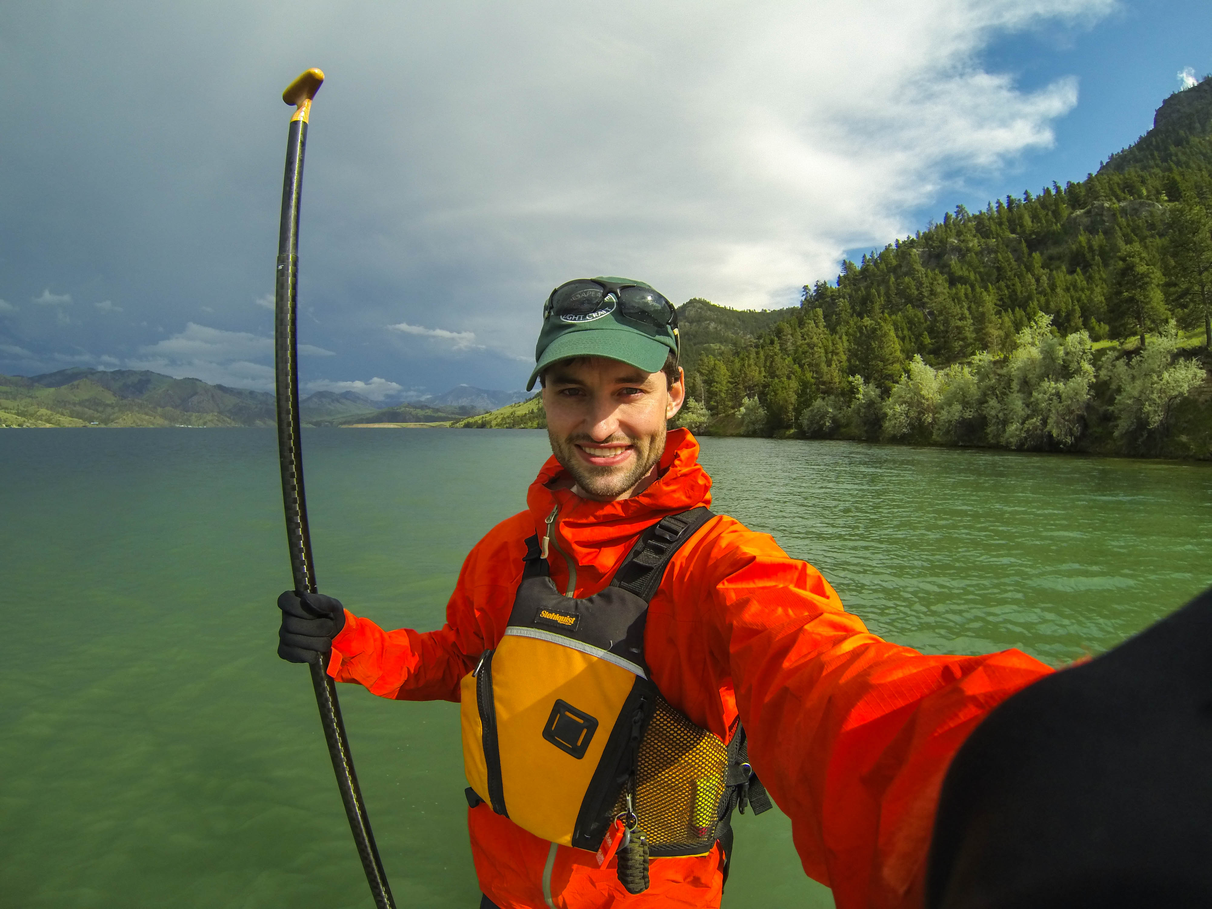
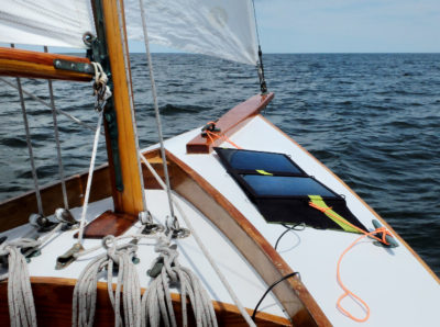
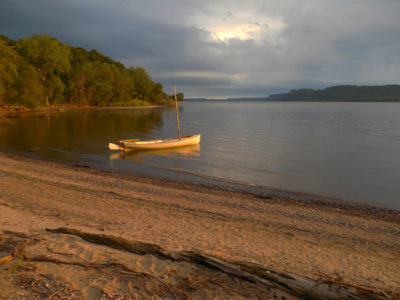
In early June in southern Montana the last light of day lingers for a long time. The mountains across the valley were still full of snow that would eventually melt and flow into the Missouri River. The day before the launch my friend Josh and I arrived at the Missouri Headwaters State Park in Three Forks where the Madison, Jefferson, and Gallatin rivers connect to form the Missouri. I was nervous, wondering how I’d maneuver my stand-up paddleboard with 100 lbs of gear, water, and food.
I secured my gear on deck. With my quick-dry pants rolled up and water shoes tied tight, I set a foot on the board, planted my paddle on deck for balance, and pulled my other foot out of the icy water and splashed it down on the deck pad. The water ahead was streaked with white. When a cowboy lingering outside the motel the night before said, “You know there are rapids on that river?” I’d brushed him off. Now I was fighting the urge to kneel on the board for balance. River rocks flew by as I gained speed. I took the rapids head on, hoping I wouldn’t slam into a submerged rock. Water crashed against my well-secured dry bags, as I flexed my knees to stay connected to the board. The water soon smoothed out, and I was still upright. My years-long dream was now my reality.
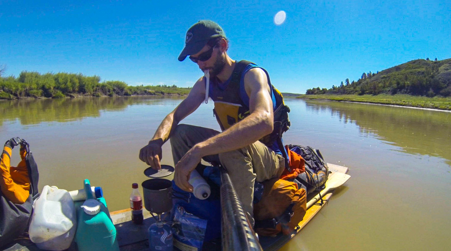
The first few small lakes were a much bigger challenge than I anticipated. After walking along shore I reached an area sheltered from some of the wind and was able to paddle to the last dam for about 240 miles.
After two days the fast water gave way to the first of nine lakes. During the late 19th century and the first half of the 20th century, 15 dams were built for flood control and electricity. This changed the river and made it harder to paddle. Canyon Ferry Lake is 44 miles from the headwaters, and at 25 miles long and as much as 5 miles across, was my first true test.
Huge white pelicans, surprisingly numerous, clamored on sandbars as I reached open water. It was dead calm, so I headed out, hoping to make the dam in a day.
The log I sat on to eat lunch was 30 vertical feet up the bank, evidence of how much the water level can fluctuate. Weekend fishermen headed back to the boat ramp as whitecaps rolled from the direction I needed to go. Within the next couple of hours headwinds had built to 30 mph. After covering only 8 miles, I wasn’t ready to call it a day and wanted to see if I could make progress walking the board. My feet twisted and slipped on softball-sized rocks as I pushed my board forward with my paddle and steered it with the bow line. I pushed forward at less than 2 mph.
After four hours, I headed for shore. I pitched my tent next to a dirt wall that looked like someone had sliced a hill in half with a knife; the hills surrounding the lake have been eroded in the 60 years since the dam was built. The sky went from pink to dark purple. My feet were in good shape for being submerged and pummeled on rocks all day, but I still had almost 700 miles of lakes still ahead.
My alarm jarred me awake at 4:55 a.m. There was enough light to see that the water was calm. I packed quickly, to get in some miles before the wind kicked up. Breakfast was bites of an energy bar between paddle strokes. The riverbanks were jagged yellow rocks, with coves fit for a seacoast. Fat carp darted everywhere. The Canyon Ferry Dam was just a couple hours away. My confidence had grown traversing the reservoir, and I’d learned to enjoy each day without worrying about what was ahead.

After watching an incredible sunrise fill the granite canyon I paddled downriver to a trailhead. A quick hike brought me to this lookout where Lewis and Clark had stood over 200 years before.
Meriwether Lewis wrote in July 1805, “This evening we entered much the most remarkable clifts that we have yet seen. These clifts rise from the waters edge on either side perpendicularly to the hight of 1200 feet… the river appears to have forced it’s way through this immence body of solid rock… from the singular appeaerance of this place I called it the gates of the rocky mountains.”
Here the sloped, green banks abruptly transition to walls of granite and the twisting river’s walls overlap, giving the appearance of stone gates. I paddled hard to enter these gates before nightfall in order to watch the sunrise fill the canyon the next morning. I set up camp on a rare flat spot on the inside bend of the river. The river didn’t flow fast enough here to produce a sound, and the birds were quiet as I lay tucked among the pines.
Fog hung over the river and moved toward me as clouds followed the canyon’s path. The reflection of both canyon walls on the river was revealed as the sun transformed the distant sky a bright pink. Trees high on the cliffs became more defined, and the dew on my tent glistened. I ate some instant oatmeal, not wanting to leave but eager to see what was around the granite-lined bend.
I walked into the blasting wind along the shores of one of the Missouri’s “little” lakes. Waves tried to rip the board from my control and throw it against the rocks. Swallows darted in and out of their nests 15’ above me.
I arrived at a campground by the Holter Dam. After setting up camp, I walked to a store in a marina. There was a freezer full of microwave food. The white-haired lady working the counter looked a bit concerned as I zapped an armful of frozen food while eating an ice cream sandwich.
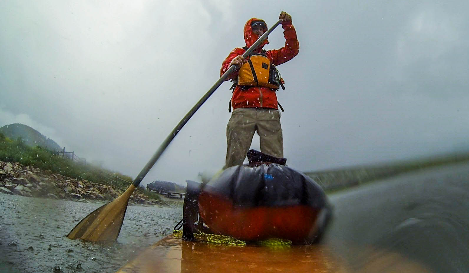
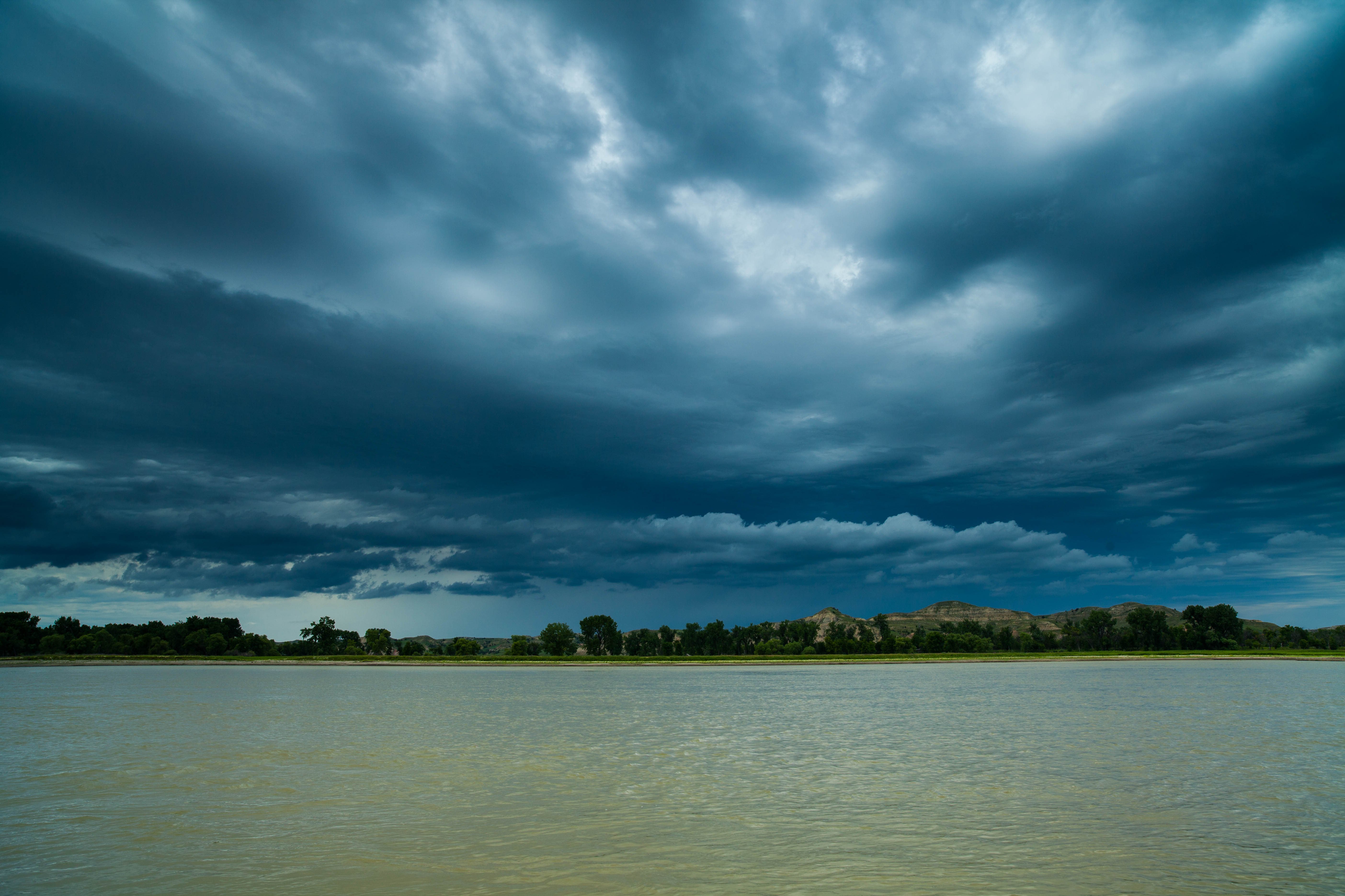
The previous night I endured a hail storm so severe I though my tent was going to collapse. As I launched the next day just above Craig, Montana, the rain started again but I didn’t care. I was around the last dam for a couple weeks and I was flying along at 7 mph.
Thunder ripped into my ears. My tent poles strained against the wind and hail loudly reverberated off the nylon. I pulled a dry bag over my head, ready for my shelter’s collapse. I could feel water flowing under my tent.
After spending the morning drying everything out, I asked the campground host for a ride around the dam. As we approached the boat ramp, it started pouring again. I pushed off into an incredible current. My GPS indicated 7 mph. My worries vanished like the raindrops into the river. The cold water rushed over polished stone as colorful as a trout’s body. I flew past a dozen drift-boaters. Many called out, “Where ya’ coming from?” I’d reply, “Three Forks.” “Wow that’s a long way. Where ya’ headed?” A look of confused contemplation came across their faces when I replied, “St. Louis,” for the first time truly believing myself.
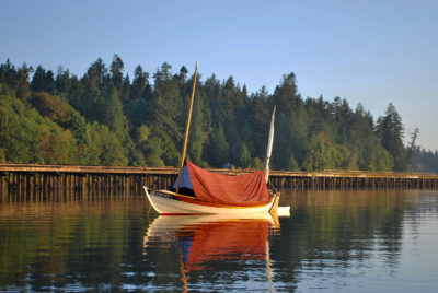
After a few days’ rest in Great Falls, my dad arrived to travel the next 150 miles with me in a rented canoe. We headed into the White Cliffs of the Missouri River Breaks. The current gave us a good boost without being overwhelming. For seven days we floated past white sandstone cliffs and wind-carved monoliths. The banks were ankle-deep with mud and thick with mosquitoes. The miles were easy, so we took many hikes, once being turned back by spooked stampeding cattle.
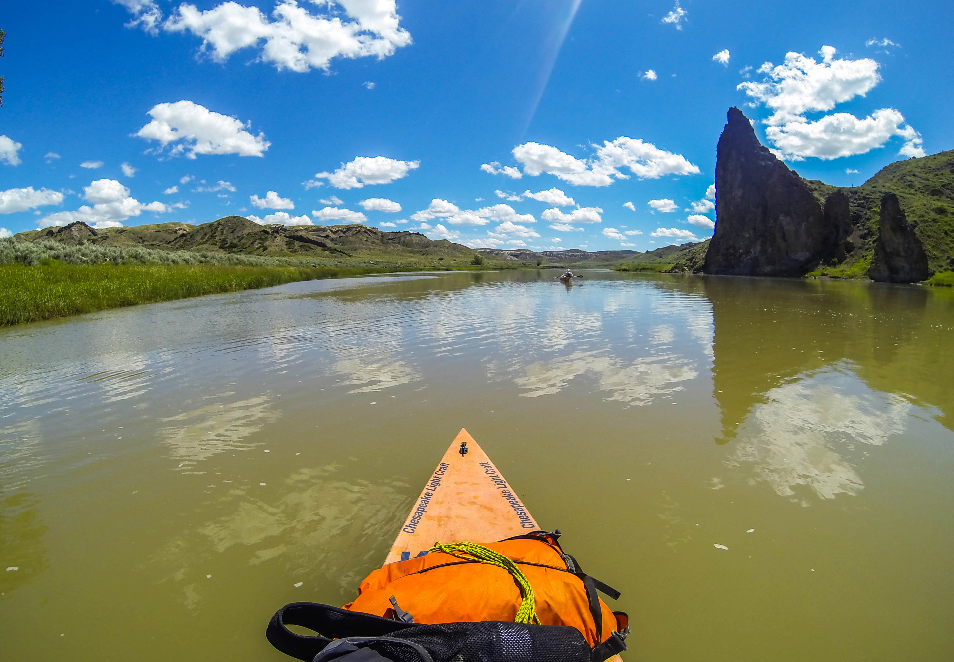
The current in the section I paddled with my dad was strong enough to allow us to make miles easily. We could afford to meander downstream and enjoy the unique rock formations— such as Citadel Rock seen here—around every bend.
Beavers slapped their tails on the water every 1,000 yards as we neared the James Kipp Recreation area. We lugged our gear and boats to the campground. It was hot, but we wore our rain jackets to get some relief from the worst mosquitoes I’d ever experienced. The fire pits were under the floodwaters, so I built a fire on an elevated cooking grate to smoke out the pests. My gear was filthy, and I’d never felt so grimy in my life.
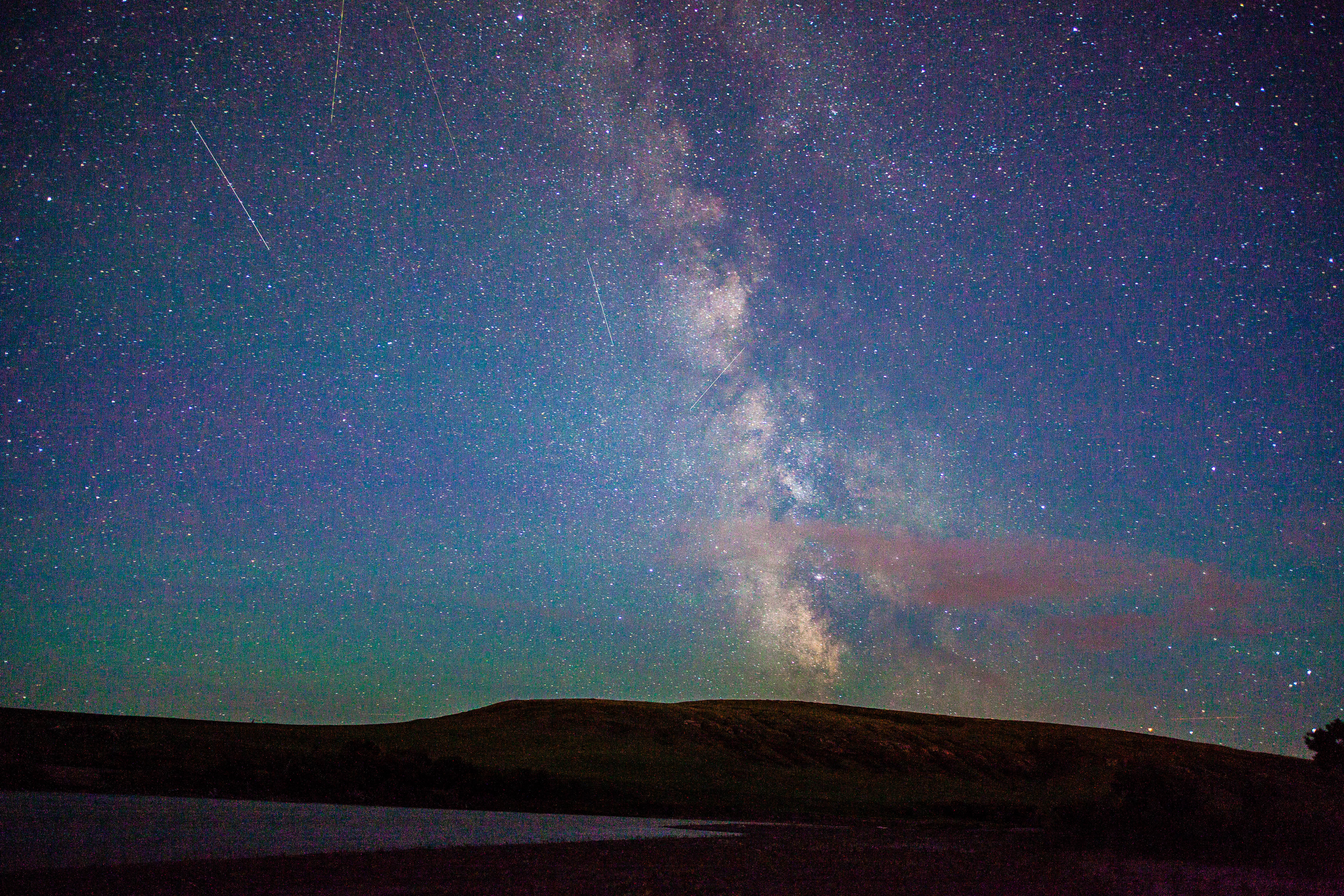
I staggered out of my tent to pee, hoping get quickly back to the comfort of my sleeping bag. The brilliance of the Milky Way changed my plans and I went for my camera. It was hard to believe the sky was so dark only a half-day’s paddle from Great Falls.
In the morning we said goodbye and I turned my thoughts to Fort Peck Lake. There wasn’t a Montanan who didn’t warn me about how quickly things could deteriorate on the 130-mile-long reservoir. Sticking to the shoreline wasn’t possible since much of lake has long peninsulas that form coves a mile or more deep. I could save days by crossing 2- to 4-mile stretches of open water between peninsulas, but only if I got breaks in the weather.
My first day was calm. I woke at first light and stepped out of my tent. I was totally alone but more content than I’d been in years. The weather radio had been silent each time I’d tried. I was in one of the most isolated spots in the lower 48 and far from a signal. I packed quickly to get on the water while the conditions were still calm. For four days, I fought against persistent headwinds. Making 20 miles was a good day, and nights I’d drift off to a coma-like sleep.
When the conditions allowed I often cooked lunch on the board to gain a couple more miles. I was always eager to catch a free ride where the current flowed between the long stretches of still water in the reservoirs.
After reaching Fort Peck Dam I had a week of strong current, which carried me to Lake Sakakawea. There the current stopped and the river widened into the 160-mile-long reservoir. I hid my gear in the brush by a bridge and walked up to the road and stuck my thumb out to get a ride into the oil boomtown of Williston, North Dakota, to resupply. After just two minutes a dilapidated red minivan pulled over. I walked to the door and climbed in as the young driver moved a skillet holding his breakfast off the seat and added it to the pile in the back. He told me the oil fields were a tough place to work, but he pays for college in cash with his summer earnings.
It was my seventh day on Lake Sakakawea and I’d seen some big water. All night I’d endured 40-mph gusts blowing against my tent, so I was happy to be able to paddle. There was a 20-mph tailwind, but it was kicking up 4’ waves, holding my pace to half of what it would be in calm conditions. My progress was painfully slow. A wave crested at just the wrong time, and I took my first fall of the trip. My top-heavy board capsized. I was in the middle of the widest section of the lake where it takes a dogleg to the left. The extra layer I pulled on in the crisp morning clung to my skin under my PFD. I tried to remain calm and take inventory. The only thing that floated off the board was my water jug; the rest was tied on. I got my arms under the board and after two attempts righted it and scrambled back on and collect the stray jug.
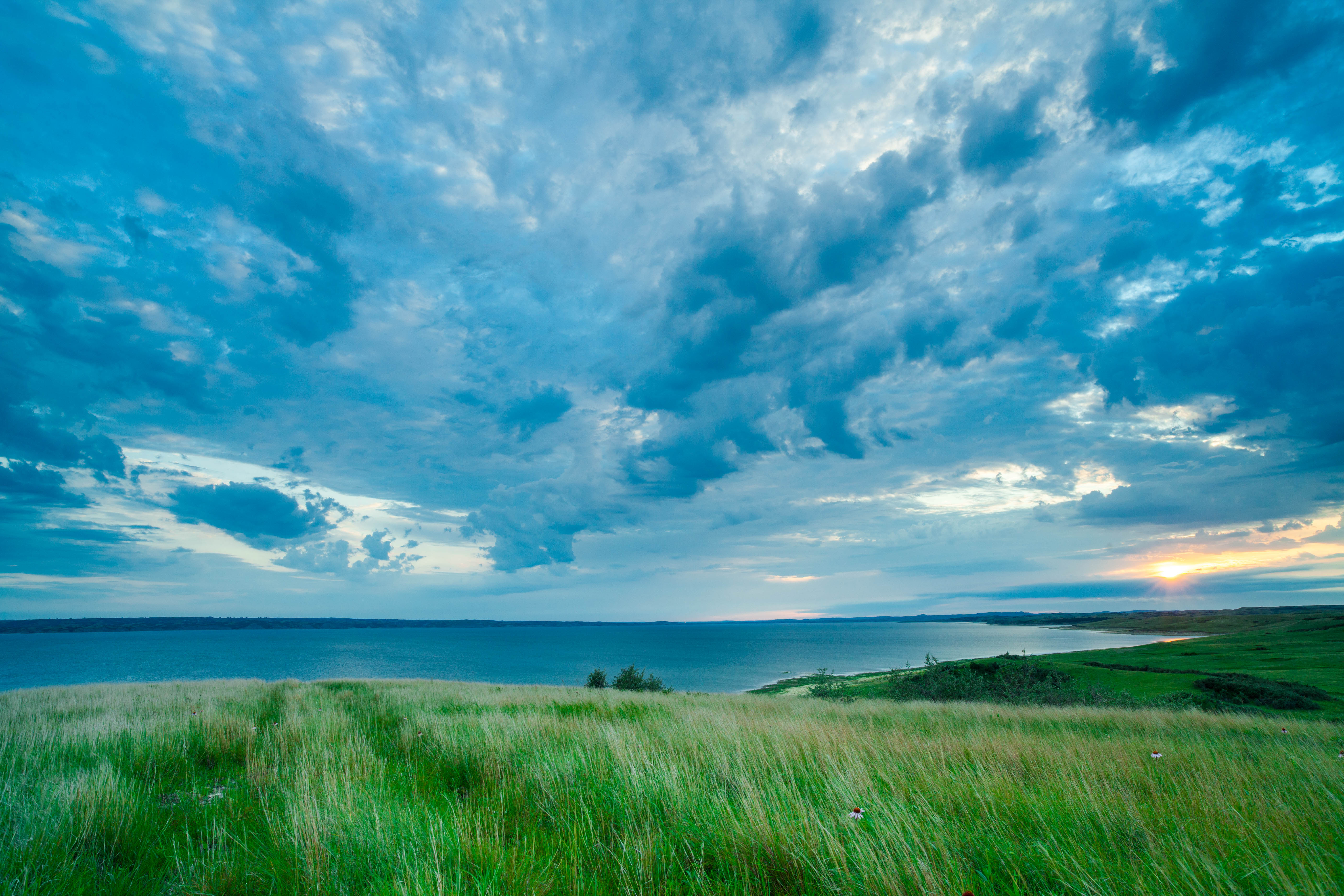
Lake Sakakawea held the best sunsets I’d ever seen. The colors were different each night and were a reward for the work I’d put in that day. My campsite this night had trails up to the bluffs where I could see the vastness of the giant lake.
The following day continued Sakakawea’s routine for me, a 12-hour day of good conditions, followed by a day of wind so strong it would be foolish to leave shore. I stopped at a campground that sold ice cream and had gloriously hot, coin-operated showers. The previous day I’d been forced to spend the day ashore. I was in a rocky cow pasture exposed to the wind. The little things can make a big difference.
A few days and a lot of big waves later, I was on the other side of the Garrison Dam and just a couple days from Bismarck. A park ranger gave me a ride around the dam, and I paddled only a few hours before I had to stop on a sandbar in the shelter of a steep bank and set up my tent to get out of yet another oncoming thunderstorm.
The next day I felt the welcome pull of the current and headed into Bismarck. I would have thought it was a holiday weekend from the amount of boat traffic that was on the river and not a regular Monday. I guess when your winters are as hard as they are here, locals have to make the most of their summer. Many of the boaters were significantly inebriated, judging by the dozens of slurred questions and beers tossed my way.
After a weeklong break in Bismarck, I was off to tackle Lake Oahe. At 220 miles, it’s the longest of the lakes. The shore was a never-ending wave of rolling green, treeless hills. Everywhere else on the river the scenery had changed enough to make me curious about what was around the next bend, but here for 10 days everything truly looked the same. While it might have been my most challenging obstacle of the trip, I got lucky with weather, for the most part.
After this storm passed I headed back out only to get trapped on the water by high banks. I settled for a muddy and sloped spot to make shelter as rain pelted me and lightning shot through the air.
As I drew near the Oahe Dam I knew a storm was coming, so I had kept paddling after dark and used the lights on the dam and my GPS to navigate to the ramp at the end of lake. I made camp in the dark and fell into a deep sleep. I woke feeling like a log washed up on shore. My creaky body was slow to get moving, and the air was thick with the humidity that comes right before a heavy rain. A south wind was ripping up the lake. I was ready to be in the civilization of Pierre, South Dakota, for a day off. I set out the next afternoon to begin knocking off miles. Ahead I had the last three lakes and 200 currentless miles.
The wind was ruthless. Most of the energy I put forth went toward just keeping my place. The camping options had been abysmal the last few days, so I settled for a patch of gravel under a 20’ vertical bank below a cow pasture, and cleared away driftwood to set up camp. I woke in the night to hear a rustling, but figured it was just the wind and passed back out. In the morning I awoke groggy, and turned my head to the left to see a few tiny brown objects in my hat. A mouse had chewed a hole through the side of my tent and pooped in my hat!
I had fought aches and a fever for a week but pressed on. Current was not far downstream beyond Gavins Point Dam, and I needed it. My final day on both Lake Sharpe and Francis Case Lake was spent walking miles along shore to make the dam. The wind continued, unrelenting for days, so there was no sense waiting for better conditions. All of a sudden the empty green hills were lush with pine trees and golden rocky cliffs. It seems as if I’d been transported back to Montana, and my mood lightened with the improvement in my surroundings.
A river angel named Jarett Bies contacted me on Facebook and offered to give me a ride around the dam and put me up. I spent the night in a comfortable bed, but I was dropped off at the river before first light so Jarett could make his early work shift. The river was barely visible in the dim bridge lights. Convincing myself that it wasn’t safe to head out on the water, but knowing I really just wanted more rest, I weighed my options. The grass was covered in heavy dew, so I opted for the dry bike path and let the sun be my alarm. A car door slammed shut. I opened my eyes to see the sun had risen. I remembered I was sprawled out on an asphalt bike path in full view of a parking lot that now held several cars. I’d camped in a city park in Yankton, South Dakota.
I looked down at the water as the floating dock slowly bobbed under my weight. Patches of foamy bubbles drifted by at a tortoise pace. I filled with energy at the sight. The water had finally been released from the last of the 15 dams on the Missouri. The tops of the trees were just holding on to the last edge of the sun as it rose over the far bank. Golden rays poured over the silhouette of the forest and landed on the fading fog hanging over the water.

Barges navigate the last 750 miles of the river. There is an immense amount of fear surrounding the danger barges impose on a paddler. I gave them plenty of room and enjoyed the site of them chugging along.
I had paddled over 1,500 miles, almost half on currentless lakes. The channelized section of the river was all that remained, and these last 800 miles would take just three weeks. It alone was longer than any trip I’d ever taken, but it would pass too quickly. The current was too good to be true. After cursing the winds and lakes of South Dakota for weeks, I couldn’t imagine such speeds as 5 mph. The forecast was for 100 degrees with strong winds, but I didn’t care. I loaded my board knowing that I’d make distance and wouldn’t have to walk alongshore again for the rest of the trip.

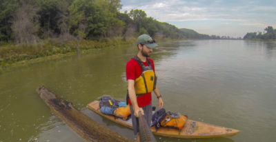
I had seen huge downed trees littered on the banks for almost 2000 miles but rarely saw one in the water. When I saw this one floating in the middle of the river just before Omaha I decided to stand-up paddle it until the next bend in the river.
Water lapped against my board as I pushed off. The current slipped under the flat surface of my board, and I just plunged my paddle in to grab a hold of it. It took just a few strokes to get moving, but I halted paddling to watch the riverbank move past. Current. Sweet, sweet current.
I paddled through Sioux City, Omaha, Kansas City, and many small towns in between. The river there is lined with riprap and hundreds of wing dams to control the flow to allow for the safe passage of barges. Many people warned me of the danger of a barge wakes, but they were nothing compared to the waves I encountered on the lakes.
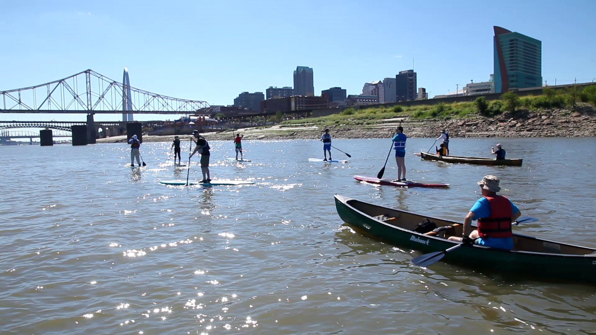
My solo trip ended with friends and family paddling with me to the Gateway Arch in St. Louis. I had the support of so many friends and strangers along the way that finishing surrounded by people was a perfect ending to the journey.
I ticked off 50-mile days. Nearing Glasgow, Missouri, a quaint town along the river, I fought off the impulse to count miles and relaxed. Thin clouds promenaded across the sky. As the day ended, blue sky met soft golden light and there was a slight chill in the late summer air. St. Louis drew closer and I enjoyed every moment. Life had been simple for 107 days. I had only what I could carry on my board. My pace of life slowed speed and I appreciated chance encounters and simple pleasures.
I will never see the Missouri River as a line on a map again. I’ll always feel its motion, hear its sounds, and see at every point along that winding line, driving rain and spectacular sunsets from the solitude of my camps. The journey far exceeded even my loftiest expectations. ![]()
Scott Mestrezat grew up in Michigan with a passion for the outdoors, but his college education landed him at a desk job in Chicago. He dreamed about getting away from the city and embarking on an expedition under his own power, and set his sights on the Missouri River. His website, Missouri River SUP, is devoted to this voyage, and on the site you can find a trailer for the movie he made about it, Big Muddy Moose.
Join The Conversation
We welcome your comments about this article. To include a photo with your remarks, click Choose File below the Comment box.