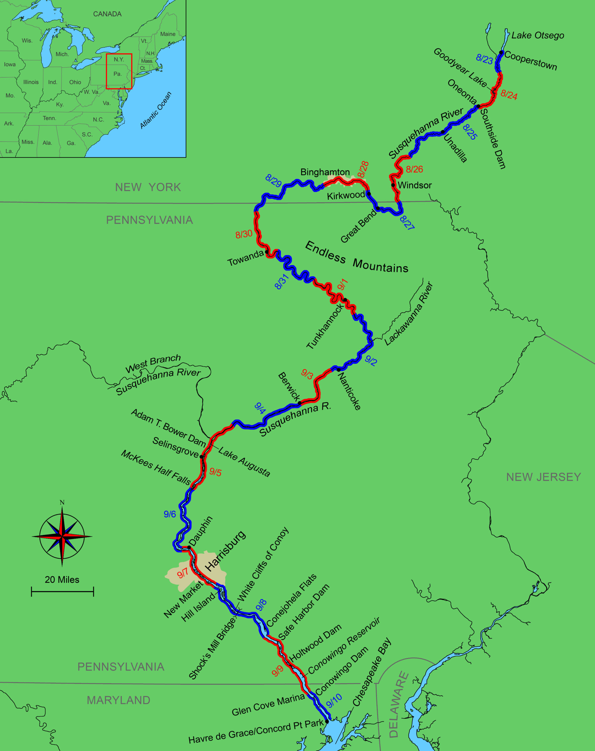
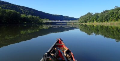
It was August 23, 2024, when I launched my 14′ 6″ Northstar composite solo canoe at midday in Cooperstown, New York, on the tree-lined banks of Lake Otsego, the source of the North Branch of the Susquehanna River. As I set out for Chesapeake Bay, 444 miles downriver, my progress was slow. The river was shallow and narrow enough to be spanned by fallen trees, which I had to crawl through or clamber over. Cornstalks littering the river’s edge had been cut by beavers from fields behind the riverbanks. One beaver, startled as I went by, raced down the bank, tripped, and rolled into the river with a great splash.
 Photographs by the author
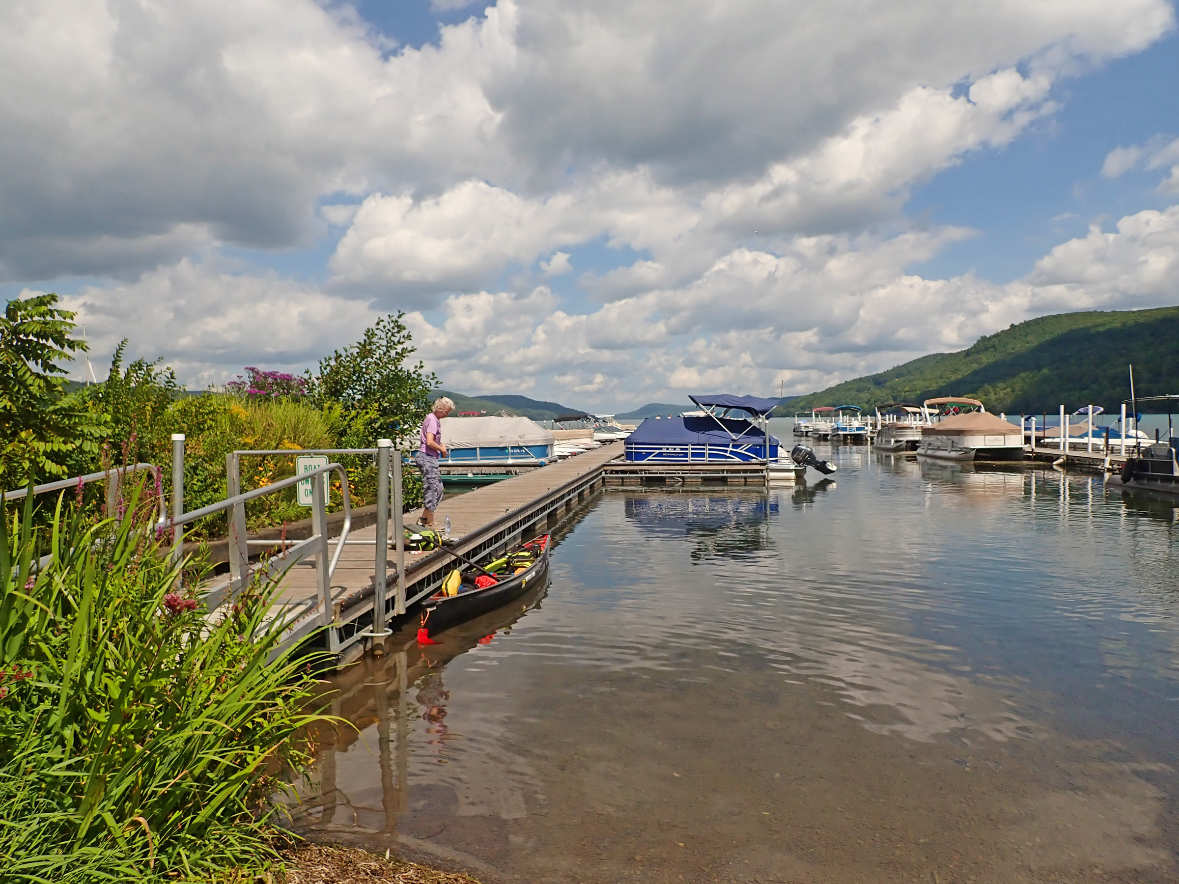
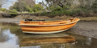
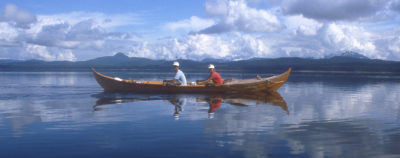
I set off from the dock at Lake Front Park in Cooperstown, New York. Before I left, my wife “reviewed” my packing job.
After five hours of paddling, I was 11 miles downstream and hunting for places to camp; another hour and I found a cobble bar overhung by a large willow tree where I could set up a tent. A half dozen mosquitoes whined around me as I got dinner down and settled in the tent. During the night I was roused several times by the slaps of beaver tails on water, but each time I quickly fell back asleep, gazing up at the willow-tree leaves silhouetted on the tent in the silver moonlight.
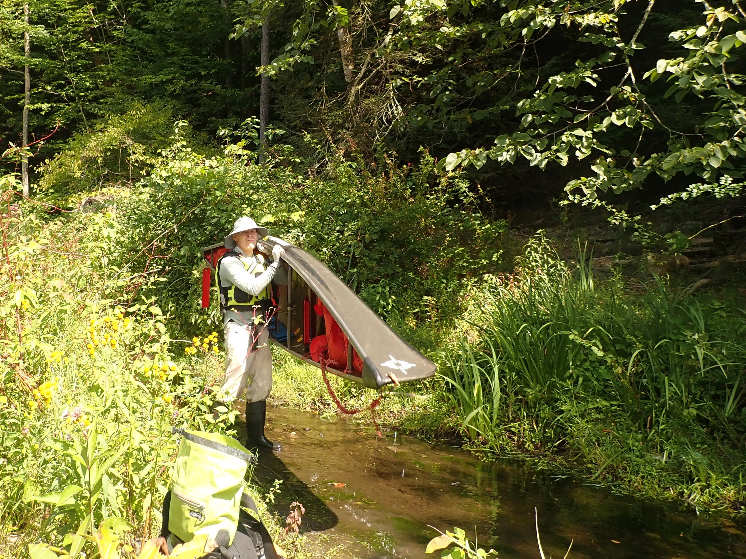
I had read several descriptions of paddling this river and anticipated it would take me close to three weeks to reach Chesapeake Bay, doing 20–25 miles a day. The river should be mostly slow-moving (with a maximum current of about 2 mph), but there were a number of low and high dams to get around, as well as a few Class II rapids to deal with. While fairly wide for much of its length, the river is generally shallow and rocky, so I would need to be attentive to my position in the current. There are few designated campsites along the river, so I would be finding suitable sites where I could.
August 24
In the murky light of early dawn, the opposite bank was a dark blur in the morning fog. I dressed in layers and dragged myself into the cold morning to start packing. When I got underway, the serpentine river was just deep enough to float the canoe, but I chafed at my slow progress in the gentle current and shallow water. Silver maple and willow trees towered over me. After three hours the river opened up into the mile-long Goodyear Lake. At the south end, a 220-yard trail led through open second-growth forest around the dam to the river below. The first 50 yards of portage were too steep and uneven to allow me to wheel the laden canoe. I unloaded everything and walked back and forth several times, first carrying the 30-lb canoe, then the gear. Safely down on the far side, I repacked and pushed off. Over the next couple of miles, the river shallowed half a dozen times, forcing me to get out and walk the canoe over the rocky riverbed in the pleasantly cool water.
I had to carry the canoe around the dam at the south end of Goodyear Lake and then follow a trail along a creek to the river to find water deep enough to paddle in.
By 2 p.m., I had paddled a total of 19 miles and reached a second portage at the Southside Dam near the town of Oneonta. The trail entrance was poorly marked and obscured by foliage, and while I knew it was there, it was only after I had paddled back upstream, away from the dam, that I realized I had paddled right by it, mistaking it for a small fishing spot. The portage was a narrow trail through bushes and small trees, but a fisherman kindly helped me carry the canoe and gear in a couple of trips.
Four miles past the dam, there was a short, rocky 12″ drop extending across the river. It was fairly obvious, but came up sooner than I expected—I had been making good time. It was straightforward to run without problems down the right side where the drop was spread over a distance of about a dozen feet.

Four miles beyond Southside Dam near Oneonta, I encountered a rocky ledge, which created a 12″ drop across the river (seen here as I looked back from downstream). I successfully ran it along the right side (at left in the picture). Rocky ledges spanning substantial breadths of the river were common, even as the river became much wider.
At 5:30 p.m. I pulled to the side of the river to camp on another cobble bar. By the time I had the tent pitched and dinner eaten, the bats were out, flitting back and forth overhead. I tried to stay awake long enough to see the stars come fully out but was lulled to sleep by the gentle murmur of the river.
August 25
In the pre-dawn dark a great blue heron, flying low over the tent, croaked loudly. It was only 3:50 but I was now thoroughly awake and got out of my sleeping bag. Though everything was damp, I broke camp, loaded the canoe, and was soon launched under clear skies.
By noon I was beyond the town of Unadilla. It had been a relaxing, smooth morning but as I took the inside corner of a bend in the river, the bow of the canoe caught on a barely submerged log sticking out of a wood pile by the water’s edge. The canoe flipped and I was dumped into the water, losing contact with the boat but not my paddle. I swam to shore in the deep, swift-moving water, clawed my way up the steep rocky bank and looked upstream. The upside-down canoe had hung up on another log. I crawled out on the log to the canoe, got it off, swam it to shore, pulled everything out, and bailed it dry. I had lost only my pride and my shoes, which I had kicked off to let my feet dry. I fashioned some sandals out of my foam sit-pad and some duct tape; they would have to do until I could find a shoe store. Everything else was in drybags so mostly stayed dry, and the clothes I was wearing would drip-dry as I paddled on. Another 15 miles down the river, I made camp on the cobblestone shoreline and spread out the maps to dry—my map case was not totally waterproof.
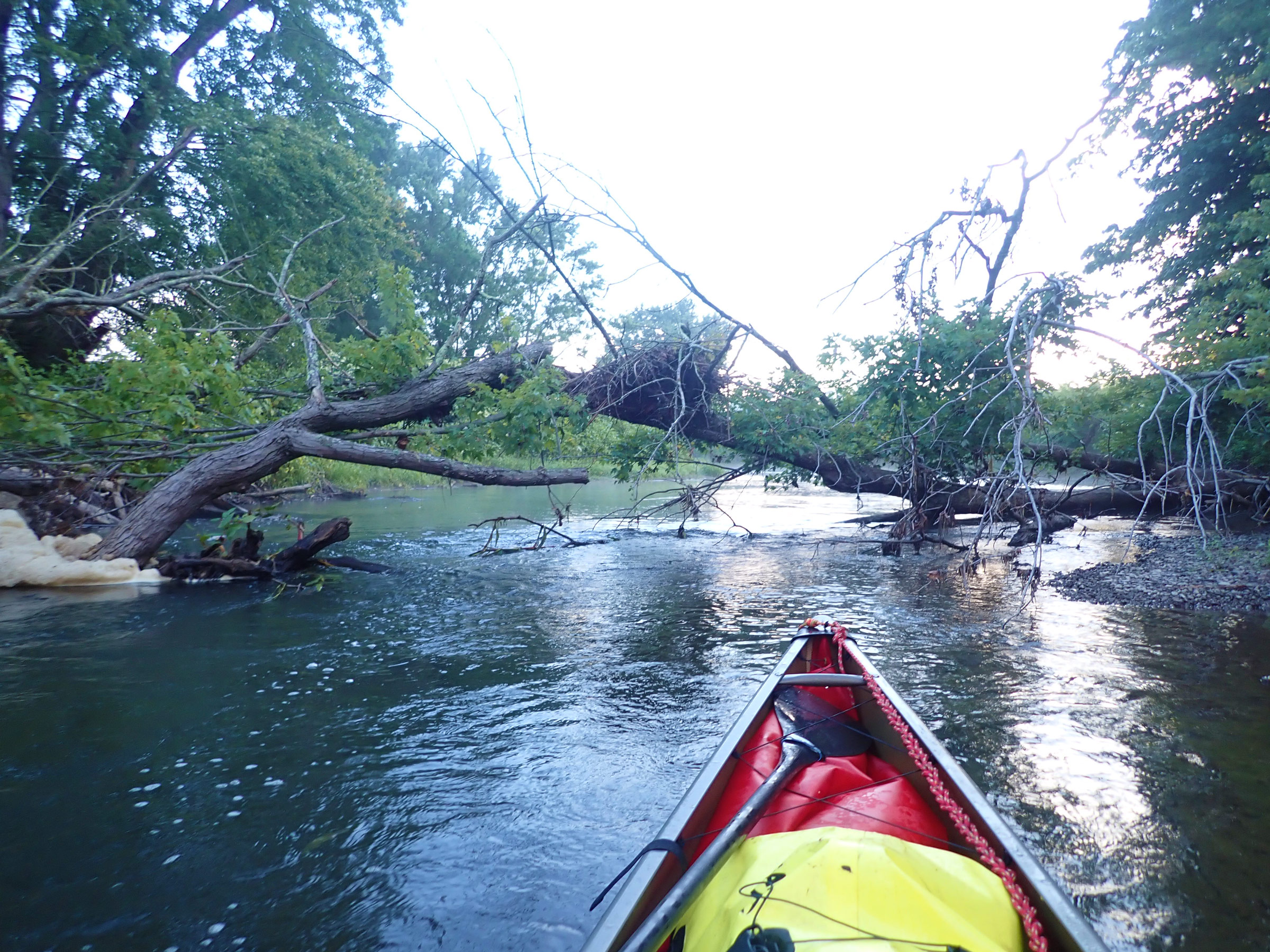
For the first three days, woody debris occasionally spanned the river, adding challenges to my downstream progress, and at times, causing me to struggle to stay both safe and dry.
August 26
When I set out the next morning, the river was noticeably wider, perhaps several hundred feet wide on occasion, where the water was so calm it felt more like a lake than a river. Between these quiet areas were small rapids and 30′-wide back-eddies wherever the current picked up.
Eighteen miles downstream I came to Windsor, the first town I had been through since leaving Cooperstown. At a store near the river, I bought flip-flops, water, duct tape, and some chocolate. By day’s end, I was good and tired—the physical and mental exertion of focusing on river conditions had taken a toll—and when I saw the primitive campsite with a picnic table atop a small bluff, 30′ above the water, I was only too happy to stop. The landing was mud and rocks with a steep trail up to the campsite. I carried some logs from the campsite down to the bank and dropped them in the mud to make the footing less treacherous while unloading the canoe. I tied the canoe to a bush along the bank, carried the gear up to the campsite, and settled in at the picnic table.
August 27
Mist insinuated itself everywhere as I arose the next morning, and the dampness slowed my packing up. The mosquitoes from the adjacent wetlands were relentless, and I decided to take a walk. A trail through the woods behind the campsite was perfectly straight and followed a retired turnaround for locomotives that had once moved trains through the nearby mountain pass. I walked the trail for 15 minutes before heading back to camp. By the time I had all my gear down the slope, across the rocks, and over the logs, the fog had burnt off.
Many houses along the Susquehanna are either built on stilts or hide behind substantial dikes. Flood waters may not have reached this house at the top of a bluff, but they had significantly eroded the bank underneath it.
Three miles downstream near Oakland was a 2′-high rocky weir with a narrow chute to the left. I saw no portage, took a close look at the chute, decided it appeared clean, and carefully paddled through, happy to find no hidden rocks. Downstream of the weir the river slowed and widened again, the slack current giving me little forward motion under sunny skies.
Another 10 miles and a gently sloping riverbank and mown field provided easy access to Great Bend, Pennsylvania. I pulled ashore, and walked into town for groceries and cheap shoes; a sandwich rounded out my shopping. Farther downriver, at a park in Kirkwood, I found drinking water and bathrooms.
That evening, less than a mile downstream of Kirkwood, I pulled ashore at a 5′-wide strip of cobbles between the water and a copse of young sycamore trees. I made camp in the company of a little green heron fishing and a killdeer darting around and piping.
August 28
I paddled through the outskirts of Binghamton, tied up just past the city’s first bridge, and walked into town, stopping first at a sporting-goods store to buy some real shoes—the cheap shoes had served their purpose, but they were giving me blisters. I had thought of exploring the town, but indications of people living under the bridges and in the bushes along the river made me nervous about leaving the boat for long. I bought what I needed and hurried back.
The 5-mile stretch of river that runs through Binghamton and adjacent Johnson City had been weighing on my mind since I left Cooperstown. Beyond the bridge where I’d stopped, I would encounter four low-head dams and had scant information about either the conditions I’d encounter or the portage details. The first dam was straightforward; the right bank had an easily-accessed wide dirt road—along which I could pull the fully loaded canoe on the set of portage wheels I had brought along—but on the downstream side, the riverbank was muddy; stepping aboard without getting everything dirty was tricky. At the second and third dams there wasn’t much of a drop in the water level, and I was able to line the loaded canoe through as I walked along the bank. The last dam required a portage along a couple hundred yards of trail too narrow and uneven to use the wheels. I unloaded, carried the canoe and gear in several trips, and, at the downstream side, spent several minutes negotiating a rock-and-mud foreshore to get back in the water.
All told, it took four hours to transit the four dams, and it felt good to be able to focus again on just moving down the river. The heat hung on as the day waned, and by the time I was ashore once more and making dinner, I had stripped down to my shorts but was still bathed in sweat. I decided to trust the no-rain forecast for the night and turned in without the fly on the tent, hoping to catch any breeze.

I wheeled my canoe and gear around the first dam below Binghamton. This was one of the two longest portages of the trip, and I was happy to have wheels.
August 29
The river was wide and still, with the occasional short reach of swift water. A gray sky and no wind made for contemplative padding, enlivened by an encounter with five otters that raced along the bank; two swam out to check me out. Even in the middle of the river, the mergansers, little green herons, kingfishers, great blue herons, cormorants, and bald eagles were readily visible and kept me company. At day’s end I found the established campsite but it was little more than a tree-root-laced mud hollow on the riverbank and I decided to set up camp on the adjacent cobblestone bar, grateful that the river was low and not likely to rise overnight unless there was a heavy rainfall. The clouds threatened rain, but it held off until I was in bed and asleep. There was, indeed, an overnight shower, but by morning it had passed through.
August 30
The day began calm and misty, but soon transitioned to a blowing mist with a headwind ruffling the Susquehanna, now at least several hundred yards wide. Close to lunchtime, I pulled in to walk up a short path and into Towanda, a quiet town of two- to four-story buildings offering social services, tourist souvenirs, restaurants, and shuttered shops. I scarfed down some faux-Mexican food and a bagel before heading back to the river.
 Roger Siebert
.
I was now well into the northeast corner of Pennsylvania, a region called the Endless Mountains, although it might more aptly be named the Endless Meanders. The river wound its way through a steep landscape that often towered 500′ above me on one or both sides. The slopes were blanketed in dark-green pine trees that contrasted with the large sycamores and maples along the river’s floodplain. Below me, a massive fish, some 7″ across and more than 2′ in length, slipped away beneath the canoe.
The current was minimal, adding only about 1 mph to my speed, so I was grateful for the gray skies that kept the sun off as I worked the paddle. When I arrived at the marked campsite near 5 p.m. (more than eight hours after setting off that morning), it was to find another unappealing mud-hole, this time among the trees at the top of the riverbank. Disappointed, I scrambled back down to the boat and set up camp alongside the river.
August 31
Through the following morning, a thick layer of stratocumulus clouds and even a light rain kept the sun off. As I approached a shallow side channel that branched off to parallel the river, a black bear splashed across it some 200′ ahead of me. I cautiously approached to see where it had gone but, hearing it in the knotweed close by, decided that paddling in the main channel, well away from shore, would be safer.
The river now averaged 500′ in width and houses occupied the occasional low flat spots scattered among the steep tree-covered slopes. The slower sections had numerous gravel bars just below the surface, and I had to get out and walk the canoe through to the next deep spot more than a few times.
I set up camp on a gravel bar, choosing a spot beneath overhanging silver-maple branches, which I hoped would keep the worst of the morning dew off. A cicada chose the same tree, and around dusk, it started chirruping so loudly it drowned out the sounds of the river. It kept it up until around 4 a.m. Had I been less tired I would have moved the tent, but the rhythm of its song did at least allow some sleep, albeit not too deep.
September 1
It was Labor Day weekend and there was an increase in river traffic. For days I’d had the waters mostly to myself, but on that Sunday I passed 20 fishing boats and four kayaks.

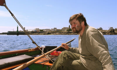
I usually had the river to myself, encountering only a handful of boats each day. This fisherman was creative about dealing with sun exposure and had mounted a patio umbrella on his boat.
The hilltops were lower now, dropping to about 350′, but from my vantage point on the river they were still impressive, and some were shrouded in cumulus clouds. I stopped in Tunkhannock, a small town with a single main street. I climbed up an aluminum ladder on the riverbank’s steep slope to begin the walk into town. The afternoon was hot and, after shopping for lunch and supplies, I was happy to sit and linger beside the creek at the edge of town. Finally, I roused myself and paddled on for eight more lazy miles to another riverside cobblestone camp.
September 2
A toad wandered around the campsite as I packed up and launched; I followed my usual pattern of eating breakfast after I’d gotten some miles in. As I paddled downstream the hills grew ever lower and the landscape more expansive with the river less sheltered. By afternoon rolling clouds had appeared and winds shifted from behind to ahead and back again. From the east, the Susquehanna was joined by the Lackawanna River, laden with mine runoff that for days after stained the Susquehanna’s rocks a dusky orange.
Five minutes downstream of Nanticoke, I encountered the first continuous rapids of the trip. It was little more than faster water moving over a shallow riverbed, but it took work to keep my sluggish, fully loaded boat lined up where I wanted it.
September 3
Overnight the temperature plummeted into the low 40s, but clear skies and sunshine soon warmed the day. By midday, scattered boulders broke the water’s surface, and the river was no longer flanked by hills; instead, gentle tree-covered slopes or simply a line of riverside trees dominated the scenery. Upstream from Berwick, I avoided the worst of a couple of turbulent rocky drops and on both occasions had to work my way close to the right bank where the gradient was more gradual.
I camped in Berwick in a large, well-tended green space with a bathroom, running water, and trash cans. That evening, at the sound of a whistle, 20 boats sped away from the ramp in a timed fishing competition, all seeking favorite spots from which to try their luck. They returned before darkness fell. In my tent, I dropped off to sleep listening to the fishing awards ceremony in the parking lot.
September 4
Packing up the next morning was made easier thanks to the picnic table, and I was eager to get going, if only to fend off the morning chill by paddling. The landscape had changed again: low wooded hills threaded with powerlines came right to the water’s edge and as I left Berwick astern, I once again had the river to myself. The water was deep and for the first time in days I didn’t have to worry about scraping bottom.
I settled for the night on a cobble bar backed by a steep poison-ivy-covered bank that rose to a working railroad. I slept well and woke with no memory of hearing trains passing in the night.
September 5
The river was now wide and unsheltered, and I expected higher winds as the day went on, so started early. As I approached Lake Augusta, I maneuvered around long, jagged rock ridges angling across the river. The West Branch of the Susquehanna merged from the right at the top of Lake Augusta reservoir—formed by the Adam T. Bower Dam—a 2,100′-long inflatable dam, the longest of its type in the world. There was a 1⁄2-mile portage along a dike starting just upstream of the dam. I wheeled the canoe full of gear on the dike-top road and then cut down steeply through a grass field to a boat ramp to get back on the river. A second portage around a low-head dam a mile farther downstream involved just a 10-yard walk along the shore. The short but untrampled grass suggested few people ever came this way.
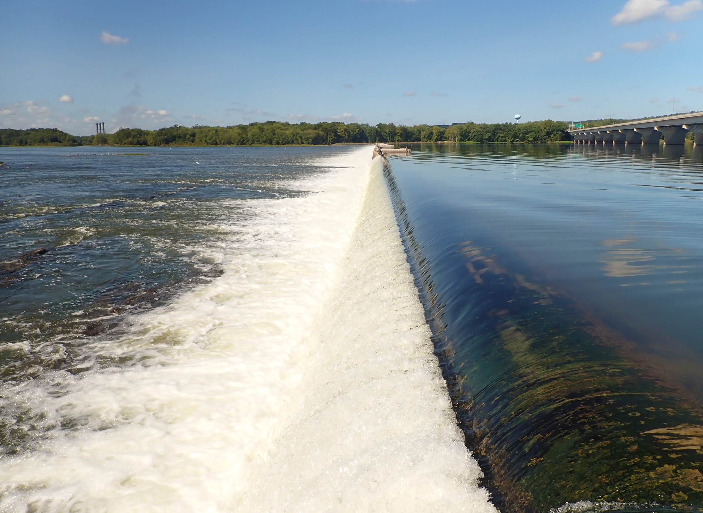
The Adam T. Bower inflatable dam was a mandatory portage. The take-out for it was no more than, perhaps, 20′ upstream from the lip, so I paddled tight to the shore as I neared the drop. Approaching dams like this was a tense part of the trip.
Beyond the dams, the river was abundant with eelgrass that swayed in the current. Spotted lanternflies, a large and colorful invasive plant-hopper, floated on the water and large patches of knotweed lined the bank.
McKees Half Falls is formed by two lines of boulders stretching diagonally across the river. The drops were less than 1′ and required just lining up in the water passing between the rocks (although I did have to maneuver a little to avoid one messy hole below the second drop). Farther on I set up camp below the railroad tracks. As I drifted off to sleep, a crescent moon shone through the silver maple behind me and the Big Dipper was bright in the sky.
September 6
I was now in the 50-mile middle-section of the Pennsylvania River Water Trail. The river was dotted with tree-covered islands with plentiful designated campsites and, after 8 1⁄2 hours of almost constant paddling, I chose a site that overlooked the water but was out of the mud and away from several standing dead trees. It looked like the rain would hold off, so I went without the tent fly and fell asleep to the sounds of busy insects.
September 7
The rapids by the town of Dauphin were the first challenge of the day. For the previous couple of days, decaying organic matter in the river had been churned by dams and rapids into finger- to hand-sized foam blobs on the water. It tracked the surface-water currents and helped me pick a course through the rapids and around rocks. Unfortunately, the day was windy, and wind-blown foam added some confusion, but I made my best guesses and hoped I would spot all the rocks before I hit them; I mostly succeeded.
The forecast rain held off until noon, by which point I was almost to the portage around the drop beneath an interstate bridge in Harrisburg. I pulled the canoe out of the water and waited out the worst of the rain under the bridge. At last, it eased up enough for a damp walk into New Market for groceries. By evening the rain was well gone, and after I made camp on the cobblestone beach below the train tracks, I sat on a boulder and watched the day’s last light yield to darkness.
September 8
Between the cicadas, the midnight trains, and the roar of jets at the Harrisburg airport across the river, my sleep had been spotty. I began the day by paddling toward the narrow mile-long channel that passed behind Hill Island. It was shallow and choked with boulders, but I took more epoxy off the paddle than the canoe. Beyond the island, I paddled through a maze of eelgrass that reached the surface and swept against the hull.

I threaded my way between the boulders that choked the channel between Hill Island and the right bank of the river. The visible boulders were of little consequence to my progress, but the barely visible submerged ones forced many last-minute course corrections.
The 30′-high White Cliffs of Conoy were bright and unmistakable on the left side of the river. I beached below this scar left by a 19th-century limestone and dolomite quarry, and followed an easy trail to the top so that I could survey the river and look for a channel through the upcoming river-wide ledge. Returning to the river, I was happy to find that the channel I had selected was, indeed, clean and I continued downstream unscathed.
I stopped on the left shore above the 120-year-old Shock’s Mill Bridge to examine the rapids just beyond. The arch nearest shore (the bridge has 28) was dry, the current in the second split around boulders, but the third and fourth arches led to a smooth wave train undisturbed by rocks. Back in the canoe, I wove around the rocks in the shallows at the top of the rapid and then had a straight shot at the third arch in the 4-mph current. Waves splashed in over the bow briefly, but there were no hidden rocks. Past the waves, I let the current carry me while I bailed. There was a long straight stretch beyond, and I ran downwind keeping an eye out for rocks masked by the wind-ruffled water.
A dozen miles beyond the bridge, I paddled through the backwaters behind the islands of the Conejohela Flats Birding Area to look for wildlife. The water shallowed. I didn’t want to go back and around so kept going, stopping regularly to wash bottom mud off the paddle and fuss about my slow progress through water 3″ to 12″ deep. As I cleared the islands, a good half mile of mudflats covered in gulls, terns, and ducks stretched off into the distance. I followed the deepest channel through the flats, hoping it wouldn’t broaden and shallow out. After a nail-biting half-hour I was clear of the worst and could relax.

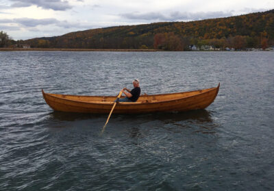
Many of my campsites looked like this. After making landfall my priority was always to unload the canoe, pitch the tent, and get organized before making dinner. The low water levels during my trip meant that cobblestone bars were common along the river, and I much preferred to camp there than among the dense bushes (often knotweed) that grew on the riverbanks.
Beyond the flats, the railroad shoulder dropped straight into the water with no beaches for camping. After another hour of paddling, I at last found a narrow stretch of beach. By sunset a pale moon had risen, and the setting sun banded the clouds in the western sky purple and orange.
September 9
I broke camp only to discover half of the tent floor was wet. This stretch of the Susquehanna is a reservoir created by the Safe Harbor Dam downstream which must have reduced the flow through the dam and caused the water level to rise 3″ overnight.
I had called Safe Harbor the previous day to schedule a shuttle around the dam at 10 a.m., but when I arrived at the take-out, the concrete boat ramp was clogged with driftwood. I scrambled up onto the adjacent concrete dock and unloaded there; vultures watched me from the mobile crane used to pull debris out of the water above the dam. The portage crew showed up on time to drive me around to the put-in. At the next dam, Holtwood, 8 miles downstream, there was no cell reception, so I walked up the road to the dam’s call box to check in. The portage crew showed up shortly to collect me.
Below Holtwood, as I paddled along the west side of the Conowingo Reservoir, I became increasingly worried about finding a place to camp. The few level spots had houses on them and everywhere else was a steep rocky wooded slope that fell straight into the water. I spied a small level spot right at the water’s edge, but mindful of the previous night, I paddled on. Finding nothing better after 20 minutes, I turned around. As I paddled back along the shore, a black bear burst out of the water 50′ away and scrambled up the slope. I could hear it paralleling me as I kept paddling toward the place I’d intended to camp. It was no good. If I stayed there, I wouldn’t sleep. I headed downriver to Glen Cove marina, two hours away. After dusk at 8 p.m., the marina entrance light was a welcome sight. No one was around, so I bedded down in my sleeping bag on the dock. Through the night, carp gulped at the surface; it was worse than the regular song of cicadas, but better than hearing a bear in every noise.
September 10
Drowsy at 5:30 a.m. I watched what I thought was a meteor, but a post-trip search online pointed to a Falcon 9 rocket lift-off. Soon a fisherman motored out. Expecting a busy morning at the marina, I packed up and went paddling in search of ripe pawpaws for breakfast. These greenish-yellow fruits grow wild along the bank and usually range from boring to good, depending on the tree; hunger that day made them delicious. Back at the marina I saw no one until the Conowingo Dam portage crew showed up. They told me about a human-habituated bear in the area: my campsite selection was vindicated.

A different world: as I approached Concord Point Park and my takeout point on Chesapeake Bay in Havre de Grace, buildings and marinas lined the right bank.
Beyond the Conowingo Dam, I spent half an hour dodging mostly submerged boulders in 1⁄2–1 mph of current as the final four bridges spanning the mouth of the Susquehanna came into view. Clearing the bridges took two hours in the bright sun, and the light sparkled on the small wind-driven waves covering the wide open expanse of Chesapeake Bay. I turned south to finish at Concord Point Park in Havre de Grace, enjoying the feel of open water, but also wanting to be ashore before the afternoon winds picked up. I had made it. Thanks to mother nature and lady luck I had avoided the high waters left from Hurricane Debby in early August, and the September 22 sewer-line rupture that would close 20 miles of the river north of Harrisburg of Selinsgrove for recreational use. It had not always been an easy trip, but the weather had been kind, allowing me the privilege to experience the wildness that still survives along one of the major U.S. East Coast rivers, despite the impacts of our modern world.![]()
Hugh Rand lives in Maryland where paddling gets him out into nature and provides some much-needed exercise. During his trip down the Susquehanna, he learned from the portage crews that as few as ten people a year paddle the entire length of the river in one go. For more of Hugh’s adventuring read “The Erie Canal by Canoe.”
If you have an interesting story to tell about your adventures with a small boat, please email us a brief outline and a few photos.


Great trip.
Loved the article! My sister and I did this trip when we were in college 20 years ago. Brought back memories reading about it. We planned to do it in a month but after a week we realized we could do more miles than we expected and finished in 17 days. Your report makes it sound like the quality of the water and abundance of wildlife has only increased since then which I was so happy to see. Thanks for the article!
I have been thinking about attempting paddling the length of the Susquehanna like this. Would you be open to answering a few questions? If so, please send me an email at [email protected] so I can email you my questions.
Thank you,
Carl