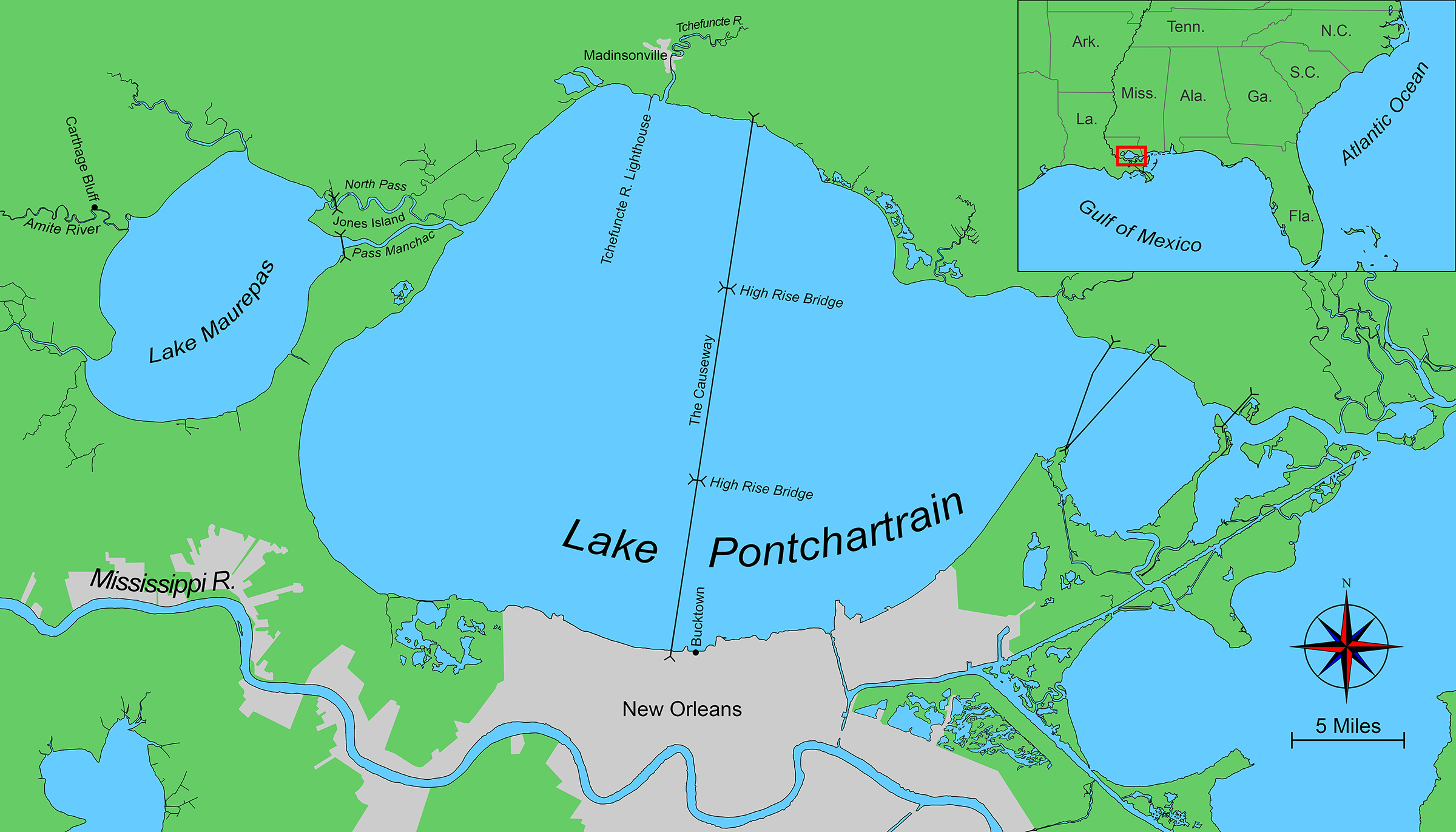
There is only land here in South Louisiana if the Mississippi River, which drains some four-tenths of the United States, brings it to spread out over the edge of the continent at the Gulf of Mexico. Its alluvium is an offering to cypress, cattails, and spartina to build the land higher—if the next flood, storm surge, or rising sea level does not reclaim it first.
Over millennia, the river has formed a 10,000 square-mile expanse of mud—the Mississippi Delta. This mud is both the product of the river and its primary impediment. The river always seeks a faster route to the sea, and so its course across the massive mudbank of its own making wavers over time. Some 5,000 years ago, as the last ice age receded, torrents of glacial meltwater flowed into the river. It sought open territory, and the delta shifted to the east.
 Roger Siebert
.
Prior to that period, what we know now as Lake Pontchartrain and Lake Maurepas would have been open coast. But, over the course of 2,000 years, the new delta hemmed in these waters until their connection to the Gulf narrowed to deep passes through the mud. The waters seemed more akin to lakes than bays.
Because the river builds the land here millimeter by millimeter, the horizon is everywhere a thin green band, like a patinaed copper weld between the expanse of the water and the dome of the sky, limiting what was once limitless. There is no vertical relief, apart from the occasional upward lilt of a road bridge lifting drivers above the water. To fully appreciate the beauty and power of the forces at work here, one must invert the landscape to see not just the thin contour of the earth above the water, but also the topography carved into the delta by ever-changing river and tidal currents.
A cool late-March breeze blew the scent of jasmine among the homes of uptown New Orleans, which lies between the manmade levee along the Mississippi River and the subtle natural levee farther inland, just a handful of feet above sea level. The river flows around Carrollton Bend, a quarter-mile from my apartment, along a riverbed that cuts 90′ deep into the muddy delta. A few miles down the river, as it rounds Algiers Point in front of the French Quarter, it deepens to 200′.
 Photographs by the author
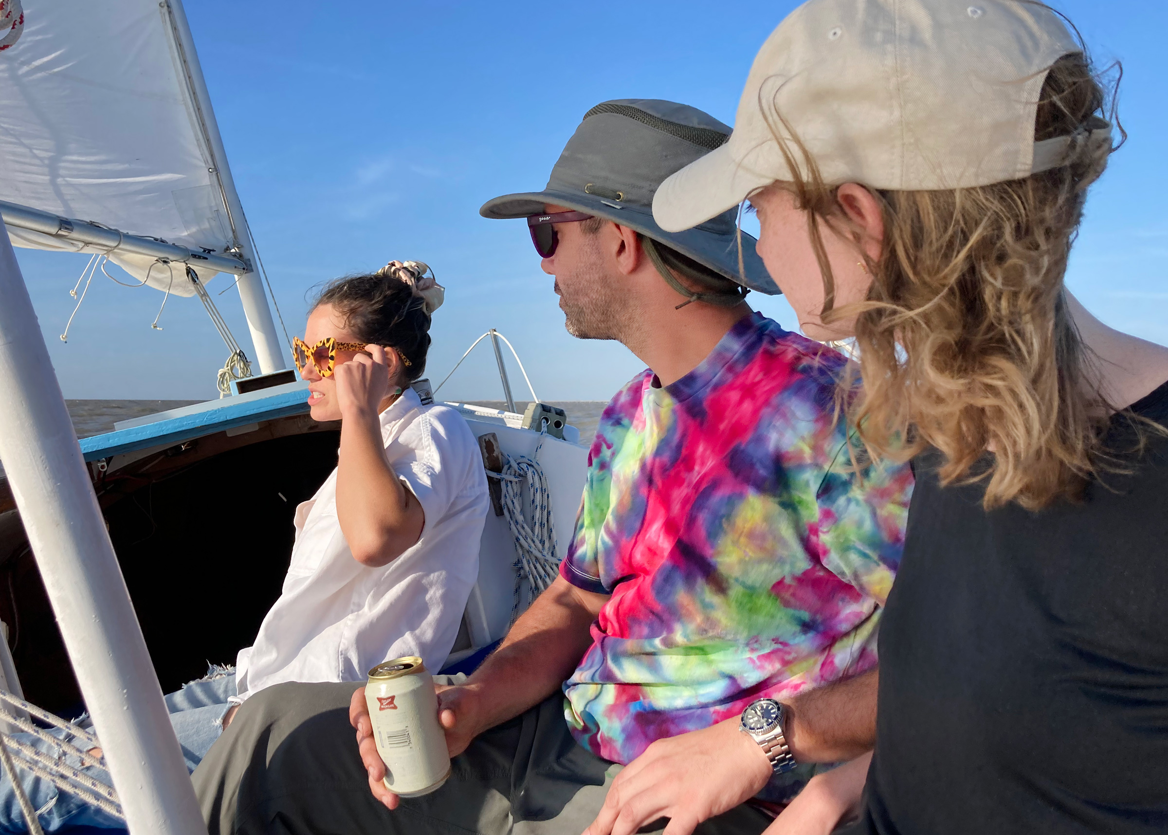
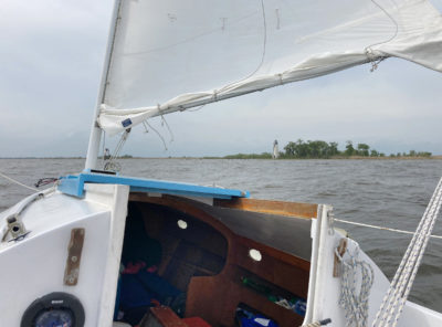
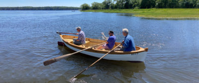
While Emma, Cassius, and Sophia (from left to right) apparently enjoyed the sail across Lake Pontchartrain, Sophia would later confess that she was seasick for much of the crossing.
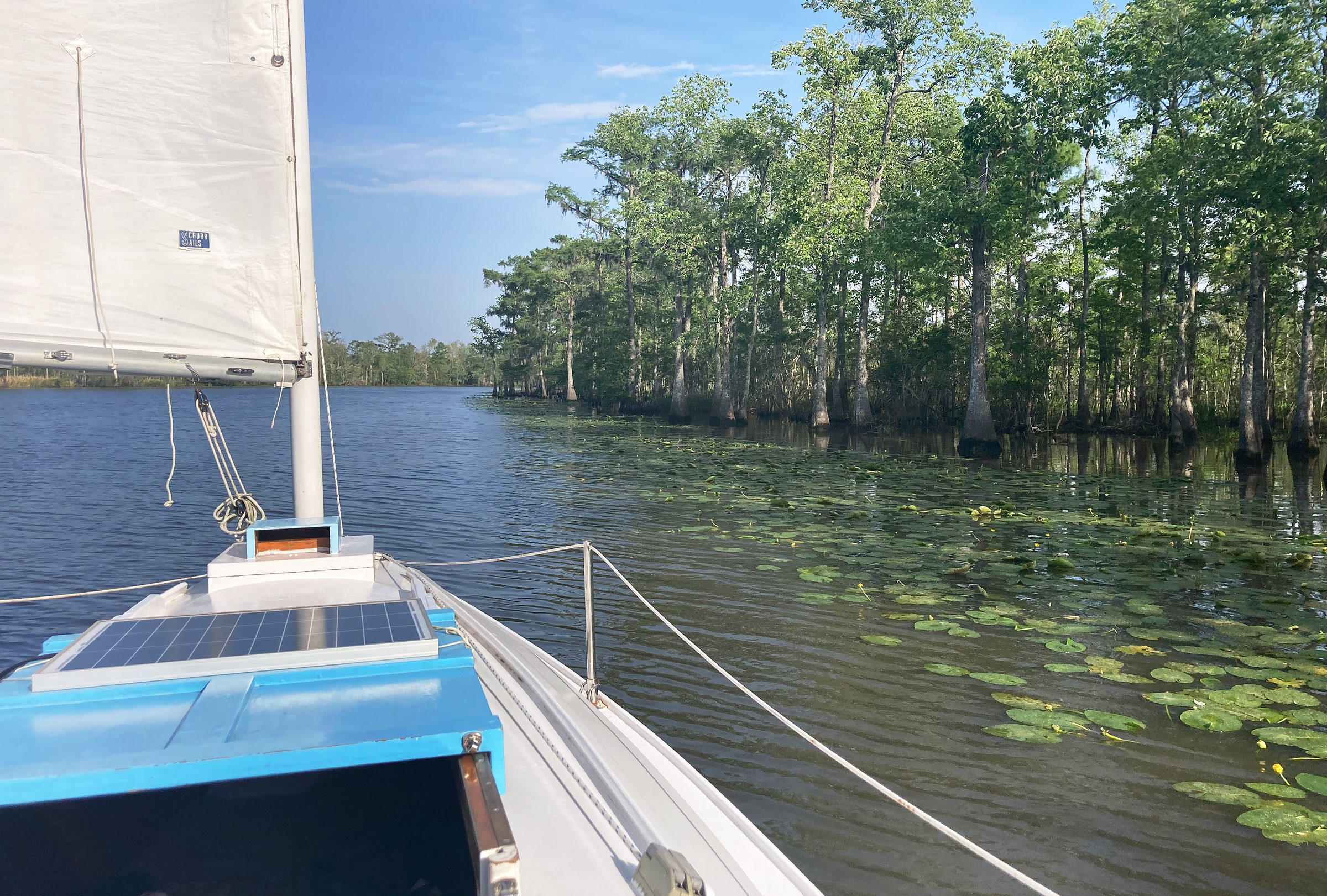
It was early afternoon, and I had just gotten home from work at the hospital. Next up for the day was a 22-nautical-mile sail aboard my 23′ Norwalk Islands Sharpie (NIS 23), MYRNA C, across Lake Pontchartrain from New Orleans to Madisonville with three friends—Emma, Sophia, and Cassius—for the first, staging leg of a weekend afloat exploring Lake Pontchartrain and Lake Maurepas.
We met at Bucktown, just across the Orleans Parish line. No clouds marred the sky. The breeze blew from the southeast at 15 to 18 knots. With a single-reefed main and a full mizzen, we sailed out of the harbor on a close reach, and then fell off to head north. A couple miles to our west, the Pontchartrain Causeway shot straight across the brackish lake until it dipped below the horizon. The lake here is 24 miles across but only 10′ to 15′ deep, a trapped shallow sea.
Our course was an easy broad reach, and we made 6 knots sliding down the fronts of the following sea. We sipped beer and chatted. Eight miles from the south shore, the causeway lifts for one of two High Rise Bridges over the channel, the only vertical relief on the horizon except the skyline of New Orleans, which was receding behind us. We plowed under the bridge on a deep broad reach as cars and trucks hammered the bridge deck above us. We were beyond sight of land in every direction, yet adjacent to a pulsing artery of civilization. It was an odd discord, and I was eager to get farther west, beyond the bridge’s intrusion.
The sun settled down among hazy low clouds. The color of water shifted from light brown to a glinting blue. The sky glimmered gold. Our bow wave rode just short of the stern, sometimes slipping farther aft as we lifted on plane, surfing the 3′ to 5′ chop.
As our spot-on Earth wheeled out of reach of the sun, we picked up the marks at the head of the channel into the Tchefuncte River on the horizon. Cassius offered me another beer, but I declined, not having made the passage into Madisonville from the lake before. I needed to focus on our course.
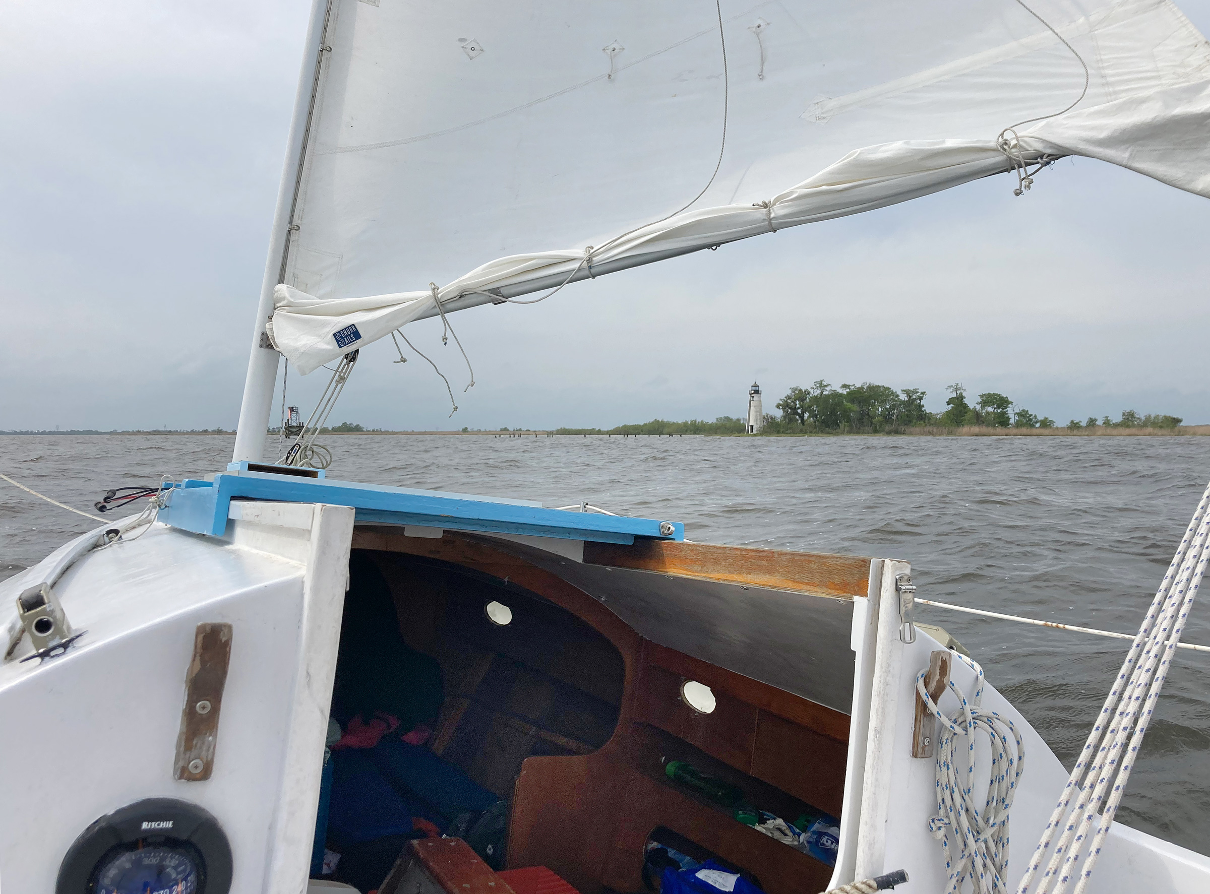
The black stripe painted on the Tchefuncte River Lighthouse provides a more precise back range mark for vessels navigating the narrow channel leading to the mouth of the river. The water surrounding the channel is only 3′ to 6′ deep.
Soon, the stars emerged. In the dark, the wind seemed stronger, the waves bigger, and the heel of the boat more threatening. The comfort of the previous four hours sublimated into anxiety. We sailed on a beam reach toward the Tchefuncte Light, and then had to turn due east to enter the last leg of the channel before the river. I considered using the engine to ease our way upwind, but with the chop, the prop would intermittently roar out the water and the hull would pound. The crew would not be happy. So, we stuck with the sails.
Cassius and Sophia used the spotlight to identify the channel’s day markers. Emma looked out for the lonely pilings and ruins from Hurricane Ida that lurked just above the surface on the west side of the river entrance. A grounded tug listed on a bar. The low land was barely land at all, just a slender finger visible between troughs of the waves. The sails crackled, and the centerboard shifted as we traded four tacks upwind in the dark.
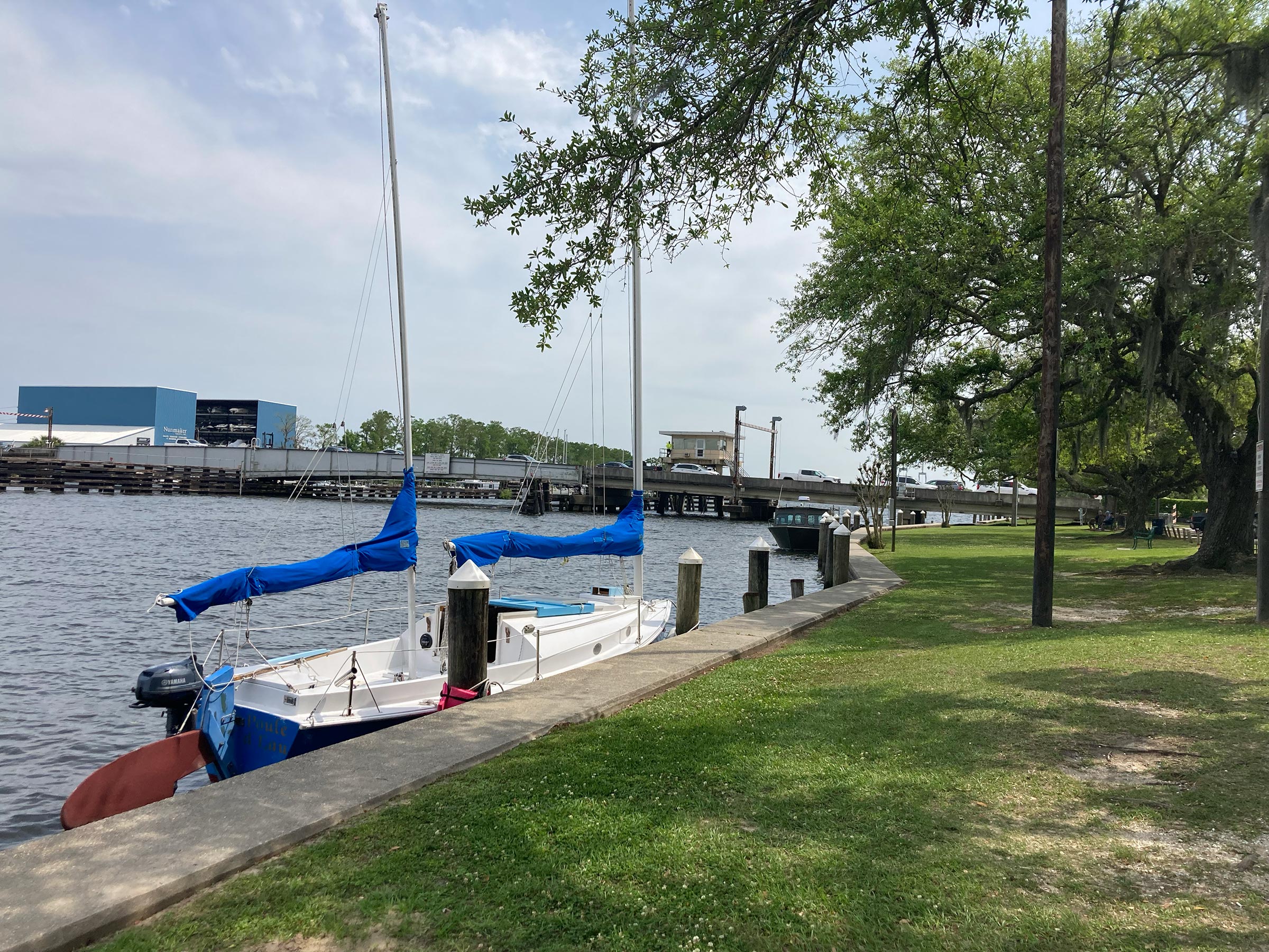
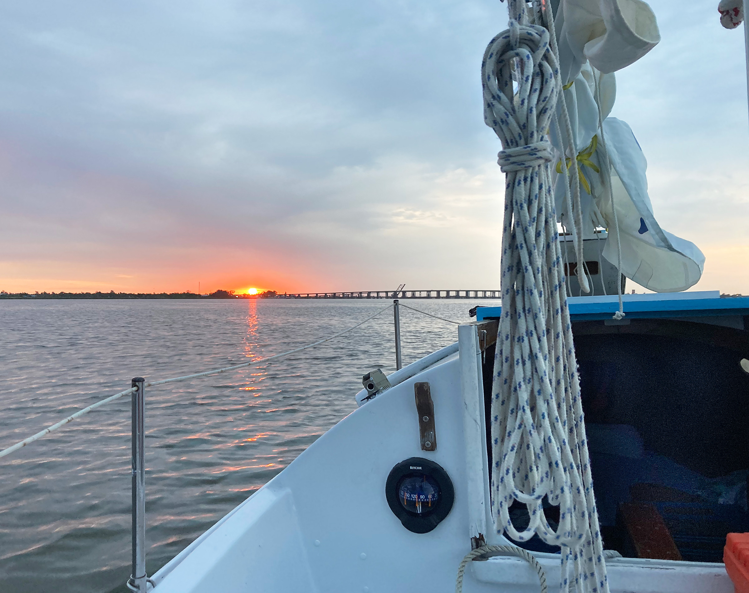
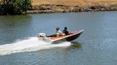
MYRNA C, here at rest on Friday morning, had spent the night at the seawall in Madisonville without me. After we had docked on the Thursday night, it took us 30 minutes to find an Uber driver willing, at 10 p.m., to drive us back to New Orleans across the 24-mile-long Pontchartrain Causeway.
We rounded the last mark and turned north to slink into the calm of the river. The boat’s heel mellowed into a gentle repose, and the mood on board transformed. We shook out the reef in the main to glide north upriver. The wind ambled through Spanish-moss-draped cypress, silhouetted against the glow of Madisonville. Cassius said he understood now why I had wanted to hold off on a beer. I finally took him up on his offer.
Two miles upriver, we made Madisonville, and sidled up to the town’s seawall for the night. I had to return to New Orleans to check on a few of my hospitalized patients in the morning. Emma, Sophia, and Cassius had to return, too. We called an Uber to bring us back across the long causeway to the city, but this time in total darkness and in just 35 minutes.
I made my hospital rounds the next morning and drove back to Bucktown to drop my car before catching another Uber back to Madisonville. As my ride crossed the low steel-plate girder swing bridge over the Tchefuncte River, I saw MYRNA C sitting prim on the town seawall against a line of grand live-oak trees, their gnarled branches reaching just shy of water. I brought my bags on board. The solar panel controller was not working, and it was not salvageable. I relied on the solar panel to recharge the battery that powers the navigation and cabin lights and radio. I debated calling off the rest of the trip, but then remembered I had backup battery-powered lights in the cabin, a backup anchor light, and colored glow sticks for navigation lights. There was enough power left in the battery to recharge my cellphone at least a couple times. The handheld VHF had a full charge. I decided to proceed.
I requested an opening of the Madisonville bridge on channel 13. I would have to wait until 3 p.m., about 15 minutes, for the next scheduled opening. When its low horn blew, drivers slowed to a stop. The steel bridge girder creaked into motion. I passed between the bridge piers into the lower Tchefuncte.
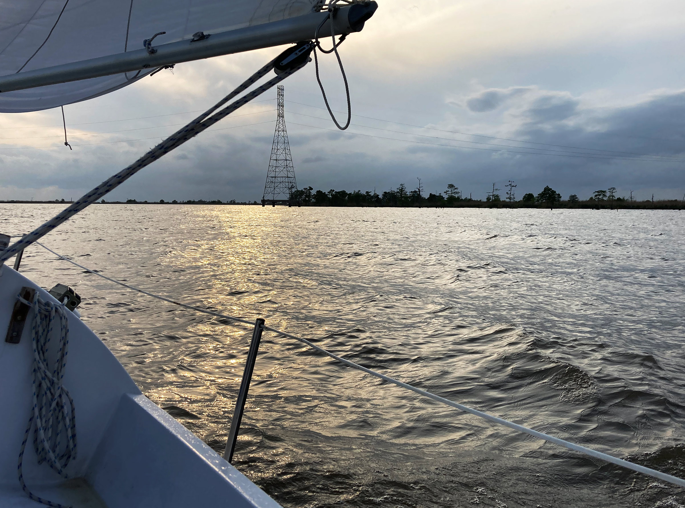
The approach to Pass Manchac during the golden hour of dusk was my favorite moment of the trip. The tower off the starboard bow is one of around 150 that carry power lines across the west side of Lake Maurepas.
A stiff south breeze pushed up the river. At its mouth, I raise a reefed main only and set off closehauled toward the Tchefuncte River lighthouse, situated on a peninsula of spartina-topped land. Clouds obscured the sun, and only an oily yellow light filtered through. The water was dirty brown and, to the west, a high-voltage powerline draped just off the coast before disappearing into the sodden air in the distance.
The whitecapped chop shoved the bow again and again, like an annoying little brother, as we made way upwind. The NIS 23 does not love a close haul and after an hour of ambivalent progress, I flopped to a starboard tack to dip the port-mounted outboard deep in the lake. I started it up and motorsailed for about 30 minutes to get well to windward in order to make the entrance of Pass Manchac, which leads to Lake Maurepas, on one tack.
The powerline running just off the swampy coast shadowing my course lifted high into the sky to cross Pass Manchac, like a woman lifting her skirt to step across a puddle. As I approached, the sun settled lower to the west. The overcast sky coalesced into islands of tall and narrow clouds, like hanging planters on the horizon. The yellow, oily light changed to a warm glow. The chop faded to gentle wavelets.
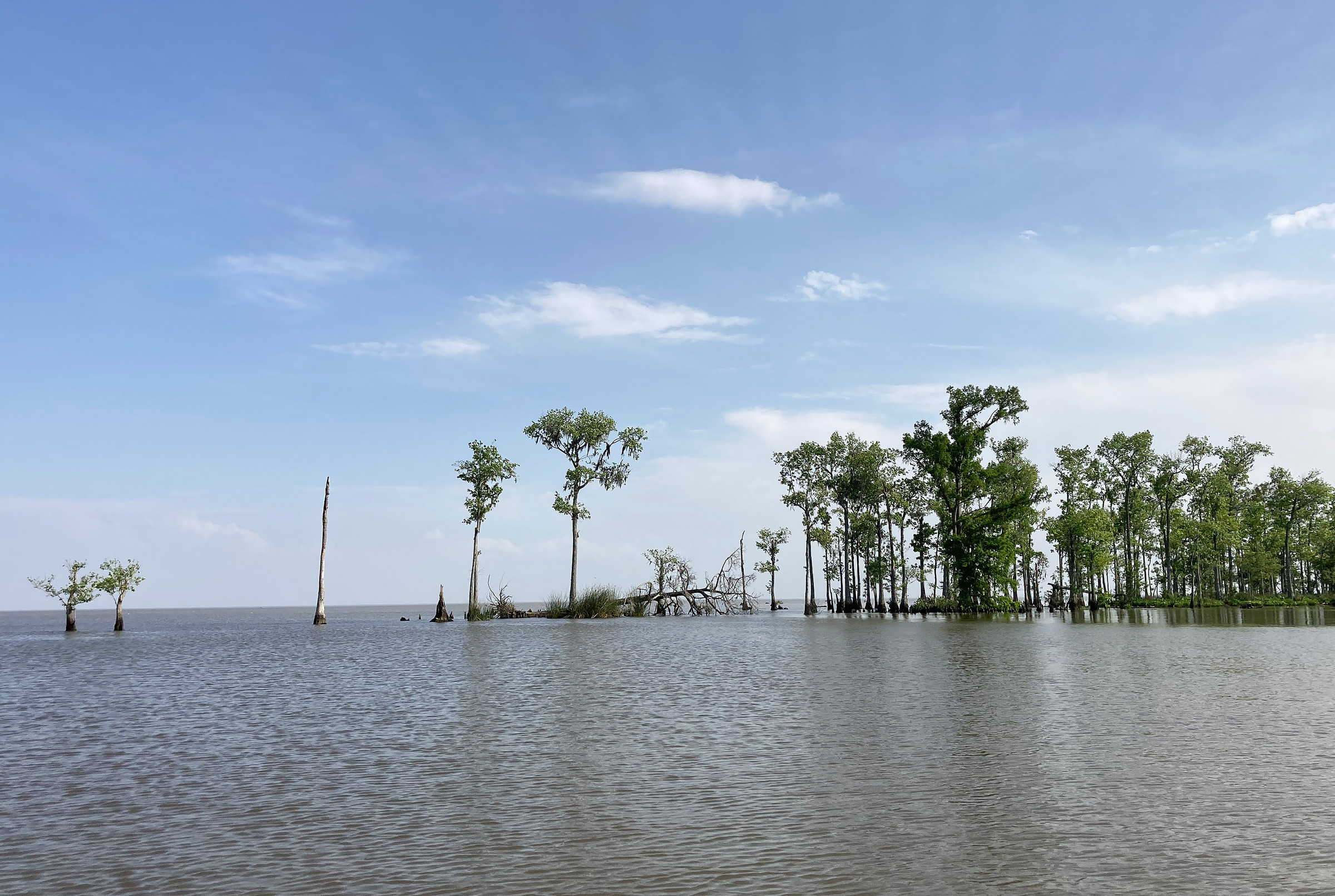
I felt the outgoing current of the pass catch the centerboard and rudder, jostling our course as the depth plunged from 5′ at the mouth to 56′ where the pass runs by the eastern head of Jones Island, a 6-mile-long low-lying island between the two meandering passages connecting Pontchartrain and Maurepas. Pass Manchac, the larger of the two, cuts deep into the mud left by the Mississippi River over thousands of years, reminding me of the accretive forces that shaped the land here. I imagined the topography of the unrelentingly flat landscape turned upside down, making the pass a sharp ridge rising 56′ above the surrounding marsh.
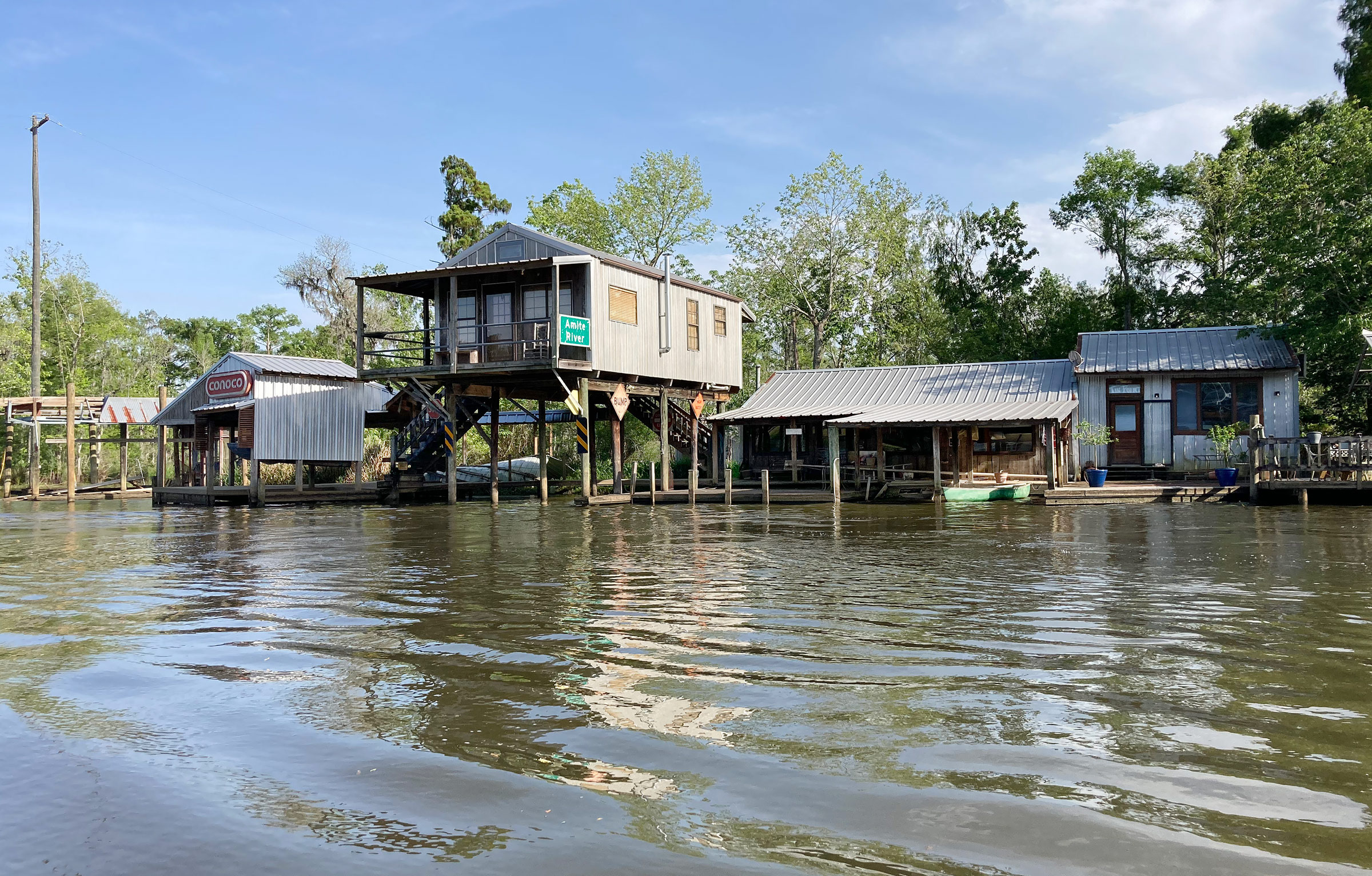
I motored up the Amite River as far as Carthage Bluff. I thought about stopping here, but the one person I saw on the bank seemed none too pleased to see me, so I continued on my way. I wondered how the buildings had made it through Hurricane Ida intact while camps just 1-1/2 miles away, at the mouth of the river, had been flattened.
As I sailed on a beam reach up the pass at 4 knots, I approached a collection of camps. Camps are what would be called a beach house in most parts of the country, though with an interesting twist: many are located deep in the marsh or bayou and are accessible only by boat. Powerlines cross miles of marsh to reach them, or they are powered by generators. They are elevated on pilings and fronted by a small dock. Sometimes they are perched entirely over the water, but usually are surrounded on three sides by marsh grass or swamp. There are some five dozen around Pass Manchac. Some seem like the full-time homes of commercial fishermen and a few are practically mansions. Nearly all of them show unrepaired wind and storm surge damage from Hurricane Ida, the Category 4 storm that passed through here in August 2021.
A man fishing from the dock fronting his modest camp gave a slow wave, seemingly in appreciation of the sight of a sailboat actually sailing in these waters. Wind rustled through the cordgrass and cattails on the banks. Purple martins looped overhead in gangs. Cormorants cruised the surface. Gulls screeched. The day seemed to be telling me to call it quits.
My goal was to reach the mouth of the Amite River that night, but it lies about 12 nautical miles farther west, on the other side of Lake Maurepas, and only 45 minutes of sunlight remained. After sailing a few hundred yards past the east end of Jones Island, I doubled back and turned into North Pass, moving silently past the camps lining the bank until marsh again fully took charge of the landscape.
I nosed the bow of the sharpie into the cattails lining the 280′-wide channel. As the wind began to push us away from the bank to the north, I dropped the anchor into the marsh’s thick mud. As we eased back, the current caught the hull, too, and angled us to the east.
I tied the mizzen off to the starboard ’midships stanchion to clear the cockpit to prepare dinner. I pulled out the Coleman stove, setting it on the port cockpit bench, and prepared a simple meal of canned chickpeas, tinned sardines, cheddar and diced onions, and bell peppers. I ate in the cockpit, surrounded in all directions by marsh. Cattails, spartina, a few palmettos, and the even rarer stunted cypress lined the bank, which made a rim of slightly higher ground around the low interior of the marsh that I could peer into only by standing on my toes on top of the cabin. Green-gold spartina standing just a couple of feet tall dominated these endlessly flat estuarine plains, amplifying the flaring spectrum of the setting sun.
Soon bullfrogs and crickets filled the enveloping darkness like radio static. Mosquitoes and no-see-ums followed, peppering the deck and cockpit. I hustled the screens into place on the hatches, retreated to my berth, and fell asleep.
Early the next morning, distant outboards whirred like giant mosquitoes, their pitch rising and falling with the Doppler effect as they raced back and forth through Pass Manchac less than 1⁄2 mile away across the narrow neck of land at Jones Island’s east end. I put on some coffee and munched an almond-butter sandwich as I looked absent-mindedly at the hundreds of flies that had drowned on deck in the night’s dew.
The third day of the trip began with a warm sunrise, but the rain soon moved in, so I decided to stay at anchor in North Pass and spend the morning reading.
The day was overcast and dreary, and I was in no rush to get going. I spent much of the morning reading journal articles on living-donor liver transplant, on which I had to give a short ethics lecture in the coming week. As I lay in my berth, light rain intermittently pattered on the cabintop overhead.
By 10 a.m., I was ready to get moving. The breeze pulsed from the southwest, meaning that the rest of Manchac would have to be covered with the motor. Tacking upwind and upstream in the serpentine 80-yard pass would be a Sisyphean endeavor, but I could still sail the mile back down North Pass.
I raised the sails at anchor and fell off to a beam reach, then wing-on-wing, then back to a beam reach as I wound through the last two bends of North Pass. Near the bank, the tail of a redfish danced just above the surface of the water as it nuzzled the bottom rooting for a meal. I came around the nose of Jones Island, and headed up to a close haul to see what kind of progress I could make upwind in Pass Manchac. The east-bound current was too much; the marsh upstream moved away from me even as I sailed toward it. I turned on my own mosquito and hummed west for Lake Maurepas.
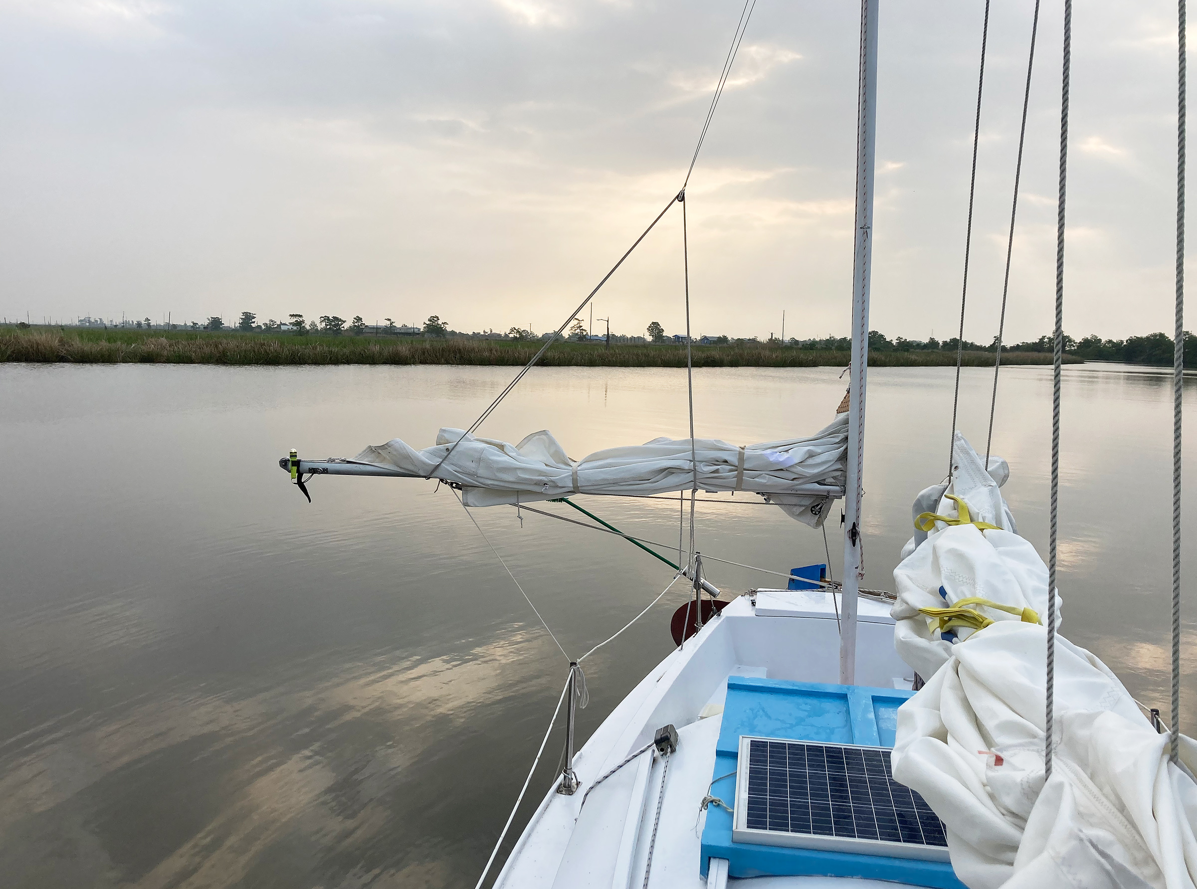
After motoring about 4 nautical miles, I passed under a bascule railroad bridge and then a road bridge and eased into Maurepas. There was a steady SSW breeze at 8 to 10 knots. I put up the full main and mizzen. It was only midday, and the Amite River, my destination, lay just 8 nautical miles due west, just beyond the horizon. The sky was a dull blue. Lazy and amorphous rain cells sauntered across the lake from the west, occasionally milling around when the wind rested.
The lake was dotted every couple hundred feet with low-profile, circular green buoys about the size of a Frisbee with a small solar panel and light in the middle. “Geophysical Technology” was stamped in black ink on the tops. I would later learn that the buoys were part of seismic testing to assess the environmental impact of a planned carbon sequestration project under the lake that would serve a hydrogen manufacturing plant 37 miles away in Ascension Parish. It is ironic that we are trying to put carbon back into the mud of the Mississippi River Delta after spending the last 100 years pumping it out through oil wells.
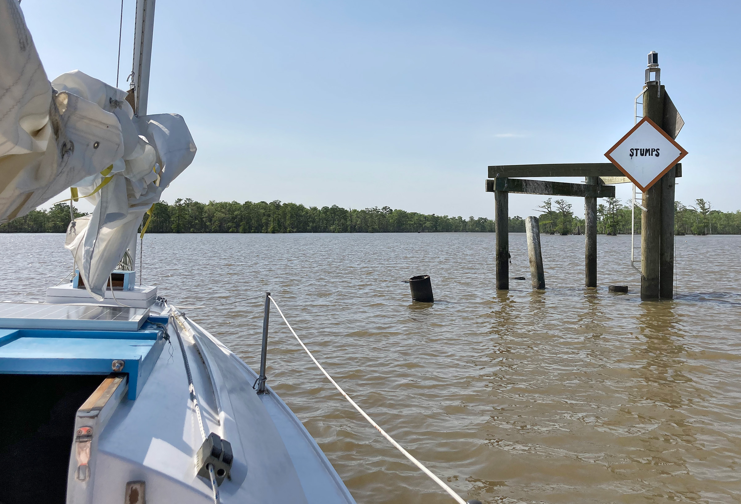
I thought this quintessential-Louisiana, hand-stenciled marker reading “STUMPS” was hilarious until my centerboard hit a stump about 100′ beyond it. I was then grateful that the person who made it had taken the time to warn me to slow down.
By late afternoon, I arrived at the mouth of the Amite River. A widely spaced line of cypress stood as sentries guarding its mouth, and I was tempted to motor through them to reach the main flow of the river. Instead, I followed the channel indicated on the chart as well as the corresponding pole-mounted channel markers. Both guided me into an oxbow that seemed like the original mouth of the river before the shoreline receded. Despite being in the middle of the channel, I saw the centerboard line go slack, and my speed slowed as I motored into a very soft mudbank. I backed off and then headed back toward the scattered and isolated cypress.
About 1,000′ from the “STUMPS” sign, there was a narrow line of cypress along the old bank of the Amite River. I thought this would be the location of the stumps, but they were much farther out, revealing just how much the mouth of the river has shifted in recent times. Beyond this line of trees and stumps, I reached the deeper waters of the river.
A couple hundred yards from the sparse line of cypress along what was once the riverbank, a group of four pilings held up a galvanized ladder to the light marking entrance to the river and a sign that read simply, “STUMPS.” I turned the throttle down to idle and crept toward the river. Clunk! My heart skipped. I yanked up the board before it could hit any more stumps and pressed on. There were no visible stumps, no irregularity in the water suggesting anything just below the surface, and the boat drew only a few inches with the board up. I decided to drift extremely slowly over the old riverbank and drop into the main river. I made it and continued to motor upriver.
The west wind let me sail down the Amite River in silence with only the occasional creak from the rigging interrupting the quiet.
I hadn’t gone far when a 6′ alligator swam toward the boat, its tail swinging in a long S. When just 2′ from the hull, it must have realized that I was not its kind, and dashed away toward the riverbed. Broad, flared, cypress trunks rose from the shallows on the bank, then narrowed as their branches angled off, full of early spring’s bright-green leaves. I motored about 2-1⁄2 miles upriver to Carthage Bluff, a collection of ramshackle camps and mobile homes. The breeze was blowing from the west now, and so I raised sail and headed back downriver. The booms were sheeted way out and almost touched the branches shading the bank. A small fish jumped out of the water, landed on a lily pad, and lay there flopping on its side. Two blue herons chased one another in soaring arcs over the cypress crowns. An owl hooted. Purple iris blooms gleamed from deep in the swamp, their seclusion given up in brief glimpses between the trees and brush.
Back at the river mouth, I furled the sails, pulled up the centerboard and rudder, and played stump roulette again as the west wind pushed MYRNA C over the old bank back into Lake Maurepas. I then motored near the NOAA-marked channel for protection from the northeast breeze that was expected to roll in that night.
I anchored about 100′ offshore, and had plenty of time before sunset. I read some more before pulling together a meal and settling in for the night. Soon after dark, I heard a motorboat approach. To make sure I’d be seen, I turned on my navigation lights, in addition to the anchor light that was already on. A 26′ Sea Ray passed me by, headed up the channel, and I returned to my reading. I heard the boat throttle up once they were clear of me, and then I remembered the NOAA channel led nowhere. Sure enough, seconds later, I heard their outboards strain against the mudbank.
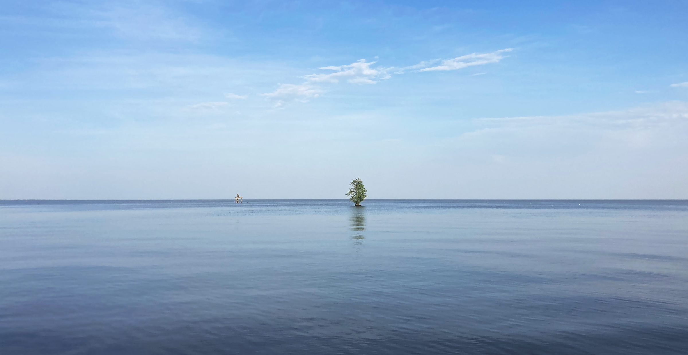
I had seen pictures of lonely cypress trees, like this one, in art galleries in New Orleans, but never a living example. Beyond it, is the “STUMPS” marker off the entrance to the Amite River.
Bugs were whining just beyond my screens, and I had very little enthusiasm for getting involved in their grounding. My plywood boat with a 6-hp would not be able to pull a boat like theirs off the bottom. I heard the engines revving and the rush of water against the hull, and figured they were making progress. Yet, the sounds seemed to be getting farther away rather than closer. I got concerned—were they trying to drive through the oxbow? I was new to these waters, and perhaps they were more familiar. Maybe there was a channel to get into. I hailed them several times on the radio to ask. No response. I went back to my reading. Twenty minutes later, I heard them getting closer again, now with the high-pitched scream of their engine alarm blaring between full-throttle blasts of water. They had made it all the way around the oxbow. Convinced now of their incompetence, I braved the bugs to come on deck. Just as I did, I watched their bow light go skyward, the engine roared, and a woman’s voice exclaimed, “There is water in the boat!” Stumps.
They were about 1,000′ from me. The night was still, and I called out to them, my voice echoing through the cypress swamp. A man yelled back that they had no radio on board and their phones were dead. There were no injuries and despite the damage to their hull, they were not sinking, perched as they were atop a cypress stump. I called the marine patrol for them and went to bed. I was not going to put my boat on a stump, too.
The next morning, I woke an hour and a half before dawn. The wind whispered over the black, glassy surface of the lake. I looked west. Every 15 seconds the lake lit up with thousands of white lights on the seismic buoys, covering the lake like an airport tarmac and signaling that it had been yoked to human enterprise. To my south, I could still see the glowing port navigation light of the marooned Sea Ray. With each flash of the seismic buoys, a faint outline of the hull appeared, angled upwards atop the cypress stump, a warning against the presumption of dominance over nature.
Before dawn, Lake Maurepas was lit up every 15 seconds by thousands of flashing white seismic-survey lights. The light show abruptly ended when the sun rose above the Pass Manchac bridges on the east side of the lake.
I raised anchor and motored through the lights toward where I expected the sun to rise, reaching the east end of the lake just as it cleared the elevated interstate bridge. I carried on back through the deep Pass Manchac to Lake Pontchartrain.
By mid-morning I had reached Pontchartrain. The gray-blue cloud cover burned off making way for clear skies and a building 12-knot breeze from the northeast. I began making my way southeast toward New Orleans. A few hours later, the wind had built to 20 to 25 knots, forcing me to double reef the main and douse the mizzen. MYRNA C powered through the 5′ chop.
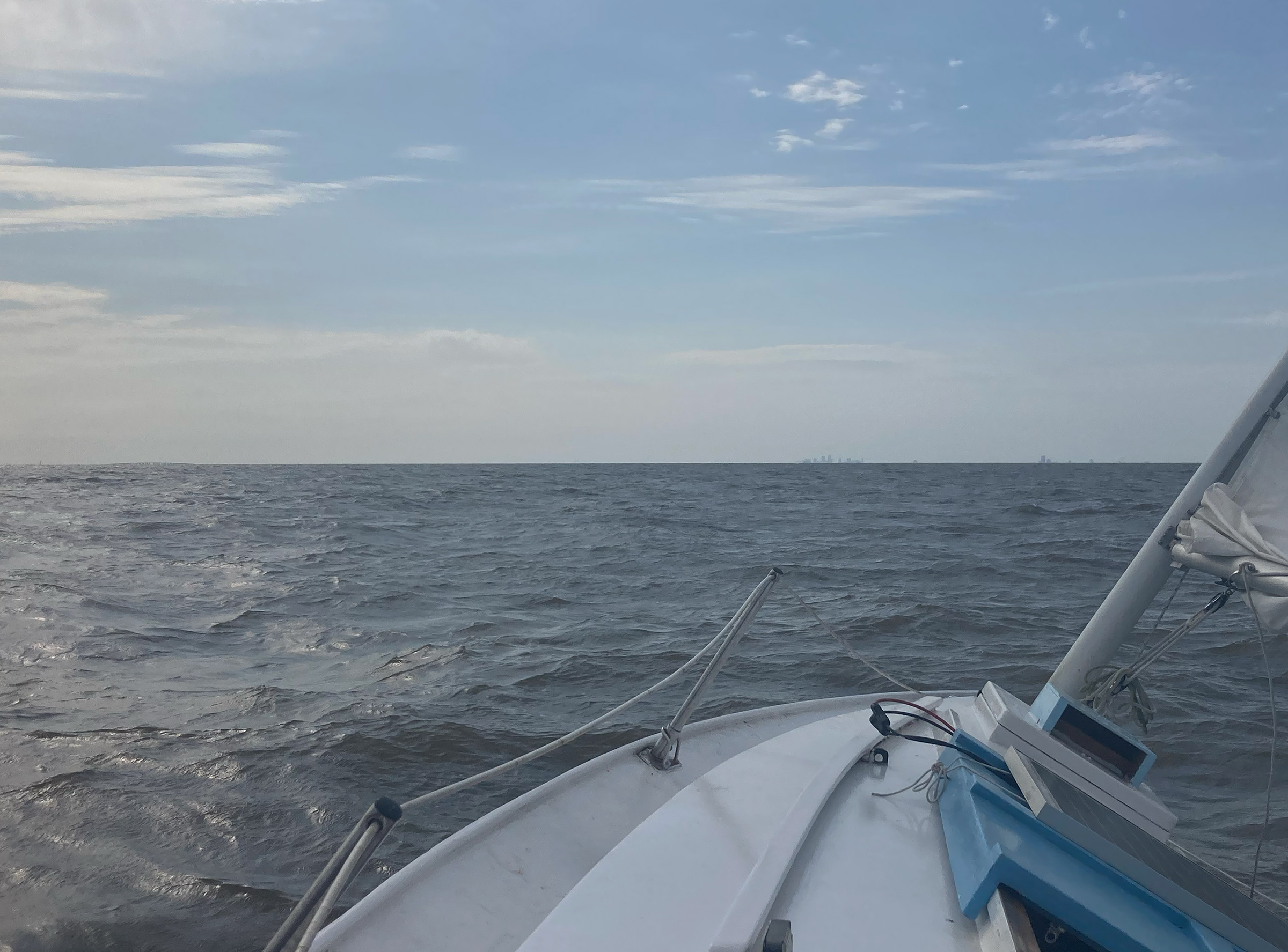
On my homeward leg across Lake Pontchartrain, the flat Louisiana terrain left little to see but water. Only the Causeway (at left) and the tallest buildings of the New Orleans skyline (right of center) rose above the horizon.
I was 10 miles and more from land in all directions and felt far offshore, but just 10′ below the tip of the centerboard was the Mississippi’s muddy runoff from the eastern United States. Even as I worked my way upwind, Lake Pontchartrain’s waves were eroding the cypress trees’ grip on the muddy shores of this endlessly flat land. The Causeway capped the eastern horizon and, to the southeast, the towers of New Orleans were back in view, rising above the thin green line of the levee protecting a city that rests largely below sea level. I passed under the hammering bridge deck of the busy Causeway, eased the sheets, and headed for home.![]()
Peter Sawyer is a general surgery resident in New Orleans, Louisiana. He learned to sail when he was 11 years old at Camp Sea Gull, a seafaring summer camp on the North Carolina coast. He has been at it ever since.
If you have an interesting story to tell about your adventures with a small boat, please email us a brief outline and a few photos.

A fun read. I enjoyed your journey and could see myself on such a river.