 Photographs by the author
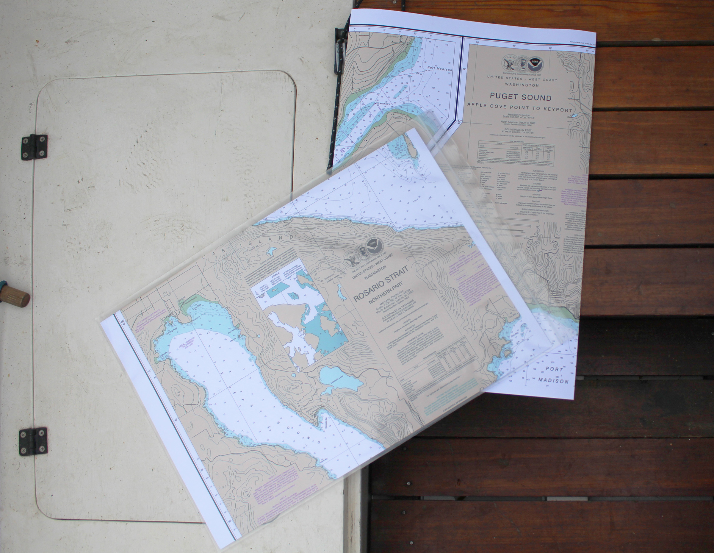
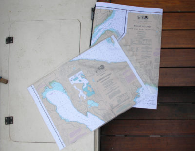
Frugal Navigator’s Small Craft version of NOAA charts comes folded to fit a waterproof chart case.
I still have the charts that my father and grandfather used when they were sailing out of Marblehead, Massachusetts. I don’t use them, of course—they’re over 50 years old and I live on the country’s other coast, 2,500 miles away. I’ve also kept my father’s charts of our local waters on Puget Sound, and every chart I used going up the Inside Passage.
While my fondness for old charts may be somewhat sentimental, I still find paper charts useful even though there are some very sophisticated electronic alternatives. If I were traveling the Inside Passage or the Intracoastal Waterway again, electronic charts would have a clear advantage in lower cost and bulk, but my cruising grounds are limited in range, so I don’t need many charts to cover the area. The screen on my handheld GPS is less than half the size of a credit card, and while it can zoom in and out, it can’t give me the big picture and the details all at once in the way that a chart can. And on a sunny day I can rarely see through the glare on the screen.
In the fall of 2013, the National Oceanic and Atmospheric Administration (NOAA) announced that the federal government would bring an end to the lithographic charts that it had been printing since 1862. Printed charts did not cease to exist the following spring when the presses stopped, but their production was taken over by NOAA-certified, on-demand printers. Initially there were only two sources of charts, a source of frustration at the time, but that number has grown to 25.
I obtained charts of my main cruising grounds—central Puget Sound (18446) and northeast San Juan Islands (18340)—from Frugal Navigator. These charts can be printed to replicate the NOAA charts and shipped rolled, but I ordered the Small Craft Charts. They’ve been configured for easy use in the large SealLine map case, the kind commonly carried aboard kayaks and small boats. The printing is two-sided, so you don’t have to struggle with a large, awkward sheet. If you’re about to sail off the edge of the chart, you can pinch your position and the location under your thumb will be near your forefinger on the other side—the area along the edge is duplicated on both sides.
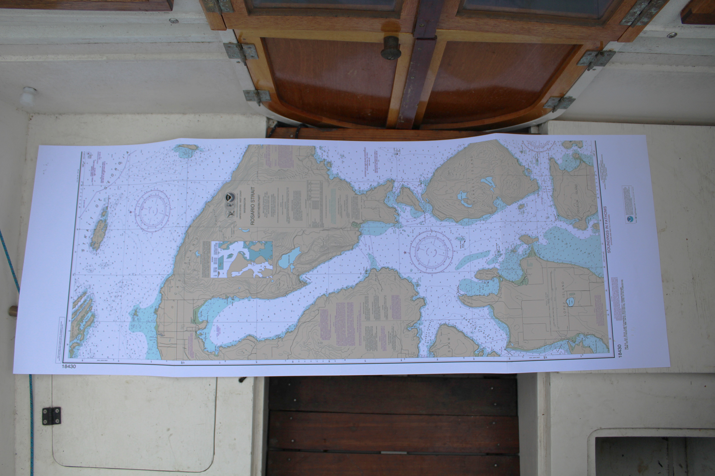
Printed on both sides of the sheet, the Small Craft chart is half the size of a traditional one-sided chart and more easily managed.
The paper is much heavier than the paper that had been used for the NOAA charts, so it is easier to slide into a waterproof case. Frugal Navigator mails the charts with a 6mm zip-lock bag that provides some protection from water and wear if you don’t need a map case with attachment points to secure on deck. The company website notes that the charts are printed on “water-resistant paper.” I wet a portion of the chart repeatedly and each time it dried out the paper was only slightly buckled, but otherwise as good as new. The ink didn’t bleed or smear when rubbed. Immersing the paper for several hours did ultimately soften the paper and made it susceptible to tearing. The paper has a good tooth for making notes with pencil or ball-point pen, even when wet. Erasing pencil marks will get them faint enough to write over, but they won’t disappear completely.
In all, these new charts are a noticeable improvement over their predecessors. I’m glad that charts are still available with the same appearance, up-to-date information, and better paper. They’ll be as useful while cruising as they are welcome in my archives.![]()
Christopher Cunningham is the editor of Small Boats Monthly.
A standard chart from FrugalNavigator , printed on one side and rolled, costs $15.95; the Small Craft version, printed both sides and folded, $21.95. You can find a list of printers, their offerings, and their contact information on the NOAA website. Frugal Navigator offers a free 8-1/2” x 11” sample chart.
Is there a product that might be useful for boatbuilding, cruising or shore-side camping that you’d like us to review? Please email your suggestions.
Join The Conversation
We welcome your comments about this article. To include a photo with your remarks, click Choose File below the Comment box.