As always, there had been a rough sketch of a plan: a 7- or 8-mile row, heading generally northward through the meandering sloughs and backwaters of the Chippewa River delta, the largest contiguous floodplain forest in the Midwest. From there, it would be an easy float down the main river channel to its junction with the Mississippi. Two or three nights aboard, a wandering pilgrimage through 30 square miles of river bottom forest and wetland bisected by only a single road. No need to pack the sailing rig—oars alone would do.
The more I thought about it, the better it sounded. With no charts available, I downloaded a set of detailed topo maps, printed them at 2″ to the mile, and ran them through a laminator. A bit smaller than restaurant placemats, and stiffened nicely by the laminating, they’d be perfect for one-handed use in a small boat—a trick I filed away for future trips. Even better, the maps seemed to suggest that the route I had imagined might actually exist. From a launch ramp 50 yards off the south side of Highway 35, a reasonably open channel paralleled the road eastward for a mile or two, snaking back and forth beneath a series of bridges before entering a thin but apparently continuous ribbon of river leading farther north.
 Photographs by the author
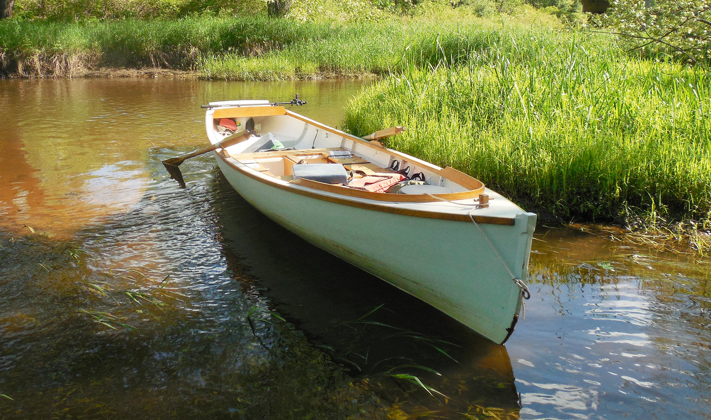
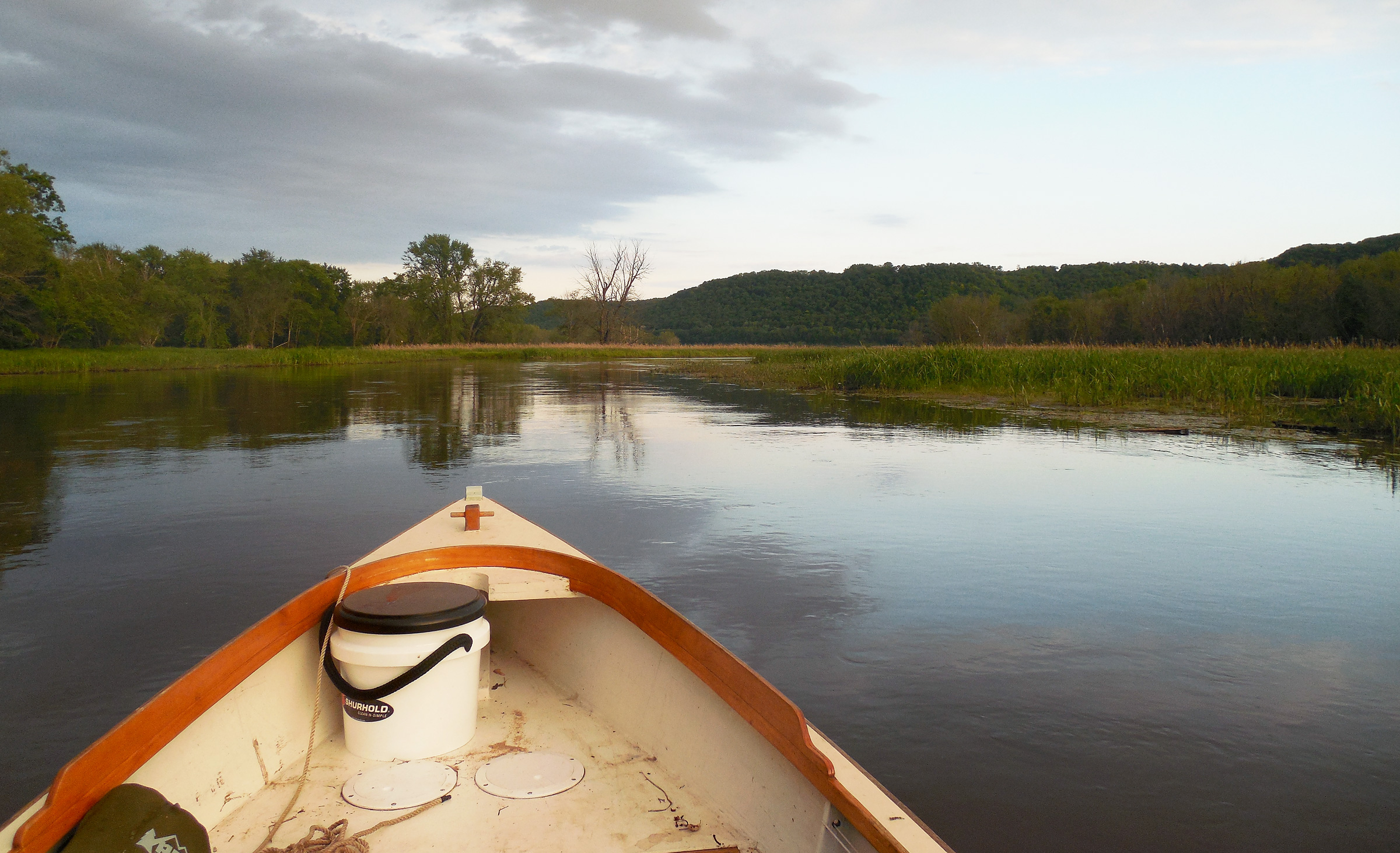
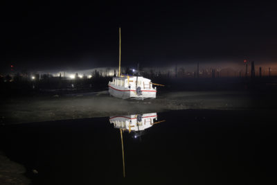
Many of the channels leading north from Highway 35 were so shallow that I could stop FOGG, my Don Kurylko-designed Alaska, in midstream, with no need to tie to shore. Sandbars and shallows were so frequent that wading upstream while pulling the boat behind me often turned out to be the only way to make any real progress.
This channel—Buffalo Slough—ran generally northward along the eastern edge of the delta for several miles, swooping through a series of bends and hairpins and pond filled backwaters to connect with another winding channel—Little Buffalo Slough—that diverged from the 300-yard-wide main channel of the Chippewa 10 miles upstream from the river’s confluence with the Mississippi. I’d anchor there, behind a half-mile-long island at the entrance to the slough, and then have an easy downstream row on the Chippewa. After a second night somewhere near the river’s mouth, I’d close the loop with a rambling track through the lower delta: up Government Light Slough to Smith Slough and on to the ramp, maybe. I didn’t overthink it. A certain degree of ignorance is a necessary component of these ventures, the best plans only vague brushstrokes to be filled in later, a new revelation at each stroke of the oars.
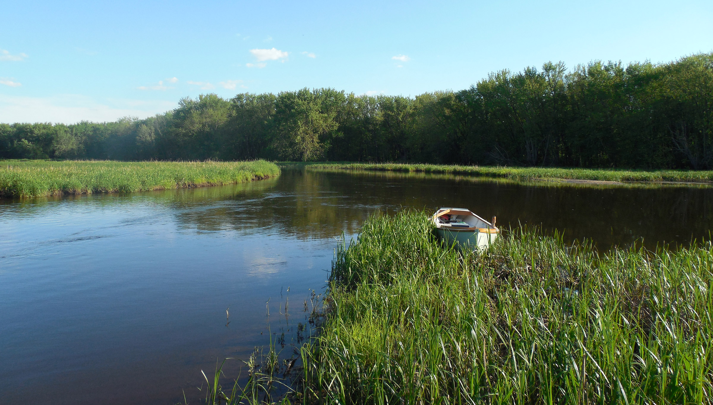
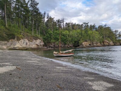
Heading south and into the delta, my route passed broad stretches of reeds and marsh grass at the upper reaches of Smith Slough, one of the widest channels in the Chippewa River delta. With the current giving me a substantial boost on this leg of my trip, I had ample time to stop ashore.
But there are plans, and there is reality. After two hours of rowing back and forth beneath the highway after launching from the ramp, I had failed to find the entrance to Buffalo Slough. Instead, I found a series of obscure channels blocked by downed trees, low water, and strainers, any one of which might have been Buffalo Slough. I hadn’t been able to go farther than a hundred yards up any of them to find out.
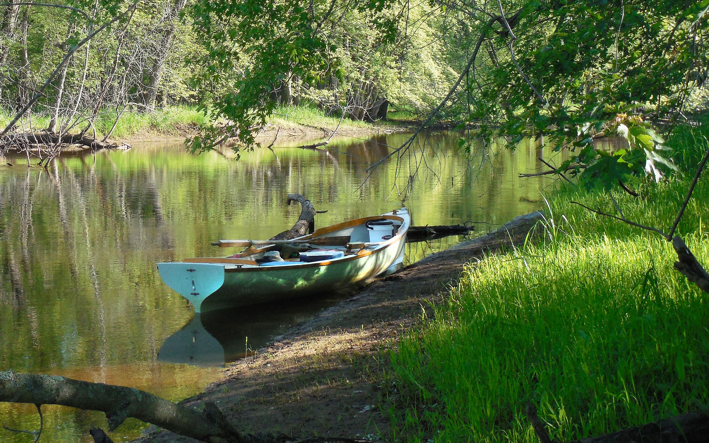
Trying to bring a boat like FOGG up Buffalo Slough was ridiculous, really. The channels were barely wide enough for oars as they were twisty, and thickly overgrown. It was the kind of delightfully pointless and uncomfortable outing I might have invented for myself as a kid, when every drainage ditch was a potential adventure, and every thicket an incitement to exploration. Long shallow stretches forced me to wade upstream, pulling the boat behind me like a dog on a leash—hard-earned, sweaty, knee-deep-mud-and-crawling-through-branches yardage. I had to climb ashore and line the boat through a few tight spots where logs or low branches prevented the use of more conventional tactics. This wasn’t a river—it was a forest. Craggy-barked cottonwoods lined the shore, with well-spaced silver maples, basswoods, and ash trees farther inland. Birds were singing everywhere, only occasionally visible as they flashed from tree to tree. Squirrels chattered loudly, scampered off when I got too close, and chattered some more.
 Roger Siebert
.
No matter what my carefully assembled maps might have suggested, the sloughs and channels here were shifty things—erratic; devious; not to be trusted. The few inlets that weren’t blocked completely grew steadily narrower and shallower as I fought my way upstream, until all that was left was a trickle of muddy water between undercut banks. I finally gave up, leaving the boat firmly aground in a side channel to explore on foot.
Tall maples and basswoods broke the late afternoon light into a rustling green-gold shiver overhead, and the damp sand of the slough bed was a jumble of tracks: the split-wedge marks of white-tailed deer, web-footed beaver prints, and the peace-sign slash of blue heron feet. The forest floor was pure floodplain and flat as a parking lot, too damp and shady to support much undergrowth—only a scattering of mayapples, and a few trilliums just starting to open into bright three-pronged stars. Farther into the woods, knee-high ferns brushed my legs with a feathery shushing at each step. Circling back to the boat, I found more tracks in the riverbed behind it: the rail-straight line of a keel dragged through the sand, and my own barefoot prints at the water’s edge.
I eventually abandoned the idea of finding Buffalo Slough and headed downstream instead, planning to anchor a few miles south of the ramp in Smith Slough, or Government Light Slough, or some nameless adjacent backwater at the edge of the delta. I’d spend the night just above the Mississippi River and come up with a new plan for tomorrow.
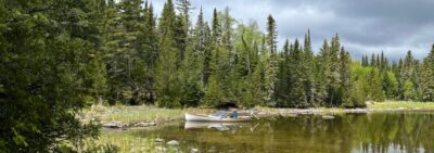
It was still a few weeks to the summer solstice when I started my trip, but days were already growing longer. With more than 16 hours of daylight, I was in no hurry to find a campsite, so I pulled in here to watch two beavers on the opposite bank.
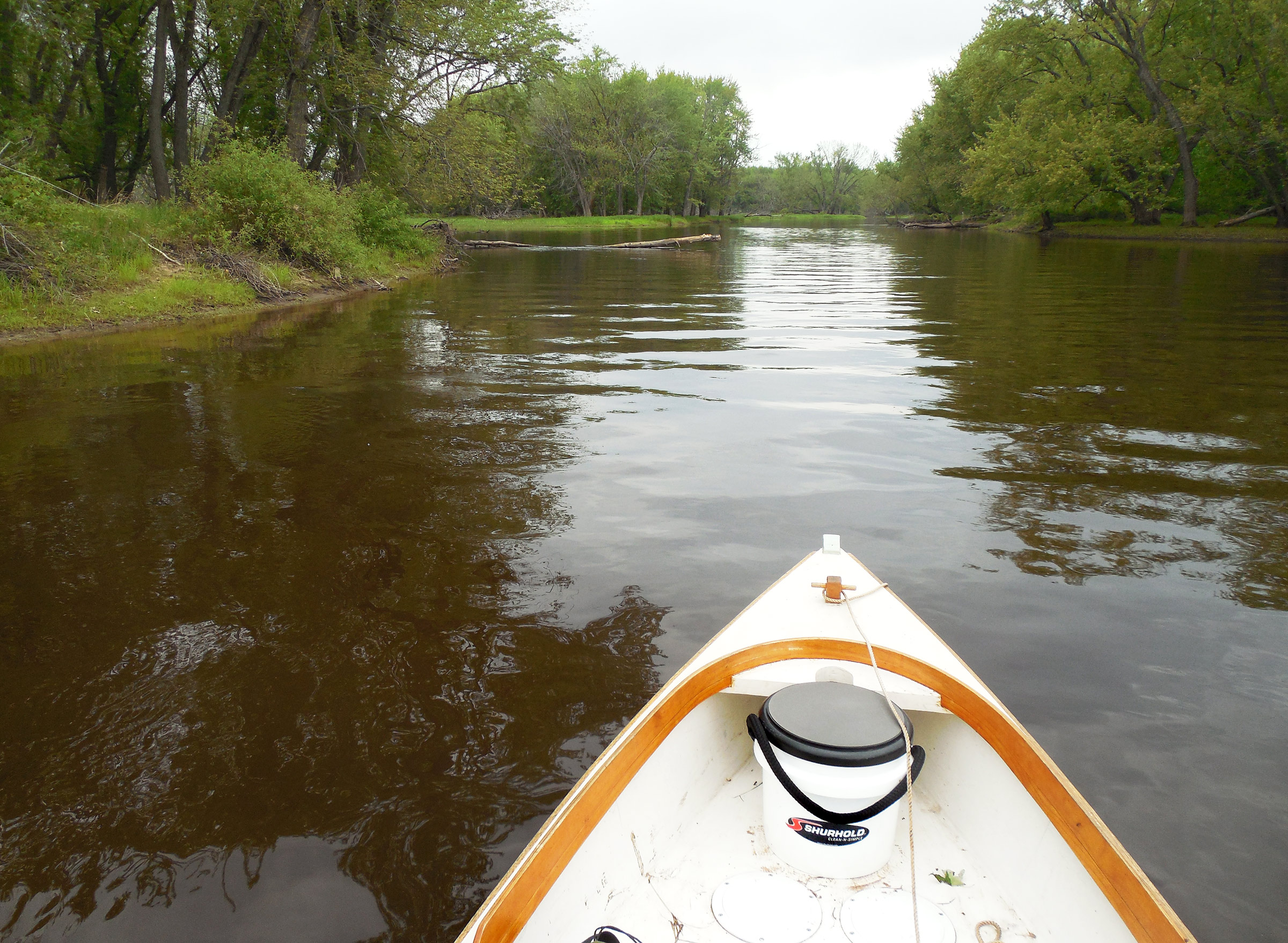
Now that I’d given up on finding a northward route, the channels grew wider—the size of small rivers, and easily rowable—and my map seemed accurate enough. The Burlington Northern rail line ran through the delta on a series of bridges and causeways, and the first bridge I passed under provided a reliable fix to confirm my admittedly hazy dead reckoning. I knew where I was, mostly, if not where I was going.
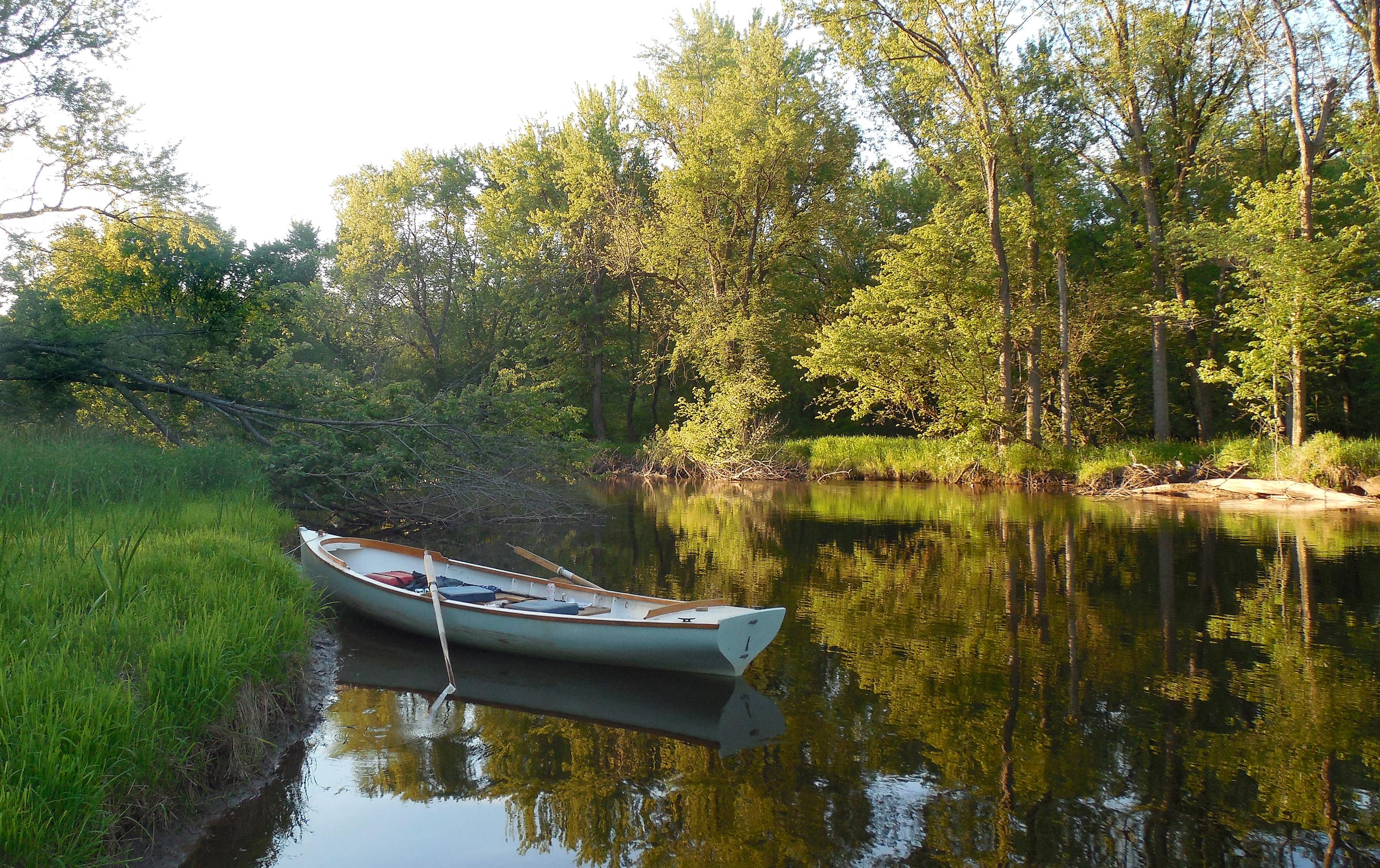
I let the boat drift along at a moderate pace, using the oars more for steering than for propulsion, stopping ashore wherever I felt the urge, or could find a relatively mud-free landing. Other than constant birdsong and the intermittent rumble of passing trains, I was caught up in a wide and rivery stillness: the faint drip of water off the oar blades, the hush of the current rippling along the banks, the breeze stirring through wide expanses of reeds at the water’s edge. After 2 or 3 miles, I pulled into a quiet backwater 20 yards wide, a still pond tucked beside the channel like a mirror sinking slowly into the mud. A few cottonwoods lined the bank, 40′ tall and leaning far out over the water. Their reflections broke into wavering ripples as the boat glided toward shore. I slid the bow up onto a low island at the edge of the pond and stepped out into thick mud.
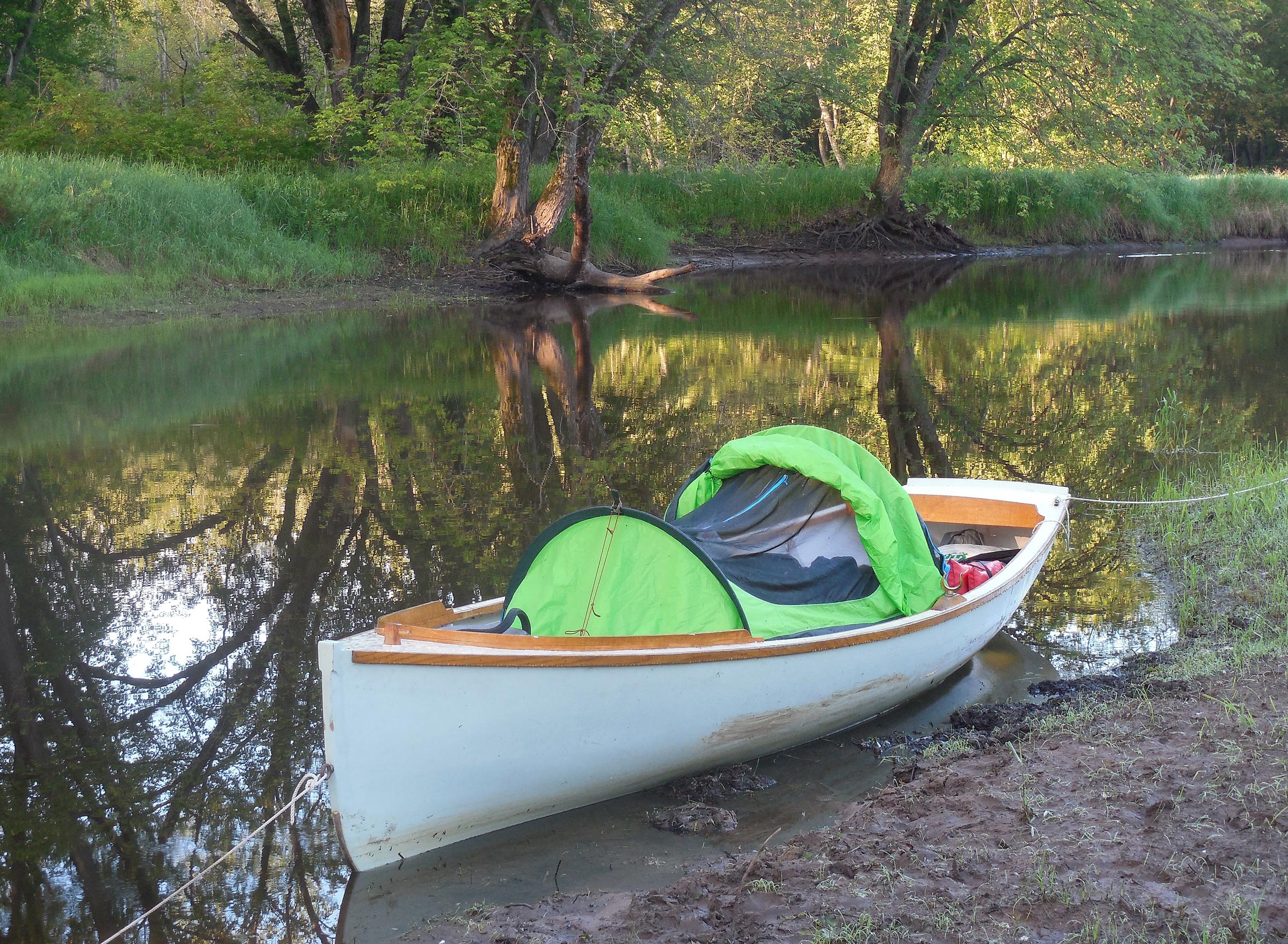
Sleeping aboard FOGG involves a fair amount of gear shuffling to arrange the platform and tent, but it opens the door to overnight trips in areas where dry land isn’t available, or where shore camping is prohibited. While a kayak would have fared better in the shallow channels north of the highway, the added comfort of an onboard sleeping system more than makes up for a heavier, less maneuverable boat.
Even well back from the river, where bright green shoots of new grass created the illusion of a carefully tended lawn, the bank was too muddy for tenting. My camp chair, a recent and dangerously hedonistic concession to comfort, sank a few inches into the earth when I sat down, and wouldn’t settle onto an even keel. The “lawn” quickly became a cattle-pen quagmire of muddy footprints as I unloaded my gear. After a supper of rice and red beans, I dragged the boat to a level position, barely afloat at the edge of the pond, and set up a thwart-height platform and small tent for sleeping aboard. I scraped most of the mud off my feet—or some of it, at least—and crawled inside at full dark. I woke again well after midnight to see a foggy glimmer of sky just visible through the leaves, and a bright half moon caught in the treetops.
By morning, after a long scrutiny of maps in the flickering light of a dying headlamp the night before, I had decided on a new plan. I’d continue down Government Light Slough to the Mississippi—less than a mile now—and then upstream past the mouth of the Chippewa River and into the western arm of the delta, an inkblot swirl of channels, oxbows, meanders, and sloughs that might allow me to piece together a loop after all. Fortyacre Lake, Chimney Lake, Swinger Slough: a devious back-channel route leading to the western bank of the Chippewa River a few miles upstream, almost a mirror image of the route I’d originally intended. From there, I could continue down to the Mississippi, up Swift Slough, maybe, and get back to the car.
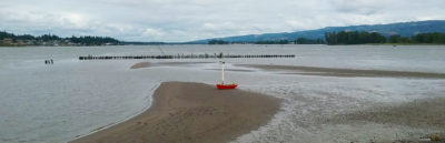
Shortly after leaving my first camp, I entered Government Light Slough, which connects Smith Slough to the Mississippi River. The floodplain’s fluctuating water levels are evident here, with bare muddy banks suggesting low water levels—probably the reason I hadn’t been able to work my way upstream to Buffalo Slough the day before.
I was happy there was still the chance for a continuous loop, however irregular and wandering it might prove. The thought of returning the way I had come would seem like a defeat, and a lost opportunity. But did the loop I saw on paper actually exist in the ambiguous and twisty delta? I had no idea.
The first leg of the day’s journey went quickly. Within 20 minutes of starting out, I reached the end of Government Light Slough and entered the Mississippi. Behind me, flat forest; ahead, wide open water, and the tall bluffs of the Minnesota side. Blue skies, bright sunlight—startlingly bright after the channels of the delta. I rowed 400 yards across the river to the mile-long ribbon of Drury Island and beached the boat as a passing barge tow sent its wake crashing onto shore. Once it was past, I headed upstream again. The current here was sluggish, and it wasn’t difficult to keep the boat moving.
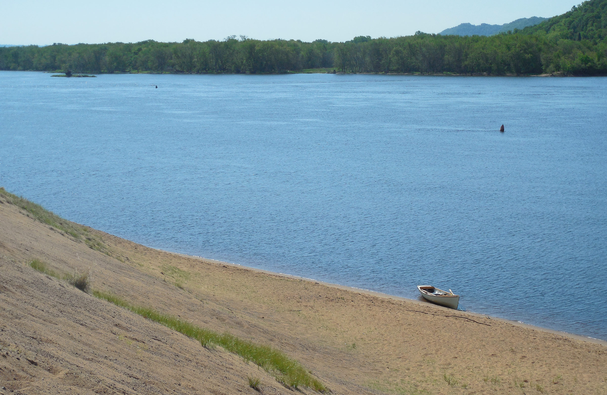
Just past the western tip of Drury Island, a line of high dunes came into view on the Wisconsin shore, steep slopes of bare sand rising 70′ from the river, half again as tall as the cottonwoods lining the bank beneath. Fake dunes, I knew. The Chippewa River runs through the sandy soils of northern Wisconsin for almost 200 miles, draining an area roughly the size of Connecticut. Much of the sand it carries drops to the riverbed where the Chippewa empties into the Mississippi. Fifteen thousand truckloads of that sand are dredged from the Mississippi River here every year and piled onto the bank in a Sisyphean effort to maintain a 9′ channel depth for commercial traffic.
I couldn’t resist a climb to the summit of the sandpile. I beached the boat, buried an anchor on shore, and headed up the slope. The sand was rough and grainy on my bare feet, and I slipped backward at every step, losing momentum, but the sun-warmed sand was already too hot for me to stop moving. When I finally reached the top, I found a barren topography of sand stretching 500 yards from east to west, far above the floor of the delta. To the south, on the Minnesota side, steep bluffs rose 500 feet above the Mississippi, capped with a thin layer of pale sandstone. To the north, the sand heap dropped abruptly to the Chippewa’s floodplain, offering a view into the forest canopy from above, leafy and green with early summer growth. A bald eagle launched from a tree below me, climbed into the sky with a ponderous rhythm of wingbeats, and angled across the river toward Minnesota.
I had visited these dunes just downstream from the mouth of the Chippewa River years before, on a weeklong trip aboard a rented houseboat. While FOGG doesn’t offer the same level of comfort—no flying bridge or hot tub—I wouldn’t be paying $450 to refill the fuel tank at the end of the trip, either.
I returned to the boat in a series of gravity-boosted leaps and bounds that carried me an improbable distance downslope at each step, nearly sending me tumbling headlong a few times. I was tempted—briefly—to climb up again for another go. Instead, I shoved off and continued upstream.
After rowing another half mile up the Mississippi’s eastern bank, I beached the boat at the mouth of the Chippewa River, set up my camp chair under a canopy of cottonwoods on a stretch of flat, firm sand, and read a few pages from George Birkbeck Hill’s Johnsonian Miscellanies, Volume II, a collection of wide-ranging anecdotes and aphorisms related to Dr. Samuel Johnson, one of the leading literary figures of 18th-century England. As an English teacher and writer, I had always felt a nagging obligation to learn at least something about him, so when I found the book in a dusty corner of a used book store, I bought it. With Volume I missing, I could appease my conscience without the bother of reading the whole thing. Besides, a collection to dip into at random seemed better suited to my lack of ambition than James Boswell’s 1,500-page opus, The Life of Samuel Johnson, which sat beside it on the same shelf. Perhaps most important of all, Johnsonian Miscellanies cost $4.50; the Boswell was priced at $65. A little learning may be a dangerous thing, but drinking deep seemed prohibitively expensive.
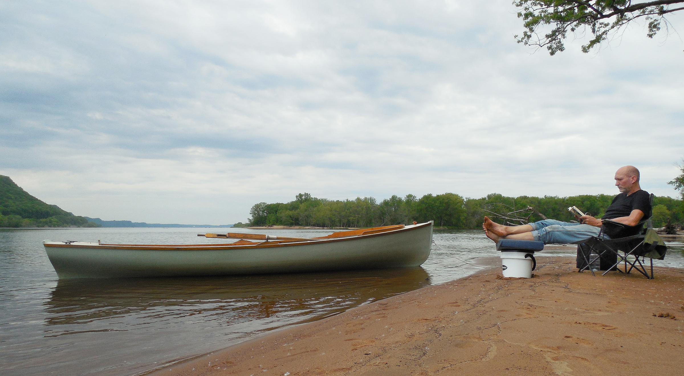
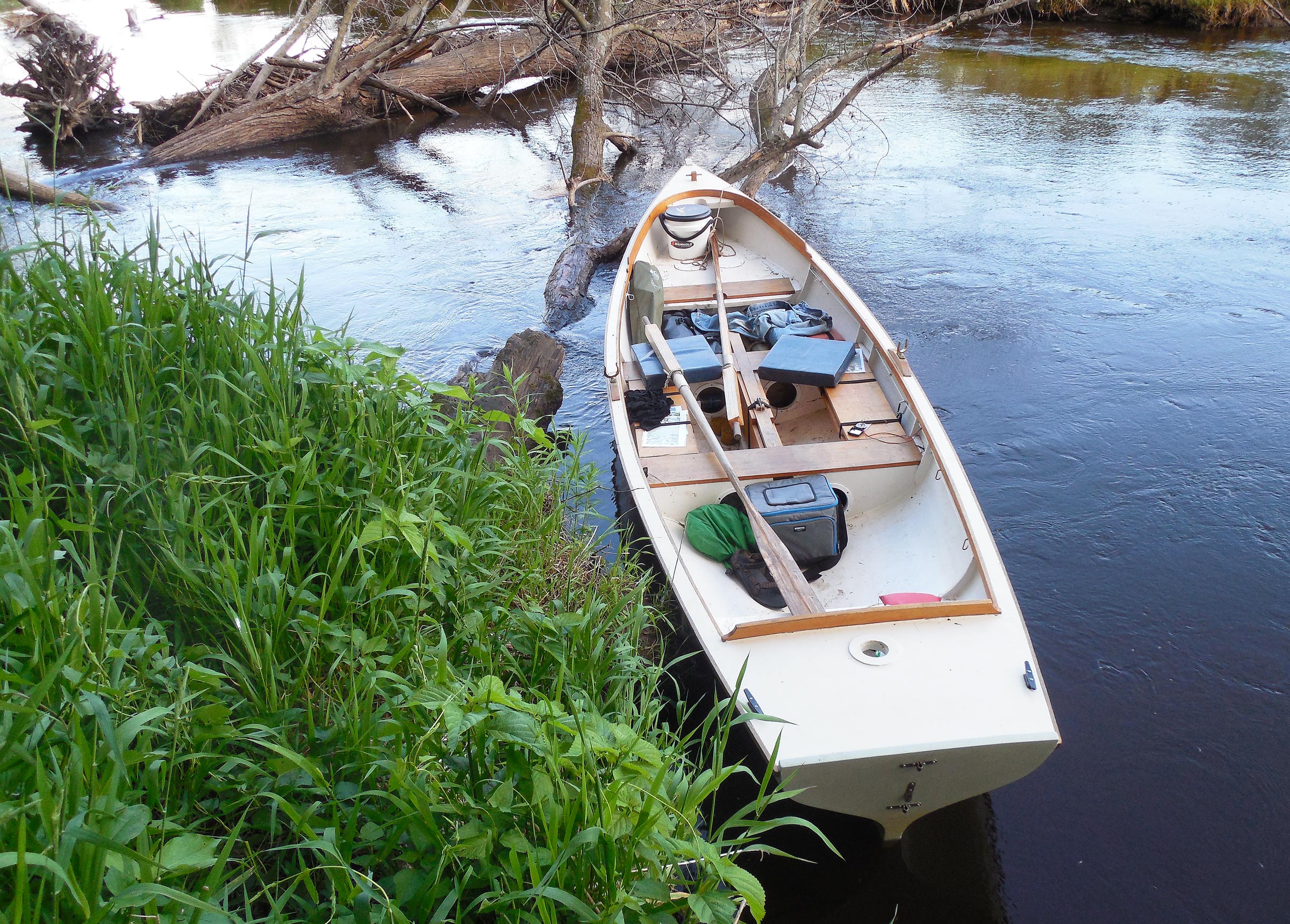
Some kind of waste-disposal system is essential for responsible camping, especially close to water. I use a simple plastic bucket with double-layer anti-odor liner bags that can be disposed of in the trash at the end of the trip. As an added bonus, the bucket makes a comfy footstool.
As it turned out, the unhurried pace of the 18th-century prose and the book’s lack of a continuous narrative thread seemed to mirror my erratic wanderings and ill-defined goals quite nicely, though I doubted Dr. Johnson would have thought much of my trip—at least, not if Hill’s portrait caught the true measure of the man: “He thought that that happiest life was that of a man of business…and that in general no one could be virtuous or happy, that was not completely employed.”
It would have been a nice campsite—level sand for tenting, plenty of shade, and a sheltered harbor for the boat—but the western arm of the delta lay just across the Chippewa River, and I was still fixed on the idea of a loop. A mile of rowing, maybe, would get me to Fortyacre Lake, the first possibility that looked worth exploring. I packed up my chair and the book and shoved off.
Fortyacre Lake went about as expected, a series of winding passages that were more forest than river. There were overhanging branches and leaning cottonwoods, side channels too overgrown or too shallow to enter, a few herons wading the reedy shallows, and finally, a dead end. I ate a late lunch aboard, grounded comfortably on a sandbar, and returned downstream to the delta’s edge to find Chimney Lake.
Fortyacre Lake looked like a dead end on the map, but I figured it would be worth checking out anyway. Despite my best efforts, though, shallow water prevented me from getting more than halfway up the channel before I had to turn around.
Here I had better luck. The channel leading into the floodplain was hidden behind a screen of reeds, and took some finding, but it kept going. Soon enough I was into a corkscrewing creek that I guessed must form the downstream end of Swinger Slough. I rowed from the aft thwart facing forward so I could weave around sandbars and downed trees without needing to turn my head to see where I was going, but it was a trade-off. The current was fast enough to require strong rowing, and pushing on the oars limited my power.
I was in no hurry, though. It was only about 3 miles along the slough from the entrance to Chimney Lake to the main channel of the Chippewa River, and the absence of downed trees and brush made up for the slow pace of upstream rowing. I pulled into a quiet corner of the woods at the foot of a railroad bridge—another definite position fix—and walked the tracks for a while, balancing on the rails as long as I could, looking for cast-off railroad spikes. The railroad causeway was the highest ground for miles, a long straight line slashed through the forest. Eventually I returned to the boat for lunch—or was it supper? I didn’t care.

The Burlington Northern rail line crosses the Chippewa River delta at the point where Chimney Lake fades into Swinger Slough. As I rowed under the bridge, a swarm of barn swallows dive-bombed me repeatedly. After a narrow escape from the birds, I pulled ashore for a break. Having made it this far, it seemed likely that I’d be able to reach the Chippewa River to complete my loop.
By 7 p.m., with plenty of daylight left, I made the turn into the upper arm of Swinger Slough. From here the route paralleled Highway 35 eastward to the Chippewa River, less than a mile ahead. By now, though, I understood that distance was not a relevant measure in the floodplain. After all, the dirt ramp I had launched from was just 2 miles farther down this same road. Through all my river wanderings, I had been covering an as-the-crow-flies distance of less than a mile per day.
FOGG, however, was no crow. No matter how twisty the channels were, I had no choice but to follow them. From here, though, it would be a straight run to the main channel of the Chippewa River. There was a fierce current against me, but with the end practically in sight, I kept rowing east along the highway, up Swinger Slough—until, with the bridge over the Chippewa River in sight 100 yards ahead, a series of downed trees blocked the channel from bank to bank.
Just after sunset, I emerged from Swinger Slough and re-entered the upper reaches of Chimney Lake. While I had an easy time here on the upstream leg, I wandered off course on the return trip, and ended up rowing through a wide expanse of water so shallow that FOGG’s keel was dragging through the mud.
Was the channel completely blocked? I didn’t want to believe it. It had taken me all afternoon to make it this far; I wouldn’t believe it. But there it was: three leafless and spindly fallen trees, spaced a boat length apart, just tall enough to stretch all the way across the slough—roots on the north bank, treetops on the south. Another dead end.
And yet, it might just be possible to drag the boat over the first tree, where the base of the trunk dipped low in the water. Once the idea had planted itself in my head, it proved hard to abandon. I rowed closer. Yes, it might be possible. I tested the depth with an oar—waist deep. It was probably stupid to try. FOGG weighs well over 300 lbs loaded, and I could barely flip the empty hull for painting, even with my wife to help me. But here I was, in sight of the Chippewa River, the last easy link of the loop.
It wasn’t easy. I managed to climb into the water and shove the bow up onto the first log, then scrambled over to the upstream side of the downed tree. The water there was neck-deep, with no firm footing to pull from. Fine. I climbed up beside the boat and manhandled FOGG farther onto the log. From there I see-sawed the boat up and down, and back and forth, walking it across the tree trunk the way you’d move a heavy cabinet across the floor, hoping the Douglas-fir backbone was strong enough to hold the hull together despite the wrangling. It must have been 10 minutes before the boat finally slid free on the upstream side of the log.
I had cleared the first obstacle—the first of three. And the next tree, higher out of the water, would be harder. I rowed up to it—awkward to do with so little room for the oars and with such a strong current flowing—and tested the depth. My 8′ 8″ oar sank all the way to the handle before touching bottom. There would be nowhere to stand for the initial heave up onto the tree trunk.
The bridge that crossed the main channel of the Chippewa was just ahead, a few yards off the right-hand bank. I could even read the green and white highway sign planted on the shoulder near the crossing: Chippewa River. It seemed a cruel blow to force an ending here.
Best to do a bit of scouting before committing to one option or the other, I finally decided. I tied the boat to the tree and climbed ashore. “Ashore,” I immediately discovered, consisted of a broad field of stinging nettles stretching 100 yards along the bank. I was wearing shorts and sandals, and a thin T-shirt. But the river was just ahead, so I waded into the nettle patch, crushing down the stalks with my feet, stomping a path. Nettles sprang back with each step to needle my legs and arms, burning and prickling my bare skin.
I finally reached the end of the nettle patch, hot, itchy, and tired. My survey from the slough bank proved that it would be nearly impossible to wrestle the boat over the second downed tree—I had known that all along, really—and the third tree was even worse. For a moment I had the mad thought of crossing the channel, dragging the boat onto the southern shore—it was cattails and reeds there, and relatively flat—and rolling it past the downed trees along the marshy ground, using my plastic boat fenders as rollers. In the end, it wasn’t prudence or foresight that saved me, but only the discovery that I had left the fenders back at the car. It would be an ignominious defeat, then, with just enough time to turn downstream and find a campsite before dark.
Where there’s a will, there’s a way. Except, sometimes, there isn’t.
The return trip—after I had dragged the boat back over the downed tree—was an easy downriver ride. I let the current carry me along mostly unaided, using the oars only for occasional course corrections. What had taken me several hours on the northward leg took less than an hour on the way back.
Even so, I had turned around none too early. The sun was almost hidden beneath the treetops as I emerged at Chimney Lake, with only a narrow arc of white-orange showing at the skyline. Soon it was gone altogether. I rowed past the delta’s shadowy wall of trees as the evening faded to a purple twilight. The surface of the water grew dark, a pitch of blackness interrupted by the glimmering reflections of the first stars appearing overhead.
I spent the night at the mouth of the Chippewa River, at the campsite I had found earlier. Flat sand, tall cottonwoods, a convenient downed log for a supper bench—perfection, or close enough to it. I sat for a long time outside the tent listening to the chuckle of water as the river slid by, and the murmuring of the cottonwoods, and the long sad whistling of passing trains along the Minnesota shore. Bats swooped and dodged at the water’s edge, and the stars seemed to pulsate with a distant hum. The boat rocked gently just offshore, the painter a long pale swooping curve from bow to riverbank. Somewhere a fish jumped and fell back into the water with a splash that seemed bigger than it should have been.

On the final morning of the trip, I got off to a slow start, brewing a batch of coffee—a rare treat—and taking my time packing up. The magic of a small boat is that you’re never far away from a quiet corner where you can spend the night unnoticed.
“Life must be filled up,” Dr. Johnson insists—a remark that had stuck in my head from the pages I’d read earlier that day—“and the man who is not capable of intellectual pleasures must content himself with such as his senses can afford.”
It didn’t seem like such a bad bargain to me. ![]()
Tom Pamperin is a freelance writer who lives in northwestern Wisconsin. He spends his summers cruising small boats throughout Wisconsin, the North Channel, and along the Texas coast. He is a frequent contributor to Small Boats Monthly and WoodenBoat.
If you have an interesting story to tell about your adventures with a small boat, please email us a brief outline and a few photos.


Tom, wonderful photos, video, and journal! I saw the “sandpile” on your map but the video makes it so that it should be renamed “sand mountain,” no? Excellent footage!
I’m wondering if any critters came around your camp sites during the night ashore? On some if my journeys I’ve been expecting to wake up with a sniffing coon next to my ear! And on that one journey I too had trains running during the night on the opposite side of the river (Potomac, C&O canal). As always Tom – thanks much!
Rob
Rob,
Thanks for the comment and the kind words. Wildlife? On this trip, I saw lots of beavers. They aren’t too shy if you’re quiet–one of them swam right by my campsite the first night. Lots of bald eagles, too.
How’s your Ilur working out? Did you end up taking delivery in August?
Tom
As usual, Tom, a great read – even if it might not have been a ‘great’ trip. Given that the world might become more sane, perhaps next year will feature another trip to the vast, and deep, Canadian waters?
John
John,
Thanks for the kind words–I appreciate it. Of course, I rely on the editing team at small boats to help shape the story and try to make me look better than I really am!
As for a Canadian trip, let’s hope so. I’ve got a long outing I’d really like to try, on some big waters farther north. I’m watching Omicron develop with a bit of trepidation over what it might mean for travel plans this summer, though…
Tom
Also: actually, it WAS a great trip, despite the dead ends. It’s the wandering around I enjoy, much more than any specific destination. A good excuse to laugh at myself for doing something so ultimately pointless, and enjoying it so much!
G’day Tom,
I’ve just re-read this article for the third time (I think) and each time I enjoy it just as much as the first. If you are enjoying the trip as you so obviously do, then it is not pointless, the enjoyment is the point. But then you knew that.
Tom, you are an artist and the water, FOGG, nature, and words are your media. Especially words.
Thanks for sharing,
Wayne
Gippsland in Victoria, Australia
A beautiful journey, Tom. Thank you for sharing. I know this special feeling of exploring well: At the upper river Rhine in Germany, where I live, we have a lot of old waterways beneath the main river, that are connected – or not. When I see an opening, I follow with my canoe, fighting and struggling aganist dead trees, mud and nettles, As long as there is current, there is hope. And like a child I expect an exiting thing behind every corner: a lost bunker of WWII, an abundand castle – or at least an old garden house 🙂 Even if it’s in reality a trip of only hundred meters with three portages, they are full of adventures … but I would never try this with the dory that is much lighter than your boat.
Gerald,
Thanks for the comment. That seems to describe this kind of small-water cruising very well. I’d love to get to the Rhine, and the canals of Europe with a boat.
Tom
Good read, as usual. I’d like to go up in Canada on a trip myself-but anchoring in a cove is the same as stepping on shore. Last year Ontario allowed fishermen in Canada but no stepping on shore without tests and shots. Not sure if the ArriveCAN will work for overnight stays.
It is surprising how similar this landscape is to what we have here in Ontario. This reminds me of the Minesing swamp—at the confluence of the Nottawasaga River and Willow Creek, west of the city of Barrie—where I made it a habit of going every spring in April/May when the water levels are so high that the rivers disappear and one can float through the woods accompanied by the same bird calls heard in this video clip. You had plenty of red-winged blackbirds around, it seems. I use a canoe, which is much lighter and the shallow draft allows getting to places impossible to reach otherwise in a swamped landscape.
I will watch the video from time to time during the winter months—nothing better to beat the blues.
Thanks for the great read.
Thanks for the comment. Yep, red-winged blackbirds and bald eagles were the ones I heard/saw the most. Blue herons, too. A canoe would have made some of this trip a lot easier, for sure! But easy doesn’t necessarily make things fun. Your trips through the flooded woods sound great.
Tom
This sounds like a great trip, full of the kinds of failures that make you appreciate what it must have been like to navigate uncharted waters in the early days before maps were available. Thanks for a great read.
William,
thanks for the comment. It would be a fun experiment to go out on a long trip without any maps at all. Maybe some day I’ll try it.
Tom
Watching you load those bags into the boat, getting ready to shove off for another day. Great stuff ! Thank You !
What a fun read, even the second time through! I’ve had many experiences similar to yours, but on a motorcycle. Here in Vermont, there are maps, and then there is the real world. Sometimes the two are close, sometimes not! As you say, the fun is in the exploring, regardless of how many miles are covered. I recently retired, and have now built a small rowboat and a kayak, so my rowing and paddling days are just getting started.
Thank You for sharing your adventure!