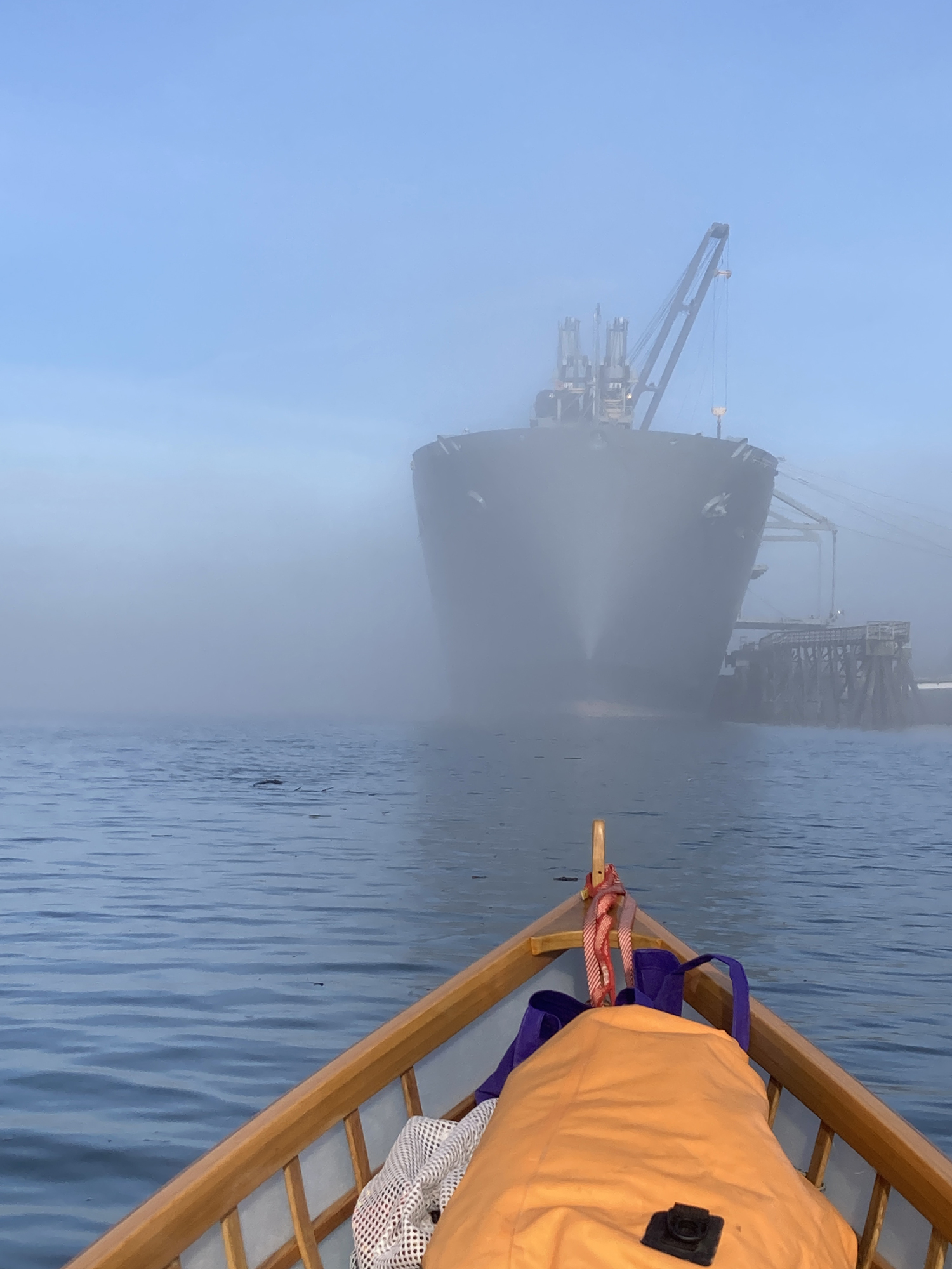
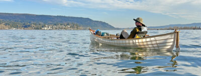
Within five minutes of setting out, a thick fog had rolled in, cutting off the sunshine and hiding the far bank. I hugged the near shore, looking and listening for tugs and freighters plying the industrial confluence of the Willamette and Columbia rivers. Early on a Tuesday, their crews had little reason to be on the lookout for a small skin-on-frame skiff edging its way along the docks.
It was early February. I had a month off from work and had decided to explore the Columbia River from Portland, Oregon, to Astoria, Oregon. Winter temperatures in Western Oregon are typically in the low 40s Fahrenheit and the weather is relentlessly rainy, but the next four days were forecast to be unseasonably warm, dry, and almost windless.
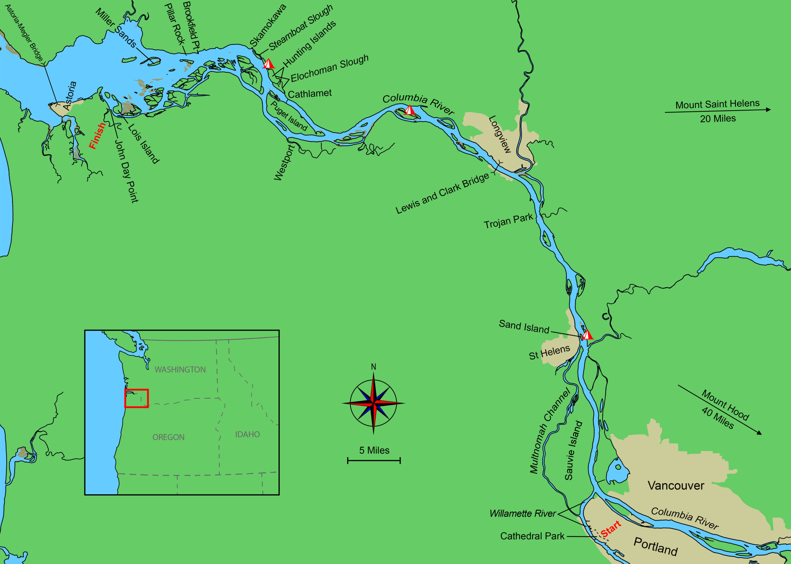
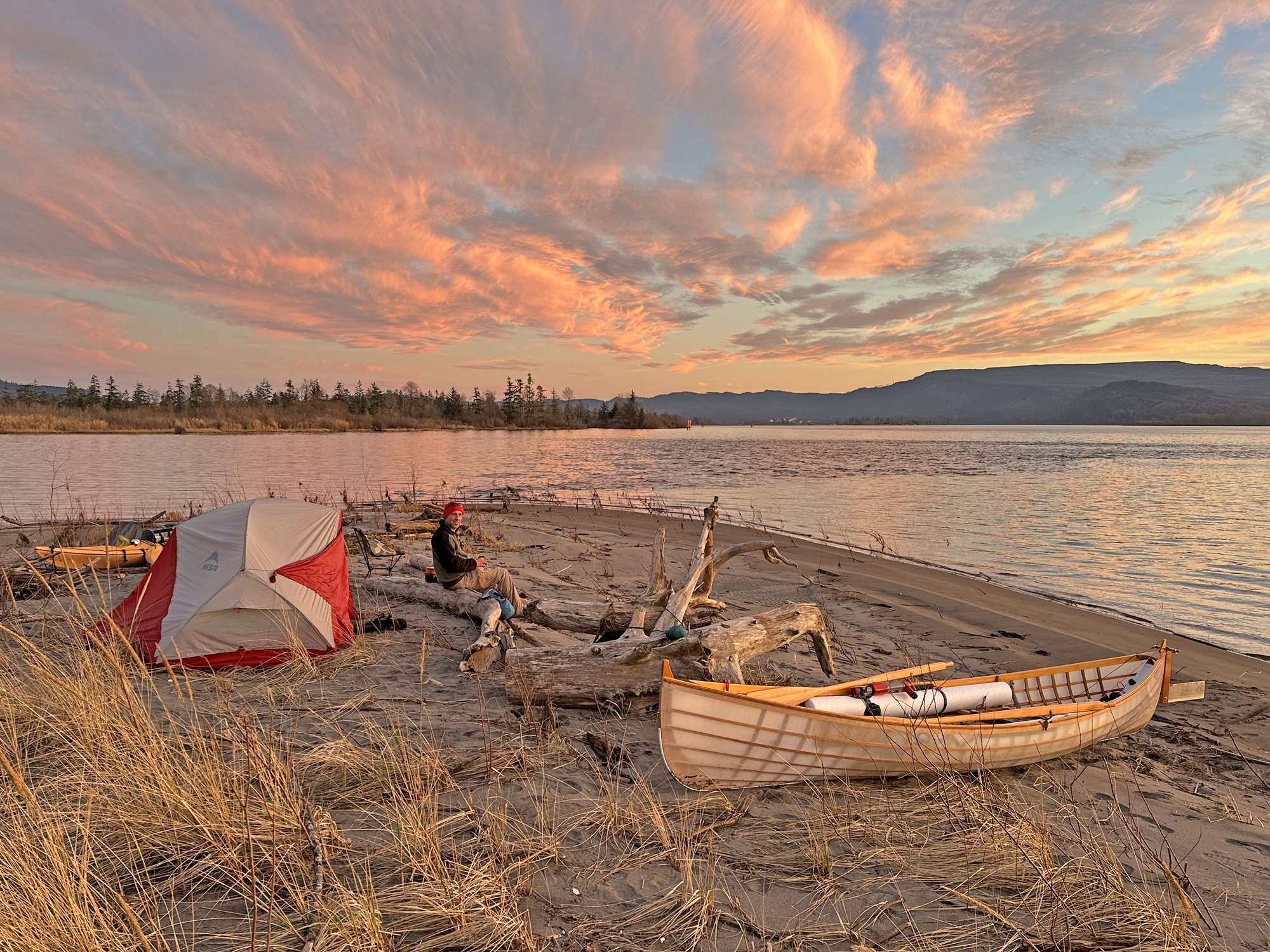
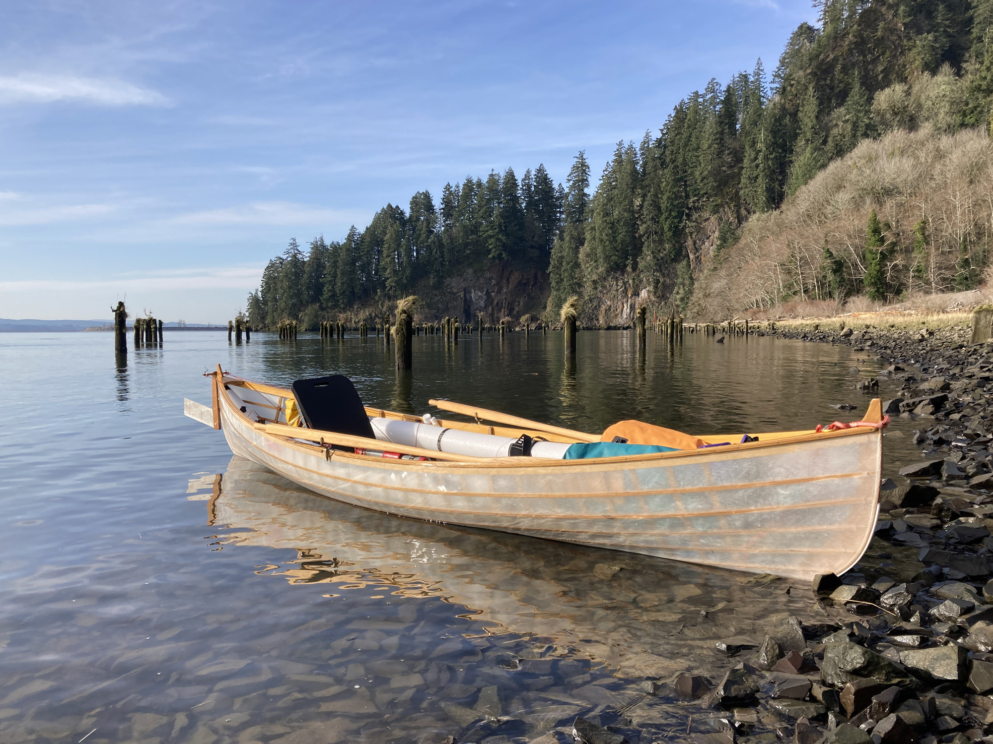
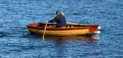
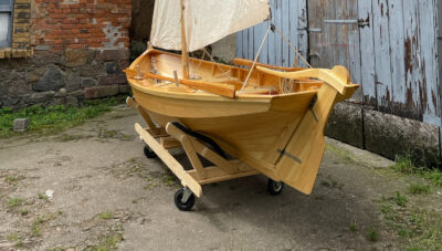
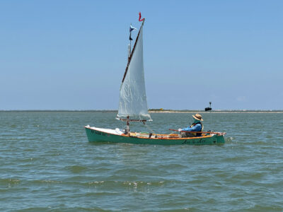
I had reached out to Brian Schulz of Cape Falcon Kayak, knowing he’d just completed two prototype skin-on-frame St. Lawrence River Skiffs and was looking for a test driver. Both boats were set up for rowing, but they had also been modified to use pedal drive. At 17′ long and 42″ wide, the larger of the two was too much for a solo mission, but the smaller one—15′ × 38″— seemed just about perfect for a multi-day camping trip. Astoria is about 90 river miles from Portland. With favorable winds and current, 20-plus-mile days would be long but not unreasonable.
 Photographs by the author
I set off from Cathedral Park in the morning fog grateful for the Hobie pedal drive that allowed me to look forward as I carefully navigated past Portland’s commercial docks. It was a Tuesday morning and I was aware that the crews of working tugboats and freighters would not be on the lookout for a small skin-on-frame skiff.
After three days of preparation, I began my trip in Portland’s Cathedral Park beneath the green-steel Gothic-arch towers of the St. Johns suspension bridge that spans the Willamette River. Apart from a few runners and dog walkers enjoying the early-morning sunshine, the park was largely empty. During fishing season, the acres set aside for boater parking would be thronged with trucks and trailers, but we had the sleepy boat ramp to ourselves as my wife helped me get the boat off the car roof rack and pulled the pile of dry bags from the trunk. Brian, too, had shown up to take photos. He was happy to see the boat on the water, but horrified by the stack of red, blue, orange, and yellow bags stuffed into the bow, making it look like a floating garage sale. “I can run home and get one 65-liter dry bag,” he offered. “Everything will fit, and it’ll look tidy. I can be back in like 20 minutes!” I apologized, but explained there was a method to my messiness and I wanted to have easy but compartmentalized access to clothes, snacks, lunch food, and my Columbia River chart book. He was skeptical, and I felt bad to be turning his elegant boat into a garbage scow, but my system works.
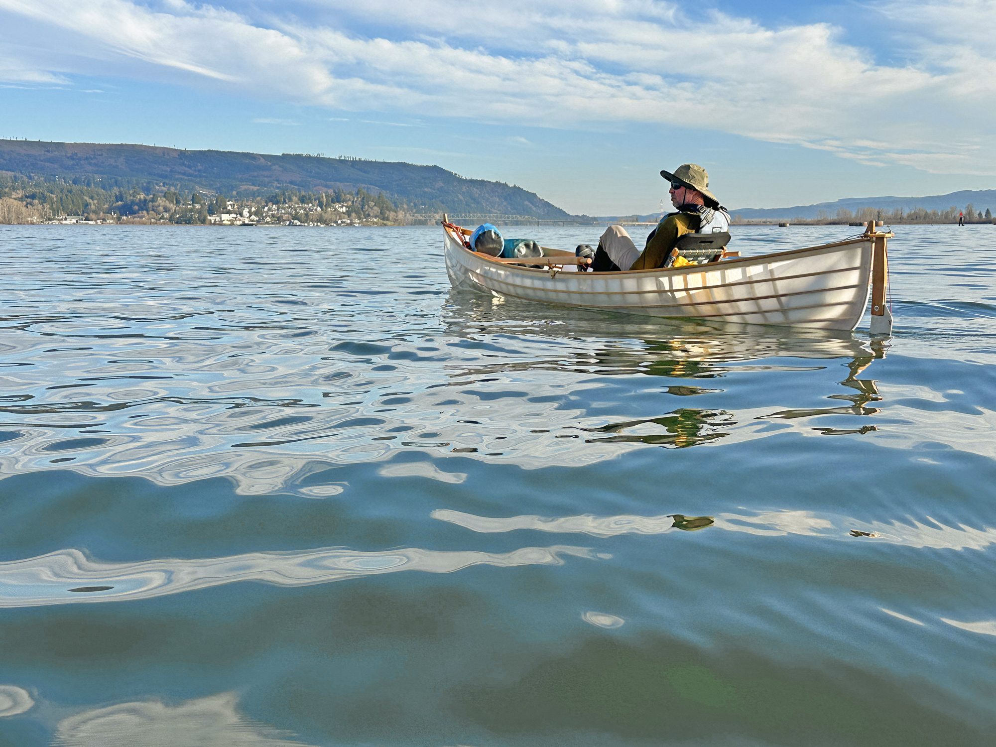
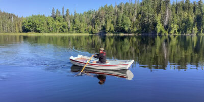
At heart, I’m a rower. I’ve probably traveled 2,000 miles facing backward, but I decided to bring Brian’s Hobie pedal drive for the novelty of seeing where I was going. Brian suggested I might like it well enough to become a convert. I had my pride, my doubts, and a moderate reluctance to embrace new technology, but if ever there was a trip on which I could learn new tricks, it was this one. The Hobie pedal-drive system uses two submerged fins that move from side to side, flexing like the tail of a fish. The hydrodynamics aren’t exactly intuitive, but the result is utterly convincing. With a wherry-shaped hull and narrow beam, I already knew the St. Lawrence River Skiff would move fast under oars, but I was surprised to find that it went as fast, if not faster, when pedaled, and with less effort. I was also excited to be looking forward without craning my neck over one shoulder.
 Roger Siebert
.
After some quick goodbyes, I started pedaling downriver. At first my upper body felt awkwardly inert, but seeing how quickly I was cruising past moored tugs and freighters, I knew that being able to switch between using my arms and my legs for locomotion would make the trip far more enjoyable than if I were just pulling oars.
The fog surrendered slowly to sunshine as I reached the confluence with the Columbia River 5 miles from my put-in. To the west, Sauvie Island would be my companion for the next 15 miles. Between Portland and Astoria, the Columbia averages more than a half-mile in width, and for the next 20 miles both shorelines were generally low-lying and sandy, with any hills and heights miles inland. Cottonwood and ash grew thick along both banks, and even though the trees were bare they still limited the views to the east and west.
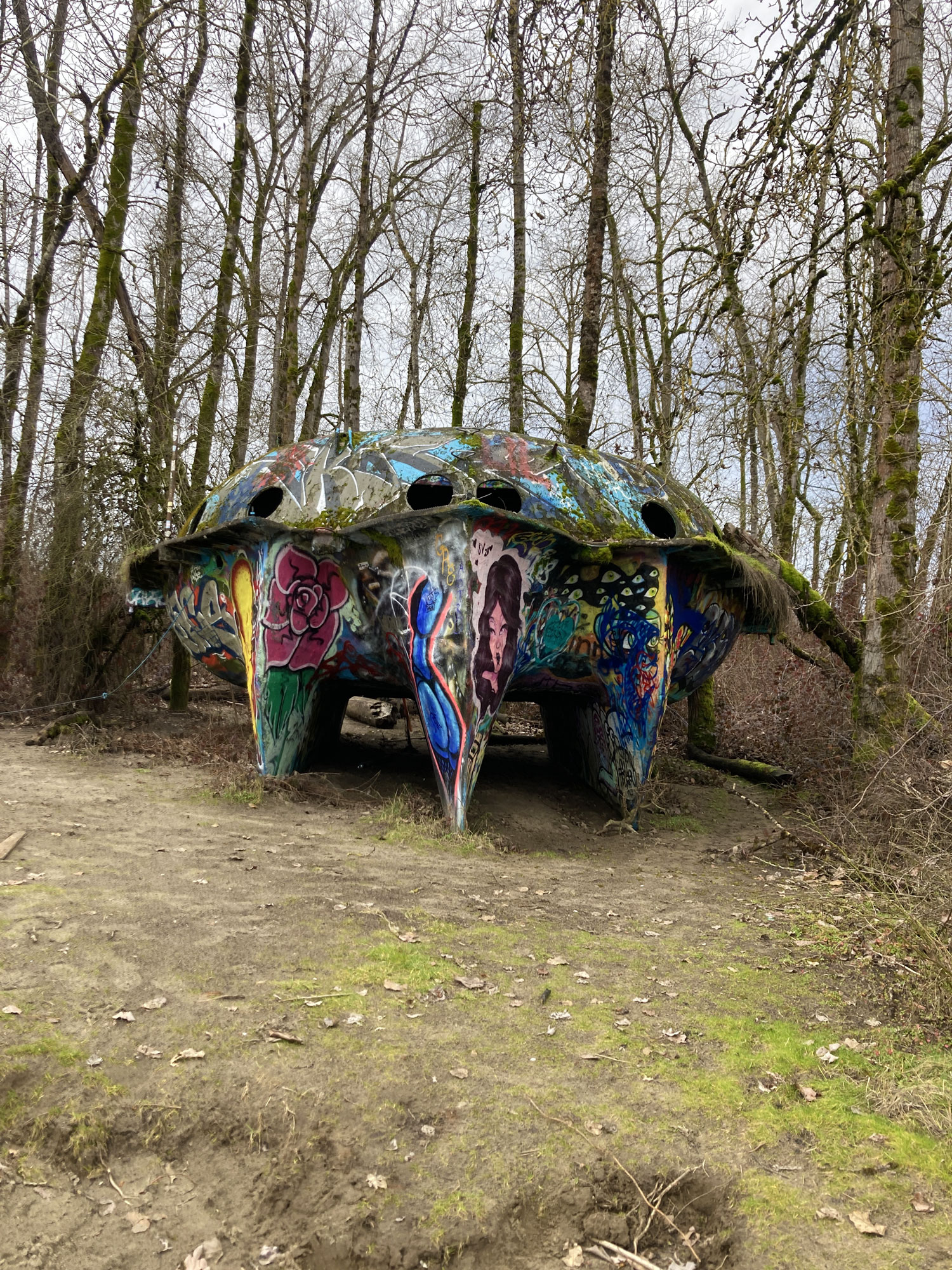
At Sauvie Island, a dozen miles downstream of Portland, I went ashore to take a look at the UFO (Unmoored Floating Object) that has long attracted local graffiti artists. This extraordinary object is what remains of a ferrocement trimaran built in the 1970s and stranded on the island in 1996.
After a solid four hours and a dozen miles of pedaling I saw the Sauvie Island UFO and decided it was time to stretch my legs. The UFO acronym stands for Unmoored Floating Object. Built in the 1970s out of ferro-cement as an experimental trimaran, the thin-shell concrete vessel was carried downstream during the 1996 flood to become stranded on Sauvie Island, where it has been accumulating graffiti and watching over a clothing-optional beach ever since. From the river, the boat was just visible at the edge of the forest where it sat in a grove of cottonwoods. I walked around the hull, admiring how much time and effort had gone into its unconventional construction. Breaks in the cement coating revealed inner substrates of welded wire, rebar, and foam, which someone had sculpted into an alien crab-shell shape. The upper decks sported thick rinds of moss, while the trimaran hulls had become canvases for graffiti artists venturing out from Portland. The UFO is just one of many ghosts of dreams scattered along the river: several abandoned algae-covered sailboats sit at anchor in lonely side channels, and there is even a nearly 400′-long ex-military landing ship slowly exfoliating its paint and surrendering to the elements, having been abandoned by its owners years ago.
Back on the water, I switched from pedals to oars, and after an hour or so of rowing, my mind went blank. I still navigated, looked for hazards and wildlife, but my thoughts simplified and eventually disappeared. Time passed, miles passed, and the shadows of trees lengthened; the water shifted through various degrees of glassiness.
The sun had already dropped below the low, rolling Oregon Coast Range foothills when I reached Sand Island off the town of St. Helens. Overall, my body felt the effort of a long day, but happily nothing hurt. The landing is home to a popular campground that offers ferry service between the town and the island during the warmer months, but I had the entire place to myself and set up my tent on a sandy beach facing away from the lights of downtown. Sleep came easily; then at midnight a freighter passed by in the moonlight, trailing a large wake that swept ashore. The accompanying noise was the beginning of a sporadic cacophony of sound: tugboats plied the waters all night long; the din of the I-5 freeway and horns of freight trains carried easily over the 3 miles of flat land between us; coyotes yipped on the Washington side of the river. And, judging by the squawking, chittering, and quacking deep into the night, the herons, bald eagles, and ducks were also awake.
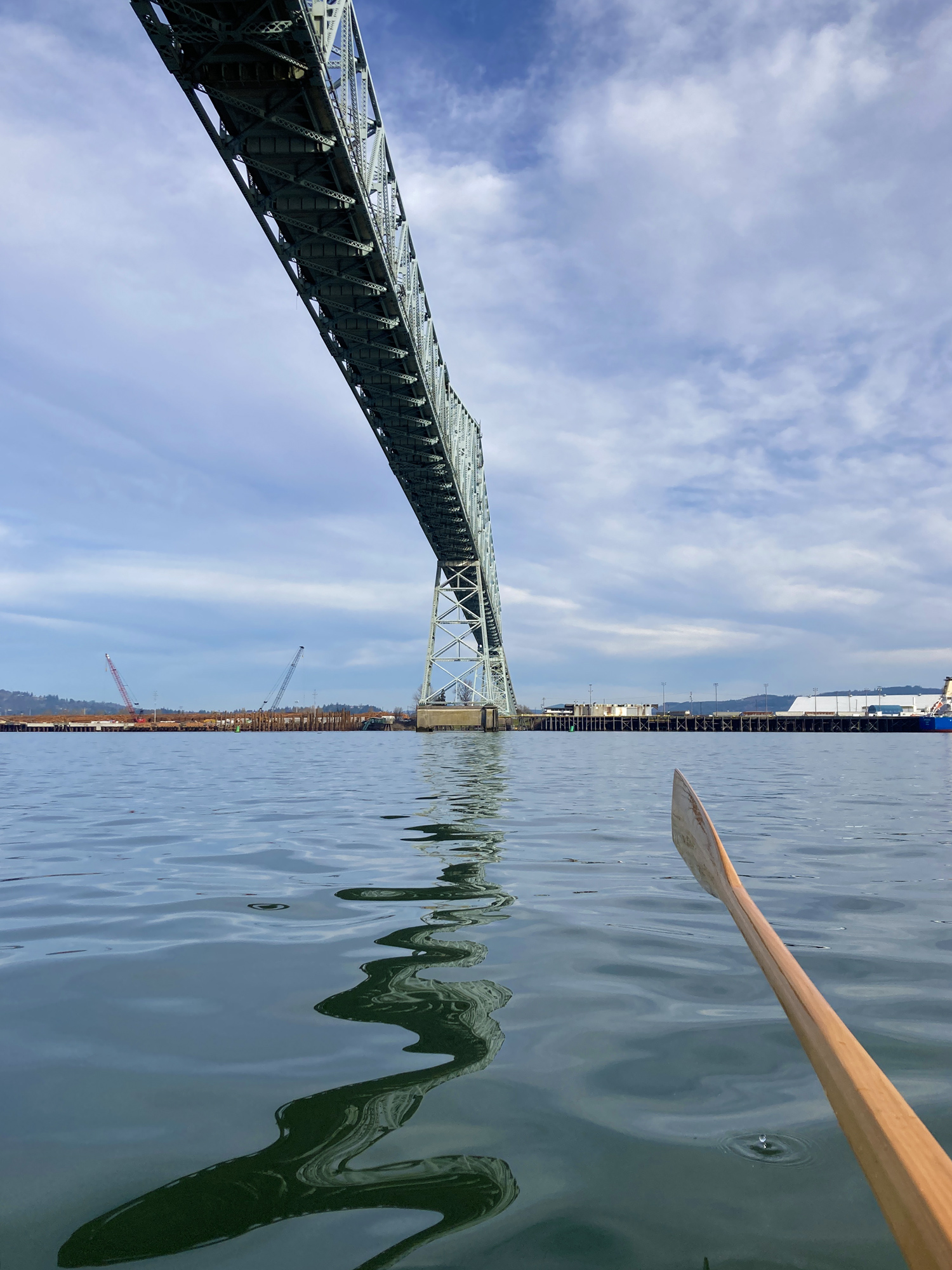
The Lewis and Clark Bridge soared 185′ above me. Built in 1930, its arch—with a maximum clearance of 210′—accommodated the last of the commercial sailing ships that still plied the Columbia River at that time. Designed by Joseph Strauss, who also chief engineer of the Golden Gate Bridge in San Francisco, it is 2,722′ long and the only bridge to cross the Columbia between Portland and Astoria.
An early start
I was a little sleep-deprived as I pushed the boat into the flat, black water well before the sunrise. The distant silhouette of Mount Hood stood in contrast to wispy clouds in the lightening sky. Even 80 miles from the sea, the Columbia is tidal and the ebb is a powerful force. An early start maximized the free ride, but after a few hours in the main channel, I started to seek out the slower, more intimate side channels. Sheltered from the battering of heavy wakes, shrubs and trees on the less trafficked waterways grew thick to the water’s edge, with some grasses thriving below the high-tide line. Kingfishers, herons, and ducks abounded, finding perches and shelter amidst the tangled vegetation.
Basalt outcroppings skinned with moss and capped by scraggly white oaks appeared on both shores as the river valley narrowed and started to bend from north to west. Glad to have a change of scenery from the sand and winter-bare cottonwoods that had lined the preceding 30 miles, I turned toward the now-defunct Trojan Nuclear Power Plant site, built on one of the few areas of exposed bedrock near the river. I approached a house-sized stone island that should have been green with moss but was, instead, capped with brown. I was close by before I realized it was a sea-lion rookery; I altered course abruptly, a chorus of grunts and barks helping to speed my departure. A few of the larger animals swam out for a closer look at the intruder.
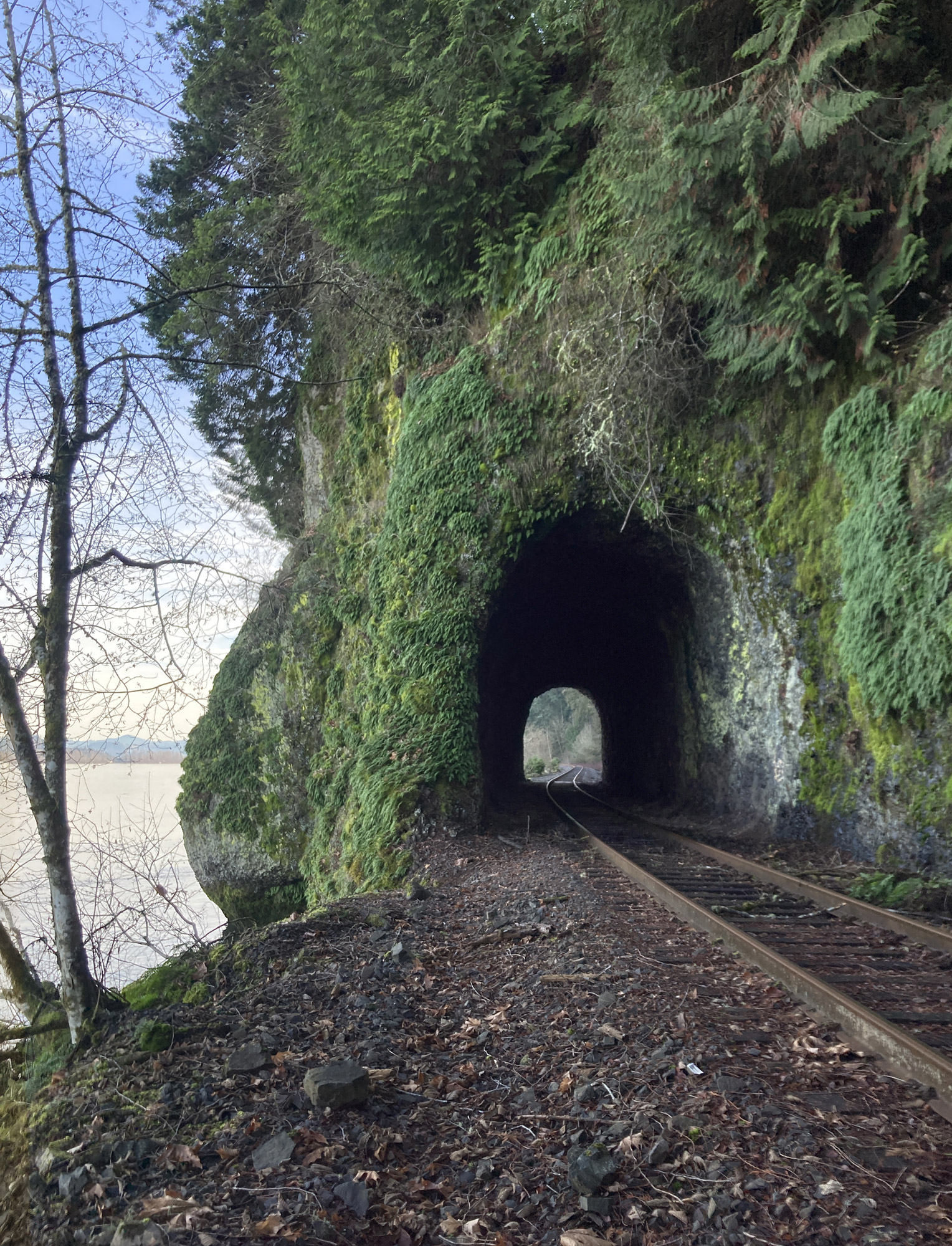
Near the Lewis and Clark Bridge, the Oregon shore became steep. The only way to access the river here is by boat or the still-used railway that was constructed in the 1890s.
Nearing my journey’s halfway point, I crossed under the Lewis and Clark Bridge, which soared 185′ overhead. When the two-lane steel bridge was completed 95 years ago, it was the longest cantilever span in the United States, and had ample clearance for the few commercial sailing ships that still made their way to Portland in the 1930s.
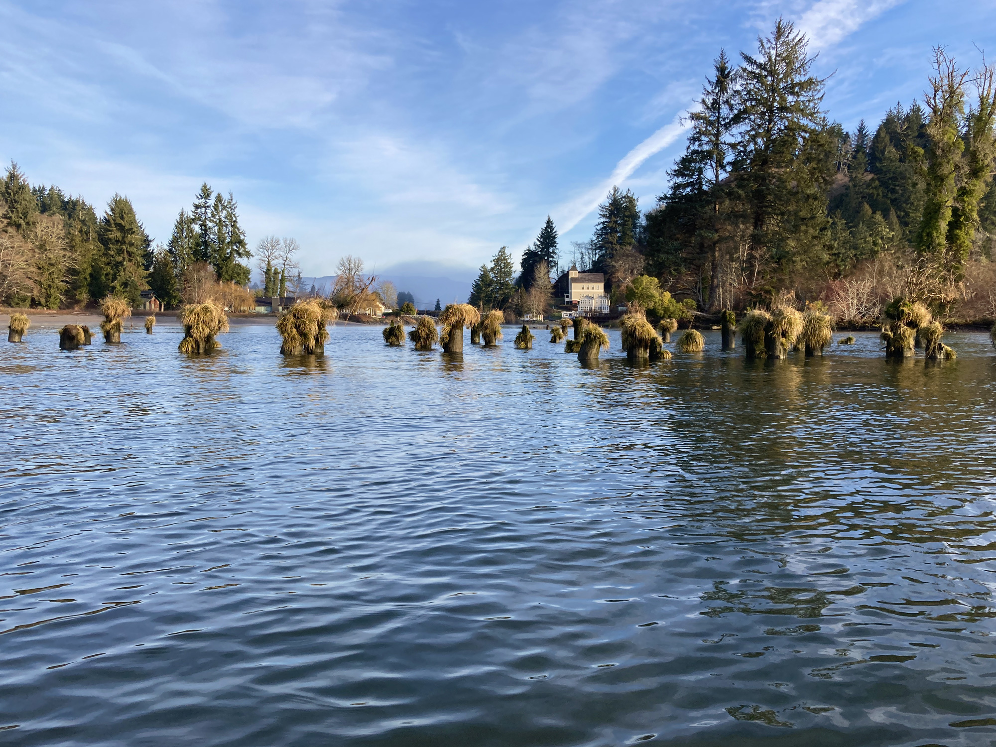
I was now happily downriver from the last of the Columbia’s major industrial and shipping ports. The Oregon shore turned steep, with occasional basalt cliff faces showing through the tall Douglas firs that covered the slopes. Only boats and the seldom-used 1890s railway provide access to the shoreline. Every hillside on both sides of the river bore scars from clearcuts. Clusters of pilings along the shores hinted at a vanished history of sawmills and salmon canneries.
Daylight was fading as I found a sandy island beach with a flat and open meadow where I could drag the boat ashore and set up camp. The last 5 miles of my 30-mile day had offered only brushy or rocky, steep shorelines, and I was elated to have found, at last, such a comfortable spot. The deserted beach offered a view of snow-capped Mount St. Helens looming high over the distant eastern hills. As I settled in, a freighter pushed upriver, its red hull riding high above the water ready to be filled with wheat before heading back to sea. I stayed up late enough to see the Milky Way emerge in the dark sky, but was fast asleep about two hours after the sun set.
Moonlight illuminated a thick fog that had filled the valley overnight, creating a false dawn. A crowing rooster on the Washington shore also seemed to believe it was morning. I looked at my clock and groaned: 4:00 a.m. After an hour of lazing, I managed to cook and eat breakfast without leaving the warmth of my sleeping bag. Trees strained the moisture from the air and I could hear the drops as they plopped from the branches. My rainfly was soaked inside and out with the humidity, and I knew I would be, too, once I was outside. The forecast had said there’d be no rain; it never said I wouldn’t get wet. Wearing full raingear and with chilled fingers and toes, I was underway before sunrise and happy to be facing forward as I picked my way through the murk. Both mainland shores were obscured by the fog, so I referenced the few bits of islands that I could see and followed the flow of the water.
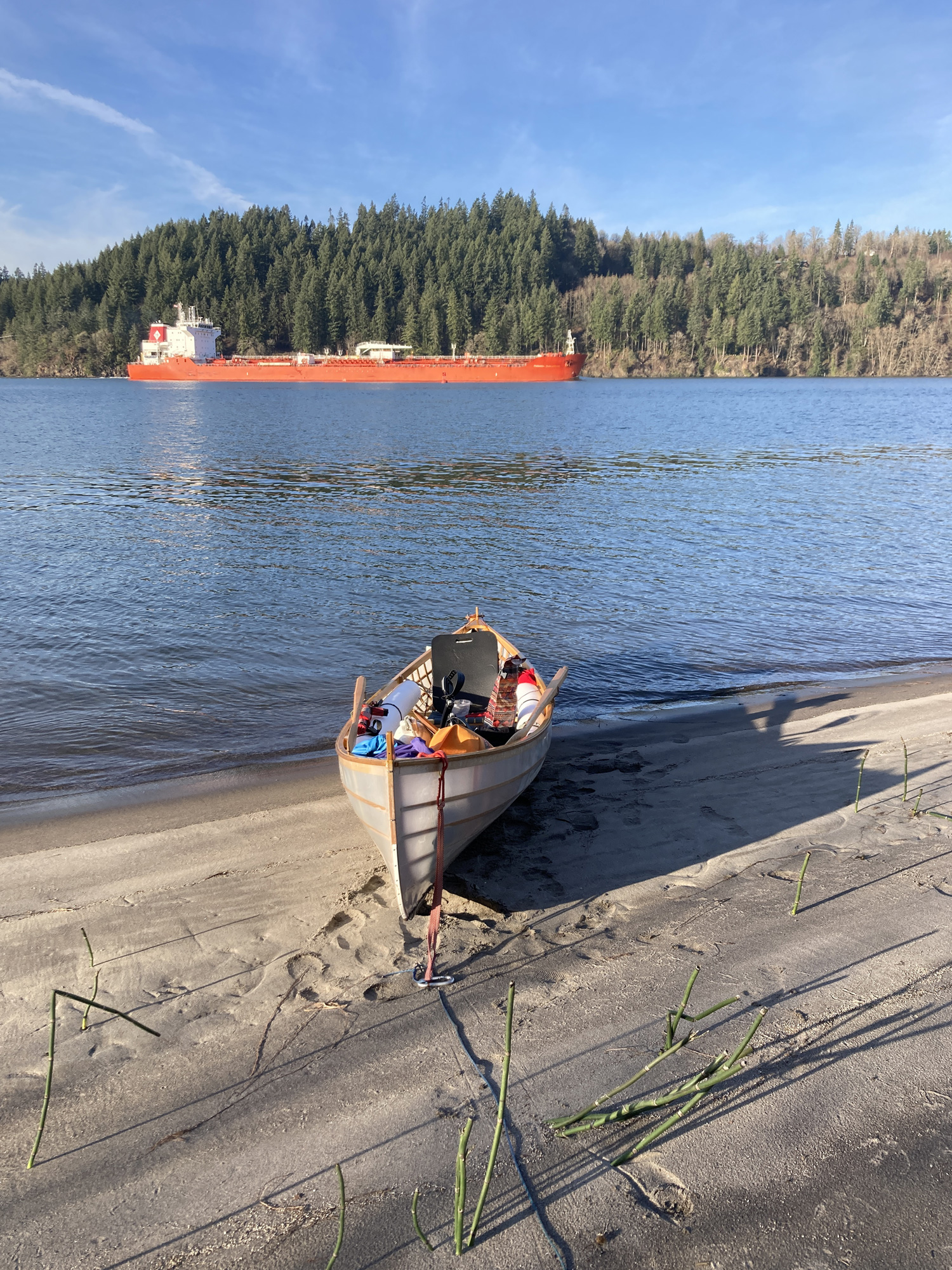
Some distance downriver from the Lewis and Clark Bridge I found a sandy beach where I could pull ashore and set up camp for the night. I had covered 30 miles and was happy to have found a good spot to rest. As I relaxed on the beach, this freighter passed by on its way upriver, its red hull riding high. In Portland, it would load up with wheat and return downriver to head out to sea with its cargo.
The fog felt interminable in the early-morning gloom, but, as the day lightened, the sun began to burn through the top layers and shafts of sunshine made their way through to the nearby hilltops. A few miles upriver of Puget Island, the light tailwind grew strong enough to send the water into a light chop with occasional whitecaps, and I decided to switch to oars, believing I’d feel more at ease with their familiarity in the rough water. With the pedal adaptation requiring a center trunk, my rowing seat was toward the stern and the boat needed a counterweight forward. Initially the weight of my gear and water bags had been sufficient to produce the best rowing trim, but now I realized I had consumed too much of my drinking water for it to provide effective ballast and the boat was no longer tracking well. I decided to forgo the familiar and went back to pedaling. The setup had performed well in tug and freighter wake; perhaps it would do equally well in the moderate chop.
Transitioning took about a minute, but I was soon comfortably pedaling again and feeling perfectly stable. According to the hiking-map app on my phone, I was traveling at approximately 6 to 7 miles per hour, with much credit owed to the stiff following breeze and strong ebbing river current, now constricted in a shipping channel narrowed by pole dikes. The Army Corps of Engineers, responsible for maintaining the river’s navigability, has pounded whole forests of trees-made-poles into the riverbed in order to adjust the flow, control erosion, and channelize the river. The two largest ports on the Columbia—Portland, Oregon, and Vancouver, Washington—lie more than 100 miles upriver from the ocean, and especially after the construction, starting in the 1930s, of several dams and locks even farther upriver, which allowed maritime traffic to reach as far as Lewiston, Idaho, the river has served as a major regional transportation artery. The Corps also dredges the navigation channel of an estimated 6 to 8 million cubic yards of material annually, creating gray sand dunes and artificial islands at intervals along the river.
 Aaron Smith
Throughout the voyage, the weather was kind. Leaving the Westport Slough the winds dropped and the day grew warm. Ahead was the small town of Cathlamet. From there, downriver, Aaron and I would enter the Elochoman Slough.
Two’s company
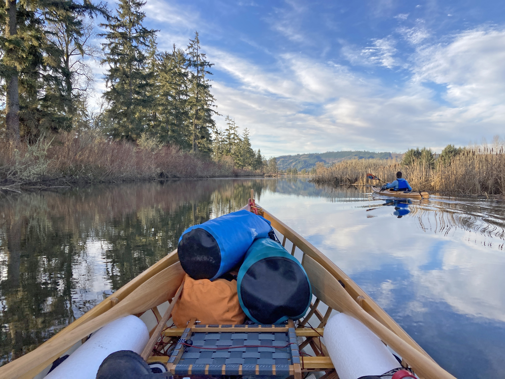
My friend Aaron had planned to meet me at Westport to kayak the rest of the river to Astoria with me. I pedaled south into the narrow Westport Slough as the final wisps of fog vanished. Three-quarters of a mile up the side channel, there was a recently constructed dock with a spacious side float for kayaks and canoes, undoubtedly popular during warmer weather. On this February day I was alone and able to monopolize the empty float and its benches as drying racks in the late-morning sunshine. Aaron arrived as I finished my lunch, and I helped him bring his kayak and gear down from his truck.
As we left the shelter of the Westport Slough together, and turned to paddle down the shore of Puget Island, I was pleased that the winds had moderated and the air was warm enough for us to stow our jackets and paddle in shirtsleeves. Puget is one of the few inhabited islands on the river and is accessed by bridge from Cathlamet, Washington, and a ferry from Westport. Much of its land is dedicated to farming, but the south shore is packed with vacation homes that sit just a few feet above the high-tide line. On the Oregon shore, the Wauna Paper Mill sent up plumes of steam against the evergreen hillsides and sounded an incessant thrum across the water. Rounding the northwest end of Puget, the small hillside town of Cathlamet came into sight. Most of its homes and buildings were built during its logging and fishing boom years, which ended more than half a century ago, and it has retained much of its historic charm with downtown storefronts and wooden houses clustered together against a green backdrop.
Aaron and I followed the Elochoman Slough downriver between the Hunting Islands and the Washington shore. The slough twisted and turned and had a primordial otherworldly atmosphere.
At the downriver end of Cathlamet, Elochoman Slough separates the low-lying, swampy Hunting Islands from the Washington shore. The slough once gave river access to a now-demolished sawmill, but just beyond the vacant site, surrounded by the Julia Butler Hansen Refuge for the Columbian white-tailed deer, the slough took on a primordial wildness. It twisted and narrowed and grew shallow, its low shores covered in moss-draped maples, alders, and scaly-barked Sitka spruce. The previous year’s dried reedy marsh grasses rose from the water and were intertwined with the bare red-willow branches to make an impenetrable understory. The sinking sun set everything aglow.
We meandered at a leisurely pace through the slough, putting high hopes on a potential camp near where the slough returned to the main stem of the Columbia. We did, indeed, find a small spot on a sand spit with just enough bare ground to pitch two tents. Driftwood had been pushed far into the nearby bushes by recent storms and high water, but it was a perfect fair-weather camp. The thin, high clouds took on brilliant hues of pink and gold, creating a panoramic sunset that surrounded us. The day’s warmth slowly faded into the clear air, reminding us that, despite all the sunshine, it was still midwinter. Stars began to show shortly after the colors faded from the sky, and we managed to stay awake past 8 p.m. to watch for satellites and shooting stars in the still silent air before retreating to our sleeping bags. I would have slept well and deeply, but long before the sun rose, hundreds of ducks, geese, and trumpeter swans in the neighboring wildlife refuge started an hours-long chorus of quacking, honking, and trumpeting.
 Aaron Smith
At the mouth of the Elochoman Slough, where it rejoined the main Columbia River, we found a sandy spit just large enough to accommodate both boats and two tents. Driftwood washed high up into the grasses suggested that the spit would be awash in a storm, but on this calm February evening it provided the perfect campsite.
A visit to Pillar Rock Cannery
Dawn came at last, bringing clear skies and crisp air. Frost whitened the tips of the nearby grass. This would be our big-water day, with minimal shelter and 8 miles of largely open water to traverse between the Washington and Oregon shores in the afternoon. About a mile downriver from our camp we entered Steamboat Slough, our last opportunity to enjoy a narrow, sheltered passage before following the exposed Washington shoreline. At the west end of the slough we passed the small town of Skamokawa, where the highway that parallels the right bank of the river heads inland for 15 miles. Beyond the town, numerous canneries, dating back to the 1870s or earlier, once lined this remote and largely roadless shore. Four miles downriver from Skamokawa we reached the site of Brookfield, once a major cannery with a population nearing 500 according to the 1900 census. It had burned down almost 100 years ago and now only a few acres of telephone-pole sized pilings indicated where the docks and buildings once stood above them.
We rounded Brookfield Point to see what was left of both Pillar Rock Cannery, and its namesake monolith, described by William Clark in 1805 as “situated half a mile from Shore, about 50 feet high and 20 feet Diameter.” Later accounts describe it as being “75–100 feet” tall before it was decapitated with dynamite so that a navigation beacon could more easily be placed on top. It was from a nearby camp that the Lewis and Clark expedition first saw and heard the ocean, still some 20 miles distant.
A few miles downriver from our overnight spot, beyond the town of Skamokawa, we passed numerous sites of once-thriving canneries. In many places, like this one, all that was left were the decaying pilings that once would have supported large buildings.
The cannery looked weatherbeaten but otherwise in surprisingly good shape. Most of the roof and walls had been clad in corrugated metal sheets, but any exterior wood surface showed the scouring effects of wind, rain, and time. Aaron and I beached our boats and ventured ashore for a closer look. The foundations of the buildings were anchored to land on the north side, but the majority of the structures were supported atop pilings in various states of repair with some of the rotted wooden posts resembling stalactites and stalagmites, their middles thinned by decay. There were even a few places where the supporting timbers were now conspicuously absent, perhaps having rotted all the way through. Recently added concrete footings suggested there had been efforts to stabilize the buildings. Through open doorways we could see a large entry hall lined with museum-like displays of artifacts from logging and fishing; beneath them a modern backhoe and tractor stood on the floor. A fine example of a wooden Columbia River bowpicker—a local boat once used in the salmon gillnetting fishery—sat on a large wooden cradle, ripe for restoration.
After a too-brief stop, but mindful of the long crossing we still needed to make to Oregon, we returned to the boats and set off. We had made it all of 500′ downriver before we saw a solidly built older man on shore waving for us to come back. We paddled to shore and nosed our boats onto the sand so we could talk. Leon and his wife had purchased both the cannery and the entire townsite, in 1978, just as it was slipping into economic irrelevancy with a slowing and consolidating fishing industry. He and his family had dedicated nearly 50 years of their lives as caretakers, restorers, and historians, preserving what they could of a rare treasure. Although Aaron and I were faced with the growing likelihood of rowing in darkness, we were not going to refuse Leon’s offer of a tour.
Four miles on from Skamokawa we came to Brookfield. This had been the site of a major cannery and in the census of 1900 the town had a recorded population of 500. Today, all that remains are a few acres of pilings where once would have been buildings and docks.
Most of the building’s galleries were empty of machinery, but we could see the ramps from the docks where the fish had been hauled in and processed in their millions. Long before a road was cut along the shoreline, the residents of Pillar Rock were solely dependent on the river for their livelihoods, food, communication, and transportation. The cannery contained the general store and post office in a corner over the water, so that residents had to walk through the length of the building past fish and nets and canning lines to get their necessities. As we walked through the whitewashed corridors, Aaron and I were surprised by how much of the interior seemed untouched by time, with the office and store looking much as they must have done in the last few years of operation. We would have happily stayed for hours hearing about the history of the cannery and the region, but the tide was already lapping at our boats and there were only a few hours of daylight ahead of us. Reluctantly, we said our goodbyes, and pushed off into the rising tide.
Crossing the Columbia
Downstream from Pillar Rock, the river widens to about 5 miles between the Washington and Oregon shores. Charts show a maze of marshy grass islands and mudflats that comprise the Lewis and Clark Wildlife Refuge between the two shores. Our plan was to cross diagonally to avoid the worst obstacles. But before we did, we paused at the eastern tip of Miller Sands for lunch, enjoying the last reliably dry ground before Lois Island, 6 miles away on the Oregon side.
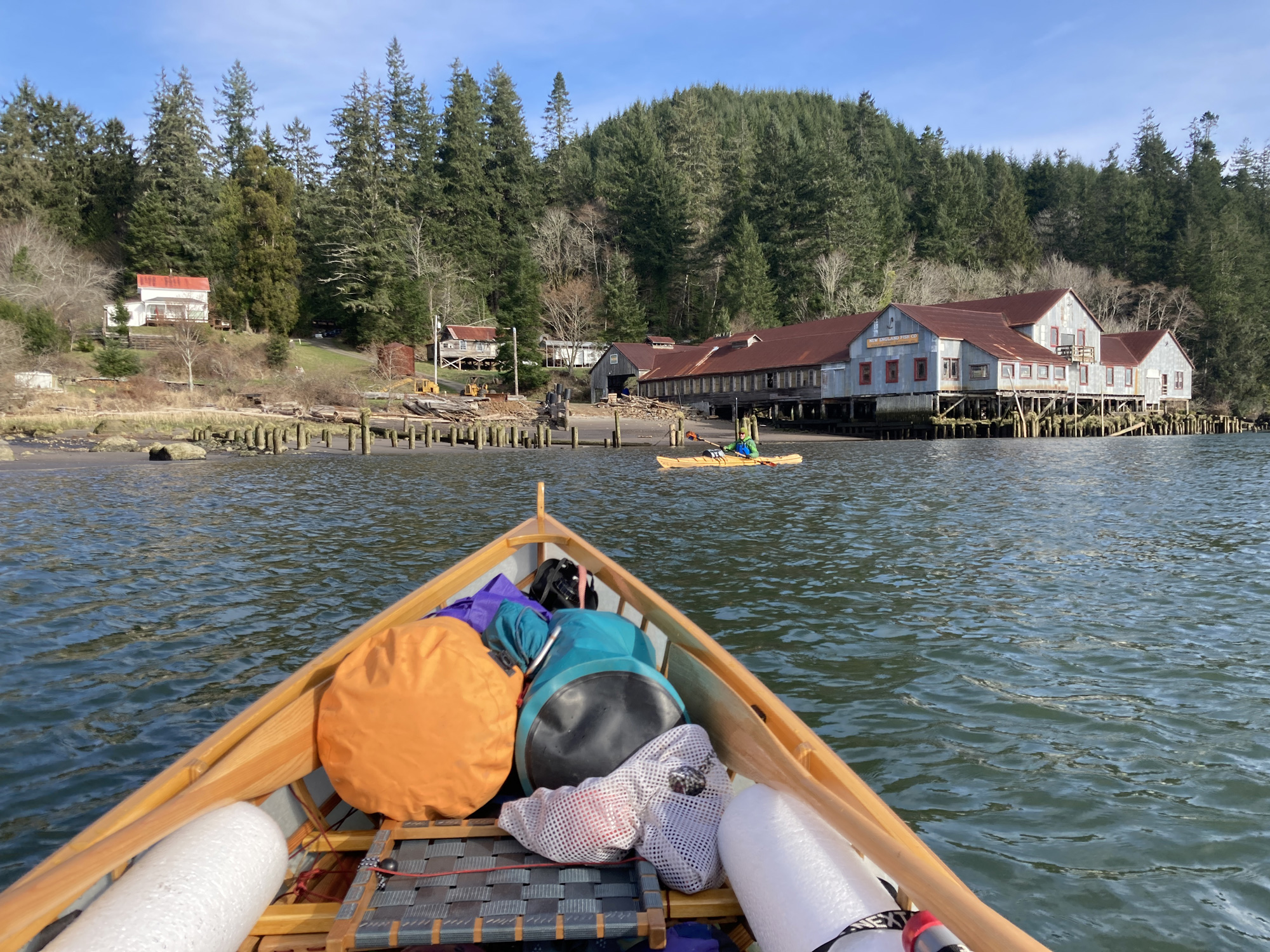
Pillar Rock Cannery is one of the few canneries that still has its original buildings. While no longer operating, the site has been privately owned and preserved for some 50 years. The machinery is long gone but the buildings are largely intact.
Rounding south of Miller Sands, we had a wide view towards the south and west, and could see the high steel-lattice towers and arched roadway of the Astoria–Megler Bridge that connects Washington State to Oregon. To our southwest, along the shipping channel off Astoria, 11 freighters sat at anchor as they awaited river pilots to guide them to ports further inland. Our plan was to skirt the marshy southern end of Lois Island and to head up the John Day River to meet my brother at the Depression-era floating home he and his wife were slowly restoring. Aaron and I were both prepared to spend another night out, but the promise of a solid meal and the prediction of 2″ of rain forecast to start falling in the early hours of the morning were incentive enough to keep going.
I was familiar with this body of water where, with the Pacific Ocean just beyond the low-lying hills to the west, strong summer sea breezes frequently build in the afternoon, and whip up waves and whitecaps that can be terrifying in a small open boat. But, on that day in February, the water could have hardly been more placid—nevertheless, I felt like we were tiptoeing around a sleeping giant. The tide was nearing the high-water mark, allowing us to pass clearly over all the mudflats and sandbars. Although high clouds began to cover the lowering sun, it would have been hard to imagine better conditions. We were happy that we could continue to make progress. Had we needed to stop, we would have been hard-pressed to find a landing: the few islets we passed were either inundated patches of grass or willow clusters sticking out of the water like temperate mangroves. None would have been suitable for getting out and stretching our legs.
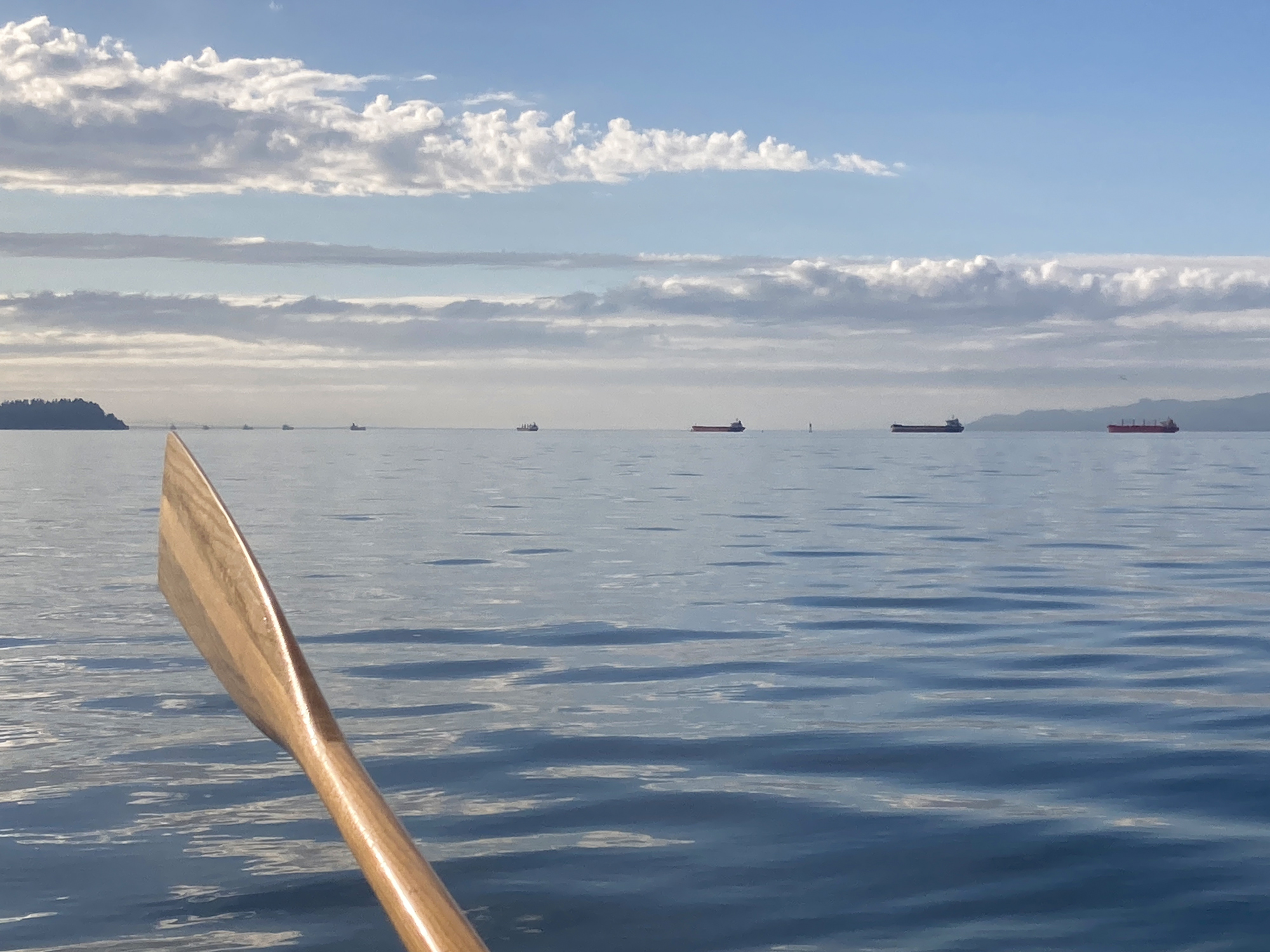
After rounding Miller Sands we had a wide-open view to the south and west. In the far distance we could make out the Astoria–Megler bridge (seen here in the haze, just above the tip of the oar blade) while nearer to us we counted 11 freighters anchored along the Astoria shipping channel awaiting pilots to take them upriver.
We reached John Day Point, with its distinctive crown of spruce, hemlock, and fir, just as the sun was setting. The railroad swing bridge at the small tributary’s mouth sat open as it has for decades since landslides and washouts a few miles to the east caused the Wauna–Astoria stretch to be abandoned. Pedaling 1 1⁄2 miles up the John Day River in the growing darkness, I was grateful for how well the boat had performed, how well the weather had behaved, and how my mind and body both felt stronger at the end of the trip than they had at the beginning. Aaron and I were tired from our few hard days of pedaling, rowing, and paddling, but we were elated as we pulled up to the floating home and were welcomed by my brother.
After a filling meal, we slept soundly in real beds, awakening the next morning to gray skies and drumming rain. The Oregon winter had reverted to its usual self, but for a few brief days, February had delivered, proving itself a perfect time to be on the water.![]()
Don Golden is a carpenter living in Portland, Oregon. He loves exploring the Pacific Northwest by boat, bicycle, and on foot. His brother, Harvey Golden, wrote “Two Nights on ZEPHYR,” which appeared in the March 2015 edition of Small Boats.
If you have an interesting story to tell about your adventures with a small boat, please email us a brief outline and a few photos.
For more Columbia River adventures, see:
Quiet Time in a Big Estuary, friends in two boats explore the Columbia River below Puget Island; by Bruce Bateau.
Taking Refuge, rowing among the islands of the Columbia River estuary; by Dale McKinnon.
Roll on Columbia, a 100-mile cruise under sail and oar in a 12′ skiff; by Torin Lee.

The structural design of the Golden Gate Bridge was primarily developed by Charles A. Ellis and Leon Moisseiff, while architect Irving Morrow was responsible for the Art Deco styling and the signature “International Orange” color.
Thanks for this correction and additional information, Julius. The original caption, in which I wrongly identified Strauss as the designer of the Golden Gate Bridge, has been corrected. This was my error, not Don’s, and just goes to prove that you shouldn’t rely on one source for information!
I really enjoyed reading about your trip. As a touring cyclist and occasional kayak camper I could really identify with the slow pace of this type of trip, giving one plenty of time really look at shoreline features and enjoy the wildlife. I am a big fan of Brian’s skin on frame boats and have watched his YouTube posts about fishing and camping in Baja with envy! I was very interested in your review of the pedal drive. As a cyclist and kayaker, I find myself irritated at how much effort it takes to see where I am going when rowing. Thanks again for the great article! Michael Morin, Los Osos, CA
Thanks for your comments. Traveling light and slow is a rare treat, and it definitely allows for closer observations of one’s surroundings than any motorized transportation would offer. Brian’s boats are a masterful blend of form and function, and I am very fortunate to have him as a friend who’s willing to loan out his creations.