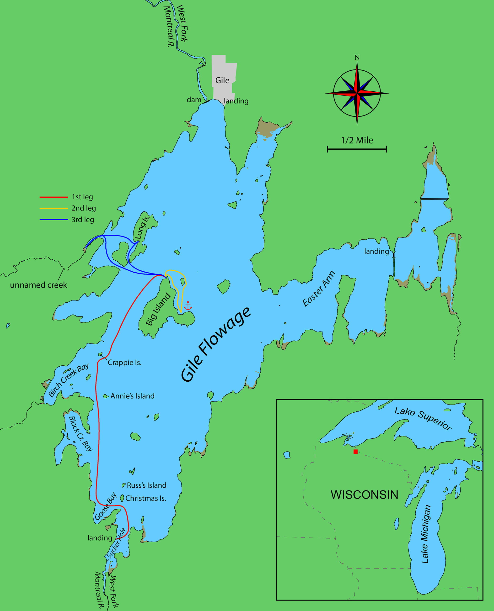
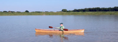
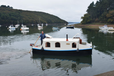
When the forecast for northern Wisconsin showed two days of fair weather after weeks of cold and rain, I loaded up my Don Kurylko–designed Alaska, which I’d lately named FOGG after Phileas Fogg, the protagonist of Jules Verne’s Around the World in 80 Days. I had nothing so grand in mind for this trip, though; my destination was Wisconsin’s Gile Flowage, a 3,400-acre reservoir near the Michigan border, a dozen miles south of Lake Superior. Here an 1880s-era sawmill dam had been unceremoniously abandoned after playing its part in reducing the old north woods to a vast field of stumps. In the 1930s, a new dam was built at the site to manage water levels for a series of hydro dams downstream. Completed in 1941, the new dam flooded a 5-mile stretch of the West Fork of the Montreal River. The result was a sprawling lake bisected by a line of rocky islands that had once been hilltops. The islands themselves, now covered with a healthy second-growth forest of oaks, maples, and spruces, remained open to my favorite kind of camping: no registration, no fees, and no reservations accepted.
The drive to Gile, a town at the north end of the reservoir that I knew only as a dot on the map, involved three or four hours of winding county roads running through long stretches of forest. I had timed my departure so I’d arrive just as a series of morning thunderstorms would be ending. I got to Gile by noon, an hour later than planned. The promised good weather hadn’t yet appeared. The rain had stopped, but bristling gray clouds raced by low overhead. A flag hung from a pole near the town-park dock, snapping and cracking in the wind. Waves were crashing over the dock and onto the launch ramp, driven by a fierce southwesterly blowing across 4 miles of open water. Streaks of white foam blown off the wave crests formed long, wavering lines across the dark surface of the water, a sure sign of serious wind.
 Roger Siebert
.
I’d need two reefs at the very least—more likely three. That was verging on foolishly windy for windward work in my low-freeboard sail and oar boat, which even the designer describes as needing “a deft hand on the tiller when the wind pipes up.” It would mean a mile or two dead into the wind to reach the nearest islands—three or four hours of cold, wet sailing even if all went well. Rowing into such a stiff headwind wasn’t appealing, either. Luckily, the map showed another ramp a few miles away on the flowage’s eastern arm, which looked like it would be a little more sheltered. I got back in the car and drove off to find it, wondering if my years of small-boat sailing had made me wiser, or just more fearful. Perhaps they’re the same thing.
But the eastern arm, too, was a mess of whitecaps and foam-streaked chop. Although this ramp looked more sheltered on paper, the wind was being funneled directly up the eastern arm of the flowage by the shape of the surrounding shoreline, a common dilemma for inland sailors, who often face headwinds wherever they go. Launching here would still mean beating off a rocky lee shore into a 3-mile fetch.
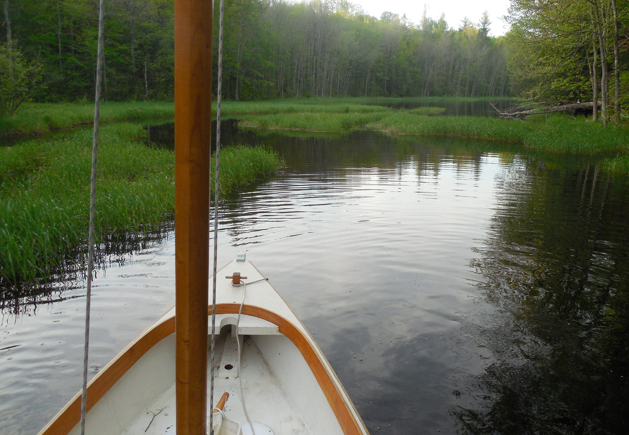
Luckily, there was a Plan C: Sucker Hole, a little-used ramp hidden away at the mouth of the Montreal’s West Fork at the southern tip of the flowage, on the windward side of the lake—an ideal launch point, really, apart from its remote location. After half an hour of bumping along at 20 miles per hour on a series of lumpy dirt roads and guessing correctly at a couple of unmarked intersections, I pulled in to the Sucker Hole launch to find a gravel parking lot the size of a tennis court, and a ladder-like ramp of rebar-linked concrete slabs. Good enough. I loaded and launched FOGG, parked the car along the shady edge of the lot, stepped the mast, and hung the rudder on the transom.
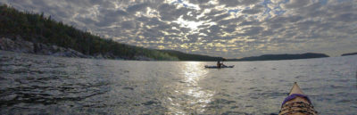
 Photographs by the author
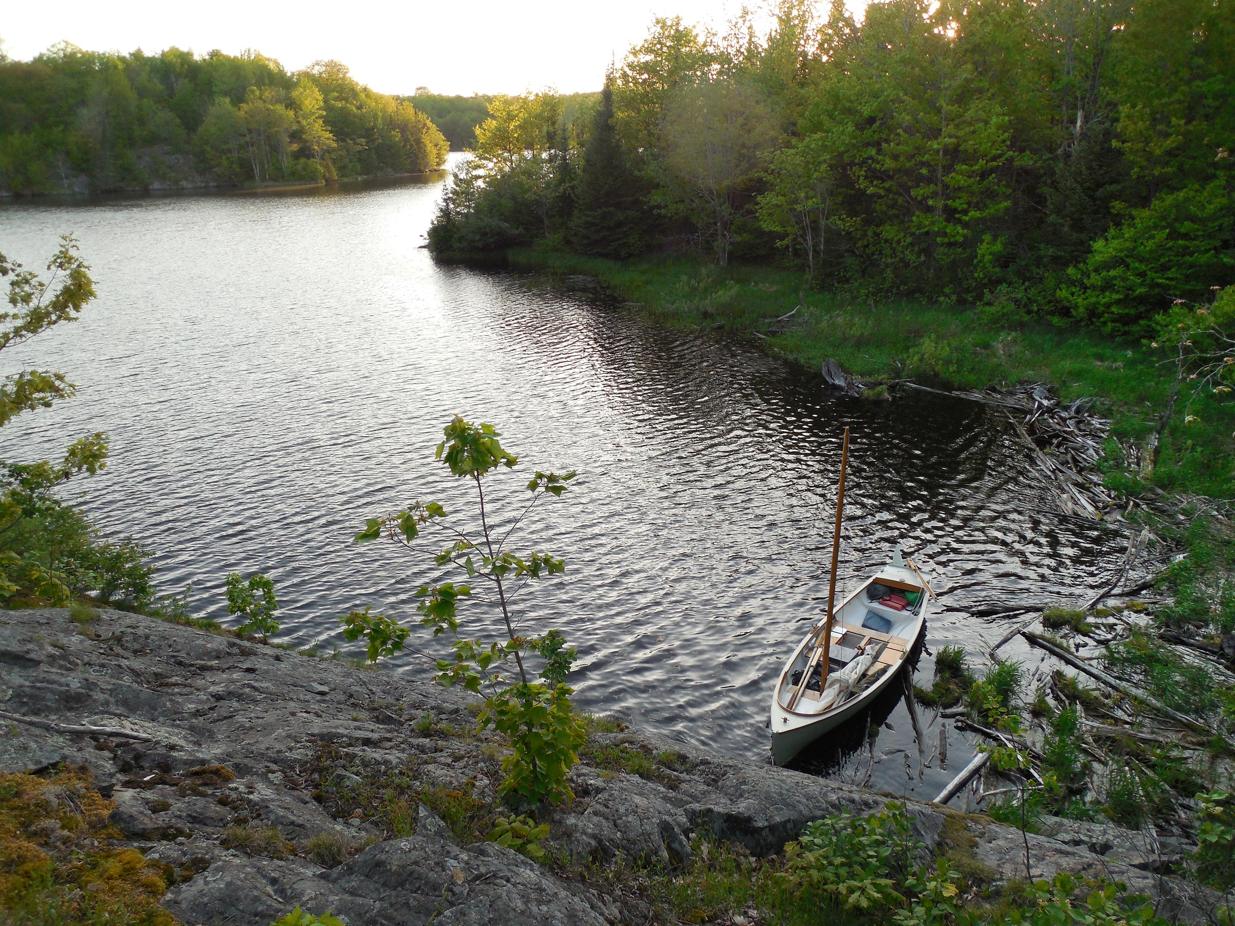
Gile Flowage lies in the southernmost reaches of the Canadian Shield, and Crappie Island, seen here on the port bow, displays the classic topography: exposed granite slabs topped by white pines.
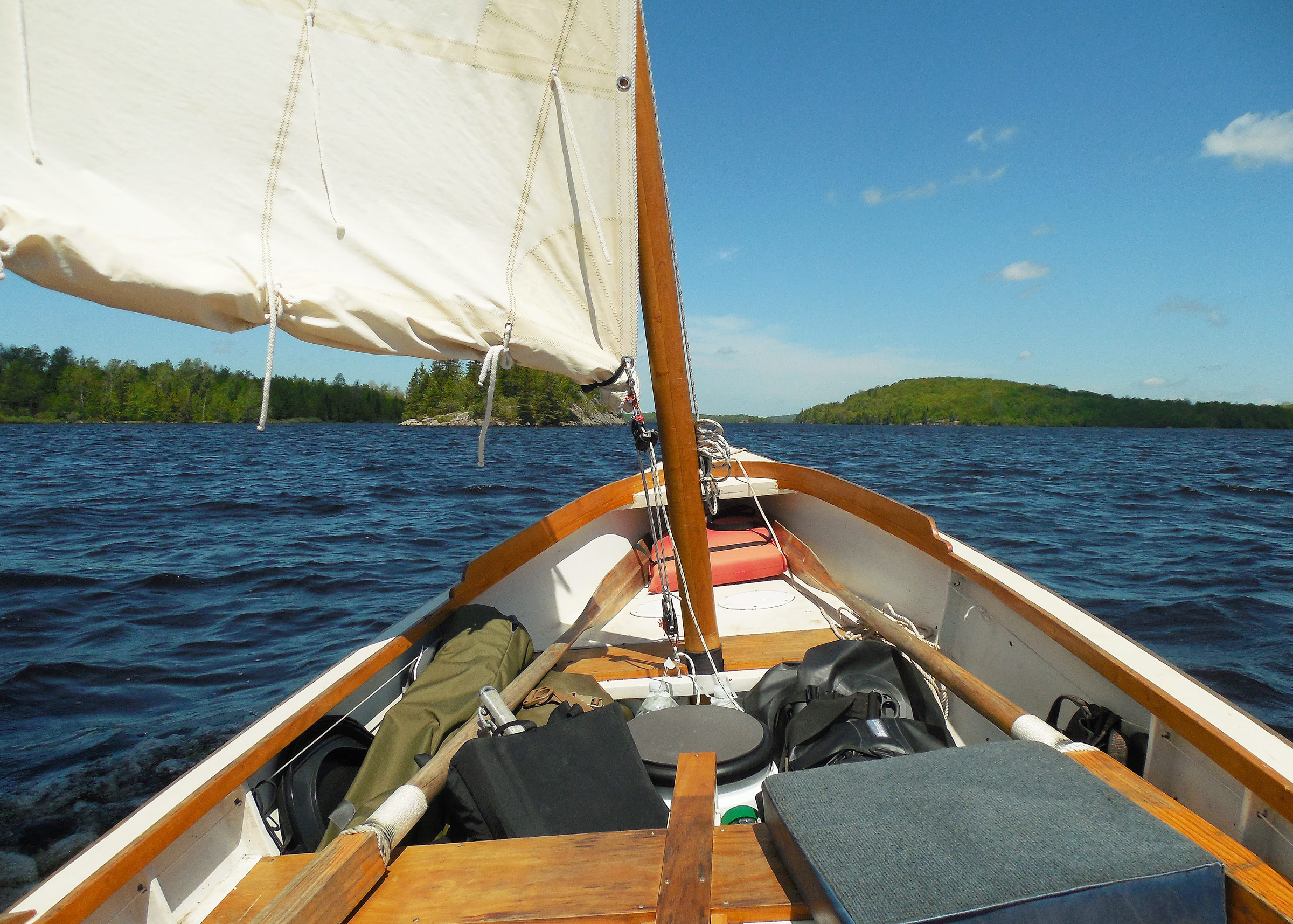
Gray skies had cleared to blue by the time I hoisted the standing lugsail and shoved off from the riverbank, sailing a broad reach on the starboard tack. Even here, a quarter of a mile up the river, the wind was more than strong enough for the double reef I had tied in before hoisting the sail. I later learned that the nearest weather stations were recording gusts up to 36 miles per hour throughout the afternoon. Almost before I could settle in at the tiller, the lee rail went under. Cool water sloshed around my ankles as I bore off and sheeted in to spill some wind. And then the opposite riverbank was coming up fast, leaving just enough room to jibe around to the port tack. I pulled in the sheet, put the tiller over, and scrambled for the high side as the sail whipped by overhead. While my sail is boomless, the snap-link I have at the clew has more than enough mass to dent the head of an incautious skipper.
In those conditions, it was a bit challenging to hook the sheet block on the new leeward side after jibing—the potential drawback of the traditional French misainier sheeting system I use. I’d have normally rigged a rope traveler for sheeting in this much wind, which would have eliminated the need to reposition the block by hand, but I had left the line I used for a traveler on my kitchen table, along with my camp stove and various other accoutrements I hadn’t even missed yet. I wasn’t sure what I was going to eat once I got to camp, but I didn’t have time to worry too much about it at the moment.
I was heading downstream now, toward the open water of the flowage. A wavering line of dark ripples racing across the water behind me, and another close behind, suggested that the gust that had put the lee rail under had been far from a fluke. Plan D: time to head for the windward shore and regroup. I steered back across the river, aiming for the 300′ gap separating the chain of thickly wooded islands from a narrow headland at the river’s mouth. Before I had time to reach back and uncleat the rudder’s downhaul in case we touched bottom at speed—or worse, slammed into a stump or rock—I was through the gap. A dense forest of spruces and maples crowded the shoreline, blocking the wind. The sheet went suddenly slack in my hand. FOGG glided slowly past the headland. The sail waved sluggishly back and forth a few times before settling somewhat unconvincingly onto a port tack again.
After a moment to tighten the downhaul and a glance at the chart to form at least the first faint glimmerings of a plan, I was through the narrows and exposed to the southwest wind again. The sheet snapped tight in my hand as the sail filled, and the boat surged forward into Goose Bay.
The first islands in the chain—Christmas Island 100 yards off the starboard bow, and Russ’s Island farther on—were rounded hilltops rising from the water, with no sheltering coves or inlets. Even on the leeward side there would be no easy place to land, with rocky shorelines backed by thick woods. The map showed a good anchorage behind Big Island, though, just 2 miles up the lake—a fast run, if not an easy one, in these conditions. I sheeted in and steered northwest, heading for the mouth of Black Creek Bay. I intended to sail as close as I could to the windward side of the lake, where the tall trees and hilly terrain might block some of the gusts.
I worked my way northward along the western shore of the flowage for 20 minutes or so, past the rocky shoals at the mouth of Black Creek Bay, jibing occasionally to avoid a dead run. A shallow curved shoreline on the northern side of Annie’s Island, tucked between sprawling bedrock slabs, might have offered a little shelter, but I thought I could do better. I continued past Birch Creek Bay and Crappie Island—a low dome of smooth granite dropping directly into the lake, making for a difficult landing—before starting the long final run to Big Island. It wasn’t easy sailing. Despite watching the sheet closely, and keeping an eye to windward to look for approaching gusts, I managed to dip the lee rail a few more times. That wasn’t particularly worrisome—during capsize tests I hadn’t been able to knock this boat over even with my full weight on the gunwale—but it wasn’t exactly relaxing, either.
Without a traveler to manage the mainsheet, I had to keep shifting the block from gunwale to gunwale by hand at each jibe. That’s a fairly a simple operation if handled carefully, one I’ve done hundreds of times without incident. Still, each repetition brought another opportunity for pilot error to creep in.
By the time I brought Big Island abeam to starboard, I was pulling hard on the tiller to fight a growing weather helm. It was well past time for the third reef—in normal conditions, FOGG can usually be left without a hand on the helm for a few moments without falling off course, even without a tiller tamer. But now, the boat was rounding up sharply at each gust, increasing the apparent wind speed and making bad manners worse.
I hadn’t intended anything close to this kind of white-knuckle outing. I had imagined an easy day lounging about in the cockpit, indulging in a bout of sustained indolence while the boat sailed itself, with the simple line-and-bungee tiller tender I call my 59-cent autopilot handling the steering. Still, there was nothing to do but use what the wind offered. Judging by the speed with which the boat was sliding past the bits of surface foam—somewhere between one-and-a-half to two seconds per 18’ boat length—I was making around 5 knots. Glancing again at the map tucked under a strap on the windward side bench, I did a bit of mental arithmetic: about 3/4 nautical mile to shelter, give or take, moving at 5 knots. I’d be pulling in behind Big Island in less than 10 minutes. Or, if I really managed to screw up, I’d be swimming.
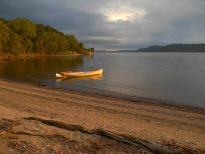
Although I had planned to circle Big Island to the leeward side before landing, this shallow sandy bight on the northern end of the island seemed like it might offer decent protection from the wind and waves, and an easy place to get ashore. I dropped the sail and rowed in to investigate.
I had planned to round the northern end of Big Island to escape the wind, but another option appeared before I made it that far: a shallow scoop of a bay on the west side of the island’s northern tip, about 40 yards wide—open to the north, but mostly protected from the south or southwest. Even better, the low sandy shore promised an easy landing. Five boat lengths out, I dropped the board, sheeted in hard, and brought the bow into the wind to drop the sail at the center of the little bay. It was a beautiful day, really, now that I had a moment to pay attention. The wind—mostly blocked by the steep rocky shoulder of Big Island here—had gentled to a breeze just strong enough to ruffle through the trees with a shifting sigh. There were no other boats in sight; an empty cottage on Long Island, 1/2 mile to the north, was the only sign of human habitation. As I bundled the sail and yard to make room for rowing, a red-winged blackbird chirped twice from its perch atop the tangle of driftwood along the shore of the bay and then flittered off into the woods. It seemed like enough of a welcome. I hauled up the rudder and rowed to shore.

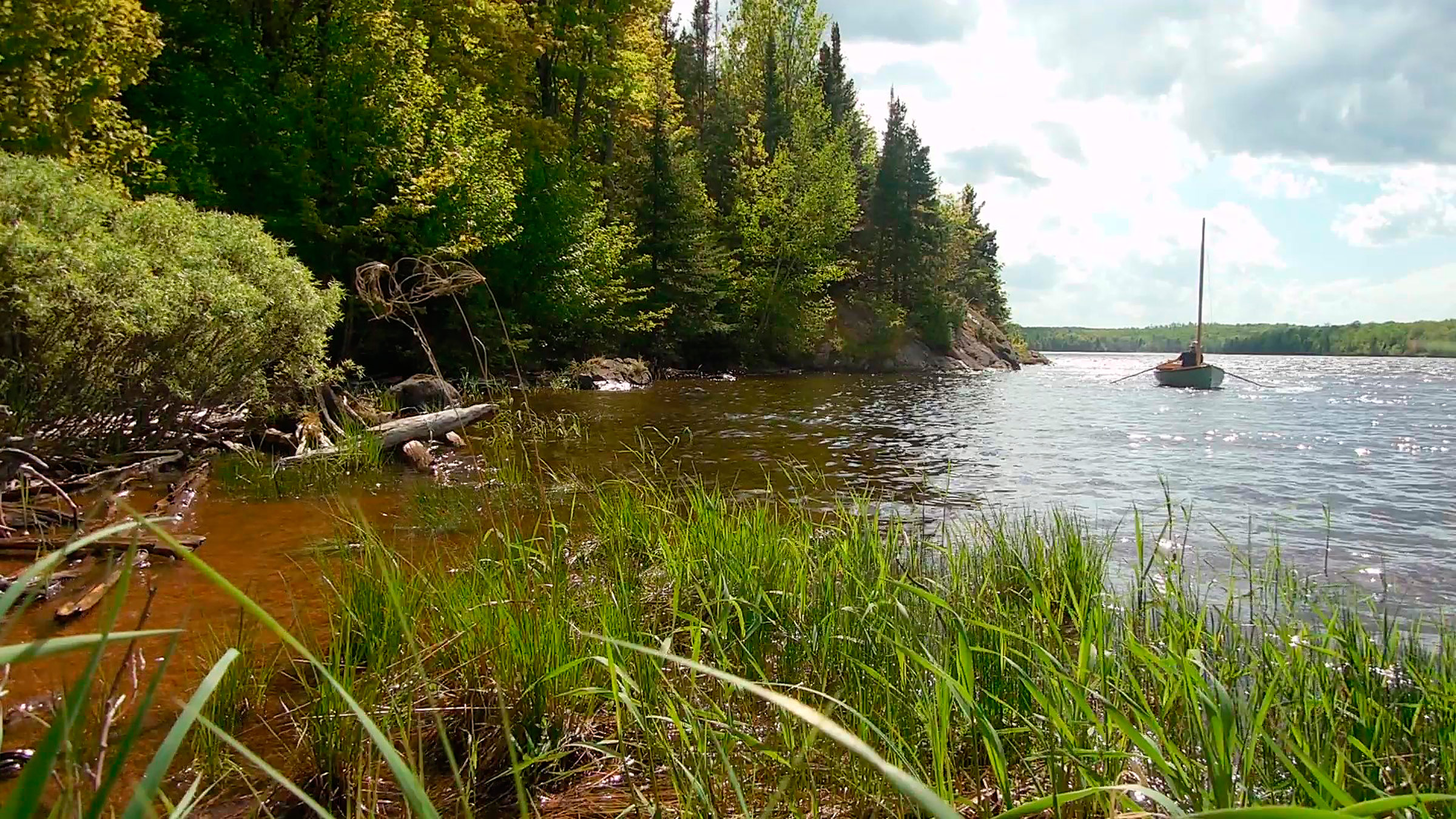
A small unnamed spot of land just east of Big Island lured me off my intended route along Big Island’s sheltered eastern shore. I came ashore for a brief exploration before continuing. Big Island’s eastern arm is visible off the starboard bow.
I had come less than 3 miles, but I felt no urge to go farther at the moment. Stepping out into shin-deep water, I pulled the boat up onto the sand—not exactly ashore, but at least solidly aground—and tied the painter to the drooping branch of a red-oak sapling. I grabbed my camp chair, a book, and the bag in which I had hurriedly packed whatever food I’d had on hand, and made my way along a faint trail through a stand of scrub brush and maple saplings to the northernmost tip of Big Island. There I found a shady spot to set up my chair beside a rounded slab of granite, a long view eastward over the lake, and enough of a breeze to keep the mosquitoes off.
The interior of Don Kurylko’s Alaska design is laid out with a thwart on each side of the oarlocks. When landing, I often move to the aft thwart and row the last few strokes while facing forward, which offers better visibility and lifts the stem to allow the boat to slide farther onto the beach.
I spent the rest of the afternoon ashore. I started to read, but soon set my book aside to simply watch whatever each moment brought: ragged wisps of white cloud passing by, a ruby-throated hummingbird buzzing around my knees, the slap of small waves at the water’s edge. Later I followed a set of wandering deer trails through the island’s interior, where the Canadian Shield started to reveal itself in broad slabs of white granite spattered with pale green and gray lichens. A band of rock faces and boulders as tall as I was formed the top of a shady amphitheater on a slope at the base of the main summit. I crossed the slope through a field of waist-deep ferns and continued on to the top of the hill, where several knee-high spruce saplings struggled to push themselves up through cracks in the smooth bedrock. There wasn’t much of a view—the surrounding maples and oaks were too tall—but there was enough of a gap in the leaves to spot a bald eagle hanging nearly motionless in the sky.
I returned to my camp chair for lunch. Dining options, as it turned out, were limited: half a bag of roasted almonds dusted with sea salt, and a small can of cashews. I must have intended to bring something more than that to augment the menu, but whatever the plan had been, it had failed. I supplemented my meager meal by browsing on some slender yellow wood sorrel I found growing along the edge of the woods—the tiny leaves had a pleasant lemony tang, though they weren’t particularly filling.
By late afternoon, the eastern side of Big Island was in the shade, with only a faint southerly breeze ruffling the water in the lee of the island. Leaving my camp chair in place on shore to pick up on my return—the little scoop of a bay was the only convenient landing spot I had found—I shoved off from the beach, rowed around the tip of Big Island, and headed south along the eastern shore to scout out an anchorage for the night. It felt good to be moving again. After five or six slow strokes to get moving, FOGG was heavy enough to glide along with no more than a moderate effort. Just as I’d expected, the broad bight on the northwestern side of Big Island was completely sheltered from the south and west. It would be a perfect place to spend the night.
By the time I got back to the landing at Big Island’s northern tip and beached the boat again, the sun was nearing the horizon, and the wind was dropping with it. I retrieved my camp chair, hoisted the sail, and set off on a beam reach toward the western shore of the flowage. Even with the double reef still tied in from earlier, FOGG wasn’t underpowered, but the wind was steadier now, making for easier sailing. In five minutes I was slipping through the passage at the south end of Long Island—at 60 yards wide, there was plenty of room—and into the unnamed bay beyond. There I lost the wind, or most of it. I eased the downhaul, slid over to the leeward side to keep some shape to the sail, and let the boat drift along, not quite becalmed. Eventually I reached a hidden finger-shaped inlet on the western side of the bay, perhaps six or seven boat lengths wide, where a row of cottages lined the shore. I dropped the sail.
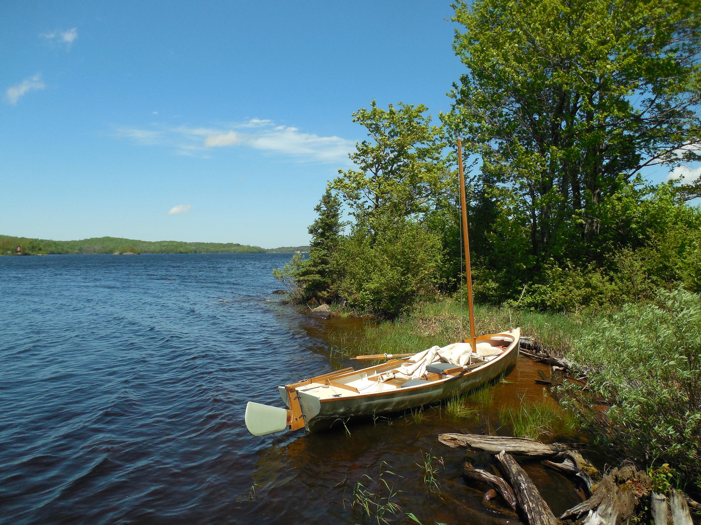
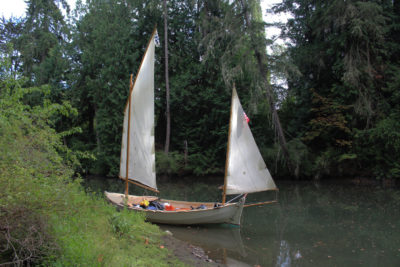
I made it less than 100 yards up the unnamed creek behind Long Island before it became too narrow for rowing. Reluctant to end my evening exploration, I managed a few more boat lengths paddling SUP style with one oar before overhanging trees closed off further progress. Here I’m about to re-hoist the sail for the return trip downstream.
Thanks to the dense forest lining both banks, the sun was well below the horizon here. The water, a dark mirror beneath the hull, reflected the jagged silhouette of each shore with perfect clarity. At the head of the inlet, above the cottages, a nameless creek snaked its way through the forest past a marshy foreshore of reeds and cattails. I pulled up the board and rudder and rowed up the winding creek until it became too narrow for oars. A chorus of frogs provided the only sound other than the faint rippling of each oar stroke, and the quiet murmur of the hull sliding through the water. Eventually, overhanging trees blocked the way. With the faint breeze behind me now, I turned the boat around, hoisted the sail, and ghosted back downstream with the rudder still half-raised and dragging in the mud, gliding silently past the cottages again. It was mid-week, so I wasn’t surprised to find them empty.
The sun had already dropped below the horizon before I landed at Long Island. After climbing the smooth slabs to the summit ridge, I was able to enjoy a second sunset from my higher vantage point.
From the creek, I sailed over to Long Island’s western side, into a quiet backwater almost completely surrounded by the island’s three distinct lobes. Steep slabs of white-gray granite, 40′ tall, lined the bay, dropping directly into the water. I headed for the northern end, unclipped the sheet from the sail 20 yards out, and let the wind carry us to shore. It wasn’t a perfect landing: FOGG bumped up against a mat of floating logs stem-first, a bit harder than intended, but then lay quietly alongside. The water at the base of the cliffs was only thigh-deep. I managed to scramble ashore with the painter, which I clove-hitched to a head-sized rock 20′ up the slabby granite. I climbed to the top of the ridge, where my higher vantage point brought the sun into view again. I enjoyed a second sunset—a vivid mix of orange, red, and yellow—before climbing carefully back down to the boat.
I slipped out of the bay under oars through a narrow gap in the southern side that, according to the map, didn’t exist. Spring’s high water levels had transformed Long Island into Long Islands, dividing the southwestern summit from the rest of the island with a shallow channel a few boat lengths wide. FOGG was sliding easily through the gap, the keel 3″ above the rocky bottom, when a sudden clatter off the port bow made me turn my head. Snorting and splashing, a whitetail deer exploded from the forest and charged across the shallow channel 10′ from the bow. Even as I rowed out to open water and raised the sail, I could still hear the rattle of its labored breathing deep in the woods.
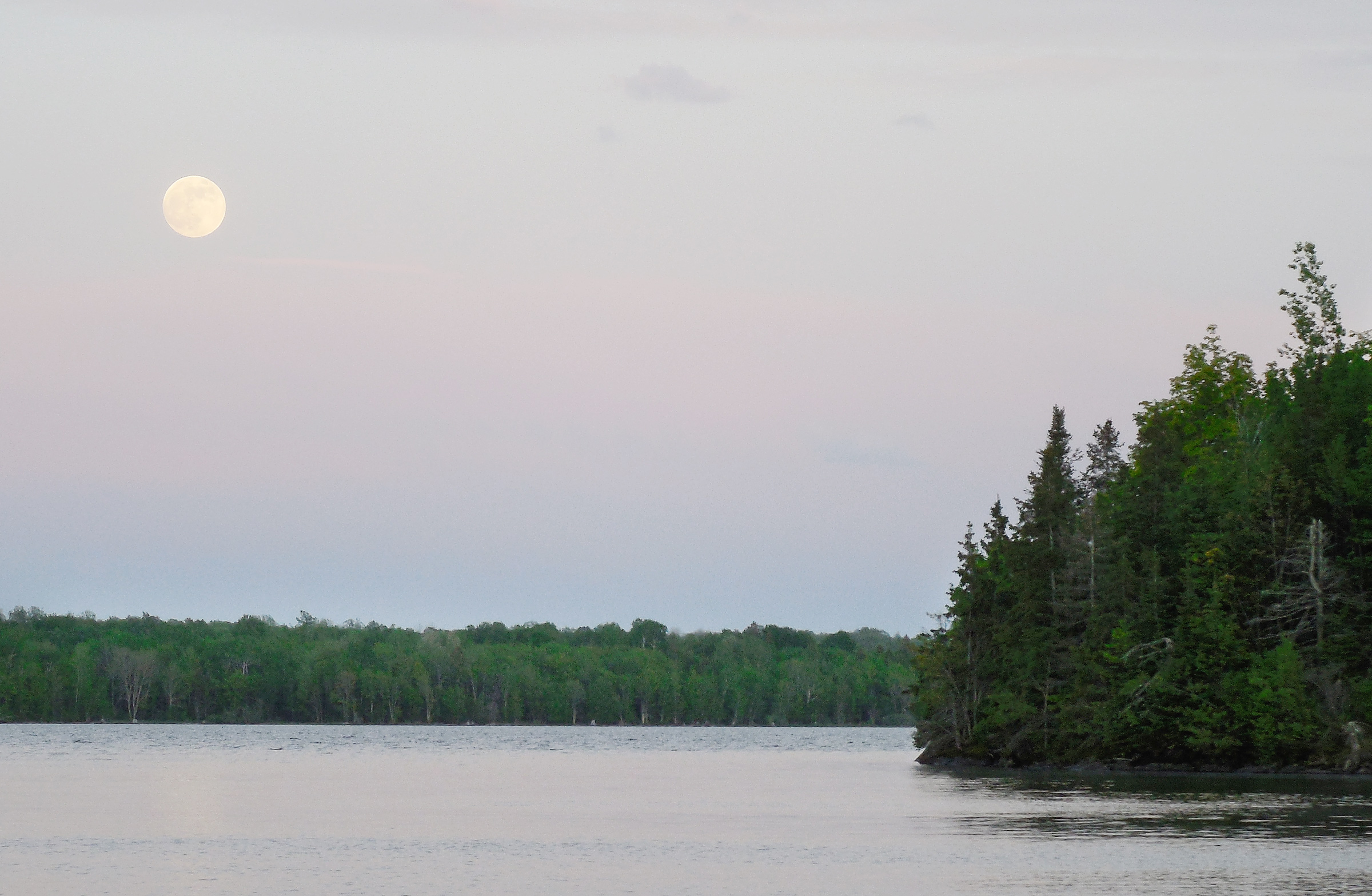
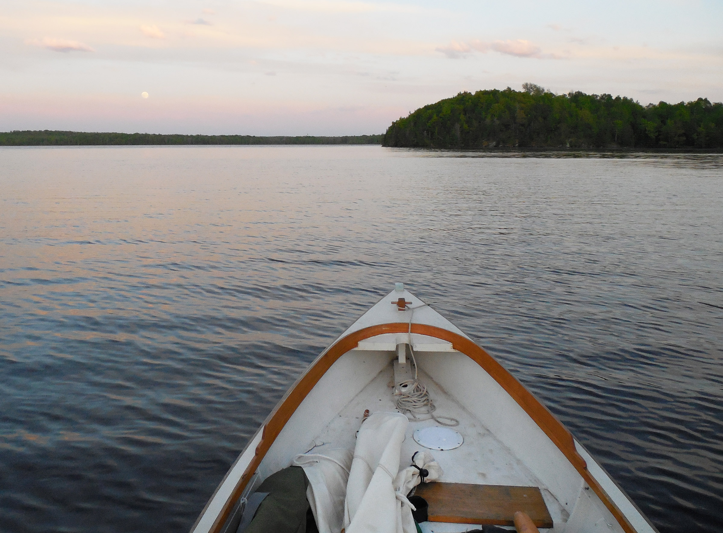
I entered the anchorage behind Big Island’s eastern arm at 9 p.m. under the light of a full moon. The sky never had a chance to darken after sunset.
That night I anchored behind Big Island as planned, and set up my tiny two-hoop backpacking tent on FOGG’s sleeping platform. The full moon hung in the sky like a spotlight, shining so brightly I didn’t even bother to pull out my headlamp. I managed to arrange my sleeping mats and blankets and crawl inside just before the mosquitoes arrived to hang on the mesh of the tent above me in a high-pitched buzzing drone that made me grateful to be inside.
As I had expected, Big Island’s eastern arm created a perfectly sheltered anchorage for southerly breezes. Hoping to keep my distance from the mosquitoes, I abandoned my usual practice of tying to shore with an anchor off the stern, and anchored 50 yards out instead.
I lay in the tent, watching through the mesh as the night came alive around me. Three or four bats began to swoop and circle overhead like flickering shadows. Hundreds of frogs on Big Island set up a continuous clamor of croaking and chirping, and I could just hear the faint whisper of a breeze in the treetops. I drifted off to sleep, happy to be tucked into a sheltered corner of the flowage, cozy and bug-free.
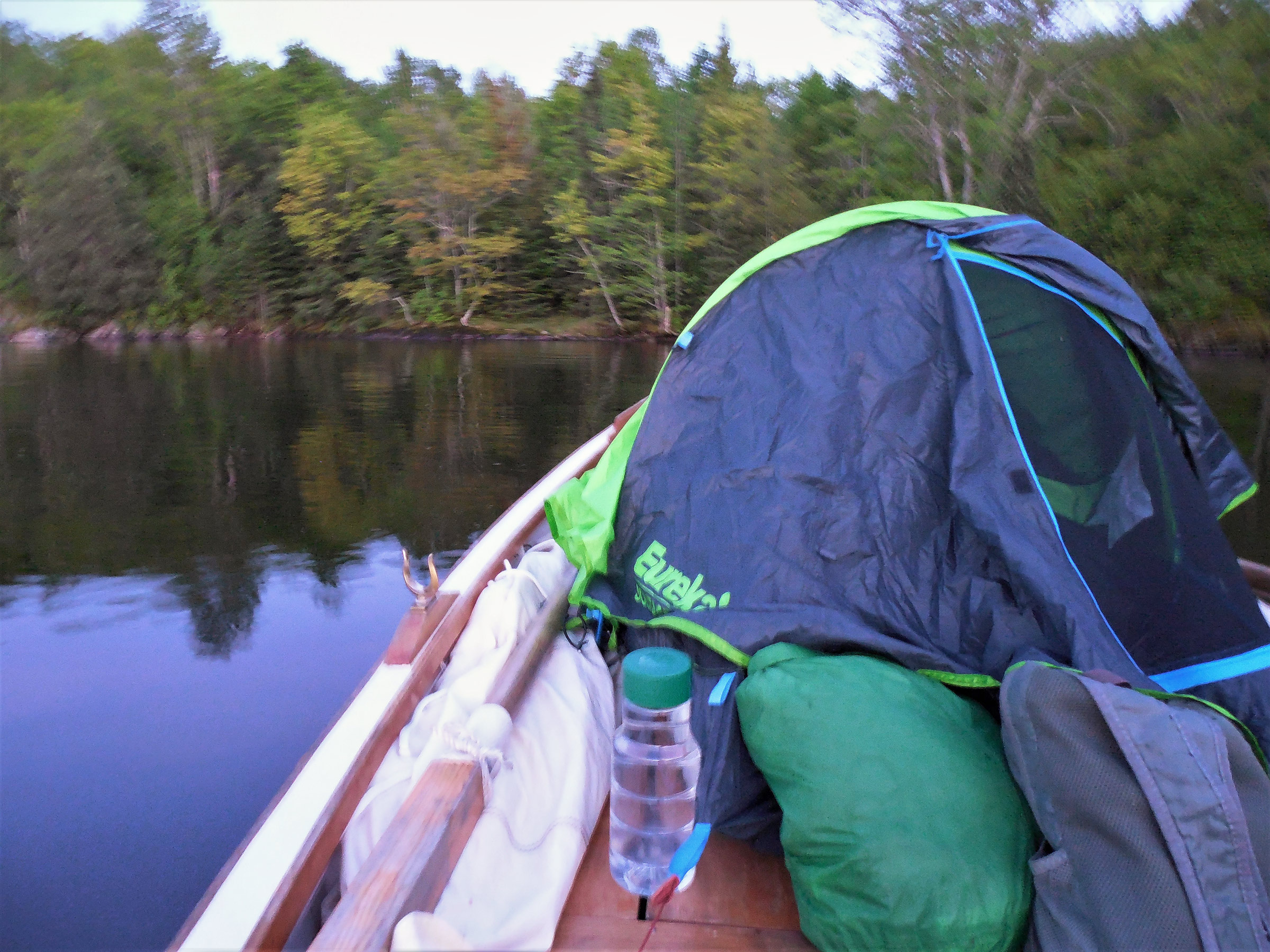
The Alaska’s 10′ long sleeping platform is just big enough to hold a solo backpacking tent to ensure bug protection. A custom boat tent to enclose the platform would offer far more room, and require less shifting and repacking of gear, but the backpacking tent has proven to be an acceptable temporary solution.
Later in the night, the wind shifted into the northwest. Rippling waves began to rock the boat, throwing me off balance on the sleeping platform, first one way, and then the other—enough to wake me from a sound sleep. There was more motion than I would have believed possible in inch-high waves. The moon was still bright in the sky, giving plenty of light to work by, but I didn’t want to bother with moving the boat. A halfway sleepless night didn’t seem like such a bad thing in comparison to the amount of work involved in dropping the tent, retrieving the anchor, and deploying the oars. I stayed in the tent, ate the last few cashews, and listened to the wavering call of a common loon somewhere out on the lake.
I must have dropped off to sleep again at some point, despite the boat’s extravagant rocking—I opened my eyes with the moon high overhead, so bright I had to shade my eyes against the glare. Polaris was barely visible, a pale dot of light identifiable only because I already knew where to look.
I shifted back and forth, trying to minimize the roll of the boat, but with my bed at thwart height, I couldn’t expect an open-water anchorage to provide a stable sleeping platform. I usually tuck the boat in knee-deep water just a couple of feet from shore and tie directly to shore, and had never encountered any significant motion while sleeping aboard before. But really, it didn’t seem to matter. I was afloat, and in no danger. Even the mosquitoes had vanished. I unzipped the door to let more of the breeze in.
I cat-napped my way through the rest of the night, dropping in and out of a pleasantly fuzzy state vague between sleep and waking, aware enough to trace the moon’s long stop-motion arc across the sky from one waking moment to the next. The boat rocked beneath me gentler than before, even as the ripples continued to roll past, stronger now, driven by the veering breeze. No matter. A northwesterly wind would be perfect for my return to the ramp anyway.
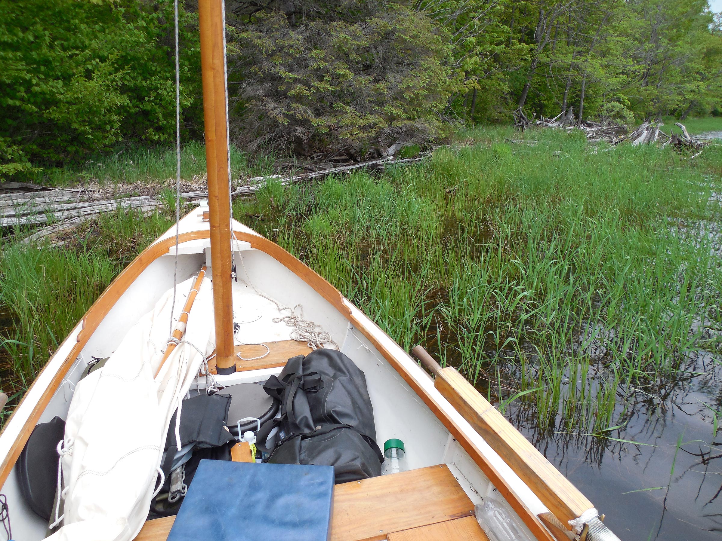
A night aboard requires careful repacking before setting sail again. I pulled up the anchor and rowed to shore to stow everything neatly before setting out the next morning.

I had hoped to continue up the West Fork of the Montreal River to explore that area before leaving the flowage, but fierce northerly winds would have made rowing back to the ramp a difficult chore. I chose the better part of valor and ended my trip at the ramp here, saving the river for next time.
…![]() .
.
Tom Pamperin is a freelance writer who lives in northwestern Wisconsin. He spends his summers cruising small boats throughout Wisconsin, the North Channel, and along the Texas coast. He is a frequent contributor to Small Boats Monthly and WoodenBoat.
If you have an interesting story to tell about your adventures with a small boat, please email us a brief outline and a few photos.

Tom:
Thanks so much for another stellar adventure write-up. They are definitely inspiring.
You discuss the difficulties of using the “traditional French misainier sheeting system” with its “need to reposition the block by hand” when tacking and gybing. Apparently, on this trip at least, your kitchen table had no such difficulties tacking and jibing in your absence.
I am a big fan of the Roger Barnes YouTube videos so I am familiar with the “helmsman pirouette” that accompanies a tack with this rig. Readers who are unfamiliar can check out his videos, and if you want to see the potential mayhem this system can produce, check out this video, starting at around 10:40.
So, I have to ask, do you use the misainier sheeting system as an anachronistic affectation: a romantic homage to the brave Breton fishermen of yore who would ply the treacherous waters of the Bay of Biscay in small open boats, in all seasons and weather, or are there situations where this system actually offers a nautical advantage over using a traveler?
Cheers,
Andy Inglis
Andy,
Thanks for the comment. As far as manually shifting the sheeting block vs. using a traveler, I don’t think it’s an affectation at all—it’s a good simple system. Here’s why: for boomless sails, the correct sheeting angle is crucial for performance—that generally means getting the sheeting point as far aft and as far outboard as possible.
On boats where the tiller is fairly high, as in my Alaska, a rope traveler long enough to clear the tiller creates enough slack to create a deep inverted “V” shape. The sheet block gets caught in that “V” and can’t slide far enough outboard for the proper sheeting angle—it sheets the sail too close to the centerline. The only way to get the block outboard is to hook it there on a cleat. That actually works fine, and I often don’t bother with a traveler unless I am expecting to gybe frequently.
On this trip, though, with frequent gusts up to 30 mph, combining a rope traveler with the manual shifting of blocks would have calmed things down a bit. That way I could gybe and let the block slide halfway over on the traveler without needing to tend it until I was ready to hook it on the cleat.
Just to reiterate: This was about as much wind as I’d like to manage, with frequent gusts over 30 mph—right at the edge of my comfort zone. In easier conditions the lack of a traveler wouldn’t have made a difference at all. I often don’t bother rigging it. I would have liked to have it here, though!
Tom
Thanks for that explanation. I get it now! Watching these rigs in action will involve less head-scratching for me.
Now get to work on your next article!
Cheers,
Andy
Tom, as always, a great read with my morning coffee. Ahh, the misainier sheeting system will be in my hands mid-August! Ron’s Ilur will be traveling 3K miles to become Rob’s Ilur, and, as such, I will be building the unhook and re-hook coordination to smooth out my tacks and jibes. And lastly the mental pictures from your words are made fast by your delightful photos.
Oh, do any of your students talk with you about sailing? Some of them must read your work I figure.
Thanks for all the inspiration you create.
Stay well,
Rob K
Rob,
Congratulations on scoring an Ilur! Though I’ve not yet seen one in person, it looks like a great design that deserves its popularity. The misainier sheeting works perfectly well—I’m sure you’ll get the hang of it soon.
As for my students, I do occasionally share my work with them, and keep a copy or two of my book on the shelf in case someone’s interested. The most popular thing I’ve shared so far has been a long essay about what it’s like as a teacher to be expected to enforce rules you don’t always agree with—actually the first piece I ever had published. But mostly, in the classroom, it’s about them and their work.
Tom
I enjoyed your trip story.
Thank you,
Culburra Beach, Australia.
Thanks, John. I appreciate it. Maybe someday I’ll get to do some sailing in Australia. Bit of a long hop for my current boat, though….
Tom
A nice account. I live in the area of the Gile Flowage. Sailing is always a bit dicey up here with gusty and swirling winds. I found myself rowing my Devlin Egret often this summer, rather than sailing her.
One important detail to add concerning the Gile Flowage. It’s infested with Spiney Water Flea. This invasive is very hard to clean off boats, trailers and fishing tackle. Please be advised and do not spread this to other areas.
Thanks for the note about Spiney Water Flea. I wasn’t aware of that one, but I am pretty careful about checking my boat and trailer at launch and recovery–there are plenty of other invasives to watch for.
The Devlin Egret looks like a neat boat.
Tom
Tom, thank you for another great account of your adventures. Question: do you use the mizzen? Would you change things, like the designed rig, if you built Alaska again?
Scot,
thanks for the note. I’ve been pretty happy without the mizzen–I built the boat that way–so I don’t have plans to add another sail. I might be tempted to change the mast step in the aft deck to a “real” one (the designed one is just to move the mizzen to for camping aboard), and then design a smaller leg o’ mutton mizzen sail, maybe 20 sq ft or so, to have a yawl rig.
I don’t know of anything else I’d change about the boat. It’s fairly tender, but the trade-off (excellent rowing performance) is more than worth it for me.
Tom