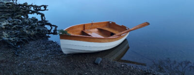
After enduring three long pandemic years without any summer paddling trips, I had some surplus vacation time and set my sights to the Erie Canal, the 363-mile-long waterway that took eight years to carve across New York before it opened in 1825. Within three weeks I had planned my itinerary and organized my food. I was happy to see that all my gear and supplies fit in my 14′ 6″ composite solo canoe. While my guidebook for the Erie Canal had lots of useful information about its natural and manmade passages and the 35 locks, it offered little advice for a paddler needing to come ashore every night. I was unsure as to exactly where and how I would be able to camp each evening but, knowing that other canoeists had done this trip before, I’d figure it out.
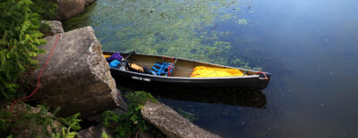
I launched on July 15, 2023, from Eastern Park in Tonawanda, New York, and followed Ellicott Creek downstream to the west end of the Erie Canal where I turned right and headed east, following Tonawanda Creek, which serves as the westernmost 11 miles of the canal. Still air and overcast skies meant good paddling weather, and I was eager to cover some miles before the heat of the afternoon and the forecast rain arrived. Even though there was little boat traffic, I paddled close to the side, gliding under overhanging branches and around numerous piers and docked boats. Hanging from the limb of a white poplar tree, half concealed by its leaves, was a bald-faced hornet nest, as big as a basketball and just above eye level. I spotted it just in time; it wasn’t the kind of adventure I wanted for the trip.
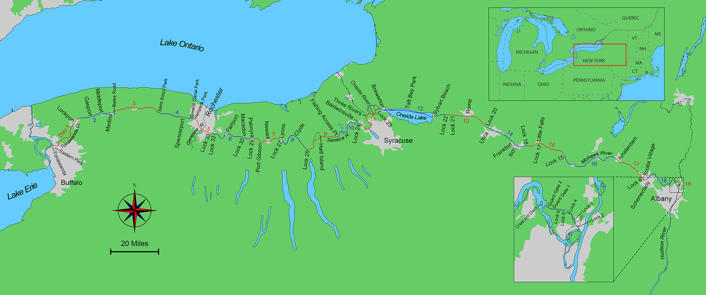 Roger Siebert
.
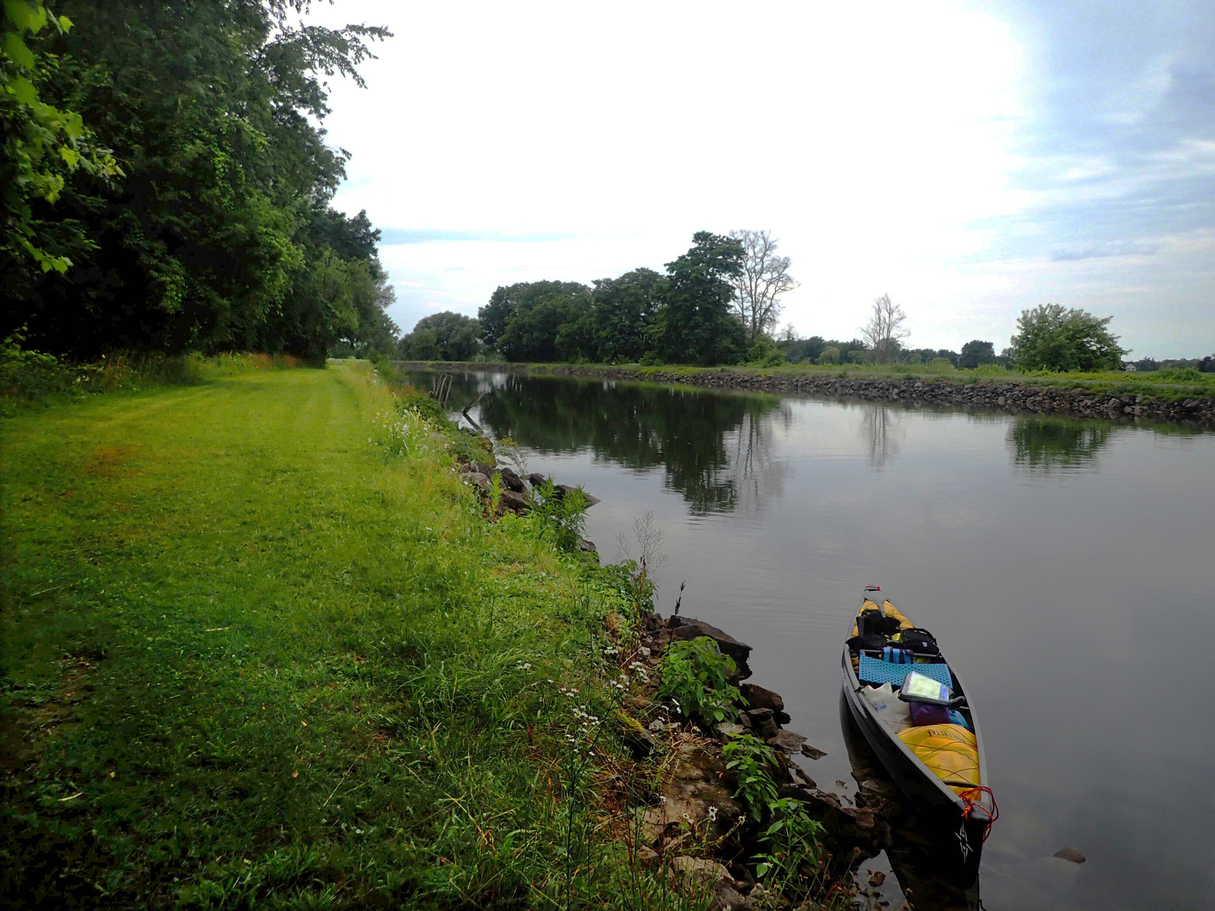
I paddled 11 miles of Tonawanda Creek’s serpentine curves to a fork where that natural waterway headed east, and the manmade canal headed north in elongated bends. I reached the first of 19 guard gates, paired steel hanging barriers, each 60′ wide by 20′ tall, which can be lowered to block the canal completely to protect it from floods or breaches. The gate was open and I paddled through to start a 3-mile stretch of the canal that was so straight I couldn’t see the turn at its end, only the notch in the horizon where the canal disappeared.
In the town of Lockport, 18 miles from Eastern Park, I arrived at my first locks, numbered 35 and 34. Having never paddled through a lock before, I stopped at the side of the canal and waited as a 65′ double-decker tourist boat came out of the lock and passed me by. I approached the lock entrance where there was a small white control-house with the lockmaster, dressed casually, standing next to it. He pointed out the ropes that hung down the lock walls. I would need to pick one, he said, and hang onto it as the gates closed and the water lowered. I grabbed onto the wet, algae-covered rope and waited. The tourist boat, already on its way back after its stop just outside the lock, joined me in the chamber and tied up on the other side. The gates closed. As the water ebbed away, I let the rope slip through my hand as the lock walls rose around me. It took about 10 minutes for the water to fall and the lower gates to open; I followed the tour boat out of Lock 35 and into Lock 34 to repeat the process, and then followed the tour boat out the gates and down the canal.
 Photographs by the author
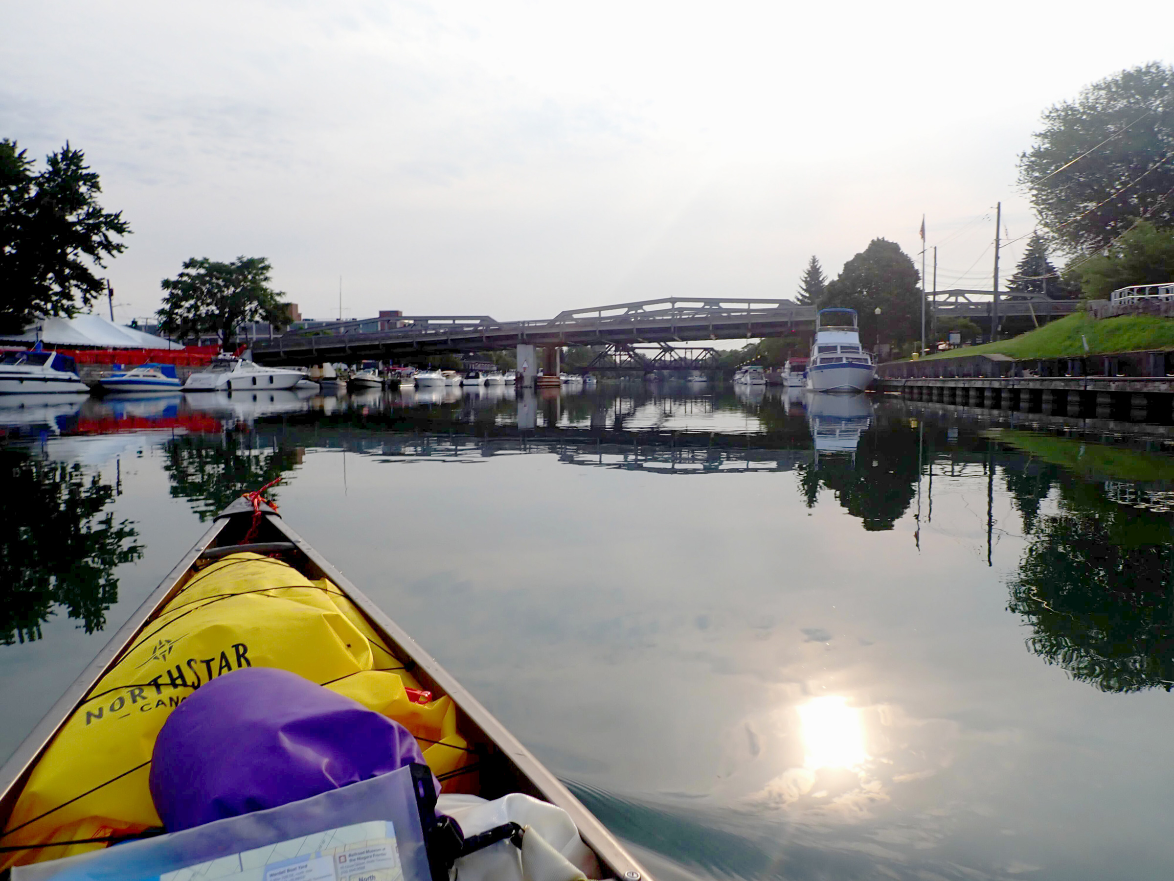
When I first started east on the Erie Canal, it was calm and quiet but there was rain forecast for the afternoon and evening. There were many powerboats moored along the canal-side docks. As I paddled along one side, I wondered how busy the canal would turn out to be.
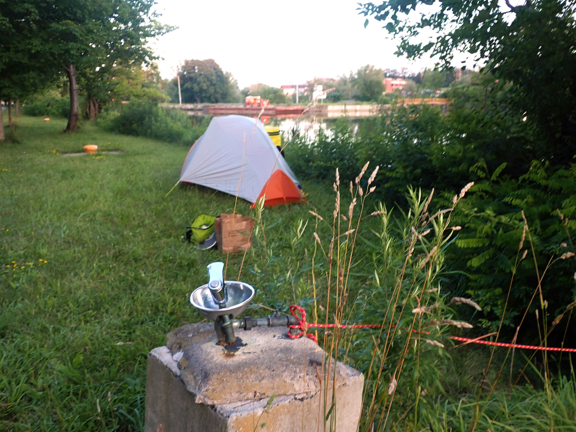
As I paddled away from Lockport, I was tired and began to look for a suitable place to camp. The canal sides were 3′-high riprap sloping up at a 30-degree angle, topped on the north side by a bicycle path and on the south side by a grassy access road. Trees, but little else, were visible above the canal sides. In the late afternoon, I pulled the canoe up the south bank onto the access road, which was flat and recently mown. I set my tent up off to one side of it, ate dinner, and settled in for the night.
It was a restless first night, listening to rain pattering on the tent, but at least the wet weather rescued me from having to rise early. By 6:30, a lull in the rain galvanized me into action. I lowered the boat into the canal, climbed carefully down the riprap, and headed out.
I paddled through Gasport and Middleport, each with a single steel-girder lift bridge so low I could reach up and touch them as I passed beneath. Gasport and Middleport had only high docks, so I didn’t stop, but Medina had a low one and I tied up to explore the town, eventually stopping at a small pastry shop. With scone in hand, I finished my wander around downtown and headed out.
Just beyond the Medina city limits I stopped where Bates Road crosses the canal near a boat ramp flanked by a grassy area with three picnic benches. I set up camp next to one, cooked dinner, and turned in for the night.
By 6 a.m. the next morning I was up and underway. The day ahead was to be one of long, straight stretches beneath high gray haze from the Canadian forest fires. Wildflowers were in bloom on the berms flanking the canal. I pulled ashore on the north side and climbed up to a view of agricultural fields and woodlands sweeping beneath the haze that hung low and obscured Lake Ontario 10 miles distant to the north.
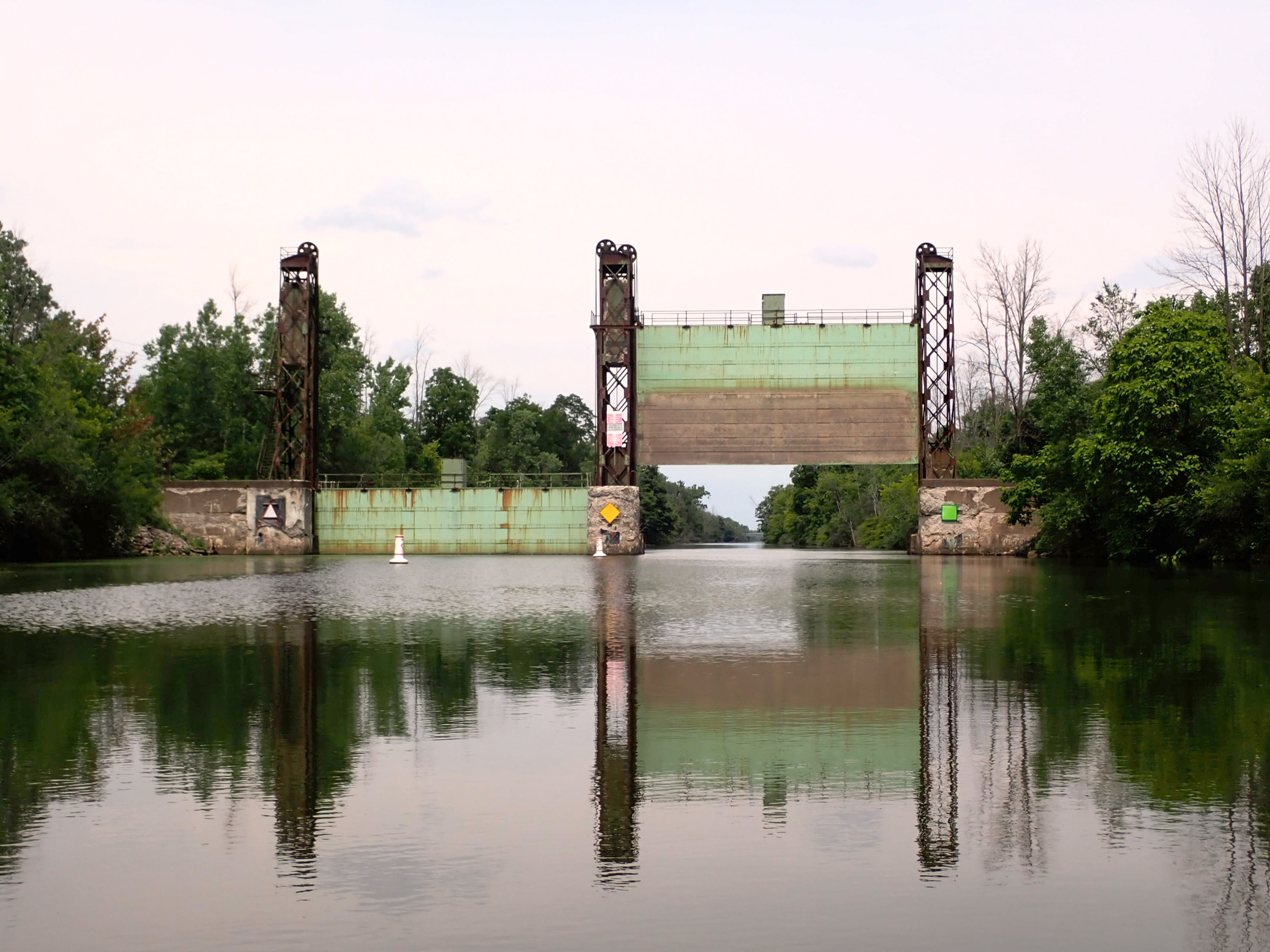
Like all but one of the 19 guard gates on the canal, this first and westernmost one was open. The barrier gates can be lowered to isolate portions of the canal in the event of flooding. As I paddled by, I looked to see if there was a spot by the gate to camp. By the end of the trip, I had become very comfortable camping on canal property, but starting off I was unclear what was either possible or allowed.
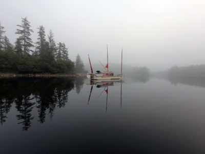
I paddled on to the Sans Souci Park boat ramp and set up camp in an empty gazebo overlooking the canal. Two teenagers wandering the grassy field stopped to hang out with me; they were worried about me sleeping in the park where people driving by might see me. Toward dusk, they went on their way, and I was alone with only the frogs croaking in the adjacent wetlands to keep me company. Fireflies, flashing pale-green lights, traced the spaces between the dark trunks of the nearest trees.
It was barely 5:20 a.m. when I was up and breaking camp. Camping under the gazebo had kept the tent dry and made for easy packing. As the morning passed, clouds built and by the time I reached Spencerport, 11 gently winding miles to the east, both my paddle and my canoe were trying to veer off in the strengthening gusts. I tied up at the dock, took a shower in the visitor center, and headed to the grocery store. My timing was perfect—the blustery weather turned into a downpour just as I got back from the grocery store, so I sat on the visitor-center porch and watched the deluge. The storm passed in an hour, clearing the wildfire haze, and the sky was truly blue for the first time since the trip started.
I paddled on for 3 miles to Henpeck Park, but it was noisy with traffic rushing along an arterial to the east and rumbling across a pale-green girder bridge to the west. I backtracked a quarter mile to Greece Canal Park, which had a dock right on the canal. I clambered up and tied off the canoe to the weathered pilings. A mown grassy area led downhill into the park where I found a bathroom and washed some clothes in the sink. I set up my tent and ate dinner on the dock before turning in.
At 4 a.m. the following morning, I woke up groggy and shivering in my lightweight sleeping bag, annoyed that I had not pulled on my fleece the night before. I curled up and suffered through till I got moving a couple of hours later. As I packed up the tent, my lower back was smarting—weekend paddles hadn’t really prepared me for paddling every day.
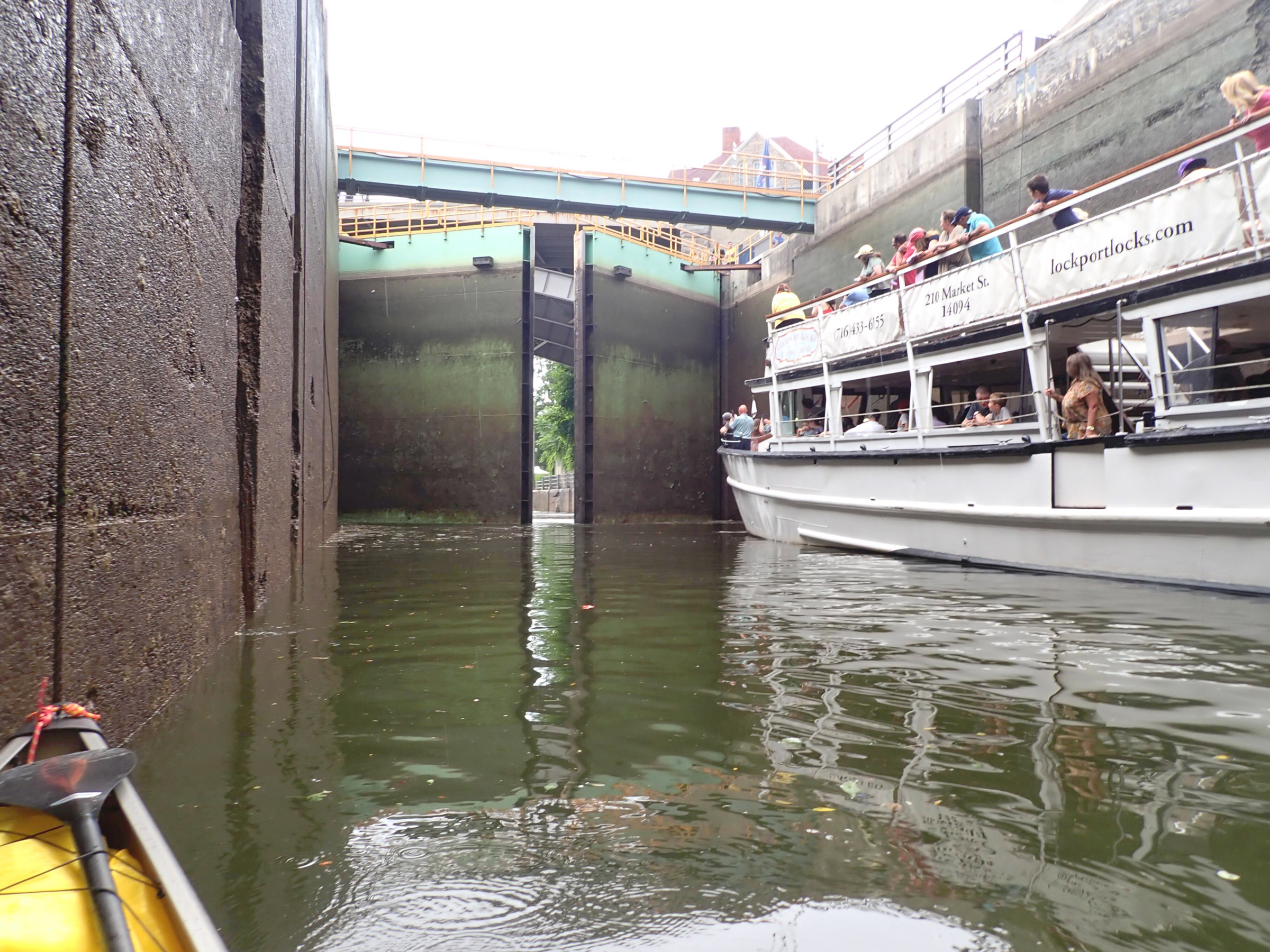
I went through my first lock, Lock 36, with a tourist boat. I talked with the lockmaster on the way in and told him this was my first time through a lock. He took good care of me and talked me through the procedure. The tourist boat had come through while I was waiting to enter, but then just turned around to go right back, so I had to wait for a bit. I chatted with some of the tourists on the boat—for them I was part of the show. I was reluctant to mention that my plan was to paddle the length of the canal—I didn’t want to jinx it starting out.
After an hour, I reached the outskirts of Rochester, where the canal sides rose from eye level to 20′ or even 30′. What wasn’t vertical rock was near-vertical wooded slopes. Water trickling down traced lacy patterns over intricate layers of limestone, and streams spilled into the air out of pipe ends 20′ overhead; rope swings hung from a couple of the dozen highway and railroad bridges. Aside from one man fishing at a small platform, the canal felt isolated and quiet with little noise from the road bridges overhead—there wasn’t even much graffiti. The canal walls provided welcome shade till about 11, and I was grateful not to have to smear sunscreen on my face and wind up with a slippery grip on my paddle. While I was in that deep canyon, a boat powered by three massive black outboard engines roared by me without slowing down. The 2′-high waves in its wake threw me around as they ricocheted off the canal walls. As I neared the Genesee River the banks dropped, and I crossed the river junction in bright sunlight and pressed on against the first, albeit weak, opposing current of the trip.
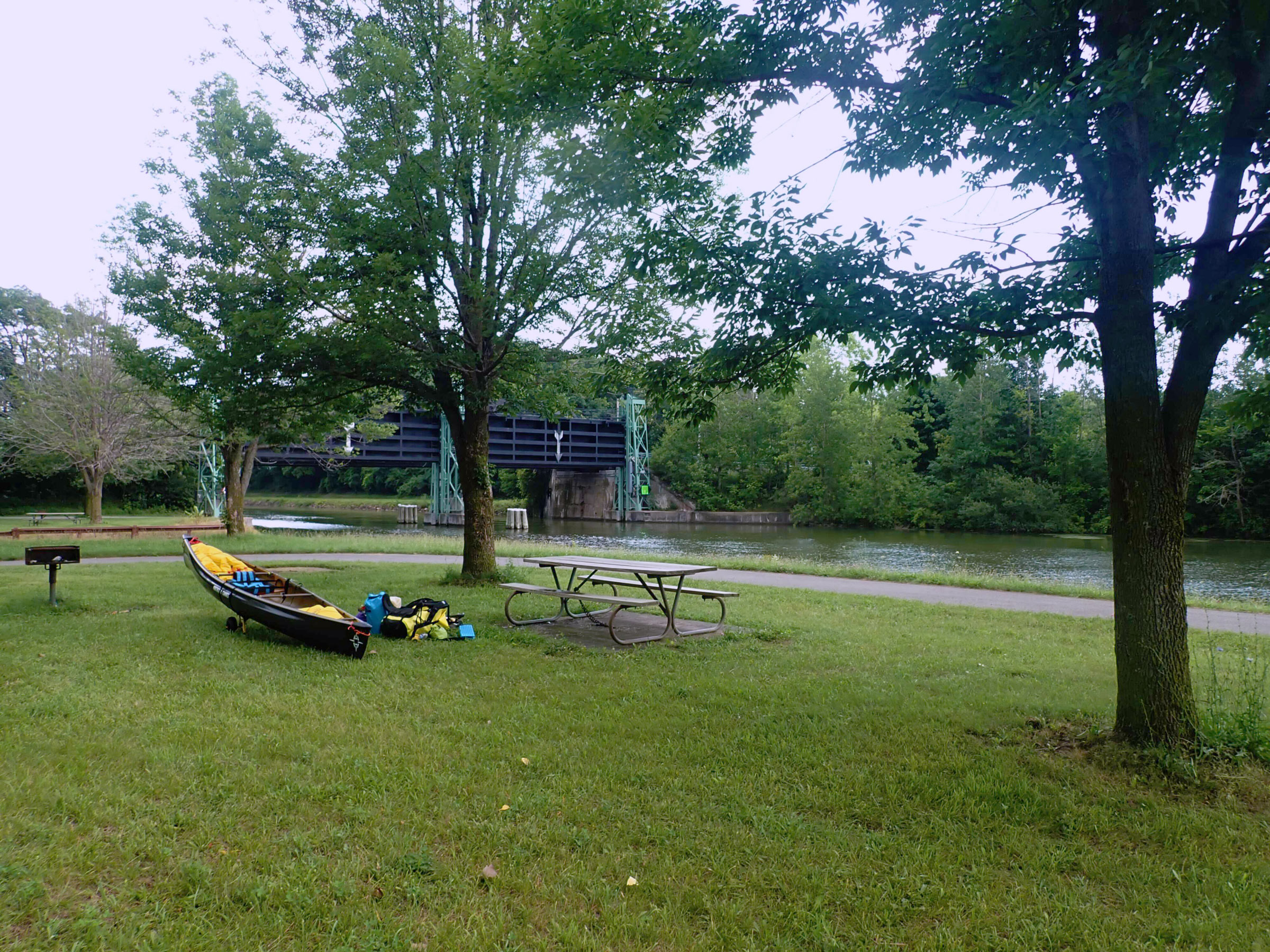
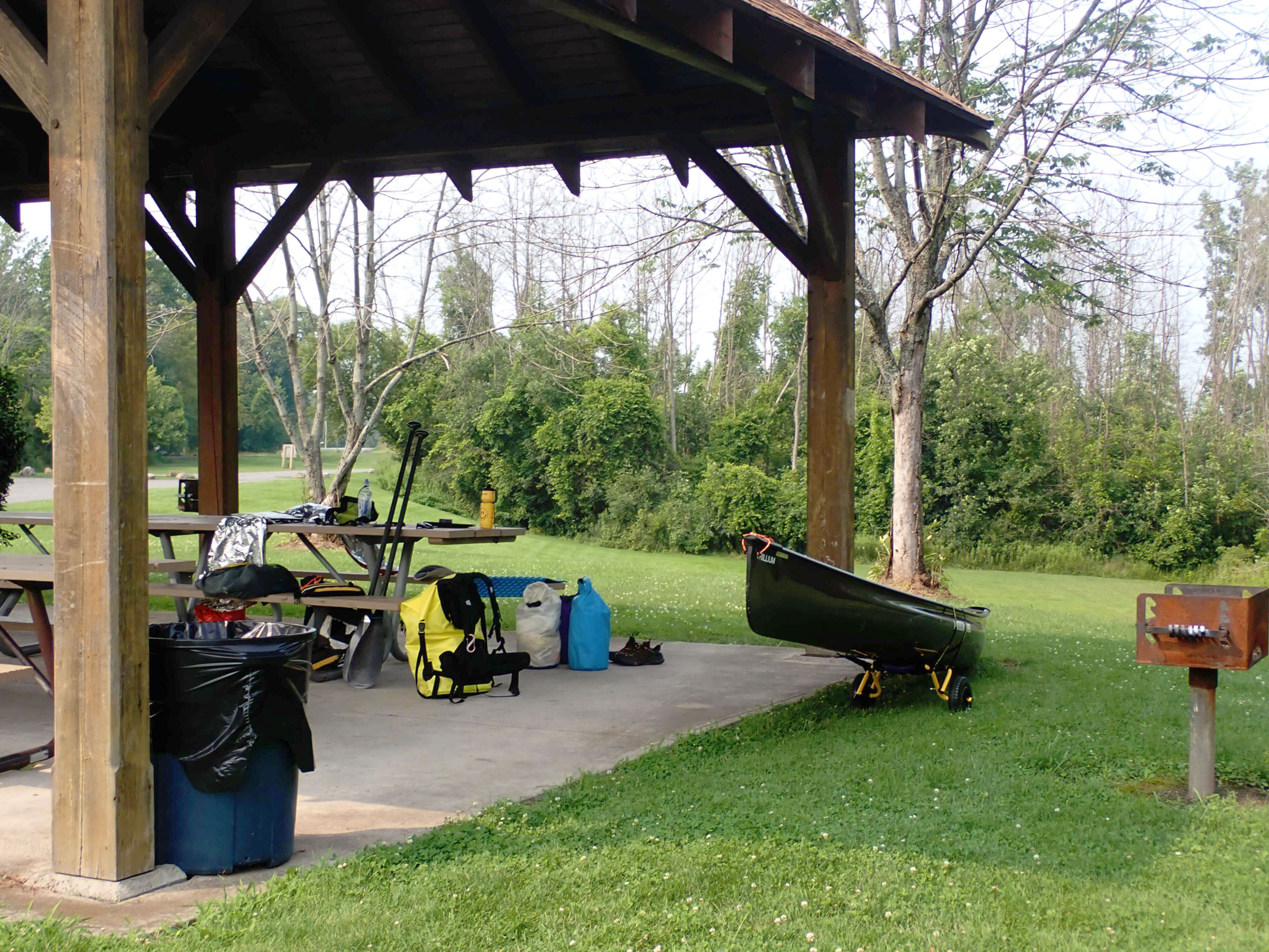
A little over 5 miles from the river, I stopped at Lock 32 to camp in the canal-side strip of grass along the Erie Canal Trail, a 360-mile gravel path for hiking and cycling. I climbed out of the canoe onto an aluminum dock so hot with the afternoon sun that it stung my hands and knees. On the north side of the lock was a gazebo large enough to host a 100-person wedding, but only a solitary person sat at one of the picnic benches. There was no rain in the forecast, so I wouldn’t need the shelter of the gazebo, and I set my tent up by a picnic bench beneath the shade of an evergreen tree, conveniently limbed up to 6′.
I walked the towpath along an old canal channel that was long, straight, and filled with trees. Black raspberries grew thick on what would have been the canal bank, and I grazed as I walked. A little over a mile north of the lock, I found a Mexican restaurant and bought a burrito that contained more food than I could eat. I also stopped at a grocery store where I bought bread and fruit to see me through the next few days. I returned to the park and enjoyed not having to make dinner. At dusk the mosquitoes came to join me, and I was happy to leave them to it and retire for the night.
I had become accustomed to the hardness of the camping pad and, dressed in my fleece this time to stay warm, I slept well and woke the next morning refreshed and ready to transit the lock where I had camped.
By 10:30 the sun, heat, and humidity combined with the monotony of the long, straight stretches were taking their toll on me. A break for a snack revived me enough to make it to Lock 30 in Macedon where I stretched my legs strolling the mowed lawns before reboarding the canoe. I paddled another 3 miles to Lock 29 and just beyond it made camp in a gazebo at a Palmyra city park. The forecast had predicted rain, but it didn’t show up until bedtime, and when it did, it came with thunder, lightning, and gusts of wind that blew the rain horizontally. I was happy to have found the gazebo, but even so I watched with trepidation to see if the hard-packed gravel of the shelter would flood and force me up onto one of the picnic benches. Eventually I relaxed because all seemed to be staying dry, and I drifted off.
At the end of my first day, I stopped to camp just outside of Lockport. The top of the berm was flat and recently mown, and it had not yet started raining. I felt I couldn’t have done much better for my first camp.
The town of Palmyra is separated from the canal by a 100-yard-wide band of forest, and I paddled several mile-long straight stretches along hardwood woodlands to the outskirts of the Port Gibson area where the canal curved and widened to 1⁄8 mile. I took the inside of the bend along the northern shore’s thick woods and bypassed the town’s homes and docks. The canal narrowed again to its usual 120′ and brought me quickly to Newark. I moored up to the town dock and made a 20-minute walk to the nearest grocery store. My walk back was a race against gathering clouds. Just as the downpour started, I’d made it back to a covered picnic table and waited out the rain near the dock. When I headed out again, I paddled over several shallows where I was startled by the sudden thrashing about of schools of carp, disturbed by my paddle.
By evening, I was just beyond Lock 27 in Lyons and camped behind the fire station with a view overlooking the lock. My campsite was tucked away, but I realized too late that there were overhead bright streetlights and a block away customers in a restaurant were enjoying a loud Friday night happy hour. I turned in, pulling my fleece up over my head and eyes to block the light and noise.
I was up and paddling by 6:20, alone on the canal as it meandered through low-lying wetlands and forested banks interrupted only by remnants of an industrial past: a handful of massive abutments supporting nothing, and an abandoned five-story brick building the size of a city block. Three-and-a-half hours after setting out, I reached Clyde, and stopped for a break. There was a bathroom in the park by the landing, and I washed my clothes and put them back on still wet so they would cool me as they dried in the heat of the sun.
The canal turned south, merging with the straightened Clyde River. From time to time the old river splits away from the canal before merging to rejoin the canal farther downstream. Several times I went with the river and was pushed along by an occasional 1⁄2-mph current. For all but a few minutes I was alone with the canoe, the water, and the sky.
Soon I was back on the canal and through Lock 25. I landed on a slippery, muddy bank at the end of the lock wall and wound up on my backside twice as I carried my camping gear ashore.
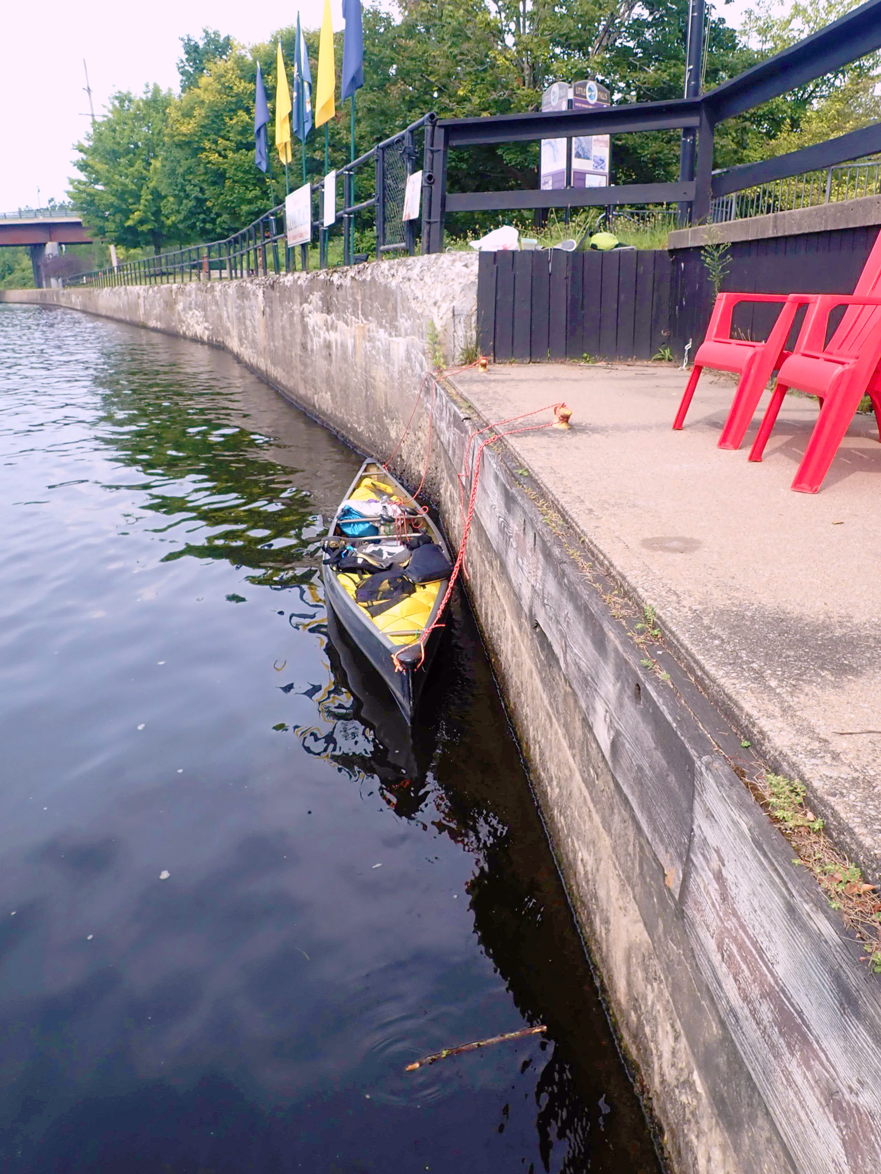
I unloaded the canoe at the Bates Road Ramp, right by Guard Gate 15. The spot provided shade, a park bench, and someone to chat with. Like many of the sites along this part of the canal, the Erie Canal Bike Trail runs right by it; my impression was that the canal sees many more cyclists than boaters.
The next section of the canal stayed away from the small towns. During my stop for breakfast in the shade of the bridge to Haiti Island, swallows put on an air show chasing dragonflies.
My planned camp at Seneca River Fishing Access Point was shadeless, littered, and busy with fishermen. I poked up a winding stream in the nearby forest looking for a camping spot. The clear water and the shade of the lush vegetation were appealing, but a swarm of mosquitoes and muddy banks put me off. I ended up back along the canal on a dry but shaded mud bank. I tied the boat between shore and a tree branch overhanging the canal so boat wakes would not bounce the canoe off the bank.
I arose sleepy after a night of trains going by and fish splashing. Baldwinsville, 14 winding miles away, was my goal for the day.
When I reached the town, I came ashore at a park and set up in the empty picnic shelter. The park was busier than many, with a softball game and a couple of people to chat with while I set up camp. I’d had no access to grocery stores during the day, so dinner was dehydrated backpacking food.
Settled in the gazebo at San Souci Canal Park Boat Ramp. There were often unoccupied gazebos at the parks, and they sheltered me through a number of rainstorms. They made packing in the morning much easier because everything was dry.
The next day I continued to follow the Erie Canal along gentle curves of the old bed of the Seneca River until it merged with the Oneida River at Three Rivers Point. I turned right and headed east toward Oneida Lake. Among the stretches of woods along the canal were many ash trees that were leafed only at the bottom, the tops likely killed due to the emerald-green ash borer.
At Lock 23 I ascended for the first time; I had been warned that there is more turbulence in a lock when going up, but it was little different from going down. I camped on the 10′-wide swath of mown grass above the long wall to the east of the lock. I set a space blanket over the tent and napped in its shade till dinner. It was going to be beastly hot again tomorrow afternoon. If I left early I could make it to Oneida Lake before the worst of the heat. The distance I would need to cover and worries about the open water of the lake made for a restless night.
I was wide awake at 4:45, well before the mosquitoes, and got moving: I was on the water in 45 minutes. The only things visible were navigation lights on the bridge 2⁄3 mile down the canal and the faint predawn sky. Bats on whispering wings darted across my bow and dark silhouettes of great blue herons lumbered by overhead while bullfrogs croaked in a distant marsh.
I passed through Brewerton in the pre-dawn darkness and was almost blinded by a bright green fuel-dock sign and an LED American flag. I passed under a 1⁄3-mile-long highway bridge and entered Oneida Lake as swallows streaked the sky and skimmed the waters.
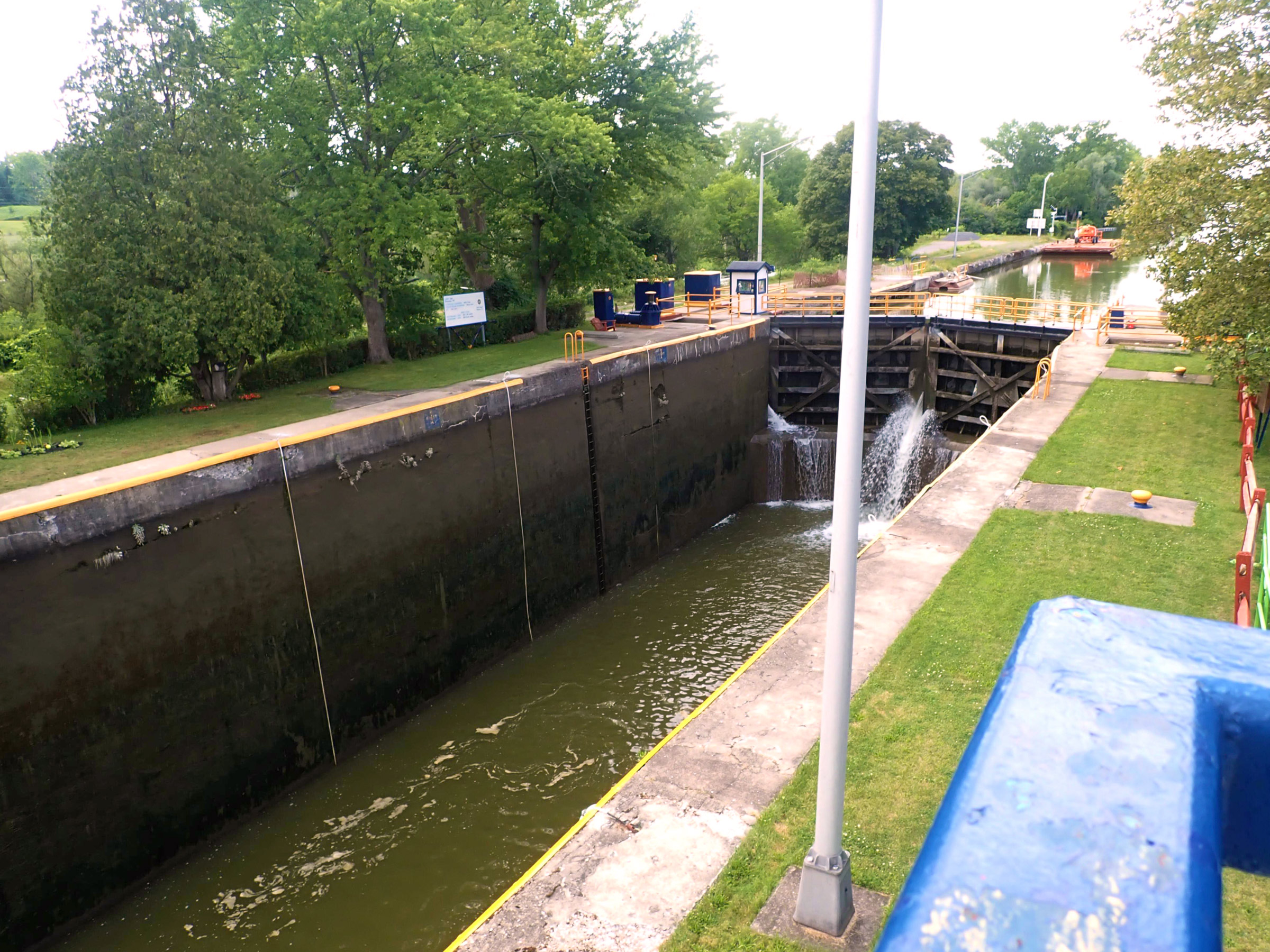
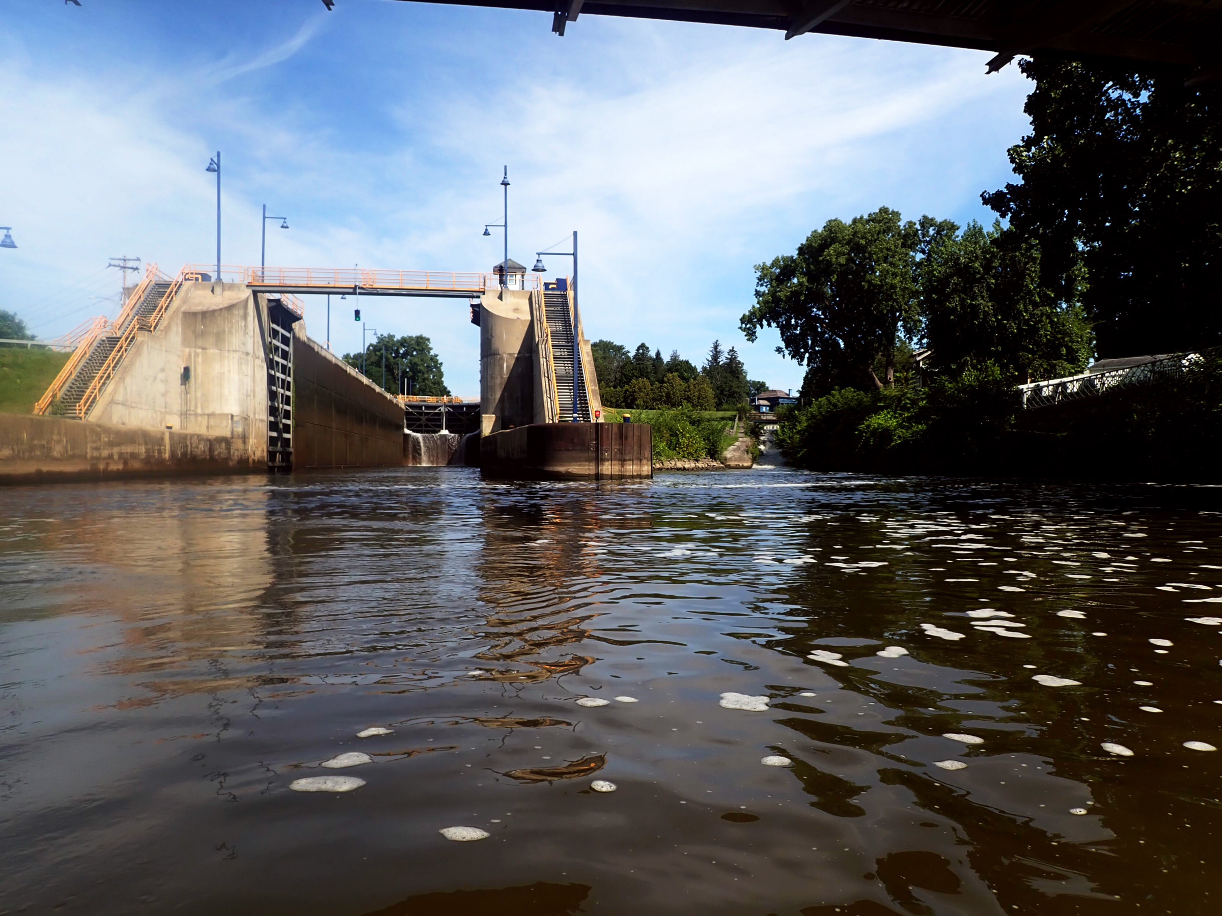
All the Erie Canal locks are 328′ long and 45′ wide. This one, Lock 32, raises and lowers boats 25′, which is on the high end for locks on the canal. The small white building by the gate is a common feature on locks and contains lock controls; I would usually chat with lockmasters there on my way in. The white lines hanging down the sides of the lock are used by boaters to maintain their position in the lock.
The eastern horizon brightened and when the sun rose, blood red, it swallowed the bow in its reflection. A light gust of wind scuffed the water, and the ripples to port sparkled like diamonds. The wind strengthened slightly and made me nervous about my exposure in a small canoe in a large lake. The headwind was not enough to slow me down much, but there were shallow spots that sapped my speed, so I shifted farther from the lake’s north shore.
At 10:30 I landed on a sandy beach at Taft Bay Park for my morning break, not as far along as I would have liked, but after five hours of paddling I was starting to fade. I settled into a gazebo and contemplated just camping there, but it was still early. The forecast for tomorrow had changed, and thunderstorms would start at 3 a.m. and continue into the day. I wouldn’t paddle the lake in that, so I decided to press on.
At 3:20 that afternoon I made a shortcut across the northeastern corner of the lake, expecting to find the canal entrance on its east end. The sun was high, turning the water pewter gray beneath a gray-green shoreline and a hazy blue sky. I followed a bearing with the compass mounted on the thwart. There was no obvious landmark for the canal. I paddled another 20 minutes under the blazing sun, and the horizon was still just a distant smudge. The wind eventually returned, now roughly in my direction and at my speed so I didn’t feel it. Time dragged and I was tired, but eventually I found the entrance to the canal and tied up along a dock just inside.
There was more boat traffic than I had seen anywhere else on this trip. It was not a weekend, so a very boat-centric town. I wandered along the dock into town, Sylvan Beach, looking for something to eat. What I really missed was fresh fruit, but I needed calories and got a chocolate milkshake.
I paddled a meandering 4 1⁄2 woodsy miles to Lock 22, keeping to the shade along the side and wove my way around the stumps and logs littering the shoreside water.
At Lock 32 I had my first experience camping on a lock’s grounds. I tied my canoe between a broken drinking fountain and the dock so wakes would not push it against the dock; using my throw bag line kept me out of the poison ivy along the bank while I set that up. I set up my tent in the mown strip between the Erie Canal Bike Trail and the canal.
The lock was closed when I arrived at 5:30. I was gaining elevation, and the lock, which would raise me 25′, was an imposing concrete structure that towered over me. I wandered around, grateful to have all evening to prepare for the night. I changed into shorts and a T-shirt. It was very warm and the mosquitoes were scarce.
After the 30 miles of paddling that day I was moving lazily, and after I made dinner I pondered ways to set up the canoe, tent, and tarp around the picnic table in preparation for a rainy night ahead. Eventually I gave up and just put the canoe over some of the gear and tossed the rest into the tent vestibule. I turned in, wrote a bit, contemplated not even bothering to inflate the sleeping pad, but eventually did and fell asleep with my gear unsorted—it would provide something to do on a rainy morning.
I roused myself at 5 a.m. Yesterday’s long day made for a good night’s sleep, and I hadn’t been awakened by the rain. By 5:30 I was out of the tent; a ceiling of ashy mottled clouds covered the sky, a pleasant change from yesterday’s sun. Rain fell occasionally so I was quick and packed up in a lull.
After clearing Lock 22, the paddle to Rome was 10 miles of arrow-straight canal, interrupted only by Lock 21 a mile out, and then it was just the canal stretching off for as far as I could see. The canal passed by but not through Rome. I tied up at a canal-side park and almost beat the afternoon rain on my walk to a grocery store.
Just beyond Rome the Erie Canal descended in the last watershed, the Mohawk River valley, and paralleled or merged with the river until the Mohawk’s confluence with the Hudson River, the Erie Canal’s eastern terminus.
Getting out at Benton’s Landing in Little Falls was easier than I expected, but I would not want to do anything much taller than this without something to grab onto; I ended up standing on my seat to get myself up. Finding peaches and blueberries at the farmers market in Little Falls made the effort worthwhile.
The wind was mostly behind me and strong enough that I was glad to be going with it. I finally got to the entrance to Lock 20. The low dock there was close to a wooden picnic table under a tree, which made it easy to set up camp. I spent some time sorting and cleaning gear; some of which might not outlast this trip. My new water shoes already smelled like old neoprene booties and were stained orange from the algae that flourishes in some of the still waters at the canal’s edges.
I spent the long hot following day paddling to the southeast into the blinding glare off the water with sunscreen dripping in my eyes. I hugged the side of the canal, looking for any shade I could find. The canal didn’t go through Utica and Frankfort, so I had little to hold my attention for more than 16 miles until I reached Ilion. The town, situated on the south side of the canal, had a very nice marina, so I stopped and did laundry. I ended the day another 6 miles farther along the canal and camped at Lock 18 by carrying my canoe up to the lawn overlooking the canal.
I chatted with the lone fisherman at the lock and learned that he had seen a bear in the vicinity, so I made sure to bear-bag and hang my food from a tree. A 30-yard-wide strip of mown grass, which served as a spillway to protect the lock from floods, led through the woods down to the Mohawk River, and I wandered to the river at dusk to watch night fall before turning in.
It was a restless night with train horns sounding for much of the night. In the morning, for a change, I had breakfast before I headed out. I was clearly losing weight. The lockmaster arrived around 7, and as he put me through Lock 18, he pointed out the scars on the walls made when tugs slammed into them in the working days of the canal before the opening of the St. Lawrence Seaway in the 1950s made the Erie Canal obsolete for commerce.
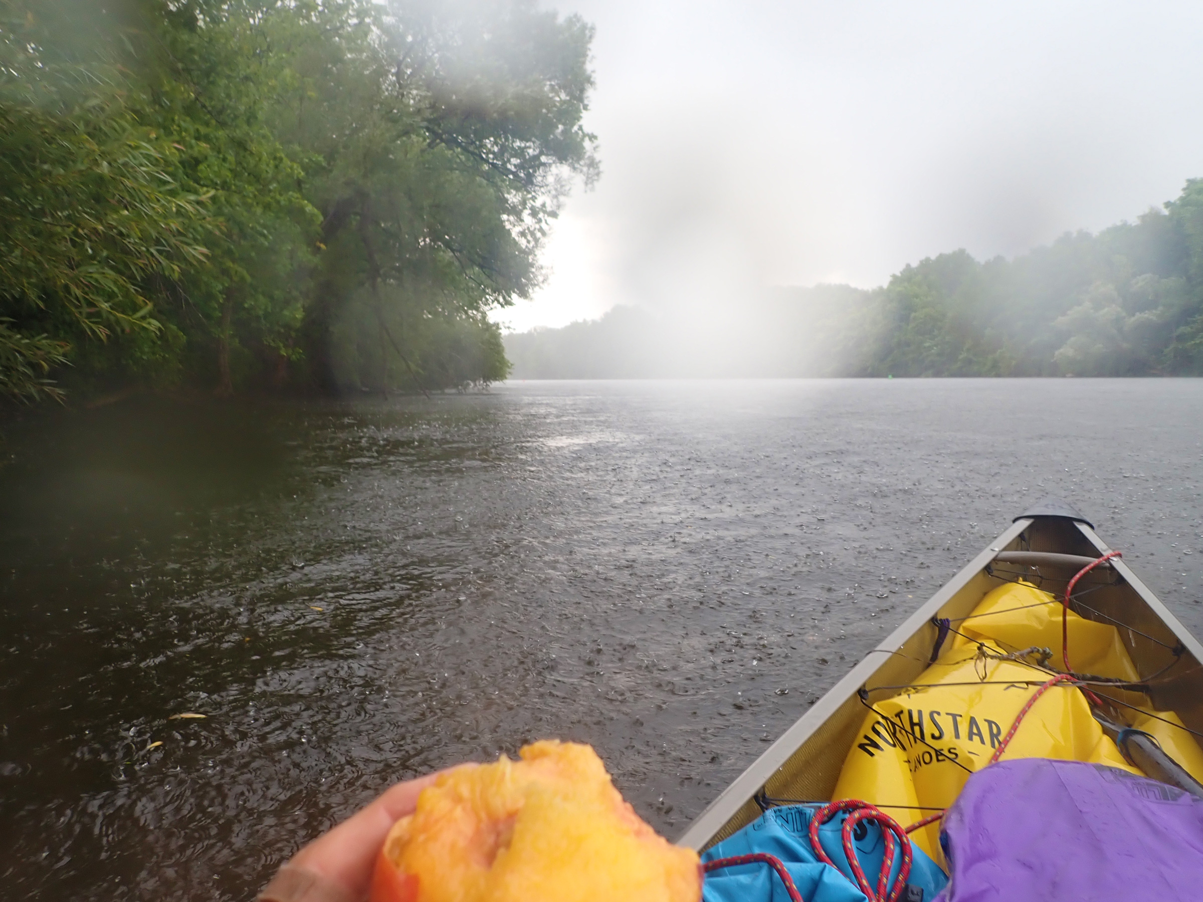
At the tail-end of the thunderstorm that blew me back down the canal, I ate a peach while I waited for the lightning to fully subside before continuing. This was the only time I dealt with wind of significant strength the entire trip.
The river was 80 yards wide, half again as wide as the canal, and exposed to the morning sun, so I paddled close to the south bank to get every bit of shade I could, even though the shallows, vegetation, and submerged rocks and logs slowed me. I stopped in Benton’s Landing to wander around in Little Falls. The 3 1⁄2′-tall concrete wall there provided an exercise in balance and scrambling, but I made it out of the canoe and stayed dry. I wandered into a small farmers’ market where I bought a quart of blueberries and a basket of peaches. Fresh fruit at last! As I meandered back to the boat, I ate all of the blueberries and several of the peaches.
A modest current on the Mohawk nudged me downstream, and I arrived at Lock 17 at 11, a little earlier than I expected, and entered the chamber through the mitered gates. At the far end of the lock, on the downstream side, was the canal’s only vertical gate, a solid 150-ton barrier, which lowers like a castle’s portcullis. The water level began to drop and would take almost 10 minutes to lower me 40′, farther than any other lock on the canal. Deep in the chamber, the lock walls squirted jets of water into the falling pool. This was entertaining until I realized the one behind me was steadily filling up the canoe. I moved forward, glad I was the only boat in the lock and free to change position.
As the afternoon progressed, I hurried through a sea of clouds reflected on the mirror-still waters of the canal, headed toward a thunderstorm. Suddenly caught by it, even pushing straight into the wind at a sprint, I was blown backward. I took shelter behind a large tree trunk fallen in the water at the side of the canal. Crowned with tall vegetation, it provided a good wind break. The world turned into a white haze of raindrop splatters as the storm intensified and thunder sounded overhead. I had put my rain jacket on before the storm but didn’t think to first throw on my long underwear top. There was no point in getting it out in the rain—it would be instantly soaked. I warded off hypothermia by vigorously bailing out the inch of water that 10 minutes of rain had poured into the canoe. The intensity of the storm dropped rapidly and, 15 minutes after it began, I ventured on, staying close to the bank in case more lightning occurred.
Rain fell intermittently until 7 p.m. and I decided to stop at Lock 15 in Fort Plain. I picked a spot in the large mown area by a trailer park and busied myself using my paddle to flick wet goose poop out of an area large enough to camp in. During a break in the rain, I set up the tent and tossed the gear in. A walk into town to use the Wi-Fi at the local library kept me occupied until the rain abated and I could return to camp to cook a quick dinner and retire for the night.
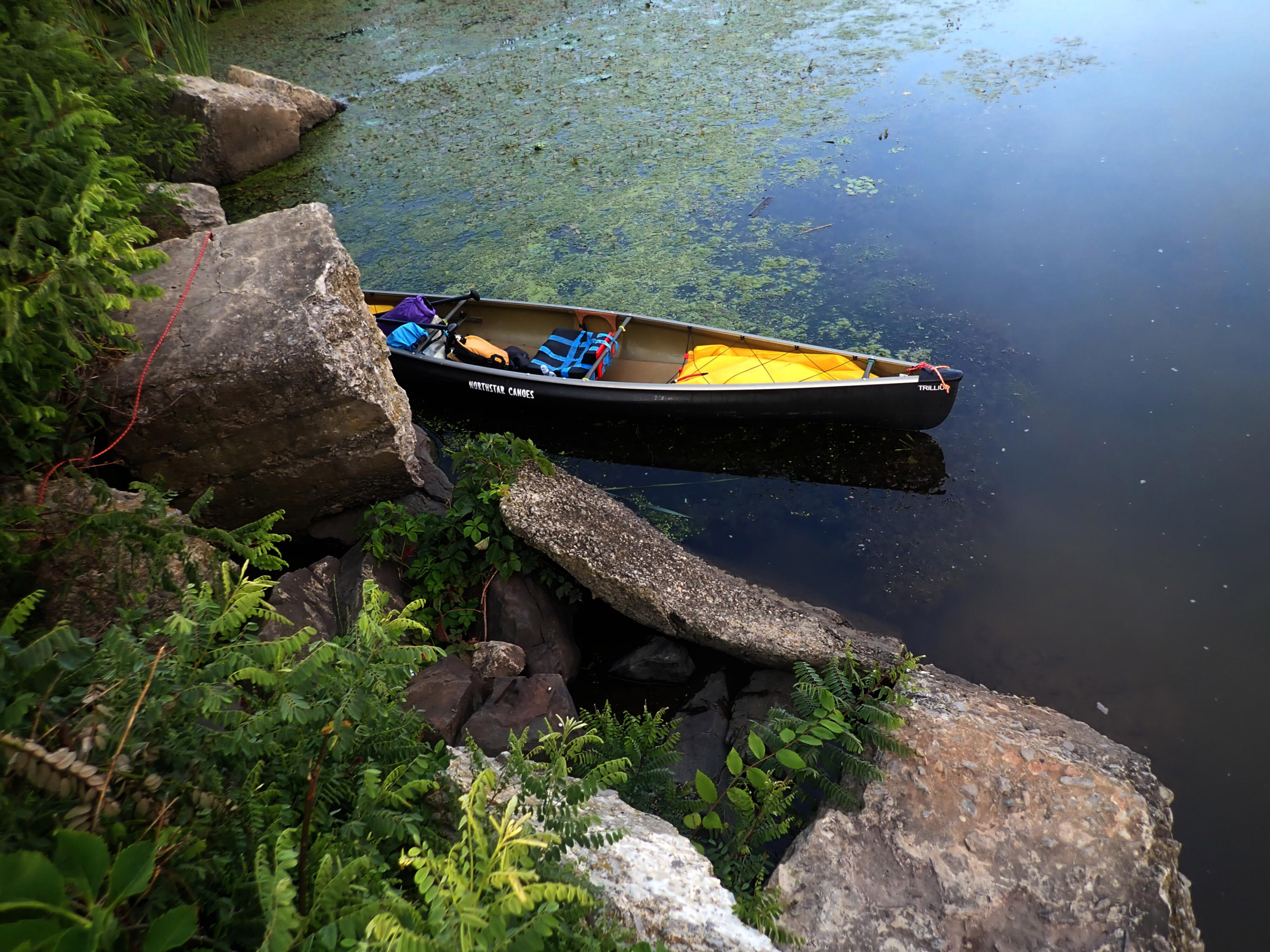
The rock on the left is steeper than it looks, and the water is deep, making a sketchy morning loading job near Guard Gate 2. The top of the rock on the right is 2′ above the water—not too hard getting stuff into the canoe in the morning, but not simple getting it unloaded the night before.
I used my canoe cart to portage around the lock before it opened; a good half mile to walk and a bit of a scramble over rocks to get in the water, but it got me moving. Once launched, I cut over to the outflow from the weir next to the lock to get a boost of speed.
I paddled more than 21 miles before stopping on the south side of the canal, across from the town of Amsterdam. The park there was small and not well appointed but seemed quieter and less exposed than the one on the city side of the water.
The next day began slowly as I wandered around Amsterdam, an old mill town that was not nearly as busy as it must have been before 1950. The large warehouses and industrial buildings looked like they had been patched and modified numerous times; several stories of glass panes that must have been broken once and replaced with whatever color was available. The surrounding neighborhood mixed ordinary and elegant houses with some in fine shape and some in need of serious repair.
The valley had opened up and the Mohawk was so wide that I wouldn’t cross from one side to the other without good reason. Highways or train tracks bounded both sides of the river but there were a few houses, and trees blanketed the surrounding hills. The waterway felt less intimate than it had, but the sky above was more expansive and captured my attention. I anxiously watched one squall line move over my port stern quarter for at least an hour, but it eventually moved north of me.
My body had mostly hardened to the rigors of two weeks of paddling, and I was grateful that it was now rare for more than one body part to complain at any one time.
I paddled past Lock 8, landed at an expansive and well-kept park at Scotia Village, and watched it rain from under a shelter while I filled up water bottles. A busy road ran close by the park, so I decided not to camp there and paddled the 2 miles back to the lock where the alley-wide beach at the lock’s south end and the lawn above it provided one of the easiest take-outs and quietest spots of the entire trip.
The final descent of the canal, Locks 6 through 2, lowered me 169′ in the span of 1 ½ miles, and provided a fitting ending to the canal journey. As I looked back at Lock 2, the final lock, I had only another 10 minutes of easy paddling to the Hudson River and I was done.
The next day’s paddling from the lock turned out to be longer than expected. Several spots where I thought I might camp turned out to be unappealing for one reason or another. Two locations I tried were choked with water caltrop and made shore access impossible. After paddling more than 21 winding river miles, I left the wide Mohawk River for the last stretch of narrow canal and stopped at Guard Gate 2 late in the afternoon. The north side was crowded by a road, so I chose the south side where the only disadvantage was a steep take-out.
On my last day I was up far earlier than necessary, but I was itching to get going. However, I couldn’t go anywhere until the five locks ahead were staffed, so I left the tent fly out to dry and wandered around in the faint dawn light as the sun barely glowed through the overcast sky. I followed a gravel road away from the canal toward Crescent Dam. After following the road for 20 minutes around a field bordered by trees, I reached an overlook at the east end of the dam, a 500-yard arc of two 50′-high walls separated by an island in the middle of the river. Downstream, hidden from view, was another dam and Cohoes Falls. Today, the 1 1⁄2-mile flight of five locks, 6 through 2, would drop me 165′ and circumvent the dam and falls. I watched the white curtain of water spilling over Crescent Dam for a minute and then headed back to get packed up for the day.
I spent some time figuring out the least hazardous way to get gear down the rocky bank and back into the boat. I couldn’t do it safely in the flip-flops I was wearing, so I forced myself to put on my damp, stinky water shoes. The rocks dropped steeply into deep water, so I found a flat place to stand; I twisted at the waist to move the gear and drop it several feet into the boat without moving my feet.
I made a couple of calls on the VHF to the lockmaster working the gates as well as the upper locks 6 and 4. Guard Gate 1 was up so I didn’t need to get that opened. I passed through Lock 6 and, as I was dropping down in Lock 5, got the lockmaster to toss me an apple from the tree that I had seen from the chamber. A bit tart, but it was some of the fresh produce I was starved for.
Lock 2, the last of the flight, deposited me into the final 150 yards of the Erie Canal where it rejoined the Mohawk River. I paddled for 10 minutes until I got to the confluence with the Hudson River.
I’d spent 19 days traversing the full 363-mile length of the Erie Canal. While it has outlived its purpose as an artery for commerce, it now thrives as a beautiful waterway for boats as modest as a solo canoe.![]()
Hugh Rand lives in Maryland where paddling gets him out into nature and provides some much-needed exercise. He especially enjoys paddling up Class-II rapids, documenting natural history on paddle explorations, pulling fishing line out of the water, and bouncing around in ocean waves. He continues his father’s tradition of honoring the water gods by sacrificing expensive items—cellphones, eyeglasses, binoculars, cameras, and more—off boats and docks.
If you have an interesting story to tell about your adventures with a small boat, please email us a brief outline and a few photos.
What a tremendous story: simplicity, historic, and self-reliant. And cheap!
Thank you for describing these adventures. It looks like you were putting in some 20- and 30-mile days. 363 miles/19 days is just over 19 miles per day. Any idea what kind of usual groundspeed your 14.5′ canoe was doing? And I’m presuming that was not with a kayak paddle but a one-blade canoe paddle? How many hours a day would you usually paddle? Tailwind and/or favorable current most of the time, going west to east? What was the make/brand of your canoe? Thanks again for writing up and publishing your intrepid account.
Hi Brad,
I was paddling a Northstar Canoes Trillium in Carbon/Kevlar with a single-blade canoe paddle. I cruise at around 3 miles/hour when I’m paddling all day. Honestly, I would recommend a faster canoe for the long straight stretches on the Erie Canal. I paddled between 5 and 10 hours each day, with at least one break in there for lunch and to stretch my legs. Usually it was 7 hours in the boat. Current was with me much of the way; mostly 2-10 cm/s until I hit the Mohawk River and then 5-10 cm/s on the Mohawk. Not much tailwind.
Great story, something I always wanted to do. My question is for all these solo one-way trips, how did you get to the start and how did you get home?
I’m curious as well. I’ve read about these multi-day trips and was always wondering about parking.
Hi Curt, John,
I was fortunate in that my wife was kind enough to provide me with a shuttle service. I did hear about one person who stashed all his gear at one end, drove his car to the other, and then took the train back to his starting point. I am not sure about long-term parking, but I bet if you talked to the folk at Erie Canalway they could help; they might very well let you park at one of the locks for an extended period.
Hugh
Great trip along a storied waterway! Thanks for bringing us with you.
What an amazing trip — certainly worth documenting — so thanks.
Sounds like a great trip
Thanks for sharing. I plan on doing this in the future need lots of trees though Haven hammock tent