The water was glassy calm as SCHERZO slid off her trailer into a muddy low tide in Porpoise Bay at the head of Sechelt Inlet on British Columbia’s Sunshine Coast, an 85-mile stretch of mainland northwest of Vancouver. With Howe Sound to the southeast, Desolation Sound to the northwest, Georgia Strait to the west, and the rugged Coast Range mountains to the north and east, the Sunshine Coast is essentially an island. It is bisected by Sechelt Inlet, a narrow body of water that extends 18 1⁄2 nautical miles south from Jervis Inlet to Porpoise Bay and the town of Sechelt, on the traditional and ancestral lands of the Sechelt (shíshálh) First Nation. At its widest point the inlet is just over 1 nautical mile across, more than 900′ deep, and framed by richly forested mountains rising to 4,000′ on either side. Just south of the inlet’s mouth are the Skookumchuck Narrows, and south of the narrows are the Sechelt Rapids, locally referred to as the Skookumchuck (“strong water” in the Chinook trade language) or, simply, the Chuck. Four times a day, 200-billion gallons of water pour through the Chuck reaching speeds of 17 knots, making it one of the fastest tidal rapids in the world. The rapids, 16 nautical miles to the north of us, were to be the first destination in our four-day trip.
 Alex Johnson
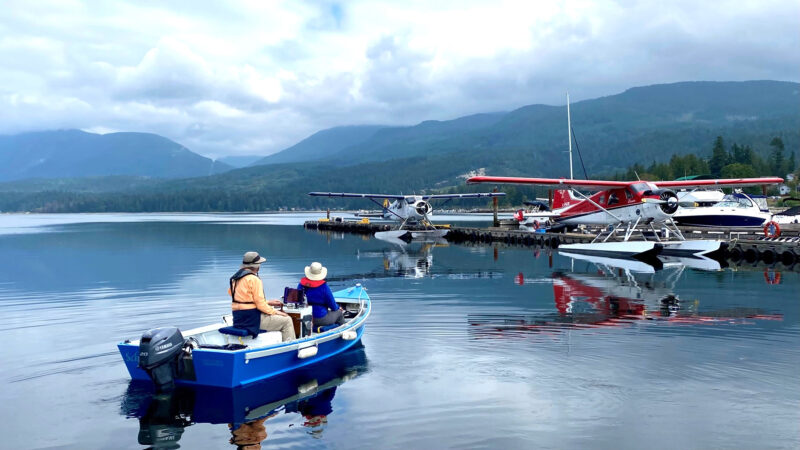
Porpoise Bay is a busy seaplane hub. We launched near one of the floats but were careful to avoid the designated take-off and landing area when we left the harbor.
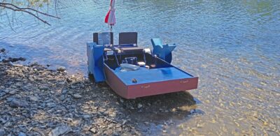
SCHERZO is a 14′ by 6′ Pacific power dory. I built her in my back yard in Santa Cruz, California, between 2010 and 2015. Her flat-bottomed plywood hull, sheathed in two layers of fiberglass cloth and epoxy, is built to the Seneca design by the late Jeff Spira. I designed her interior around a 14″-diameter wooden ship’s wheel that I found in an antique shop on Long Island, New York. She is outfitted for day cruising with a helm-seat cooler, an Anchor Buddy and 100′ bow line for beaching, waterproof USB charging ports for an iPad, a waterproof caddy for paper charts, nav lights in case we stay out too late, and 15 gallons of gasoline—good for about 15 hours of cruising. Powered by a 20-hp Yamaha outboard, with three adults sitting amidships, she cruises at an easy 10 knots at 5,200 rpm.
I had timed our departure from Porpoise Bay to arrive at the Skookumchuck at or near slack water at about 7 that evening. We had plenty of time to get there. I had been joined for the adventure by Alex Johnson, an engineer highly capable in all things mechanical and electrical, and his wife, Allison Gong, a marine biologist, published nature photographer, and college professor who was eager to see what was living beneath the surface of Sechelt Inlet’s chilly waters.
 Roger Siebert
.
Away from the launch ramp, we idled our way through 20 or 30 anchored boats, many of them with failing paint, rust-stained hulls, and tangled rigging. Porpoise Bay is a water aerodrome, with five scheduled incoming and outgoing flights daily plus sightseeing tours and the occasional private seaplane. We steered to the west of Poise Island to avoid the designated landing and take-off area on the east side, but there was no air traffic as we motored out and the morning was still and quiet.
Past the island I throttled up to cruising speed. The forested hillsides to either side of us were dotted with summer cabins, year-round homes, and even a couple of small marinas. But as we motored beyond the settlement of Tuwanek, some 4 nautical miles down the inlet, all signs of human encroachment disappeared, the mountainsides grew steeper, and we found ourselves gliding between high dark-green walls of cedar and Douglas fir that loomed over the sea. The mountains that frame Sechelt Inlet rise straight up from the water. Except where the shoreline is interrupted by steep granite bluffs, the trees grow so close to the water’s edge that overhanging branches touch the surface at high tide and at low create a perfectly straight line paralleling the water. Ahead of us, for as far as we could see, point after point of land reached into the inlet from both sides.
 Allison Gong
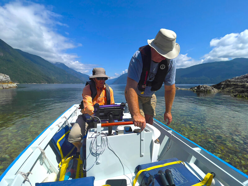
Our first stop was at Kunechin Point. The weather was perfect: little wind, clear skies directly overhead, and balmy temperatures. Everywhere in Sechelt Inlet the waters are crystal clear, which makes coming ashore easier as you can see the shoals and hazards.
Passing Nine Mile Point to starboard, we motored across the mouth of Salmon Inlet, headed for Kunechin Point. It was getting on for lunchtime and the chart showed a provincial campsite here. Kunechin Point is a granite outcropping, perhaps 100′ across, extending out 100′ from the edge of the forest, its top about 40′ above the water. Its rocky dome hosts a few scraggly trees, lichen, moss, and some patches of tall grass. From the picnic table, the views up Salmon Inlet and across to the Kunechin Islets are breathtaking. The campsite is a water-access-only provincial park. Sometimes such parks have dinghy docks, but at Kunechin Point there was no such amenity.
On the east side of the point, a small cove with a beach barely 50′ across afforded a good landing spot, and we decided to beach and then anchor SCHERZO off with the Anchor Buddy. Like many beaches on this coast, this one was covered with large shingle and sharp rocks, many the size of grapefruit, some as large as a volleyball, all of which, below the tideline, bristled with giant jagged barnacles.
 Allison Gong
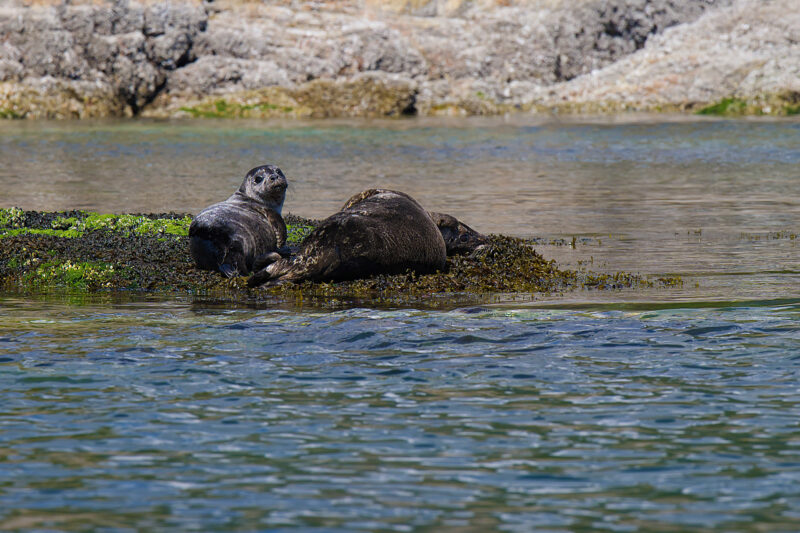
As we left Kunechin Point we passed some seals basking in the sun. Only the pup seemed interested in us.
A 50′ walk across the sharp rubble brought us to a granite ledge about 2′ high against which several 1′-and 2′-diameter logs had been strewn by winter storms. Fifty years ago, I would have danced across the tangled logs like a mountain goat, but today I envisioned myself lying between them with a broken leg, so I chose each footstep with great care. Once off the beach we followed a 2′-wide trail along uneven, moss-covered granite for 100′ or so, climbing up to a point where we ate lunch overlooking the inlet. Except for an aluminum workboat that skimmed lightly across the still water leaving a long sugar-white wake, and a seaplane flying noisily down the inlet, there was not another soul in sight.
The overcast sky that had umbrellaed our morning had slowly given way to a blue sky with patches of cloud sitting over the mountains but rarely directly above us. The air was calm and pleasantly warm.
Back in the boat after lunch, we went a short way up Salmon Inlet but, ever mindful of our need to be at the Chuck by 7 p.m., we soon turned back to continue our northward journey. We passed Kunechin Point where a harbor seal pup was resting with its mother and other seals lounged on the rocks.
 Murray Walker
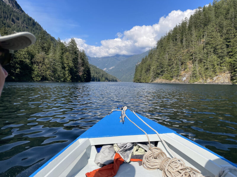
We went through the Tzoonie Narrows on a gentle flood tide. Water marks on the rocks revealed that some of the trees’ lowest branches must be resting on or even under the water at extreme high tides.
We turned north into Sechelt Inlet for the 5-nautical-mile run up to the Tzoonie Narrows where the channel is reduced to 280′ and modest tidal currents of up to 4 knots occur. We landed briefly at Tzoonie Narrows Provincial Park, a disused logging site, now a water-access-only wilderness campground below mountainsides where verdant new growth conceals decades-old logging scars. Back on the boat we motored out into the narrows, cut the motor, and allowed the flood tide to carry us a half mile up Narrows Inlet. All was quiet, save for the gentle swish of the moving water.
Before long we were again heading back to Sechelt. I studied the chart; there was one rock that I had to avoid. I soon saw it: a 2′-high rock, visible between us and the shore. We were well clear. Then, at the last moment, I realized I was wrong…the charted rock was dead ahead, beneath the water, evidenced only by the gentle turbulence on the surface. I swung the helm, and we passed by unharmed, disaster averted just in time.
We were early for slack water at the Skookumchuck, so we nipped across the inlet to Doriston where, on an uncharacteristically level few acres, there had once been a year-round community of three or four families who made a living from fishing, logging, boatbuilding, and growing vegetables. Gunnar Gjerdin, once known as the Mayor of Doriston, had arrived here from Sweden in 1924, at age 10, with his parents and two siblings. He never left, living in the same house until his death in 2003. His only connection with the outside world was on his occasional runs through the Skookumchuck to Egmont, the village on the other side of the rapids, to pick up mail and provisions. Doriston remains private property, so we did not land. Scattered across a wide, green lawn there were half a dozen houses, some clapboard, some shingle, some bright with new paint, some unpainted, most with green metal roofs. Two docks were tucked behind a low tree-covered breakwater, and there was an old boathouse with a launching rail. There was no sign of life.
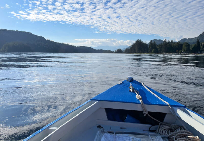 Murray Walker
As we neared the Skookumchuck heading north, we took our time to get a sense for the flow of water. Even though we were nearly at slack tide, we could make out swirls and eddies on the surface.
It was just after 6 p.m. and the time had come to head to the Chuck, about 15 minutes away. We anticipated navigable water for about 30 minutes on either side of high tide. About a quarter mile south of the rapids, with the Sechelt Islets light in view, we stopped the boat, got a sense of the water’s flow, and reviewed our course on the chart one more time. We would steer to the west of Sechelt Islets but keep clear of Roland Point, which can be deadly on the flood. The current was still flowing toward us and the surface of the water was laced with lively swirls, but there were no serious whirlpools or whitewater.
At 6:25 I put SCHERZO’s motor in gear and moved cautiously ahead. We were alone in the gap: there were no visible obstacles ahead of us, no other boats, no one on the rocks on either side. I clutched the steering wheel and braced myself for the current. There was a slight pull to the left, toward Roland Point, but I kept close to Sechelt Islets, and we passed through more easily than I’d expected. The GPS readout showed that we were cruising at 10 knots through the water but making 7 knots over the ground. By 6:35 p.m. we were through and zipping away into the warm summer evening. In a few short minutes we had reached Egmont, our final destination for the day. We tied up to the dock below our rental cabin and, saving the exploration of the village for another day, settled in for the night.
The morning dawned mild and still under a mostly overcast sky with promising patches of blue. Alex and I headed out to explore Hotham Sound. We passed the tree-covered Captain Island on its east side and from there it was an easy run across the lower reaches of Jervis Inlet, where the water is more than 2,100′ deep, some of the deepest water on the coast.
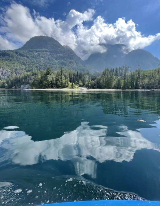 Murray Walker
We saw several sites like this abandoned log dump in Hotham Sound, where dirt roads, created during times of commercial logging, came right to the water’s edge so that logs could be rolled directly into the sound.
Until the middle of the last century, several families made their homes year-round along the wooded shoreline of Hotham Sound or lived in floating cabins tied into protected bays tucked along its 16 miles of shoreline. Dotting the verges of the sound are alluvial fans, where creeks flowing out of valleys have built up rocky beaches. They provided ideal locations for logging operations, and some still hold scattered remnants from that era: a rusting piece of machinery near the trees, a length of heavy cable thrusting out of the ground. As we passed by, we spotted several logging roads that emerged from the woods and ended abruptly in bulkheads where logs could be rolled into the salt chuck for sorting and booming. The trucks and logs are gone, for now. As Alex and I motored by, the only signs of human life we saw were two boats tucked into a tiny cove.
Along the east side of the sound, we stopped at Freil Falls, also known as Harmony Falls. A narrow stream flowing out of Freil Lake at the top of the mountain cascades down a vertical rock face for about 1,000′ to a ledge where the water is redirected toward the ocean. From there it falls a final 450′ to a tree-covered flat at sea level. We brought the boat close inshore and cut the motor. We could hear the muffled sound of the falls but could see no sign of them—they were hidden somewhere among the trees.
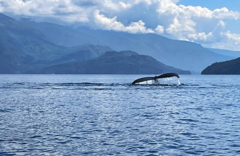 Murray Walker
In Jervis Inlet we came within a few hundred yards of a group of humpback whales breaching, rounding out, and fluke-diving. We killed the motor and stayed to watch for about 30 minutes.
Soon we were passing the Harmony Islands Marine Park, a cluster of three tree-covered islands, each about 50′ high, that parallels the eastern mainland shore of Hotham Sound for about a mile. At high tide the northernmost island becomes two islands as the rocky isthmus between them disappears under water. There are no public facilities on the islands and no good landing sites except a parcel of private property where there are some buildings and a dock. However, for cruisers on their way up Jervis Inlet to Princess Louisa Inlet the islands offer a convenient overnight anchorage.
Just beyond the Harmony Islands, on the mainland shore, was a rocky beach where we pulled in for lunch. As we ate, we watched the sculpins darting in the crystal-clear waters and saw purple sea stars wrapped around oysters.
After a slow circle around the shores of Hotham Sound we set our course back across the calm waters of Jervis Inlet, aiming for Agnew Passage on the west side of Captain Island. Misty-white whale spouts appeared off the starboard bow barely a quarter mile away. As we drew closer, several humpbacks, in two or three groups, leapt and dove. One lay on its back slapping its pectoral fins forcefully against the water’s surface. Captivated, we killed the motor to watch and listen for almost 30 minutes.
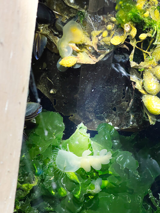 Allison Gong
Allison introduced us to marine wildlife that we might otherwise have missed. These two hooded nudibranchs (photographed at night) were crawling on algae beneath the Egmont dock.
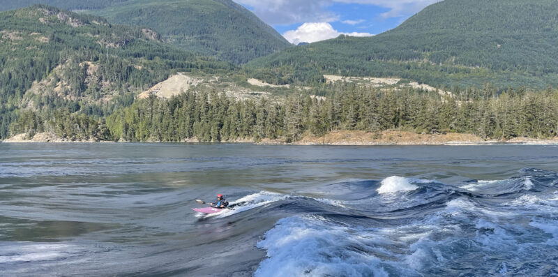
We arrived back in Egmont in time to hike the 2½-mile forest trail to the Skookumchuck’s south viewing area at Roland Point where the trail descends right to the water’s edge. Our timing was perfect, the current was running at more than 11 knots. A dozen or so kayakers were riding the 5′ standing waves created by the rush of water pressing against the shore. In mid-channel a powerboat was pushing its way steadily against the current and through the rapids.
That evening we ran the boat a mile down the inlet to the Backeddy Marina for dinner at the Backeddy Pub, on the edge of Skookumchuck Narrows. We returned in the near dark and, back at our cabin, took our flashlights out to the dock to view the sea life clinging to the submerged surfaces of the float and piles. When Alex stirred the water vigorously with a paddle, a bright cloud of bioluminescence lit up the blackness.
 Murray Walker
A kayaker rides the standing wave in the Skookumchuck at full flood.
We had big plans for our third day, so we got an early start. Our first goal was Pender Harbour, 15 nautical miles south down Agamemnon Channel, between the Sechelt Peninsula and Nelson Island. Hidden behind a narrow entrance, Pender Harbour is a 3-mile-long inlet that boasts 40 miles of coastline with multiple bays and islands. Its shoreline is a riot of docks, boathouses, primitive summer cabins, fancy new summer homes, multiple marinas, a public dock, a grocery store, and a fuel dock.
The morning was gray with a suggestion of rain. Our run down Agamemnon Channel was chilly and calm, but as we neared the south end of the channel, we encountered a few raindrops and a light southerly chop coming toward us.
At Pender Harbour we topped up our fuel at one of the marinas and found lunch at a local eatery.
The morning’s threatened rain did not materialize, and as we left Pender Harbour for Ballet Bay, 10 1⁄2 nautical miles up the west side of Nelson Island, the sky was brighter. But the light southerly chop had built to a moderate southerly slop, so for a more sheltered route, we decided to retrace our route up Agamemnon Channel, and then around the top of Nelson Island, through the ¼-mile-wide Telescope Passage, between Hardy Island and Nelson Island, across Blind Bay, and finally sneak into Ballet Bay through its narrow, reef-bound eastern entrance. By the time we arrived, the overcast sky had become mostly clear.
 Murray Walker
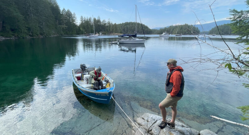
Ballet Bay is a popular anchorage for cruisers as it is well-protected in most weather conditions. Thanks to the Anchor Buddy we were able to bring SCHERZO into the granite ledges and step ashore dry-shod.
Ballet Bay is really a bay within a bay. A cluster of rocky islets on the south side of Blind Bay creates a body of water a half-nautical-mile-long, that lies roughly east–west with narrow entrances at either end. It is well-protected in any weather and is a popular anchorage for cruisers heading up the coast; on this day there were eight or ten boats anchored. There is no settlement or public dock, just a few fancy summer homes with high-performance powerboats and an occasional float plane tied to the private docks, and plenty of No Trespassing signs.
Ballet Bay was named by longtime residents Harry and Midge Thomas in honor of their daughter, Audree, who had a successful career as a professional ballerina under the stage name Anna Istomina. The Thomases’ cabin, now 80 years old, still stands on the western point of the bay. We anchored SCHERZO and climbed up a rocky promontory to photograph the two bronze plaques mounted in memory of Harry and Midge, and Audree.
Leaving Ballet Bay by the west entrance, we squinted into the afternoon sun to see a tugboat pulling a boom of logs. We crossed Blind Bay to the western end of Hardy Island, where a bend to the south creates a bay on its east side, about a half nautical mile across, with several small coves within it—Hardy Island Marine Park. Multiple stern-tie rings have been set into the granite shoreline, and it is a favored anchorage among larger cruisers. We had the bay to ourselves and found a tranquil spot between Hardy and Musket islands where a granite outcropping supported a few skinny trees, some salal bushes, and sparse dry grass. The water was clear and the color of emeralds. We dropped the anchor with the Anchor Buddy as its rode and tied SCHERZO’s bow to a log. We went ashore and, for a half hour or so, Allison and I sat and enjoyed the quiet and beauty while the more adventurous Alex, taking advantage of the low tide, clambered across the exposed rocky isthmus to Musket Island. Too soon it was time to begin our journey back to Egmont.
 Allison Gong
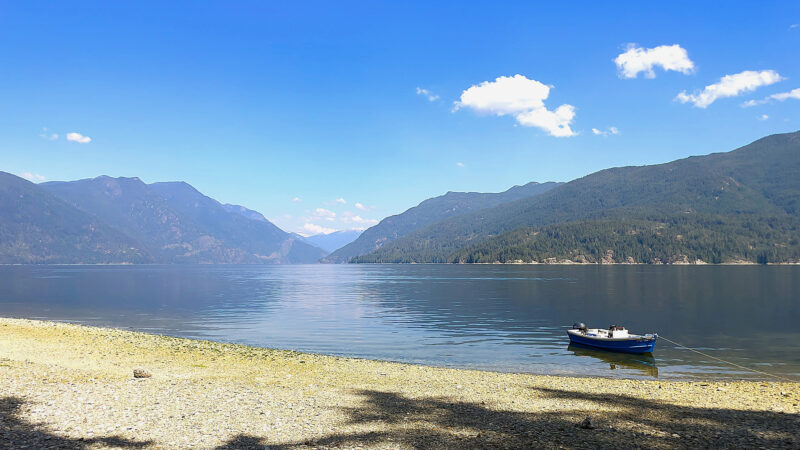
As we made our way south on our last day, we stopped briefly and anchored SCHERZO off Halfway Beach, across the inlet from the mouth of Salmon Inlet.
The tugboat we had seen before our stop had also turned into Blind Bay, and as we headed east across the bay, we were surprised to see an active logging operation on the southeast corner of Hardy Island. We retraced our way through Telescope Passage, along the south shore of Jervis Inlet and through Agnew Passage to Egmont in still air and warm rays of the evening sun.
For our last day we would again pass through the Skookumchuck. Slack water was around 1:30 p.m. so we had the morning free to stroll around Egmont.
The village is home to a few hundred year-round residents whose houses are scattered among the trees along a mile of shoreline on the west side of Skookumchuck Narrows. Most of the commercial activity is centered around Secret Bay where there is a small marina, a general store, one or two marine businesses, and a government dock. Red-painted federal government docks were built along the British Columbia Coast at the beginning of the 20th century and today are reminders of a time when these remote places relied on steamship services for all their transportation needs. While most of the docks on the Sunshine Coast are now administered by local authorities, the dock at Egmont is an exception, wearing its red paint proudly.
At 12:30 p.m. we were back in SCHERZO and headed for the Chuck. The tide was changing from ebb to flood, so we would once more be going against the current. The tidal range was larger today and there was more surface turbulence when we started through the rapids, but there were still no whirlpools or overfalls, and despite the force of the current against us, we passed through safely.
 Murray Walker
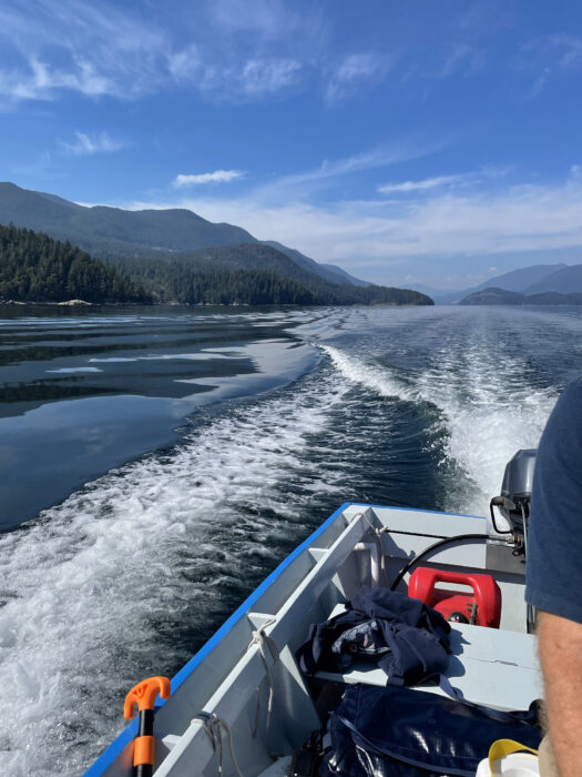
For our final run south from Halfway Beach, back to Porpoise Bay, the water remained smooth, the sky blue. It was a fitting end to the trip.
A short distance farther on we dropped the anchor close to the steep shoreline and ate lunch in the boat. Beneath us, for about 6′ down through the clear water, we could see an abundance of underwater plants and animals, including fat, white-spotted, purple sea cucumbers, clinging to the rocks.
Underway again, we cruised up the inlet in tranquil water under a blue sky. We stopped briefly at Halfway Beach Provincial Park, another former logging site taken over by the B.C. government to be used as a water-access-only campground, but we had a ferry to catch and couldn’t dally. We ran up the last few miles to Porpoise Bay, pulled SCHERZO out of the water and onto her trailer, and parked her at a nearby marina. I was already looking forward to my planned return in a few days with my grandchildren.![]()
Murray Walker is a native of Vancouver, British Columbia, who spent much of his early life up on the B.C. coast. He has lived in Santa Cruz, California, since 1986 and is retired from a nearly 40-year career teaching music in high school. He and his wife, Carol, think about returning to Vancouver but, says Murray, “There is always that Vancouver weather!”
If you have an interesting story to tell about your adventures with a small boat, please email us a brief outline and a few photos.
Murray, do you have a source of plans for your pacific power dory?
Thank you,
Bill