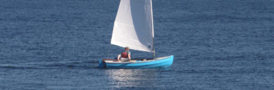
When I bought my first handheld marine GPS (a Garmin 12 in 2000), I thought, like many of us in fog-bound Maine, that I now had the ultimate answer to kayak and open-boat navigation. I regularly swapped it for newer handhelds as features were added or mine broke. Then last summer I heard about Maptattoo, a promising new chartplotter specifically created for small boats. It was being crowd-funded and I sent in a deposit to reserve one.
The Maptattoo was designed to address the difficulties its developers encountered using a tablet in the 2018 Race to Alaska (R2AK). The first issue was visibility. If you’ve used a dedicated handheld tablet or smartphone to navigate, you know how frustrating it is to read an LCD screen in bright sunlight. Reflections make it difficult enough; with dark glasses it’s almost impossible. Power management is a challenge, with LCD screens needing plenty of power when running at full brightness. Batteries require replacing or charging, and on small, often wet boats this can be a problem. Handhelds that run 19 hours or so on a couple of AA batteries are fine for a day’s outing, but beyond that, the batteries need to be replaced or recharged. Despite manufacturers’ claims of watertightness, their handhelds’ battery boxes eventually fail, as my numerous dead handheld GPS units can attest, even when I’ve operated them in windowed dry bags, which also worsened visibility.
The Maptattoo developers had several goals: a large screen with visibility even in bright sunlight, a multi-day battery, watertightness, impact resistance, and the ability to be operated with a wet finger or push-buttons. For readability and low-power consumption they settled on the only technology that provides both: E Ink, the black-and-white screen technology used for e-readers like Kindle.
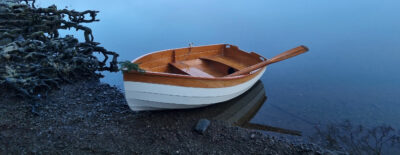
They hand-built several prototypes and field-tested them on three boats in the 2022 R2AK. Two of the boats finished and the other capsized, yet they all provided useful feedback. With the benefit of the sea trials and crowd-funding financial support, production started, and the first units went out in the fall of 2023. I got mine in November and did my initial testing while rowing my dory in subfreezing temperatures, sailing on an iceboat, and then rowing the dory on longer trips the next spring.
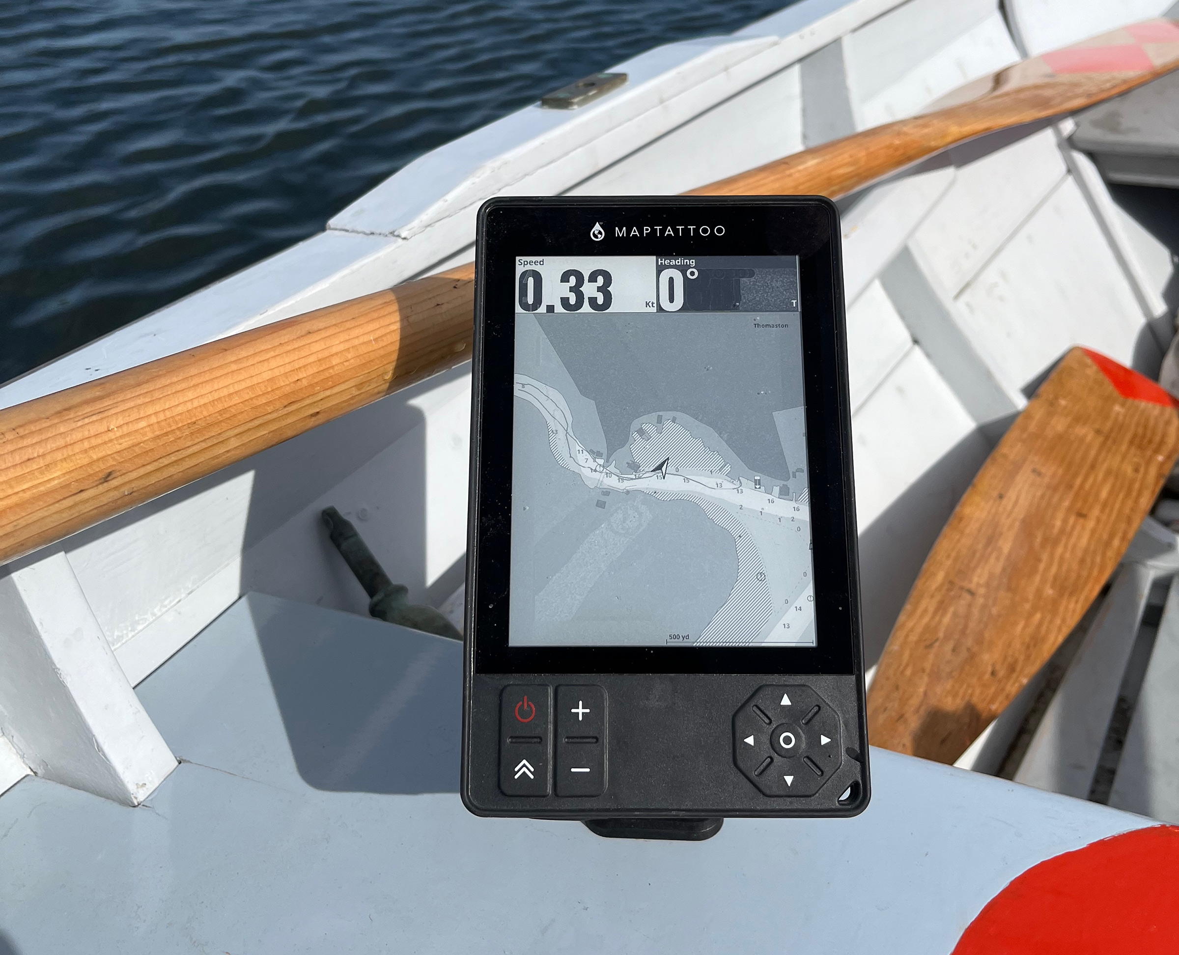
Maptattoo is built in the U.S. and comes in a pouch with cables for charging and computer interface: one USB-C/USB-C and one USB-C/USB. The unit is 7 1⁄2″ tall, 4 1⁄2″ wide, and 1⁄2″ thick; the screen measures 6″ on the diagonal. Besides the power button on the left, and a menu key under it, there are zoom-in and -out buttons. On the right, four navigation buttons cluster around an enter button.
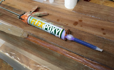
 Photographs by the author
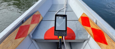
The display can be read in any light from bright sunlight to night darkness. The speed and heading are presented in large numbers that can be read from a distance, and the device can be operated via the control buttons beneath the display, or with touch-screen commands.
When you turn the device on you get a picture of a cigar-chomping balaclava-clad gent missing a front tooth. I had to ask. It is Henry Worsley at the end of his solo trek across Antarctica in 2016, just 100 miles short of completing the more than 1,000-mile crossing. The trek killed him. Why Henry? It’s a reminder of the spirit of adventure, the folks for whom Maptattoo was designed. Several of the devices were used on the 2024 Everglades Challenge and Worrell 1000, a sailing catamaran race on the Atlantic coast from Florida to Virginia.
A few seconds after the image of Worsley appears, the main screen comes up with a chart with your location centered, and your speed and heading displayed in large type above the image of the chart. It is eminently readable. Course and speed are in type large enough to be readable 6′ or more away, as are land masses, the intertidal zone, and water shallower than 6′. This is done with two shades of gray and the intertidal zone shown in hatched diagonal lines. Details such as submerged and drying rocks, aids to navigation, and geographical names including waterbodies are visible at arm’s length, pretty much the same as in other electronic and paper charts. In the dark, turning the light switch to high powers-up a backlight that fully illuminates the screen.
Depths are indicated in feet, but to keep the screen uncluttered there are no contour lines. Depth and distance units can be user set; users can also choose between true and magnetic courses.
Other GPS navigation devices, like the paper charts on which they are based, display charts and information in color on LCD screens. The black-and-white E Ink used by Maptattoo makes the screen more easily readable outdoors, but it required the developers to write new software to reinterpret the color-coded data from the International Hydrographic Organization. So, the developers needed to make decisions about how much data to show and how to show it to keep the screen from being cluttered. Information is provided in drop-down menus.
I had a bit of a learning curve to get used to working without color, and for those used to scrolling on LCD screens, scrolling here is a little different: the screen blinks off and then comes up with the spot you’ve scrolled to; it’s like turning a page on an e-reader.
When you touch the menu key, several menu items display across the screen bottom. These are: Light, Search, Forward, Route, Waypoint, Tide, Info (about the unit), USB connect, and Touch (turning off or adjusting the touch-screen function). The latter is handy when it’s rough and an inadvertent touch can shift the screen; you then control the unit solely using the buttons. The Forward mode attaches a line to your position arrow that varies in length to scale. It helps while reading the unit at a distance.
To keep the amount of on-screen clutter to a minimum, detail about objects such as an aid-to-navigation or a tide symbol comes by touching the object in question. This opens a drop-down box with fields based on the IHO standard that provide data about the object or a small tide or current table. Once you move beyond 500′ scale, fewer aids are shown, and your touch is less accurate. People familiar with software such as OpenCPN or iBoating are used to this. It is a little different for those of us who are used to reading NOAA chart abbreviations, but it does present a clean, clear look. When you shut the unit down and turn it back on, the light level reverts to the default low, and touch defaults to two-finger, but the scale stays as you left it.
For much of the winter, while I was unable to get afloat with the Maptattoo for sea trials, I familiarized myself with the device’s software and provided feedback to its developers. Many of the recommendations that I made about how names of bodies of water, islands, rocks, and hazards would be shown, were incorporated into the first major software upgrade, which happened in January 2024. There will be more improvements in the forthcoming second major upgrade; widgets to display route information as well as a trip summary will be included.
I’ve not worked with routes and waypoints much. They can be set up on computer with software—such as OpenCPN, Garmin BaseCamp, and GPSVisualizer—that work with GPS Exchange Format (gpx) files that the Maptattoo uses. The online manual has the details. The developers plan to add a Maptattoo-dedicated software tool for creating gpx files, but that is in the future. Their focus is currently concentrated on the unit’s interface and on adding more charts.
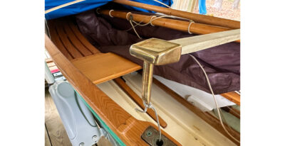
In the lower right corner of the device there is an attachment point for a lanyard. The developer recommends Quadlock gear to make a mount. I’ve picked up the pieces needed and attach the mount to a thwart in my dory with a spring clamp, rather than screwing the base in place. This allows me to move the unit wherever I like. In a kayak or sailboat there might only be one place/spot that you want to fix it, and securing the base would be best and more secure.
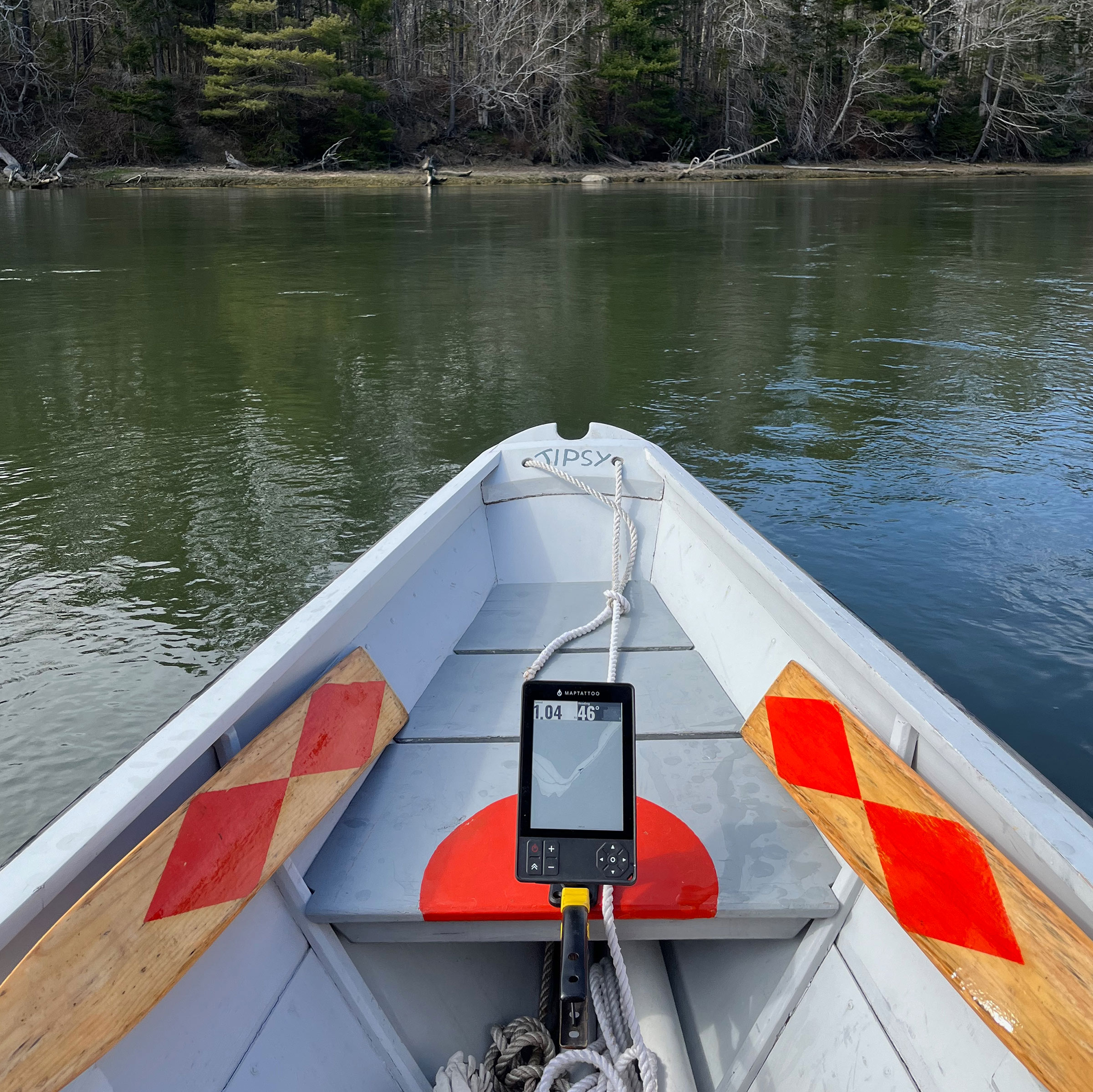
The Maptatto can be mounted with Quadlock gear with a base permanently afixed in one spot or, as seen here, on a spring clip so it can be moved around the boat. The designers have put concerted efforts into “decluttering” the display. Depths are given in feet but contours are eliminated.
On a recent trip as a passenger in a fast outboard on a choppy day for the Maine Island Trail Association, I used the Maptattoo as a handheld. While I was bouncing around at speed the accuracy of touch suffered, so the buttons at the bottom were easier to use. I confirmed that the Maptattoo is indeed shockproof and can survive being dropped and bounced around an aluminum boat’s bottom. With its rubber charging-port cover fully in place the Maptattoo is waterproof to the IP68 rating—fully sealed against dust and able to survive 30 minutes underwater at a depth of 1 meter. I didn’t give mine the IP68 test, but it did survive being dropped into a sinkful of water. The seal is replaceable. The charging cords have O-rings so the Maptattoo can be charged even when exposed to rain or spray.
I’ve not been out long enough to test the 50-hour battery time. I do know that an eight-hour trip with continuous use took a little over 10 percent out of the battery and that the recent adventure-race users were impressed with the battery life between charges.
Maptattoo is aimed at the users of small boats, and comes from developers who also use small boats, occasionally get wet, and use them for more than day trips. The company is small, and its principals are happy to answer questions and address concerns. They welcome and implement suggestions for improvements. The Maptattoo eliminates the problems of bright light, battery life, and waterproofing. It is certainly up to the demands of those who may be using their small boats in places and weather beyond most of us. This is a product for the demanding. Seeing Henry Worsley come up when I turn it on is a reminder that navigation is serious and Maptattoo is, indeed, meeting the needs of the serious user.![]()
Ben Fuller, curator emeritus of the Penobscot Marine Museum in Searsport, Maine, and former curator of Mystic Seaport and Chesapeake Bay Maritime Museum, has been messing about in small boats for a very long time. He is owned by a dozen or more boats ranging from an International Canoe to a faering.
The Maptattoo marine GPS is available from Maptattoo for $799. It includes a 1-year warranty, firmware and software updates, and a chart package for a chosen coastal or Great Lakes area of the U.S. or Canada.
It looks like an interesting device that solves many of the problems of hand-held navigation. Do the developers have a timetable which includes distribution to, and charts for, Western Europe?
I suspect so; post a question on their web site. One of them is French so that should help.
I’ve seen the marketing info but this is the first hands-on from a reviewer. Thanks Ben!
It will be interesting to see how many of the open-boat entrants in next week’s R2AK will be using this device.
My 15-year-old Garmin handheld finally died due to sun-damaged pixels and battery-compartment corrosion. I considered getting Maptattoo. It would be similar at showing big numbers for speed and heading, but far better than the tiny chart display. Research showed two issues: First, chart coverage is limited. US lakes are scheduled to be added soon, but the database will have only a few for my state (CA) and no plan yet to add the rest. Second, the manufacturer advised not exposing it to full sun on hot days. On an open boat in CA that is going to happen. I got another small handheld, backed by my existing coated-paper charts and Navionics on the phone if an up-to-date chart was ever required. That is sufficient for my local waters.
Just was sent and installed the next major software upgrade to which I alluded in the review that it was coming. It’s too bad that while the salt-water data is pretty accessible through the international hydrographic office, inland lake information is not and costs to add it. My guess is that Europe will be the next area where charts are added.
Thanks for putting this review together, Ben. Since the idea for this device began with the R2AK, have you seen any user comments from the R2AK that’s currently wrapping up? I didn’t see anything on their website as of the end of June.
This will be a great improvement over grabbing for my phone, which I can’t read with my polarized lenses while rowing. And could be a great backup to the aged Garmin in the stinkpot.
I also got a Maptattoo early on, as a so-called crowd-funder. The founders were and continue to be as responsive as their resources (being a tiny two-person company) allow to problems, feedback, and input. I had been procrastinating on investing in a portable GPS for paddling and sailing for some years, for all the reasons Maptattoo addresses (battery life, daylight readability, weather-proofness, ruggedness, all-conditions usability). A further motivation for me is that Maptattoo runs on a linux-based operating system, instead of the proprietary and exploitative Android or iOS operating systems used by smartphones or tablets. There are still a few basic functions missing, but I trust that future software updates will add those, as other requests by early users have been added in previous updates.